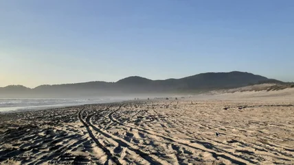
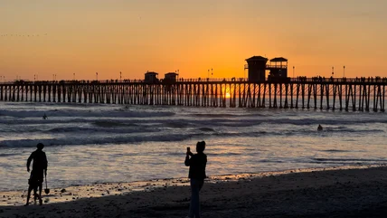
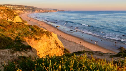
15 Top-Rated Hiking Trails in Southern California

Written by Brad Lane
Updated May 26, 2022

From desert floors to snow-painted peaks, the best hiking trails in Southern California span a vast array of beautiful environments. Whether you're looking for easy hikes or strenuous climbs that test the legs, SoCal hiking trails have the distance and elevations for a memorable adventure – not to mention the scenic destinations at the trail's end.

Hiking trails in Southern California provide a fun California adventure every month of the year. For desert attractions and potential winter hikes in Southern California, natural spaces like Death Valley and Joshua Tree National Park deliver magnificent sand dunes and features like Skull Rock.

Numerous mountain ranges run in every direction in Southern California, with abundant hiking trails switchbacking their way throughout. The nation-spanning Pacific Crest Trail follows the route of many of these mountains. And while some may associate the region with busy traffic and congested streets, these alpine environments provide a valuable escape from the city scene.

Find the best places to enjoy the outdoors with our list of the top hiking trails in Southern California.

1. Solstice Canyon Trail, Santa Monica Mountains National Recreation Area

Solstice Canyon Trail

Solstice Canyon provides a vibrant sagebrush environment in the Santa Monica Mountains, an hour's drive from Los Angeles. The multi-use Solstice Canyon Trail follows a slow-flowing creek out-and-back for an approximately 2.6-mile round trip. The hike begins in a parking area near the Pacific Coast Highway and is easy to navigate the entire way.

The turnaround spot includes a few notable trail markers like a perennial waterfall and the Robert Ranch House ruins. The waterfall sometimes may present itself as only a trickle depending on the time of year. Also along the way, especially heading back to the parking area, are long-distance views across the ocean.

For a more difficult hike, the Rising Sun Trail can be connected to the Solstice Canyon Trail for a steep four-mile loop.

Official site: https://www.nps.gov/samo/planyourvisit/solsticecanyon.htm

2. Bridge to Nowhere, Angeles National Forest

Bridge to Nowhere
Bridge to Nowhere

This 10-mile round trip follows the banks of the East Fork of the San Gabriel River, not far from the Mount San Antonio summit (Mount Baldy). It's a quintessential hike of Southern California and traverses a scenic canyon and the attempted path of a highway connecting the San Gabriel Valley with Wrightwood.

All that remains of this washed-away road is the impressive bridge spanning the "Narrows" part of the canyon. This remaining architecture offers a scenic photo opportunity and an excellent hiking destination.

Hikers will want to avoid trekking to the Bridge to Nowhere when water levels are high, or any speculation of a storm is in the forecast. Flash flooding occurs along the route, and the trail crosses the San Gabriel River at least a dozen times. However, when conditions are right, the refreshing river has several wading spots along the route, perfect for beating the summer heat.

For a unique capstone experience of visiting the Bridge to Nowhere, one of the few bungee jumping companies in California offers their breath-taking services on the side of the bridge on the weekends.

3. Main Trail, Malibu Creek State Park

Malibu Creek State Park
Malibu Creek State Park | Photo Copyright: Brad Lane

Malibu Creek State Park is an excellent spot to explore the Santa Monica Mountains backdropping Malibu. The park encompasses over 8,000 acres and a 35-mile network of hiking trails and fire roads. And users often come across abundant wildlife along the way.

The Main Trail at the park follows the contouring Malibu Creek with a flat and wide path. This beautiful riparian corridor extends for nearly 15 miles, with several trail junctions and possible side trips along the way. Follow this Main Trail, though, and enjoy views of Las Virgenes Valley and Malibu Canyon the entire way.

Prior to opening in the public in the 1970s, the area that is now Malibu Creek State Park was used as several Hollywood filming locations. Less than three miles along the Main Trail from the primary trailhead parking lot, users encounter a filming site for the 1969 Planet of the Apes movie.

4. Salt Creek Interpretive Trail, Death Valley National Park

Salt Creek Interpretive Trail

The Salt Creek Interpretive Trail is a great starting point in one of the hottest and driest places on Earth. It's also one of the few spots in Death Valley National Park to find water. A half-mile boardwalk trail navigates Salt Creek, adding shades of life to an otherwise harsh environment. Here, visitors catch a glimpse at the resident wildlife, the Salt Creek pupfish.

The best time to visit is between November and May when the high-salinity creek is at its heaviest flow. Be sure to fill up on gas and any essential gear before driving into the desert.

The Salt Creek Interpretive Trail barely scratches the surface of things to do in Death Valley National Park, the biggest national park in the contiguous states. The world-famous Mesquite Sand Dunes stand high with mountain-like status near Salt Creek, and the more difficult, nine-mile Mosaic Canyon trailhead is also a short drive away. Farther north in the park, Badwater Basin offers the chance to hike at the lowest point in the country at 282 feet below sea level.

5. Switzer Falls, Angeles National Forest

Switzer Falls
Switzer Falls

Switzer Falls is in the San Gabriel Mountains north of Pasadena and is one of the most popular waterfall hikes in Southern California. The trail begins at the Switzer Falls Picnic Area, where hikers hop on the Gabrielino Trail to reach the two-tier Switzer Falls.

The lower section of the falls is two miles down the trail, and the upper section of the falls requires a challenging quarter-mile scramble with exposed rock ledges. There's limited elevation change the entire way, making it a popular family route. And opportunities to soak in the Arroyo Seco line the entire route.

Address: 701 Angeles Crest Highway, Tujunga, Calfironia

Official site: https://www.fs.usda.gov/angeles/

6. Big Laguna Trail, Cleveland National Forest

Big Laguna Trail meadow

The Big Laguna Trail is a popular 10-mile loop hike under an hour's drive east of San Diego. It highlights the many different environments found in Mount Laguna Recreation Area of Cleveland National Forest.

The trail crosses the Sunrise Highway and tours through pristine meadows, pine forests, and an array of wildflowers come spring. During wetter years in California, the Big Laguna Trail also passes by an idyllic lake. The entire loop gains approximately 1,000 feet of elevation, giving the trail a moderate to difficult rating.

The Big Laguna Trail connects with the nation-spanning Pacific Crest Trail at the Desert View Picnic Area, and hikers will want to pay attention to the abundant trail signs to make sure they stay on the right route.

On portions that aren't shared with the Pacific Crest Trail, it's common to see mountain bikers also enjoying the Big Laguna Trail. The nearby Burnt Rancheria Campground in Mt. Laguna offers over 100 sites available for tents and RVs.

Address: Pacific Crest Trail, Mt Laguna, California

Official site: https://www.fs.usda.gov/recarea/cleveland/recarea/?recid=47406

7. Skull Rock, Joshua Tree National Park

Skull Rock
Skull Rock | Photo Copyright: Brad Lane

The trail to Skull Rock departs from the Jumbo Rocks Campground - one of the best campgrounds in Southern California. The route immediately plunges visitors into a boulder-strewn desert environment.

An assortment of desert flowers and cactus line the route to Skull Rock, with interpretive information about the various flora along the way. And while the 1.7-mile loop from the campground is all about the journey itself, the actual Skull Rock formation offers a fun photo opportunity. And if the time and heat of the day allow, discover more eye-catching boulder formations by navigating the Split Rock Trail from Skull Rock.

The rest of the Joshua Tree National Park encompasses weeks and months of other hiking trails, including routes that lead to spring-fed oases, Hidden Valleys, and other high points like Ryan Mountain. To spend the night near Skull Rock, reservations are recommended for the Jumbo Rocks Campground during fall and spring peak seasons.

Read More:

8. San Jacinto Peak, Mount San Jacinto State Park

Mount San Jacinto
Mount San Jacinto

Located east of Los Angeles near Palm Springs, the 10,834-foot Mount San Jacinto is one of the tallest mountains in Southern California. The state park surrounding San Jacinto offers many trails to explore. And for those looking to hike to the top, one of the most popular routes includes starting with a ride on the Palm Springs Aerial Tramway.

The Palm Springs Aerial Tramway delivers hikers within 2,400 feet of the summit. And the most frequented summit trail departs from the Upper Terminal of the tramway. It's a strenuous six-mile route from the tramway to the summit, but still one of the easiest routes to the top. Alternatively, visitors also enjoy the vistas along the 4.3-mile Round Valley Trail, which also departs from the tramway.

Other ways to reach the summit of Mount San Jacinto include trekking on the country-spanning Pacific Crest Trail from the mountain town of Idyllwild. Idyllwild is one of the best small towns in California and is an excellent base camp for exploring Mount San Jacinto State Park and the surrounding San Bernardino National Forest.

For a very strenuous hike to the top, the formidable Cactus to Clouds Trail, also known as the Skyline Ridge Route, spans 14 miles from the desert floor to the top of the mountain. One of the more challenging hikes of Southern California, the Cactus to Clouds Trail should be attempted by experienced and prepared hikers only.

9. San Clemente Beach Trail, San Clemente

San Clemente Beach Trail
San Clemente Beach Trail | Photo Copyright: Brad Lane

For those that enjoy the ocean, head to San Clemente in far southern Orange County. This surfing destination and coastal town has four glorious miles of shoreline, each offering postcard views across the ocean.

The best way to explore the San Clemente coast is on the San Clemente Beach Trail. This rail-to-trail conversion spans 2.3 miles from North Beach down to Calafia Beach. The trail is primarily compacted sand and a few sections of pavement, with beautiful landscaping and beachscapes along the way.

San Clemente City Beach and the San Clemente Pier are approximately halfway along the route. These scenic spots are worth a stopover when traveling the San Clemente Beach Trail, where visitors find restaurants on the pier and plenty of room to spread out on the beach.

Read More: Top-Rated Things to Do in San Clemente, CA

10. Borrego Palm Canyon Nature Trail, Anza-Borrego State Park

Palm Canyon, Anza-Borrego State Park

Anza-Borrego State Park is one of the best state parks in California and also the largest, encompassing over 600,000 acres of rugged desert landscapes and wilderness. Numerous trails span throughout the arid environment of Anza-Borrego, navigating badlands, slot canyons, and superblooms of wildflowers come spring.

Perhaps no hike in Anza-Borrego is as refreshing as the Borrego Palm Canyon Nature Trail. It's a three-mile loop marked by palm trees, traversing to a spring-fed destination. The area is popular with hikers and is also frequented by many species of migratory birds.

Address: 200 Palm Canyon Drive, Borrego Springs, California

Official site: https://www.parks.ca.gov/?page_id=638

11. Moro Canyon Trail, Crystal Cove State Park

Laguna Coast Wilderness Park, next to Morro Canyon
Laguna Coast Wilderness Park, next to Morro Canyon | Photo Copyright: Brad Lane

Combining the beauty of the beach with a vast inland wilderness, Crystal Cove State Park is located right off the Pacific Coast Highway just north of Laguna Beach. The over 2,400 unspoiled acres of Moro Canyon within the state park are a gem of Southern California, and Crystal Cove provides plenty of trails and backcountry camping sites to explore it all.

From the Moro Campground, the 1.5-mile Moro Canyon Trail connects with side routes including Moro Ridge and Red Tail Ridge. Most of the routes starting from the campground include moderate to strenuous uphill travel. For those interested in additional unspoiled acreage, the park's trail system connects to the adjacent Laguna Coast Wilderness Park.

Address: 8471 N. Coast Highway, Laguna Beach, California

Official site: https://www.parks.ca.gov/?page_id=644

12. Smugglers Cove, Channel Islands National Park

Smugglers Cove, Channel Islands National Park
Smugglers Cove, Channel Islands National Park | Photo Copyright: Brad Lane

Channel Islands National Park comprises a chain of five islands off the Southern California coast. It's one of the best national parks in California and those looking to hike this remote archipelago must take a ferry or seaplane to get there. No water or resources exist on the Channel Islands, meaning visitors need to come prepared to spend the day outside.

The largest island, Santa Cruz Island, is also the most popular to visit much in thanks to the Scorpion Ranch Campground and the challenging hiking trails that cross the island. Smugglers Cove Trail on Santa Cruz Island is one of the most popular, with generous ocean views and a true sense of wilderness.

Smugglers Cove Trail departs from the Scorpion anchorage, where ferries drop off passengers from Ventura and Oxnard. Hikers head up either Smugglers Road or Scorpion Canyon to reach the cove with an eight-mile round trip. There is a moderate 600-plus foot of elevation gain along the way, and those making the hike in a day need to be sure to get back to the ferry on time.

Official site: https://www.nps.gov/chis/index.htm

Read More: Top Things to Do in Channel Islands National Park, CA

13. Boucher Hill Loop, Palomar Mountain State Park

Boucher Hill Fire Lookout

On the west side of Palomar Mountain in northern San Diego County, Palomar Mountain State Park is a hidden gem of natural space under two hours from the city. One of the most popular hikes to explore the unique forests and streams of this Southern California state park is the 3.5-mile Boucher Hill Loop.

With panoramic views of both the desert and the ocean, the Boucher Hill Loop climbs steadily until reaching the historic and still functioning Boucher Fire Tower. The route gains approximately 800 feet on its way up to the fire tower, making for moderate to strenuous effort.

Address: 19952 State Park Drive, Palomar Mountain, California

Official site: https://www.parks.ca.gov/?page_id=637

14. Baldy Loop (Mount San Antonio), Angeles National Forest

Devil's Backbone Trail on the Mt. Baldy Loop

Mt. Baldy is the crown jewel of the San Gabriel Mountains and the tallest peak in this range just outside of Los Angeles. The mountain is officially known as Mount San Antonio and is popular with locals and world travelers alike. And the Mt. Baldy Loop is a challenging trek to the top and around the mountain.

With a couple of route options available, nearly all hiking trails to the top of Mt. Baldy start at the Manker Campground within Angeles National Forest. From the campground, the roughly 10-mile Mt. Baldy Loop is done either clockwise or counter, by heading up either the Ski Hut Trail straight to the summit, or the Devil's Backbone Trail with a detour at Baldy's Notch.

Both trails encompass panoramic views and calf-burning inclines, with the route up the Ski Hut Trail providing the most elevation gain. Mt. Baldy is one of the more challenging hikes in Southern California–ambitious hikers often use the Mt. Baldy Loop as a training hike for larger summits in the state like Mt. Whitney.

Official site: https://www.fs.usda.gov/angeles/

15. Signal Hill Trail, Hilltop Park

Hilltop Park, Signal Hill
Hilltop Park, Signal Hill | Photo Copyright: Brad Lane

Few cities in the country are completely surrounded by another city. But in LA County, right in the middle of Long Beach, the city of Signal Hill is one of these island cities, and it has quite the view.

Parking is available at the top of Hilltop Park, where one of the best views of LA County awaits. However, hiking the Signal Hill Trail is a preferred way to earn this big vista, which includes the Long Beach skyline and well past the ocean.

The Signal Hill Trail is an approximately 1.7-mile loop. Much of the route traverses through private property and residential neighborhoods with easements in place. Users are asked to stick to the trail when visiting.

Map of Hiking Trails in Southern California

More Related Articles on PlanetWare.com

image

More California Adventures: For some of the most outstanding scenery and breathtaking landscapes in the state, the best national parks in California deliver with places like Yosemite, Joshua Tree, and Redwoods. Outnumbering the national parks in California, state parks in California deliver with similar scenic appeal–including lots of places to pitch a tent or park an RV. For even more hiking trails to explore, the top-rated hiking trails in California cover the state from south to north.

image

Discover California: The top-rated tourist attractions and best places to visit in California are just the beginning of everything California has to offer. For some unique spots to add to a California itinerary, our guide to California Off the Beaten Path and the California Desert Region can help you discover a wilder side of the state. To help inspire future road trip plans, many of the best West Coast road trips tour throughout California and connect scenic spots and bucket-list destinations.