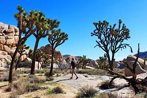
Hikes in Joshua Tree National Park
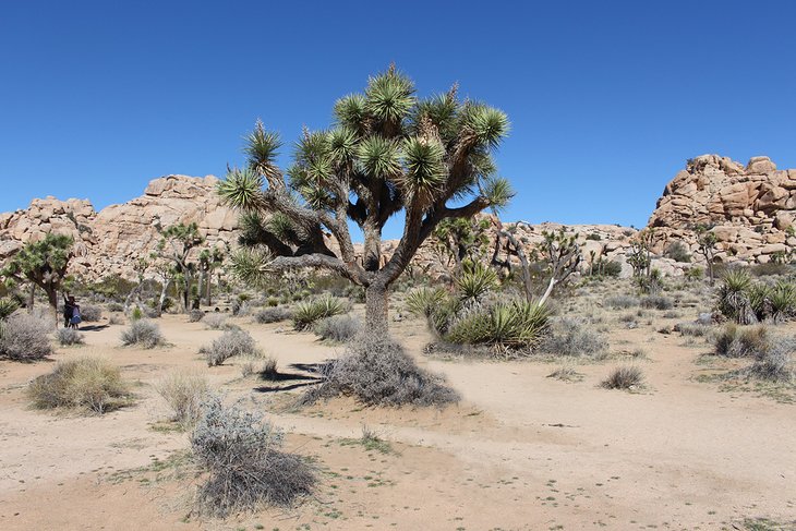
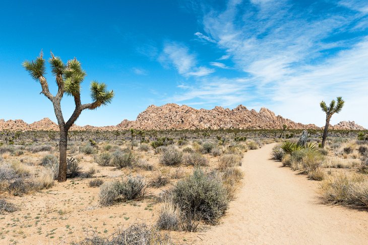
Joshua Tree National Park has a diverse range of hiking trails, both in terms of level of difficulty and scenery. The namesake trees, bizarre rock formations, high lookout points, and historic sites set within the park all make for interesting hiking.
Many of the most popular hikes are short, with a good effort-to-reward ratio, but you can also find longer hikes, where you can get lost in your thoughts and enjoy the peaceful surroundings.
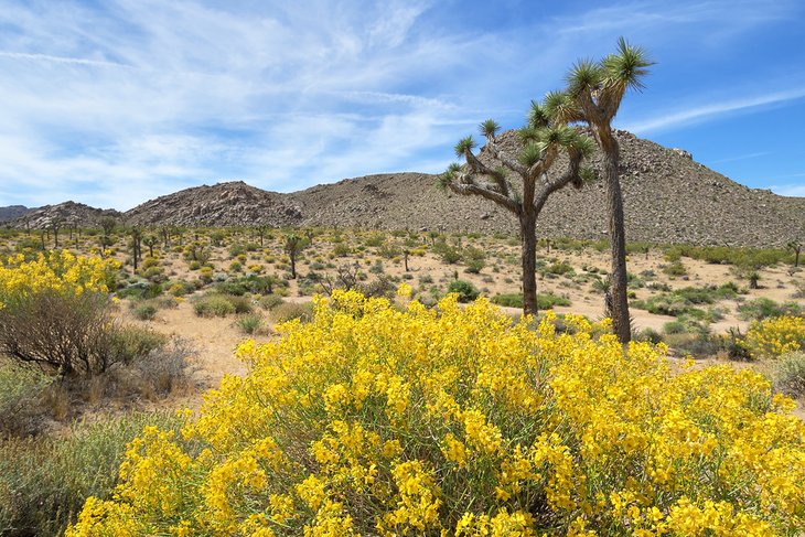
Hike up a mountain, meander through the rocks and trees, or watch for birds and wildlife near water sources in the desert. The park is full of life, from colorful birds to desert tortoises, and the best way to see them is to get out on the trails. Note that dogs are not allowed on any of the hiking trails within the park.
For a look at the options, see our list of the best hiking trails in Joshua Tree National Park.
Hidden Valley
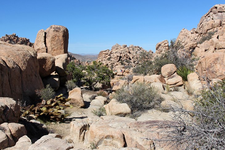
If you are looking for a short and relatively easy hike with a mix of scenery, the Hidden Valley trail is a great option. This is one of the most popular trails in the park.
Once used as a hideout by cattle rustlers, Hidden Valley is truly hidden from view. This small valley is surrounded by smooth boulders and hills, and entered by a notch in the landscape.
The loop trail is one mile and suitable for most people. It's ideal for families with young children or teenagers, who can scramble over boulders on the side of the trail. Informative signs along the trail provide insight into the various plants.
You will almost certainly see climbers attempting, with varying levels of success, to scale boulders large and small throughout the valley. A huge monolith in this area, known as the Great Burrito, is popular with climbers.
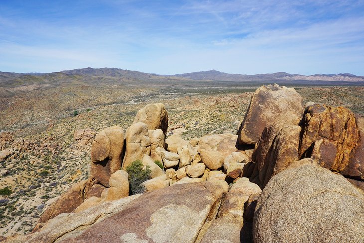
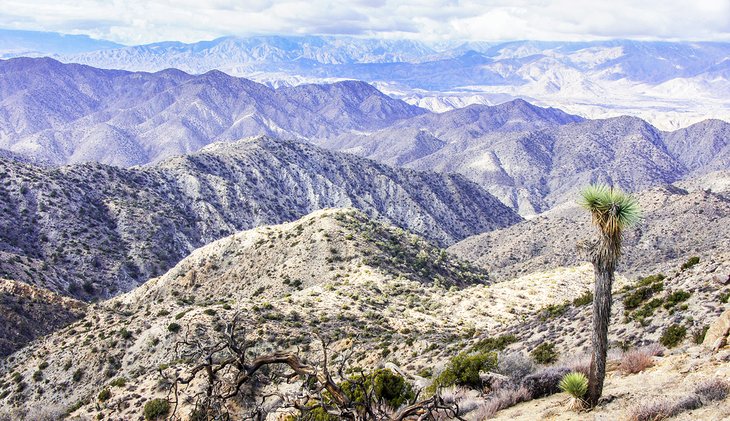
Keys View and Inspiration Peak
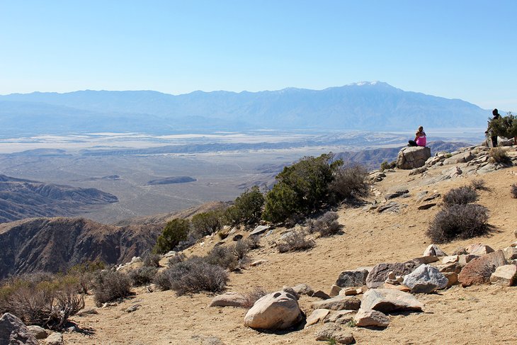
If you are looking for a walk or hike in Joshua Tree National Park that provides the greatest reward for the least amount of effort, head to Keys View. You can either go for an easy walk at Keys View or do a longer hike to Inspiration Peak.
The Keys View trail is short and paved for the entire way and has virtually no elevation gain. When you reach the lookout point, you'll be rewarded with views out over the San Andreas Fault and the Salton Sea. Off in the distance, a range of mountains include Mount San Jacinto and Mount Gorgonio. This is arguably the best view in the park.
For a longer hike, you can go from Keys View to Inspiration Peak, a 1.2-mile round-trip trail that leaves from the same area. The trail has a total elevation gain of about 400 feet.
The views from this vantage point are to the south and the north. You'll see Ryan Mountain, the Wonderland of Rocks, Mount San Jacinto, and Mount Gorgonio.
The drive up to Keys View ascends several different climate zones, and the plant life changes along the way. It's a long, slow climb to 5,185 feet, and is popular with road bikers.
Ryan Mountain
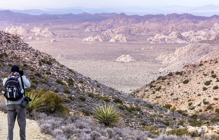
The hike up Ryan Mountain is hard but worth the effort. From the top are 360-degree views of the entire park. Sights include the Wonderland of Rocks, Pinto Basin, Little San Bernardino Mountains, Mount San Jacinto, and Mount San Gorgonio.
This is one of the most popular hikes in the park for people looking for an actual hike, rather than a short walk. The hike is three miles round trip (up and down) and has an elevation gain of 1,050 feet.
You'll find stairs every now and again to help in the climb, but what you won't find is any shade. Carefully consider when you want to undertake this hike, as there is no respite from the heat should it turn out to be a hot day.
It's also worth taking the side trail to Indian Cave to see this site.
The trailhead is easily accessible off Park Boulevard, not far from the Ryan Campground.
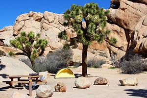
Barker Dam
The Barker Dam hike is one of the few in the national park that leads to a semi-permanent water source. The hike is a relatively easy, 1.1-mile loop that winds through Joshua trees; desert flowers; pinyon pines; and, close to the dam site, oddly shaped boulders.
You'll have the best chance of seeing water in the winter and spring. When the water is available, it attracts wildlife, especially birds.
Along the trail, a spur leads off to one side. It's worth taking this small jaunt to see pictographs.
The national park website offers an excellent description of the flora along this trail, along with pictures and a blooming schedule.
Skull Rock Nature Trail
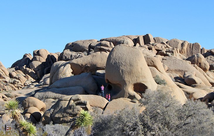
You have two choices at Skull Rock: The first is just to pop out of your car and walk the short distance to the skull-shaped rock. The second is to more fully immerse yourself in the crazy rocks and desert landscape by continuing the 1.7-mile nature trail.
The trail winds its way around and through the giant boulders and is a fun area to climb on the smooth rocks. At one point, the trail gets very narrow, and you'll need to pass through a tight opening. It also cuts through the Jumbo Rocks Campground.
In the spring this is a great area to see wildflowers.
Lost Horse Mine
The Lost Horse Mine trail takes you on a scenic hike to one of the best preserved mine sites in the park. You'll find decaying equipment at the site, most impressive being the ten-stamp mill.
The trail is a four-mile round-trip loop with a gentle incline almost the entire way to the mine site.
The trail bursts into a riot of color in the spring, when the wildflowers emerge from the desert floor. If you have the energy, continue past the mine works and climb up the ridge in behind for better views.
Combine the hike to the Lost Horse Mine with a much shorter hike at Keys View. Both of these are found along the same road.
Ryan Ranch
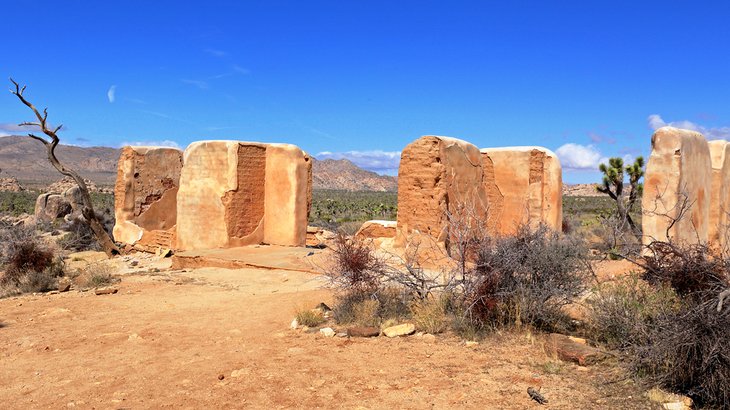
An ideal hike for the entire family, the Ryan Ranch trail leads to an old abandoned estate built over 100 years ago. The estate was built by Jepp and Tom Ryan, and a portion of the original building is still intact.
In fact, much of the main building and the outbuildings were in quite good condition up until a suspicious fire in 1978 leveled most of what remained.
In addition to the homestead and old machinery littering the site, a number of old gravesites can be seen.
The trail is 1.2 miles long and has a slight elevation gain of 85 feet.
Arch Rock Trail
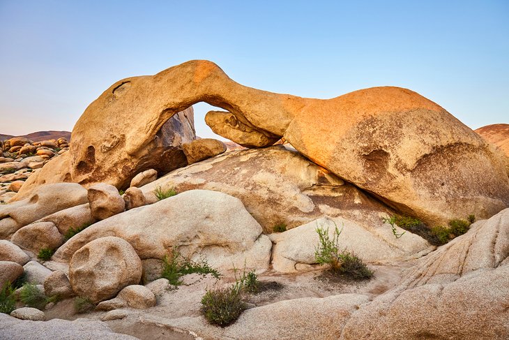
Arches are rare in Joshua Tree National Park, and this trail takes you to one of the best. Originally not on the list of "official" trails, the park service has recently added it due to its incredible popularity.
The arch extends over a 30-foot distance, and the best part is, you can go right up underneath it. The surrounding area is full of rocks and hills, and families with young children will enjoy searching out all the nooks and crannies.
The trail is a lollipop-style loop and is 1.4 miles long in total with a slight elevation gain of 100 feet. The trailhead is located at the Twin Tanks day use area.
Wall Street Mill
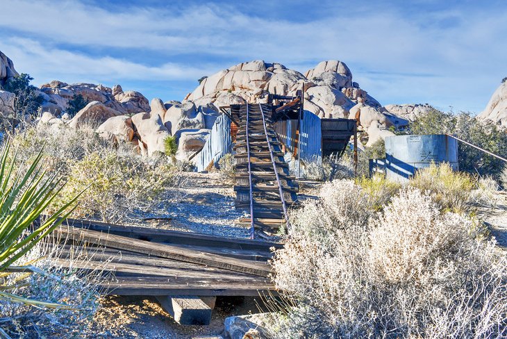
This fascinating hike takes in some of the best and most notorious history of Joshua Tree National Park. The Wall Street Mill is an interesting spot, complete with railroad tracks, old equipment, a winch, 12-horsepower engine, and mill shed.
Most of the historic equipment is actually in pretty decent shape considering how old it is; informational signs at the site show the original blueprints. Photographers will be in their element framing the old mill equipment up against the harsh desert background.
The trail is just slightly longer than two miles out and back, and the elevation gain is slight, at 115 feet. Located along the trail is a marker detailing the gunfight between Bill Keys and Worth Bagley, which sent Bill Keys to prison for five years and Worth Bagley to the afterlife.
Mastodon Peak
Mastodon Peak trail provides incredible views out over the Colorado Desert portion of the park. This 2.6-mile round-trip loop trail gains 400 feet of elevation, making it one of the harder hikes in the park.
The trail climbs to the top of 3,400-foot-high Mastodon Peak, where you'll be able to catch a glimpse of the Salton Sea shimmering in the distance. On your way back down, keep an eye out for 50-year-old remains of the Mastodon Mine.
The start of this trail is at Cottonwood Spring, so be sure to stop in to check out this desert oasis. Note that it is best to hike this trail in a counter-clockwise direction to avoid having to ascend through loose sand.
Hi-View
The Hi View trail is the first trail that you come across if you are driving in from the Los Angeles area. The trail climbs up over the surrounding countryside, and when you reach the top, looks out to San Gorgonio Mountain. This towering mountain caps out at 11,500 feet high, and for most of the year has a dome of snow on top.
The trail is 1.3 miles long and has an elevation gain of 400 feet. There is no shade along the trail, except perhaps under some of the larger Joshua trees; a few benches are available should you need a break.
Prior to setting out, stop by the Black Rock Visitor Center to pick up a trail map. This informative pamphlet details the various plants you'll see along the way and is a handy reference.
Cholla Cactus Garden Trail
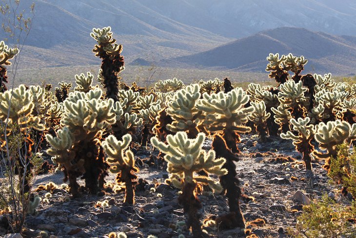
While more of a short walk than a hike, the Cholla Cactus Garden offers a very different experience and is suitable for all abilities.
Set on a wide, flat plain, this magical loop takes you through a veritable forest of cholla cacti. These diminutive plants stand about chest high and look soft and inviting to touch as it glows in the sun. Don't be fooled - those little yellow limbs that seem soft and fluffy are actually made up of thousands of incredibly sharp needles.
The trail is level only .25 of a mile. Along the way, the gravel route is interspersed with the occasional boardwalk area. An ideal time to visit the Cholla Cactus Garden is in the late afternoon, when the sun shines at a lower angle and casts a beautiful light on the cacti.
The Cholla Cactus Garden is just over 25 miles north of the south entrance to the park.
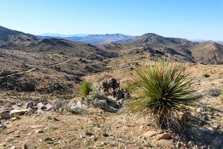
Warren Peak Trail
If you crave views out over the wonderful panorama of Joshua Tree National Park and don't mind expending a bit of effort, the Warren Peak hike is for you. This 6.3 mile trail has some of the largest elevation gain in the park at 1,110 feet. Once you get to the top of 5,103-foot-high Warren Peak, the views will make the tiredness in your legs fall away quickly.
Off in the distance to the north, you'll see the Mojave Desert; the Coachella desert is south of you. The two huge mountains are Mount San Jacinto at 10,834 feet and San Gorgonio Mountain at 11,499 feet respectively.
There's a good chance you'll have the trail to yourself; most visitors give it a pass due to the work involved. The trailhead for the Warren Peak hike is located at the Black Rock Campground.
Willow Hole Trail
Love hiking but hate elevation? Head for the Willow Hole Hike, located at the Boy Scout trailhead in the southern part of the park. This 7.2-mile out-and-back trail is almost entirely flat for its entire length as it traverses the desert floor past an incredible assortment of Joshua trees, with the Wonderland of Rocks visible in the distance. Basically, it's a pleasant walk in the desert with wonderful scenery. That said, still be prepared, and bring lots of water and comfortable walking shoes.
You'll spend part of the walk on the Boy Scout Trail before peeling off to the Willow Hole trail. Stroll along across a few washes, and eventually the trail dead ends at the relatively lush Willow Hole where, depending on the season, you may find water.
Map of Hikes in Joshua Tree National Park
More Related Articles on PlanetWare.com
Exploring Joshua Tree National Park: You'll find more than just hiking trails in the park. For a complete overview, see our guide to the top things to do in Joshua Tree National Park. Another great way to experience this beautiful area is to camp. If this is of interest to you, have a look at our list of the best campgrounds in Joshua Tree National Park.