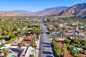
Hikes in Palm Springs, CA
Author Freddy Sherman moved to Palm Springs a decade ago and often hikes its many trails.
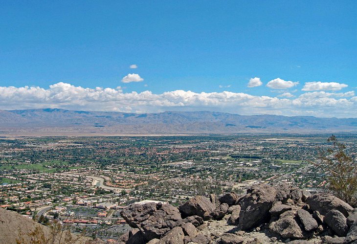
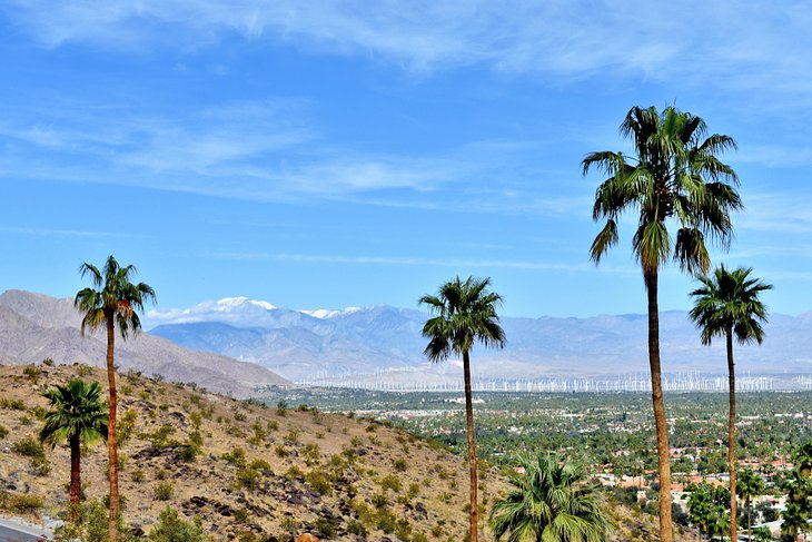
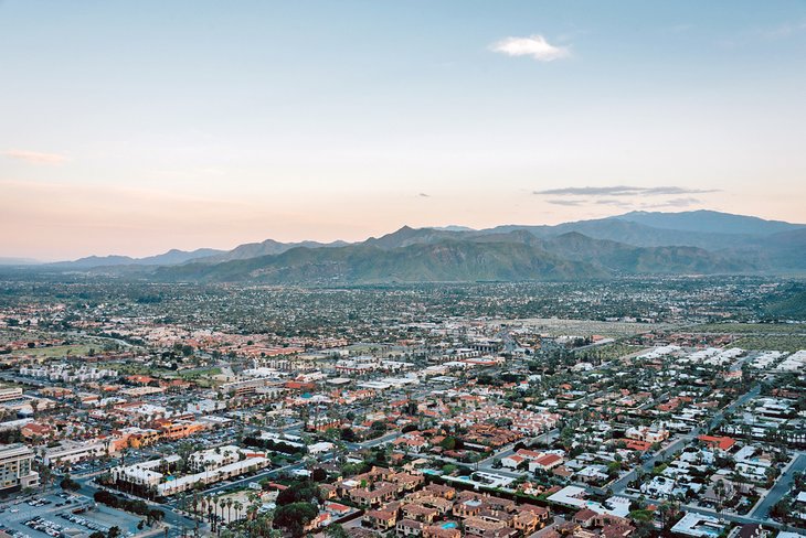
Surrounded by four different mountain ranges (San Bernadino, Santa Rosa, San Jacinto, and Little San Bernadino), the incredible terrain of Palm Springs and the sheer natural beauty of the surrounding Coachella Valley make for some great hiking.
The city and the mountain foothills around it are filled with miles of hiking trails of all levels of difficulty. Beginning hikers might want to take a stroll on the Bump-n-Grind Trail before having lunch at the mall, while serious hikers might do the Cactus to Clouds Hike, which takes you 10,000 feet into the mountains on a single-day hike.
Palm Springs, located two hours east of Los Angeles, offers year-round hiking, but the extreme summer weather means most hiking needs to be done in the very early morning or early evening. Summer daytime temperatures can exceed 120 degrees Fahrenheit (49 degrees Celsius). In all seasons, it's necessary to carry a lot of water, along with sunscreen and food. Although Palm Springs is a very dog-friendly city, no dogs (other than service dogs) are permitted on any of these hiking trails.
Discover the top places for a desert hike with our list of the best hikes in Palm Springs.
The Bump-n-Grind Trail
Highlights: Convenient, relatively easy trail in Rancho Mirage with great views and close-by parking
This very popular hiking trail is in the adjacent city of Rancho Mirage, about 25 minutes from downtown Palm Springs. It's where the entire Coachella Valley comes to exercise in the mountains. The trail starts at an elevation of about 250 feet and rises about 1,000 feet with a fairly gentle slope. The loop trail is about four miles long and takes about two and a half hours to do. Frequent hikers recommend you do the circular trail in a clockwise direction.
There are very nice valley views from the trail and from the summit but no facilities or other services. It's popular also because it's convenient: there is easy, nearby parking, and the trail starts very close to a big shopping center. It's also a wide trail with a lot of open space, something important for avoiding rattlesnakes.
Access to the Bump-n-Grind Trail is off a street named Painters Path located behind the Target store on SR 111 in Rancho Mirage.
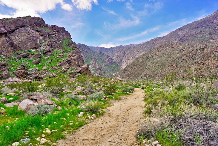
The Araby Trail
Highlights: Hour-long hike, which can connect with an extensive local trail network, offering great views and landmarks, including Bob Hope's iconic mid-century modern home
The Araby Trail hike takes you up into a canyon known as Araby Cove, on the eastern edge of Palm Springs. It's behind the city's Backstreet Art District, off Palm Canyon Drive near the Parker Palm Springs hotel.
Aside from some strikingly beautiful mountain terrain, this hike also takes you right past Hollywood icon Bob Hope's former house, an architectural landmark. The 24,000-square-foot, 10-bedroom Modernist house was designed by architect John Lautner. You may also see horses, as this trail is horse-friendly.
The hour-long Araby Trail hike starts at the Southridge/Rimcrest housing development. Park on the dirt, off the road, just before the entrance gates. This is a moderately strenuous hike, starting at about 400 feet in elevation and rising to about 1,200 feet. This out-and-back trail is about four miles long. At the turnaround point, you can connect to the Henderson, Berns or Garstin Trails, or hike back down.
The Berns Trail
Highlights: Connector trail located between the Garstin and Araby Trails with valley views
This Palm Springs hiking trail is in the foothills, in the eastern part of the city. The Berns Trail is a connector trail, running along the ridgeline of Smoketree Mountain between the Garstin Trail and the Araby Trail (and leading to the Shannon and Eagle Canyon Trails, too). You can access the Berns from either of those trails, and doing any three of them makes for a nice afternoon, as each one takes about an hour.
Like many Palm Springs hiking trails, the Berns Trail is out in the open; there is no shade or cover. It's a great winter hike but not something to be done during the summer, except in the very early morning or evening.
The Berns Trail is about two miles long and rises a few hundred feet in elevation. Overall, it's a fairly easy hike. You can also do the hike as a loop, which is almost six miles.
Like some of the other trails in Palm Springs, the Berns Trail is horse-friendly. Nearby Smoke Tree Stables offers visitors trail rides into the desert.
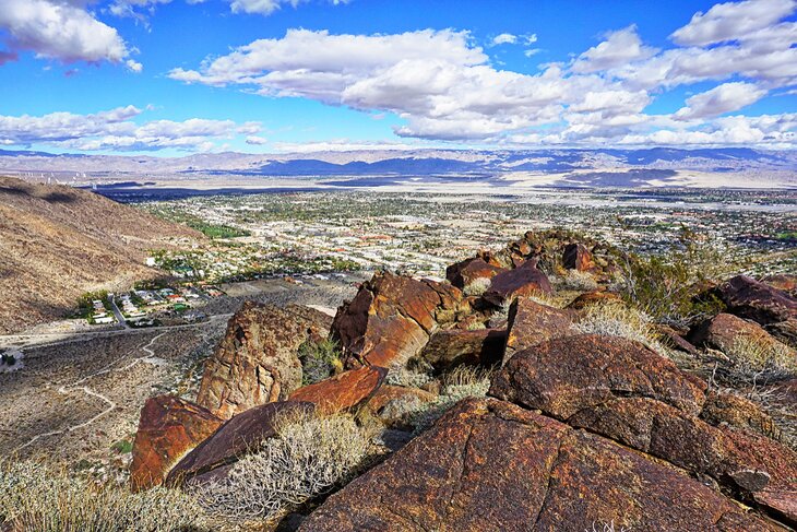
The Palm Springs Museum Trail
Highlights: Moderately difficult trail rising behind the city's art museum, also the start of the epic Cactus to Clouds hike
As its name implies, this hiking trail begins right behind the Palm Springs Art Museum, located in downtown Palm Springs. The basic hike is about two miles, back and forth, and takes about two hours. It's a moderate hike, rising about a thousand feet in elevation over its course. There are great views of the mountains and downtown Palm Springs.
After the hike, you can connect to the North Lykken Trail to go back down and end up at the end of Ramon Road. You can then make your way through downtown Palm Springs to get back to the art museum, about a 30-minute walk from the Ramon Road trailhead. You can also connect to the Skyline Ridge Route for the ultimate Palm Springs hike (see Cactus to Clouds below) all the way up to the Palm Springs tramway's mountain station.
If you drive, be a good neighbor and don't park in the art museum parking lot. Park on the surrounding streets or in the free city parking structure across the street.
The North Lykken Trail
Highlights: The downtown area's most popular hiking trail, with easy parking and access to connect to the Palm Springs Museum Trail on the other side of town
The North Lykken Trail hike is probably the most popular downtown Palm Springs mountain hike. It's often referred to as the Ramon Road hike, as the start point and parking area is at the end of Ramon Road (one of the city's main east-west thoroughfares). Just take Ramon Road west past Palm Canyon Drive until it ends, and you'll see the trailhead. Park on the street.
The trail goes for about a mile and a half, ending at a viewpoint and clearing with picnic tables (make sure you pack food to enjoy there). After enjoying the view, you can then head back down the trail or connect to the Palm Springs Museum Trail which takes you to the downtown area near the intersection of Tahquitz Canyon and Palm Canyon. You can also continue hiking into Chino Canyon.
The out-and-back North Lykken Trail is 3.7 miles long, and it rises about 1,700 feet over that length. It's popular for runners, bird-watchers, and mountain bikers, as well as hikers.
The South Lykken Trail
Highlights: A trail at the south end of the city with easy parking and an information and visitor center at the trailhead
This trail is located at the south end of the city, accessible from a point near the intersection of Mesquite Road and Palm Canyon Drive. If you drive, park near Palm Canyon and walk down Mesquite until you see the Tahquitz Canyon Visitors Center — the north trailhead of the South Lykken Trail is right there.
The South Lykken Trail is about two miles long and ends near Murray Drive and Palm Canyon. During the hike, you get some cool views of the entire Coachella Valley and also downtown Palm Springs. It's a moderate hike, with only a few hundred feet in elevation change.
Palm Springs Indian Canyons
Highlights: A protected nature reserve with excellent services, including ranger-led tours and trail horseback rides with a charge for parking
This is a protected nature reserve located on Native American land. There are multiple canyons in the park (Murray Canyon, Andreas Canyon, Palm Canyon) and they have over 60 miles of hiking trails located throughout. Admission is $12 for adults, with discounts for children, seniors, and students (free for military members). Ranger-led tours, talks, and walks are given each day for paying visitors (not available July through September due to heat).
The Indian Canyons area has multiple well-marked, well-maintained hiking trails of varying difficulty. They range from the easy, 1.2-mile Andreas Trail to the strenuous 12.3-mile Hahn Buena Vista Trail. The park and the trails are horse-friendly and a popular spot for trail rides. The tribe also has a golf course at the base of one of the canyons.
The Indian Canyons hiking area is quite close to downtown Palm Springs, a 15-minute drive away.
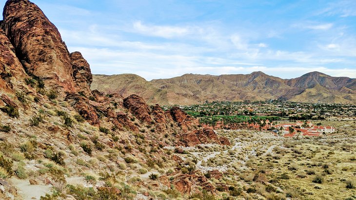
Andreas Canyon
Highlights: A family-friendly hiking trail, landmarks include the world's second-largest California fan palm oasis and ancient stone tools and carvings
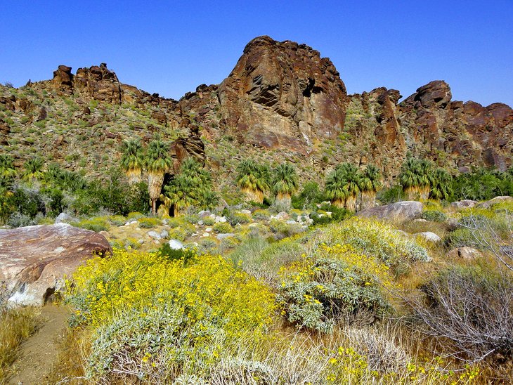
This gentle hike allows you to experience the world's second-largest California fan palm oasis. The area follows a natural spring and is filled with fan palm trees. The easy hike on a loop trail is about two miles and only rises about 200 feet in elevation. The hike even offers some exposure to the ancient culture in the area - the canyon's entrance is the site of two ancient stone mortars, used for grinding corn and other materials.
Andreas Canyon is part of the Indian Canyons tribal area, and there is an admission charge. Parking is easy and plentiful, and the trails are very well maintained. It's very safe and a great place for family hiking. The trail is about 15 minutes south of the downtown area.
Murray Canyon
Highlights: A long hike leading to a 15-foot-tall waterfall inside a lush desert oasis area
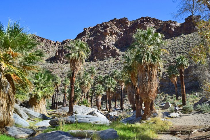
This almost five-mile-long hike in the Indian Canyons tribal area takes you on two specific trails: the Murray Canyon Trail and the Coffman Trail. The highlight is the 15-foot-tall Seven Sisters Waterfall, located at the endpoint of the Murray Canyon Trail.
The hike takes about two hours. You start by walking about a mile through the open desert until you arrive at Murray Canyon. Most months, the canyon has a stream running through it, and the trail crosses it several times. This trail features some amazing rock formations along the way.
The in-and-out trail is almost five miles long and takes most people about two hours. This trail is a bit farther out and sees fewer people than other trails in the Indian Canyons area. If you're lucky, you might see an endangered bighorn sheep or a mule deer on the high ground above the canyon.
Palm Canyon Trail
Highlights: Hike through the world's largest California fan palm oasis, with thousands of trees and a stream; admission charge for parking
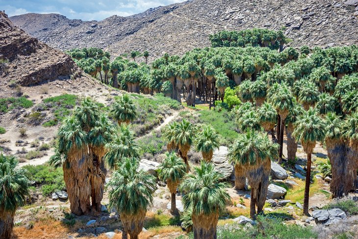
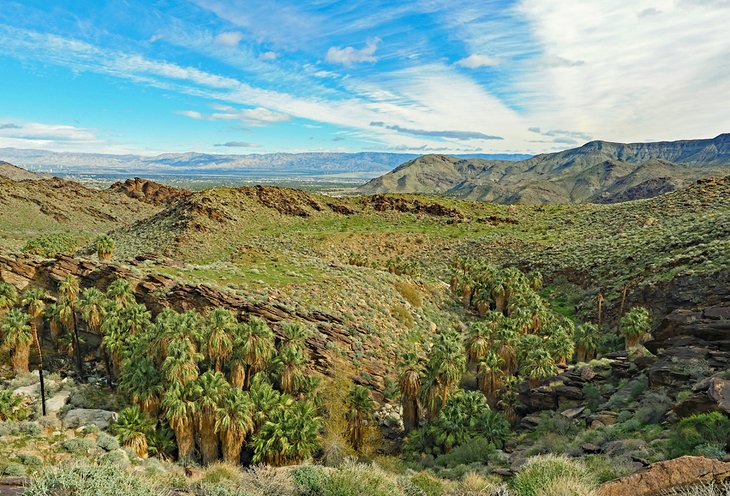
A hike along the scenic Palm Canyon Trail, through Palm Canyon, gives you the chance to walk through the world's largest California fan palm oasis. There are thousands of large trees here, enjoying the fresh water from Palm Canyon Creek, which flows through the area.
You can hike the entire Palm Canyon Trail, which is about 15 miles and leads to Highway 74 and the Idyllwild area, but many people do the Victor Trail loop, which is about three miles in total. It takes you through the palm groves, into the mountains above them, and then back down to the valley floor.
Palm Canyon is part of the Indian Canyons tribal area. There is an admission charge. The park closes at 5pm, and they do tow cars that remain in the parking lot. The park is popular, and there can be a long line of cars backed up at the entrance gate on busy weekends and holidays.
The Hahn Buena Vista Trail

Highlights: A strenuous 12.5-mile loop hike, part of Indian Canyons Park, with 360-degree views of the Coachella Valley
This is the Indian Canyons park's most strenuous trail but rewards hikers with its best views. It's considered one of the most scenic trails in the Santa Rosa Mountains. The end of the trail is at a peak, with true 360-degree views of the entire Coachella Valley.
Most hikers do the hike as a 12.5-mile loop, which includes the Fern Canyon Trail, the Dunn Road Trail, and the Vandeventer Trail. The total elevation change is around 2,000 feet, and the entire loop on all three trails will take about three to four hours.
The Tahquitz Canyon Trail
Highlights: Popular two-mile hike with its own visitor center, highlighted by a 60-foot waterfall
This trail is also part of the Agua Caliente Band of Cahuilla Indians Reservation, but it's located outside the Indian Canyons preserve area. There is a separate Tahquitz Canyon visitor center, with a display of artifacts and a theater showing a documentary about the canyon.
The Tahquitz Canyon Trail hike takes you past ancient pictographs, ancient agricultural water canals, and a lot of interesting plants and wildlife. The trail ends at a very cool, 60-foot-tall waterfall.
The trail is a two-mile hike, taking you from the visitor center to the falls and back. The elevation change is only about 350 feet but there are some steep rock steps, some of which are 12 to 15 inches tall, so overall this Palm Springs hike is considered strenuous.
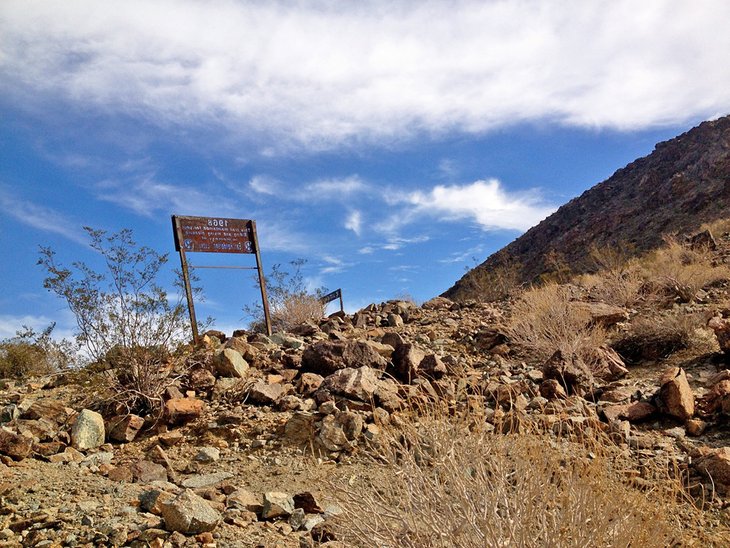
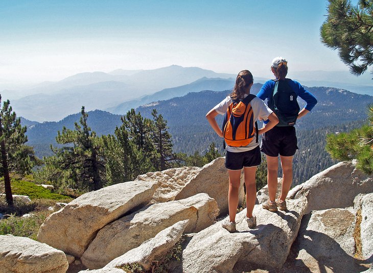
The Cactus to Clouds Hike
Highlights: One of the world's great (and most strenuous) day hikes, for experienced hikers only, with a 10,300-foot elevation change over 21.2 miles
This hike, for extremely prepared and experienced hikers only, offers one of the most extreme changes in elevation (10,300 feet) available in any day hike anywhere in the United States. It really is an all-day, 21.2-mile hike, typically taking around 14-15 hours. With the extreme weather at both ends, the hike is best done in the spring or fall, and many start around midnight.
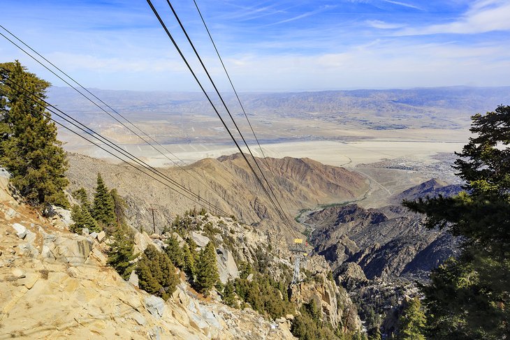
The incredible hike delivers on its title, taking you from the cactus of the desert floor (the hike begins just behind the Palm Springs Art Museum) to the clouds of the area around the peak of Mt. San Jacinto. You start in downtown Palm Springs and end at the top part of the Palm Springs Aerial Tramway, which you then take down the mountain.
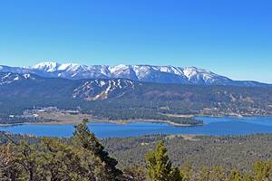
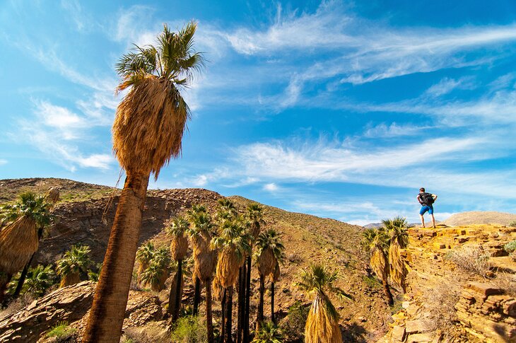
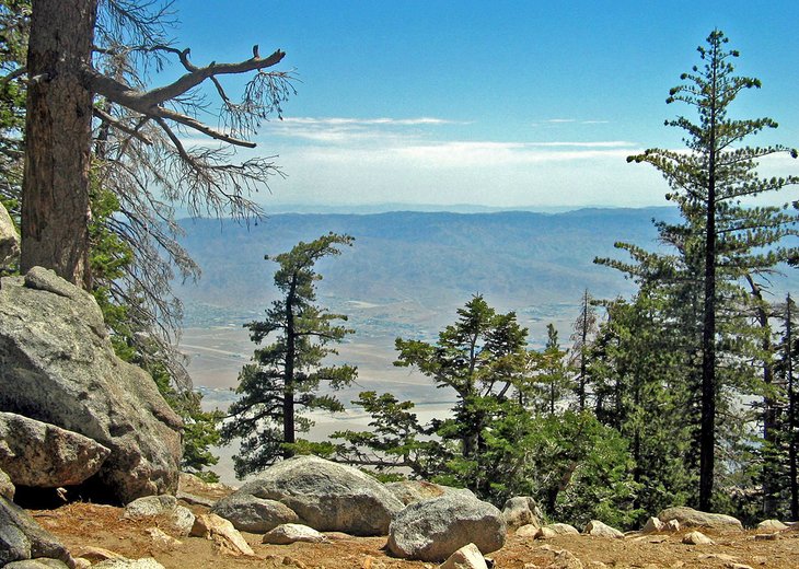
Mt. San Jacinto State Park
Highlights: The trail at the top of the tramway; the temperature here can be 40 degrees cooler than the city below and features an alpine environment
Mainly accessible by taking the Palm Springs Aerial Tramway, this alpine wilderness area offers 50 miles of hiking trails and 14,000 acres of raw wilderness. The Palm Springs Aerial Tramway is the world's longest-rotating aerial tramway. It whisks you from the desert floor to an elevation of almost 9,000 feet in just 10 minutes.
At the top, you'll find an alpine environment, with temperatures that are 30 to 40 degrees cooler than the desert floor below. Trams run from about 10am to 8pm, with the last tram down at 9:45pm. Summer hours are a bit longer, with a later last tram down.
A free, California Wilderness Permit is necessary to go beyond the main clearing area. The timed permits help track visitors for safety reasons and are also used to limit crowds for a more intimate experience. The hikes up here can be done year-round, but you will encounter snow in the late fall and winter months. In the summer, the temperatures can get high and sometimes exceed 100 degrees Fahrenheit (38 degrees Celsius).
The San Jacinto Peak Hike
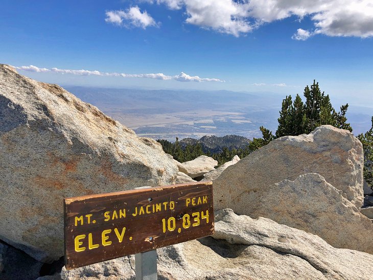
Highlights: An 11-mile trail at the top of the tramway that is moderately difficult but rewards with views that can include Las Vegas on a clear day
This out-and-back hike starts at the Mountain Station of the tramway and is almost eleven miles, round trip. The hike ends atop Mt. San Jacinto, the second-highest point in Southern California (about 10,000 feet above sea level). The views are endless, stretching across the area, extending to Catalina Island (26 miles off the coast). If you do the hike at night or in the early morning, you can sometimes see the glow of the lights of Las Vegas about 300 miles away.
It's a popular hike for people who take the Palm Springs Aerial Tramway, as it starts at the tramway's mountain station and it really takes advantage of the tram, bringing you 8,500 feet to the top of the mountain. The hike is moderately easy, with an elevation gain of about 2,600 feet.
Wellmans Divide
Highlights: Another hike at the top of the Palm Springs Aerial Tramway; this three-hour hike is also popular in winter for snowshoeing
This is another Palm Springs hike that starts at the top of the tramway and is for people who have taken the tramway up the mountain. It's a loop trail about seven miles in length and takes most people about three hours to do the loop. The Wellmans Divide trail is also used during the winter for snowshoeing.
Like other trails that start at the tramway station, you need a free permit, available at the ranger station in Round Valley. The permit system also allows the rangers to keep track of who is on the mountain, for safety reasons.
After you've hiked from the Mountain Station to an area called Round Valley, continue on another mile (and climb about 600 feet in elevation) to Wellmans Divide. This provides sensational views of the region, including the dome of the Palomar Observatory almost 200 miles away in San Diego County. From this trail, you could continue on to the San Jacinto Peak hike, or head downhill on a 10-mile hike to Idyllwild.
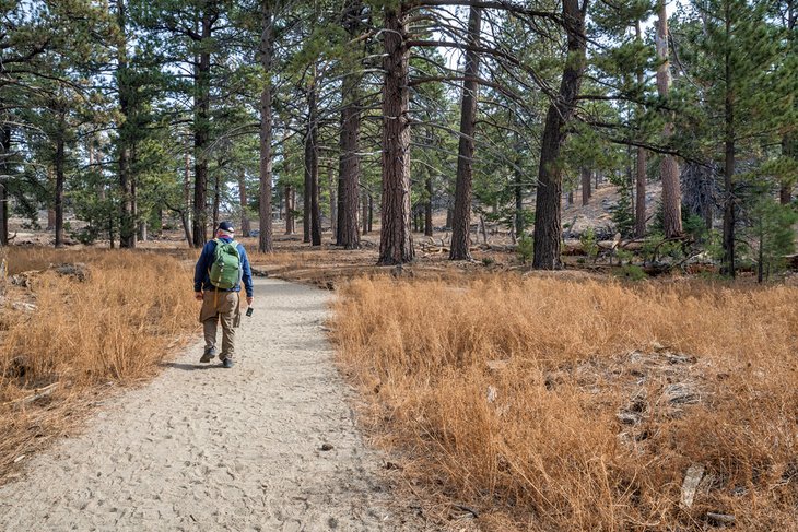
The Long Valley Discovery Trail and The Desert View Trail
Highlights: Two easy, family-friendly mountain hikes, well-marked and featuring lots of informational signage
These are two of the easy hikes you can do at the Mountain Station of the tramway. The Long Valley Discovery Trail is great for families and kids, as it's only three-quarters of a mile (1.2 kilometers) long and marked with a lot of informational signage.
The Desert View Trail is a bit longer, at almost two miles, and a bit more strenuous, but you visit a few scenic overlooks. The views are both of the Coachella Valley and surrounding region to one side and across the pine forests and valleys of Mt. San Jacinto State Park looking to the other direction.
Map of Hikes in Palm Springs, CA
Palm Springs, CA - Climate Chart
| Average minimum and maximum temperatures for Palm Springs, CA in °C | |||||||||||
| J | F | M | A | M | J | J | A | S | O | N | D |
| 21 7 | 24 8 | 27 11 | 31 13 | 35 17 | 40 21 | 42 24 | 42 24 | 38 22 | 33 16 | 26 10 | 21 6 |
| PlanetWare.com | |||||||||||
| Average monthly precipitation totals for Palm Springs, CA in mm. | |||||||||||
| 32 | 29 | 16 | 2 | 2 | 1 | 5 | 10 | 10 | 3 | 7 | 16 |
| Average minimum and maximum temperatures for Palm Springs, CA in °F | |||||||||||
| J | F | M | A | M | J | J | A | S | O | N | D |
| 70 44 | 75 47 | 80 51 | 88 56 | 95 63 | 104 70 | 108 76 | 107 76 | 101 71 | 91 61 | 78 50 | 70 43 |
| PlanetWare.com | |||||||||||
| Average monthly precipitation totals for Palm Springs, CA in inches. | |||||||||||
| 1.3 | 1.2 | 0.6 | 0.1 | 0.1 | 0.1 | 0.2 | 0.4 | 0.4 | 0.1 | 0.3 | 0.6 |
The best time to visit Palm Springs is during the late fall in October and November and the winter months of December, January, and February. Nights are usually in the 50s Fahrenheit, and days are sunny, with average temperatures around 75 Fahrenheit. March and April can see high winds and by May, the temperature starts to hit levels that make hiking unsafe.
More Related Articles on PlanetWare.com
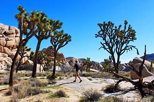
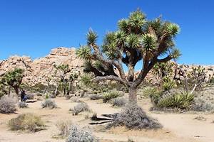
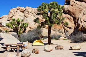
Things to Do around Palm Springs: Once you've had your fill of hiking, be sure to check out the main attractions in Palm Springs. Alternatively, you may want to simply spend some time relaxing around a pool if you are staying at one of the area's luxury resorts. If you want to do a day trip, head out to explore Joshua Tree National Park, where you'll also find beautiful hike trails and other sights.