Hikes in Austin, TX
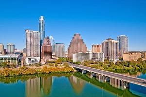
A major appeal of Austin is its access to the outdoors and several great hiking trails. Amid the skyscrapers of downtown and the urban development of the city, several natural spots encourage time spent outside. The crown jewel of hiking trails in Austin, the Ann and Roy Butler Hike and Bike Trail, is one of the best places for hiking when the weather is nice. And the weather is often nice in Austin.
Other in-city hiking trails, like the Barton Creek Greenbelt and the Turkey Creek Trail, also dive deep into nature within city limits. McKinney Falls State Park is also within the city limits and provides a trail system that connects two waterfalls and a swimming hole. And if it is swimming holes you're looking for after a hike, the quarter-mile trail leading to Hamilton Pool is also just right for you.
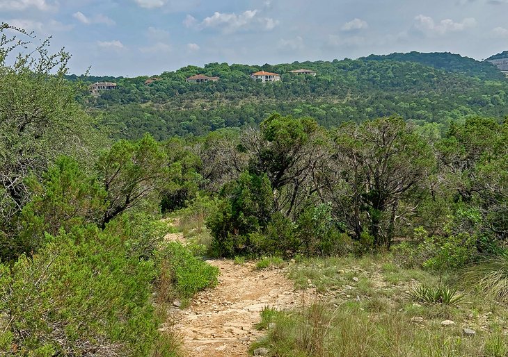
Places like St. Edwards Park offer amazing views of Hill Country on various trails, as does Mount Bonnell, one of the highest points in the city. Interesting rock formations, spring-fed swimming spots, and peacock plumage are also encountered on some of the best hikes in Austin and the surrounding area.
Ann and Roy Butler Hike and Bike Trail
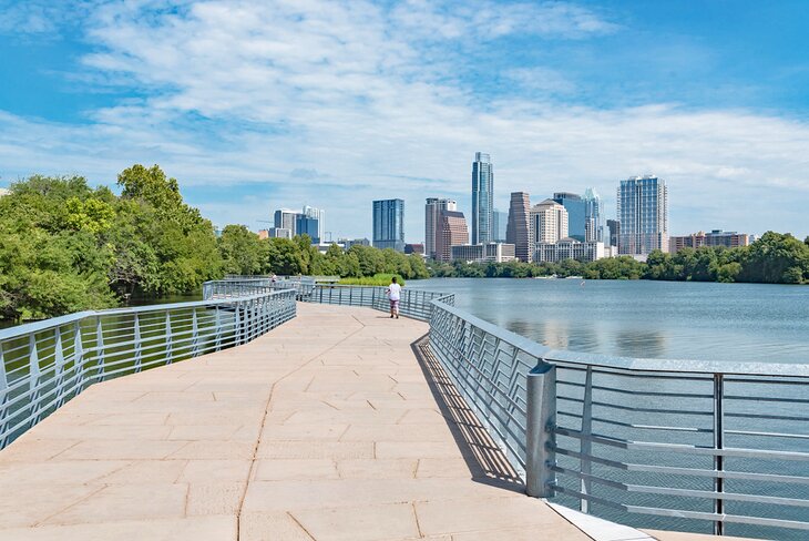
The Ann and Roy Butler Hike and Bike Trail is a defining aspect of Austin's appeal. This 10-mile trail borders downtown and spans either side of Lady Bird Lake, one of the best lakes in Texas. It's named after a former mayor and his wife, and the city's skyline is within view for much of the paved trail, as is the span of Lady Bird Lake.
Millions of people bike, run, and walk on the Butler Trail each year. The trail connects to several riverside attractions, including Zilker Park, home to the Austin City Limits music festival. Auditorium Shores and Deep Eddy Pool are other points of interest on the Butler Trail.
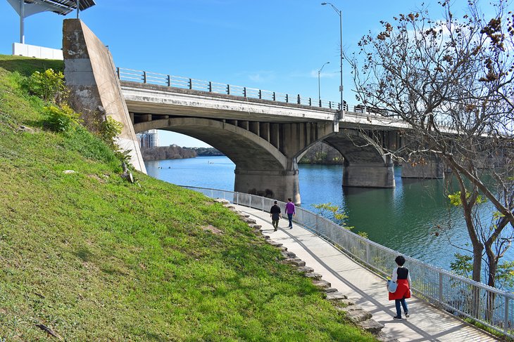
The Boardwalk on the Butler Trail is particularly fun to visit on the south bank of Lady Bird Lake, east of Congress Avenue. Viewing areas, public art, and thousands of LED lights span this concrete and steel boardwalk that extends over a mile. Entry points like Blunn Creek and International Shore lend access to the Boardwalk.
Read More: Tourist Attractions in Austin, TX
Mount Bonnell, Covert Park
Mount Bonnell offers one of the most panoramic views of the region within city limits. It's a short hike to reach the peak of Mount Bonnell, within Covert Park, but the 102 limestone steps leading to the top still make it feel like a workout.
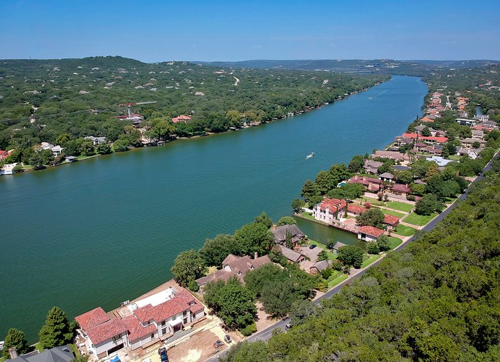
Mount Bonnell offers one of the highest natural vantage points in the city at 775 feet. The view atop includes the Texas Hill Country, the Austin skyline, and most prominently, Lake Travis on the Colorado River.
Mount Bonnell offers a tremendous western view, which makes for amazing sunsets atop the mountain. These breathtaking moments also make the evening a popular and often crowded time to visit. Room is available at the top to avoid some of the congestion, and visitors should practice extreme caution when approaching the cliff edge.
For an add-on adventure, the peacock-infused grounds of Mayfield Park offer 26 acres of walking trails nearby.
Address: 3800 Mount Bonnell Road, Austin, Texas
Barton Creek Greenbelt
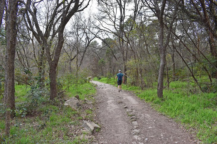
Barton Creek Greenbelt stands above the other greenbelts in the city. It's in south-central Austin, and alongside a beautiful flat path through natural surroundings, Barton Creek also offers a variety of other ways to enjoy the day. Opportunities to rock climb, swim, and mountain bike line all 12 total miles of the Barton Creek Greenbelt system.
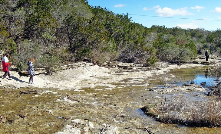
Several access points line the Barton Creek Greenbelt. The greenbelt begins near Barton Springs Pool at Zilker Park. Swimming and wading in Barton Creek is only possible when water levels are high. Otherwise, users enjoy hiking the dry creek bed. Other prominent points of interest on the Barton Creek Greenbelt include Cambell's Hole and Sculpture Falls.
Turkey Creek Trail, Emma Long Metropolitan Park
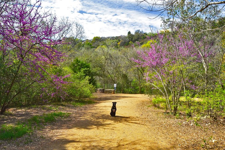
Northwest of the city, the Turkey Creek Trail is a popular place to let the dogs run free. Pets can roam off-leash on this 2.5-mile trail within Emma Long Metropolitan Park, a 30-minute drive from downtown Austin. The trail begins at the end of City Park Road and makes a lollipop loop from there.
The trail crosses Turkey Creek several times as it follows the banks. These crossings are generally easy to navigate, though more challenging if water levels are high. The well-marked loop trail gains little elevation, and by going counterclockwise, hikers avoid the bulk of the climbing. Mile markers along the trail help keep hikers on course.
Address: 1401-1711 City Park Road, Austin, Texas
Onion Creek Hike and Bike Trail, McKinney Falls State Park
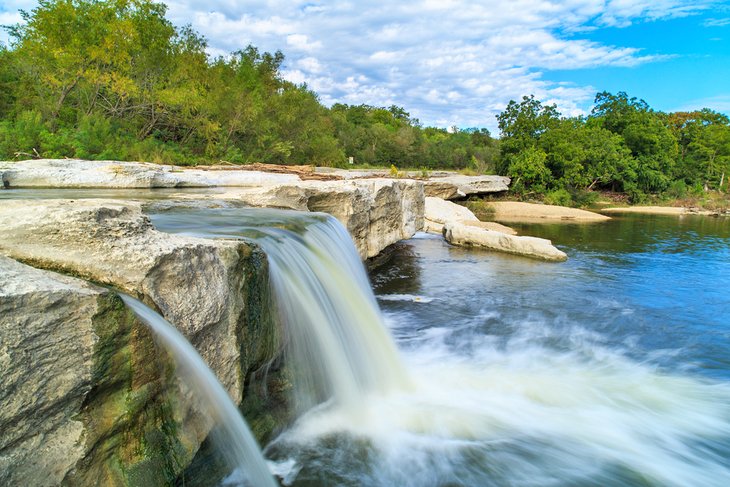
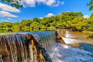
Ten miles southeast of the Texas Capitol, McKinney Falls State Park is a natural getaway within city limits. This expansive state park features camping, hiking trails, and one of the best waterfalls in Texas.
Nearly nine miles of trails make their way through McKinney Falls State Park, and the Onion Creek Hike-and-Bike Trail is the main path that connects them all. The Onion Creek Trail circles the park in just under three miles, including a stretch near Upper Falls on Onion Creek. Upper Falls is a popular spot to swim and fish when the weather is warm.
The trail is a hard surface and is suitable for hiking, biking, and pushing a stroller.
Several trails branch from the Onion Creek Trail, including a northern trail network that passes by Lower Falls and the McKinney Homestead.
Address: 5808 McKinney Falls Parkway, Austin, Texas
Southern Walnut Creek Trail
The Southern Walnut Creek Trail offers residents and tourists an excellent corridor for hiking or biking on the east side of Austin. The trail extends over seven miles north from Govalle Park to Johnny Morris Road. Future installments of the trail will add a dozen more miles to the pathway and connect to more neighborhoods in North Austin.
Hikers, cyclists, and inline skaters all enjoy the 10-foot-wide concrete path of the Southern Walnut Creek Trail. It's also an accessible path for strollers and dog walkers. The trail offers scenic surroundings and minimal elevation gain along the banks of Walnut Creek. Several access points line the path, as do public benches and water fountains.
Canyon Trail, River Place Nature Trail
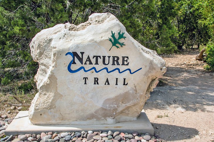
The Canyon Trail is a challenging hiking trail in northwest Austin and part of the larger River Place Nature Trail. The path is 2.3 miles long and features several log steps and steep elevation changes. Hikers looking to do an out-and-back hike ascend over 1,300 feet. This elevation lends to soar leg muscles, but the lush forest and scenic outlooks make for a pretty good distraction while climbing.
Two other prominent trails at River Place Nature Trail are the Panther Hollow Trail and Little Fern Trail. Both trails connect to the Canyon Trail at Panther Junction. The Panther Hollow and Little Fern Trails each traverse approximately a half mile, with a gentle slope and wide path. These two trails are the most popular for families at River Place Nature Trail.
Address: 4998 River Place Boulevard, Austin, Texas
Mayfield Park and Nature Preserve
The tranquil acreage at Mayfield Park provides a peaceful getaway within city limits and a fun place to hike with the whole family. This park and preserve are a historic estate turned public space and now feature a lovely cottage and wide-growing garden.
Also on display at the park are a pride of peacocks that like to strut their stuff and fan out their plumage. Visitors are asked to give peacocks plenty of space when visiting the park.
Alongside the colorful gardens and wildlife, Mayfield Park features a family-friendly hiking trail system. The trails cover nearly the entire 20-plus acres of the park and navigate in small circles, which prevents most visitors from ever feeling lost.
The Lake Trail at Mayfield Park leads to a quick view of Lake Travis on the Colorado River. For a better look at the water, the nearby Mount Bonnell at Covert Park features a stunning panorama.
Address: 3505 W 35th Street, Austin, Texas
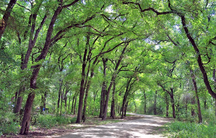
Creek and Hill Trail, St. Edward's Park
St. Edward's Park offers a quiet escape into nature in the northwest corner of Austin. It's a popular family hike, and the park offers shaded hiking trails, dramatic bluffs, and opportunities to play in the creek. Several trail junctions greet visitors at the entrance to the park, many of which are also popular with mountain bikers in the area.
It helps to take a picture of the trail map when first visiting. The park is not big enough to officially get lost, but the trail network can be confusing even to people who visit often.
Among the network of trails, two popular routes stand out as the most common to explore: The Creek Trail and the Hill Trail. These two well-trodden trails uncover two different perspectives of the natural area.
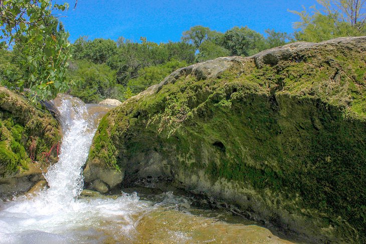
The Creek Trail offers a two-mile round trip heading north along Bull Creek. This nicely shaded corridor flourishes with flora and has features like waterfalls when rain levels are high. The Hill Trail at St. Edwards offers more of a challenge as it climbs up the limestone bluffs of the park. An excellent overland view of Bull Creek awaits hikers at the top of the Hill Trail.
Address: 7301 Spicewood Springs Road, Austin, Texas
Read More: Waterfalls in Texas
Hamilton Pool Preserve
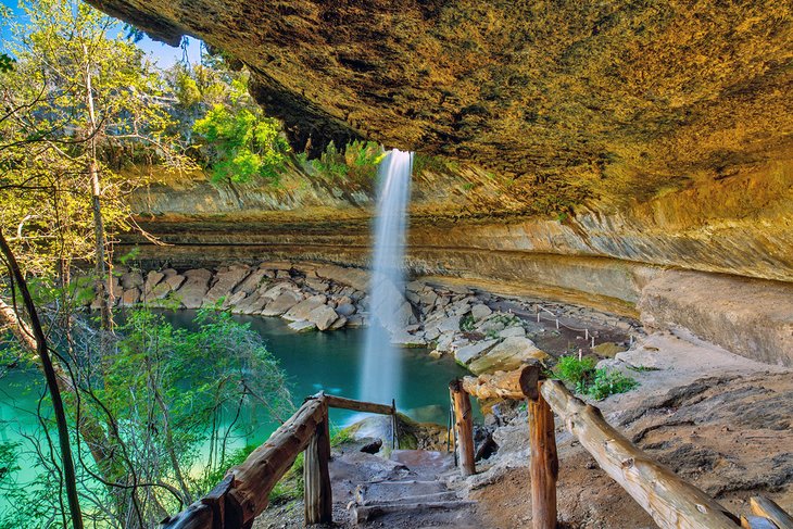
At under a quarter mile, the steep path leading down to Hamilton Pool isn't a very long hiking trail. However, the spectacular waterfall and Hill Country cave at the end of the trail is a real reward for the hike. It's this plunging feature that makes Hamilton Pool one of the best day trips from Austin and a popular hiking and outdoor destination.
Hamilton Hill Preserve requires reservations to help cut down on overcrowding. Weekend and holiday trips are harder to get. Reservations are typically available 3-4 months prior to the expected date of travel.
This quarter-mile trail is steep and can be tricky to navigate after wet weather. Hamilton Pool itself is also affected by wet weather, and the preserve may prohibit swimming after heavy rainfall. Hot and sunny weather is the best time to hike to Hamilton Pool. When swimming is allowed, the natural grotto offers a great place to cool off.
Address: 24300 Hamilton Pool Road, Dripping Springs, Texas
Pedernales Falls State Park
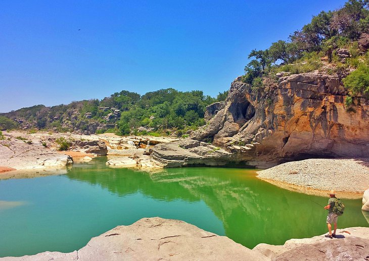
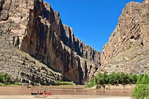
One of the best state parks in Texas is only an hour's drive from Austin. The Pedernales River carves its way through the limestone bedrock of the region to create a dynamic series of waterfalls and the state park's namesake feature. Swimming is not allowed at Pedernales Falls due to the turbulent nature of the water. But the dynamic landscape does encourage safely rock hopping around.
While the falls are the main feature of Pedernales Falls State Park, several other hiking trails navigate the area. The 8.9-mile Juniper Ridge Trail at the park is as popular for mountain bikers as it is for hikers. The equally challenging Wolf Mountain Trail features scenic vistas and a few creek crossings. When visiting Pedernales Falls, take notice of park signs detailing the warnings of a river surging.
Address: 2585 Park Road 6026, Johnson City, Texas
Mary Moore Searight Park
Mary Moore Searight Park is popular for several outdoor activities in Austin. This metropolitan park is south of downtown and features a renowned 18-hole disc golf course, playground equipment, dog parks, and a model airplane field. And on top of everything else that draws crowds, hiking and horseback trails also weave throughout the landscape.
The trails at Mary Moore Searight Park can be disorientating. But with so many facilities and the noise of traffic nearby, it's hard to officially get lost. The most common loop and largest path extend from the parking lot on the park's north side off Slaughter Lane. Several smaller trails branch out from here.
Wild Basin Wilderness Preserve
This wilderness preserve is a 10-mile drive from downtown Austin and is part of the larger Balcones Canyonlands Preserve. Unlike other parts of the preserve, the Wild Basin portion allows the public to tour the wooded environment on their own, including over 2.5 miles of hiking trails within its 227 acres.
Trails at Wild Basin are accessible from sunrise to sunset. Several loops make up the trail system, with points of interest including waterfalls and scenic overlooks. The Wild Basin Creative Research Center within the park, operated by St. Edwards University, acts as a visitor center. The creative research center also offers public guided hikes on the second Saturday of each month.
Address: 805 N Capital of Texas Highway, Austin, Texas
Blunn Creek Preserve
Blunn Creek Preserve provides a wild 40 acres near the heart of the city, just across the street from St. Edward's University. This compact parkland and preserve deliver the quick feeling of escape throughout its sprawling network of trails.
Hikers encounter dynamic landscapes like creekbeds and rocky slopes and a few outstanding elevated views.
The Blunn Creek Greenbelt is the primary corridor through the preserve and has a few looped intersections. Hikers can navigate at least two miles along this compact gravel path, which is wider than a traditional hiking trail. The preserve is popular for trail running and jogging.
Map of Hikes in Austin, TX
More Related Articles on PlanetWare.com

More Places to Visit in Austin: For some urban adventures, our Visitor's Guide to Downtown Austin details the best entertainment and attractions of the city. A part of Austin's allure is its prime location in Texas. With Hill Country to the west, and other prominent cities like San Antonio nearby, the best day trips from Austin continue the urban experience.

Outdoor Adventures in Texas: The best state parks in Texas display the wide range of landscapes found throughout the state. For a place to spend the night, our guide to places to camp in Texas will have you snoozing under the stars in no time. Everything is bigger in Texas, and that includes fish pulled out of the water. Our best fishing lakes in Texas article highlights some of the best bass, crappie, and catfish spots in the state.