Hiking & Walking Trails near Boston
Although Boston has a compact downtown of winding old streets, it has an astonishing wealth of open space and parkland where you can walk or hike and enjoy the urban landscapes framed by trees and grass.
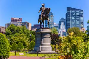
The wide Charles River runs within blocks of busy downtown, bordered by a broad esplanade park. From its busy hub at Park Street and the Boston Common, a green swath known as the Emerald Necklace connects parks, fens, ponds, public gardens, and an arboretum in a continuous 1,100-acre chain, linked by seven miles of hiking trails.
All around the city are leafy suburbs with vast parks and reserves of public lands that include gentle hills to climb for views back at the city skyline, and miles of trails along the rivers and bay.
Many of the walking routes pass close to Boston's tourist attractions, including historic sights and world-class museums and universities. Two are city walks that take you to some of the most iconic places to visit in Boston. Another traces the route of the Minutemen at the battles of Lexington and Concord.
If you're looking for a short getaway from the busy city streets, you'll find plenty of places to visit with our list of the top walking and hiking trails near Boston.
Emerald Necklace
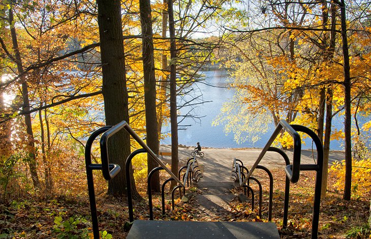
More than 100 years ago, the preeminent landscape architect Frederick Law Olmsted envisioned a long green space connecting downtown Boston to the suburbs. This Emerald Necklace he designed has survived intact, and today connects more than 1,000 acres in six different parks from the Boston Common to Franklin Park.
You can walk the entire seven miles or any part of it, either returning on foot or by public transportation (nearby stops are marked on the excellent Emerald Necklace map). On its way to Dorchester, the route passes two major art museums, Boston's famous Swan Boats, a stunning rose garden, the historic Fenway Victory Gardens, three ponds, a wildflower meadow, the Arnold Arboretum, and a zoo.
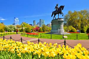
The route is filled with things to see and do in Boston and its suburbs. The Emerald Necklace begins with the Boston Common and Public Garden, continuing along the tree-covered park in the center of Commonwealth Avenue, lined on either side by rows of distinguished brownstone and brick townhouses that were homes to the "Boston Brahmins."
You can walk the portion from Charles Street, through the Public Garden and the length of Commonwealth Avenue for a 2.5-mile round-trip, or add another 1.6 miles by strolling through the Fenway community gardens and the rose garden.
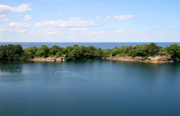
A popular side trail on the Emerald Necklace circles Jamaica Pond; the main trail runs along its south side, where there is a scenic overlook.
Address: Shattuck Visitor Center, 125 The Fenway, Boston, Massachusetts
Battle Road Trail
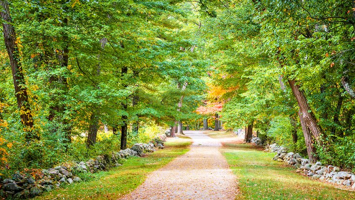
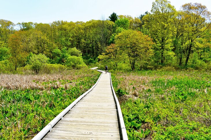
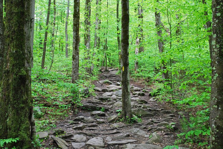
The beautiful level path through forests and riverside wetlands seems far removed from its historic context-the first shots of the American Revolution and Paul Revere's famous ride. Along with sections of the Battle Road, where the British troops were harassed by Minutemen firing from behind stone walls, the trail follows the route of the Minutemen as they moved from their first skirmish with the British troops on Lexington Green to the battle at Concord Bridge.
Here, the small band of ill-armed farmers stood off the British, who scuttled back to Boston without having seized the Colonists' stockpiled weapons and munitions in Concord as intended.
Along the five-mile route, you'll want to stop to read the historic markers, see the displays and multi-media presentation in the visitors center, follow a few side paths, visit Hartwell Tavern, and look around Concord Bridge.
For avid readers, one of the favorite places to go near the trail is Authors Ridge in Concord's Sleepy Hollow Cemetery, the burial place of Louisa May Alcott, Ralph Waldo Emerson, and Henry David Thoreau.
The trail is open year-round, although the visitor center is open only from April through October.
Address: 250 North Great Road, Lincoln, Massachusetts
Blue Hills Reservation
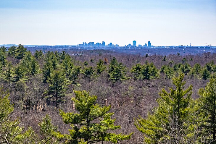
The 635-foot summit of Great Blue Hill is the highest of the 22 Blue Hills protected by the 7,000 acres of the reservation stretching across parts of Milton, Quincy, Braintree, Canton, Randolph, and Dedham, south of Boston.
Climbers are rewarded with sweeping views of the entire metropolitan area from its rocky top, but this is only part of the park's 125 miles of trails. Some lead to sites with evidence of Native American presence here, others past remnants of early farms and old quarries.
The park protects natural habitats that you can explore on trails that lead past ponds, marshes, and swamps, and through high and lowland forests, meadows, and an Atlantic white cedar bog. The six-mile Skyline Loop involves some serious exercise, with rock scrambles and a lot of ups and downs. Maps are available at the headquarters, and the rangers are helpful in suggesting and describing routes.
Also in the park are the Blue Hills Trailside Museum and the Blue Hill Observatory and Science Center, at the summit of Great Blue Hill. You can get to the park by public transportation.
Address: 695 Hillside Street, Milton, Massachusetts
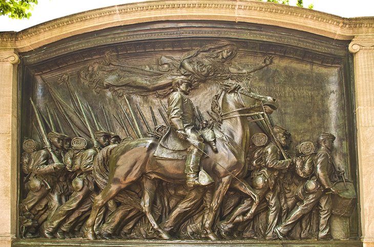
The Freedom Trail
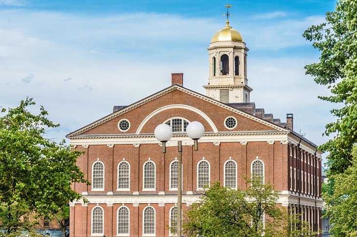
One of the country's best-loved city walks, The Freedom Trail follows the events leading up to the American Revolution, visiting the sites where many of the seminal events took place.
The three-mile walk, marked by a line of red bricks in the sidewalk, begins at the visitor center in the Boston Common and visits 16 historic monuments and sites. These include the site of the infamous Boston Massacre and Old South Meeting House, where the speeches of patriots lead to the Boston Tea Party.
Old Granary Burying Ground is where Paul Revere, Samuel Adams, and John Hancock are buried, and the trail leads past Faneuil Hall and The Paul Revere House in Boston's North End. Not far away is Old North Church, where the lanterns were hung to signal his famous ride.
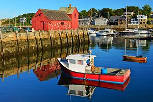
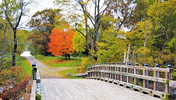
The Atlantic Path and Halibut Point
A scenic two-mile walk along the shore, over rock ledges that slope to the sea, begins just past The Emerson Inn, a beautiful historic hotel overlooking the sea on Cathedral Avenue in Rockport, and continues to Halibut Point State Park. Here, you will find 2.5 miles of trails along more rocky shore and around a granite quarry that has been filled by springs.
An interpretive trail explains the quarry's operation and the fascinating history of this point. Granite quarried and cut here was used for paving stones and to build Boston's Custom House Tower. You can learn more about Halibut Point's and Cape Ann's granite quarrying and natural history at the visitor center and museum.
The views along the coast reach across Ipswich Bay as far as New Hampshire and Maine. Birders will like this park, with its rocky coast covered in bayberry and shad, good habitats for small birds. The Atlantic Path continues from the far side of the park.
Location: Rockport, Massachusetts
World's End
The gentle hills and rocky shorelines of 251-acre World's End, 15 miles from the city on the south shore, has something for everyone: hiking, cross-country skiing, snowshoeing, kayaking, canoeing, birding, horseback riding, and mountain biking.
Like the harbor islands, the hills of World's End are drumlins, left by retreating glaciers, which also scraped bare the granite ledges that are now covered in blueberry bushes and cedar.
Trails skirt saltwater marshes and cross woodlands and meadows that are important habitats for birds and native plants. From its hills and shore are views of the Boston skyline, and winding through the park under a canopy of trees are carriage lanes designed by landscape architect Frederick Law Olmsted.
These carriage paths and walking trails combine to create 4.5 miles of moderate hiking. Although World's End is managed by the Trustees of Reservations, it is part of the Boston Harbor Islands National Park area.
Address: Martins Lane, Hingham, Massachusetts
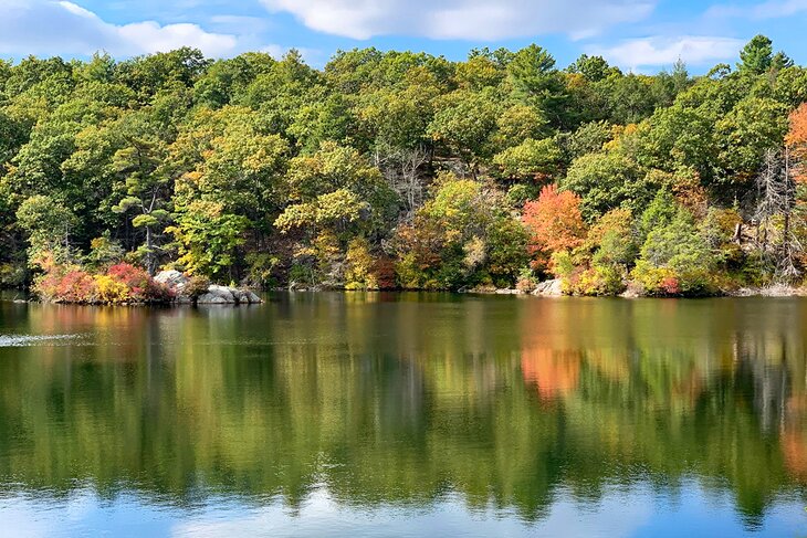
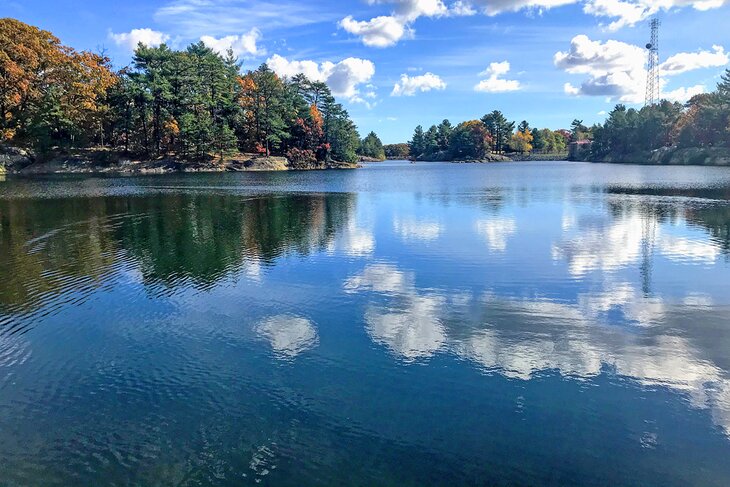
Charles River Reservation
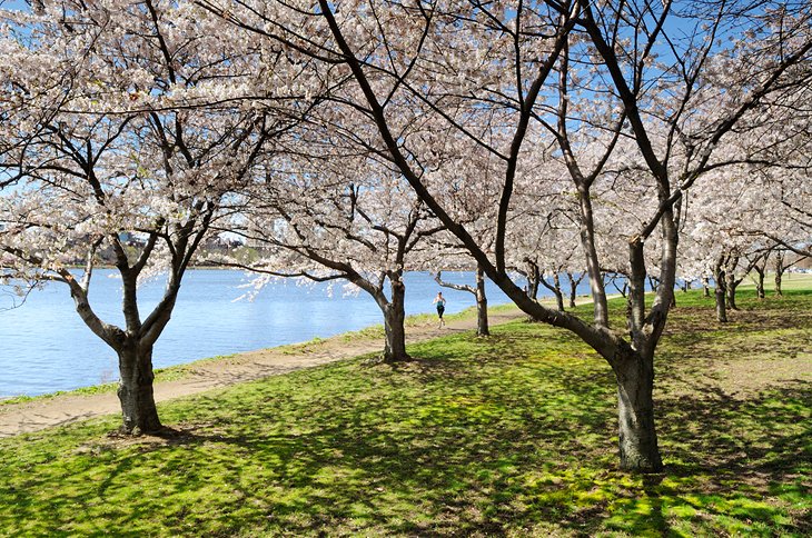
Boston and Cambridge share the Charles River, which flows in a wide band between them. On each side is a green strip with walking and cycling paths that make good loops, thanks to the well-spaced bridges. The Charles River Reservation is a linear park that stretches 20 miles upriver from Boston Harbor.
On the Boston shore, it includes the wide Esplanade, and on the Cambridge side, it runs past the scenic campuses of Harvard and MIT. The best view of the Boston skyline is from the MIT shore, with the river as a foreground, dotted with sailboats.
Various local trail networks join, leave, and intersect the trails along the river. The Charles River Link is a 16-mile trail along one of the most scenic stretches, connecting green spaces in Newton, Wellesley, Needham, Natick, Dover, and Medfield.
The Wellesley Trails network, which it includes part of, follows the Charles River, continuing through the Town Forest and past Longfellow Pond. The portions of the riverside paths on the Boston end are heavily used by cyclists, rollerbladers, and runners, so walkers need to be alert and stay to one side to avoid annoying encounters.
For less traffic and more nature, head for the suburban riverside paths. You'll have immediate access to the riverside path from the Royal Sonesta Boston, overlooking the Charles River in Cambridge, next to the Museum of Science.
Mt. Auburn Cemetery
This is a walk for birders, history buffs, and anyone who loves flowers, plants, and trees. The idea to create a spacious tree- and flower-filled cemetery was conceived by a Harvard professor of medicine, Dr. Jacob Bigelow, as a solution to a shortage of burial spaces around urban churches.
The Massachusetts Horticultural Society wanted a botanical garden for plants they were collecting from around the world, and in 1831, they worked with Dr. Bigelow to create this 170-acre park of beautifully landscaped grounds, America's first garden cemetery.
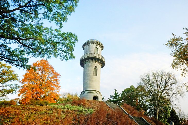
Mt. Auburn Cemetery has been compared to Westminster Abbey for the number of notable statesmen, authors, scientists, artists, academics, clergy, and actors interred here. Monuments are works of art themselves, and there are fountains, pools, and a chapel with stained-glass windows. At the highest point is the Gothic-style Washington Tower, with views over Boston and Cambridge.
Begin exploring Mt Auburn's 10 miles of paved lanes and pathways at the Egyptian-inspired stone gate and chapel. Stop at the office for maps and information in case you want to locate specific memorials or identify some of the flowering shrubs, trees, and plants that make it as much an arboretum as a burial place.
Stroll around the Asa Gray Garden, then follow Fountain Ave. to the left and circle Halcyon Lake, with its memorial to Mary Baker Eddy, founder of Christian Science. Then follow paths at will, using the map to identify landmarks and notable trees, or just find a bench and sit listening to the birds.
A stop for migrating birds, Mt. Auburn counts about 80 different species each spring, making bird-watching one of the most popular things to do here.
Address: 580 Mt Auburn Street, Cambridge, Massachusetts
Black Heritage Trail
While the south side of Beacon Hill is known for its rows of stately brick homes of Boston's elite old families, the north slope has long been a neighborhood of immigrants, including a sizable African American population that dates to the early 1800s.
The area was an active part of the Underground Railroad before the Civil War, and the Black Heritage Trail leads through the Boston African American National Historic Site to 15 pre-Civil War homes, schools, businesses, and churches that were part of Boston's 19th-century African American community.
You'll get even more of a picture with a visit to the African Meeting House, the oldest (1806) church built by and for Black Americans, restored to its 1854 appearance to house the Museum of African American History.
More exhibits are in the 1834 Abiel Smith School, America's first public grammar school for African American children. The tour is self-guided, or you can join a National Park Service Ranger on a free guided tour from April through November.
Breakheart Reservation
Almost unknown to any but those who live nearby, the 640-acre Breakheart lies along a wild section of the Saugus River, north of Boston. Inside its hardwood forest are two lakes and seven hills, rocky outcrops just over 200 feet in height, but high enough above the woods for views of Boston and southern New Hampshire. Hiking trails circle both lakes, border the river, and form loops throughout the park.
The riverbanks are popular with birders. In the summer, the park may be crowded with swimmers at the lake beaches, but even then you're likely to have its trails to yourself.
Address: 177 Forest Street, Saugus, Massachusetts
Appleton Farms Grass Rides
Borrowing "rides," the English term for a carriage path, Appleton Farms' grassy footpaths were originally bridle paths, and five of them converge like spokes of a wheel at the "Roundpoint," a clearing with a large granite pinnacle in the center. This and three other stone pinnacles were given to the Appletons, whose gentleman farm this was when the old Harvard library was torn down.
The family had long-standing ties with Harvard. In addition to the Grass Rides, Appleton Farms maintains six miles of footpaths, bridle paths, and farm roads open to walkers and equestrians (the latter by permit).
Appleton Farms Grass Rides includes a mix of forest, fields, and wetlands, which were once more extensive than they are today, but were drained by early farmers. You'll see examples of skilled stonework in the bridges and culverts around the property.
The wetlands here are spring feeding stops for migrating marsh birds and migrating hawks in the fall. The extensive grasslands are home to one of New England's largest bobolink and meadowlark populations.
Visit the working farm to gather bread and cheese at the dairy store for a picnic, one of the popular things to do here.
Address: 219 Country Road (Route 1A), Ipswich, Massachusetts
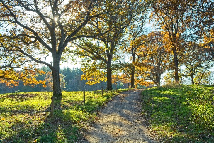
Middlesex Fells Reservation
With 2,575 acres of rocky, hilly terrain, the Middlesex Fells attract serious hikers, as well as walkers out for a stroll in the woods. The former will find a demanding five-hour hike on the seven-mile Skyline Trail, across a boulder-strewn terrain of woods and ponds, with repeated climbs and descents.
The main trail leaves Bellevue Pond, where white blazes lead up Pine Hill, topped by an observation tower with sweeping views across the reservation to Boston. Head north from the tower, following blazes on the rocks.
More than 100 miles of trails lead through the reservation, revealing meadows; ponds; Wright's Tower; and Virginia Wood, site of a vanished mill village called Haywardville. Here, you'll find an interpretive trail through the hemlock forest describing its history. The park reveals a lot more local history, of timbering, quarries, ice harvesting, and water that powered local mills.
A trail map, available at the visitors center, will direct you to trails that include the Rock Circuit and Crystal Springs loops in the eastern Fells and to the Cross Fells Trail that traverses the whole property. Allow more than four hours for the 3.7-mile Rock Circuit, one of the park's most difficult.
Address: 4 Woodland Road, Stoneham, Massachusetts
Mount Wachusett
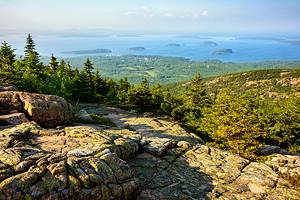
The tallest mountain near Boston, at a height of 2,006 feet, Mount Wachusett is popular with skiers in the winter and hikers the rest of the year. On clear days, the view extends to Mt. Monadnock in New Hampshire, the Berkshires in western Massachusetts, and the Boston skyline.
Surrounding the summit, the 3,000-acre Wachusett Mountain State Reservation protects forests, mountain meadows, ponds, streams, fields, and a raised bog, all of which you can explore on its 17 miles of hiking and walking trails. The reservation includes 3.9 miles of the Midstate Trail, which runs through the state from the New Hampshire line to the Rhode Island border.
The largest area of old-growth forest in eastern Massachusetts is inside the park, with trees more than 350 years old. Balance Rock, where two large boulders stand stacked one on top of the other, shows the force of moving glaciers at the close of the Ice Age.
Address: 345 Mountain Road, Princeton, Massachusetts
Lynn Woods Reservation
The 2,200-acre Lynn Woods Reservation holds more than 30 miles of hiking trails, through woodlands and alongside three ponds. The trails are some of the most interesting, with varied terrain and one four-mile loop revealing huge glacial erratic boulders and other rock formations.
Along with wildlife (at least 100 bird species have been spotted here), local history abounds in Lynn Woods. The area was farmed as early as the 1600s, and you might see stone wolf pits constructed to trap wolves that attacked livestock.
Tales of pirate treasure surround the curious Dungeon Rock and its underground tunnel, and a stone tower stands atop the park's highest point. The loop trail is about 4.5 miles long, and moderately difficult, with an elevation gain of about 300 feet.
One of the three ponds you'll skirt is the famous Walden Pond, where Henry David Thoreau lived in a cabin.
Map of Hiking & Walking Trails near Boston
More Related Articles on PlanetWare.com
Where to Go from Boston: If you are looking for a quick escape from the city, you'll find plenty of ideas in our pages on Day Trips from Boston and Weekend Getaways from Boston. If you're traveling in the summer, be sure not to miss the beaches in the Boston area.
Places to Hike in Nearby States: All of New England is rich in places to hike, and you'll find a great variety of trails for all energy levels on our pages Hiking Trails in New Hampshire and Hiking Trails in Vermont. And if camping is on your agenda, you can find great places to pitch your tent or park your RV with our list of the Campgrounds in New Hampshire, too. Farther north, you'll find plenty more hikes and climbs in Maine's Acadia National Park.