National Forests in Montana
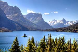
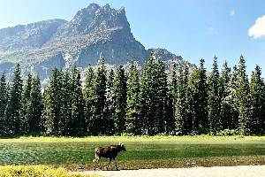
National forests are a big part of the Montana landscape. These federally managed lands encompass over 17 million acres in the mountainous western half of the state, astride the Continental Divide. Alongside impressive Rocky Mountain peaks, other defining natural features include wild rivers, ancient cedars, and miles-long lakes.
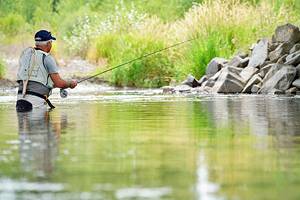
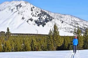
Almost every adventure associated with Montana awaits within the state's national forests. Just a few of these adventures include extended backpacking trips, fly fishing, and wilderness treks. Other popular endeavors include horse riding, wildlife spotting, and camping under the stars. And come winter, these forested acres are home to world-class skiing, snowmobiling, and snowshoeing.
Like Helena-Lewis and Clark National Forest, some national forests in Montana began as two separate units before merging into one. As a result, today Montana is currently home to seven national forests. And in the neighboring states of Idaho and Wyoming, other public lands connect to provide even more space to explore. Plan your next outdoor adventure with our list of the best national parks in Montana.
Flathead National Forest
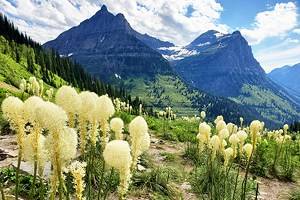
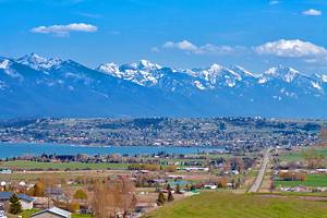
Flathead National Forest does well to define the wild places of Montana. This 2.4-million-acre forest encompasses five districts and several iconic landscapes in the northwest part of the state. The forest borders Glacier National Park and Canada to the north, and several other national forests surround it on all sides.
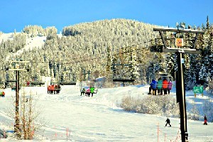
Flathead National Forest also provides the backdrop for the adventure-filled town of Whitefish. And the forest is home to Whitefish Mountain Resort, one of Montana's best ski resorts. This popular winter destination also entices visitors throughout the summer with scenic lift rides and downhill mountain biking. Whitefish Mountain is also home to the Summit Nature Center, where visitors learn more about the surrounding outdoor space.
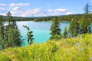
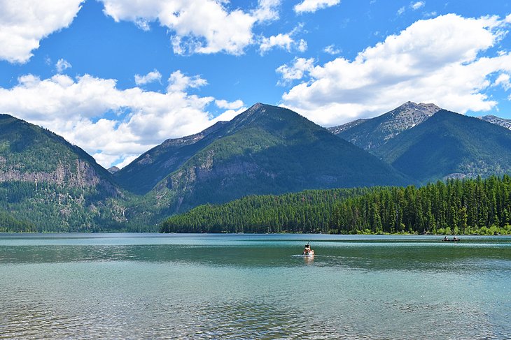
The Seeley-Swan Scenic Drive is another popular avenue to explore the forest. This 90-mile corridor spans Highway 83 between Seeley Lake and Swan Lake. The stunning Swan and Mission Mountains surround either side of the drive, and a chain of lakes along the Clearwater River lines the roadside. Holland Lake is one notable stop along the route, including the Holland Falls National Recreation Trail.
The Forest is also home to some of America's most impressive wilderness areas. For example, much of the fabled Bob Marshall Wilderness lies within Flathead National Forest, including the adjacent Scapegoat and Great Bear Wilderness. All three of these designated wilderness areas encompass a total of over 1.5-million acres of undeveloped terrain.
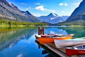
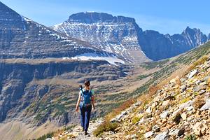
Flathead National Forest is a popular alternative to visiting Glacier National Park. These two public lands border each other and share similar stunning scenery. Flathead National Forest, however, sees only a fraction of the three million visitors the national park gets in the summer. Flathead National Forest is also much more pet-friendly with very few dog restrictions.
Read More: Things to Do in Flathead National Forest
Beaverhead-Deerlodge National Forest
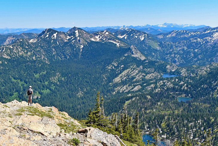
Beaverhead-Deerlodge National Forest, spanning eight counties in Southwest Montana, is the largest national forest in the state. It encompasses 3.35-million-acres or approximately similar square footage as Connecticut. This mega-status of the forest came to be in 1996 when the Beaverhead and Deerlodge National Forests merged into one.
The forest spans either side of the Continental Divide, primarily surrounding the historic mining town of Butte. This rugged landscape runs rampant with adventurous landscapes, including snowcapped mountains, massive alpine lakes, and ski resorts come winter. Camping is also abundant within developed campgrounds or primitively off the roadside.
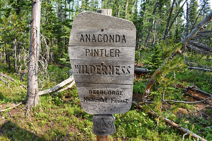
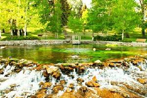
Several scenic drives in Beaverhead-Deerlodge National Forest offer avenues for adventure. A great route to explore the forest is the Pintler Veterans Memorial Scenic Highway. This approximately 64-mile drive is an excellent alternative to Interstate-90 between Butte and Missoula. The route passes by the sterling Georgetown Lake approximately mid-route, which is a real aquatic gem of the national forest.
Another scenic drive is the Pioneer Mountains Scenic Byway. This approximately 49-mile drive navigates beautiful mountain terrain between Wise River and Highway 278 in Beaverhead County. This paved route is well-marked and accessible for any vehicles that can handle mountain passes. A few notable roadside attractions along the way include Maverick Mountain Ski Area and Coolidge Ghost Town.
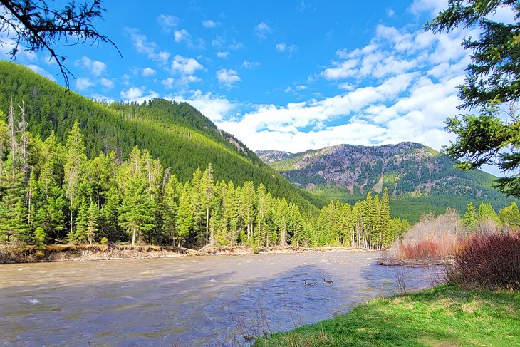
Custer-Gallatin National Forest
In 2014, the Custer and Gallatin National Forests combined to encompass over three million acres. Today, seven ranger districts oversee the entire forest, spread throughout south-central and southeast Montana. Custer-Gallatin also extends into northwest South Dakota.
The national forest covers some of the most iconic landscapes in Montana. It provides three access points to Yellowstone National Park, including the spectacular Beartooth Pass leading to the Northeast Entrance Station. And the entire forest is part of the Greater Yellowstone Ecosystem — one of the largest nearly intact ecosystems on Earth.
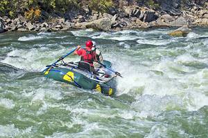
Recreation is abundant throughout the forest. A few popular activities include hiking, boating, backpacking, birding, hunting, and camping. And wild waterways like the Gallatin, Madison, and Yellowstone Rivers, plus thousands of tributaries, also lend the forest a world-class fishing reputation. And come winter, the forest transforms into a mecca for snowmobiling, skiing, and snowshoeing.
Several towns lend access to the forest and serve as excellent base camps. Bozeman, home to Montana State University, is one such city where access is abundant. Several of the best hiking trails near Bozeman are within the forest. And community members often take advantage of the nearby slopes at Bridger Bowl Ski Area, jointly operated by the Forest Service.
Livingston, less than 30 miles east of Bozeman, is also a jumping-off point into the forest. Heading south from Livingston, Highway 89 navigates Paradise Valley, beckoning with adventure on both sides of the road. On the east side of Paradise Valley, the imposing Absaroka-Beartooth Wilderness offers the most rugged of Montana adventures.
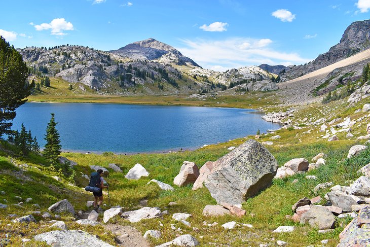
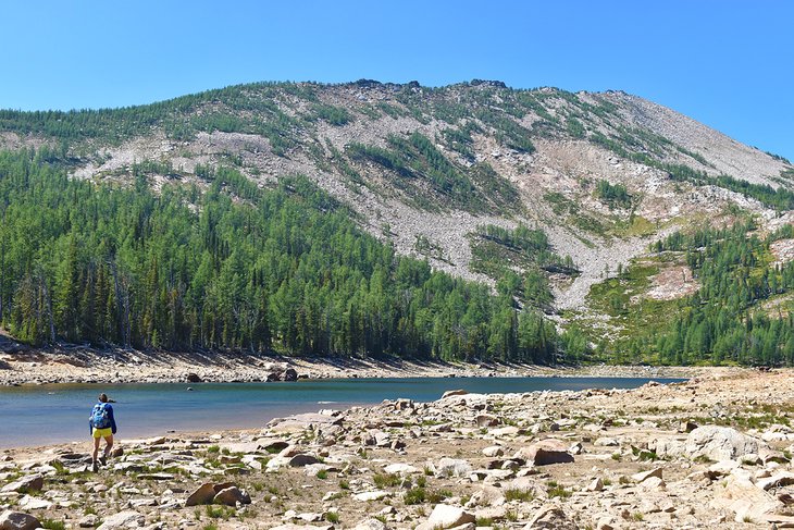
Bitterroot National Forest
Bitterroot National Forest is in Southwest Montana and extends into Idaho. And it is a place of legend. Over half of this 1.6-million-acre forest is a designated wilderness area. Part of this undeveloped nature includes the iconic Frank Church-River of No Return Wilderness, one of the most extensive wilderness tracts in the country. This unmodernized and mountainous terrain offers true American adventures in the heart of a wild country.
The primary automobile route to access the Bitterroot National Forest heads south from Missoula on Highway 93. The highway navigates the Bitterroot Valley, connecting small towns like Lolo, Florence, Stevensville, and Hamilton. Two imposing mountain ranges sandwich the route, with the Sapphire Mountains to the east and the Bitterroot Mountains to the west.
Glacier-carved drainages punctuate the Bitterroot Range to the west, offering excellent hiking trails. All down Highway 93, roadside markers indicate these trailheads and entice all lengths of adventures. A few to check out include Blodgett Canyon, Camas Lake Trail, and Trapper Peak.
Other popular recreation outlets in the Bitterroot National Forest include camping, boating, and cross-country skiing come winter. The forest is also a hot spot for fishing, and anglers from across the world come to Montana to cast into the Bitterroot River.
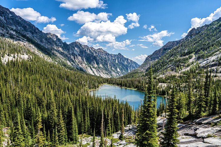
Lolo National Forest
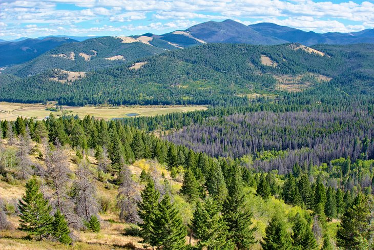
Lolo National Forest encompasses over two million acres in Western Montana. The forest surrounds the university city of Missoula and extends west to the Idaho border. A few other prominent towns nearby include Superior and St. Regis along the Interstate-90 corridor. Several other national forests also surround and connect to Lolo in this adventure-filled region of the state.
The forest supports a diverse ecosystem thanks to its location west of the Continental Divide, where maritime climate also influences abundant growth. Alongside a wide variety of aromatic conifer trees, wild streams and hundreds of mountain lakes also define much of the scenery.
Recreation runs rampant in the forest throughout the year. Popular things to do include hiking, backpacking, fishing, and boating. Camping is also popular, with over 30 developed campgrounds throughout the five forest districts. And cross-country skiing and snowmobiling take over during winter, as well as skiing at places like Montana Snowbowl.
Missoula, home to the University of Montana, is an excellent base camp for exploring Lolo National Forest. Forest access points and designated recreation areas surround the city. Rattlesnake National Recreation Area & Wilderness is one of the most popular sites, less than a six-mile drive from downtown.
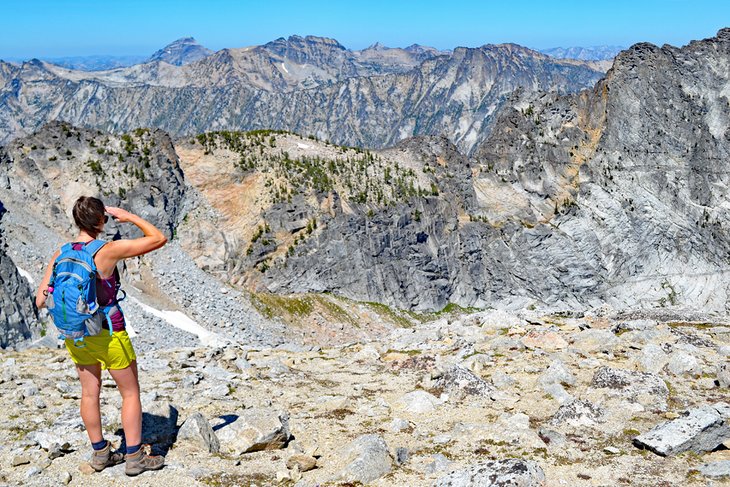
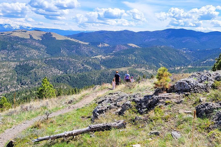
Lolo Peak is an iconic hike within the forest south of Missoula. It's a challenging summit hike and offers an excellent bird's-eye view of the forest. This 9,000-plus-foot peak is accessible with a tough 14-mile round trip. Ch-paa-qn, formerly Squaw Peak, west of Missoula, offers a similar outstanding view with approximately a 6.5-mile round trip. Both hikes rank high as some of the best hikes near Missoula.
Helena-Lewis and Clark National Forest
This sprawling forest spans over 2.8 million acres in central and north-central Montana. The massive land area is a result of the Helena and Lewis and Clark National Forests merging in 2015. Today, the cumulative Helena-Lewis and Clark National Forest straddles the Continental Divide and encompasses several island mountain ranges.
A few notable mountains include the Crazy Mountains, the Big and Little Belt Mountains, and the Snowy Mountains. And these eye-catching peaks are just the tip of adventurous surroundings. The forest is also home to thousands of fishable streams, hundreds of miles of multi-use trails, and unlimited opportunities to camp and spend the night.
The forest surrounds Helena, the state capital, and residents often take advantage of this proximity. The closest area of the forest to the city is accessible via Mount Helena City Park. This sprawling natural space navigates the city's dominant backdrop, Mount Helena, whose backside marks the boundary to thousands of forest acres.
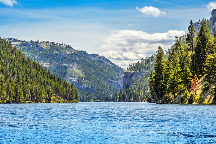
Helena also makes a good base camp for adventures into one of the forest's most fabled wilderness areas. First coined by Meriwether Lewis, the Gates of the Mountain Wilderness is an outstanding natural area accessible from the city with less than a 45-minute drive. This unique landscape displays the mighty Missouri River carving its way through tall limestone cliffs, leaving quite the impression on anyone who visits.
Gates of the Mountain isn't the only known stop within the forest for the Corps of Discovery in the early 1800s. The Lewis and Clark Interpretive Center in Great Falls is a must-visit for those interested in following footsteps. The forest jointly operates this education center, which offers in-depth information on the Corps of Discovery's entire Western journey.
Kootenai National Forest
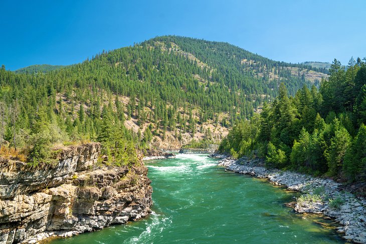
Kootenai National Forest is in the far northwest corner of the state, bordered by British Columbia to the north and Idaho to the west. Pointed peaks and rushing rivers define much of this rugged portion of Montana, as well as dense forest and lush vegetation. Snowshoe Peak, part of the Cabinet Mountain Wilderness, is the tallest peak in the Kootenai at 8,738 feet.
State and U.S. Highways access the forest, including Highway 2 and Highway 93 coming from Kalispell. One of the most scenic routes is State Highway 37, spanning from Libby to Eureka, better known as Lake Koocanusa Scenic Byway. Several recreation outlets, like campgrounds and boat launches, line this postcard route that parallels the eastern lakeshore.
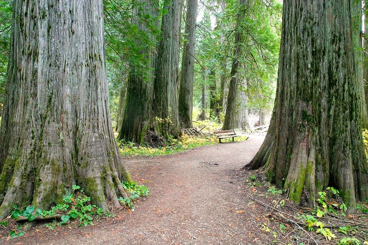
South of Lake Koocanusa, the Ross Creek Scenic Area is another unique place to visit. This lush part of the forest is home to massive Western Red Cedars, which stand uniquely as some of the tallest trees in the state. Some of these cedars have been growing for the better part of a half century and have 12-foot diameters. It's easy to explore the immensity of these trees with a one-mile interpretive trail.
The majestic Ten Lakes Scenic Area is another popular spot in the northern part of the forest, next to the Canadian border. This 15,000-plus-acre scenic area is exclusively for backcountry use, including hiking, backpacking, and horse riding. Several alpine lakes dot this rugged region, often teeming with freshwater fish waiting for the hook.