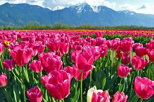
Hikes in Bellingham, WA
World-class hiking trails surround the city of Bellingham in far northwest Washington State. The town is next to Bellingham Bay, with several mountainous landscapes sloping toward the seashore. This geography opens a world of year-round adventure and new trails to explore every day of the year.
The number of hiking areas in Bellingham is almost overwhelming. The city itself has several in-town hiking trails leading through old-growth forests and atop old railroad beds. And the surrounding Whatcom County offers several dozens of hiking destinations within a short drive.
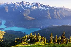
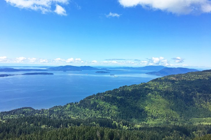
No Bellingham visit is complete without checking out the Chuckanut Mountains south of town. These impressive peaks are the only Cascade Mountains to reach the sea. This seaside status enables several mountainous views overlooking the San Juan Islands.
And for even more to explore, Bellingham makes an excellent Mount Baker basecamp. The seasonal Mount Baker Highway, Highway 542, is less than an hour north of the city. Here, a breathtaking collection of elevation-inducing hiking trails offers more than a few days' diversion.
Find your own memorable Pacific Northwest adventure with our list of the best hikes in Bellingham.
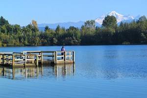
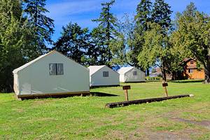
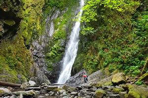
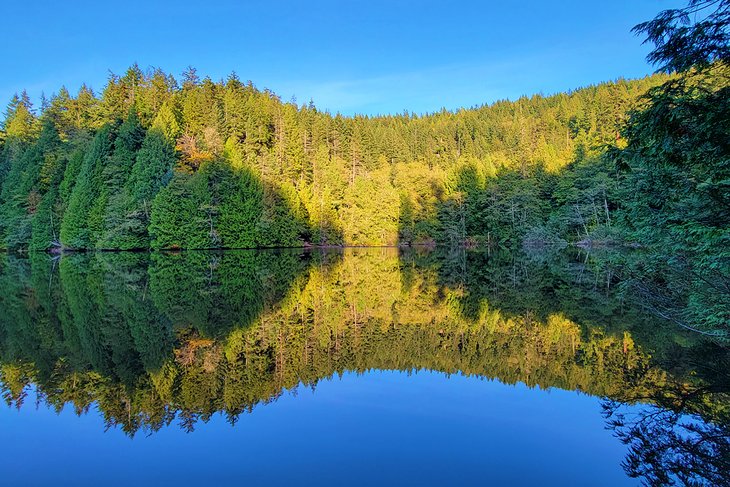
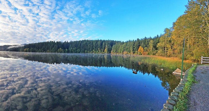
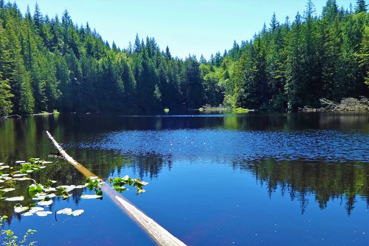
Whatcom Falls
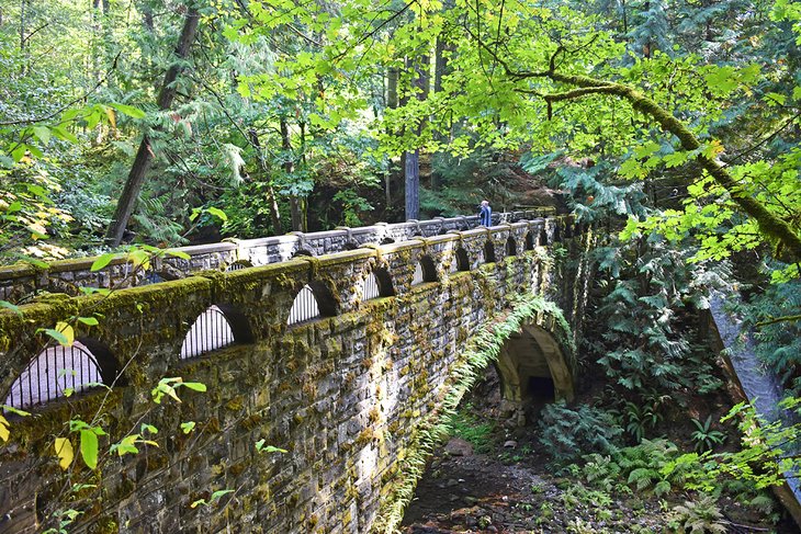
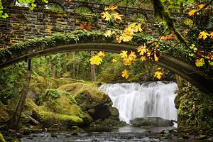
Whatcom Falls Park is the crown jewel city park of Bellingham and a must-visit for any outdoor enthusiast. The centerpiece of this public park is a 1939 sandstone bridge crossing Whatcom Creek near the namesake Whatcom Falls. Moss-strewn and covered in lichen, it's also one of the city's most photographed attractions.
For those interested in checking out Whatcom Falls, head to the park's lower entrance off Silver Beach Road. Here, it's only a few minutes' walk on a paved trail to the bridge, where visitors hear the tumbling Whatcom Falls before laying eyes on the postcard scene.
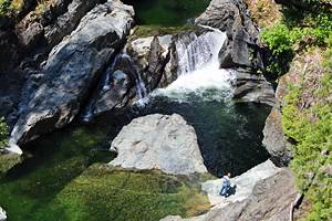
Take some time to enjoy Whatcom Falls and the old stone bridge, and perhaps pose for a few pictures. But don't stop exploring the city park there. Over five miles of trails expand throughout the rest of the park's verdant 241 acres.
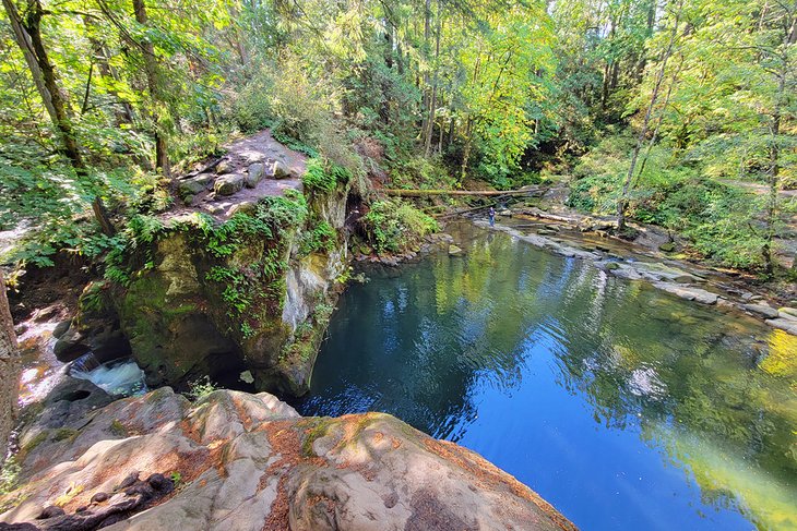
A primary trail of compact gravel navigates much of the park's length. Several side trails branch from this primary route, leading to fishing spots, swimming holes, and off-leash dog areas. Trail signs help you navigate the park, but it's best to take a picture of the map at the trailhead.
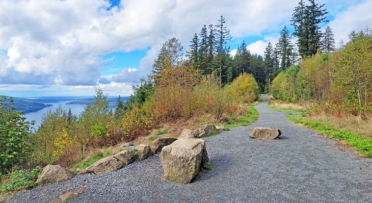
Fragrance Lake, Larrabee State Park
The Chuckanut Mountains are a special place to explore south of Bellingham, and they are the only part of the Cascade Mountains that reach far enough west to meet the sea. This seaside status leads to enormous views overlooking the water and snow-free summits throughout the winter.
City, county, and state parks jointly operate much of the Chuckanuts, offering a connected network of hiking trails to explore. And Chuckanut Drive is the main twisting thoroughfare throughout the mountains.
Fragrance Lake, in Larrabee State Park, is an excellent introduction to the Chuckanut Mountains. Its trailhead is across Chuckanut Drive from the main entrance of the state park. The hike offers a bit of everything, including a reflective alpine lake, with a 5.5-mile out-and-back journey.
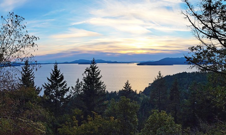
It's nearly a thousand feet of elevation gain from the trailhead to Fragrance Lake. After the first mile, take the short detour and spur trail to check out the Fragrance Lake Overlook. Here, a stunning perspective across the Salish Sea includes several of the San Juan Islands.
Galbraith Mountain Trails
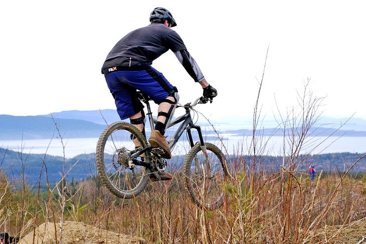
Galbraith Mountain is a world-class mountain biking destination right in Bellingham's backyard. Whatcom Mountain Bike Coalition (WMBC) maintains all 3,000 acres and 65-plus miles on the mountain. And it's not only mountain bikers who enjoy the professionally designed trail network, as hundreds of hikers make tracks each day.
Galbraith Mountain has two main access points. Most Bellingham residents use the North Entrance, accessible with a bike ride from town. Here, a myriad of beginner and moderate trails lead up the mountain. Even with blazes on most routes, it helps to have a map for the first few times visiting.
With so many trails at Galbraith Mountain, it makes sense why the area is most explored via mountain bike. Expect plenty of other users on the trails, especially near the trailhead, including mountain bikers with a bit of speed.
Oyster Dome
Oyster Dome is a quintessential hike in the Chuckanut Mountains. It offers a steep grade through a sterling second-growth forest, leading to a fantastic view overlooking the Salish Sea. This view alone makes Oyster Dome one of the most popular trails in the area.
Visitors looking to hike to the top of Oyster Dome have a few different trekking options. Most drive the rough road to the Samish Overlook parking area to start the hike. Here, it's approximately a five-mile out-and-back journey with just over 1,000 feet of elevation gain.
Another trailhead is on Chuckanut Drive, on the opposite side of the highway. This trailhead has fewer parking spots and adds more switchbacks to the trip. Hikers can also opt to make a loop out of Oyster Dome, utilizing Max's Shortcut Trail and the Larry Reed Trail for an 8.3-mile hike.
The beginning of the trail is the hardest, as it switchbacks with a steep grade up Blanchard Mountain. But this rapid elevation gain is just an investment for the view at the top. Whichever way you travel, plan to spend some time catching your breath with the Salish Sea on the horizon.
Lake Padden Park
On the south side of the city, Lake Padden Park is a beautiful gem of outdoor space in Bellingham. A popular 2.6-mile trail circles the water, and several additional hiking trails branch away from the southeast shore. And within a five-mile drive from downtown, it's an easy place to get away.
Several parking areas line the north and east side of the lake, with seasonal restrooms available. Here, hop on the 2.6-mile shoreline trail and head in either direction. The trail is primarily flat with some undulations, and several lake views line the entire way. Wildlife is also abundant along the route, especially birds, so consider bringing some binoculars.
For a longer hike, a network of trails extends from the southeast shore and explores the rest of the property's 745 acres. These trails are designated as leash-free and tend to be a popular spot for pet owners.
Chanterelle Trail, Lake Whatcom Park
Lake Whatcom is a massive 10-mile lake east of the downtown district. It's a lake of scenic attraction and provides drinking water for over 100,000 Whatcom County residents. One of the best places to hike near its shores is at Lake Whatcom Park.
Lake Whatcom Park is near the center of the lake, on the eastern bank, opposite downtown. It's about a 30-minute car ride to the park, passing through the community of Agate Bay. Upon arriving, an upper parking lot lends access to both the Chanterelle Trail and the Hertz Trail.
Those looking for the highest vantage point should head to the Chanterelle Trail. It's approximately a 2.4-mile hike to the Chanterelle Trail Overlook, gaining over 1,300 feet of elevation. Here, enjoy one of the most commanding views of Bellingham's drinking water found anywhere else in town.
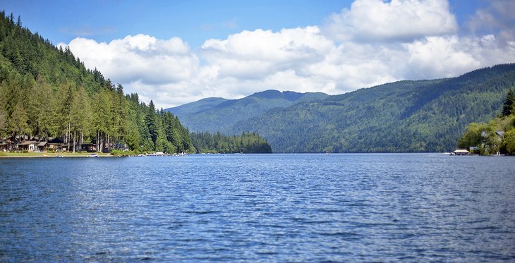
The Hertz Trail offers a more leisurely and equally scenic hike. It follows a flat grade along the former Bellingham & Eastern Railway route, next to the water. This family-friendly trail extends for three miles, but visitors can hike as far as they like before turning around.
South Bay Trail
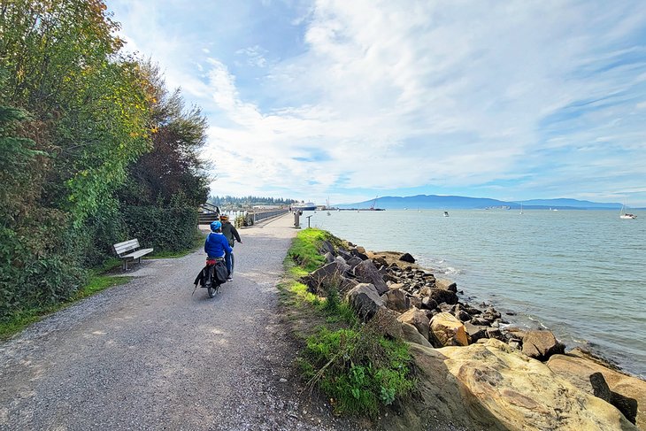
The South Bay Trail navigates the Bellingham shoreline and connects to the historic community of Fairhaven. The route is a rail-to-trail conversion and offers a flat grade the entire way. For this reason, expect to encounter other hikers, bicyclists, and families along the path.
Most of the route is on compact gravel, and nearby water views provide a welcome distraction. Near the north end of the trail, Boulevard Park offers a nice place to enjoy a packed lunch or sit next to the water. From here, the path crosses above the water via a beautiful cement boardwalk.
It's less than a five-mile out-and-back journey on the South Bay Trail. Users can extend their adventure by hopping on the Interurban Trail near South Bay's southern terminus. The Interurban Trail extends south to Arroyo Park and eventually to Larrabee State Park in the Chuckanut Mountains.
Hemlock Trail, Chuckanut Mountain Park
Washington State, Whatcom County, and the city of Bellingham all oversee recreation opportunities in the Chuckanut Mountains. Larrabee State Park defines much of the Chuckanut's southern half. Up north, closer to town, Whatcom County manages the sprawling Chuckanut Mountain Park.
The primary access to Chuckanut Mountain Park is from the North Chuckanut Mountain Trailhead. Here, trail users ascend the Hemlock Trail to reach a vast network of high elevation hiking trails. Hemlock Trail spans nearly three miles in total, with over 1,000 feet of elevation gain, but hikers often veer off before reaching the end.
Several hiking options atop the Chuckanuts lead to variable adventures. For a long but memorable trek, head to the Ridgeline Trail. This beautiful route is divided between a lower, middle, and upper section, covering a total distance of over 10 miles.
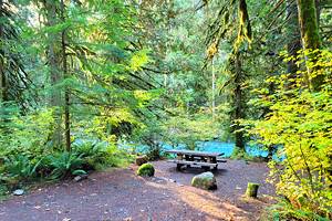
Stimpson Family Nature Reserve
Dive deep into Pacific Northwest terrain at this nature reserve less than a six-mile drive from downtown. It quickly transports visitors into an undisturbed forest characterized by big trees and an abundance of ferns. Among the standout scenery are massive Douglas firs, some over 400 years old.
Two connected loops navigate the 350 acres of the Stimpson Family Nature Reserve. The Main Loop spans 3.2 miles through the imposing forest with little elevation change. The other loop circles Geneva Pond with a two-mile trip. Hikers and trail runners looking for a lounger route often combine the two loops for an approximately five-mile figure eight.
Because of its flat path and easy navigation, Stimpson Family Nature Reserve is a popular place for family outings, especially those with young children. Expect to encounter other trail users along the route on the weekends. Early morning weekdays, however, are much quieter.
Mount Baker Hiking Trails
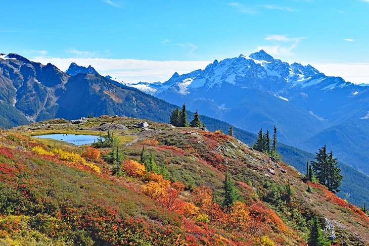
The behemoth known as Mount Baker is accessible from Bellingham with a 60-mile drive. Thousands of acres of Mt. Baker-Snoqualmie National Forest and Mt. Baker Wilderness surround the mountain, offering endless hiking trails to explore.
The main recreation route for Mount Baker is highway 542, also known as the Mount Baker Highway. This paved state highway ends at the aptly named Artist Point, where stunning views of Mount Baker and Mount Shuksan await the camera lens.
Several trailheads and a few campgrounds line Highway 542, offering days and nights of adventure. Just a few of the notable treks include Yellow Aster Butte, Skyline Trail, and Hannegan Pass. At Artist Point itself, the Chain Lakes Loop is a bucket-list route to check out.
Baker Lake Trail
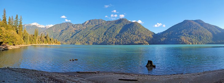
Baker Lake is a beautiful nine-acre reservoir within Mt. Baker-Snoqualmie National Forest. It's almost directly east of Bellingham and accessible via Highway 20 with a 65-mile drive. This area is a gateway to bigger landscapes and offers several recreation options along the shore.
The Baker Lake Trail extends for 14 miles along the eastern bank. This popular trail offers several lakeside campsites and views of Mount Baker with easy to moderate elevation gain. Most often, day hikers go for a few miles in before turning back. A good turnaround point is the Maple Grove Campground, four miles from the trailhead.
The Baker Lake Trail is popular throughout the year thanks to its low elevation and often lack of snowfall. It's also a jumping-off point for the rest of Highway 20, also known as the North Cascades Highway. This dazzling route heads right into the heart of North Cascades National Park, including several of its best hiking trails.
Map of Hikes in Bellingham, WA
Bellingham, WA - Climate Chart
| Average minimum and maximum temperatures for Bellingham, WA in °C | |||||||||||
| J | F | M | A | M | J | J | A | S | O | N | D |
| 8 2 | 9 2 | 12 4 | 14 6 | 17 8 | 20 11 | 23 12 | 23 13 | 19 10 | 15 7 | 11 4 | 8 2 |
| PlanetWare.com | |||||||||||
| Average monthly precipitation totals for Bellingham, WA in mm. | |||||||||||
| 99 | 80 | 77 | 68 | 65 | 48 | 31 | 35 | 45 | 76 | 142 | 121 |
| Average minimum and maximum temperatures for Bellingham, WA in °F | |||||||||||
| J | F | M | A | M | J | J | A | S | O | N | D |
| 46 35 | 49 36 | 53 39 | 58 42 | 63 47 | 68 51 | 73 54 | 73 55 | 67 50 | 59 45 | 52 40 | 47 35 |
| PlanetWare.com | |||||||||||
| Average monthly precipitation totals for Bellingham, WA in inches. | |||||||||||
| 3.9 | 3.2 | 3.0 | 2.7 | 2.5 | 1.9 | 1.2 | 1.4 | 1.8 | 3.0 | 5.6 | 4.8 |