Hiking Trails in Glacier National Park, MT
Author Brad Lane lived in Montana and hiked extensively in Glacier National Park.
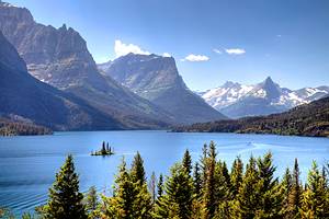
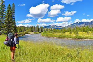
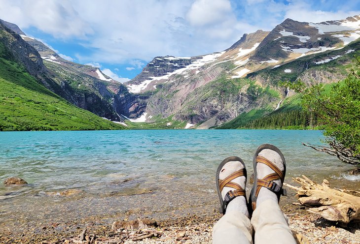
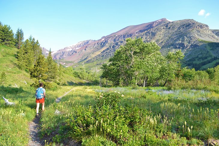
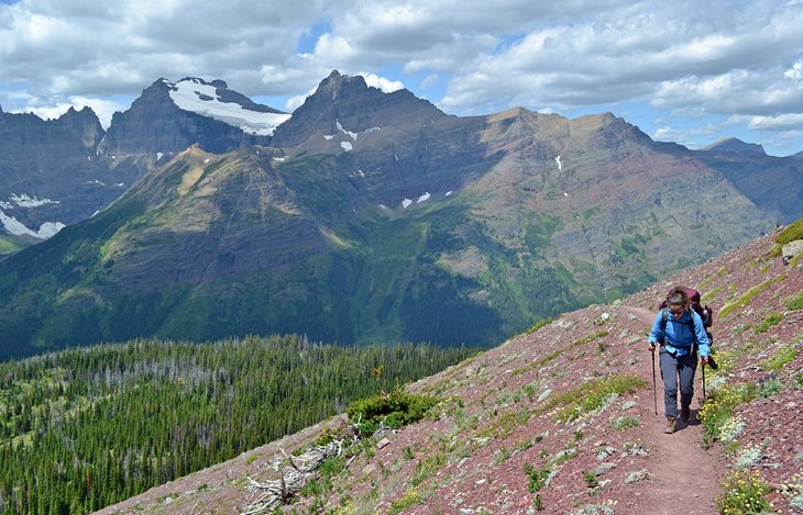
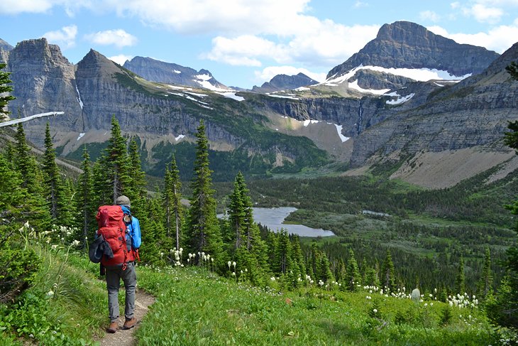
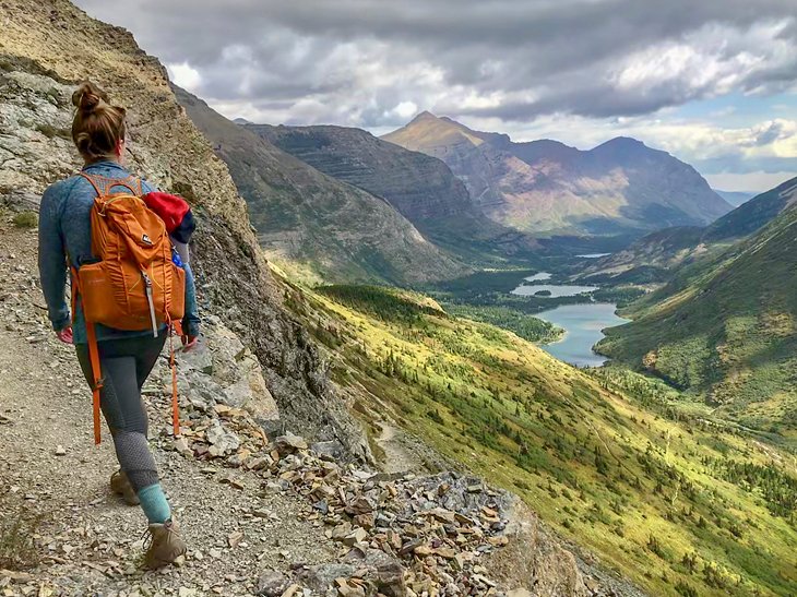
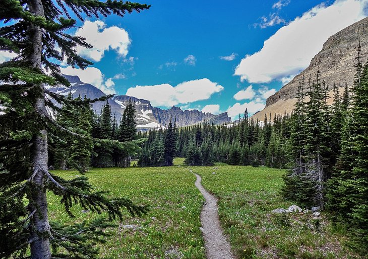
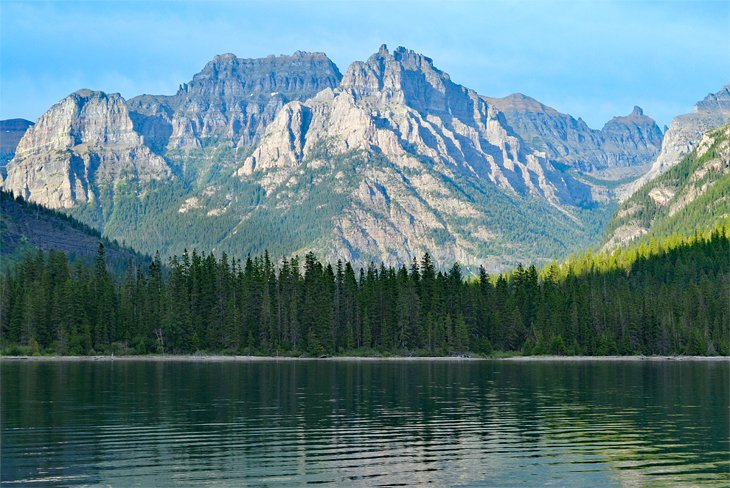
The best hiking trails in Glacier National Park really take you somewhere special. And with over 700 miles of trails spread throughout this massive national park in northern Montana, it's hard to narrow down the list. A common denominator between all the best hiking trails in Glacier, however, is the deep feeling of grandeur the glacial valleys evoke.
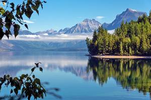
Great day hikes are found in every region of Glacier, especially along the impressive Going-to-the-Sun Road, spanning the national park for 50 miles from east to west. Hiking areas along this iconic roadway are generally split into three areas: Lake McDonald on the west, St. Mary to the east, and Logan Pass - the midway and highest point along the Going-to-the-Sun Road. This main corridor has several routes to choose from, ranging from family-friendly lake hikes to all-day mountain climbs.
Other areas in the park not connected to the Going-to-the-Sun Road include Two Medicine, Many Glacier, and the far western edge of the park bordering the North Fork of the Flathead River. These areas also provide a variety of life-changing hiking trails and places to experience the breathtaking landscapes within the park.
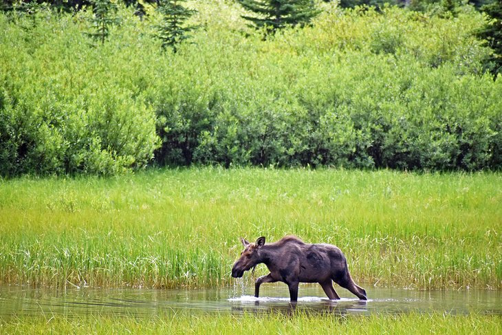
Every hiking trail in Glacier National Park crosses through bear habitat, as well as habitat for numerous other wildlife species, big and small. Proper precautions like bear spray, traveling in groups, and following Leave No Trace guidelines should apply when exploring hiking trails in Glacier. Visit the Glacier National Park site for more information on getting to trailheads and traveling through the park safely.
Find out for yourself why Glacier is known as the "Crown of the Continent" with our list of the best hiking trails in Glacier National Park.
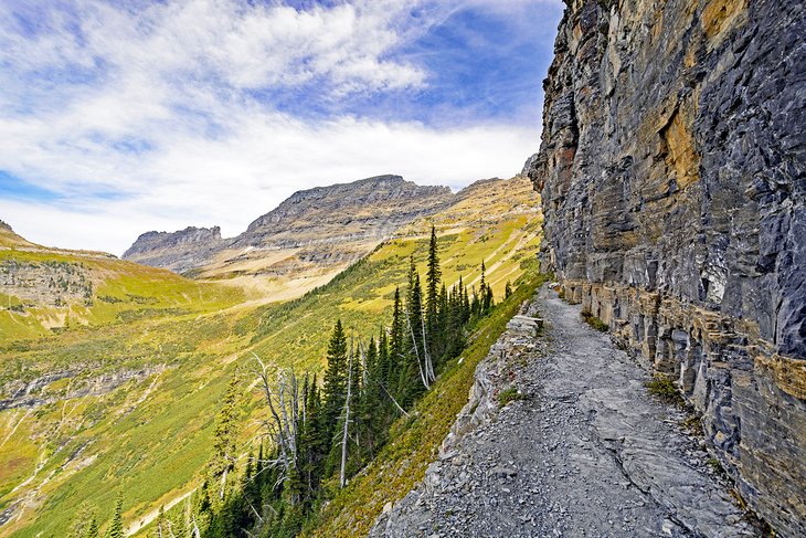
Highline Trail
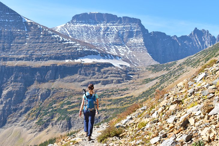
The Highline Trail is a signature hiking trail in North America. It departs from Logan Pass and spans 7.6 miles to the historic Granite Park Chalet (built in 1914). This relatively flat trail follows the Continental Divide through the heart of the park with jaw-dropping views of glacier valleys and imposing alpine landscapes. With truly incredible beauty on display throughout, there are plenty of breathtaking moments lining the entire route.
One breathtaking moment occurs at the beginning of the trail near Logan Pass. Here, hikers encounter a short stint of ledge hiking with enough space for two hikers to pass in opposite directions. While it's completely safe and hundreds of hikers pass by this ledge each day with no problem, those with a fear of heights need to mentally prepare for this section.
Despite the consistent crowds and popularity of the trail, wildlife sightings, especially mountain goats, are a common occurrence on the Highline Trail. And farther along the route, near Granite Park Chalet, hikers have an opportunity for a short side trip to the Grinnell Glacier Overlook.
After traveling the 7.6 miles to the Granite Park Chalet, where snacks and beverages are available, those on the Highline Trail need to figure out a way back to the original trailhead. A common approach is hiking the steep 4.2 additional miles down the Loop Trail to the Going-to-the-Sun Road and taking the free shuttle back up to Logan's Pass. Another option is to hike back the 7.6 scenic miles you came, making for a 15-plus-mile day hike.
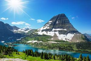
Grinnell Glacier
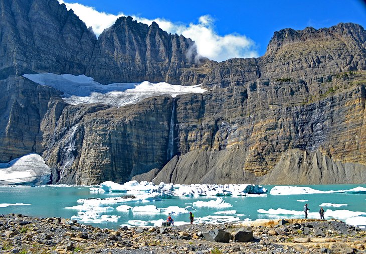
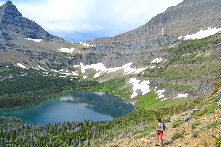
Within the Many Glacier region of the park, the 5.3-mile hike to the Grinnell Glacier viewpoint offers some of the most iconic scenery in the park. The trail starts near one of Glacier's best campgrounds, the Many Glacier Campground, near the banks of Swiftcurrent Lake. The first two miles of the hike are fairly level as the trail crosses to the banks of Lake Josephine.
At 2.1 miles, hikers come across a junction that either continues flat to the aquamarine waters of Lower Grinnell Lake or begins a steady ascent towards Upper Grinnell Lake and Grinnell Glacier. The trail climbs over 1,500 feet in the proceeding 3.2 miles leading to Upper Grinnell Lake as it steadily gains an excellent vantage point of the glacial valley below. Pit toilets are available 0.4 miles from the lake, just before the steepest and final section of the trail.
Upper Grinnell Lake and Grinnell Glacier are worth every step of the trail. Massive icebergs fill this shimmering glacier-fed lake, backdropped by vertical mountain peaks known as the Garden Wall. Packing an extra jacket makes eating lunch at the lake a warmer endeavor, and the rocky banks have plenty of space to find your own spot to enjoy the surreal alpine landscape.
A fee-based ferry ride across Swiftcurrent Lake is available to cut down on trail miles. Glacier Park Boat Company operates these scenic shuttles. They also offer optional guided hikes to Grinnell Lake. This service is available between July 1st and September 11th.
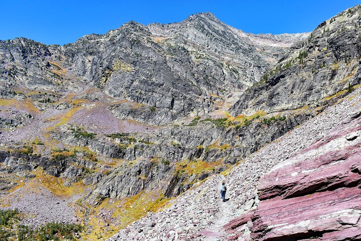
Avalanche Lake
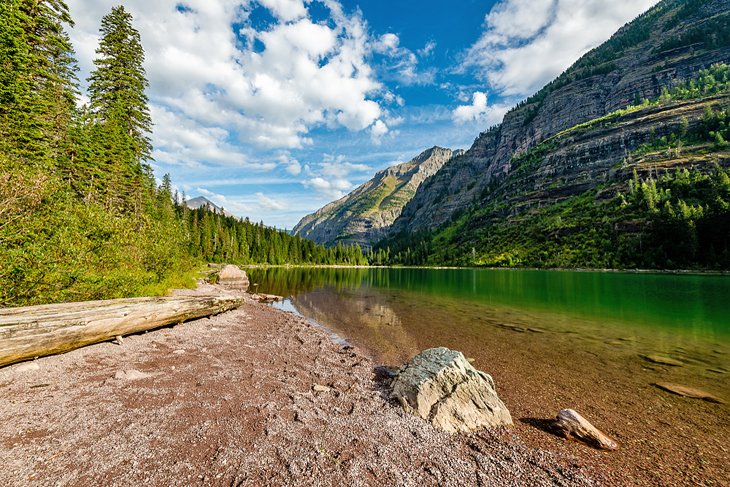
The 2.3-mile trail leading to Avalanche Lake is one of the best short hikes in Glacier National Park. It's near Lake McDonald on the west side of the park and begins from a busy parking area. The hike to Avalanche Lake immediately runs parallel to Avalanche Creek with great views of the icy, blue water carving its way through a canyon.
With a total elevation gain of roughly 500 feet, the trail is suited to most abilities and wide enough to support two-way traffic. About halfway through the hike, hikers pass through a massive tree fall from the trail's namesake natural disaster. From this overturned spot in the forest, the trail begins a steady but moderate uphill push to the lake.
A rocky shoreline dotted with makeshift benches welcomes hikers to Avalanche Lake. Here, an iconic spot for a picture awaits with the waterfall-laden Little Matterhorn as a backdrop. Hikers can continue along the west bank of the lake to escape the crowds.
From toddlers riding in backpacks to senior citizens navigating the trail, numerous types of hikers enjoy the five-mile round trip to Avalanche Lake. For an easier adventure in this lush part of the park, the interpretive Trail of the Cedars also shares a trailhead with Avalanche Lake. This less-than-a-mile interpretive hike follows a flat, wooden boardwalk and passes through a dense forest of ancient western hemlocks and red cedars.
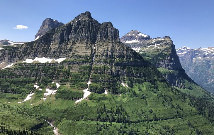
Hidden Lake Nature Trail
The Hidden Lake Nature Trail is a popular short hike that departs from the west side of the Logan Pass Visitor Center. It crosses through an area also known as Hanging Gardens. The 1.4-mile trail through Hanging Gardens is filled with a dominating view of the snow-crusted Clements Mountain and very minimal elevation gain. Wildflowers and wildlife, including marmots and bighorn sheep, are commonly sighted along the trail.
Hikers may recognize the Hidden Lake Overlook from postcards of Glacier or on social media feeds, and the view really does inspire an appreciation for the park. Hikers can proceed another 1.2 miles from the overlook down to the lake itself, with an additional 780 feet of elevation drop.
Parking is extremely scarce at Logan Pass, making the Hidden Lake Trail most accessible in the extremely early morning or by riding on the free Going-to-the-Sun Road shuttle to Logan Pass.
Iceberg Lake
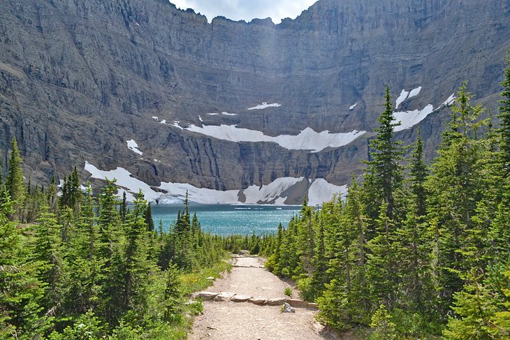
This aptly named day hike departs from behind the Swiftcurrent Motor Inn and travels 4.5 miles and 1,200 feet up to an icy body of water. The trail passes by the junction for the Ptarmigan Wall, another popular hike in this region of the park. With plenty of foot traffic during the summer, the trail is wide enough and accommodating for two-way travel.
Hikers encounter vibrant and sensitive alpine meadows near the end of the trail before descending into the bowl of Iceberg Lake. Depending on the time of year, the iceberg in Iceberg Lake may have receded. Alongside icebergs and alpine meadows, bears and other wildlife are known to be spotted along this route. It's a nearly nine-mile round trip to appreciate Iceberg Lake.
Gunsight Lake
The 6.3-mile hike to Gunsight Lake begins from the Jackson Glacier Overlook on the east side of the Going-to-the-Sun Road, approximately 12 miles west of the St. Mary Entrance. It offers a challenging out-and-back day hike with beautiful views in both directions. It is also a popular choice as the beginning of a backpacking route.
The trail descends from the Jackson Glacier Overlook parking area to reach Reynolds Creek and the St. Mary River. It's undulating topography once you reach the river, with no significant climbs or descents for the final four miles to Gunsight Lake. The route passes through prime bear and moose territory the entire way, and hikers need to prepare accordingly.
Gunsight Lake appears after a slight incline toward the end of the trail. And the tall, craggy mountain backdropping the lake makes the eyes linger on the grandeur. Bring bug nets most of the year, as it's fertile ground for mosquitos. Those with a backcountry permit set up camp here and reach Gunsight Pass the following day.
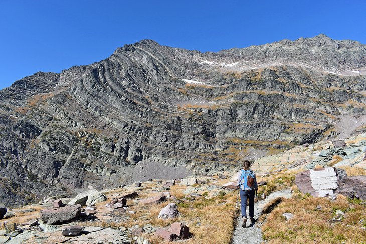
Piegan Pass Trail
Piegan Pass offers a moderate day hike that ends above the tree line, with significant views much of the way. The hike starts at the Siyeh Bend Trailhead a couple of miles east of Logan Pass on the Going-to-the-Sun Road. From here, it's approximately a nine-mile out-and-back hike, with 1,800 feet of elevation gain.
Alternatively, hikers can also start farther down the road at the Jackson Glacier Overlook, adding another mile and steep elevation to the round trip. Either way, hikers cruise through the forest at the beginning of the route, eventually coming to an intersection with the Siyeh Pass Trail.
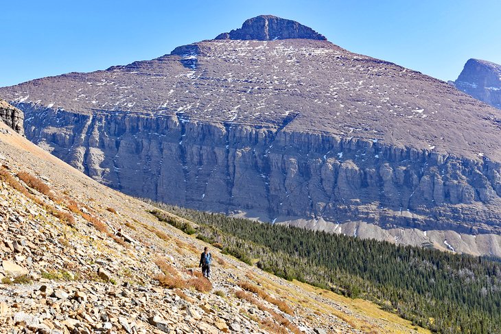
Follow trail signs to Piegan Pass and enjoy the wide-spread alpine views for the last two miles of the trail. Dramatic mountains and glaciers are in sight along this final section, including the nearby Piegan Glacier directly to the west. This last section of the trail is also highly exposed to the sun and shifting winds throughout the day.
Pitamakan Pass and Dawson Pass
The route connecting Pitamakan Pass and Dawson Pass offers one of a few looped day hikes in Glacier National Park. But it comes at a challenging price, and this demanding 18-mile trail steadily climbs and traverses two mountain passes to make a full circle.
The trail starts and departs from the Two Medicine Campground. Hikers can head either clockwise or counter to climb over 2,400 feet up to Dawson or Pitamakan Pass. Both directions enable views of glacier lakes and pointed mountains, as well as wildlife sightings, including marmots and mountain goats.
The 3.4-mile moderately flat stretch of trail that connects Dawson and Pitamakan Pass has very mild exposure and astounding views that make you feel on top of the world. This area is also commonly frequented by resident marmots. Keep your distance from these large furry creatures, and they'll do the same.
While the roughly seven miles it takes to climb up to either pass is challenging, it's really the downhill in the other direction that creates sore legs after this long day hike. Hikers can opt to take a fee-based ferry across Two Medicine Lake to cut down on some miles.
Cracker Lake
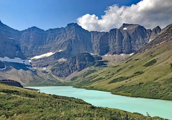
The 6.4-mile route to Cracker Lake departs from behind the Many Glacier Hotel and navigates through the stunning Cracker Flats area of the park. The long stretch of pointed peaks lining this part of the hike is nothing short of an alpine wonderland.
The aquamarine waters of Cracker Lake are also mesmerizing, and the surrounding mountain peaks are filled with bands of color and a stark geologic presentation. The trail ascends 1,400 feet to the banks of Cracker Lake, making this bucket-list hiking trail and nearly 13-mile round trip an all-day endeavor.
Near the banks of the lake are many great spots to grab a snack before heading back to the trailhead. Cracker Lake has a reputation as one of the windiest spots in the park, and bringing an extra layer for warmth can help alleviate the chill while hanging out by the shore.
Ptarmigan Tunnel
The Civilian Conservation Corps constructed the Ptarmigan Tunnel in the 1930s, dynamiting this passageway that connects two stunning glacial valleys. The trail is a popular choice for backpackers heading deep into the park, and day hikers can reach this impressive feat of trail engineering from the Many Glacier region with a 10.6-mile round trip.
The route climbs over 2,300 feet to reach the tunnel, making for a demanding day hike with plenty of scenic stops along the way. The junction for Iceberg Lake is encountered about halfway up the trail to the Ptarmigan Tunnel, where hikers will want to head right towards Ptarmigan Lake.
The sight of the big switchbacks leading up to the tunnel seems intimidating at first, but the view of the Belly River valley on the other side of the tunnel is well worth the effort. The entire route goes through heavily populated bear country, and hikers will want to make noise, travel together, and carry bear spray.
Stoney Indian Pass
Stoney Indian Pass is an eye-popping backpacking destination within the park's extensive backcountry. It's most easily accessible from the Chief Mountain Customs Trailhead near the Canadian border. A popular 27-mile trip starts at the Chief Mountain Trailhead before heading up and over Stoney Indian Pass to end at the Goat Haunt Ranger Station near Waterton Lake.
Every step of this drool-inducing route includes views of outstanding mountain peaks, icy-cold alpine lakes, and numerous tumbling waterfalls splashing hundreds of feet down the mountains.
Like all backpacking in Glacier National Park, those looking to spend the night and explore Stoney Indian Pass will need to have permits to camp in the backcountry. Backcountry permits are now available online as of the 2023 season.
Alongside permits, any overnight travelers will need to bring bear precautions, including bear spray and a rope to secure food at designated bear hangs.
Swiftcurrent Pass
Extending nearly seven miles one way, with over 2,200 feet of elevation gain, the trail up to Swiftcurrent Pass from the Many Glacier region of the park is an ambitious day hike. Many opt to tackle this high-mountain pass as a backpacking trip and gateway into deeper regions of the park.
But, with numerous scenic stops like Redrock Falls along the way, and with much of the elevation gained near the pass, hiking even partway to Swiftcurrent Pass makes for quite a memorable day hike.
The highest points of the trail are typically covered in snow outside of the late summer months of July and August and into September. Moose sightings are a regular occurrence along this slightly less crowded hike in the park.
Siyeh Pass Trail
The Siyeh Pass Trail is a less crowded alternative to the Highline Trail at Logan Pass. It delivers with a similar caliber of stunning scenery with fewer people sharing the trail. But, like any hiking trail accessible from the Going-to-the-Sun Road, don't expect a complete solitude experience.
Hikers have the choice between starting at the Piegan Pass or Sunrift Gorge Trailhead, with both trailheads located a couple of miles east of Logan Pass. The climb up to Siyeh Pass from the Piegan Trailhead involves fewer miles and climbing, though the 4.6 miles and 2,240 feet of elevation gain to the top is still a challenging endeavor.
Alongside an abundance of wildflowers and alpine meadows, the Siyeh Pass Trail traverses through the subliminal Preston Park area of Glacier. The trail officially ends at the saddle and pass of Mount Siyeh, where hikers can head back on the same 4.6 miles they came or descend the 5.5 miles to Sunrift Gorge. Alongside human hikers, bears are also known to congregate along this popular trail.
Bowman Lake
For a less crowded place to hike in Glacier, any trail departing from the northwest North Fork and Bowman Lake area of the park offers remote surroundings and equally stunning hikes. It's also a popular starting point for backcountry hiking.
Near the Polebridge Ranger Station and departing from the Bowman Lake Campground, the trail along the western edge of Bowman Lake extends for seven rolling miles next to the water. With the water in sight the entire way, the best views of Bowman Lake come from the head and foot of the lake.
Another great day hike from the Bowman Lake area includes the nearly 12-mile round trip to Akokala Lake. And those with permits can access stunning places like Hole-in-the-Wall and Goat Haunt with an overnight trip from Bowman Lake. For snacks and supplies, the nearby Polebridge Mercantile is the only place to stock up on the essentials.
Sperry Chalet
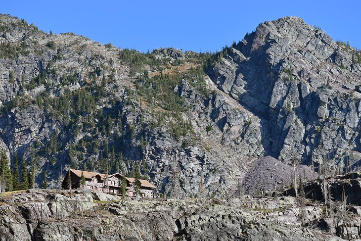
The Sperry Chalet is a National Historic Landmark Hotel located within the park, only accessible by a sizable hike. The most common route to reach the chalet is from a trailhead located directly across the Going-to-the-Sun Road from Lake McDonald Lodge. It's an uphill 6.1 miles from here, with over 3,300 feet of elevation gain.
The Sprague Fire consumed much of the Sperry Chalet area in 2017, including significant portions of the chalet itself. Much of the stone structure of the chalet remained, and extensive restoration efforts brought Sperry Chalet back into operation by 2021. The resulting scorched landscape means much of the Sperry Chalet Trail, also known as Gunsight Pass Trail, is very exposed to the sun.
Reservations at the Chalet are hard to come by. Score a spot, though, and expect three square meals and primitive accommodations with no electricity, heat, or water in any room. For those not staying, it's approximately a 12-mile day to reach the Chalet and head back down.
For ambitious hikers, a side route from the Chalet leads to the awe-inspiring Sperry Glacier, adding four challenging miles to the trip.
Map of Hiking Trails in Glacier National Park, MT
Best Time to Go Hiking in Glacier National Park
The summer is the best time to visit Glacier for hiking. Snow starts to clear off the high-mountain passes sometime in late June, kicking off a prime hiking window of July, August, and up to mid-September. While this time of year also brings about the most visitors, the sheer amount of open trails makes it easy to ditch the crowds.
The summer also offers the best weather in the park. Daytime highs in July and August typically hover around the low 70s Fahrenheit, with cool nights in the 40s. This is the warmest temperature the park receives all year, and with consistently sunny skies, besides the occasional afternoon rainstorm, it's ideal hiking weather.
The shoulder months, including May and October, also offer hiking opportunities, although resources like campgrounds and visitor centers are more limited. The Going-to-the-Sun Road typically opens in June and closes in October, depending on the weather. Pack a warm base layer for these shoulder seasons, however, and enjoy less-crowded park conditions.
More Related Articles on PlanetWare.com
More to Explore in Glacier National Park: Including iconic areas and attractions like Logan Pass, St. Mary, and the Going-to-the-Sun Road, the Things to Do in Glacier preview all the grandeur found in this esteemed national park. Covering such a large amount of space and natural attraction, the only way to really explore Glacier is by taking a multi-day trip. The Campgrounds in Glacier National Park provide great places to spend the night under the stars to enjoy the park by day.
Montana Camping and Hiking Trails: Montana's big sky beauty doesn't stop at Glacier National Park-the rest of the state is filled with great places to explore and spend the night. While many of the Hiking Trails in Montana are found on the west side of the state, numerous adventurous routes are spread throughout every corner of the state. For a great place to spend the night, the Campgrounds in Montana offer access to wild rivers, underground caves, and unfettered wilderness.