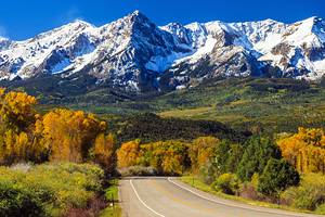
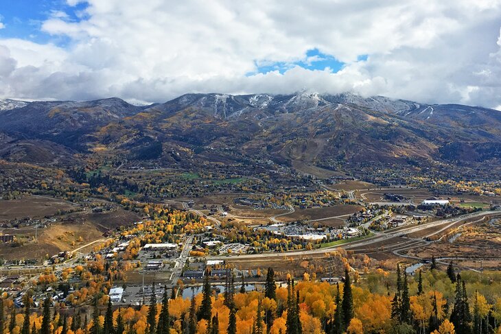
Hikes in Steamboat Springs, CO
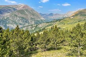
Steamboat Springs, Colorado is home to some epic hiking, ranging from easy strolls down nature trails to challenging full-day climbs to some of the highest elevation points in the state.
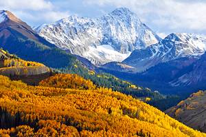
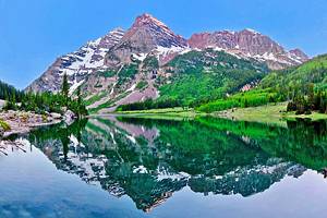
The area is home to six mountain peaks within the Park Range and overlooks the Yampa Valley. The range includes Mount Werner, Sunshine Peak, Storm Peak, Thunderhead Peak, Pioneer Ride, and Christie Peak. Throughout the mountains and valleys are hundreds of miles of hiking trails through lush evergreen forests and across vast, wildflower-strewn meadows. Gaze out over the Continental Divide, or peer down some of the most dramatic waterfalls you've ever seen.
The Northern Colorado string of Rocky Mountains is right here in Steamboat Springs, home to the Medicine Bow and Routt National Forests — 2.9 million acres of protected land. You will not be deprived of fantastic hiking when you visit Steamboat Springs. Lace up your boots and get ready to hit more than 80 maintained trails in the region, whether you're a pro at the backcountry or are simply out for an afternoon walk with the family.
Check out our list of the best hiking spots in Steamboat Springs.
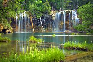
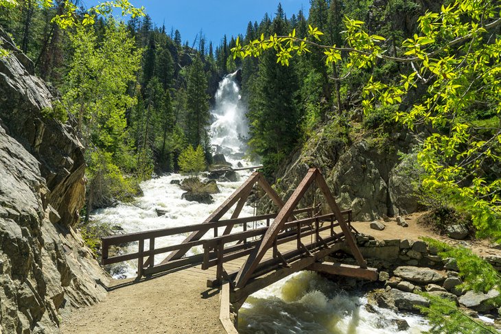
Fish Creek Falls
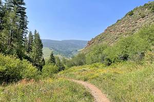
The best introduction to Steamboat Springs has to be the Fish Creek Falls Trail. Fish Creek Falls is one of the most beloved landmarks and top places to visit in town, and you can get up close and personal with it on this 4.7-mile out-and-back trail.
Over the course of the hike, you'll gain 1,450 feet. It's rare you'll have the trail to yourself because it is one of the more beautiful and popular in Steamboat Springs, but the views are worth every step. Tip: If you arrive after 3pm, you will likely have the parking lot to yourself.
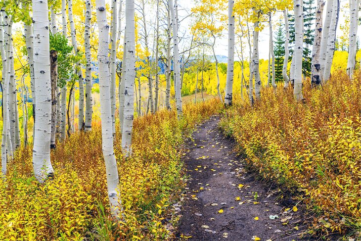
Along the hike, you'll pass two waterfalls: Lower and Upper Fish Creek Falls. The lower falls tend to be the most photogenic. It's definitely worth the scramble to the upper falls, though. Just bear in mind that the path is quite rocky. But you'll have gorgeous views of fluttering aspen trees the entire way.
Tip: If you don't feel like doing the hike, a short quarter-mile path leads from the parking lot to a lookout point, where you'll have a head-on view of the 283-foot falls.
Uranium Mine Trail
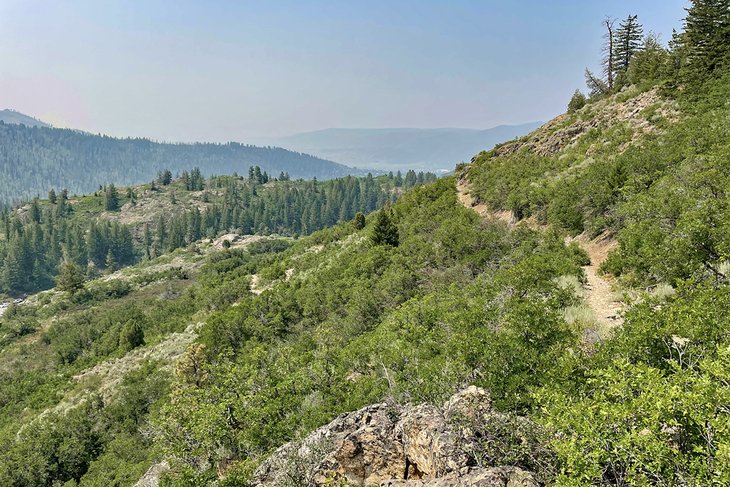
While everyone else is tackling Fish Creek Falls, you can head in the opposite direction up the Uranium Mine Trail. The trailhead is from the same parking lot, but far fewer people are headed up in this direction.
The 3.1-mile out-and-back trail has an elevation gain of 593 feet up the rocky hillside. The majority of the trail is exposed, save for a few hundred yards that wind through aspen forests past fields of wildflowers. Sunscreen is imperative, as are secure shoes, as this tends to be a rather rocky hike along the trail.
At the top of the trail, you'll discover an old abandoned uranium mine (as the name suggests). There is a lovely cliff, as well, with a gorgeous view over Fish Creek Falls. It's a great spot to stop and have lunch on this short (but challenging) hike.
Strawberry Park Hot Springs Trail
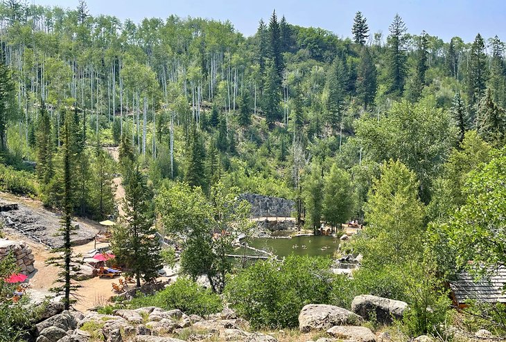
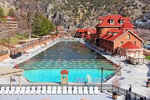
Among Steamboat Springs' most beloved attractions are the hot springs. Strawberry Park Hot Springs, for example, is one of the best spots in town to soak in the natural mineral waters. You can drive into the site, or, if you're feeling adventurous, you can hike the 6.2-mile out-and-back trail, which features hot springs along the way.
To find the trailhead can be a little tricky. You'll have to park at the Mud Creek trailhead and backtrack down the road. The trail gains 915 feet in elevation. Along the way, you'll gently climb uphill alongside a stream, past forests of evergreen trees and lush thickets of shrubs.
Once you reach the springs, you can soak in the mineral pools, which have temperatures that range from 101 to 106 degrees Fahrenheit. Be sure to make a reservation to use the hot spring pools.
Just keep in mind that the trail is closed from November to early May, so if it's really the hot springs you're after, you will have to drive in during the winter.
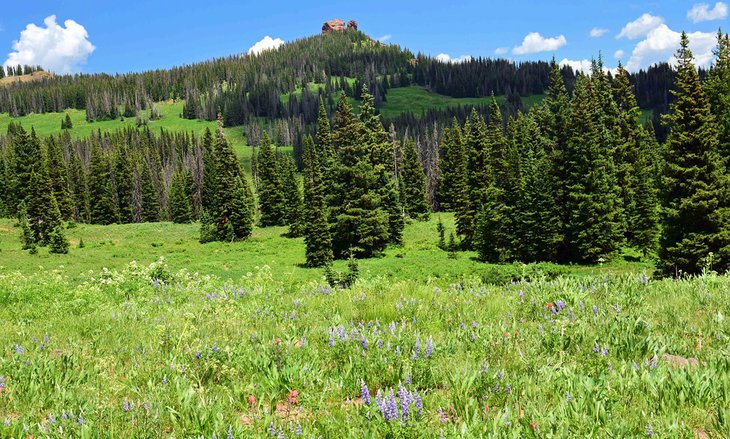
Mad Creek Trail
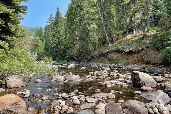
For a lovely, sometimes strenuous 8.8 miles (out and back), Mad Creek Trail offers so much variety in terms of topography. Wind past plunging canyons, through magical aspen groves, and past historic mining cabins that tell the story of Colorado's settler history.
The route gains 800 feet of elevation right up front, within the first mile and a half. The entire trail gains 1,322 feet of elevation, and you can expect to see snow along the trail after mid-October. In fact, if you're planning to hike in the fall or winter, snowshoes or crampons are highly recommended.
Note that the first portion of the trail has little-to-no coverage, so you will be fully exposed to the sun. It also has a very steep incline for the first portion. It will be a solid workout.
This is a popular trail for mountain bikers, as well, so be on the lookout.
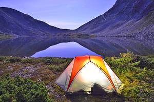
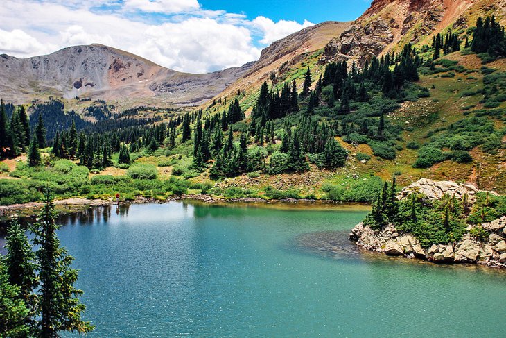
Gilpin Lake
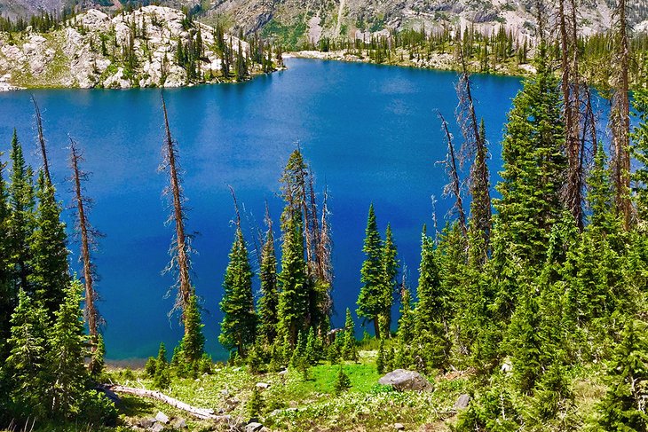
It's a bit of a drive from Steamboat Springs (31.2 miles, to be exact), but the hike to Gilpin Lake is worth the drive — without a doubt. The trail kicks off at the Slavonia Trailhead and meanders its way through a deep forest of evergreens and poplars and across vast fields full of wildflowers.
For the majority of the 9.7-mile, out-and-back hike, you will be following Gilpin Creek as you ascend to the lake. The trail has an elevation gain of 2,004 feet. Along the way, keep your camera ready to take photos of the stunning, craggy Sawtooth Range.
The last half mile of the Gilpin Lake trail gets a bit more challenging, but the views are absolutely worth the effort. If you're feeling ambitious, you can add onto this hike to combine it with Zirkel Circle, which makes the entire hike 11 miles round trip.
Devil's Causeway
This six-mile out-and-back trail takes hikers right into the heart of the Flat Tops Wilderness (the third largest U.S. Wilderness Area in Colorado) near Steamboat Springs. What keeps hikers' attention on this hike is the dense forest that leads to Little Causeway Lake. It's from here that you'll catch your first glimpse of the causeway — the spiny, rocky ridgeback that rises up out of the mountains.
After reaching the lake, the hike starts to get increasingly more challenging. You'll have lovely wildflowers along the way, but don't be fooled — it will be a bit of a huff-and-puff experience. The causeway itself is a narrow bridge that can be as narrow as four feet wide, with drops on either side that are hundreds of feet in depth.
If you have a fear of heights, you may want to turn around after the lake. The causeway caps out at 11,800 feet. If you do manage to brave the causeway (and only do so in dry weather), you can continue for about another mile and end at the Chinese Wall Trail. Turn around here, or keep going to continue a loop trail, which makes the entire hike 10 miles. You will gain 1,637 feet in elevation for the experience.
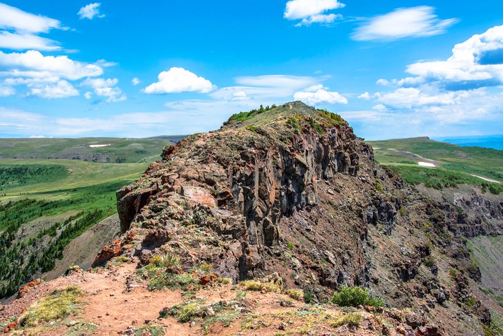
Rabbit Ears Peak Trail
Rabbits Ear Peak sits at more than 10,600 feet above sea level. The hike to get here is certainly challenging, but well worth it for the endless fields of wildflowers and the spectacular views from the top.
The 5.5-mile trail (out and back) has an elevation gain of 974 feet, but keep in mind you're starting at a high altitude to begin with. You can access the trail easily if you're staying at the Dumont Lake Campground. The trail is actually a dusty road, so you may encounter people tackling it in their 4WD cars — an option for you if you don't feel like hiking that day.
The majority of the trail is a steady, moderate climb, but the final stretch gets a lot more challenging. It's more of a rocky scramble than anything. But the views and interesting rock formations will keep you motivated through the challenge.
Bear in mind that over time, the "rabbit ears" for which the trail is named have eroded, but if you use your imagination, you may be able to make out the namesake ears.
The trail also is exposed for the majority of the trip, which means sunscreen and a hat are musts.
Fishhook Lake, Lost Lake, and Lake Elmo Trail
An easy, three-mile round-trip hike will take you to Fishhook and Lost Lakes. It's part of the greater 3,100-mile Continental Divide Trail. The high-elevation hike takes just a slice of the greater trail, starting from Rabbit Ears Pass.
The trailhead sits at just over 10,000 feet of elevation and descends about 800 feet through a lush evergreen forest before giving way to a sprawling meadow. In fact, this part of the trail is more than 100 years old — it was used by ranchers to drive their sheep between Colorado and Wyoming.
A mile in, you'll reach Fishhook Lake, and just a quarter mile beyond is Lost Lake. From here, you can turn around and head back home, or you can continue for another few hours to hit Lake Elmo and Little Lost Lake.
Yampa River Core Trail
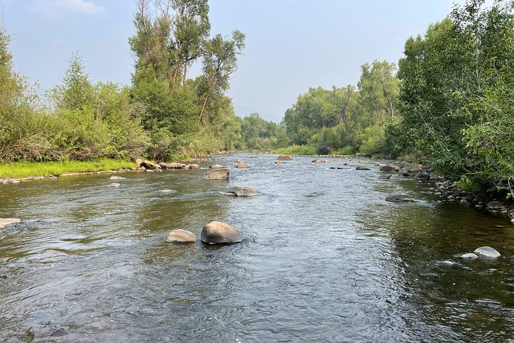
You don't have to be a monster hiker in order to get the most out of nature trails in Steamboat Springs. In fact, the beauty of Steamboat Springs is that the adventure literally comes right to your door. The Yampa River Core Trail is an easy, 2.8-mile hike/walk that takes you along the Yampa River through the valley.
Surrounded by mountains, with the city of Steamboat Springs not far away, this is the perfect way to introduce yourself to the city and all that it has to offer. The out-and-back trail has only a 39-foot elevation gain and is great for all levels, especially if you're a runner or have your dog in tow.
The trail is paved the entire way, which makes it great for wheelchairs or strollers, too. It's a quick bike ride, as well.
Fish Creek to Long Lake
What starts at Fish Creek Falls can be expanded to become a longer, more challenging hike to reach Long Lake.
Most hikers turn around when they hit the Upper Falls, but those who want to hike an additional 3.5 miles can reach the Continental Divide. It is a full-day hike with a 2,552-foot elevation gain, so packing water and something to eat is probably essential.
Those who hike the entire trail say that once you get past Upper Falls, the trail does become easier as you wind your way through open fields papered with wildflowers. Brace yourself for canyon views, waterfalls, and, of course, the alpine Long Lake.
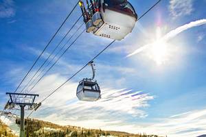
Thunderhead Hiking Trail
Thunderhead Hiking Trail will take hikers 6.6 miles out and back along one of the more challenging hikes in Steamboat Springs. The single-track trail zigs back and forth with extreme switchbacks that flow through gorgeous aspen groves.
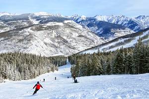
The hike features an elevation gain of 2,180 feet and runs between the top of the gondola and the base of Mount Werner. It's one of the few hiking-only trails on the mountain, meaning mountain biking is not permitted. Along the way, you'll have grand vistas of downtown, as well as the forested mountains in the distance.
You can do the hike a variety of ways: hike up and take the gondola down, take the gondola up and hike down, or hike in and out. The views are spectacular no matter which way you slice it. That said, you'll have to be prepared to pay the $25 fee to ride the gondola.
Emerald Mountain via Blackmere Trail
Of the many mountains around Steamboat Springs, one of the most popular is Emerald Mountain, also known as Quarry Mountain. This outdoor adventurer's paradise is famous for its many, many trails, which are used for hiking, cross-country skiing, mountain biking, horseback riding, and snowshoeing.
Perhaps one of the best trails up Emerald Mountain is the moderate Blackmere Trail. This 3.8-mile, out-and-back trail has an elevation gain of 902 feet and takes an average of two hours to finish.
Of course, hikers can spend multiple days exploring the web of trails along Emerald Mountain. Many trails have views of Mt. Werner, Sleeping Giant Mountain, and sweeping views over the Yampa Valley.
Map of Hikes in Steamboat Springs, CO
Best Time to Go Hiking in Steamboat Springs
While Steamboat Springs is a year-round destination, the best time to hit its hiking trails is between June and August. The summer months are known for the warm and sunny weather, which hits an average of 82 degrees Fahrenheit in June. These months also have the lowest average precipitation. Travelers on a budget may consider May for hiking. The weather may be a bit cooler (an average of 64 degrees Fahrenheit), but hotel rates will be considerably lower than in the summer.