Oregon's Hidden Gem Mountain City Boasts Scenic Nature And Outdoor Recreation
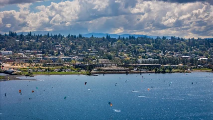
Between a mountain and a river in Oregon, you'll find the "windsurfing capital of the world" and one of the "most underrated travel destinations in the U.S."
Read More
Between a mountain and a river in Oregon, you'll find the "windsurfing capital of the world" and one of the "most underrated travel destinations in the U.S."
Read More
Largely due to rising fuel costs, American Airlines is cutting six different domestic routes between August and early October, which may impact your trip.
Read More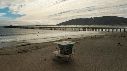
This small, coastal community in California has been named one of the best hidden-gem beach towns, where you can soak up water sports, seafood, and hot springs.
Read More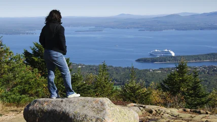
One East Coast port town could start welcoming large cruise ships back during the off-season following a new judicial ruling, though some obstacles remain.
Read More
Planning a trip to Las Vegas? You might have a harder time finding a flight. Here's what's going on and what you can expect traveling to Las Vegas this summer.
Read More
Channel your inner child (or bring your actual child!) to this new indoor theme park near Atlanta, Georgia, that offers endless thrill rides for the family.
Read More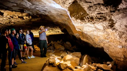
Tucked into woodlands in the South is a national park with fascinating underground trails, along with camping, boating, and other activities above ground.
Read More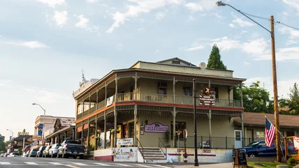
Within an hour's drive of Yosemite is a small community bursting with gold rush history and outdoor adventures, from rafting to skydiving and cycling.
Read More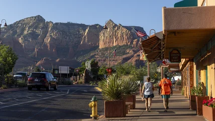
This Arizona city with a small-town atmosphere oozes feel-good vibes with its spiritual sites, rich arts scene, local wine trail, and charming trolleys.
Read More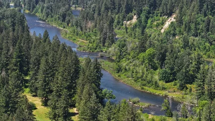
Discover one of the country's top disc golf courses, along with cozy campsites and plenty of wildlife, in this state park near Portland, Oregon.
Read More
This wine-producing Central Coast gem in California offers a more relaxed (and often affordable) alternative to the resorts and vineyards of Napa Valley.
Read More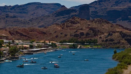
Arizona may not usually be associated with beaches, but this local town boasts sandy shores along its crystal-clear river and spots for water sports.
Read More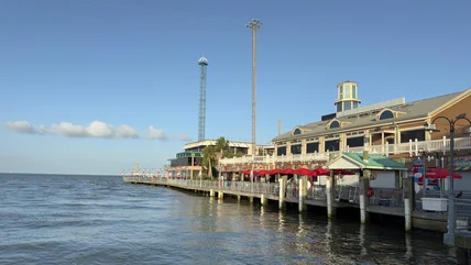
Just outside of Houston, the family-friendly Kemah Boardwalk is expected to open a new water park in 2027 with slides, a net bridge, and other attractions.
Read More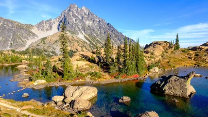
Choose from three different trails to reach a stunning, crystal-clear Washington lake surrounded by mountain peaks and captivating wildlife.
Read More
One coastal city in California has enacted a new rule on shade coverings, starting in May 2026, and those who don't comply may have to pay a hefty fine.
Read More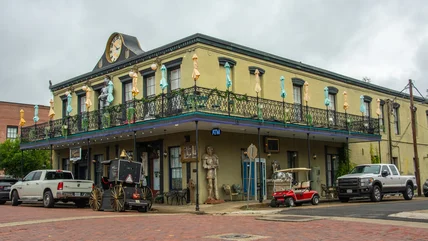
This city, once the second largest in Texas, is now a living time capsule with historic sites, haunted hotels, trolley tours, and unique shops and eateries.
Read More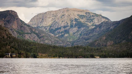
With the western Rocky Mountains as its backdrop, this ancient glacial lake is hub of activity and has remained a beloved getaway spot for generations.
Read More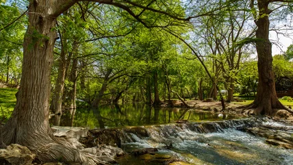
This enchanting little city offers a refreshing escape from the Texas summer heat, with spring-fed swimming holes and a charming downtown square.
Read More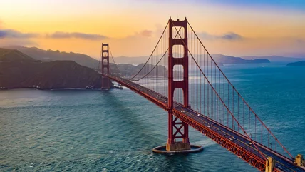
California's most famous sites have been depicted in films, art, and photographs, but nothing compares to seeing them for yourself, in living color.
Read More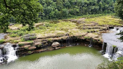
Spanning over 500 acres at the convergence of two ecological zones, Tennessee's newest archeological park sits atop a fascinating underground cave.
Read More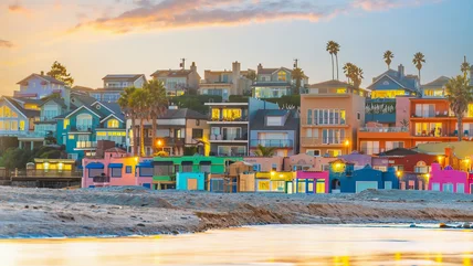
Widely considered California's original beach town, this charming destination on Monterey Bay is home to a vibrant wharf and colorful seaside architecture.
Read More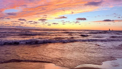
Originally named after its beautiful sunsets, this lesser-known city on Lake Michigan's shore is home to seven majestic beaches and a colorful downtown.
Read More
Pennsylvania has introduced a law to improve safety for residents and visitors on the road, and officers are now taking enforcement to the next level.
Read More
The TSA is taking airport security screening to the next level with a brand new program that is set to make traveling smoother and more efficient.
Read More
Ranking above Magic Kingdom Park and Universal Studios Florida, this iconic destination is known as America's largest free admission amusement park.
Read More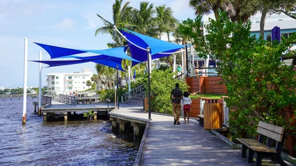
Ranked one of the best coastal towns of 2026, this vibrant destination blends Old Florida charm with perfect beach days and endless family fun.
Read More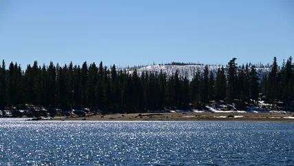
This pristine mountainside lake in the Sierra National Forest is a beloved hot spot for fishing, swimming, paddling, boating, and simply relaxing.
Read More