Hikes in Big Bend National Park
Authors Michael and Lana Law have made multiple trips to Big Bend NP to camp and hike the trails.
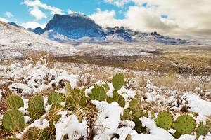
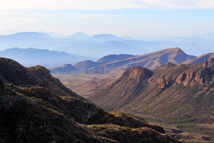
Big Bend National Park is remote and takes time and effort to get to but is worth the effort, particularly for hikers. Incredible hiking trails range from hikes through the desert, along mountain ridges, beside the Rio Grande river, and through canyons.
The park is divided into three main areas: the Rio Grande Village, the Chisos Basin, and the Ross Maxwell Scenic Drive to the Castolon/Santa Elena Canyon. Each of these offer completely different hiking experiences.
The Chisos Basin area is set high in the mountains and is where you'll find the majority of the hikes. The Rio Grande Village area, located on the east side of the park along the Rio Grande River, offers a smaller number of beautiful hikes and short trails with views of the river.
The Santa Elena Canyon is on the west side of the park, also on the Rio Grande River, and home to one of the park's most spectacular hikes. To get to the Santa Elena Canyon area, you will drive along the Ross Maxwell Scenic Drive, from where you can access a couple of interesting desert hikes and viewpoints.
If you are staying in Marathon and commuting to the park, the Chisos Basin area is the closest point, and Rio Grande Village is farther south. From Terlingua, Study Butte, and Lajitas on the west side of the park, the closest area is Santa Elena Canyon.
The park is large, but it's still possible to stay on either side and easily drive across the park and back in a day. Save yourself some time with our list of the top hikes in Big Bend National Park.
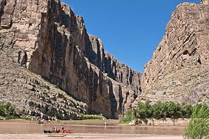
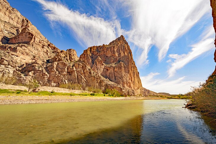
Santa Elena Canyon Trail
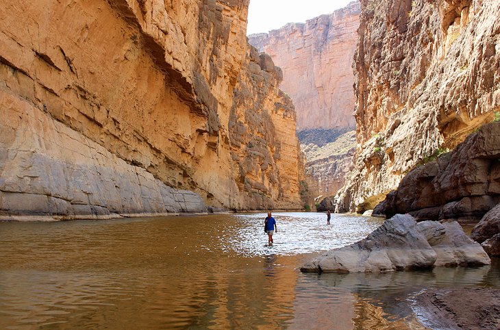
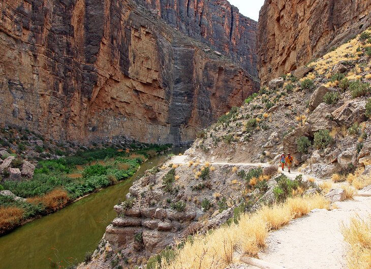
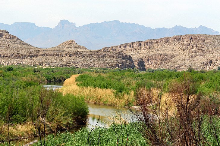
This amazing 1.7-mile, in-and-out hike takes you into one of the most dramatic features in Big Bend National Park, the Santa Elena Canyon. The trail runs along the edge of the Rio Grande River, sometimes at the water's edge and sometimes on a ridge a few stories above, while the walls rise up to 1,500 feet above you on both sides of the narrow canyon.
The orange glow of the canyon walls reflecting in the water is captivating. At the far end of the trail, the path takes you down to the water's edge, where you can wade out into the canyon if the water is low. Depending on the flow of the Rio Grande, you may even find yourself walking up a mostly dry riverbed, especially later in the summer.
In the afternoon, the trail can be hot, but the final third of the route is in shadow, offering some respite from the sun. At the start of the trail, you can also go for a dip in the shallow water or enjoy a picnic near the parking area. Bring a pair of shoes that you are comfortable getting muddy and dirty no matter how dry the weather may have been.
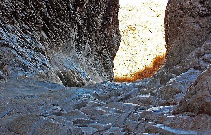
Hot Springs Trail
Most people only walk as far as the hot springs, but the full trail, just under a mile in length, delivers some incredible views out over the Rio Grande, to the mountains in the far distance.
In the spring, when the flowers are blooming along the hillside and the trees along the river are glowing a bright green, this hike is an absolute must. From the parking lot, cross the bridge and turn left to begin the hike. You'll gradually ascend to a ridge above the river, and from here, it's non-stop scenic views in both directions over the Rio Grande.
At one point, you'll see a cement pad with a half-wall. If you walk out to the wall and look down, you can see the hot springs directly below. The trail continues along and descends to the river, leading to the hot springs, where you can stop for a soak in the 105-degree-Fahrenheit waters and cool off with a dip in the Rio Grande River.
This is one of the top things to do in the park. From the hot springs, it's a .25-mile walk back to the parking area. Along this stretch, you'll pass some pictographs, a dramatic wall of layered limestone, and abandoned structures from a resort built here in the 1920s. This hike is just a short drive from the Rio Grande Village.
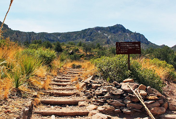
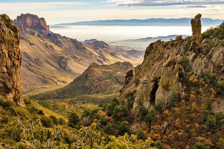
Lost Mine Trail
This hike in the Chisos Basin area is a delightful walk up to, and along, a ridge, with beautiful views over Juniper Canyon. Although the entire hike is 4.8 miles return, many people opt to go only as far as a viewpoint at about the one-mile mark and turn around, making this a simple two-mile hike with a little elevation gain.
From the parking area, which fills quickly in the mornings, you gradually ascend, with intriguing views through the trees to impressive cliff walls. Eventually, the path reaches a ridge at around one mile in, where the view opens up and looks out over Juniper Canyon, for what most people describe as the best view on the entire trail.
If you go on to complete the hike, the trail continues up along the ridge and a series of switchbacks, with scenic vistas most of the way, until it eventually dead ends at a pile of rocks. The return hike is along the same route. The total elevation gain for Lost Mine Trail is 1,100 feet.
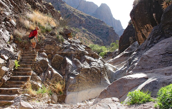
The Window Trail
This 5.6-mile trail delivers beautiful views almost the entire way in both directions. The destination on this hike is the Window pour-off at the far end of the trail, where a notch in the mountain ridge dips down, forming the Window.
This is the "window" you see in the distance from the Window View Trail. Through the opening is a portion of a rock face and a vista out to the desert landscape far below. This area at the end of the trail, known as the Window pour-off, is only about eight to 10 feet wide, and the rock surface here is worn smooth and is slippery.
You should use caution as you approach the edge, as the back side is a sheer drop-off. The safest option appears to be the left side, where a dip in the rock forms at least a small barrier before the cliff's edge.
The Window Trail starts from a trailhead at the Chisos Basin Visitor Center. You can also access it from the Chisos Basin Campground, near site 51, which cuts down the total distance to just 3.7 miles return.
In either case, the trail starts with a descent, then levels off as you walk through the lovely Oak Canyon. Eventually, you come to some large rock walls, which offer some shade, before reaching the Window.
The elevation change for this hike is just under 1,000 feet from the visitor center and 500 feet from the campground.
Nature Trail at Rio Grande Village
While this is a very short hike with only 130 feet of elevation gain, even the most hardened hiker will enjoy this trail. From the top, you can see across to the Boquillas Village in Mexico and all around the surrounding area. It's also a great area to see wildlife and ideal for families.
Leaving from the Rio Grande Village Campground, this .75-mile hike starts out over a bridge spanning a small pond alongside the Rio Grande River. From the bridge, you can peer into the pond and see a variety of fish or turtles basking on a mound of mud. On the opposite shore, the landscape quickly turns from green to typical desert.
Eventually the trail, which has some confusing signage, circles left, up a hill. This is where you'll gain the most outstanding views, which range from a patch of sand dunes, to cliff ridges, and beyond to the landscape of Mexico.
South Rim Trail
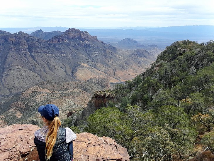
Fit hikers looking for a full-day hike should head to the South Rim Trail. Located in the Chisos Basin area, this is often described as the most scenic hike in the park, but it requires a lot of effort for the reward.
The hike takes you up 2,000 feet of elevation to the rim of the cliff for incredible views out over the desert below. This is a 12- to 15-mile hike, with an option to add on a spur to Emory Peak, and takes eight to 10 hours.
The hike starts from the Chisos Basin Trailhead, near the Chisos Basin Store.
Emory Peak
Another epic, all-day hike not for the faint of heart is the Emory Peak Trail, which takes you to the highest peak in Big Bend National Park.
If you want an idea of what you are getting into before you hit the trail, you can see the peak from the Chisos Basin Store and visitor center.
This is a 10.5-mile hike with 2,400 feet of elevation gain, and it takes about seven hours to complete. Be prepared for a heart-pounding grunt up to the peak.
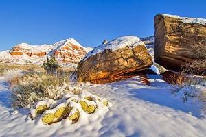
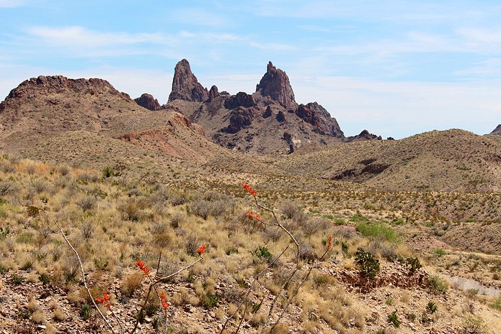
Balanced Rock (Grapevine Hills Trail)
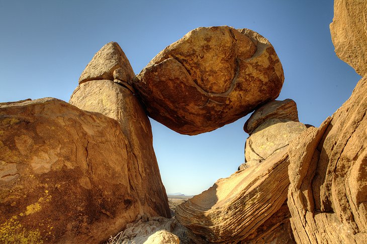
The Balanced Rock Trail is relatively easy, heading out across the desert to this unique inverted triangle-shaped rock formation, framing the sky and distant landscape.
The trail is only 2.2 miles with 240 feet of elevation gain but it's in full sun and can be very hot. It also starts six miles down a rugged dirt road, which is best done in a 4WD vehicle.
The hike itself will only take you an hour or so, but the drive down the Grapevine Hills Road will be slow and add time to your trip.
Chisos Basin Loop Trail
This scenic little trail generally sees less traffic than many of the other hikes in the area, least beyond the split for Emory Peak and South Rim.
Leaving from the Chisos Basin Visitor Center, the trail can be done in either direction. Done in a counter clockwise direction, the trail quickly ascends before flattening out and then gradually descending back to the parking lot.
From the path you get intermittent but beautiful views to the Window, as well as Emory Peak and the Pinnacles.
Total distance for this hike is 1.8 miles and the elevation is 350 feet. This is an easy trail with no cliffside drop-offs, making it very suitable for children.
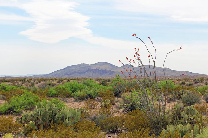
Mule Ears Spring Trail
The dramatic mule ears, two old volcano cores rising up in the desert, are an interesting site as you drive along the Ross Maxwell Scenic Drive.
The Mule Ears Spring Trail starts at the Mule Ears Overlook and leads out into the Chihuahuan Desert to a spring, where the dry gray and brown desert turns to a green oasis of Cottonwoods and other plants.
This 3.8-mile round-trip hike is in full sun and can reach extremely high temperatures from spring until fall. It's best to start this hike very early in the day and avoid it completely on hot summer days.
Chihuahuan Desert Nature Trail
If you are only interested in a short little stroll through the desert, this is the place to do it.
On this half-mile trail, with almost no elevation gain, you can learn about the ecology of the area. A number of interpretive signs along the trail offer information on the plants and landscape.
This is also a good place to spot birds and possibly javelina, or at least javelina tracks. The Chihuahuan Desert Nature Trail is located at Dugout Wells, where there is a natural spring, small picnic area under a large tree, and an old windmill.
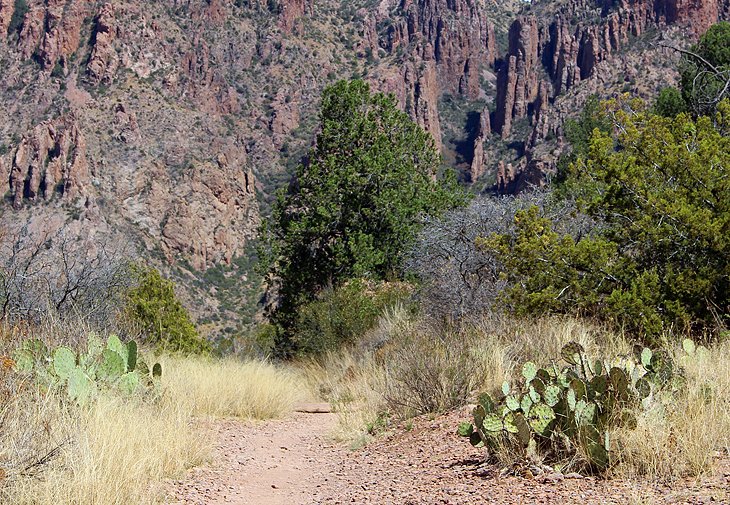
Chimneys Trail
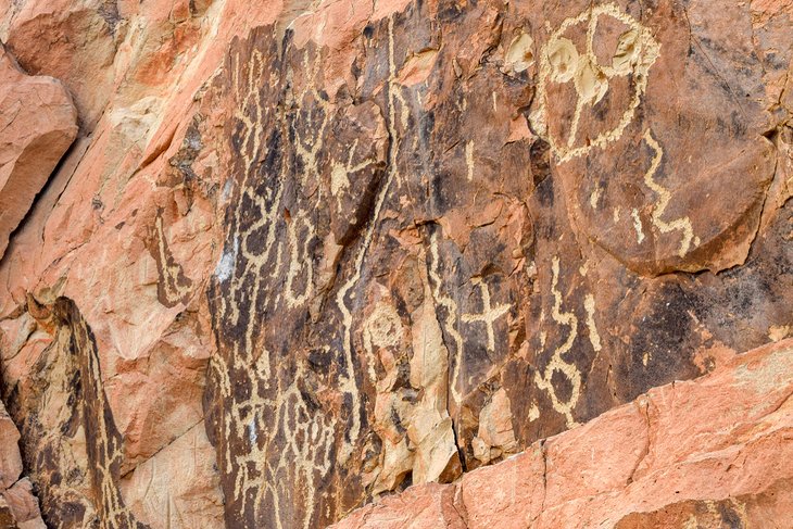
The Chimneys Trail offers a glimpse of interesting geology and cultural artwork. This 4.8-mile round-trip hike traverses the desert and leads to ancient volcanic spires.
The trip is mostly level, with a slight downhill on the way to the chimneys. Along the way, you'll pass creosote bushes, spiny ocotillos, and prickly pear cactus.
The geology here is fascinating, and at the base of the spires, you'll find beautiful petroglyphs made by Native Americans hundreds of years ago.
The trailhead is at mile marker 13 of the Ross Maxwell Scenic Road.
Boquillas Canyon Trail
This delightful 1.4-mile trail climbs relatively steeply as it ascends a bluff overlooking the Rio Grande. Expansive views from the top are only part of the great reward of undertaking this easy trail, while at the top, keep an eye out for holes in the bluff made by early inhabitants.
After you crest, continue onwards and enter Boquillas Canyon, where depending on the time of day, shade is plentiful. Eventually the canyon peters out, and the trail meets the sandy shores of the Rio Grande.
Along the way, you may find small items on the trail. These are craft items that the people from across the river in Mexico leave for sale.
The Boquillas Canyon trailhead is located near Rio Grande Village at the end of Boquillas Canyon Road.
Boot Canyon Trail
This 3.5-mile trail is of special interest to birders due to the prevalence of avian inhabitants along the way. Boot Canyon is a unique area that stays relatively lush all year, and its pools of water draw not only birdlife, but other animals as well.
Birds spotted in Big Bend are varied and colorful. Some of the most spectacular are painted buntings, yellow-breasted chats, and golden-fronted woodpeckers.
Boot Canyon is also home to several species of tree found nowhere else in the park, the most notable of which is the Arizona cypress.
Map of Hikes in Big Bend National Park
Frequently Asked Questions
When is the best time to hike in Big Bend National Park?
The best time to hike in Big Bend National Park is in the spring, generally mid-February until the end of March. At this time, you'll have sunny days, reasonable temperatures, the best chance of seeing the desert in bloom, and migrating birds.
The winter months are also pleasant, with cooler temperatures and less crowds on the trails. Hiking in the summer is not recommended or safe.
What are the best hikes for families in Big Bend National Park?
The best hikes for families in Big Bend National Park are Santa Elena Canyon, the Hot Springs trail, and the Nature Trail at Rio Grande Village. All these trails are relatively short, easy, and provide lots of interesting things to see and do for children of all ages.