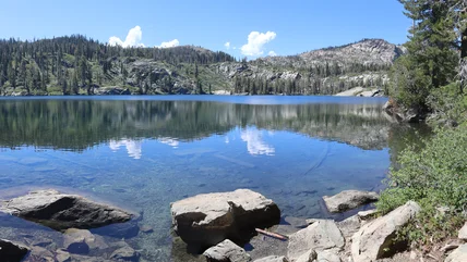
15 Top-Rated Hiking Trails near San Francisco, CA

Written by Brad Lane
Updated Mar 21, 2023

With beautiful bayside views and coastal redwood forests, hiking trails in San Francisco illustrate what makes The City by the Bay one of the most beautiful in the world. Places to hike range from in-city trails to routes that require less than an hour's drive, and the range of landscapes includes redwood forests, sandy beaches, and rolling valleys.

Mount Diablo State Park at sunset
Mount Diablo State Park at sunset | Photo Copyright: Brad Lane

The illustrious Golden Gate National Recreation Area is the true backbone of hiking trails in the Bay Area. It encompasses over 80,000 acres and 37 distinct park units north and south of the Golden Gate Bridge, with quintessential hiking areas like the San Francisco Presidio and the Marin Headlands.

But it's not just the Golden Gate National Recreation Area with hikes near San Francisco. Every direction from the city has a new trail to explore. These other environments include the surrounding mountains, along the coast, and the East Bay – all highlighting this dynamic and rich region of California.

For more ideas on where to hike around the City by the Bay, see our list of the best hiking trails near San Francisco.

1. Presidio of San Francisco

Golden Gate Bridge from the Presidio
Golden Gate Bridge from the Presidio | Photo Copyright: Brad Lane

The Presidio of San Francisco is an iconic destination for Bay Area views. It encompasses nearly 1,500 acres on the northern tip of San Francisco, connected to the Golden Gate Bridge.

The Presidio was a former military post until 1994, and today the park features numerous hiking trails, swimming beaches, and historic military structures. Cultural attractions like the Presidio Officers' Club and the Walt Disney Family Museum are also within this defining San Francisco public space.

Vehicles are allowed on the roads of the Presidio, but the best way to take in the Bay Area beauty is on foot and walking near the shore. East of the Golden Gate Bridge, near the historic Fort Mason, visitors access the Golden Gate Promenade and Crissy Field alongside a sandy beach where dogs can run leash-free.

Hikers, bikers, and joggers can continue through the historic Crissy Airfield until reaching the Golden Gate Bridge Welcome Center less than two miles away.

Batteries to Bluffs Trail
Batteries to Bluffs Trail | Photo Copyright: Brad Lane

A coastal trail stretches along the southwest shoreline from the Golden Gate Bridge, where hikers come across the Batteries to Bluffs Trail with stunning views of the bridge. This side of the Presidio also lends access to Baker Beach–one of the best beaches in San Francisco. The equally iconic Lands End Trail is farther southwest along the shore from Baker Beach.

Official site: https://www.nps.gov/prsf/index.htm

2. Twin Peaks, San Francisco

Twin Peaks
Twin Peaks | Photo Copyright: Brad Lane

Twin Peaks is one of the most popular hikes in San Francisco. It's the second tallest point within city limits (Mt. Davidson is the first), and on clear days, visitors see every San Francisco landmark, including the Golden Gate Bridge, Alcatraz Island, and downtown Market Street. Careful eyes might also espy Mount Diablo off in the distance across the bay.

Fog and other moving systems can hinder views atop Twin Peaks, but when the timing is right, the overlook is spectacular.

Visitors can drive nearly to the top of either the South or North Peak, with a short trail and wooden steps leading to the actual summits. For those looking to earn the views with a little hiking or bicycling, adjacent pathways run alongside Twin Peaks Boulevard. Users can also hike through Glen Canyon Park to Portola Drive and pick up the Twin Peaks Trail from there.

Trail through eucalyptus trees in the Mount Sutro Open Space Preserve

Hikers and mountain bikers can also reach the forested slopes of Mount Sutro from Twin Peaks. Primarily owned and managed by the University of California San Francisco, the 61-acre Mount Sutro Open Space Preserve attracts more locals than tourists. And to the east of Twin Peaks, Bernal Heights offers an additional casual one-mile loop with more great views of the Bay Area.

Address: 501 Twin Peaks Boulevard, San Francisco, California

3. Redwood Creek Trail, Muir Woods National Monument

Redwoods at Muir Woods National Monument
Redwoods at Muir Woods National Monument | Photo Copyright: Brad Lane

Muir Woods National Monument protects a stunning example of old-growth coastal redwoods north of the Tennessee Valley in the Marin Headlands. The best way to experience the neck-craning canopies of these redwoods, some over 200 feet tall, is the boardwalk path within the monument that follows the banks of Redwood Creek.

Starting from the Visitor Center, this universally accessible trail meanders alongside these massive trees and provides information about their 800-plus-year history in the region.

The boardwalk trail traverses both sides of the creek with three different bridges to cross. Making it to each bridge adds roughly 30 minutes to a hike, and maybe longer depending on how much you stop to admire the massive tree trunks all around.

Muir Woods National Monument

Dirt hiking trails lead up the canyon walls from boardwalk path, and each lend different vantage points of the giant forest. Longer area trails also run through Muir Woods National Monument, like the Dipsea Trail, which connects to the surrounding Mount Tamalpais State Park before reaching the ocean.

Parking reservations are required to visit Muir Woods National Monument and must be purchased ahead of time. Parking reservations can be made through the official website.

Address: 1 Muir Woods Road, Mill Valley, California

Official site: https://www.nps.gov/muwo/index.htm

4. Lands End Trail, Golden Gate National Recreation Area

Sutro Bathhouse foundations on Lands End Trail
Sutro Bathhouse foundations on Lands End Trail | Photo Copyright: Brad Lane

Lands End provides a dramatic coastal trail and a great view at the edge of the continent. This popular trail is southwest of Baker Beach and the San Francisco Presidio and heading north along this ocean-edge trail is the most common way to go, starting at the Lands End Visitor Center within the Sutro Historic District.

The historic foundations of the lavish late-1800s Sutro Bathhouse are seen before even starting the trail, as well as the rehabilitated Cliff House restaurant and public space that overlooks Seal Rocks.

A few strenuous hills are encountered heading north from Sutro Baths along the Lands End Trail, but the route is mostly flat. Views of the Bay filter in along the two-mile route, including areas where past ships have wrecked when trying to navigate the notoriously tricky waters.

The Golden Gate Bridges comes better insight the farther you make your way north along the trail, where hikers eventually reach a turnaround point in the affluent Sea Cliff neighborhood.

5. Tennessee Valley Trail, Marin Headlands

Beach on the Tennessee Valley Trail, Marin Headlands

The Tennessee Valley Trail is a popular family hike within the Marin Headlands north of the Golden Gate Bridge, leading to a sandy beach and overlook. The quickest trail to Tennessee Beach spans 1.7 miles from the trailhead with very little elevation gain. More strenuous hiking trails branch off in the Tennessee Valley and up the surrounding steep hills.

Spring is one of the best times to visit the Tennessee Valley when wildflowers are in full bloom. Some of the best campgrounds near San Francisco, including the Haypress and Hawk walk-in campgrounds, are also reached from the Tennessee Valley trailhead. Nearly the entire route is exposed to the sun and subject to windy conditions.

Tennessee Valley Trail, Marin Headlands
Tennessee Valley Trail, Marin Headlands | Photo Copyright: Brad Lane

Ambitious day hikers can reach Muir Beach on a nine-mile loop starting from the Tennessee Valley trailhead, including an optional stop at the tucked-away Pirate's Cove for some whale watching.

Address: 591 Tennessee Valley Road, Mill Valley, California

Official site: https://www.nps.gov/goga/planyourvisit/tennessee_valley.htm

6. Diablo Summit, Mount Diablo State Park

Mount Diablo State Park

The most popular hikes at Mount Diablo State Park in the East Bay lead straight to the summit. That's because enormous views of the region unfurl from this highest point in the East Bay. The easiest route to the top is the one-mile Mary Bowerman Interpretive Trail, which starts from the Summit Visitor Center.

On the other end of the spectrum, the trail through Mitchell Canyon spans nearly eight miles and has over 3,500 feet of elevation gain. It's a more demanding hike but offers the most dynamic landscapes to hike through. The Juniper Campground, near the summit, offers a great basecamp for exploring.

Address: Summit Road, Walnut Creek, California

Official site: https://www.parks.ca.gov/?page_id=517

7. Angel Island State Park

Angel Island State Park seen from Marin Headlands

Angel Island is the largest natural island in the San Francisco Bay, with a hidden gem of a hiking trail close to San Francisco. The state park is only accessible by private boat or public ferry, and a paved and approximately five-mile road that circles the entire island is open to pedestrians.

A designated hiking-only trail system stems from the road and has paths that lead to the 788-foot summit of Mt. Livermore–the tallest point on the island. Picnic tables, restrooms, and potable water are available on Angel Island.

Official site: https://www.parks.ca.gov/?page_id=468

8. Shoreline Trail, China Camp State Park

Shoreline Trail, China Camp State Park
Shoreline Trail, China Camp State Park | Photo Copyright: Brad Lane

China Camp State Park is across the bay from San Francisco, next to the scenic city of San Rafael in Marin County. It's a site of significant cultural history, first home to Indigenous cultures of the region, and during the 1880s, a vibrant Chinese fishing village with over 500 residents.

The park sits near the shores of San Pablo Bay. Alongside several cultural monuments, including the remaining Chinese Camp Village, the park also has a winding trail network that connects several attractions and points of interest.

The Shoreline Trail is one of the most popular in the park. It has several access points and different side trails to make variable distance loops. However, the mainstay of the trail sticks close to the water, enabling excellent views throughout. A few popular sidetracks along the route include China Camp Village, Buckeye Point, and Turtle Back Hill.

9. Mori Point, Pacifica

Mori Point
Mori Point | Photo Copyright: Brad Lane

Mori Point offers stunning hiking trails next to the ocean south of the city in central Pacifica, on the San Mateo County coast. This 32-acre wetland waterfront is an easy drive or bus ride from the city and has numerous trails to explore, including an accessible boardwalk trail that leads to the ocean. Higher vantage points are available via dirt trails and steep steps that lead up to Mori Point and the surrounding foothills.

Mori Ridge is accessible on the other side of Highway 1 from Mori Point, which steeply connects to the more inland Sweeney Ridge Trail. The 1,200-foot summits atop Sweeney Ridge provide a comprehensive view of the Bay Area.

Both Mori Point and Sweeney Ridge are managed as part of the Golden Gate National Recreation Area. To the south, San Pedro Valley Park features additional trails, including the iconic Montara Mountain Trail.

Address: Mori Point Road, Pacifica, California

10. Summit Loop, San Bruno Mountain State and County Park

Summit Loop on San Bruno Mountain
Summit Loop on San Bruno Mountain | Photo Copyright: Brad Lane

San Bruno Mountain is on the southern border of San Francisco, surrounded by nearly 2,500 acres of parkland. A shaded picnic area with barbecue pits is at the entrance of San Bruno Mountain Park, as well as numerous trailheads, like the Summit Loop that delivers hikers to the top of the mountain. The two-mile trail to the top goes through a coastal shrub environment and crosses Radio Road along the way.

Despite being a summit trail, hikers tackle only 700 feet of elevation gain on their way to the top of San Bruno Mountain, which stands at 1,314 feet above sea level. The entire San Francisco Bay is on display from the summit of San Bruno Mountain on clear days. The route is fairly exposed on these same sunny days, and visitors should bring sun protection.

Other popular hiking trails in the mountain park include the Eucalyptus Loop Trail and the Old Guadalupe Trail.

Address: 555 Guadalupe Canyon Parkway, Brisbane, California

11. Skyline Gate Staging Area, Redwood Regional Park

Hiking trail in Redwood Regional Park

Redwood Regional Park encompasses over 18,000 acres near Oakland in the East Bay and it's a popular place to get away from the crowds. The Skyline Gate Staging Area in the northwest corner of the park is a good first place to head to see some big trees. This easy-to-reach trailhead is on the east side of Oakland, less than 10 miles from downtown.

Heading on either the Stream Trail adjacent to Redwood Creek, or either direction on the East and West Ridge Trail, provides a relatively flat grade to follow. Check out a trail map before visiting. Several junctions along the Stream and West Ridge Trail make for variable distance looped hikes.

Address: 7867 Redwood Road, Oakland, California

Official site: https://www.ebparks.org/parks/redwood/

12. Point Reyes National Seashore

Chimney Rock Trail in Point Reyes National Seashore

Point Reyes is the only nationally designated seashore on the West Coast. It encompasses over 70,000 acres of a nearly detached coastline an hour north of San Francisco.

Escaping San Francisco to Point Reyes is easy with its several beaches, lagoons, and wild places it protects. Three visitor centers help orient visitors at Point Reyes National Seashore, including the Lighthouse Visitor Center, located on the extended tip of the Point Reyes Headlands.

The Chimney Rock Trail extends from the Lighthouse Visitor Center for just under two miles. Both the beating waves of the ocean and the calm waters of Drakes Bay are seen heading down the trail, and the route offers a great vantage point for whale watching throughout much of the year. The trail can be a bit steep at points, and stairs have been built into the ground on certain portions of the hike.

Point Reyes has nearly unlimited hiking trails and areas to explore. A few other popular routes include Tomales Point Trail, the Laguna-Coast Loop, and the challenging hike to Alamere Falls.

Address: Lighthouse Visitor Center, 27000 Sir Francis Drake Boulevard, Inverness, California

Official site: https://www.nps.gov/pore/index.htm

13. Point Bonita Lighthouse Trail, Marin Headlands

Point Bonita Lighthouse

The Marin Headlands are a crown jewel of the Golden Gate National Recreation Area and are on the north side of the Golden Gate Bridge. The headlands are home to retired military forts, headland hiking trails, and numerous sandy beaches, many with stunning views of the San Francisco Bay, including the Golden Gate Bridge. And one of the best vantage points of this wild area is seen at the Point Bonita Lighthouse.

Hikers access this still-active lighthouse, constructed in 1885, with a half-mile hike from the Nike Missile Site. More intrepid hikers can reach the lighthouse from the Golden Gate Bridge via paved and dirt pedestrian paths, including the Coastal Trail. Other sites to see along the way in this part of the Marin Headlands include Kirby Cove, Hawk Hill, and Black Sands Beach.

14. Lake Chabot Loop, Anthony Chabot Regional Park

Aerial view of Lake Chabot

Anthony Chabot is adjacent to Redwood Regional Park in the East Bay and offers a great hiking destination that doesn't receive as many tourists as hiking trails in the Golden Gate National Recreation Area. The regional park is a 20-minute drive from Oakland.

The 315-acre Lake Chabot is the park's centerpiece attraction, and the 12.5-mile Lake Chabot Loop multi-use trail circles the entire reservoir. Numerous side hikes stem from the Lake Chabot Loop, and hikers should expect to encounter mountain bikers and horse riders also sharing the trail.

Address: 9999 Redwood Road, Castro Valley, California

Official site: https://www.ebparks.org/parks/anthony_chabot/default.htm

15. Half Moon Bay Coastside Trail

Half Moon Bay Coastside Trail
Half Moon Bay Coastside Trail | Photo Copyright: Brad Lane

The small city of Half Moon Bay is less than an hour's drive south of San Francisco. It's right on the San Mateo County coastline and offers some of the best coastal landscapes within a short drive. One of the most popular thoroughfares for exploring is the Coastside Trail, sometimes also known as the Half Moon Bay Coastal Trail.

The Coastside Trail spans just over four miles from approximately Kelley Avenue north to Pillar Point, navigating the entirety of Half Moon Bay State Beach. It's a rail-to-trail conversion, formerly the line for the Ocean Shore Railroad. This means the path is mostly flat the entire way.

The Coastside Trail is primarily paved, though an adjacent dirt horse trail parallels the path through the state beach. Take a leisurely pace along the path and explore the side trails that lead through dunes and towards the beach.

Map of Hiking Trails near San Francisco, CA

San Francisco, CA - Climate Chart

Average minimum and maximum temperatures for San Francisco, CA in °C
JFMAMJJASOND
14 8 16 9 17 9 18 10 18 11 20 12 20 12 21 13 22 13 21 13 18 11 15 8
Average monthly precipitation totals for San Francisco, CA in mm.
120 105 86 32 14 3 1 2 7 30 84 81
Average minimum and maximum temperatures for San Francisco, CA in °F
JFMAMJJASOND
58 46 61 49 62 49 65 50 65 51 68 53 68 54 69 56 71 56 70 55 64 51 59 47
Average monthly precipitation totals for San Francisco, CA in inches.
4.7 4.2 3.4 1.3 0.5 0.1 0 0.1 0.3 1.2 3.3 3.2

More Related Articles on PlanetWare.com

image

More to Explore in San Francisco: For the ultimate outdoor adventure near San Francisco, campgrounds near San Francisco offer a special overnight experience. After exploring the many natural splendors surrounding the city, see our list of the top tourist attractions in San Francisco covering all the fun things to do in SF.

image

Hiking in California: For a good look at the diversity of hiking trails the state has to offer, see our article on the best hiking trails in California and the best hikes in Southern California, from the desert floor to mountain peaks. Santa Cruz is another coastal city with great hiking trails, and the beautiful hiking trails near Santa Cruz illustrate the beauty of coastal California.