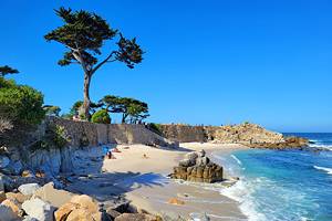
Beaches near Carmel, CA
Several postcard-worthy beaches await visitors to Carmel-by-the-Sea on the coast of Central California. This Monterey County enclave has its own designated beach: the stunning and dog-friendly Carmel Beach. But the sugary white sand and cypress trees of this city beach are just the tip of stunning ocean landscapes nearby.
Point Lobos State Natural Reserve and Big Sur are south of Carmel, offering their own enchanting beach adventures close to Carmel. And north of Carmel, on the rest of the Monterey Peninsula and beyond, coastal splendor is abundant at places like 17-Mile Drive and Lovers Point Park.
It's not all broad beaches and suntanning in this region, and activities vary widely at the different beaches near Carmel. Tide pool exploring, wildlife spotting, and scuba diving are also popular things to do along the rocky coastline. But the common denominator between all Carmel beaches is a scene of coastal beauty.
Discover the best beach for your next vacation with these top beaches near Carmel-by-the-Sea.
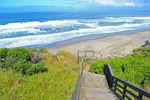
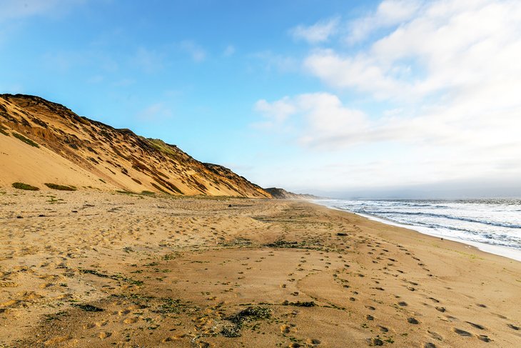
Carmel River State Beach
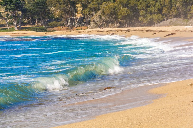
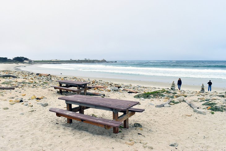
Carmel River State Beach is a beautiful stretch of sand accessible on the south side of Carmel-by-the-Sea. It's bounded by the ocean and the wetlands created at the mouth of the Carmel River, known as the Carmel River Lagoon Wetlands Natural Preserve. Birds perhaps frequent this lagoon more than humans visit the beach.
The beach stretches for approximately a mile, with lovely white sand. Popular activities here include suntanning and photographing the resident wildlife. Riptides and a steep drop-off make swimming dangerous. However, it's common to see kayakers launching from the beach.
Beachcombing and beach walking are also popular activities. Walkers often head south on the beach and toward the blufftop trails next to the Carmel Meadows neighborhood. These panoramic hiking paths connect to Monastery State Beach to the south, which is also part of the state park.
Parking can be a challenge at Carmel River State Beach. A small lot accommodates perhaps a dozen cars at the end of Carmelo Street, with some overflow parking available nearby. Try to arrive early to secure a spot on any sunny weekend.
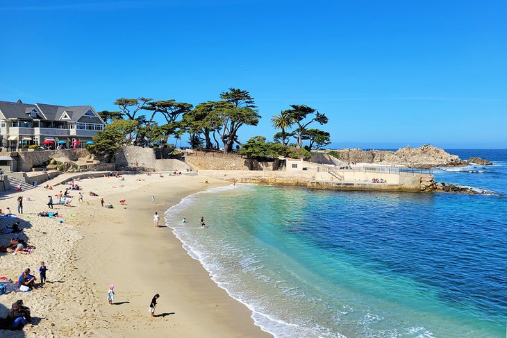
Carmel City Beach
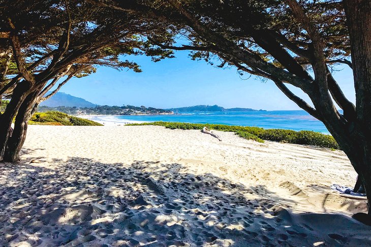
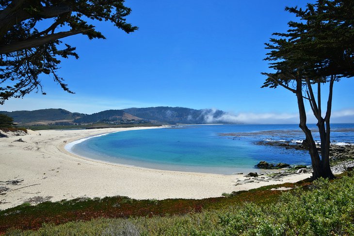
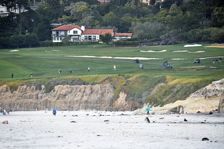
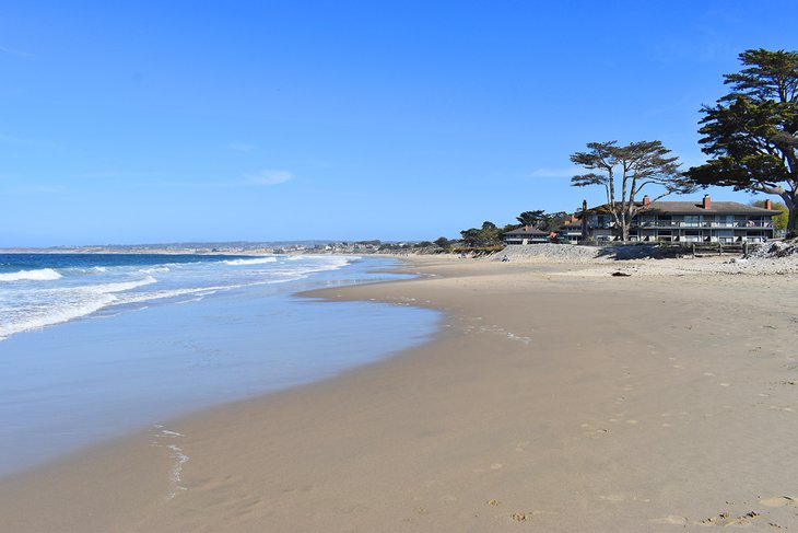
Carmel City Beach is a coastal scene ripped right from a postcard. The white sandy beach borders the entire city to the west, buffered by Monterey cypress trees, and holes 9 & 10 of Pebble Beach Golf Links are visible on the northern end. And every bit of the beach offers excellent views across the water and the Monterey Bay National Marine Sanctuary.
Carmel City Beach is a popular place, especially on warm-weather weekends. The main parking and access point is at the end of Ocean Avenue. When busy, visitors may have to find overflow parking south on Scenic Road. From any parking area, it's typically a short but somewhat steep walk down a white dune to the main beach.
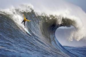
Carmel City Beach attracts several interests. The water runs a bit chilly, with potentially dangerous riptides, so swimming isn't common, but surfers with wetsuits catch some waves. No lifeguards are on duty. Setting a towel down and lounging is usually the base activity enjoyed by everyone.
Thanks to a no-leash policy, Carmel City Beach is also extremely popular for dog owners. Dogs are welcome to run and explore the surf but always must be under voice command. The beach is also home to a decomposed granite walkway. This walking trail, dubbed the Scenic Path, starts near 8th Avenue and follows the coast south.
Monastery Beach
Monastery Beach is part of Carmel River State Beach. It's accessible right off Highway 1, or an approximately one-mile walk from Carmel River State Beach through Carmel Meadows. The crescent beach is bountiful, with plenty of space to spread a towel out and enjoy the scenic ocean view.
The water is home to a deadly undertow, and swimming and shoreline walking is dangerous at Monastery Beach. Past accidents have given the beach the morbid nickname, Mortuary Beach. A relatively new lifeguard tower at the beach helps visitors heed the large caution signs.
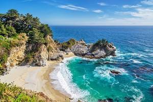
The beach is a popular spot for experienced scuba divers, though not as popular as the adjacent Point Lobos State Natural Reserve to the south. Monastery Beach is also a popular spot for general beach lounging and soaking up the sun.
Gibson Beach, Point Lobos State Natural Reserve
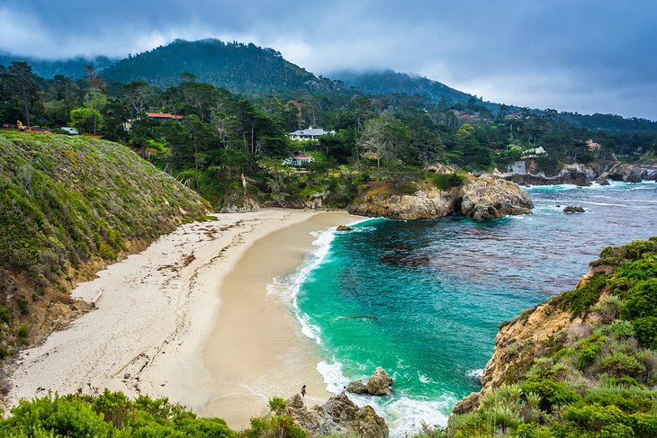
Point Lobos is the expansive headland just south of Carmel-by-the-Sea. It's a state natural reserve and a crown jewel of the state park system. Meadows, bluff-top trails, and abundant wildlife draw crowds of nature lovers to the headland throughout the year. Several secluded coves and rocky beaches also attract interest, all connected by a network of hiking trails.
Suntanning and other "traditional" beach activities aren't as popular at Point Lobos. Instead, at beaches like China Cove and Sea Lion Cove, the major attraction is the postcard setting. Popular activities at these rugged beaches include tide pooling; beachcombing; and watching wildlife like sea lions, sea otters, and whales. Scuba diving is also popular, with permits required to dive.
At the southern end of Point Lobos, Gibson Beach is the sandiest beach. Like the rest of the shoreline, reaching the coast requires a short walk. The shortest hike is from the end of the paved road in Point Lobos, where parking is limited. The walking route passes right by China Cove for a great view on the way to the sand.
Asilomar State Beach
Asilomar State Beach is a scenic stretch of coastline on the other side of the Pebble Beach neighborhood from Carmel. It's a famous beach for several reasons, including the on-site and historic conference grounds, which once belonged to the YWCA. Today, California State Parks owns and operates the conference grounds and the Asilomar Hotel.
The beach itself is very scenic and comprises several rocky coves punctuating short stretches of sand. This landscape lends to beachcombing, beach picnics, and simply admiring the dynamic environment. The Asilomar Coast Trail navigates the entire backend of the beach and is a popular flat path to explore.
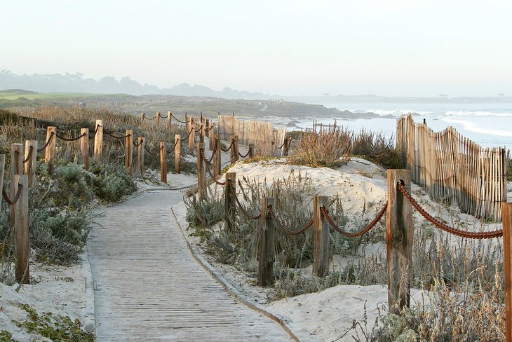
Asilomar State Beach is also home to a Dunes Natural Preserve. This reclaimed and vital dune habitat is on the other side of Sunset Drive from the ocean, next to the conference grounds. A universally accessible boardwalk trail navigates this fragile dune environment for a pleasant quarter-mile walk.
Lovers Point Park Beach
Lovers Point is a beautiful 4.4-acre oceanfront park in Pacific Grove on the Monterey Peninsula. It's at the end of 17th street and easily accessible from Carmel with less than a 15-minute drive. The park has several amenities, including a couple of gorgeous beaches.
The beach space at Lovers Point is unique in that it faces east, making it one of a few places to catch the sunrise on the West Coast. And outside of its orientation, the beach is simply beautiful. The water is a bit chilly at Lovers Point, but the calm conditions allow swimming. Watercraft like kayaks and paddleboards also commonly dot the water.
Several other outdoor attractions also draw attention to Lovers Point Park. Plenty of open green space and shade trees cater to picnics, as does the on-site Beach House Restaurant with coffee and casual fare. The actual point is also fun to explore, offering excellent vantage points north and south along the coast.
17-Mile Drive Beaches
The famous 17-Mile Drive tours the mansions and coastline of the Pebble Beach neighborhood, just north of Carmel. It's one of the most scenic driving routes in the country, with several roadside attractions worth a pullover. Alongside a few beautiful beaches, the route is home to iconic landscapes, including the Lone Cypress standing above the sea.
Moss Beach, within Spanish Bay, is one of the largest beaches along 17-mile drive. This beach is stop #3 when starting the route in Pacific Grove. Picnic tables and a broad shoreline invite activities like picnicking and beachcombing. And for those interested in a long beach walk, the sand extends north to Spanish Bay Beach, traveling through an intertidal zone.
There is a fee for non-residents to drive 17-Mile Drive. Various entrance stations connect to the route, including one in Carmel at the north end of San Antonio Avenue. Other entrance gates are in Pacific Grove and off Highway 1.
Del Monte State Beach & Monterey State Beach
A long stretch of beach extends east of Municipal Warf #2 in Monterey. Several different beaches constitute this continuous stretch of sand. Monterey Municipal Beach is the closest to the wharf, and perhaps the most popular, with easy parking nearby and safe swimming conditions.
Monterey State Beach encompasses two different sections of sand east of the wharf. The first, next to Monterey Municipal Beach, is commonly referred to as Window on the Bay Beach. This name is perhaps thanks to the landscaped entryways provided by Monterey Bay City Park.
Farther north along the coast, the state beach's second unit surrounds the Monterey Tides hotel with plenty of sand to explore.
Del Monte State Beach is the stretch of sand between the two units of Monterey State Beach. It tends to be a quieter place to enjoy the ocean, as it requires a bit of a walk to reach. The closest access point is from a boardwalk trail leading from a small parking area in the Del Monte neighborhood.
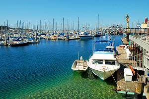
McAbee Beach and San Carlos Beach
McAbee Beach and San Carlos Beach are two small beaches next to Cannery Row on the Monterey Peninsula. And they both are among the many scenic attractions in this historic part of Monterey.
McAbee Beach is within Cannery Row, accessible from the scenic Steinbeck Plaza and the Cannery Row Monument. The beach is a sliver of sand come high tide, but it's worth stepping onto the shore and looking around during low tide. It's also a known spot for scuba entry.
San Carlos Beach is south of Cannery Row, next to the Coast Guard Pier. It's a more extensive beach accessible at all tides and another common entry point for scuba divers. The beach and inland grassy area are ripe for picnicking or taking a break in the day. And Monterey seals often line the adjacent Coast Guard Pier, offering easy wildlife watching nearby.
Garrapata State Park Beach
Garrapata State Park is on the northern Big Sur coastline, just a few miles south of Point Lobos State Natural Reserve. The park encapsulates what this beautiful region offers, including redwood hiking trails and a dramatic coastline.
The only stretch of sand along Garrapata's four shoreline miles is at the park's southern end. Parking is available off Highway 1, and it's a steep dirt trail to meet the beach. And while the state park is popular, the sand tends to be a little less crowded than other beaches on the Big Sur coastline.
The hiking trails at Garrapata are also a popular avenue for adventure. Many of these lead up the forested canyon on the other side of the highway, often revealing panoramic views of the Monterey Bay National Marine Sanctuary.
Fort Ord Dunes State Park
Over 20 miles of public beaches comprise the coast north of Monterey to Moss Landing. And six state beaches make up this accessible oceanfront, including Monterey State Beach, the farthest south.
Fort Ord Dunes State Park is the next northern state park and coastline. This newly established state park encompasses almost a thousand acres of retired fort land, including four miles of coastline. This beachscape is excellent for those looking to ditch the crowds, as it's easy to lay a towel down with few other people in sight.
The following two northern beaches are Marina State Beach and Salinas State Beach. And farthest north is Moss Landing State Beach and Zmudowski State Beach. Each of these public beaches offers its own appeal and similar facilities, such as parking and restrooms.
Map of Beaches near Carmel, CA
Carmel, CA - Climate Chart
| Average minimum and maximum temperatures for Carmel, CA in °C | |||||||||||
| J | F | M | A | M | J | J | A | S | O | N | D |
| 16 6 | 16 7 | 17 8 | 18 8 | 18 9 | 19 10 | 20 11 | 21 12 | 22 12 | 21 11 | 18 8 | 16 6 |
| PlanetWare.com | |||||||||||
| Average monthly precipitation totals for Carmel, CA in mm. | |||||||||||
| 106 | 95 | 90 | 38 | 13 | 5 | 2 | 3 | 7 | 27 | 62 | 69 |
| Average minimum and maximum temperatures for Carmel, CA in °F | |||||||||||
| J | F | M | A | M | J | J | A | S | O | N | D |
| 60 43 | 61 45 | 62 46 | 64 47 | 65 48 | 67 50 | 68 52 | 70 53 | 71 53 | 70 51 | 64 47 | 60 43 |
| PlanetWare.com | |||||||||||
| Average monthly precipitation totals for Carmel, CA in inches. | |||||||||||
| 4.2 | 3.8 | 3.5 | 1.5 | 0.5 | 0.2 | 0.1 | 0.1 | 0.3 | 1.1 | 2.4 | 2.7 |