Hiking Trails near Mt. Shasta, CA
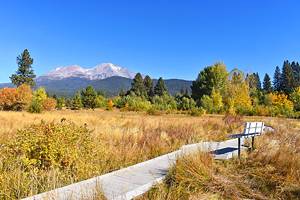
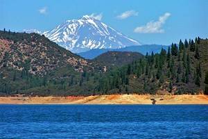
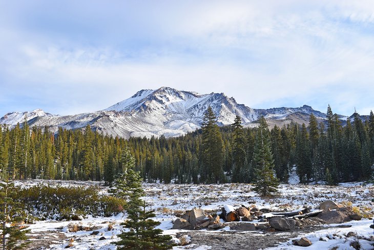
Mount Shasta is a beacon of adventure and hiking trails in Northern California. This over 14,000-foot mountain is arguably the most scenic in the Cascade Range, and the second tallest, only behind Mount Rainier in Washington. Its glistening glaciers have attracted people to its sacred slopes for thousands of years.
California's largest national forest, Shasta-Trinity National Forest, surrounds all sides of the mountain. Hiking areas lace this massive expanse of public space, including on-the-mountain routes and iconic trails in the larger Siskiyou County.
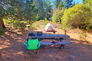
The Everitt Memorial Highway, extending from the City of Mt. Shasta, is one of the main avenues for adventure. This paved route navigates the southern flanks and ends at the defunct Mt. Shasta Ski Bowl, now known as the Old Ski Bowl trailhead. Alongside picturesque hiking areas, the highway is also the spot to find some of the best places to camp near Mount Shasta.
Note that Shasta-Trinity National Forest has been negatively affected by forest fires in recent years. Consult the National Forest website before visiting for current conditions and closures.
Find your own NorCal adventure with our list of the top hiking trails near Mt. Shasta.
Bunny Flat Trailhead, Everitt Memorial Highway
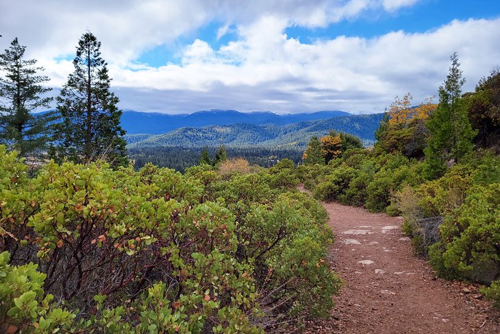
The Everitt Memorial Highway is one of the most popular and accessible routes to explore Mount Shasta. This paved highway is a continuation of Lake Street from the City of Mt. Shasta and extends 14 miles up to Mt. Shasta Ski Bowl. This defunct ski resort is now known as Old Ski Bowl and is why a paved road leads so far up the mountain.
Approximately eleven miles up the highway, the Bunny Flat Trailhead is a gathering spot for several mountain activities. It's also an easy spot to admire Mount Shasta, with a great view of its southern flanks, and starting from the trailhead, the 3.5-mile trek to Horse Camp and back is one of the most popular routes in the area.
The 1.75-mile trek to Horse Camp leads through a red fir and lodgepole pine forest to a historic stone cabin owned by the Sierra Club Foundation. The route is considered moderate, with just under 1,000 feet of elevation gain. Expect to encounter other trail users along the way.
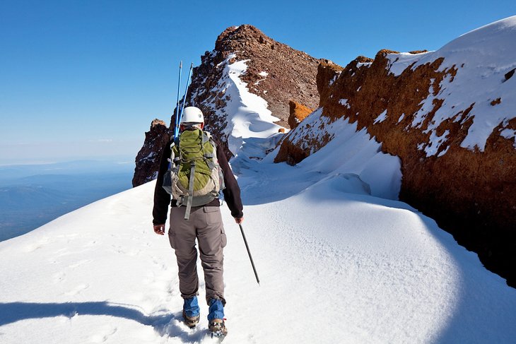
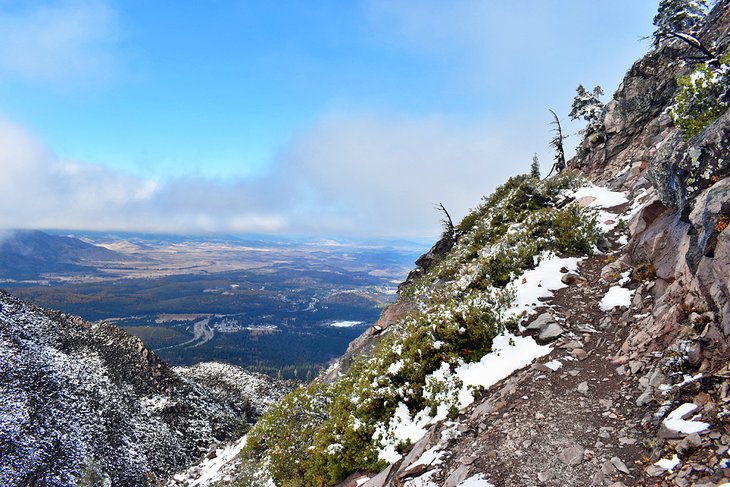
Bunny Flat is also a base camp for bigger adventures. It's a common starting point for those looking to make the technical summit of Mount Shasta. Avalanche Gulch is the most common summit route and perhaps the easiest, but it still requires crampons and dangerous snow travel.
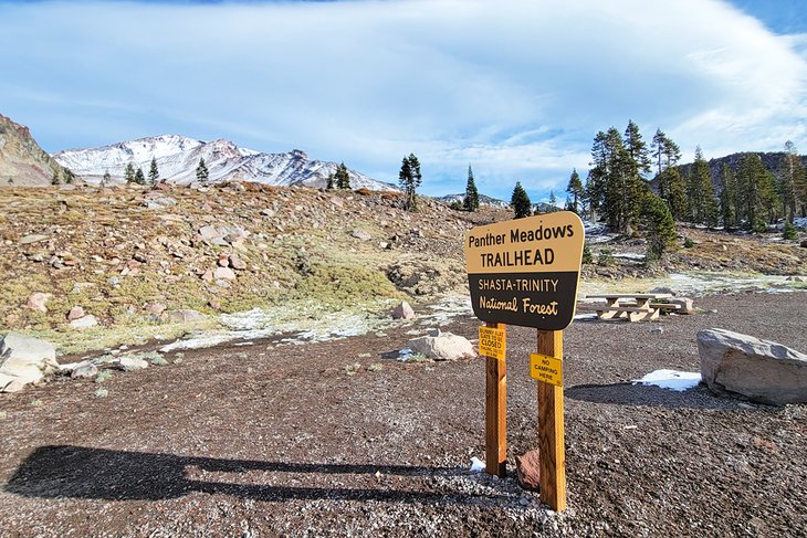
Panther Meadows and Gray Butte, Everitt Memorial Highway
Several other recreation opportunities line the Everitt Memorial Highway. And while Bunny Flat Trailhead tends to see the most traffic, it's not the only spot to enjoy the surreal mountain atmosphere.
A few miles up the road from Bunny Flat, the Panther Meadows area is also popular. It's the site of Panther Meadows Walk-In Campground, one of Shasta's most popular designated campgrounds. It's free to stay the night at this first-come, first-served campground, with a three-day stay limit.
From the campground, Panther Meadows itself is a picturesque place to explore. A one-mile loop navigates these fragile meadows, where users need to stick to the trail when exploring. And for more of an adventure, the meadow trail lends access to the steep route ascending Gray Butte.
South Gate Meadows, Everitt Memorial Highway
The 14-mile Everitt Memorial Highway ends at the Old Ski Bowl, formerly the Mt. Shasta Ski Bowl. An avalanche took down several chairlift towers at this ski spot in the 1970s. Today, little of the property's infrastructure remains, excluding a few notable service roads that branch away from the parking area.
The Old Ski Bowl is at an elevation of approximately 7,800 feet, well above the treeline, offering unique high-alpine views right from the start. This high-altitude trailhead makes for a short hiking season, typically starting in late June or even later during high snow years.
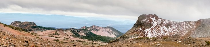
South Gate Meadows is a popular trek from the Old Ski Bowl area, offering an approximately two-mile one-way trek. The route heads east and crosses a small divide within the first half-mile, adding to the total of 1,000 feet of elevation gain on the four-mile round trip. Along the way are dominating views of the southern flanks of Shasta and the nearby Red Butte.
The route quickly enters the Mt. Shasta Wilderness, encompassing the mountain's upper slopes. Special restrictions apply when traveling in the wilderness, including a strict no-dog policy. The route also enters fragile meadowlands, where it's vital to stick to the trail.
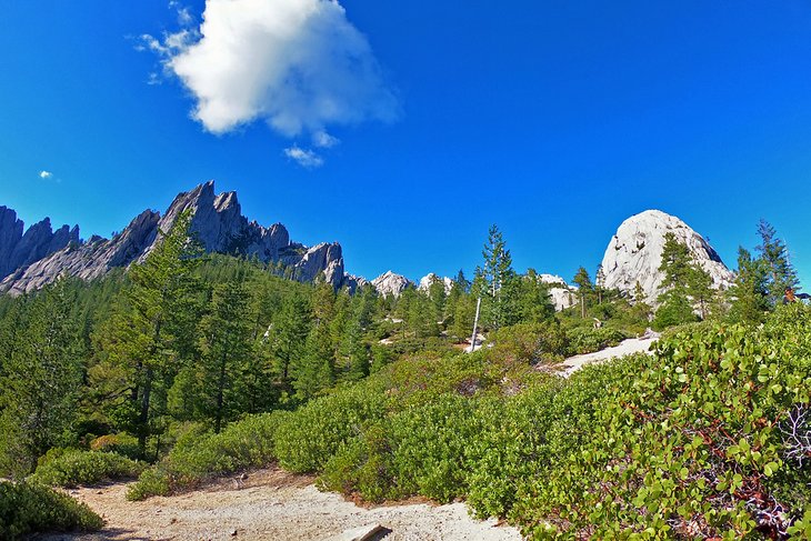
Black Butte Trail
Black Butte is the prominent conical peak less than three miles northwest of the City of Mt. Shasta. It's commonly spotted when driving around town or passing by on Interstate 5. And despite its rocky slab and steep composition, a challenging 2.5-mile trail leads to the top of this outstanding volcanic landform.
Hikers access the Black Butte Trail from dirt roads branching off the Everitt Memorial Highway. A few signs point to the trailhead, but it helps to have a map or GPS to navigate. And upon reaching the small parking area, it's nothing but uphill to the summit.
The trail gains over 1,800 feet in less than three miles. And much of the route traverses the scree field that defines Black Butte's upper slopes. This steepness and rocky approach make the hike a challenging endeavor. Plan for between 3-5 hours for the approximately 5.2-mile round trip.
Spectacular views of Mount Shasta appear on the horizon toward the end of the route. And these cloud-willing vistas are only the appetizer for the views at the top. Upon reaching the 6,325-foot Black Butte summit, 360-degree views of the entire valley reward the sore legs achieved by getting there.
Spring Hill Trail
Spring Hill Trail is a family-friendly hike across Mt. Shasta Boulevard from Mt. Shasta City Park. Spring Hill, also known as Sisson Cone, is the prominent feature, jutting 600 feet into the sky behind the park.
It's just over a three-mile round trip to reach the summit of Spring Hill and back. The route switchbacks plenty, offering a minimal grade to climb the 600-plus feet to the top. And this moderate uphill travel is well worth the effort with great views of the city, the mountain, and Trinity Alps upon reaching the summit.
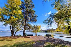
After the hike, the nearby Mt. Shasta City Park is an excellent place to visit for a packed lunch or hangout. Alongside plenty of open green space, the park is home to Big Springs, also known as the Headwaters of the Sacramento River. This water source is where Spring Hill gets its name.
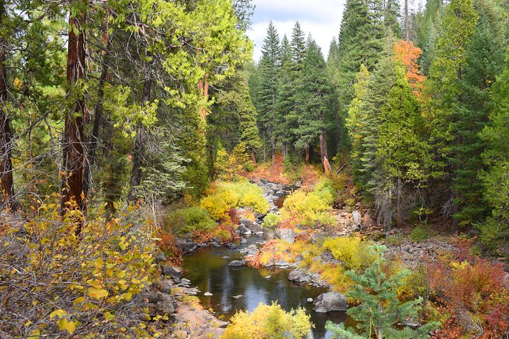
Elsa Rupp Trail
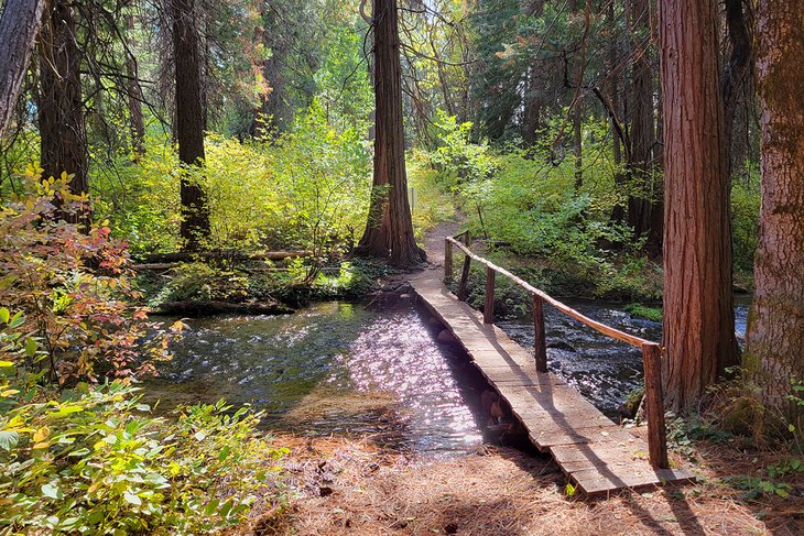
The Elsa Rupp Trail is a lovely extension to the Mount Shasta Hatchery and Mount Shasta Sisson Museum. These historic city facilities are on the opposite side of Interstate 5 from downtown, and they offer a quiet and peaceful place to get away on busy summer days.
The trail begins at the parking area for the hatchery and museum, denoted by a sign describing who Elsa Rupp was and why she donated the land. The route quickly crosses Old Stage Road and enters the Elsa Rupp Nature Study Area. Here, several looped hiking trails invite exploration.
The Nature Study Area has approximately a mile of interwoven hiking trails. Many of the routes cross tributaries of Big Creek, offering the sound of babbling water along the way. It's not a big enough area to truly get lost within, but the trails crisscross enough that it's easy to feel a bit turned around. And many people come to Elsa Rupp for this feeling of losing themselves.
Lake Siskiyou Trail
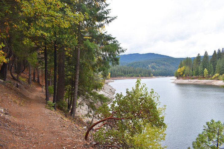
This seven-mile path circles the Lake Siskiyou shoreline, less than three miles southwest of the City of Mt. Shasta. It's a beautiful and popular pedestrian path with several areas for boating, swimming, and off-route exploring.
Many opt for a bicycle ride when navigating the entire path. Several parking areas enable shorter day hikes, and alternative trails, like the Chalet Trail, offer easy looped routes. Two popular access points are Lake Siskiyou Camp Resort and the parking area across from the Mt. Shasta Resort Golf Course.
The Lake Siskiyou Trail traverses over the scenic Wagon Creek Bridge, which offers a great view across the water. And the entire route showcases stunning views of the surrounding region, including views of Mount Shasta. Expect to encounter other trail users on any sunny day, including bicyclists and horse riders.
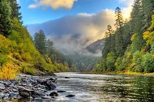
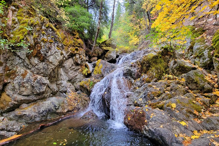
Hedge Creek Falls
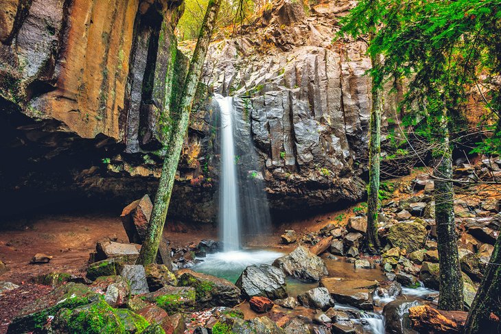
Several waterfalls near Mt. Shasta help define adventure in Siskiyou County. Hedge Creek Falls is one of the closest to town, located seven miles south of downtown near Dunsmuir. And the falls themselves are next to Interstate 5, offering easy access and a short hike to see the 30-foot drop.
It's a quick pull-off from the interstate and a less than a quarter-mile round trip to see Hedge Creek Falls. This ease makes it a popular family hiking destination, especially for families with young children. It's also a popular pull-over spot for those driving through the area and wanting to stretch their legs.

Hedge Creek Falls isn't the only waterfall in the area. The nearby Faery Falls is a bit smaller but incredibly scenic nonetheless. And farther south, within Castle Crags State Park, the series of waterfalls known as Burstarse Falls also attracts a lot of attention. Visitors to Castle Crags reach Burstarse Falls with a 4.5-mile round trip.
The Crags Trail, Castle Crags State Park
Castle Crags State Park, one of California's best state parks, has a surplus of hiking trails less than 20 miles south of the City of Mt. Shasta. Over 28 miles of dirt trails weave throughout the park, including the country-spanning Pacific Crest Trail. And while the many routes lead to different places, they all encompass spectacular views of the park's namesake features.
The Crags Trail is one of the most popular trails in the park and one of the most challenging. This approximately six-mile trail climbs more than 2,000 feet as it ascends into the granite wonderland of Castle Crags. Its final destination is the rock feature known as Castle Dome. This steep grade and the double-digit round-trip mileage makes the hike something to plan a whole day around.
Make the trek, however, and the views of the surrounding Castle Crags and not-so-distant Mount Shasta are worth the effort. Be sure to bring plenty of water along the route, especially in the heat of summer. Before leaving the park, make an additional pitstop at Vista Point for an excellent terrain perspective.
Official site: https://www.parks.ca.gov/?page_id=454
McCloud River Three Waterfalls Trail
The McCloud River makes a notable impression on Shasta-Trinity National Forest southeast of Mt. Shasta city. It's a popular waterway for its fishing and its continuous scenic landscape. It's also home to three spectacular waterfalls, all within a short drive of the city.
Head to the Fowlers Campground or Lower-Falls Day-Use Area to check out the McCloud River's three waterfalls. The campground is within a 30-minute drive of Mt. Shasta. Here, a paved trail heads downriver to the Lower Falls, and a dirt trail leads upriver to the Middle and Upper Falls.
It's approximately a four-mile round trip to see all three waterfalls. One section between the middle and upper falls requires some uphill switchbacking, but the rest of the route is primarily flat. And while it's hard to say which gravity display is the most scenic, it's highly recommended to take time to check out all three.
The three waterfalls are part of the larger McCloud River Trail. This approximately 15-mile trail spans the Lower Falls to the upriver Algoma Campground. The total length of the path is multi-use and popular with runners, cyclists, and horse riders.
Map of Hiking Trails near Mt. Shasta, CA
Mount Shasta, CA - Climate Chart
| Average minimum and maximum temperatures for Mount Shasta, CA in °C | |||||||||||
| J | F | M | A | M | J | J | A | S | O | N | D |
| 7 -3 | 9 -2 | 11 -1 | 15 1 | 19 4 | 24 7 | 28 9 | 28 9 | 24 6 | 18 3 | 10 -1 | 7 -3 |
| PlanetWare.com | |||||||||||
| Average monthly precipitation totals for Mount Shasta, CA in mm. | |||||||||||
| 179 | 164 | 148 | 67 | 48 | 25 | 10 | 11 | 22 | 56 | 129 | 136 |
| Average minimum and maximum temperatures for Mount Shasta, CA in °F | |||||||||||
| J | F | M | A | M | J | J | A | S | O | N | D |
| 44 26 | 48 29 | 52 30 | 59 33 | 67 39 | 76 45 | 83 49 | 83 48 | 76 43 | 64 37 | 50 30 | 44 26 |
| PlanetWare.com | |||||||||||
| Average monthly precipitation totals for Mount Shasta, CA in inches. | |||||||||||
| 7.1 | 6.5 | 5.8 | 2.7 | 1.9 | 1.0 | 0.4 | 0.4 | 0.9 | 2.2 | 5.1 | 5.4 |