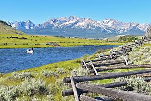
Hiking Trails near Boise, ID
Author Brad Lane enjoyed a trip to Boise where he broke new Fitbit records exploring its hiking trails.
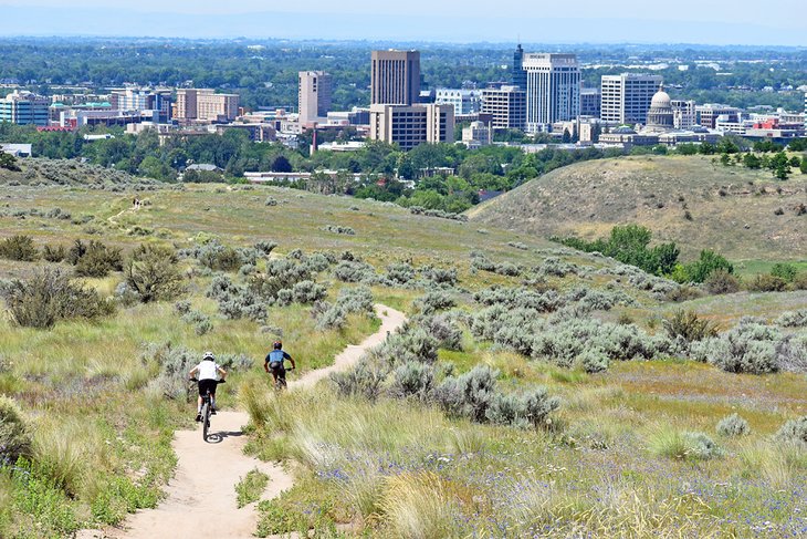
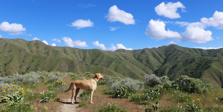
Adventure awaits outside the backdoor of Boise, Idaho's state capital and most populous city. An incredible network of trails winds through the rolling foothills on the city's northeast side. These trails offer expansive views of downtown and the surrounding Boise Mountains.
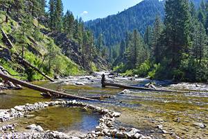
It's not just the foothills, though, that offer great hiking trails near Boise. Higher elevations of the adjacent Boise National Forest offer several forested hiking opportunities. Getting higher into the Boise Mountains is a great way to beat the summer heat. These forested trails also provide a woodsier environment to explore compared to the shrublands down below.
From the foothills and beyond, the Ridge to Rivers Partnership protects and maintains over 190 miles of Boise's best trails. With a multi-agency agreement led by the city, Ridge to Rivers works with landowners and enables easy access and navigation of their network of trails. The Ridge to Rivers website has an interactive map and general trail etiquette guidelines.
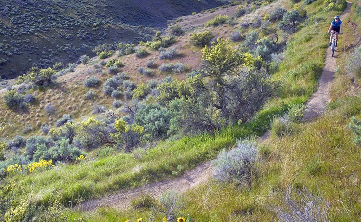
With access points like Camel's Back Park within the city, many of the best Boise trails are reachable by foot or bicycle. These trails are popular for multiple uses, including hiking, mountain biking, and horseback riding. Users should prepare to yield to others while navigating any trail. Traveling on wet or muddy trails is prohibited to prevent erosion.
Enjoy the outdoors near Idaho's capital with our list of the best hiking trails near Boise.
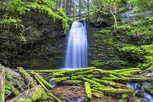
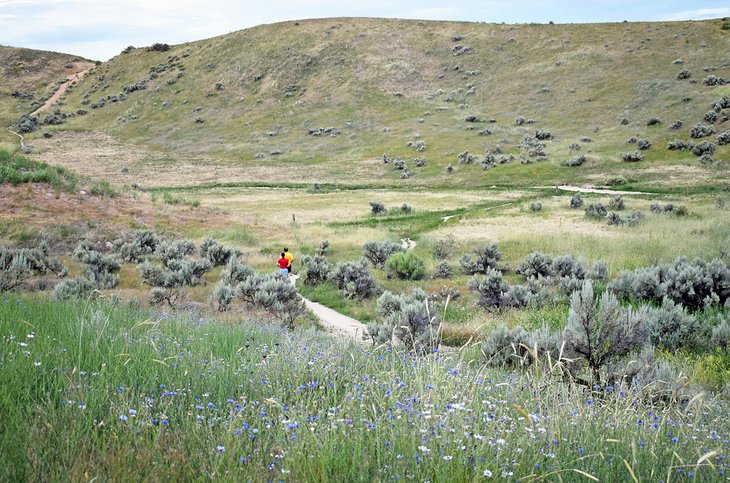
Lower Hulls Gulch Trail, Camel's Back and Hulls Gulch Reserve
Camel's Back Park on North 13th street offers some of the most popular trailheads in Boise. It serves as an excellent starting point for exploring the vast Ridge to Rivers trail system in the Boise foothills. Climbing out of the public park are several family-friendly trails. Many of these routes lead to Lower Hulls Gulch Trail #29 — one of the most-used trails in the network.
This winding 2.5-mile trail follows Hulls Creek in a tight corridor surrounded by lush riparian habitat and boulders. A recommended approach is hiking up Kestrel and Crestline Trails to the top of Lower Hulls Gulch. Hiking to the top of Hulls Gulch enables users to hike down the approximately 800 feet of elevation and enjoy the scenery. Many users also opt for an out-and-back on the trail.
Lower Hulls Gulch is a designated classic hiking trail of the city. Mountain bikers, trail runners, and casual hikers all share the route. Blind corners and dense vegetation make it essential to be aware of your surroundings while navigating Lower Hulls Gulch.
For those not interested in hiking up to Hulls Gulch, the lower trail system in Camel's Back Park has many family-friendly and easier hiking trails. The Red Fox, Gold Finch, and Owls Roost trails in this lower section make great variable-distance loops. A set of protected ponds in this lower section is also an excellent place for bird-watching.
Central Ridge Trail, Military Reserve
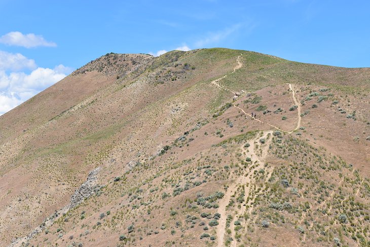
This sprawling natural space is behind Fort Boise Park and the Boise VA Medical Center. With over 700 acres, Military Reserve provides several trail options that suit nearly every ability of hiker. Arguably one of the best trails within the reserve, or at least the one with the best views of downtown Boise, is Central Ridge Trail #22.
The trail traverses the spine of the foothills and gains a moderate 500 feet of elevation gain over two miles. This acquired vantage point reveals striking views of the Boise Skyline. The Central Ridge Trail is accessible as part of a loop in Military Reserve. Great options for a loop hike include Bucktail Trail and Mountain Cove Trail.
Central Ridge Trail also makes for a fun jumping-off point for more extensive hikes into the Boise foothills. The notable Three Bears Trail is accessible from Central Ridge Trail with a short connection. From Three Bears, the entire upper foothills trail system opens for miles of more exploration.
Table Rock Trail
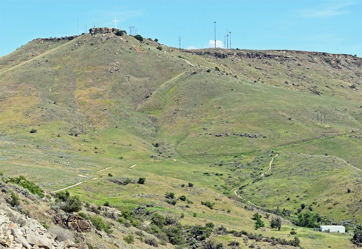
Table Rock Trail provides excellent views of Boise on the southeast side of the city.
Starting from the Old Penitentiary parking lot, the trail climbs for nearly two miles to the top of Table Rock itself. Here, visitors get a close look at the Table Rock Cross, which has stood for over 60 years. The trail gains nearly 1,000 feet of elevation along the way, but the views of the surrounding city are worth the effort.
Table Rock is commonly done as an out-and-back hike, though several other trails in the Table Rock area enable a loop. Table Rocky Quarry Trail is a great loop option to add to a Table Rock hike. Sharing the same trailhead parking lot but heading in the other direction, the Castle Rock Trail is a fun and easy trek nearby.
The clay nature of the Table Rock trail network is vulnerable to damage when wet. Avoid the Table Rock area when melting snow or rain is causing muddy conditions.
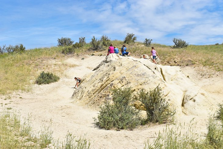
Harrison Hollow Trail, Hillside to Hollow Reserve
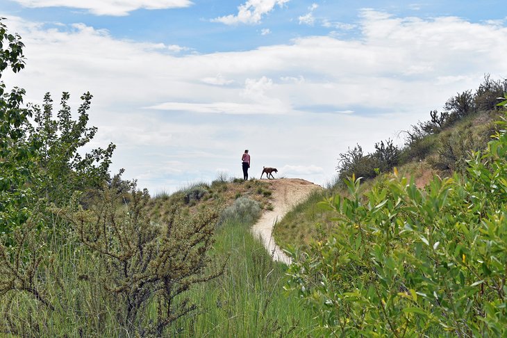
The Hillside to Hollow Reserve is on the northeast side of the city near the beginning of Bogus Basin Road. This public space encompasses 260 acres, with neighborhoods surrounding all sides. The eye-catching landscape and topography of the reserve make for an easy escape into nature.
The primary thoroughfare in the area is the Harrison Hollow Trail. This less-than-a-mile trail is mostly sand and gravel, making it accessible when other trails in the area are muddy. The path is popular with families as it has minimal elevation gain and gorgeous views. The ease of access also makes it popular for casual sunset strolls.
The Harrison Hollow Trail is a central connection to every other trail in the Reserve. After completing the mile trek on Harrison Hollow, the connected Harrison Ridge Trail makes for a fun loop. For more elevation gains, users can also access the Who Now Loop for the most prominent views of the area.
Stack Rock Trail, Boise National Forest
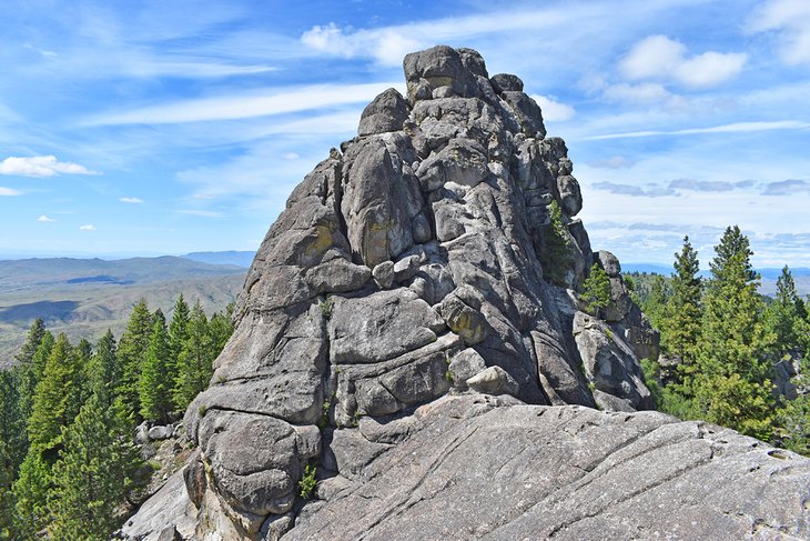
Stack Rock Trail has a much woodsier environment thanks to its elevation within Boise National Forest. These pine surroundings are often a welcome relief from scorching summer temperatures in the city. The forest also adds lovely scenery to appreciate on this approximately 10-mile lollipop loop trail.
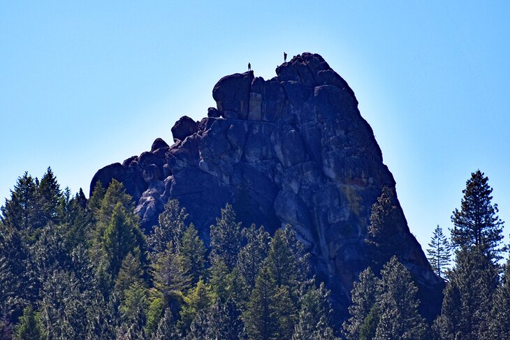
Also known as Freddy's Stack Rock Trail, this forested hike leads to an impressive rock feature with 360-degree views of the Treasure Valley. While the trail can feel long as it climbs more than 1,300 feet of elevation, the impressive Stack Rock is well worth the effort. Hikers should plan for some time spent exploring this monolithic boulder once they make it to the top.
Stack Rock Trail is a popular hike for all members of the family. The trailhead is accessible via a 13-mile drive on Bogus Basin Road. A recently constructed trailhead has ample parking space, though it does fill up by early afternoon on busy days. A vault toilet and small picnic area are at the trailhead.
Read more: National Forests in Idaho
Around the Mountain Trail, Shafer Butte Area
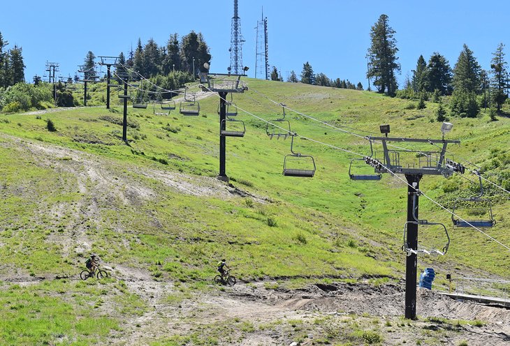
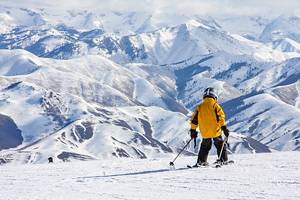
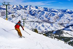
The non-profit Bogus Basin Mountain Recreation Area is a hot spot for skiing and snowboarding in the winter. In mid-June, when the last of the snow melts, this accessible alpine environment is also well used for hiking and downhill mountain biking.
One of the crown jewels of the area is the aptly named Around the Mountain Trail. Circling the perimeter of the ski resort, including Deer Point and Shafer Butte, the path has new views around every turn.
The Around the Mountain Trail itself is approximately 6.5 miles long. To indeed hike or bike around the mountain, users need to connect with other trails like Deer Point and Pioneer Trail for a roughly 10-mile loop.
The most common starting spot for the Around the Mountain Trail is from the JR Simplot Lodge. The Deer Point Trail winds its way under the Deer Point Express chairlift to access the Around the Mountain Trail from the Simplot parking lot. The recommended direction of travel is counterclockwise along the loop.
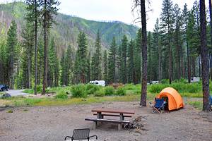
One of the best campgrounds near Boise is nearby at the Shafer Butte Campground and Picnic Area. From this small camping area, users can access the Around the Mountain Trail via a short cutoff trail.
Mores Mountain Interpretive Loop, Boise National Forest
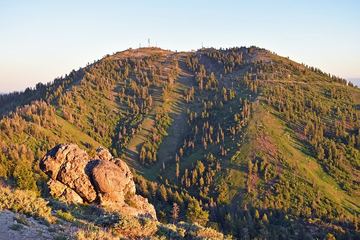
Mores Mountain is next to Shafer Butte and a 20-mile drive from the city on Bogus Basin Road. The approximately two-mile Mores Mountain Loop begins at the Shafer Butte Picnic Area and climbs to the summit. The trail presents some challenges, with roughly 500 feet of elevation gain, but is accessible by most hikers.
It's worth making the full loop on Mores Mountain. Unique rock fixtures atop the mountain entice photography enthusiasts and outdoor lovers alike. The sunset from atop Mores Mountain is particularly stunning, including a great view of the glowing Shafer Butte to the east. To make the most out of the sunset, consider pitching a tent at Shafter Butte Campground near the picnic area.
Adelmann Mine and Lucky Peak
The hike to the top of Lucky Peak is a challenging nearly 10-mile round-trip trek with approximately 2,500 feet of elevation change. This demanding trail has a fun side trek along the way or a standalone destination to hike toward, the Adelmann Mine. This abandoned gold mine is three miles up the trail and dates back over a century. Despite its age, most of the structure is fairly intact.
The small parking area and trailhead for the Adelmann Mine and Lucky Peak Trail are off the potentially busy Highway 21 as it descends out of Boise. This is also the location of the Boise River Wildlife Management offices, and the hike begins by hiking past their buildings.
The first three miles of the route follow an overgrown forest service road with wildflowers blooming on either side in the spring. The junction for Adelmann Mine is three miles into the route, where an additional 0.3-mile singletrack trail leads to the mine. The historic structure is not safe to explore or interact with but offers a good photo opportunity and a place to rest.
The route to Lucky Peak continues from the junction, following a singletrack trail for another 1.5 miles with significant elevation gain. The uphill effort is well-rewarded, however, with great views of the contoured Boise National Forest. Other challenging trails, such as Lucky Peak Trail #6, also meet at the summit and provide all-day loop options.
Elephant Rock, Military Reserve
Elephant Rock Trail is a half-mile lollipop loop that is popular with families. The trail is within Military Reserve and is accessible by other trails in the area or by driving up Mountain Cove Road to the trailhead. The trail features very minimal elevation gain that is manageable by young children and strollers.
The trail isn't lacking in scenery, though, and Elephant Rock provides one of the best views of downtown Boise, more than any other hiking trail. The trail gets its name from a large boulder found along the loop, which is also a favorite spot for young explorers. If you catch it at the right angle, it does have an elephant's appearance.
The route to Elephant Rock, and the rock itself, is highly exposed with little shade along the way. Prepare for hot temperatures if traveling in the summer.
Polecat Loop Trail, Polecat Reserve
Polecat Reserve is northwest of Hillside to Hollow Reserve, on the northwest side of town, and is a popular spot for trail running and mountain biking. The relatively low grade of the trail system caters to beginners in both sports. With over seven miles of trails to explore, the most popular route is the approximately six-mile Polecat Loop Trail.
The trail gains less than 1,000 feet of elevation and offers views of the city and the Boise ridgeline. The traditional Polecat Loop follows the perimeter of the trail system. Users can make shorter loops with various cutoff trails.
Two trailheads access Polecat Reserve: one on Cartwright Road and the other at the end of Collister Road. Both trailheads feature limited parking spaces, so carpooling is encouraged.
Oregon Trail Reserve
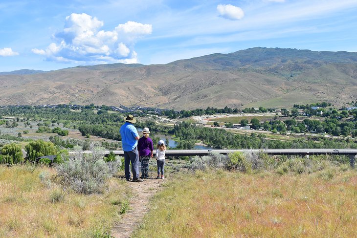
The Oregon Trail Reserve is near Southeast Boise, less than 10 miles from the Idaho State Capitol. This 77-acre natural space offers a great family-friendly hike alongside historic wagon tracks. For the thousands of migrants that crossed the Oregon Trail in the mid-1800s, this reserve offered a prominent viewpoint of the Boise River.
Hikers today can still catch a glance of the ambling Boise River as it makes it way downtown. The landscape has slightly changed over the years to include roadways and neighborhoods. From the trailhead off Highway 21, hikers have nearly four miles of trails to make a loop at Oregon Trail Reserve. Elevation gains are minimal much of the way.
Several interpretive markers in the Oregon Trail Reserve paint a picture of a wagoner's past. Visitors can even find historic wagon ruts throughout the acreage. The trailhead has a small exhibit and displays that are worth checking out before a hike. Having a map or taking a picture of the one at the trailhead helps when visiting for the first time.
Cervidae Peak Trail
Cervidae Peak provides a short but challenging hike overlooking Lucky Peak Lake, east of the city. The hike up to Cervidae Peak is less than two miles in length, but with over 2,000 feet of elevation gain, each step is steep. Cervidae Peak is a great trail to test your fitness or train for other big mountain hikes. It's not suited for someone's first hike.
The sight atop Cervidae Peak is also an excellent incentive to make it to the top. Clear days present stellar views of the surrounding Boise Mountains and Lucky Peak Lake from the nearly 5,000-foot-tall peak. The hike is less popular than Ridge to Rivers trails, increasing the chances of having the summit to yourself.
To access the trailhead, take Idaho 21 until it crosses Mores Creek Bridge after nearly 10 miles. Take a right immediately after the bridge and head towards the Spring Shores Marina, operated by Lucky Peak State Park. Less than a mile after the marina, a large, unmarked dirt parking area serves as the trailhead for the popular southeast route up Cervidae Peak.
Read More: National & State Parks in Idaho
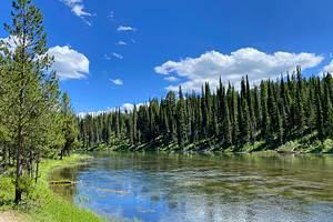
Bethine River Trail, Boise Greenbelt
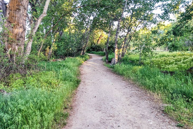
The 25-mile Boise Greenbelt is a natural landmark of the city. This paved pedestrian path runs next to the Boise River. It connects the city's "Ribbon of Jewels" — a series of very scenic parks and natural areas. The popular Ann Morrison and Julia Davis Parks are part of this Ribbon Jewels.
Bethine River Trail offers the perfect dirt path to follow for those that want to ditch the pavement and hike where bicycles aren't allowed. This popular dirt path is on the eastern side of the greenbelt, near Parkcenter Boulevard. Here, the Boise Greenbelt veers from the river as it encounters a 24-acre natural area. Foot traffic can continue on the Bethine River Trail for 1.6 miles.