Hikes in Banff National Park
Authors Michael and Lana Law lived in Alberta for several years and return regularly to enjoy hiking in Banff National Park.
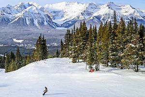
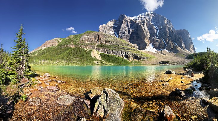
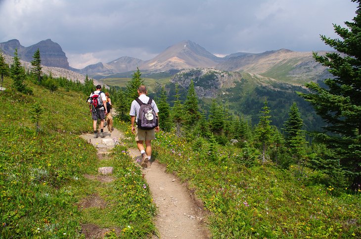
Hiking in Banff National Park is an experience of a lifetime for many visitors and one of the best things to do in Banff's wilderness wonderland. As people who have spent a lot of time hiking these trails, we're still always amazed at the sights. Turquoise lakes, glaciers, alpine meadows, and stunning mountain vistas are just a few of the highlights.
Some hikes offer great rewards for little effort, others are harder or longer, but the investment in time and energy is rewarded many times over.
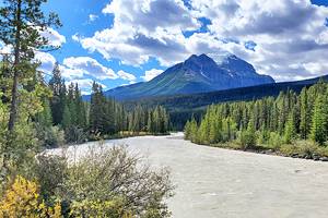
Many of the hikes are clustered either around the Lake Louise area or along the Icefields Parkway. As a general rule, the farther you get from Lake Louise, the less crowded the hike. However, the farther up the Icefields Parkway you go, the higher you get, and the more temperamental the weather can become.
The scenery also needs to be taken into account. The hikes around Lake Louise are more heavily forested, and some of these trails spend a significant amount of time in the forest before emerging to amazing views.
The hikes on the Icefields Parkway start higher and tend to spend less time in the forest and more time in wide-open spaces. This is fine if the weather is clear, if it's not, conditions can deteriorate rapidly, and you can find yourself in a tricky situation faster than you might think.
Hikes in Banff range in level of difficulty, access, and length, and you'll need to consider your level of fitness carefully before setting out. All the trails listed here are popular, so it's unlikely you'll have the trail to yourself. Even if it's busy, the sheer grandeur of the surroundings makes everyone happy and courteous.
Find the trail that suits you with our list of the best hikes in Banff National Park.
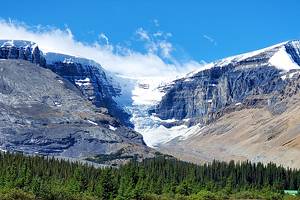
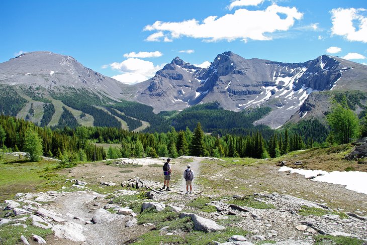
Parker Ridge
We put this hike at the top of our list because it's relatively easy to moderate and the view over the glacier is beautiful. This trail starts off as a rather uninspiring walk up to the ridge, but it's worth sticking it out for what awaits you.
Parker Ridge is perhaps the best hike in Banff National Park, when viewed from an effort-to-reward basis. The high trailhead basically starts at a point that makes the hike an easy uphill walk to the top.
At 5.4 kilometers (3.3 miles) round trip, this is, compared to may other trails in the park, a relatively easy hike. The elevation gain is only 250 meters (820 feet), and it's not a technically difficult hike at all.
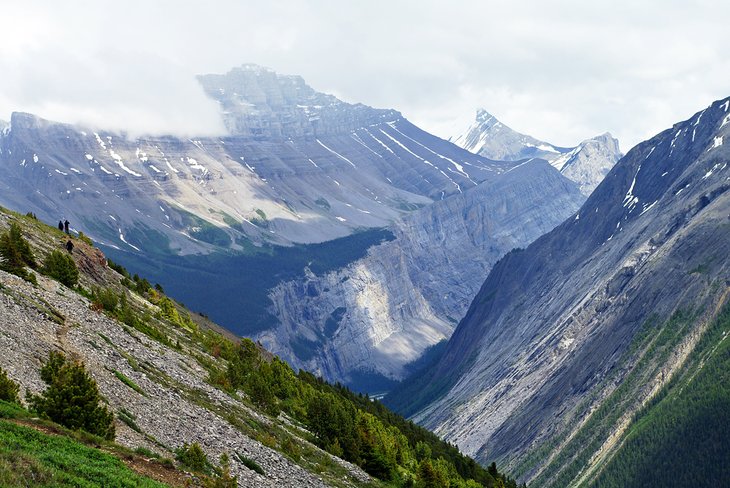
From the highway, this may not look like the most exciting hike, but once you crest the ridge, the views out over the Saskatchewan Glacier are truly spectacular. The trail is easy to follow and is open almost the entire way, which allows for fantastic views across the valley. Soak up the vista looking out to Mount Athabasca, Mount Andromeda, and Cirrus Mountain.
Time your hike right, in late July through to early August, and you'll be treated with a wonderful wildflower display. The trail usually has snow lingering on it late into June, possibly longer, depending on the year.
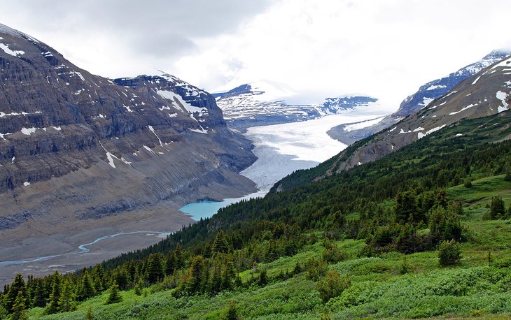
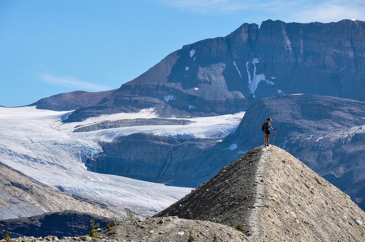
Wilcox Pass
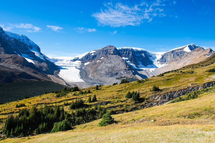
Just beyond Parker Ridge along the Icefields Parkway towards the Athabasca Glacier Visitor Center is the Wilcox Pass hike. This is one of the premier hikes in the park, rising up 390 meters (1,280 feet) to provide unparalleled views of the Athabasca Glacier, Snow Dome Mountain, Snow Dome Glacier, and the Columbia Icefield.
The hike is eight kilometers (five miles) return and is not for the faint of heart. You'll climb relatively quickly at the start, and when you factor in the elevation and the thin air, it can be tough. However, do not be dissuaded. If you take it slow, you'll be glad that you made the effort.
The trail eventually emerges from the forest, and its at this point you may find yourself coming to a stop to soak up the incredible views. Continue on, though, and eventually, you'll come to the official Wilcox Pass summit, marked by a large cairn of rocks.
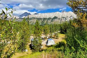
Authors' Tip: If you're camping, spend the night at the Wilcox Campground and get an early start before the crowds.
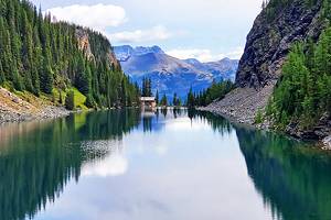
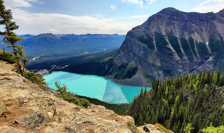
Lake Agnes Tea House and Big Beehive
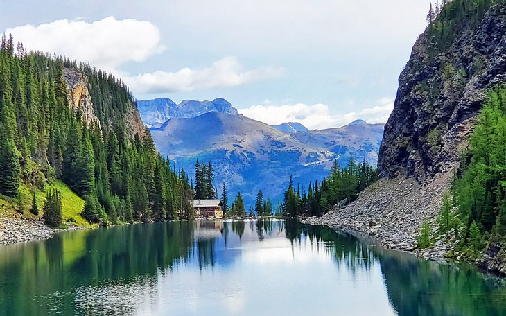
One of the most popular hikes at Lake Louise is the Lake Agnes Tea House. It's spectacular but it's busy! We usually opt for quiet trails when we hike, but this one is worth walking with the crowds. And the number of hikers dwindle the further you go on this trail.
The beauty of this hike is that you can stop in at the tea house for a snack and drink and relax while enjoying the scenery. Sitting on the patio or one of the nearby picnic tables makes the effort all worthwhile.
The trail takes you up a wide path to the historic tea house, perched on the edge of a glacier-fed lake surrounded by mountains. The hike is seven kilometers round trip to the Tea House, with an elevation gain of 400 meters (1,312 feet). The trailhead is just past the Chateau Lake Louise, branching off the Lakeshore trail to the right.
As you gaze up at the aforementioned mountains, you may wonder what the view would be from the Big Beehive. Well, the answer is that it is a spectacular view out over Lake Louise and well worth the extra effort. Grab a snack at the Tea House to fortify yourself for the additional 3.4-kilometer round-trip jaunt with a gain of 135 meters, 442 feet.
Even if you don't go all the way up to the Big Beehive, it's still worth walking down to the far end of Lake Agnes to soak up the view of the Tea House and the Bow Valley off in the distance.
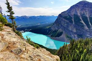
Plain of Six Glaciers
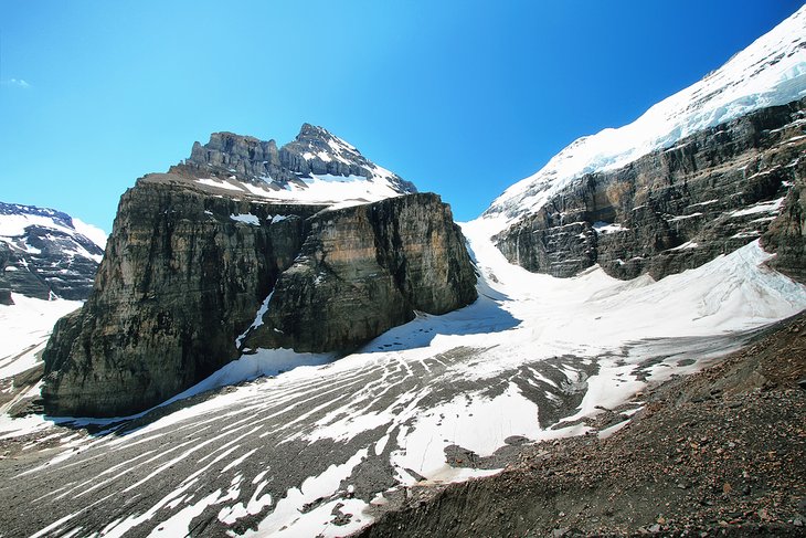
Many people who end up on the Plain of Six Glaciers hike have not actually planned to hike it. Curious hikers who start on the Shoreline Trail sometimes just have to find out what's around the corner at the end of Lake Louise.
That curiosity is rewarded as they trek their way across and up the open plains beyond the lake towards the end of the trail, with the Victoria Glacier on their right.
Eventually, all this extra effort is also rewarded, not only with great views, but also by a snack and warm drink at another historic tea house.
The trail is 13.8 kilometers (8.6 miles) to the very end, but if you want to duck out and turn back at the tea house, it's only 10.6 kilometers (6.6 miles). The elevation gain is relatively easy at 365 meters (1,197 feet) to the tea house and 464 meters (1,522 feet) at the turnaround point.
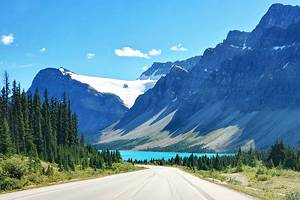
Bow Glacier Falls
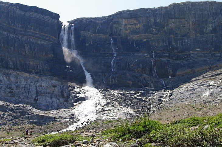
As you drive along the Icefields Parkway, it's likely that you'll find yourself stopping at Bow Lake to take a photograph. The blue turquoise waters demand your attention and just beg to be photographed.
If you look down the lake towards the glacier as you start out on this you hike, you can see a waterfall cascading down. This is Bow Falls and your destination for the day. This is a beautiful hike almost the entire way, and more about the journey than the destination, although Bow Glacier Falls won't disappoint.
This is a relatively easy hike with only moderate elevation gain of 148 meters, 485 feet, and a round-trip distance of 9.2 kilometers (5.7 miles).
As with most hikes in Banff National Park, the effort is rewarded handsomely. You approach from the base of the waterfalls and can watch the water tumbling over the ridge high above.
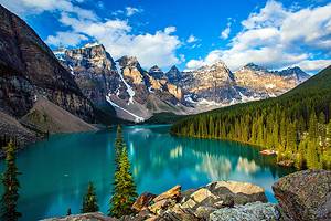
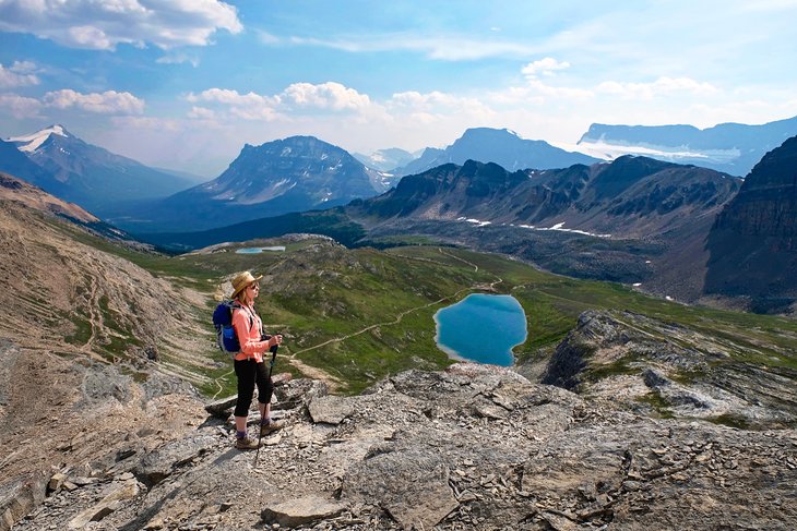
Sentinel Pass/Larch Valley
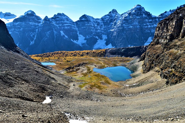
Just above and to the right of beautiful Moraine Lake is a hidden wonderland of Tamarack trees, small lakes, and rock towers called sentinels. This is two hikes in one, whether you do one or both depends on how much energy you have, the weather, and your sense of adventure.
The trail leads up from Moraine Lake and climbs steadily through the trees where it is blissfully quiet. After a while, you'll emerge into an open bowl area, and this is where the views begin. You'll make your way to Minnestimma Lake, an ideal place to stop and rest before turning back if you are only hiking Larch Valley.
As you sit by the lake soaking up the views, you'll be able to see the trail up to Sentinel Pass. The allure is hard to resist, and you shouldn't fight it if you have the wherewithal to continue onwards and upwards to the saddle. Your reward will be one of the finest views in Banff National Park. In one direction, the Ten Peaks tower against the sky with Minnestimma Lake in the foreground. In the other direction, you are treated to commanding views of Paradise Valley.
The hike to Larch Valley is 8.6 kilometers (5.3 miles), and you'll gain 535 meters (1,755 feet); count on about four hours. If you continue up to Sentinel Pass, the hike becomes 11.6 kilometers (7.2 miles) long with an elevation gain of 725 meters (2,378 feet). Add about 1.5 hours on to the Larch Valley hike for a total time on the mountain of 5.5 hours.
Larch Valley is best done in the fall, generally, the second or third week of September, when the larch trees turn from green to gold. Sentinel is best done in the peak of the summer, when the weather is fine and the snow at the higher elevations has melted.
Healy Pass
A kaleidoscope of wildflowers and wide-open spaces are the rewards for making it to the top of Healy Pass. This hike used to be more difficult — you had to take a bone-jarring shuttle at a specific scheduled time from the Sunshine gondola base to the ski area. Now, you just show up and step onto the gondola and arrive at the start of your hike in just under 20 minutes with 500 meters, 1,640 feet, already under your belt.
The trail from the upper village to Healy Pass is a gentle 360 meters (1,180 feet) of elevation, taking you up open areas that, in the winter, are downhill ski runs. The best time to hike Healy Pass is late July into early August, when the wildflowers will be at their peak and the weather at its finest.
If the wildflower displays weren't enough, the views out along the Continental Divide will truly floor you. Out in front, you'll see Mount Pharaoh, Mount Assiniboine, Mount Brett, Mount Bourgeau, and The Monarch. Over the pass, sitting perfectly at the base of Mount Pharaoh is Pharaoh Lake.
The trail is just over 18 kilometers (11 miles) return, and the effort-to-reward is off the scales.
Johnston Canyon and The Inkpots
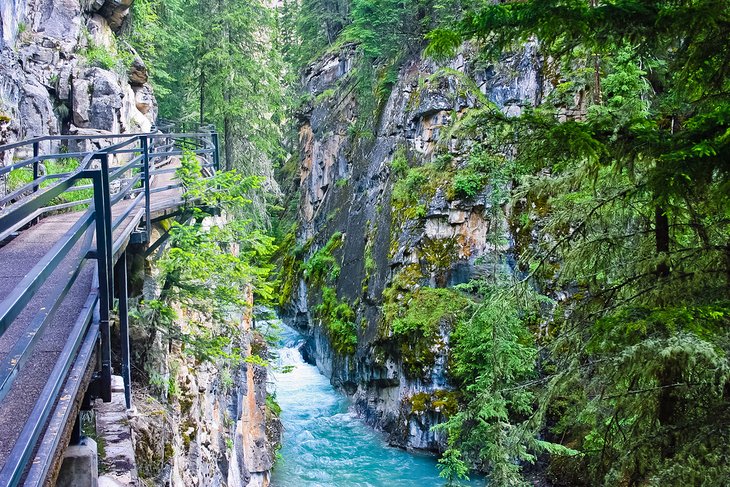
Johnston Canyon is a good family hike in Banff National Park. The trail to the lower falls round-trip is only 2.4 kilometers (1.5 miles) and has minimal elevation gain. The walk to the rather impressive 30-meter-high (100 feet) upper falls is 1.3 kilometers (less than a mile) farther along.
The sheer canyon walls and the roaring waterfalls never fail to impress.
The trail is quite pleasant, as it follows Johnson Creek, and a big part of the fun of this hike is traversing the metal walkway that is bolted directly into the canyon walls. As you look down, you'll be able to see the river rushing below you.
If you still have energy and want to see a unique geological formation, continue onwards to the Inkpots. Here, water bubbles out of holes in the ground from natural springs.
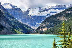
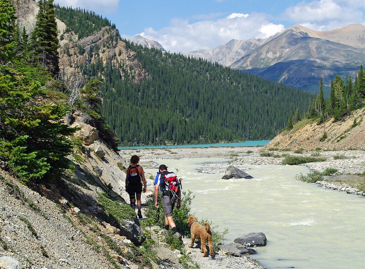
Lake Annette/Paradise Valley
If an uncrowded hike to a pristine lake surrounded by cliff walls, hanging glaciers, and towering mountains is of interest, consider taking the Lake Annette/Paradise Valley trail.
This is an easy hike with regards to elevation gain and distance. The round-trip hike to Lake Annette is 11.4 kilometers (just over seven miles) and gains only 245 meters (804 feet). If you want to add on the Paradise Valley segment, the distance jumps to 20.6 kilometers (12.8 miles).
The trail follows Paradise Creek up towards Lake Annette, crisscrossing the creek on a regular basis. Several of these creek crossings provide exceptional mountain views and are a welcome break from the forest.
Once you reach Lake Annette, you'll be greeted with an incredible view of Mount Temple towering above the green-hued lake.
Those that crave a bit more adventure can continue on to the Giant's Steps waterfalls, about an hour beyond.
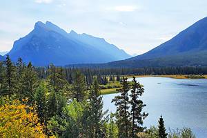
Helen Lake
A little time spent in the forest pays off handsomely on the Helen Lake hike. The scenery from the lake, and especially from the ridge above the lake, is quite spectacular and includes long views down the valley and across to the Crowfoot Glacier and Bow Falls.
This hike is a moderate undertaking at 12 kilometers (7.4 miles) round trip with an elevation gain of 455 meters (1,492 feet), fairly easy by Banff National Park standards.
One of the best parts of this hike are the open areas packed with glacier lilies. You or your dog may feel the need to wander off the trail, but resist the urge, as this is sensitive ground that does not recover well from being stepped upon.
Once you reach the lake and sit down to rest, you'll definitely be tempted to continue on as you look up at the ridge. Go with your urge; you won't be disappointed, as the views from here are far superior to those of the lake.
Above Helen Lake, you'll see Cirque Peak, and if you are tempted to continue on, you'll be looking at another hour of climbing to reach the top. Up here, you'll be at an elevation of 2,993 meters (9,817 feet) and have unobstructed 360-degree views. Off in the distance is Mount Hector, and Helen Lake looks suddenly quite small below you.
The great thing about this hike is that the views just keep coming. The return trip down provides incredible views across the valley that will override any fatigue that may have set in.
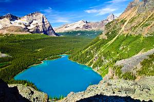
Peyto Lake
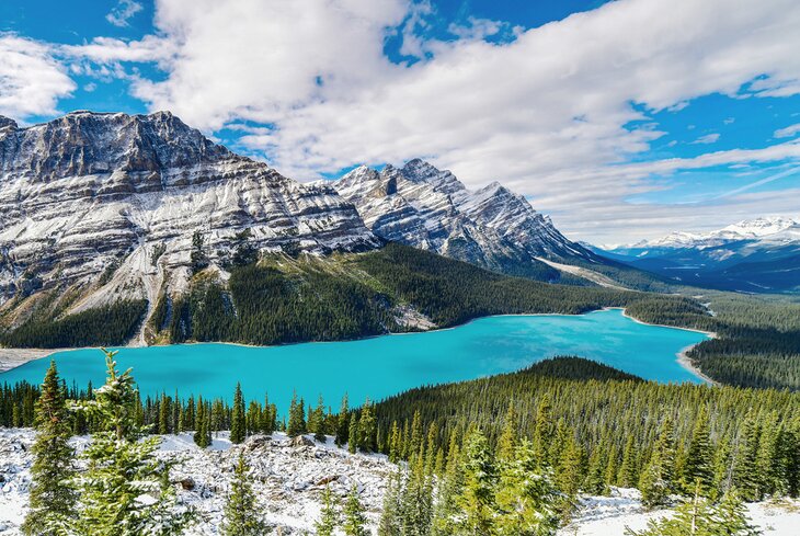
If all the hikes listed sound like a bit too much for you or if you have young children in your crew, Peyto Lake might just be the answer. One of the most spectacular lakes in the park is visible by taking a very short 500-meter paved path to an overlook. The light blue colored water seems to almost glow in the sunshine and is likely nothing you've ever seen before.
Most people stop and turn around at this point; however, an unpaved trail continues farther on for a few kilometers and provides what many people consider an even better view of the lake and surrounding mountains.
Mistaya Canyon
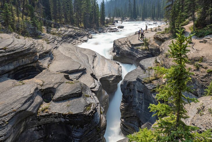
Although not a destination hike like Parker Ridge or Healy Pass, Mistaya Canyon is a short snapper of a hike that is fun and easy. Perfect for all ages and abilities, this 1.8-kilometer trail delivers big on interesting features.
The trail is wide and easy with little elevation gain or loss. The view from the bridge of the water churning through the narrow chasm coupled with the roaring sound is an assault on the senses. The snakelike chasm is a fascinating testament to the power of water and its ability to erode solid rock. Flows are highest in June when the melt has started and frequent rainstorms are common.
The rocks on either side of the canyon are popular places to walk and hang out but caution is advised.
Nearby: Iceline Trail, Yoho National Park
Although this hike is not in Banff National Park, it's one of our favorite hikes in the area and only a few minutes away. It's well worth checking out if you are interested in a more difficult but jaw-dropping hike. Just outside Banff National Park in Yoho National Park is the Iceline Trail.
This trail leads up through the trees and pops you out on an open bench lined with ice on the upper side (the Emerald Glacier). As you stride along, passing over small creeks and glacial moraines, the Vice Presidents (mountains) stand proudly above you. From up here, you have spectacular views across the valley to the Daly Glacier and Takakkaw Falls.
This hike can range from 13 to 20 kilometers, (eight to 12.4 miles) in length. It depends on how far along the bench you want to walk. If this hike is sounding appealing, be aware that the elevation gain is 710 meters (2,229 feet), almost double many of the hikes described in this article.