Hiking Trails near Leavenworth, WA
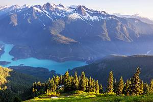
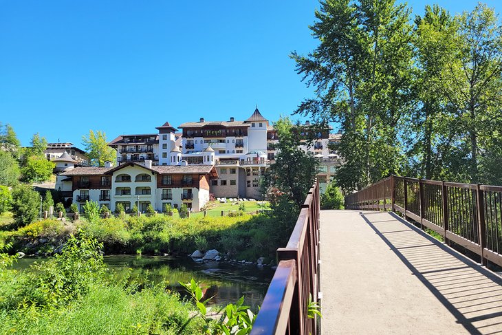
Leavenworth is a Bavarian-themed mountain town approximately two hours east of Seattle. The city sits on the east side of the Cascade Mountains in dramatic fashion, with a craggy backdrop that adds to the town's Alps-inspired theme. And it's these mountains within the Okanogan-Wenatchee National Forest that contain some of the best hiking trails in Washington.
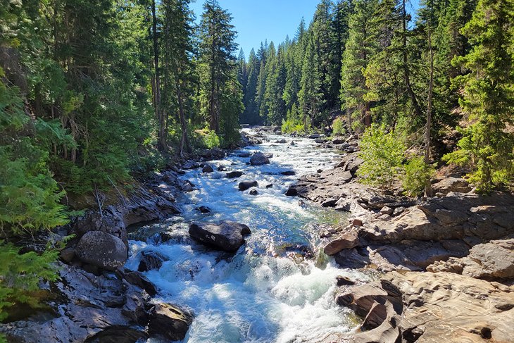
Several hiking trails surround Leavenworth, but the first place to check out is Icicle Creek. Here, the waterway carves its way through the mountainscape to leave a memorable impression. Icicle Road is the main automobile route through this adventure corridor, connecting one iconic trailhead after the other.
The 20-mile route through the Core Enchantment Zone is one such iconic route stemming from Icicle Creek. This popular and permitted hike has earned its reputation as a once-in-a-lifetime, bucket-list backpacking trail.
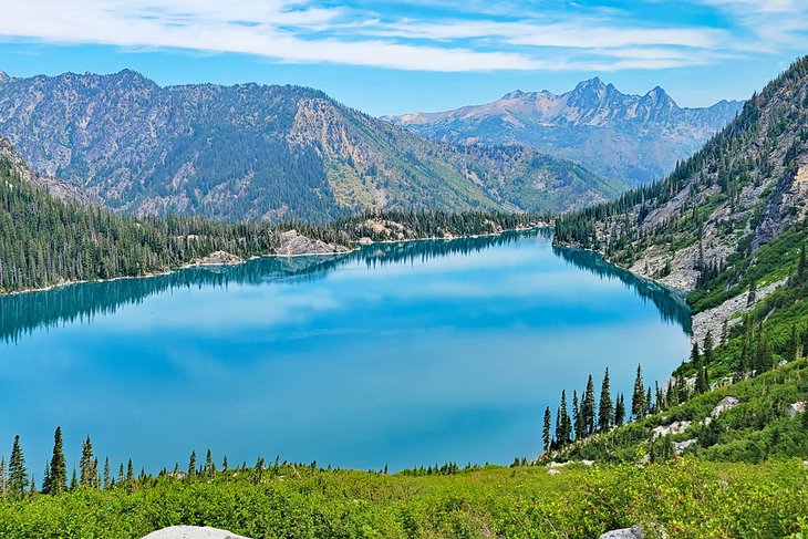
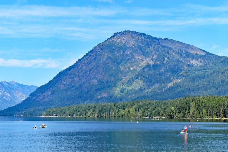
But it's not just Icicle Creek that caters to the hiking crowd in Leavenworth. Several trailheads line Highway 2, extending across Stevens Pass to connect with Seattle. A famous glacial lake in the region, Lake Wenatchee, is accessible along this route. Here, several hiking trails lend quite the view.
Explore the world-class mountain surroundings with our list of the top hiking trails near Leavenworth.
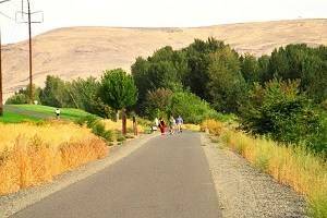
Waterfront Park Trail & Blackbird Island
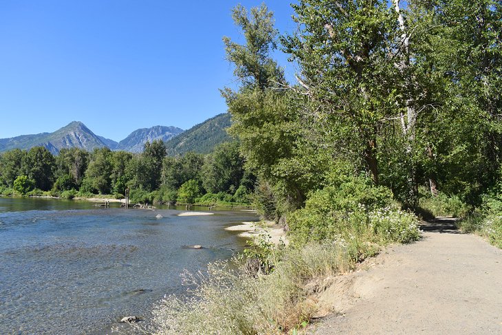
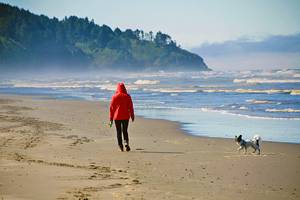
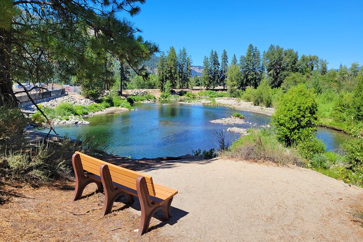
Leavenworth's Waterfront Park provides excellent in-town hiking trails and a great place to cool off during the summer. It's at the edge of the Bavarian village next to the Wenatchee River. A wide and flat trail extends through this public space, lending access to small beaches and other public waterfront areas.
To get to Waterfront Park from the Bavarian downtown, head toward the river on 9th Street to access the park's main entrance. Alternatively, the Wenatchee River Institute on Division Street also offers a public trailhead.
Interpretive information and scenic benches line much of the route. The area next to the river is verdant, with a riverside forest providing shade throughout the day. And it's a completely flat and wide path, making for universally accessible travel.
Less than a half-mile from the Wenatchee River Institute, the trail crosses a bridge onto Blackbird Island. Here, a short loop navigates the lush islet before crossing another bridge. The waterfront trail ends at Enchantment Park at the boundary of the Leavenworth Golf Club. It's approximately a two-mile loop between Waterfront and Enchantment Park.
Read More: Things to Do in Leavenworth, WA
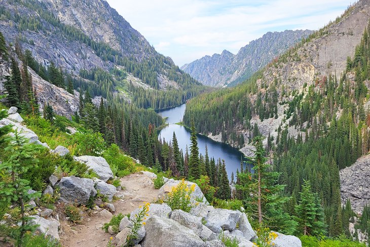
Icicle Gorge Loop Trail
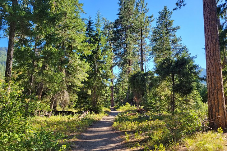
This four-mile loop is excellent for experiencing Icicle Creek without trudging up and down massive elevations. The trailhead is approximately 15 miles down Icicle Road (Forest Road 7600), of which the last three miles are gravel. From the large parking area, hikers head left or right to begin the loop.
Both directions lead to bridges crossing Icicle Creek. If heading clockwise, the first bridge offers a great place to sit and take in the churning beauty of the creek and the cold air rushing above. After crossing either bridge from the trailhead, the route navigates the lush south side of the creek through varied landscapes, including a cedar swamp.
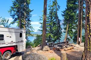
Interpretive information lines much of the trail, offering valuable insight into the environment. The trail's western loop connects with Rock Island Campground, one of the best campgrounds near Leavenworth, and navigates close to the campsites on the northern shore.
With approximately 150 feet of elevation gain, it's easy to take this hike at leisure. The Icicle Gorge View Trail extends from the parking area for a bonus 1.25-mile hike and extra elevation gain. This trail is less trodden and may have overgrown plants blocking some of the route.
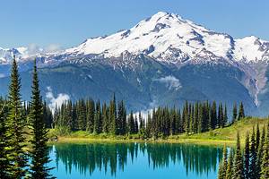
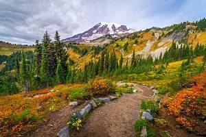
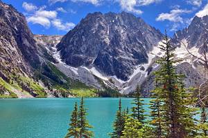
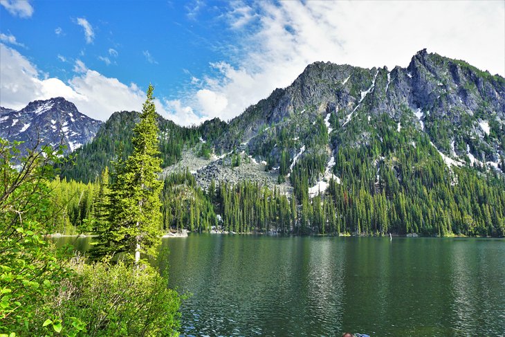
Colchuck Lake
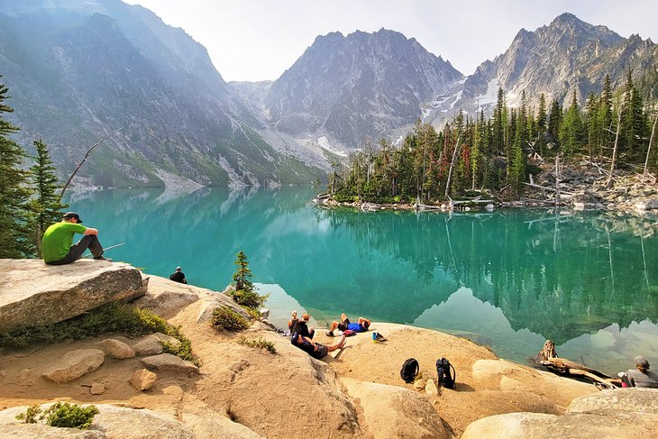
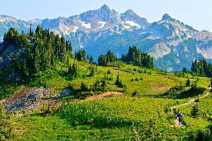
Colchuck Lake is one of the most popular hikes accessible from Icicle Creek, and for a good reason. It captures the high-mountain grandeur of the Alpine Lakes Wilderness with its size and brilliant backdrop. And for many, it's a memorable landscape to behold for the first time.
The hike spans approximately four miles from the trailhead up to Colchuck Lake, climbing over 2,200 feet of elevation. This ascent isn't easy, but it's well rewarded at the top of the trail. Much of the route travels through a vibrant forest and boulder fields, adding lovely scenery to enjoy alongside the heavy breathing.
After what feels like a never-ending uphill battle, the imposing Colchuck Peak and Dragontail Peak come into full view. Here is where jaws drop and giddy exclamations of joy echo across the lake. Find a place to sit anywhere near the water and enjoy the well-rewarded view.
Most do the Colchuck Lake hike as an eight-mile out-and-back. The route is also a popular entry point for venturing deeper into the fabled Core Enchantment Zone. From Colchuck Lake, the trail continues up the thigh-busting Aasgard Pass before reaching this high-mountain paradise.
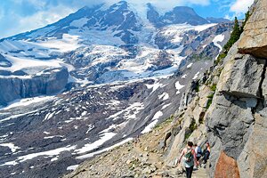
The Enchantments
The area of high-alpine lakes known as the Core Enchantment Zone, or the Enchantment Permit Area, lives up to its lofty name. It is also well established as a world-class, bucket-list backpacking destination. The traditional Core Enchantments Trail is nearly 20 miles long with over 5,000 feet of elevation gain.
Backpacking the Core Enchantments requires a competitive permit issued by the Forest Service. This permitted entry season spans May 15th through October 31st - the prime hiking season for this high-altitude route. Before 2020, permits were allotted between walk-ups and a lottery system that opens on February 15th. For the 2021 season, all permits are available through Recreation.gov.
The two entry points into the Core Enchantments are the Stuart Lake Trailhead and the Snow Lakes Trailhead. The 20-mile route connects the two, ascending two mountain passes and wandering along the banks of several scenic lakes. It's a 360-degree postcard view within the Core Zone, offering landscapes larger than the eyes can take in.
For those unable to secure a backpacking permit, ambitious hikers can tackle the entire route in a single day. Thru-hiking the Enchantments is an all-day endeavor and a challenge not to be underestimated. Ensure fitness levels and experience match up to the 12-plus hours needed to make the trek in a single day.
Icicle Creek Nature Trail
This one-mile loop extends from the Leavenworth National Fish Hatchery on Icicle Road. It's designated as a National Recreation Trail and part of the Audubon Society's Great Washington State Birding Trail.
Several interpretive plaques on the trail lend insight into this vibrant riparian corridor. Benches and wildlife blinds also provide fun pitstops along the route. There's very minimal elevation gain along the entire loop, making it a popular spot for young families to explore together.
Plan to spend some time checking out the Leavenworth Fish Hatchery after the hike. This national facility is one of three in the region that help maintain salmon populations once displaced by the Grand Coulee Dam. The hatchery is open throughout the year, with self-guided tours available.
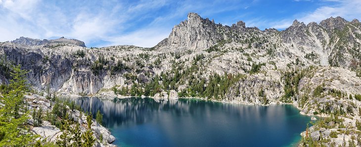
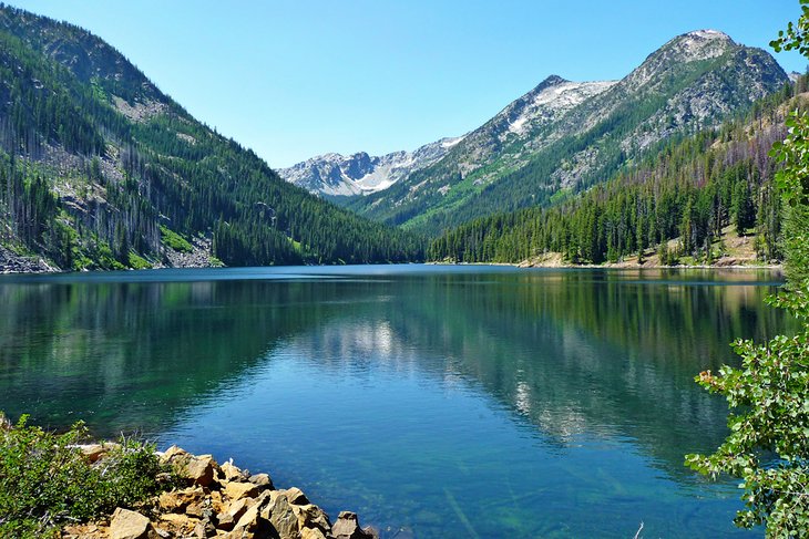
Stuart Lake Trail
Stuart Lake Trail shares the same trailhead with Colchuck Lake - the main entry point for those exploring the Core Enchantment Zone. And like Colchuck, it's one of the most popular trails in the area. Stuart Lake is also within the Enchantment Permit Area, where permits are required to spend the night.
The route to Lake Stuart is an easier trail to follow. Colchuck and Stuart share the same trail for the first 2.2 miles before diverting at a signed junction. Head right at this junction, and travel another approximately 2.3 miles to Stuart. This second half of the trail is moderately flat with a few small climbs but is otherwise a lovely hike through a second-growth forest.
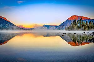
The lakeside scenery includes dominant views of Mount Stuart reflecting over the lake. Stuart is the second-largest non-volcanic mountain in the state and one of the top 10 tallest peaks overall. Its steep, exposed face overlooks the lake with an inescapable presence. If doing an out-and-back hike, plan to spend some time near the shoreline, hooked by the views.
Eightmile Lake
Eightmile Lake is another increasingly popular hike into the Alpine Lakes Wilderness. Its trailhead is along the same gravel road that accesses the Stuart and Colchuck Lake Trailhead. The hike to Eightmile Lake is slightly easier than the routes to Stuart or Colchuck. However, the approximate six-mile out-and-back hike with 1,300 feet of elevation change still requires some effort.
The route starts with a climb before joining with a relatively flat forest service road. There's a final push up to the lake, where high jagged peaks surround the watery expanse. Plan to spend some time on the Eightmile Lake shoreline digging the mountain scene.
Like all hiking trails accessible from Icicle Road during the summer, expect other hikers on the trail, especially on the weekends. While there's too much incline to be considered an easy hike, it is a more moderate option in the area. For that reason, the trail attracts all types of hikers.
Icicle Ridge Trail
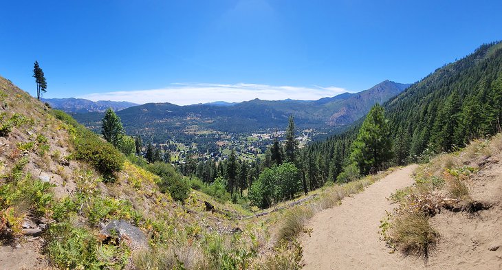
The Icicle Ridge Trail is one of the first trailheads on Icicle Road coming from Leavenworth. It's approximately 1.5 miles down Icicle Road, with a hidden trailhead on the right. Keep an eye out for a trailhead parking sign.
The total Icicle Ridge Trail spans 29.6 miles and ends in the Alpine Lakes Wilderness. But most visit the trailhead for a much shorter six-mile out-and-back hike. This distance is how far hikers must travel on Icicle Ridge for defining views of Leavenworth and Icicle Canyon.
It's a steady uphill climb the entire way up Icicle Ridge. However, the route varies between shaded and exposed areas, offering plenty of places to rest. The total elevation gained in the first three miles is approximately 1,800 feet. This climb opens an excellent vantage point of the city and surrounding mountainsides.
Ambitious hikers can tackle as much of Icicle Ridge as they please. The route eventually connects with the Fourth of July Creek Trail around mile nine. At this junction, the trail crosses into the Alpine Lakes Wilderness, where backcountry campsites are aplenty. Self-issued permits are required to spend the night in the wilderness area.
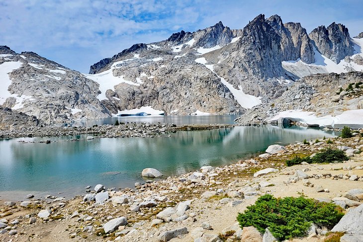
Snow Lakes Trail
The Snow Lakes Trail is often a downhill exit point for traveling out of the Core Enchantment Zone. On its own, however, it presents a worthwhile grind of a hike to a pair of beautiful alpine lakes. It's approximately seven miles of hiking to reach Lower and Upper Snow Lakes, with much of the route uphill, climbing more than 4,000 feet.
The route utilizes several switchbacks on its way up to Snow Lakes, particularly in the first mile. It's nothing short of an endeavor navigating the rest of the trail, passing through a lush forest and a small section of an old burn area.
Snow Lakes Trail is also a popular backpacking route and a less-used option to enter the Core Enchantment Zone. Permits are required to camp at either Snow Lake between May 15th and October 31st. Several larch trees on the route glow with some extra color for a week or two near the end of this permitted season.
Dirty Face Peak Trail
Dirty Face Peak is the dominant mountain backdrop at Lake Wenatchee State Park. Legend says that the mountain got its name from a homesteader at its base who was so busy, his face always appeared smeared with grime and sweat. However named, the mountain stands out with scenic appeal and offers a steep trail to the top.
The trail is undoubtedly steep, starting at lake level near the northwest shore and climbing approximately 4,000 feet in four miles. This uphill travel entails over 90 switchbacks and plenty of sore muscles. While parts of the route are shaded, much of the trek is not, especially sections that navigate through an old burn area, making it a scorcher of a hike in midday summer.
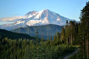
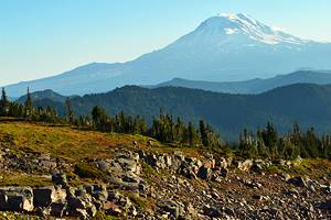
Bring plenty of water and stamina, however, and the view atop Dirty Face Peak offers an excellent vantage point over the lake and into the northern Glacier Peak Wilderness. On clear days, other mountains in sight include Mount Stuart and Mount Rainier far to the south. If the wind isn't ripping too much, the summit is an excellent spot for a well-deserved snack break.
Map of Hiking Trails near Leavenworth, WA
Leavenworth, WA - Climate Chart
| Average minimum and maximum temperatures for Leavenworth, WA in °C | |||||||||||
| J | F | M | A | M | J | J | A | S | O | N | D |
| 1 -8 | 6 -6 | 11 -3 | 17 1 | 22 4 | 26 8 | 31 11 | 31 10 | 26 6 | 18 1 | 7 -3 | 1 -7 |
| PlanetWare.com | |||||||||||
| Average monthly precipitation totals for Leavenworth, WA in mm. | |||||||||||
| 112 | 82 | 53 | 28 | 22 | 21 | 10 | 15 | 19 | 44 | 109 | 123 |
| Average minimum and maximum temperatures for Leavenworth, WA in °F | |||||||||||
| J | F | M | A | M | J | J | A | S | O | N | D |
| 34 17 | 42 22 | 52 27 | 62 33 | 71 40 | 79 46 | 87 51 | 88 50 | 79 42 | 64 33 | 44 27 | 34 19 |
| PlanetWare.com | |||||||||||
| Average monthly precipitation totals for Leavenworth, WA in inches. | |||||||||||
| 4.4 | 3.2 | 2.1 | 1.1 | 0.9 | 0.8 | 0.4 | 0.6 | 0.8 | 1.7 | 4.3 | 4.8 |