Hikes on the Oregon Coast
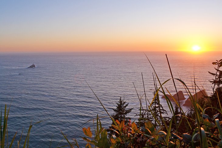
The beautiful Oregon Coast is one long slice of paradise lined with hiking trails. Elevated headlands punctuate miles of sandy shoreline often dotted by stunning sea stacks. These eye-catching landscapes offer postcard views one after the other.
Unlike different coastlines in the United States, Oregon's entire oceanfront is public property thanks to the 1967 Oregon Beach Bill. This prominent public access lends to the nickname, the "People's Coast," and opens a world of hiking opportunities.
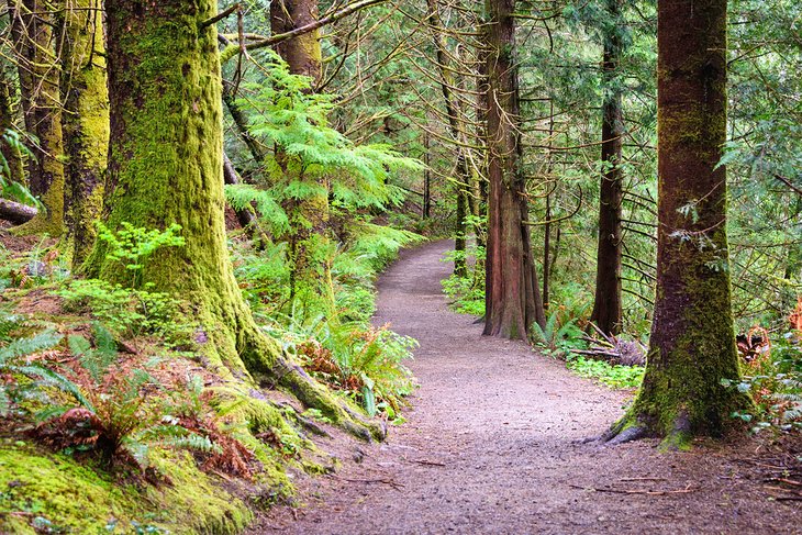
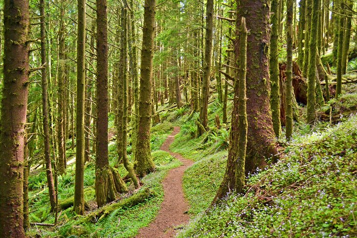
It's always a good adventure whenever the ocean is in earshot. And alongside the surf's soundtrack, hiking trails on the Oregon Coast lead through coastal forests, down to secret beaches, and across solitary sand spits. Other landscapes include shifting dunes and trails that follow the footsteps of Lewis and Clark.
Many of the best hiking trails are connected. The 362-mile Oregon Coast Trail spans the entire public oceanfront, paralleling much of the Oregon Coast Highway (Highway 101). This remarkable state-spanning trail navigates all the best hiking trails in one continuous route.
Find your own stretch of paradise with our list of the top hikes on the Oregon Coast.
Fort to Sea Trail, Fort Clatsop
History and nature collide on the northern Oregon Coast at the Lewis and Clark National Historical Park. The park's centerpiece is the replica Fort Clatsop and adjoining visitor center, at the site of the Corps of Discovery winter encampment between 1805 and 1806. Today, it's a popular area to learn about Lewis and Clark and the last few miles of their incredible journey.
The Fort to Sea Trail, leading from the Fort Clatsop Visitor Center, allows visitors to walk in the footsteps of the Corps of Discovery. It spans approximately 6.5 miles from the fort through forest, fields, and dunes to reach Sunset Beach. It's a wild environment and a long walk to make the one-way trek, but the changing coastal environment offers welcome distractions along the way.
A two-car shuttle eliminates the need for an out-and-back hike. Whatever direction, though, bring plenty of water because no potable water is available along the route. The trail includes steep inclines in either direction and sometimes muddy footpaths.
Other trails stem from Fort Clatsop for more accessible hikes, including the popular Clay Pit Pond Primitive Trail.
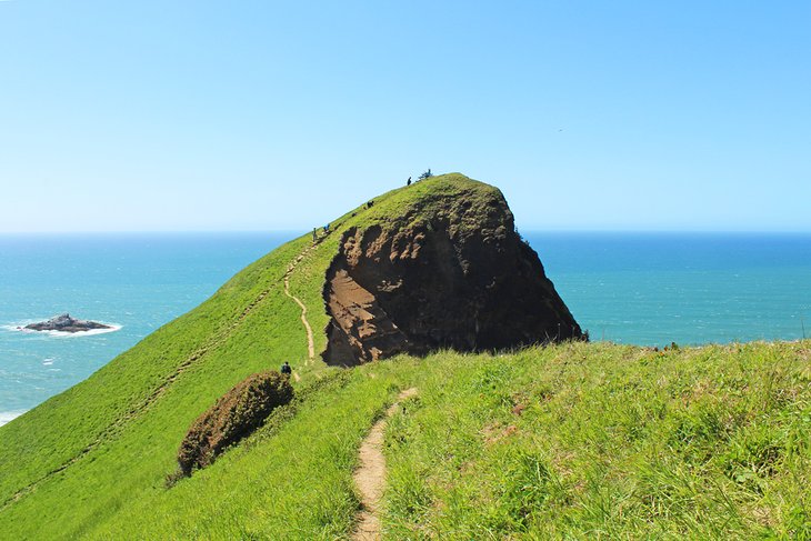
Tillamook Head Traverse Hike
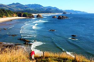
Tillamook Head is a defining headland separating Cannon Beach and Seaside on the northern coast. And the hike across this forested promontory is a must-do when visiting the region. It's also a historically significant route, once traversed by the Corps of Discovery and the many cultures that came before them.
The trail spans between the Tillamook Head Trailhead to the north and the Indian Beach Trailhead to the south. It's approximately a 6.3-mile hike between the two, with over 1,000 feet of elevation gain. Shuttles are available from Seaside to the Tillamook Head Trailhead.
A highlight of the route, alongside the verdant scenery, is the beautiful viewpoint at the top of the head. Here, distant views of the retired Tillamook Rock Lighthouse encourage sunset visits, and a nearby backpacker's camp enables overnight expeditions.
Cape Perpetua Scenic Area
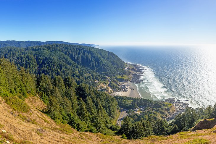
Cape Perpetua is two miles south of Yachats on the Central Oregon Coast, within the Siuslaw National Forest. It's one of the highest points accessible by car on the Oregon Coast, rising over 800 feet above the shoreline. However, while it's accessible via vehicle, the better way to experience Cape Perpetua is via its 26-mile network of trails.
A short 0.2-mile trail leads from the small parking area atop Cape Perpetua to the views. Alternatively, hikers can climb the 800-foot promontory from the north or south. These summit trails are a part of the state-spanning Oregon Coast Trail. The view atop Cape Perpetua is truly breathtaking, especially when opting for the uphill routes.
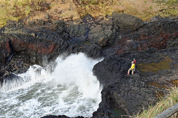
The Devil's Churn and Thor's Well are other must-do hikes when visiting Cape Perpetua.
The trek to Devil's Churn starts from the Devil's Churn Info Center off the 101 and proceeds with a half-mile loop to the namesake feature. It's an even shorter hike to reach Thor's Well from a similar pull-off farther north on the 101.
High tide is the best time to visit either feature, when the turbulent wake hits the jagged shoreline with full force.
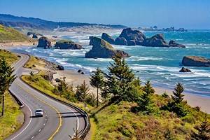
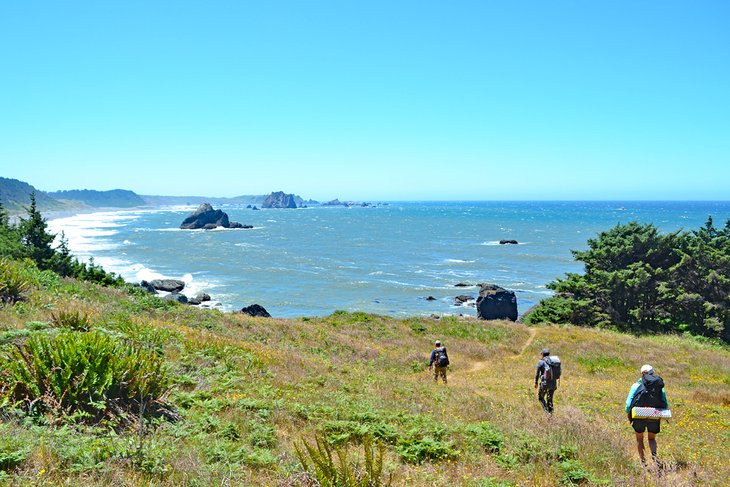
Samuel H. Boardman State Scenic Corridor
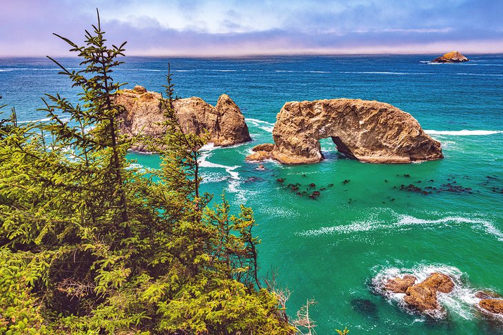
The Samuel H. Boardman State Scenic Corridor is a stunning 12-mile stretch on the Southern Oregon Coast. Rocky headlands, secret beaches, and adventurous hiking trails define this linear park, and several roadside trailheads and viewpoints line the entire expanse, offering days of exploration.
Signage can be hard to catch on this rugged section of the coast, and The Oregon Coast Trail connects nearly every route through the scenic corridor. A few recommended places to check out include Arch Rock, China Beach Trail, and Thomas Creek to Whaleshead Beach. However, half the fun can be pulling over wherever catches the eye.
Expect elevation change for any hike in the Samuel H. Boardman State Scenic Corridor. The roadway sits above the rugged coastline, and almost every hike begins with a steep route to the ocean. However, the views and feeling of wild exploration are well worth any uphill effort back to the car.
Netart's Spit - Cape Lookout State Park
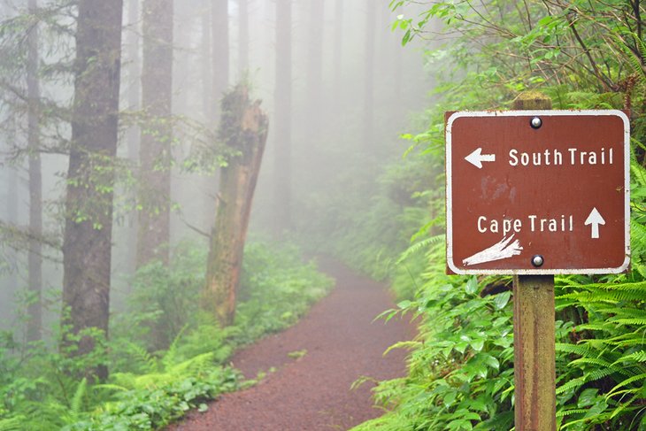
Approximately 80 miles west of Portland, Cape Lookout State Park is a signature destination on the coast. It's in the middle of the Three Capes Scenic Loop, one of the most scenic drives on this side of the country. The state park offers several recreation outlets, including a popular campground.
The 2.3-mile Cape Trail is one of the most popular routes in the park. This one-way route navigates a mossy coastal environment to reveal excellent views of the ocean. In addition, the Cape Trail is a great route to see migrating whales passing by the peninsula in the spring and fall.
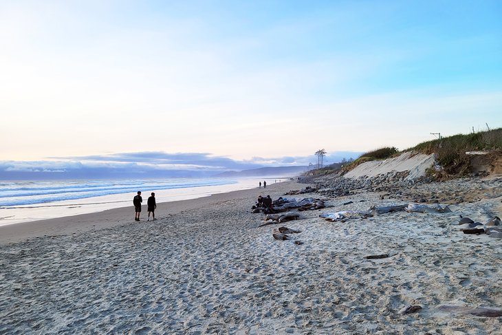
Another adventurous route at Cape Lookout is the Netart's Spit Trail. This long stretch of undeveloped sand extends north from the cape, and visitors are free to explore at their leisure. This sandy environment spans over five miles and offers moments of solitude watching the ocean waves. Trek as far as desired along this remote landscape and experience a quieter connection to the coast.
Heceta Lighthouse Trail and Hobbit Trail
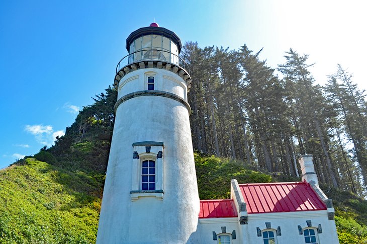
The 1,000-foot Heceta Head protrudes proudly as a significant attraction on the Central Oregon Coast. The historic lighthouse perched atop Heceta Head is one of the most photographed in the region, and the adjacent lighthouse keeper's home now operates as a charming bed and breakfast. This spectacular place to visit is approximately a 70-mile drive from Eugene.
It's an easy half-mile hike from the 101 to the top of Heceta Head from the parking area. There's slight elevation gain, but the path is wide and accommodating to most skill levels. For those making the trek during the summer, complimentary lighthouse tours are available between 11am and 3pm.
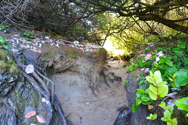
For a more adventurous trail from Heceta Head, the Heceta Lighthouse Trail continues down the opposite side of the head as part of the Oregon Coast Trail. This route descends quickly through a verdant forest known to host herds of Roosevelt elk.
After a mile of trekking down from Heceta Head, the route connects to the trailhead for the Hobbit Trail. The Hobbit Trail earns its name as it navigates a miniature world of coastal shrub with little natural alcoves throughout. The trail concludes at Hobbit Beach with plenty of sand leading up the north end of Heceta Head.
Alternatively, for those interested in hiking the Hobbit Trail up to Heceta Head, or just the Hobbit Trail down to the beach, a separate parking area sits across the 101 from the trailhead. Accessing the trailhead from this parking area requires crossing the highway without a crosswalk.
Cedar Wetlands, Rockaway Beach
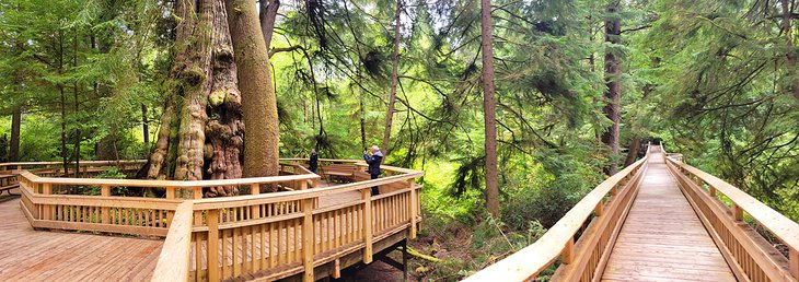
Remarkably, right in the middle of Rockaway Beach is a native forest untouched by development. This cedar bog and urban forest present a dazzling collection of Sitka spruce and western red cedars in a lush and thriving environment. And thanks to a recent addition of a boardwalk trail above the boggy landscape, no one has to get their shoes wet to explore.
The boardwalk trail begins from a small parking area off the 101 in Rockaway Beach. The entire path is wide, about a mile long, and easy to navigate. It ends at the massive Rockaway Cedar – one of the largest western red cedars in the region, standing approximately 154 feet tall with a 50-foot circumference.
An extended viewing platform surrounds the tree, accommodating the small crowds that tend to linger. There is a short and signed off-boardwalk path near the Rockaway Cedar. This muddy walkway navigates through a tunnel in the coastal salal. Expect to track out some mud if taking this optional side-adventure.
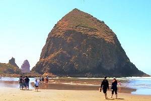
Cape Kiwanda
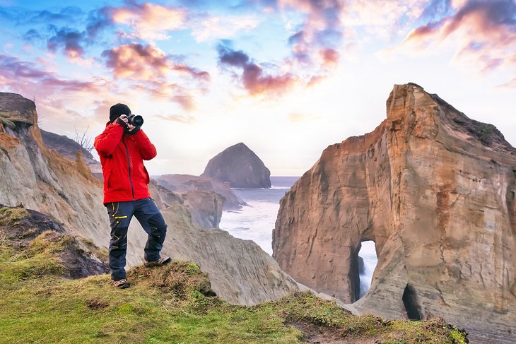
Cape Kiwanda, on the southern end of the Three Capes Scenic Loop, offers a unique hike with quite a view. Unlike the other two capes, Cape Kiwanda is made of sandstone and offers a shifting route to the top. Because of the dynamic terrain, there's no official hiking trail to summit Cape Kiwanda, but rather, other people's footsteps to follow.
The most common route to get to the top of Cape Kiwanda is from the neighboring Pacific City to the south. It's a short walk on the beach to Cape Kiwanda and up a sandy slope from there. The view atop Cape Kiwanda is spectacular, and the elevated landscape is a popular place for hang gliders to launch.
Take your time atop Cape Kiwanda, and watch the waves pound and shape the promontory. Be sure to remain behind the roped-off areas on the cape where the sandstone isn't stable for human exploration. Miles of untouched beaches surround both sides of Cape Kiwanda.
Neah-Kah-Nie Mountain Trail
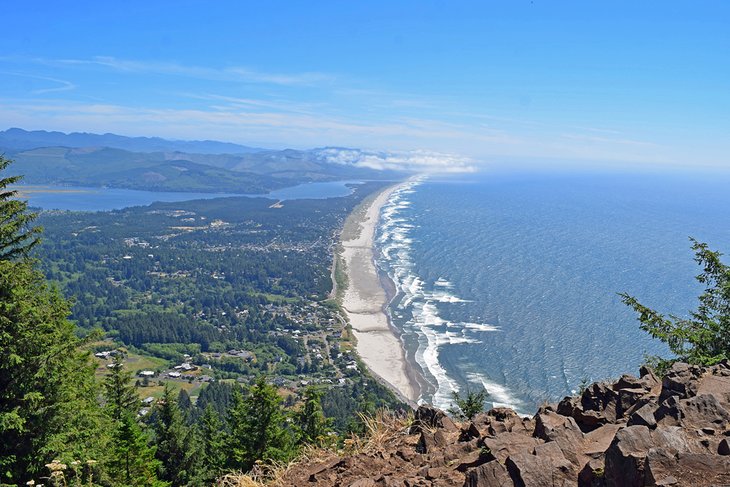
Neah-Kah-Nie Mountain, north of the charming town of Manzanita on the northern coast, is one of the highest points along the Oregon Coast Trail. It also provides a popular day hike that comes with quite a view. The mainstay of the mountain is within Oswald West State Park, which supports several other hiking trails worth checking out.
The South Neah-Kah-Nie Trail is currently the only route to the top of the mountain. It starts on a gravel trail and is an approximately three-mile out-and-back hike with 800 feet of elevation gain. The views atop Neah-Kah-Nie Trail span for miles on clear days. The outlook includes Tillamook Head to the north and Cape Lookout to the south.
Neah-Kah-Nie Mountain isn't the only trail worth exploring in Oswald State Park. The Cape Falcon Trail and the Devil's Cauldron Overlook also offer memorable day trips.
God's Thumb via The Knoll
The Thumb Hike, also known as "God's Thumb," is a popular uphill route north of Lincoln City. The trail navigates through Siuslaw National Forest above neighborhoods before entering The Knoll Open Space. Here, the basalt formation known as the Thumb is easy to spot, and a well-defined trail leads to the top.
A few different trailheads lend access to God's Thumb and The Knoll. Like the Villages at Cascade Head Trailhead, many of these trailheads are at the end of residential streets. Typical round trips on the trail span anywhere between three and five miles with moderate elevation gain.
The Salmon River Estuary and Cascade Head are in plain view to the north from atop God's Thumb, as well as a commanding view of the ocean. Plan to spend some time hanging out at this windy spot to take some pictures. Keep an eye out for Roosevelt elk, too, as they are known to frequent the area.
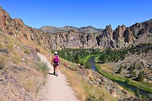
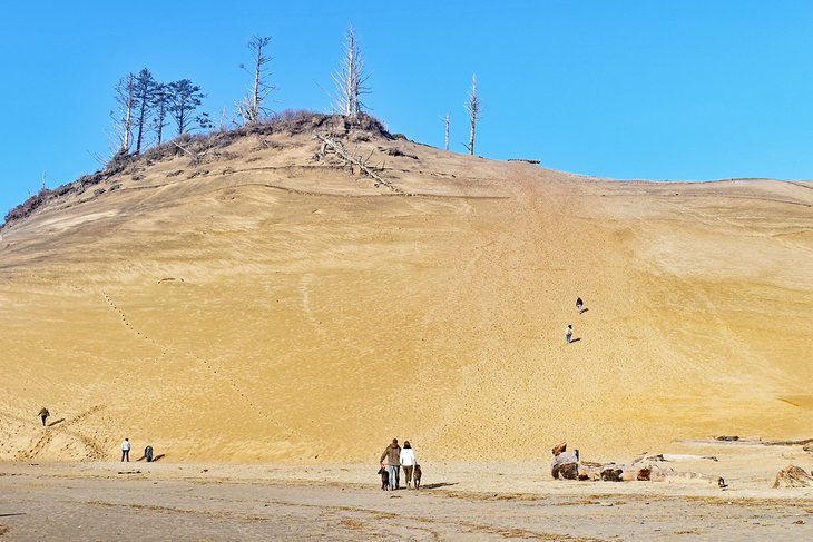
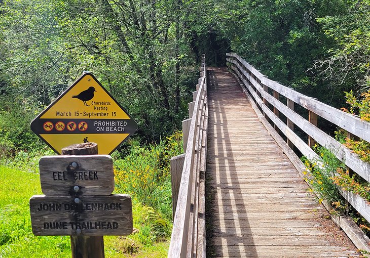
John Dellenback Trail, Oregon Dunes National Recreation Area
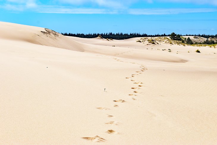
The Oregon Dunes National Recreation Area encompasses one of the largest expanses of temperate coastal dunes in the world. The amount of sprawling sand throughout is simply stunning, and the landscape is constantly changing depending on which way the wind's blowing.
The dunes are a hot spot for off-road vehicles and all-terrain vehicles. Several staging areas line the approximately 40-mile stretch of the national recreation area between Florence and Coos Bay. This means revving engines are potential soundtracks to a hike unless you visit motor-free areas and trails.
The John Dellenback Trail, part of the Umpqua Dunes Area, is one such spot to explore the dunes in solitude. The trail, named after the U.S. Representative responsible for the National Recreation Area's creation, starts near the Eel Creek Campground and Highway 101. It quickly crosses through a conifer forest and into a sprawling set of dunes.
The route spans nearly three miles before reaching the beach. The shifting landscape doesn't allow for traditional trail markers along the way, and instead, keep an eye out for posts buried in the sand. It's recommended to climb up the highest dune to gain some bearings upon starting the hike. Expect hot weather, no water, and slow-moving footsteps when navigating the sand.
Humbug Mountain
Humbug Mountain is a massive headland jutting from the southern Oregon coastline, approximately six miles south of Port Orford. And the 5.5-mile loop trail to the top of this promontory is a quintessential hike in the region. But with over 1,700 feet of elevation gain, it's not exactly a leisurely stroll in the park.
The hike starts on the other side of the Oregon Coast Highway from the campground, accessible with a footbridge. It's primarily an uphill route the entire way, often navigating old-growth forests and a few small creeks. Approximately a mile into the trail, the route forks, offering a looped hike in either direction.
Lush foliage shrouds much of the route, limiting the expansive views gained with elevation. The top does present a south-looking view from its 1,765-foot summit, alongside a sense of accomplishment.
Oregon Coast Trail
A state-spanning trail connects Oregon's entire coastline for those looking for an extended adventure. The Oregon Coast Trail (OCT) spans 360-plus miles from Astoria down to the California border. And while this might sound like a long beach walk, the route traverses several unique coastal landscapes, including 28 charming towns.
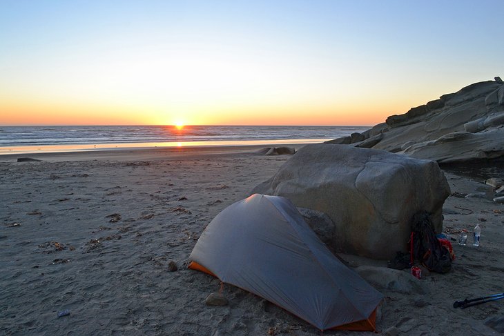
The route combines headland hiking trails, sandy shorelines, and the occasional road walk along Highway 101. As of 2022, approximately 10 percent of the path follows pavement. Other challenging landscapes along the way include shifting dunes and estuary crossings. High tide is also something to contend with, especially on sections where camping on the beach is allowed.
However, most of the camping on the Oregon Coast Trail takes place slightly inland, typically at a state park. Every state park along the coast has hiker/biker campsites reserved for non-motorized travelers. These sites have a place to pitch a tent and community picnic benches. Reservations are not required at hiker/biker sites.
A complete thru-hike of the Oregon Coast Trail takes about four to six weeks. The trail is roughly divided into 10 sections, which can be tackled individually for those without a whole month to devote to hiking. Several online resources assist in logistics like campsites, re-supply locations, and gear lists.