Attractions & Things to Do in Bremen, Germany
Officially known by the rather lofty title of the "Free Hanseatic City of Bremen" (Freie Hansestadt Bremen), Bremen is situated on Germany's lower Weser River an hour's drive west of the major port city of Hamburg.
Itself one of the largest seaports and centers of seaborne trade in the country, this vibrant port city is one of the best places to visit for an authentic northern Germany vacation.
The greater Bremen area also includes the important port of Bremerhaven. Just 60 kilometers north of the city of Bremen, it's here that the River Weser flows into the North Sea. Both cities are also popular places from which to embark on sightseeing boat trips and river cruises of the dramatic scenery to be found in this part of the country.
Bremen has also long been an important cultural center, boasting numerous top attractions and plenty of fun things to do. Key events in the city's cultural calendar include the Freimarkt, the country's largest funfair, and one that has taken place here almost continuously since 1036. Also fun is catching a concert by the International Youth Symphony Orchestra of Bremen.
Other memorable experiences for tourists include exploring the historic Old Town (Altstadt) on foot. It's a very pedestrian-friendly city, ensuring that a leisurely stroll through Bremen's many fine parks and green spaces is never noisy or crowded.
To help you find the best places to visit in this exciting corner of Germany, check out our list of the top attractions and fun things to do in Bremen.
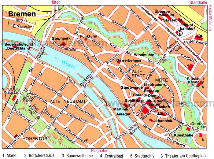
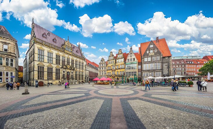
Explore Bremen's Historic Marktplatz
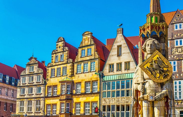
There's no better way to get to know a German town or city than making a beeline for the community's old marketplace, or Marktplatz. Located in the Old Town (Altstadt) and very much the beating heart of this historic city, the picturesque Marktplatz is home to many of Bremen's top attractions.
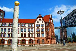
Here, you'll find the lovely old Town Hall (Bremer Rathaus), one of the most iconic buildings in Germany for its mix of Gothic and Renaissance designs.
Equally famous is the five-and-a-half-meter-tall statue of Germany's most famous knight, Roland. Erected in 1404, the statue, the oldest of numerous such monuments dotted around the country, remains a symbol of the city's freedom and independence from the church. Stop for a look and you'll notice the statue in fact faces the city's main church defiantly.
Address: Am Markt 2, 28195 Bremen
Experience an Authentic German Christmas Market
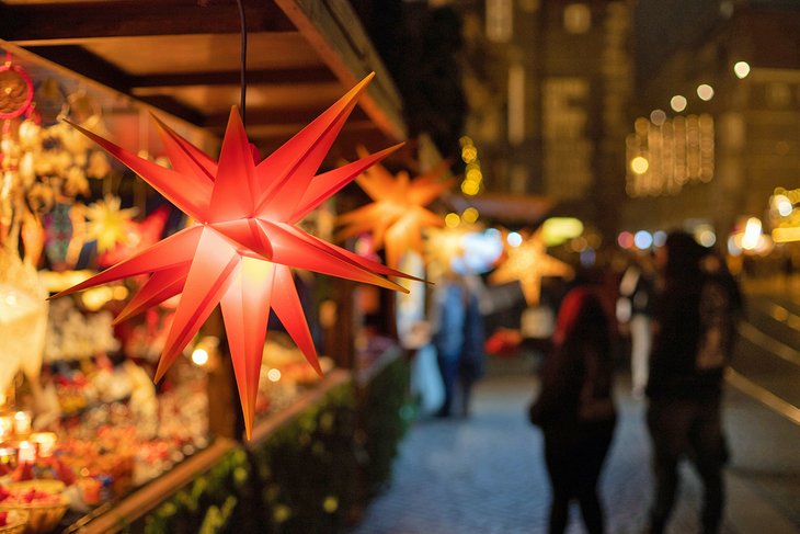
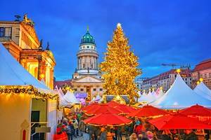
If you're planning on visiting Germany in winter, Bremen's Marktplatz is also the site of the city's popular Christmas Market (Bremer Weihnachtsmarkt). This spectacular celebration of the season lasts for a whole month in the lead-up to Christmas.
It's a great excuse for a visit to Bremen, especially for couples seeking romantic things to do in winter, and is especially fun at night due to the many festive light displays.
Bremen's historic Marktplatz is also where the city's famous Freimarkt, or "Free Fair," is held. This ancient fair has taken place here for almost 1,000 years. Attracting over four million visitors a year, this two-week-long event culminates in a colorful parade that's well worth seeing.
As you explore this large public space, you'll likely stumble across Bremer Geschichtenhaus. This fun "living history" museum uses costumed characters to tell many fascinating stories from the city's history from the 17th to 20th centuries and is well worth the cost of admission.
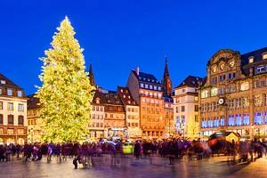
Read More: Christmas Markets in Germany
Take a Tour of Bremen Town Hall
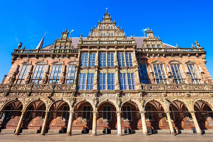
Bremen Town Hall (Bremer Rathaus), also sometimes referred to as City Hall, is a beautiful brick Gothic structure located in the city's Marktplatz. Built in 1410, it's famous for its sumptuous Renaissance facade added later in 1612. Now designated a UNESCO World Heritage Site, the building boasts one of the most elegant banqueting and reception halls in Germany.
Measuring an impressive 40 meters in length, 13 meters across, and eight meters high, its most notable feature is a large painting of the Judgment of Solomon dating from 1537. Also of note is a richly carved spiral staircase, just one of the many features that can be seen up close when you join in one of the regular and extremely informative guided tours.
Regular free concerts are held at the old Town Hall, too, including vocal soloists and organ recitals. You'll also notice, located under its northwest tower, an eye-catching yet unusual bronze sculpture of a rooster standing on a cat standing on a dog that's standing on a donkey. Known as the Bremen Town Musicians, these fascinating characters are straight out of the pages of a famous local folk tale.
Adding to the fun is a unique manhole cover in the road that doubles as a collection box. Drop in some change, and you'll be rewarded by a call from one of the Town Musicians themselves by way of a thank you.
Address: Am Markt 21, 28195, Bremen
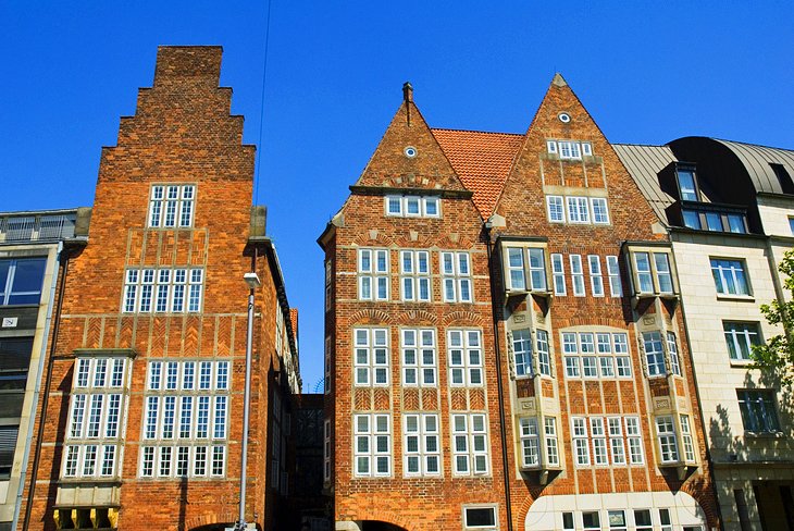
Wander through Bremen's Medieval Schnoor Quarter
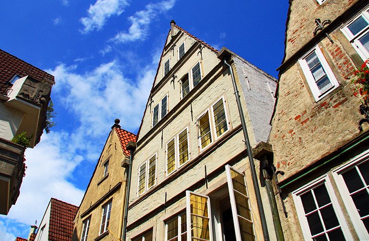
The charming medieval district of Schnoor, most commonly referred to as the "Schnoor Quarter," is named after the traditional rope-making trades that once flourished here. The oldest part of Bremen, it was also once the poorest part of the city.
These days, though, Schnoor is now the haunt of artists and other creative types and is an amazing area to explore for its many well-preserved 15th- to 18th-century homes. In addition to the many cafés and craft shops that now dot the district, highlights include the Schifferhaus, or Shipper's House. Built in 1630, it's now a private museum.
Also worth a visit is the lovely Landherrnamt. Dating from 1856, it was once home to the state government and notable for its well-preserved Neo-Romanesque façade. Nearby St. John's Church, a 14th-century brick-built Gothic place of worship, is also worth a visit.
Address: Hutfilterstraße 16-18, 28195, Bremen
See the Cathedral of St. Peter
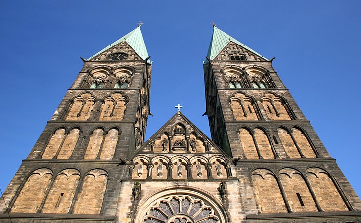
The Cathedral of St. Peter in Bremen, known locally as St. Petri Dom, dates from the 11th century, with later additions being made in the 13th and 16th centuries. The exterior, with its twin 98-meter-tall towers, was restored in 1898, while its richly decorated Baroque pulpit was a gift from Queen Christina of Sweden in the 17th century.
A must-visit is the fascinating Cathedral Museum (Dom-Museum), located in the Bleikeller, or Lead Cellar. Here, you'll have a chance to see eight well-preserved mummies, the remains of medieval archbishops, along with displays of other items related to their tombs. A nominal admission charge is required to visit the cathedral's tower, but it's well worth it for the views.
Address: Sandstraße 10-12, 28195 Bremen
Take a Stroll along the Böttcherstrasse
Bremen's narrow Böttcherstrasse, transformed between 1926-31 into a street of museums, is one of the city's most popular tourist attractions. Although only 100 meters long, its many examples of unusual expressionist architecture make it tremendously fun to explore.
Fortunately, you can't miss the entrance to this interesting neighborhood: simply look for the "Light Bringer" (Lichtbringer). This impressive gold sculpture is located above the not-so-secret archway entrance. While strolling, be sure to pop into some of the street's unique shops and galleries, as well as the famous Glockenspiel House with its thrice-a-day chime.
Another must-see here is the wonderful Paula Becker-Modersohn Museum. The museum is the world's first gallery dedicated to the art of a single woman and is housed in a specially designed expressionist brick building. Highlights of the collection include photos, paintings, and documents relating to the artist, as well as displays of work by her contemporaries.
Also of interest to art lovers is Roselius-Haus. Built in 1588 and home to the Ludwig Roselius Museum, it contains many fine examples of Low German art from the Gothic to Baroque periods.
Address: Böttcherstrasse, D-28195, Bremen
Enjoy a Boardwalk Stroll along the Schlachte
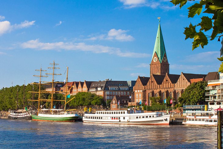
Another of Bremen's must-visit districts is the Schlachte. This pleasant Old Town pedestrian zone follows the River Weser's east bank and can trace its history all the way back to the 13th century. Named after the wooden piles driven deep into the ground to support the riverbank, this charming boardwalk area started off as the city's original port and harbor.
However, as the shipping industry changed, with larger vessels becoming the norm, it fell into disuse. After a great deal of rejuvenation, the Schlachte is now a wonderful place to spend time. In fact, one of the top things to do in Bremen at night is to simply spend time strolling the promenade or stopping in at one of the many cafés and restaurants housed in the old warehouses.
You'll also enjoy seeing the many old historic vessels docked here, some of which now serve as unique hotels and restaurants, alongside their more modern cousins. Others are set up to offer tourists fun riverboat cruises.
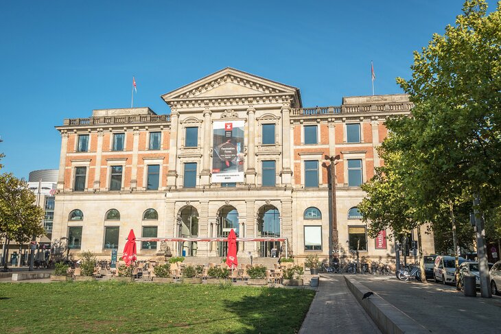
Get Your Art Fix at Kunsthalle Bremen
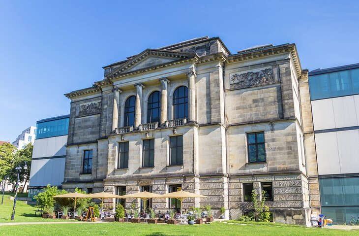
The Kunsthalle, located in the center of Bremen's Old Town, opened in 1849 and contains numerous fine 17th-century Dutch paintings, as well as many old German masters dating as far back as the 14th century.
Other highlights include its collection of French and Dutch paintings of the 19th and 20th centuries, works by painters from the famous Worpswede artists' colony, and more than 220,000 drawings and prints, one of the largest such collections in Europe.
The museum also houses a sizeable collection of notable sculptures, as well as a collection of works in modern media. Guided and audio tours are available in English, and a first-class restaurant with a terrace is located on-site.
Fans of modern art will want to also include the Weserburg Museum of Modern Art on their itinerary. One of the country's largest modern art galleries, the Weserburg hosts frequently changing exhibits of artwork from artists around the world.
Address: Am Wall 207, 28195, Bremen
See the Blossoms at Rhododendron-Park and Mühle am Wall
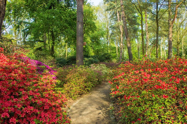
Bremen's 114-acre Rhododendron-Park (Rhododendron-Park und Botanischer Garten Bremen) was established in 1933 and is a wonderful place to explore, whether you're a nature lover or a gardener. In addition to its huge collection of rhododendrons and azaleas, it's also home to the eight-acre Bremen Botanical Garden.
Created in 1905 with plant species from alpine regions, Asia, Australia, and the Americas, the park is also home to more than 1,000 native plant species, some of them endangered. Also located within the Rhododendron-Park is a lovely old windmill, the Mühle am Wall, built in 1888 and now a heritage building, which houses one of Bremen's top restaurants.
Another garden-related attraction worth visiting is Botanika Bremen, a pleasant botanical garden, which also offers fun things to do for kids, including a playground.
Address: Deliusweg 40, 28359, Bremen
Get Smart at Universum Bremen
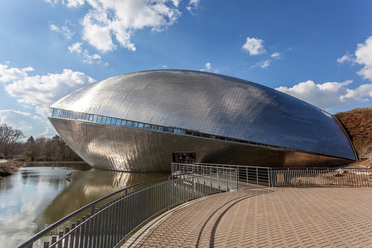
One of Bremen's newest attractions, Universum Bremen is also one of its most interesting architecturally. Built in 2000 and looking not unlike a large, partially opened clam or a grinning whale, depending on where you're standing, the building was made from more than 40,000 metal tiles.
This first-rate science center is home to some 300 fascinating hands-on exhibits focusing on human history, the earth, and the cosmos.
A recent addition to the attraction is EntdeckerPark, which includes the Turm der Lüfte, a 27-meter-tall tower with superb views of the area, as well as a restaurant, which runs interesting "dining in the dark" experiences, one of the more fun things to do at night in Bremen. A variety of educational programs, science shows, and workshops are also available.
Address: Wiener Straße 1a, 28359, Bremen
Explore the Overseas Museum
The Overseas Museum (Übersee-Museum Bremen) has many excellent collections related to natural history, trade, and ethnography, including displays focusing on the South Seas, Australia, and Asia.
The magnificent building itself is listed, and highlights of the museum include exhibitions related to Bremen's import and export trade. Free English-language brochures, educational materials, and audio guides are available when purchasing tickets, as are guided tours in English.
Address: Bahnhofsplatz 13, 28195, Bremen
Learn about Bremen's History at the Focke Museum
For those with the time and the interest to learn more about the rich human and cultural history of Bremen, a visit to the Focke Museum could be just the ticket. Established in 1924, the museum complex covers an 11-acre site in a leafy neighborhood of the city and consists of a number of interesting structures built between the early 1500s and late 1800s.
Highlights of a visit include a permanent exhibit focusing on the city's 1,200-year history, which includes numerous antiquities along with more recent artifacts such as a fascinating automaton, a lifeboat, and unique collections of furniture, farm tools, toys, and glass. If traveling with kids, head for the attic of Haus Riensberg, where they can enjoy a variety of fun hands-on experiments.
Address: Schwachhauser Heerstraße 240, 28213, Bremen
Visit the German Maritime Museum in Bremerhaven
Located in Bremerhaven's Old Harbor a little more than 60 kilometers north of Bremen, the German Maritime Museum (Deutsches Schiffahrtsmuseum) is a superb museum dedicated to the country's rich seafaring history.
Notable among its exhibits is a Bremen "kogge," an old Hanseatic merchant ship; a Mark XXI submarine from WWII; the four-masted tall ship, the Seute Deern with its on-board restaurant; and the old paddle steamer, the Meißen.
Also of interest is a 112-meter-tall radar tower with a viewing platform, as well as exhibits relating to European shipping from prehistoric to modern times. Afterward, be sure to spend time exploring Bremerhaven itself, in particular the harbor area with its busy fishing port.
Address: Hans-Scharoun-Platz 1, 27568 Bremerhaven
Take a Drive to the Valentin Submarine Pens
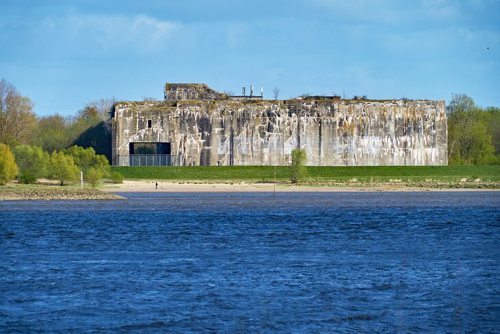
The Valentin Submarine Pens (Denkort Bunker Valentin) is another historic attraction that's of interest to war buffs. Located about halfway between Bremen and Bremerhaven, it was here that the Germans built and maintained many of the navy's U-Boats during WW2.
Once the country's largest fortified U-boat facility, this huge concrete structure still impresses with its vast dimensions and durability. Today, this huge structure can be visited and explored as part of a guided tour.
Address: Hans-Scharoun-Platz 1, 27568 Bremerhaven
See the Views from the Zarm Drop Tower
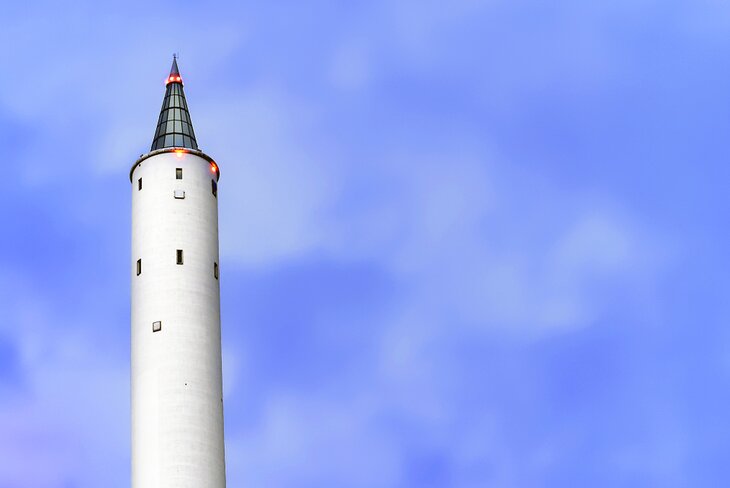
Another interesting science-related attraction that's well worth seeing in Bremen is the fascinating Zarm Drop Tower. Located in Bremen University and a 15-minute drive from the city center, this 146-meter-tall structure was built for zero-gravity experiments, something it's still known for to this day.
Built in 1990, it's well-known to researchers the world over. For those interested in science, there's also the occasional opportunity to watch experiments being undertaken. Among tourists, though, this tall, pencil-like structure is known for its superb views over Bremen.
English-language guided tours are available. Lasting up to 90 minutes, they take in the labs and research areas, with visitors being able to climb the tower itself afterward. Age restrictions do apply, with guests over 12 and up welcome to join the tours.
Address: Am Fallturm 2, 28359 Bremen
More Related Articles on PlanetWare.com
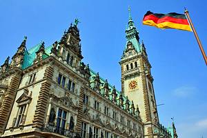
Trains Take away the Strain: Thanks to its fast, efficient, comfortable, clean, and extremely punctual railway network, Germany is a delight to explore by train. Just an hour away from Bremen by rail, the port city of Hamburg boasts plenty of fun things to see and do. Highlights include exploring its vast port area with its many fine tourist attractions. Be sure to make time for the International Maritime Museum, as well as its inner city lakes, the Inner and Outer Alster.
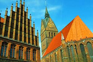
Also easy to get to by rail, lovely Hanover offers amazing historic architecture to explore, from the Old Town Hall and churches in the Marktplatz, to the elegant New Town Hall and majestic Opera House.
Although further afield, the three-hour train ride to the university city of Düsseldorf is worth it for the chance to stroll along the beautiful Königsallee, widely regarded as Germany's most elegant avenue.
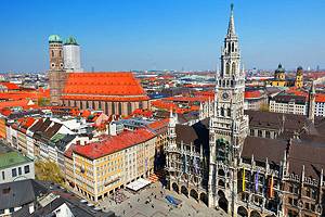
Medieval Architecture: The Germans have done a tremendous job of preserving, or even rebuilding, the many fine examples of medieval architecture found within their borders. The beautiful town of Augsburg, for example, features many magnificent medieval-era buildings, one of the finest examples being its 11th-century cathedral.
Then, of course, there's Nuremberg, which boasts one of the largest collections of medieval structures anywhere in Europe, including its famous castle and Old Town Walls.
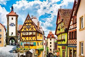
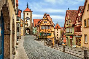
However, no destination in Europe quite matches Rothenburg when it comes to the sheer quantity of well-preserved medieval architecture. Here, you'll find everything from the beautiful 13th-century Town Hall (Rathaus) and the nearby 14th-century Council Tavern, numerous old churches, and many fine old half-timbered houses, which together make Rothenburg one of the prettiest of German towns.
Big City Escapes: Germany's many big cities have also done their bit to preserve their past. Some of the best examples, of course, can be found in the country's capital, Berlin, where in the space of a few minutes' walk you'll find the splendid Brandenburg Gate, the opulent Charlottenburg Palace, and the city's famous Museum Island, home to five of the country's oldest and most important museums.
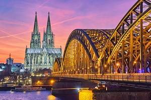
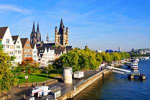
Other big city destinations to consider visiting include Frankfurt, where you can wander one of the largest public squares in Europe while taking in its many beautiful half-timbered homes and merchant buildings, now home to great restaurants and boutique shops, and Cologne (Köln), famous for its magnificent cathedral and well-preserved Old Town.