Exploring Watarrka National Park (Kings Canyon)
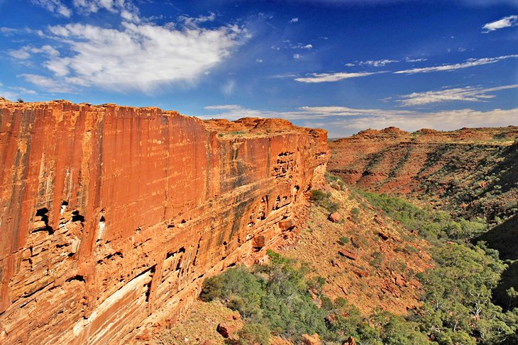
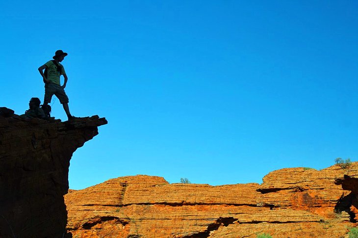
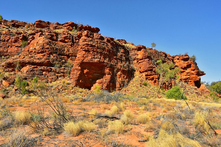
Spectacular Watarrka National Park (Kings Canyon), about 330 kilometers southwest of Alice Springs, encompasses the western edge of the George Gill Range. Its star attraction is the magnificent Kings Canyon, with the deepest gorge in Australia's Red Centre. Steep sandstone walls rise to a height of more than 100 meters, sometimes appearing as if they were neatly sliced with a giant knife.
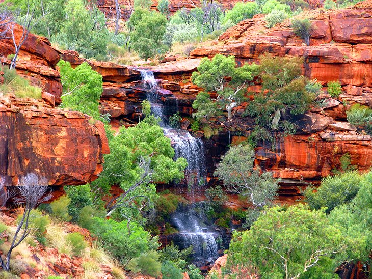
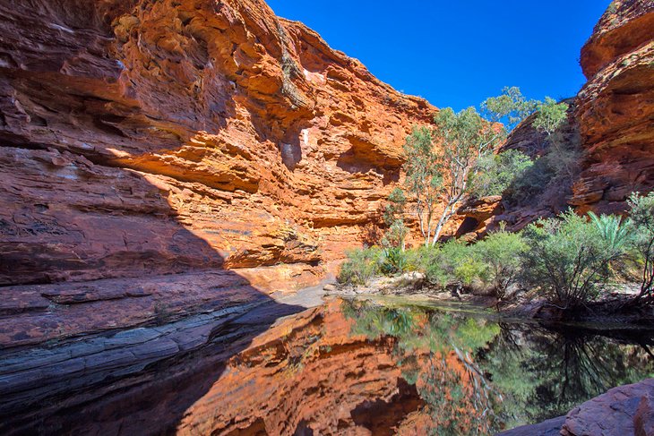
On the bottom of the canyon, permanent waterholes punctuate the dry landscape. In the upper part of the gorge, the Garden of Eden surprises visitors with its lush vegetation. Plants such as palms and ferns flourish here, the relics of a time when the area was covered in rainforest. On the plateau above the canyon is the Lost City, an area of red sandstone rocks weathered into beehive-shaped domes.
Today, tourists visit from around the world to see the rugged gorge, rocky domes, and palm-fringed permanent waterholes. The best way to explore Watarrka National Park (Kings Canyon) is on foot, and hiking through the dramatic scenery is one of the most popular things to do. Sightseeing flights and camel safaris are also a great way to soak up the vistas-especially during the hottest months, from September through May, when the weather can be too hot for hiking.
No matter how you see it, Kings Canyon in the Northern Territory is one of the most ruggedly beautiful places to visit in Australia.
Hiking Trails
The park's hiking trails are a great way to experience the dramatic beauty of the landscapes. Hikes range from long treks around the lip of the canyon to shorter family-friendly hikes. Extreme care should be taken in the hotter months (September through May). At this time of year, you should consider shorter walks if you are planning to hike during the middle of the day.
The Kings Canyon Rim Walk
Tracing the edge of this vertigo-inducing canyon, this six-kilometer loop walk is one of the best hikes in Australia and the most famous Kings Canyon walk. It starts with a steep climb to the top of the canyon, before continuing along the rim.
About halfway along the walk is the Garden of Eden, an area of refreshing waterholes and lush riverine foliage. From here, hikers continue to the south wall of the canyon and down to the bottom of the gorge, past aboriginal rock paintings. The trail then descends back to the parking lot.
The Canyon Walk requires an average to high fitness level and takes approximately three to four hours.
The Kings Creek Walk
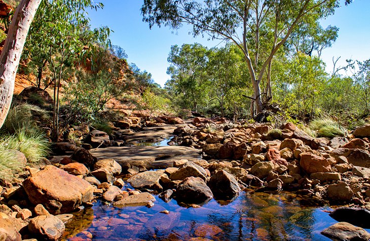
This 2.6-kilometer return trip weaves along Kings Creek to a scenic lookout before returning along the same route. On the way, you can learn about the Aboriginal sites through interpretative signs. Suitable for hikers of all ages, the Kings Creek Walk takes about an hour and provides wheelchair access for the first 700 meters.
The Kathleen Springs Walk
Recommended for families with young children and visitors with limited mobility, the 2.6-kilometer Kathleen Springs walk leads to a peaceful spring-fed waterhole at the head of Kathleen Gorge. Along the way, you can learn about aboriginal culture and the cattle industry through interpretative signs.
Flora & Fauna
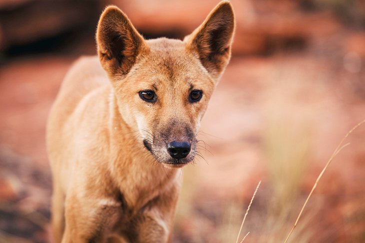
Watarrka National Park protects a rich diversity of flora and fauna. More than 750 species of plants have been recorded here, including desert oaks, acacia, eucalypts, and rare cycads and ferns. After the rains, wildflowers bloom, adding splashes of color to the red earth. Animals inhabiting the park include rock wallabies, dingoes, and many species of birds, such as the crested bellbird, white-fronted honeyeater, and galah.
History
To the Aborigines, the area of Watarrka National Park was a sacred site and a refuge in times of severe drought. The Luritja people came here to take shelter in the shady overhangs and gather around the waterholes. They decorated their dwellings and places of assembly with rock paintings and engravings, some of which can still be seen today. The Luritja named the area "Watarrka," after an acacia tree found within the park.
In 1872, Ernest Giles was the first white man to see the dry riverbed, though not the canyon itself, which was 30 kilometers away. Giles named it after his principal sponsor, Fieldon King. His favorable report brought many cattle farmers to the area, but the area has only been accessible to tourists since 1960, when English immigrant Jack Cotterill realized its potential as a tourist attraction and built a track to Kings Canyon.
Where to Stay in Watarrka National Park for Sightseeing
Watarrka National Park is remote, so if you want to spend time exploring some of the hiking trails, it's best to base yourself as close to the park as possible.
- In the Park: The only accommodation available within the park boundaries is at Kings Canyon Resort. This Kings Canyon wilderness lodge offers everything from hotel rooms to lodge rooms with communal kitchens and bathrooms. You can also opt for a glamping experience in air-conditioned permanent tents, or pitch your own tent in the campground. RVs and caravans are also welcome. You'll find plenty of amenities here, including several restaurants and a lovely outdoor pool. If you're interested in Kings Canyon camping, this is the only place in the park to pitch your tent. You can also book Kings Canyon tours from the resort, including scenic helicopter flights, quad bike tours, and cultural experiences.
- Near the Park: A great option for accommodation outside the park is Kings Creek Station, a working cattle and camel station, just 36 kilometers away from the canyon. This remote wilderness lodge offers everything from basic campsites to safari tents and a glamping experience. From here, you can organize quad bike tours, helicopter flights, and camel safaris. If you don't mind driving a few hours to the park, you can also base yourself out of either the Outback town of Alice Springs (330 kilometers away) or Uluru (297 kilometers away)
Tips and Tactics
The following Tips and Tactics will help maximize the potential for fun when visiting Watarrka National Park:
- Access to the Kings Canyon Rim Walk is restricted during periods of hot weather. On days when the temperature is forecast to be 36°Celsius or above, visitors wishing to undertake the Canyon Walk need to start their walk before 9am. Temperatures relating to these restrictions are based on Bureau of Meteorology forecasts at: http://www.bom.gov.au/nt/forecasts/precis.shtml
- On days forecast at 35°Celsius or less, no access restrictions are in place, but the Parks & Wildlife Commission encourages hikers to set out early in the morning to avoid the heat.
- Hikers should bring at least three liters of water per person and consider bringing a topographic map and compass, or a GPS. For long hikes, take basic first aid equipment, register the planned route, and advise friends and family of an estimated return time. Sturdy walking shoes are highly recommended.
- Take binoculars for a close-up view of birds and other wildlife.
- Emergency Radios can be found along the Kings Canyon Walk and at the Canyon car park.
- Watarrka National Park is open all year-round. The cooler months (April to September) are the most popular times to visit.
- Driving from Watarrka National Park (Kings Canyon) to Uluru takes almost four hours, and you can visit both of these iconic tourist attractions on a road trip from Alice Springs.
Getting There
By Car from Alice Springs:
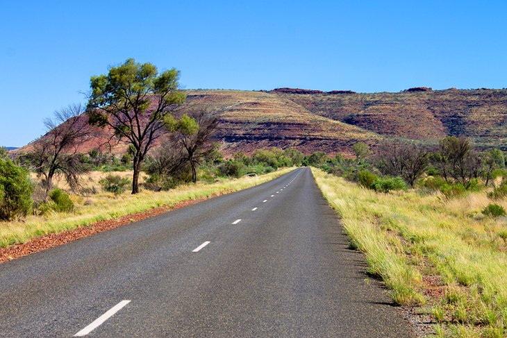
The park is located about 330 kilometers southwest of Alice Springs and is accessible via 2WD vehicle via Luritja Road from Yulara and Lasseters Highway.
An alternative route is via Larapinta Drive, through the West MacDonnell National Park, which connects to the new gravel Mereenie Loop Road (4WD recommended), or via Ernest Giles Road (4WD essential) and Luritja Road.
Official site: http://www.parksandwildlife.nt.gov.au/parks/find/watarrka#.U1_UWeCgVvA