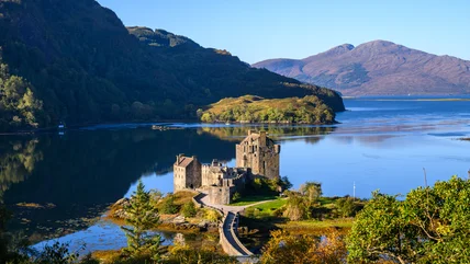
Scotland's 14 Top-Tier Tourist Attractions For Your First Trip
Planning your first trip to Scotland? These iconic castles, lochs, and islands offer plenty of unforgettable experiences for every type of traveler.
Read More
Planning your first trip to Scotland? These iconic castles, lochs, and islands offer plenty of unforgettable experiences for every type of traveler.
Read More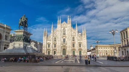
Once the capital of the Western Roman Empire, this city has completely reinvented itself into a thriving hub of commerce, art, fashion, and culture.
Read More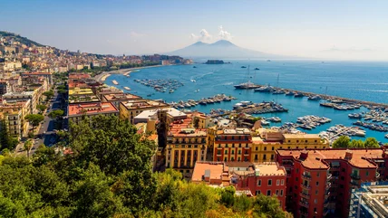
Explore 10 unforgettable day trip escapes from Naples — from ancient ruins and archaeological sites to picturesque islands and royal palaces.
Read More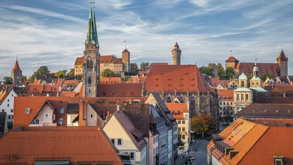
Experience Nuremberg’s incredible mix of medieval architecture, world-class museums, and historic WWII sites on this ultimate city itinerary.
Read More
Body language can be useful when you're traveling and don't speak the local language, but there are some gestures you should avoid while in Europe.
Read More
While you've no doubt heard of the Cannes Film Festival, there's far more to do in Cannes. Even if you're not a cinephile, there's much to enjoy.
Read More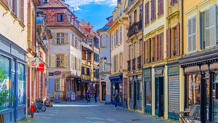
Planning a European getaway? Strasbourg delivers old-world architecture, world-class culture, and plenty more to explore for every type of traveler.
Read More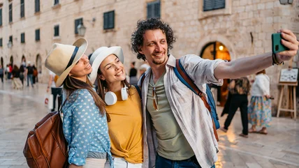
There’s one major unexpected American habit that immediately stands out to locals when traveling abroad, and it’s probably not what you’re expecting.
Read More
Travel expert Andy Steves warns against this major fashion mistake that screams "tourist" and could easily put you at risk on your European vacation.
Read More
Rick Steves’ surprising hotel booking advice could save you hundreds while traveling through Europe while actually improving your vacation in unexpected ways.
Read More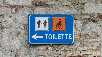
Seasoned travel pro Rick Steves reveals the awkward bathroom quirks that catch tourists off guard and essential tips to avoid embarrassing situations.
Read More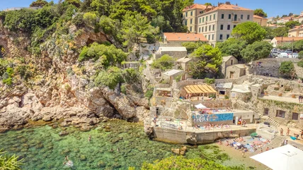
Step into a world where medieval history meets stunning Adriatic views, centuries-old fortresses, and pristine beaches just waiting to be explored.
Read More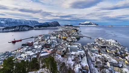
The place for a winter wonderland vacation is this scenic city in Norway that is underrated, uncrowded, and filled with gorgeous Art Nouveau buildings.
Read More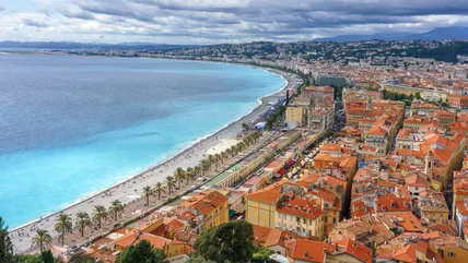
Nice has long been a destination for those looking for a warm, beautiful spot. Filled with art, entertainment, and delicious food, there's plenty to see here.
Read More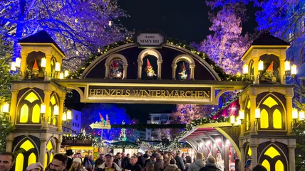
Headed to Germany? Consider visiting around the holidays, when this city bursts with Christmas markets filled with shopping, food, and entertainment.
Read More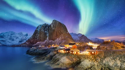
From fjords and mountains, to Viking history and dazzling northern lights, there is so much to discover in Norway and your adventure starts here.
Read More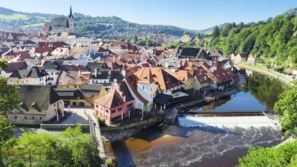
Dive into the Czech Republic’s rich history and breathtaking scenery to explore some its top tourist attractions — from medieval castles to national parks.
Read More
When is the best time to visit Europe? Travel veteran Rick Steves has a unique perspective on the best season to visit Europe and avoid the crowds.
Read More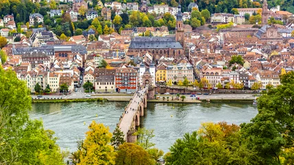
Discover Heidelberg’s top 11 must-see attractions — from a fairytale castle to scenic river cruises — that make this German city the perfect getaway.
Read More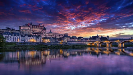
Embark on a journey through the stunning Loire Valley, home to some of Europe's most spectacular castles, cultural gems, and timeless French heritage.
Read More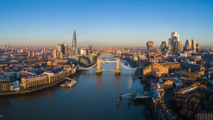
In a city so dynamic and rich with history, it's hard to know where to begin — these iconic destinations capture London's soul like nowhere else.
Read More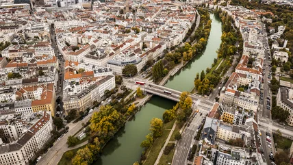
You may recognize Austria as the setting of "The Sound of Music," but there's more to see here than the destinations portrayed in the iconic film.
Read More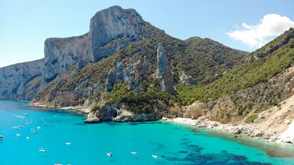
Italy has plenty of gorgeous beaches, but one of the most breathtaking is a protected gem located on the island of Sardinia that takes some planning to reach.
Read More
This sunny destination combines affordable living, thousands of miles of coastline, and a world-famous culinary scene for the perfect escape.
Read More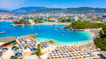
If you want to live in or travel to Europe on a budget, head to this country which is one of the more affordable with plentiful beaches and friendly people.
Read More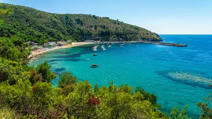
For an Italian coastal experience without the Amalfi Coast prices, head just a few hours south to this region boasting historical sites and superb eats.
Read More
Rick Steves’ strict baggage philosophy might seem a little extreme, but his packing strategy could transform your entire European adventure for the better.
Read More