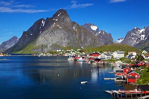
9 Top-Rated Tourist Attractions in Sognefjord
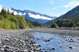
The Sognefjord is the largest of Norway's numerous fjords and is also the third largest in the world. Extending inland for 204 kilometers from Sygnefest to its easternmost point, Skjolden, this spectacular 4.8-kilometer-wide, 6905-meter-deep fjord is only a three-hour drive from the city of Bergen (five hours from Oslo).
At its eastern end, the fjord splits into a number of narrow arms enclosed by steep rock walls rising to heights of over 1,676 meters. Here and there along the shores, quaint fishing and farming communities nestle at the base of the mountains. With its combination of coastal and continental climates, the inner reaches of the Sognefjord enjoy mild winters and warm summers.
Despite its ruggedness, exploring the Sognefjord is easy and can be done by car, train, or boat, and even by bike. During the summer months, the ships of the Hurtigruten, Norway's superb coastal ferry service, sail frequently from Bergen to Årdalstangen at the east end of the fjord, calling on numerous ports along the way.
In addition to the numerous local boat services and cruise ships that ply these waters, this impressive fleet offers countless tour options for visitors wishing to explore the fjord's spectacular national parks, mountain ranges, glaciers, waterfalls, and numerous other attractions and fun things to do.
For ideas on the best places to visit, see our list of the top attractions and things to do in Sognefjord, Norway.
- 1. Nærøyfjord
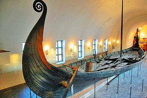
- 2. Live Like a Norseman in Viking Valley - The Viking Experience
- 3. Take the Train: Flåm Railway Line
- 4. Fjærlandsfjord & the Norwegian Glacier Museum
- 5. See Where the Kaiser Vacationed at Balestrand
- 6. Visit a Historic Stave Church
- 7. Take a Break in Ardalstangen
- 8. Vettisfossen
- 9. Kaupanger & Heibergske Samlinger Open-Air Museum
- Map of Attractions & Things to Do in Sognefjord
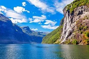
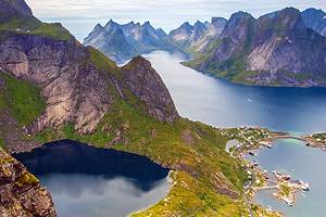
1. Nærøyfjord
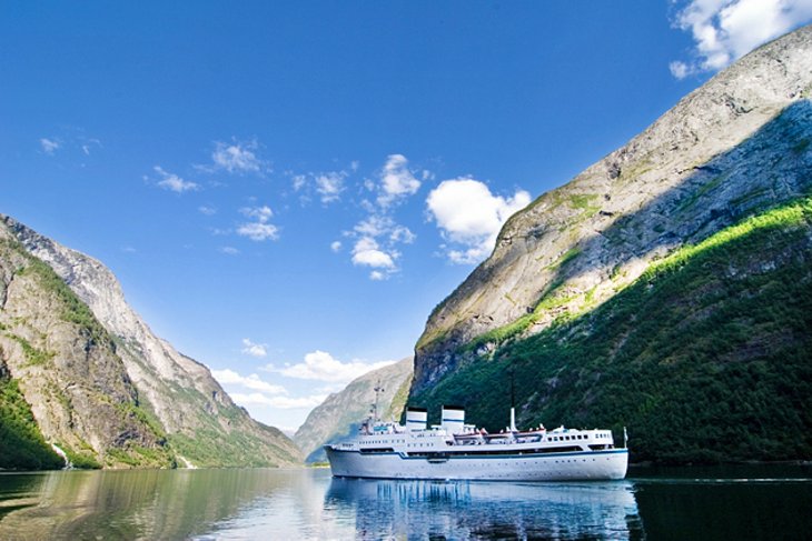
Widely considered one of the most spectacular fjords on the planet, the nearly 18-kilometer-long Naeroyfjord - an arm of the Sognefjord and named after the Norse god of seafaring, Njord - is, at its narrowest point, only 249 meters across. Hemmed in by nearly vertical mountains rising more than 1,706 meters above its tranquil waters, it's an awe-inspiring sight. In fact, it's so important that UNESCO has in fact included Naeroyfjord, along with many other Norwegian fjords, on its World Heritage List.
The village of Gudvangen at the head of the fjord is a great place to begin exploring the area. From here, you can hope aboard a pleasure cruise, or rent a kayak and explore the rugged shoreline under your own steam. You can also start a fun, though steep, hike here, something that does require a great deal of fitness and stamina given the climbing involved.
2. Live Like a Norseman in Viking Valley - The Viking Experience

The excellent Viking Valley - The Viking Experience is undoubtedly one of the newest attractions in the Sognefjord area. Although now fully open, its first permanent buildings only opened to the public in 2017 in Gudvangen and was the logical expansion of a decades-long Viking market held here each summer.
Given the old Viking name of Njardarheimr, Viking Valley is billed as a "living village" and has rapidly become one of Norway's top immersive attractions. And for good reason. There's much to see and do here, from exploring the many authentic buildings to chatting to informative costumed guides (most of them Viking enthusiasts) eager to share stories and interesting facts about the tough Viking times. Along the way, you'll also learn plenty about the rich traditions and culture of the times.
In addition to a standard 45-minute tour, a variety of extended experiences are available. One of the best is the day-long "Explore & Learn" packages, which include instruction in axe-throwing and archery, Viking games, as well as participating in daily activities and chores. You can also experience traditional Viking food and drinks, too, in an authentic Viking food market.
Address: Nærøydalen 15, 5747 Gudvangen, Norway
Official site: www.uk.vikingvalley.no
3. Take the Train: Flåm Railway Line
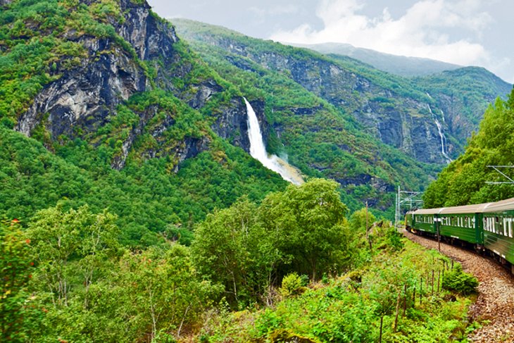
The Flåm Railway Line (Flåmsbana), the world's steepest standard gauge railway (and Norway's third most popular tourist attraction), provides visitors with close-up views of the Aurlandsfjord's most spectacular scenery, including tall waterfalls and towering snow-capped mountains. This wonderful 20-kilometer engineering feat opened in 1940 and is easy to get to as it's connected to the main train line from Bergen and twists through 20 tunnels before depositing passengers at the foot of the 224-meterKjelsfossen waterfalls.
If you're lucky, you may catch a glimpse of a legendary Huldra, a forest creature from Scandinavian folklore that dances and sings in front of the waterfall. The railway is also a popular tourist destination during the winter months.
Address: 5742 Flåm, Norway
Official site: www.norwaysbest.com/flamsbana/
4. Fjærlandsfjord & the Norwegian Glacier Museum
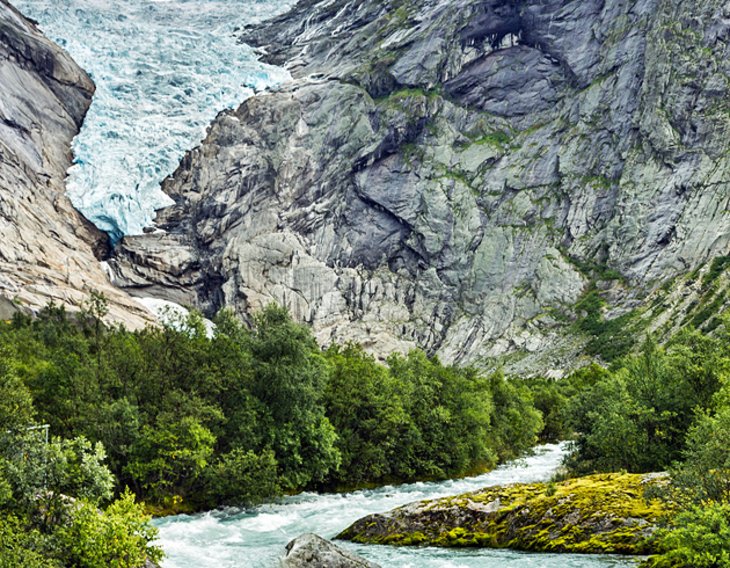
Fjærland is the area surrounding a branch of the Sognefjord near Jostedalsbreen, the largest of Europe's glaciers. Taking a walk on or around this magnificent (though sadly retreating) glacier is an unforgettable experience, and a variety of organized hikes and tours are available.
Fjærland is also where you'll find other fun things to do, including visiting the Norwegian Glacier Museum, Norwegian Booktown (an interesting collection of book shops, galleries, and cafés), as well as lovely Hotel Mundal, built in 1891. A number of cruise options are also available around the fjord. From Fjærland, an eleven-kilometer-long tunnel runs under the glacier to Skei, in the heart of the Sogn og Fjordane region.
Address: Fjærlandsfjorden 13, 6848 Fjærland, Norway
Official site: https://english.bre.museum.no
5. See Where the Kaiser Vacationed at Balestrand
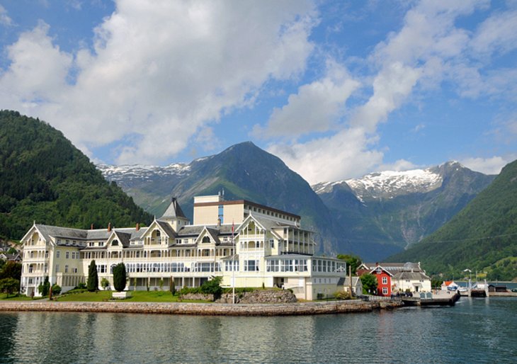
The most attractive of Sognefjord's communities, Balestrand has been a popular tourist destination for well over a century. Much of this popularity stems from its dramatic surroundings, which over the years has lured artists such as Hans Gude, Alfred Heaton Cooper, and Hans Dahl.
Along the town's Cultural Heritage Trail are many historically significant treasures: the Cooper House, St. Olaf's Church, the statue of King Bele with its burial mounds, and numerous lovely old holiday villas. The new Norwegian Museum of Travel and Tourism is a fitting attraction, given the town's popularity as a tourist destination, and features interesting exhibits and artifacts related to the history of travel to the region.
Another great reason to visit is the majestic Kviknes Hotel. Built in the 19th century, the hotel is famous for having been where Kaiser Wilhelm II was holidaying when informed of the assassination of Archduke Ferdinand, the event that sparked WWI (the chair in which he was sitting at the time is still in the hotel).
Address: Kong Beles veg 20 N, 6899 Balestrand, Norway
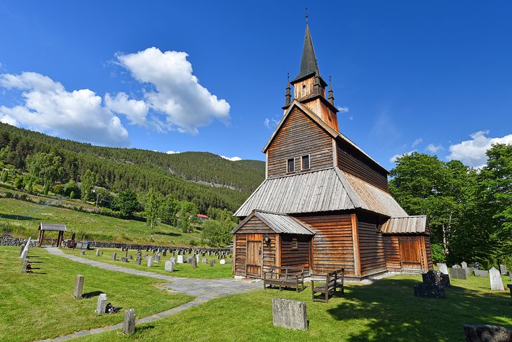
6. Visit a Historic Stave Church
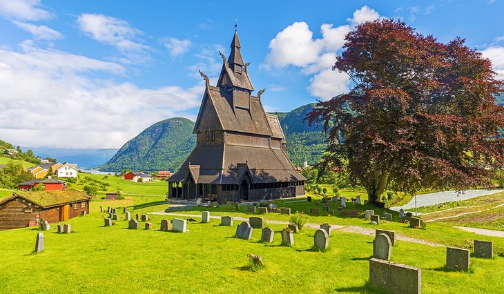
The Sognefjord is home to some of the best preserved of Norway's few remaining historic Stave Churches. The ornately decorated Hopperstad Stave Church, built in 1140, can be found on the south side of the fjord in the village of Vik, an ancient community consisting of wide and fertile farmland. The 40-seat Undredal Stave Church (1147) is located on the Aurlandsfjord and is the smallest church still in use in Scandinavia.
If you're only able to visit one of these UNESCO-protected buildings, make it Urnes Stave Church on the Lusterfjord, the oldest such church in Norway. Once a private church for a powerful family, this beautifully decorated wood building still retains its nearly 900-year-old timber.
7. Take a Break in Ardalstangen
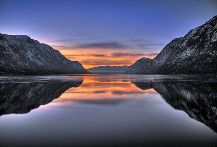
Located in the Årdalsfjord, the most easterly arm of the Sognefjord, the picturesque little town of Årdalstangen is a good place to take a break from all that hiking and sightseeing.
With its top hotels, great dining and shopping, as well as its location at the head of the Sognefjord, it's a good base from which to begin exploring the area, whether on a boat tour, or for the adventurous, as part of an outdoor kayaking experience.
Address: Årdalstangen, Årdalsfjord, Norway
8. Vettisfossen
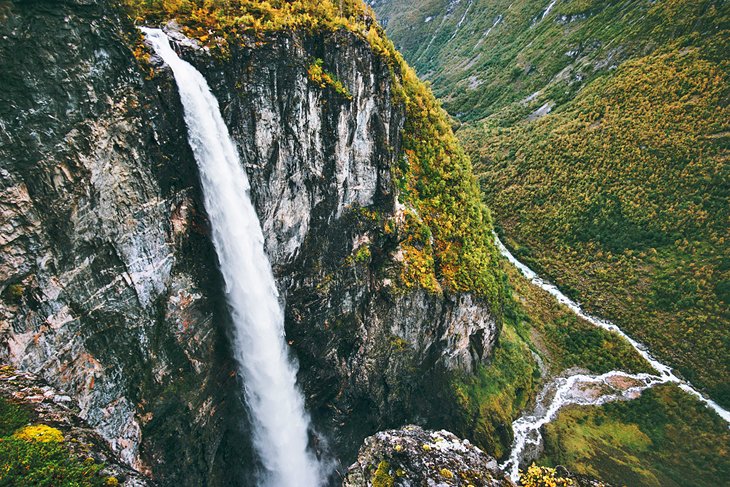
To the north of Årdalstangen, and also on the Årdalsvatn, Øvre Årdal is a great town from which to explore some of Norway's most spectacular waterfalls, including Vettisfossen. While a bit of a hike-the falls are a three- to four-hour walk up the Vettisgjel gorge-it's a must-do. Protected as a natural monument, Vettisfossen has a free fall of 274 meters, making it one of the highest waterfalls in Norway.
Other waterfalls in the area worth exploring include Feigumfossen in Luster, Kjosfossen in Flåmsdalen, and Kvinnafossen between Leikanger and Hella.
9. Kaupanger & Heibergske Samlinger Open-Air Museum
Situated at the head of the Amlabugt, an inlet on the north side of the Sognefjord, Kaupanger was once a Viking settlement. It has a wonderful 12th-century stave church built on the ruins of two previous churches.
Also worth visiting is its interesting open-air museum, Heibergske Samlinger, with displays of local life from the Middle Ages to the present. A number of boat cruise options are available.
Official site: www.dhs.museum.no/en/about-museum
Map of Attractions & Things to Do in Sognefjord
More Related Articles on PlanetWare.com
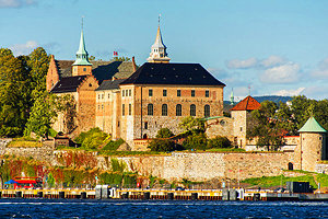
Big Cities: Norway's capital city of Oslo should definitely top your travel itinerary and is a delightful place to explore on foot, thanks to its wide, pedestrian-friendly streets and avenues, its many parks and public squares, and excellent pathways leading to top attractions such as the Royal Palace.
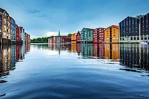
Bergen, Norway's second city, is another must-visit and is popular as a cruise ship port of call, as well as for its lovely natural harbor and many fun music festivals. Farther north, Trondheim-Norway's oldest city-is popular for its cultural attractions, shopping, and the historic Nidaros Cathedral.
Norway Vacation Ideas: Another area of outstanding natural beauty is the Hardangerfjord region, a popular destination since the 1800s for the dramatic scenery around the second biggest fjord in the country.
Equally attractive are the lovely Lofoten Islands, popular for their stunning hiking trails and scenic driving routes, and Tromsø, Norway's most northerly city, popular for visitors wanting to catch a glimpse of the amazing aurora borealis.
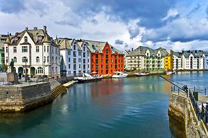
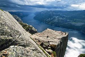
Other Norwegian Must-Sees: Another great tourist destination in Norway is the city of Stavanger, a cruise ship port popular for its famous rock formation known as the Preacher's Pulpit (Preikestolen). Also worth visiting is the city of Ålesund, famous for its well-preserved Art Nouveau architecture.