11 Top-Rated Tourist Attractions on the Lofoten Islands
Author Bryan Dearsley has traveled Norway extensively and especially enjoys visiting the Lofoten Islands where he has family.
While among some of the most remote places to visit in Scandinavia, the spectacular Lofoten Islands are well worth considering as you plan your Norwegian travel itinerary. The Lofoten's four main islands of Austvågøy, Vestvågøy, Moskenesøy, and Flakstadøy, together with a number of smaller islands, lie so close together that from a distance, they resemble a single mountain range.
It's only as you get closer that this spectacular northern European archipelago reveals itself. Surrounded by countless rocky islets, the islands are indented by numerous inlets and fjords with towering rock walls of up to 1,005 meters, posing an extremely dramatic vista especially if you're arriving by ferry or cruise ship.
The mountains themselves, some as high as 1,266 meters, are alpine, with characteristic steep-sided, snowcapped summits. Lofoten's many cliffs are perfect for nesting seabirds and other wildlife, while abundant marine life, such as migrating killer whales, provides another great reason to visit.
Despite being in the Arctic Circle, the Lofotens experience one of the world's largest elevated temperature variances relative to its latitude. Thanks to the Gulf Stream, the region has mild winters and warm summers, with weather not as severe as other such northerly regions.
In summer, the secluded beaches and snug fishing harbors draw sightseers, kayakers, and campers. Come winter, seeing the fantastic northern lights and skiing are popular things to do in the Lofoten Islands.
To learn more about one of the top destinations in Norway, be sure to read through our list of the top tourist attractions on the Lofoten Islands.
See also: Where to Stay in the Lofoten Islands
- 1. Svolvaer
- 2. The Svolvær Goat Trail
- 3. Lofotr Viking Museum
- 4. Trollfjord
- 5. Kabelvåg
- 6. Å
- 7. Røst Island
- 8. Reine
- 9. Rorbuer: Fishing Huts
- 10. Glasshytta: The Glassblower at Vikten Leknes
- 11. Lofoten War Memorial Museum
- Places to Stay in the Lofoten Islands for Sightseeing
- Tips and Tours: How to Make the Most of Your Visit to the Lofoten Islands
1. Svolvaer
Lofoten's largest town, Svolvaer has a population of 4,720 and is located on the south coast of Austvågøy. Well served by ferries and cruise ships from the mainland and elsewhere, this town is an important fishing port and is where most people begin their Lofoten adventure.
Svolvaer is a vibrant place to visit, especially around the harbor area with its many excellent cafés, bars, and restaurants. In addition to its shops and galleries, there are a number of excellent cultural attractions worth visiting, too.
Topping the list are the Lofoten War Memorial Museum with its displays relating to the wartime occupation and Magic Ice. The latter is a unique space where Lofoten life is illustrated in ice sculptures. You'll also want to visit the North Norwegian Artist's Centre, which has a continuously changing variety of artwork in varied media.
2. The Svolvær Goat Trail
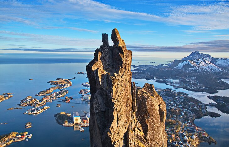
If you're a hiker or a mountain climber (or possibly a bit of both), check out the famous Svolvær Goat (Svolværgeita).
This unusual twin-peaked rock outcrop is visible from downtown Svolvaer and offers incredible views for those brave enough to perform the famous "Svolvær Goat leap." This daring 1.5-meter leap certainly isn't for the faint of heart, but it's not unusual if you do make it to the top, to see the occasional experienced climber perform it.
Although the steep climb to the base of the peak takes less than an hour, the services of a professional guide are highly recommended for those wanting to make their way to the top. If it's on your bucket list, expect to spend about four hours all told, including the hike, the climb, and rappelling back down this incredible rock formation.
Read More: Best Hikes in Europe
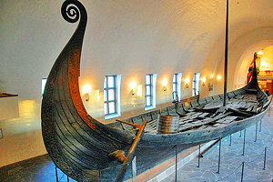
3. Lofotr Viking Museum
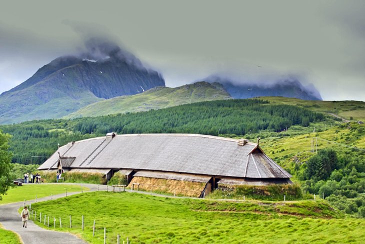
The Lofotr Viking Museum (Lofotr Vikingmuseum) at Bøstad on the island of Vestvågøy is a must-visit when in the Lofotens. The highlight is an authentic reconstruction of the 272-foot-long chieftain's house, the largest Viking-era building on record, that once stood on the site around 500 CE.
This excellent Viking adventure includes a superb short film about the life of the chieftain and his family, as well as interpretive tours of the house and the numerous artifacts discovered on the site during archeological digs.
Afterward, walk down to the adjoining lake to see the replica Viking vessels, including an impressive longship. If visiting in August, be sure to catch the Lofotr Viking Festival, which includes re-enactments and the chance to see these Viking vessels at sea. A café and museum shop are located on-site.
Address: Vikingveien 539, 8360 Bøstad
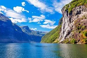
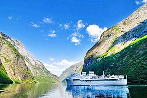
4. Trollfjord
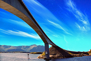
From the straits of Raftsund, a narrow, rocky opening gives access to the Trollfjord, one of Lofoten's most popular tour boat excursions. Towering over the fjord is the snowcapped Higravtinder (1,191 meters) and the jagged Trolltinder (1,045 meters) mountains, both rising high above the Trollfjord. This spectacular 3.2-kilometer-long mountain lake is usually frozen over.
Another popular day trip is by bus from Svolvðr to Stokmarknes and back by the express boat, which sails via the Trollfjord. Only 800 meters at its widest, it is quite the sight to watch cruise ships squeeze through the narrow gap during the summer months.
5. Kabelvåg
Kabelvåg, a small fishing village on Austvågøy, is a great place to learn more about the importance of fishing in Lofoten. Start with the Lofoten Museum (Lofotmuseet) with its displays of life in the 1800s, including the history of fishing on the islands, a collection of Nordland-type boats, and original fisherman's cabins.
The Lofoten Aquarium (Lofotakvariet) is also worth a visit. This popular attraction offers a chance to learn more about the area's marine life, including fish and sea mammals from Lofoten. Finally, be sure to also visit Vågan Church, the largest wooden church north of Trondheim.
Aquarium Address: Storvåganveien 28, 8310 Kabelvåg
6. Å
You could say all roads lead to Å, Lofoten's most westerly point. In addition to its spectacular views, this village on the island of Moskenesøy is home to the Norwegian Fishing Village Museum (Norsk Fiskeværsmuseum).
Exhibits include a working forge and stone oven bakery, the typical home of a fisherman, and traditional boats, as well as a gift shop with locally made products, including cod liver oil produced right at the museum.
Afterward, visit the Lofoten Stockfish Museum (Lofoten Tørrfiskmuseum) dedicated to Lofoten's most famous, thousand-year-old export. Made from the plentiful cod that spawn around Lofoten's shallow waters, stockfish is everywhere on the islands, left to cure during the colder months on countless drying racks, and forming the basis for many of Lofoten's excellent fish dishes.
Address: Å vegen 5, 8392 Sørvågen
7. Røst Island
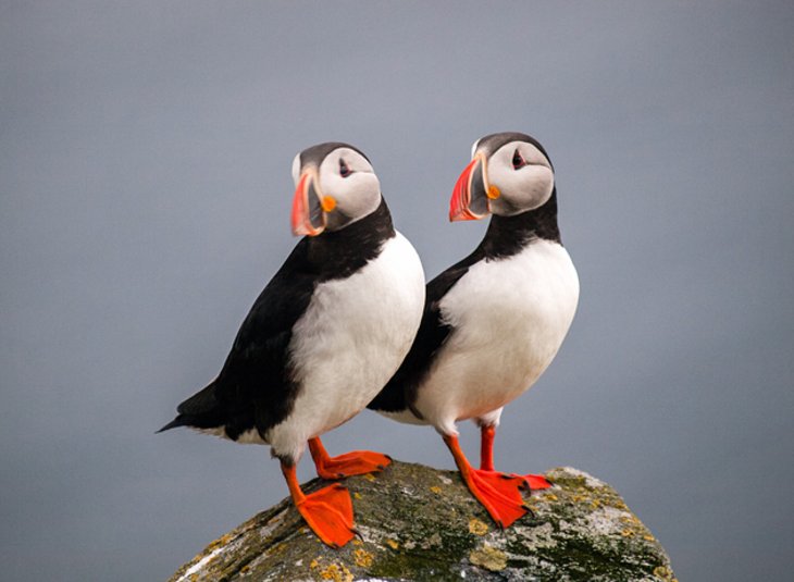
Accessible only by boat, the remarkable Røst Island (Røstlandet), located about 99 kilometers from the mainland, is home to a large colony of seabirds, including some three million puffins. Thanks to its remoteness, the island's high crags, named Vedøy, Storfjell, Stavøy, and Nykan, are perfect homes for many rare species, such as the greater and lesser storm petrels and fulmars.
All told, a quarter of Norway's seabird population lives on the island, a fact that makes the trip by boat from Røstland all the more worthwhile. As a result of this abundance of wildlife, much of the island has been designated a conservation area.
While there, be sure to also visit the Skomvær Lighthouse (Skomvær fyr). Built in 1887, it's considered to be the Lofoten's most remote Atlantic outpost.
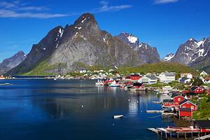
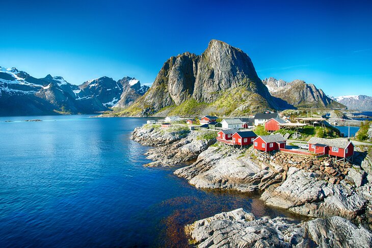
8. Reine
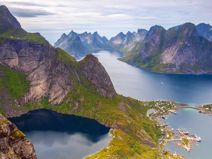
Often cited as the most beautiful village in Norway, Reine, which literally translates as "Queen," is a picturesque fishing community located on Moskenesøy. This popular tourist attraction has long been a favorite haunt of painters and climbers due to its spectacular fjord and mountain views.
The high ground above the village offers superb views of the Moskenesstrømmen, a maelstrom described by Jules Verne and Edgar Allan Poe and considered one of the strongest such whirlpools in the world. For a close-up view of the maelstrom, take one of the many exciting boat trips through Moskenstraumen.
Address: Reine, Moskenesøy
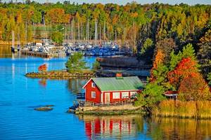
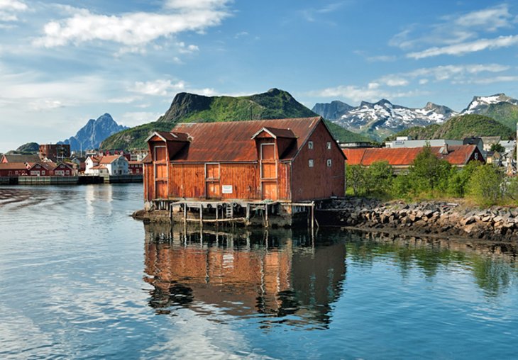
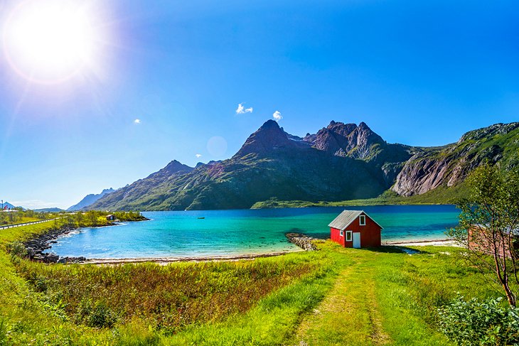
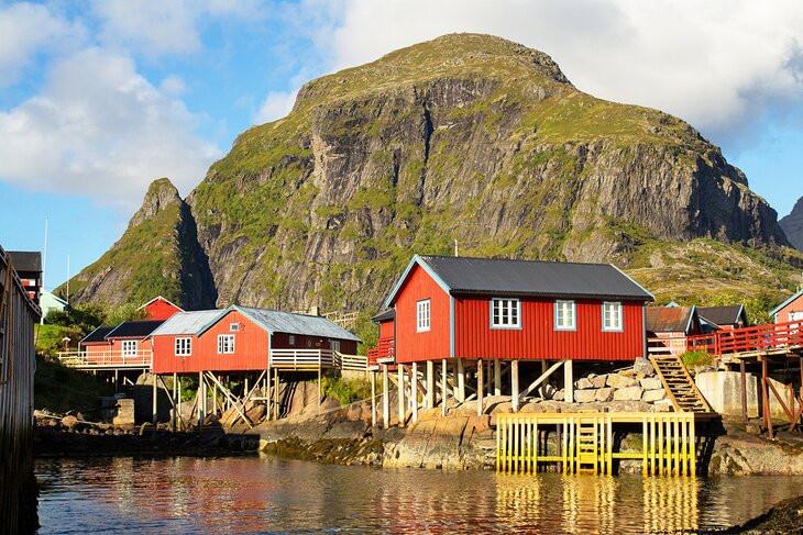
9. Rorbuer: Fishing Huts
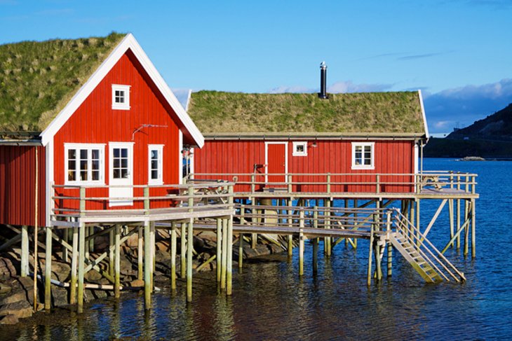
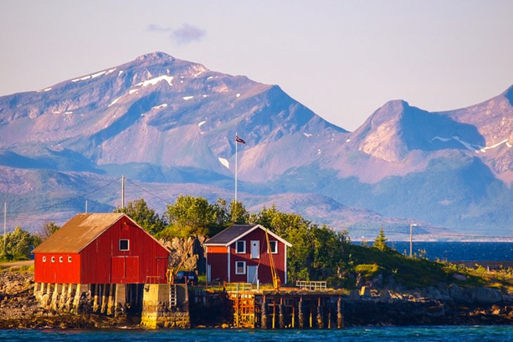
For a truly unforgettable experience, treat yourself to a stay in one of Lofoten's iconic red fishing huts. Perched high above the tidal waters in countless fishing villages around Lofoten, many of these "rorbuer" (or "sjøhus") have been converted into accommodations and are perfect for use as a base to explore the area.
Originally built to provide simple overnight shelter for fishermen, many of these wharf buildings, often two or three stories high, are now available for rent. Accommodations run from basic, which means a few bunks and a stove, to luxurious fully catered suites.
10. Glasshytta: The Glassblower at Vikten Leknes
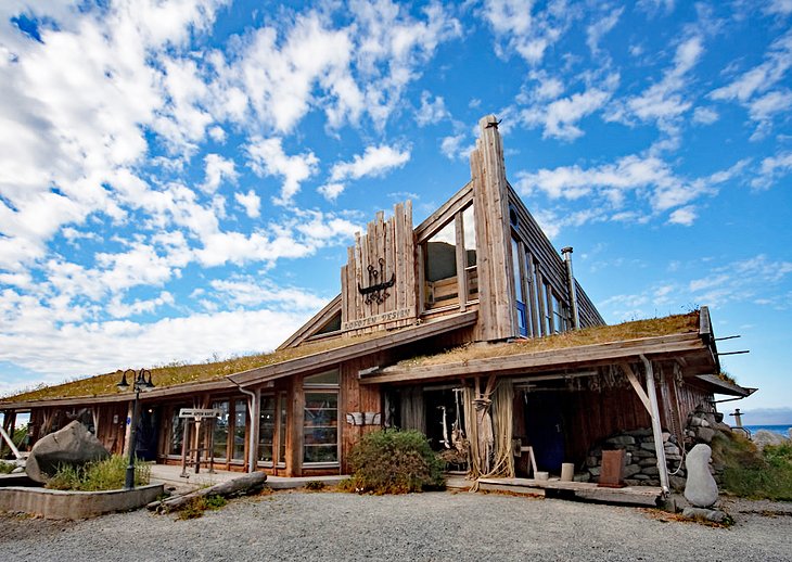
Northern Norway's first glassblower, artist Åsvar Tangrand, began to create blown glass artwork and items after being inspired by the beautiful surrounding landscape of Vikten. Tangrand's work quickly became known throughout Norway for the techniques he developed and his trademark symbol "Lofotruna."
The studio, named Glasshytta, is a quirky group of attached buildings that are worth visiting even if you're not in the market for glassware. The studio is also home to a pottery workshop, as well as a cozy coffee shop, and visitors can tour the grounds.
Address: Gnr 34 Bnr 22, 8382 Napp
11. Lofoten War Memorial Museum
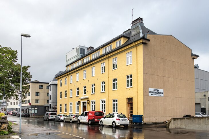
The Lofoten War Memorial Museum (Lofoten Krigsminnemuseum) is well worth visiting for military enthusiasts and history buffs alike. This fascinating museum features a sizeable collection of WWII-era uniforms and artifacts related to the WWII period and the Nazi occupation of the islands.
In addition to exhibits portraying the role of the Norwegian resistance, it also includes displays relating to the lives of everyday citizens during the German occupation.
Address: Fiskergata 3, 8300 Svolvær, Norway
Places to Stay in the Lofoten Islands for Sightseeing
Most of the accommodation on the remote Lofoten Islands consist of charmingly-restored fishermen's cabins called "Rorbu," and private vacation rentals. The port town of Svolvær, on the south side of Austvågøy, is the archipelago's largest town and home to the Lofoten War Memorial Museum and the distinctive twin-peaked rock outcrop called Svolvær Goat. This town is a great place to stay, as is picturesque Henningsvær, a fishing village known as the Venice of the Lofoten. Ballstad, on a small island off the southwestern tip of Vestvågøya is one of the archipelago's largest fishing villages and also makes a great base. Here are some hotels and specialty lodging options in these convenient locations:
- On the waterfront in Svolvær, the pet-friendly Lofoten Suite Hotel features gorgeous views of the islands and sea and it's only three minutes on foot from Magic Ice, a gallery with evocatively-lit ice sculptures. Amenities in the hotel include a hip restaurant, bakery, and cafe. The sleek and contemporary two-bedroom suites are great for families and longer stays, but note that the one-bedroom suites share a living area with guests in a bedroom on the other side.
- About eight minutes by car from Svolvær, in the town of Kabelvåg, the Lofoten Rorbusuiter offers delightful seaside apartments and cottages with fully-equipped kitchens.
- Options for specialty lodging in Ballstad include the budget-priced Villa Ballstad, a large, bright house with a shared kitchen and bathrooms, and Solsiden Brygge, which are modern apartments in restored fisherman's cottages with views of the sea and crags.
Tips and Tours: How to Make the Most of Your Visit to the Lofoten Islands
- The Lofoten Islands in a Day: Those who only have a limited time in the area can see the highlights on a guided tour of the Lofoten Islands. Operating in the summer months, when the light and temperature are more favorable, this full-day small-group tour lasts five to six hours, exploring top attractions like the picturesque fishing villages of Kabelvåg and Henningsvær, Viking archaeological sites, and even the white beaches of Haukland.
- The Sightseer's Dream: The varied landscapes and cultural heritage of the Lofoten Islands make it a popular subject for both professional and amateur photographers, as well as tourists and sightseers. The Summer Cruise and Tour of Lofoten will take you to some of the best scenery on the island and allows plenty of opportunity for you to get your photography fix.
More Related Articles on PlanetWare.com
Northern Lights and the Midnight Sun: The northernmost city in Norway, the city of Tromsø is an important fishing center, as well as a port for tourists who want to witness the stunning aurora borealis and explore other top tourist attractions. Located about 217 miles north of the Arctic Circle, visitors can experience the eerie midnight sun from May through mid-July. Tromsø is also located near the borders of both Sweden and Finland, where you can explore Swedish Lapland, home to Abisko National Park, as well as the Finnish Lapland.
Norway's Biggest Fjords: Stretching into the mainland along the southwestern coast of Norway are its two largest fjords. The Sognefjord is the biggest, stretching 127 miles from Sygnefest to Skjolden, where it splinters into narrower inlets. To the south, just past the historic city of Bergen, is the country's next largest, Hardangerfjord. The Hardangerfjord area has been a top tourist destination since the second half of the 19th century, known for its glacial waterfalls.
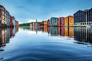
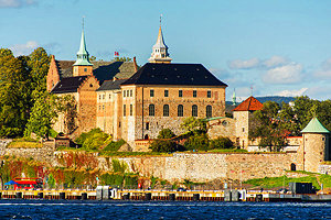
Urban Norway: Norway's largest city and one of the biggest capitals in the world, Oslo is known for its historic tourist attractions and things to do, from museums to music and theater. Trondheim, founded by Vikings in 997 CE, is the country's second-largest city and conveniently located on the Hurtigruten ferry line, which connects with Bergen and other coastal cities via Trondheimsfjord. Stavanger is also a thriving metropolis, situated on the southwest coast of Norway and known for its annual music festivals and numerous museums.