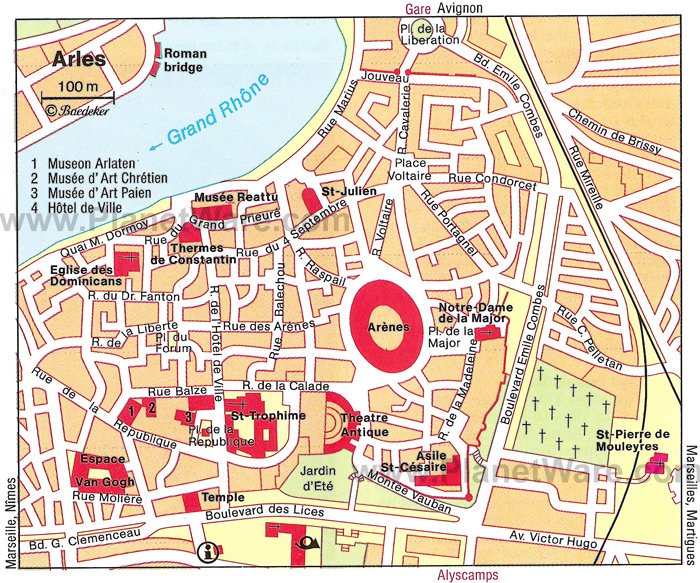
11 Top-Rated Tourist Attractions in Arles
In the heart of Provence, Arles offers distinctive Provençal character and small-town charm. Thanks to its relaxing atmosphere, Arles is a pleasant place to explore. The narrow pedestrian streets and tree-lined public squares invite you to take leisurely strolls, then relax at the shaded terraces of outdoor cafés.
Despite its slow-paced southern-French lifestyle, Arles inspires sightseeing at a fast clip. There are so many attractions to see: wonderfully preserved ruins, including the ancient Arena, Roman Theater, the Forum, and the Baths of Constantine. These archaeological sites make Arles one of the best places to visit in Provence for a glimpse of the region's Roman heritage.
Art lovers will want to follow in the footsteps of Vincent van Gogh by visiting the scenes of the artist's famous paintings. For more ideas on things to do, read our list of the top attractions in and around Arles.
See also: Where to Stay in Arles
- 1. L'Amphithéâtre Romain (Les Arènes d'Arles)
- 2. Les Alyscamps
- 3. Cloître Saint-Trophime
- 4. Théâtre Antique
- 5. Musée Départemental Arles Antique
- 6. Van Gogh Self-Guided Walking Tour
- 7. Thermes de Constantin
- 8. Musée Réattu (Musée des Beaux-Arts d'Arles)
- 9. Place de la République
- 10. Fondation Vincent van Gogh Arles
- 11. Place du Forum
- Where to Stay in Arles for Sightseeing
- Best Day Trips from Arles
- Avignon
- Nîmes
- The Camargue
- Les Baux-de-Provence
- Abbaye de Montmajour, a Romanesque Pilgrimage Church
- Tips and Tours: How to Make the Most of Your Visit to Arles
1. L'Amphithéâtre Romain (Les Arènes d'Arles)
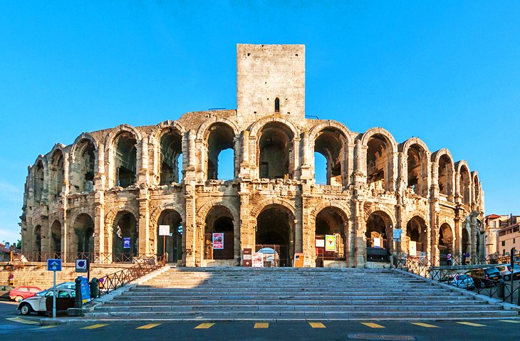
The UNESCO-listed Roman Amphitheater (les Arènes d'Arles), dating back to the 1st century CE, is the largest and best-preserved ancient monument in Arles. With a length of 136 meters and a width of 107 meters, the arena was one of the largest in Gaul and could accommodate around 21,000 spectators.
The facade has a double row of arcades with 60 archways and four arches used as main entrances. Seating for the spectators was once on 33 rows of tiered steps. The arena was actually built into the bedrock of the site, and in Roman times, the stone seats were covered with wooden planks.
During the Middle Ages, towers were added to the arena. Visitors can climb to the top of the tower over the entrance for a wonderful view of the old town of Arles and the nearby ancient theater. The amphitheater is still used today as an open-air venue for bullfights, reenactments of gladiator fights, music concerts, and shows.
Address: 1 Rond-Point des Arènes, Arles
Read More: Best Places to Visit in the South of France
2. Les Alyscamps
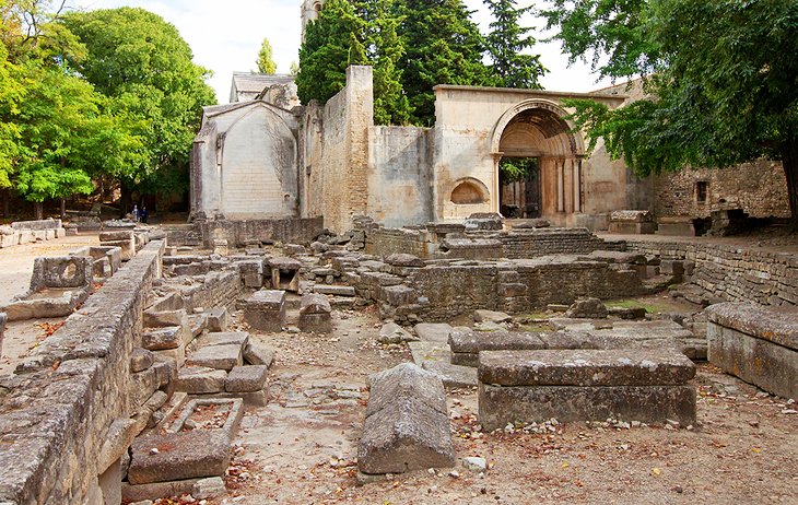
Another UNESCO-listed site, Les Alyscamps reveals the remains of ancient Arles' vast Gallo-Roman necropolis. This site was also an important stop on the Way of Saint James medieval pilgrimage route to Santiago de Compostela in Spain, because of a priory installed here around the year 1040.
In the Middle Ages, the Alyscamps was so revered that the dead were brought here for burial from considerable distances. Dante refers to this necropolis in his Inferno. Only the plain stone tombs remain; more ornate examples are on display at the Church of Saint-Trophime.
At the end of the Allée, visitors arrive at the 12th-century Church of Saint-Honorat. In the side chapel on the left, lies a beautiful sarcophagus dating from the 4th century CE.
In October 1888, Vincent van Gogh captured the Alyscamps in several paintings. Around the same time, Paul Gauguin also created two paintings of the Alyscamps.
The site is open year-round, with longer hours during summertime. Entrance requires an admission fee.
Address: Avenue des Alyscamps, Arles
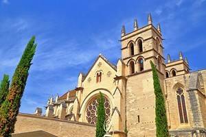
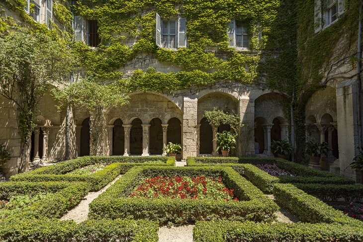
3. Cloître Saint-Trophime
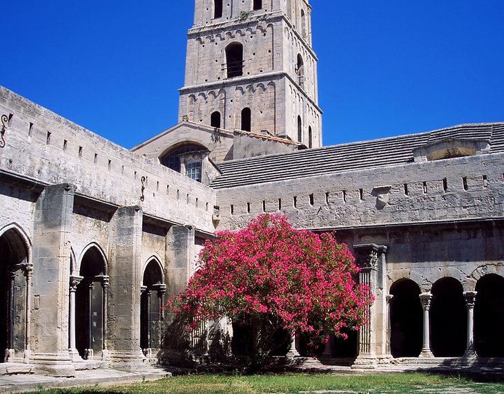
The Cloître Saint-Trophime is a masterpiece of Provençal Romanesque architecture. This UNESCO-listed monument was constructed between the 12th and 14th centuries.
The cloister features pairs of pillars with beautifully carved capitals. Upon closer observation, the finely detailed sculptures reveal biblical scenes, including the life of Christ and Saint Trophime.
The medieval cloister adjoins the Church of Saint-Trophime and is accessible by way of the church's courtyard. The adjacent Eglise Saint-Trophime also exemplifies Romanesque architecture with its marvelous intricately sculpted portal, featuring a theme of the Last Judgment.
Along with Les Alyscamps, the Church of Saint-Trophime was a stop on the Chemin de Saint Jacques medieval pilgrimage route to Santiago de Compostela in Spain.
The cloister and the church are dedicated to Saint Trophime. An important local historical figure, Saint Trophime was the first bishop of Arles during the early Christian period.
The Cloître Saint-Trophime welcomes visitors daily (except holidays) year-round. Entrance requires an admission fee.
Address: Place de la République, Arles
Read More: Top-Rated Attractions of Parc Naturel Régional du Luberon, Provence
4. Théâtre Antique
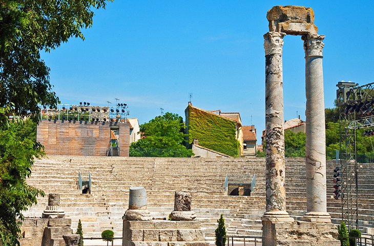
Not as well preserved as other ancient sites in Arles but still interesting, the UNESCO-listed Théâtre Antique (Roman Theater) was built in the 1st century BCE during the rule of Augustus. The theater could accommodate a crowd of 10,000 people in 33 rows of seats.
Archaeologists have discovered that the theater's stage was sumptuously decorated with marble columns and statues. The Musée Départemental Arles Antique displays some of the objects that were excavated here, including an enormous statue of Augustus.
During the early Middle Ages, the theater was used as a quarry, and the town wall was built with the material it provided.
The Théâtre Antique is open year-round daily, except for January 1st and December 25th. The theater also serves as a venue for outdoor performances and cultural events during the summer.
Address: Rue de la Calade, Arles
5. Musée Départemental Arles Antique
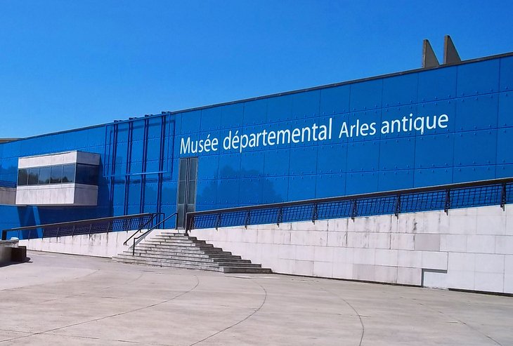
If you are interested in ancient history and archaeology, the Departmental Museum of Ancient Arles is a must-see destination. The museum occupies a striking contemporary building on the remains of the ancient Roman circus.
The museum's wealth of art and everyday objects reflects Arles' status as one of ancient Rome's most important colonial outposts. Featuring a wide range of exhibits, the museum's collection includes mosaics, statues, and other objects offering insight into daily life during Roman times.
The Musée Départemental Arles Antique is open Wednesday through Monday from 10am until 6pm and closed on Tuesdays, January 1st, May 1st, November 1st, and December 25th. The first Sunday of every month, entrance is free of charge. From July 9th through August 30th, guided tours in English are available on Thursdays at 3pm.
Address: Presqu'île du Cirque-Romain, Arles
6. Van Gogh Self-Guided Walking Tour
Follow in the footsteps of Vincent van Gogh by visiting the sites where he created some of his most well-known works. The Van Gogh Pedestrian Path indicates 11 of Van Gogh's painting sites. Pick up a map of the pedestrian circuit at the Tourist Office of Arles (9 Boulevard des Lices).
Highlights of this self-guided walking tour include the outdoor café on the Place du Forum (now the Café Van Gogh) that provided the scene for the Café Terrace at Night (Terrasse du Café le Soir) painting, and the location of the celebrated Starry Nights (La Nuit Etoilée) painting.
Read More: Top-Rated Day Trips from Marseille
7. Thermes de Constantin
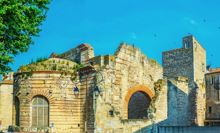
Visit the ancient Roman ruins of an extensive bathing complex, which was once as elaborate and pampering as any modern-day spa.
The Thermes de Constantin (Baths of Constantine) is a UNESCO-listed 4th-century CE bathing complex. During Roman times, the complex served as a place where people could socialize, exercise, bathe, and relax, and even get massage treatments.
The site is open every day (for an admission fee). You can see remains of the Caldarium ("hot bath"), parts of the underfloor heating system, and the Tepidarium ("warm air room" that functioned as a steam room).
Address: Rue Dominique Maïsto, Arles
8. Musée Réattu (Musée des Beaux-Arts d'Arles)
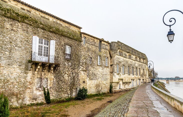
The Musée Réattu (Arles Fine Arts Museum) is housed in a magnificent Renaissance building that was once the Grand-Prieuré de l'Ordre de Malte (Grand Priory of the Knights of Malta). The 15th-century building is found in an inspiring spot, overlooking a bend in the Rhone River.
The museum exhibits paintings by Jacques Réattu, who purchased the Grand Priory building in 1796 and lived here for about 30 years. Réattu was a renowned Peintre d'histoire, the esteemed French classification for a History Painter. Réattu painted historical, biblical, and mythological subjects in a realistic yet aesthetically pleasing way.
Contemporary art is also well represented at the museum. There is a noteworthy assortment of artworks by Pablo Picasso. Many of the Picasso pieces on display are painted in his characteristic whimsical, humorous style. Several paintings feature Picasso's evocative images of musketeers and harlequins.
The museum is open year-round from Tuesday through Sunday. Closed on Mondays, January 1st, May 1st, November 1st, and December 25th. Admission is free of charge on the first Sunday of every month.
Address: 10 Rue du Grand Prieuré, Arles
9. Place de la République
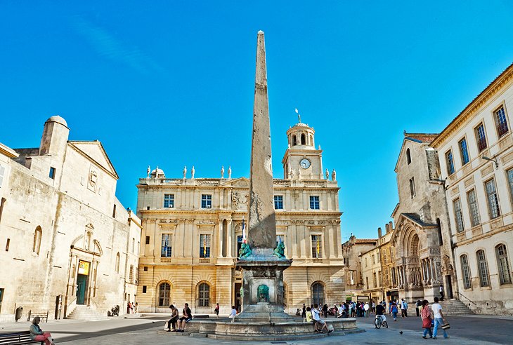
At the heart of Arles, the Place de la République centers around an ancient Egyptian obelisk that is 15 meters high. The obelisk was found in the amphitheater and placed here in 1676.
On the north side of the square stands the Hôtel de Ville (Town Hall), an elegant building constructed between 1673 and 1675. Its bell tower dates from 1553 and came from the building that previously stood on the site.
10. Fondation Vincent van Gogh Arles
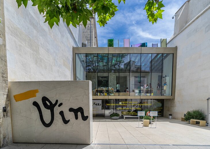
The Fondation Vincent van Gogh Arles explores the influence of Vincent van Gogh on 19th-century and 20th-century art. The gallery space displays themed exhibits. Many exhibits feature contemporary artworks alongside influential paintings by Van Gogh.
Not to be missed, the rooftop terrace affords beautiful views of the city. The Fondation also has a gift shop/bookstore.
Address: 35 ter, Rue du Docteur Fanton, Arles
11. Place du Forum
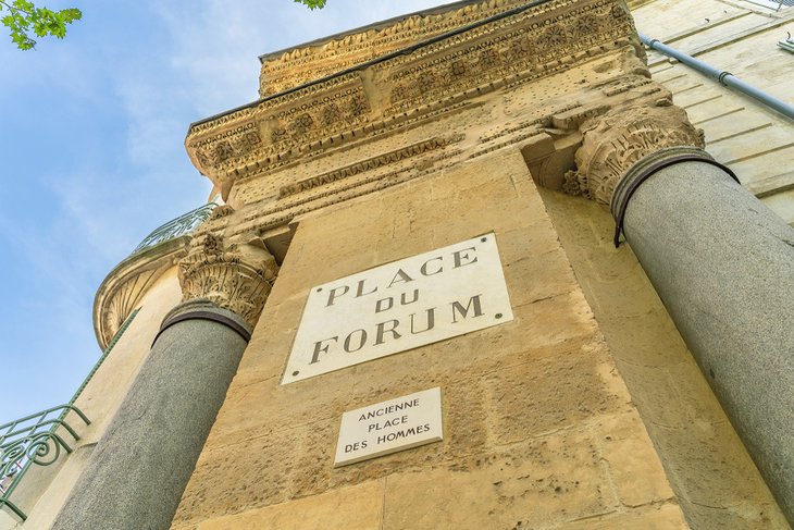
Vincent van Gogh depicted a café on the Place du Forum in his famous painting Le Café Le Soir (Café Terrace at Night). On the pleasant tree-lined square, the café's outdoor terrace still has the same enchanting ambience captured by Van Gogh. This café is today called the Café Van Gogh.
Another point of interest: The Place du Forum was the Roman-era town center. Part of an ancient building with weathered Corinthian columns is visible in one corner of the square.
Where to Stay in Arles for Sightseeing
The historic center of Arles is compact and easily walkable, and most of the tourist attractions lie within an easy stroll of each other. For sightseeing, this is the best place to stay. Many of the hotels here offer parking nearby, some for a fee. Here are some highly rated hotels in this convenient and central location:
Luxury Hotels:
- About a 10-minute walk from the Roman Amphitheater, the five-star Hotel Jules Cesar blends old and new in a former 17th-century convent with chic decor designed by Christian Lacroix. Other amenities include an outdoor pool, a spa with a sauna and hot tub, and a gourmet restaurant.
- L'Hôtel Particulier is a five-star hotel that features luxurious modern guest rooms in a historic building. The hotel has a delightful garden courtyard (where breakfast is served) and an outdoor pool. Other amenities include a spa, concierge, and room service.
Mid-Range Hotels:
- On a quiet street near the Roman Amphitheater, the Hôtel de l'Amphithéâtre offers comfortable accommodations in a renovated 17th-century building. Some rooms have rooftop views.
- Near the Roman Amphitheater, the Hôtel Spa Le Calendal features cheerful contemporary-style decor. Guests will appreciate the hotel's spa and hammam, sandwich bar, and garden courtyard dining.
- A short walk from the Fondation Vincent van Gogh, Le Cloître is known for its welcoming staff, eclectic interior decor, and sunny rooftop terrace. Guest rooms have either freestanding bathtubs or Italian showers.
Budget Hotels:
- Steps away from the Musée Réattu, the Hôtel du Musée provides stylish accommodations in a quaint historic mansion. The hotel has two courtyard patios where breakfast and refreshments are served.
- On a tree-shaded square near the Roman Amphitheater, the Hôtel La Muette occupies a renovated 14th-century hôtel particulier (mansion). Guest rooms feature antiques and modern furnishings and ceilings with exposed wooden beams. This family-run hotel offers homemade breakfasts that include excellent coffee, fresh-baked cakes, pastries and bread from a local bakery, artisanal jam, and seasonal fruit.
- The affordable ibis budget Arles Palais des Congrès has an outdoor swimming pool, garden, and free parking. The hotel is about a 10-minute taxi ride from the tourist attractions in the old town of Arles.
Best Day Trips from Arles
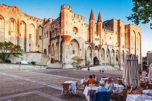
Avignon
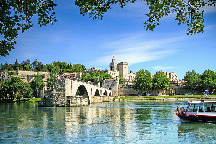
Tourists flock to Avignon to visit the UNESCO-listed Palais de Papes, a remarkable fortress-like palace that was built in the 14th century. Between 1309 to 1377, seven Popes lived in lavish quarters of the Palais de Papes.
Avignon's other must-see attractions include the Pont d'Avignon (Saint Bénézet Bridge) and the Musée du Petit Palais, which displays masterpieces of medieval and Renaissance art.
Arriving at Avignon from Arles (43 kilometers away) takes about 50 minutes by car and less than 20 minutes by train.
Across the river from Avignon (three kilometers away) is Villeneuve-lès-Avignon, with a splendid Carthusian Monastery. Also worth a detour, the medieval village of Châteauneuf-du-Pape is perched on a hilltop about 20 kilometers away from Avignon. Slightly farther north (10 kilometers from Châteauneuf-du-Pape) is Orange, a Provençal town renowned for its ancient Roman ruins.
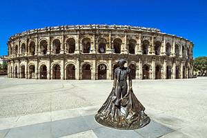
Nîmes
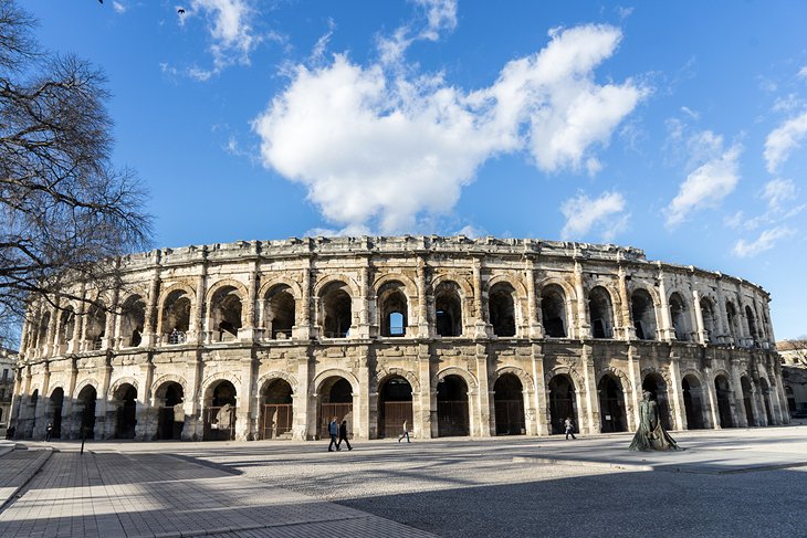
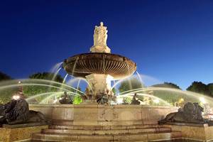
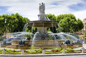
Nestled in the foothills of the Languedoc region, Nîmes has a lovely historic center with shady, tree-lined streets and squares that feature gushing fountains, typical of Southern France. Outdoor cafés in the pedestrian areas add to the appealing ambience.
One of Nîmes' top attractions is the Arènes, the best-preserved of all existing ancient Roman amphitheaters. This 1st-century amphitheater is now used as an open-air venue for music concerts and cultural events.
For the most relaxing and enjoyable experience, take a guided tour of Nîmes. The Private Day Trip to Nimes is a customizable tour of Nîmes that includes a visit to the Pont du Gard aqueduct, a UNESCO World Heritage Site.
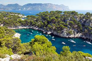
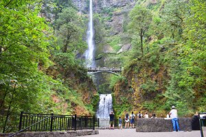
The Camargue

The Camargue is a wild and unspoiled region of Provence, protected as a natural regional park (the Parc Naturel Régional de Camargue) and a UNESCO Biosphere Reserve. Vast open spaces, lagoons, and wetlands characterize this unique landscape that is less than 20 kilometers from Arles.
An incredible variety of bird species inhabit the marshlands. For many visitors, a highlight of visiting the Camargue is the chance to spot pink flamingos.
Les Baux-de-Provence
Listed as one of France's Plus Beaux Villages (Most Beautiful Villages), this ancient hilltop town feels a world away but is just a 30-minute drive from Arles. One of the most enjoyable things to do in Les Baux-de-Provence is to wander the quaint, old streets and soak up the medieval ambience.
The most striking aspect of Les Baux-de-Provence is its dramatic location on a rocky outcrop. The vantage point affords breathtaking panoramic views of the Provence countryside.

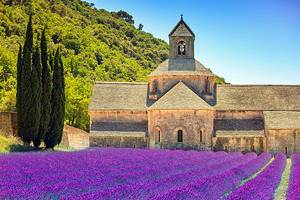
Abbaye de Montmajour, a Romanesque Pilgrimage Church
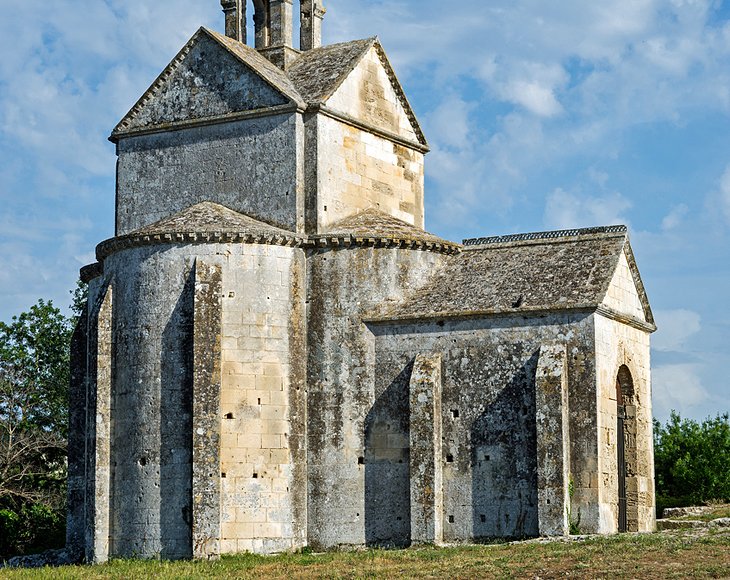
In the countryside, about a 15-minute drive from Arles, this monumental abbey is the perfect spot to meditate and contemplate the spiritual heritage of the Benedictine monks. Perched on a rocky hill like a fortress, the Abbey of Montmajour was an important place of pilgrimage throughout the Middle Ages.
The abbey has an immense Romanesque crypt dating back to the 12th century and an austere single-aisled church. Built in 1369, the abbey's cloisters exemplify serene Romanesque design with rows of double pillars.
Address: Route de Fontvieille, Arles
Tips and Tours: How to Make the Most of Your Visit to Arles
- Tour of Van Gogh Sites in Arles from Avignon: Art enthusiasts will appreciate the Private Provence Tour: In the Footsteps of Van Gogh. On this four-hour excursion, an expert guide shares details about Van Gogh's life while covering an itinerary of landmarks in Arles that inspired some of his most famous paintings. The tour also stops at ancient Roman sites, such as Arles Amphitheater.
- Camargue Tour from Avignon: The Small-Group Tour to Arles and the Camargue is a popular tour among nature lovers. This full-day guided tour includes transportation by minivan, wildlife spotting at the Camargue nature preserve, and visits to UNESCO-listed sites in Arles.
More Related Articles on PlanetWare.com
Quintessential Provence: At the center of Provence, Arles is a great place to begin exploring the region. Several interesting historic towns are within easy travel distance: the medieval city of Avignon, renowned for the UNESCO-listed Palais de Papes, is one hour by train; the ancient Roman ruins of Orange are 30 minutes by train; and Nîmes is one hour by train.
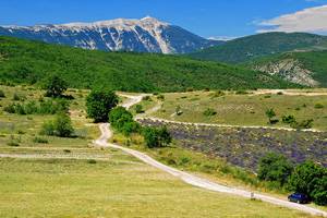
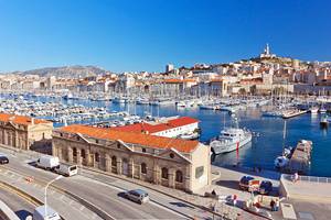
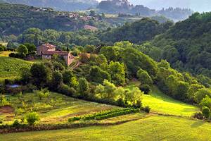
Less-Touristy Places to Visit: In the Provençal countryside, the Haut-Vaucluse area is dotted with picturesque perched villages such as Gordes, about a one-hour drive from Arles. Farther off-the-beaten tourist path, Vaison-la-Romaine (about a 90-minute drive away) is renowned for archaeological sites and summertime festivals. For a taste of real life in Provence, the seaside metropolis of Marseilles (less than one hour from Arles by train) is the place to go.