Bicycling the Columbia River Gorge from Portland
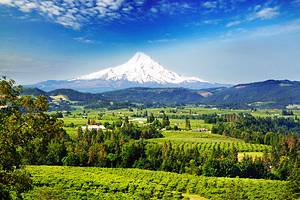
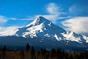
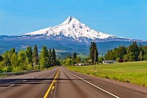
The Columbia River Gorge cuts through the Cascade Mountains separating Oregon and Washington in the Pacific Northwest. This eye-popping river corridor served as a vital connection to the Pacific Ocean for the Corps of Discovery in 1805, and today, it's a mecca for outdoor recreation, including windsurfing, waterfall hiking, and one of the best multi-use paths in the Pacific Northwest – The Historic Columbia River Highway State Trail.
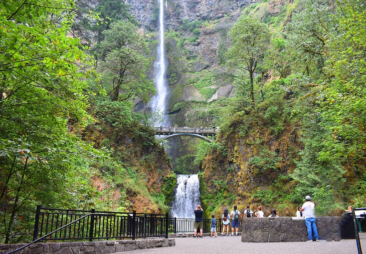
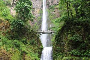
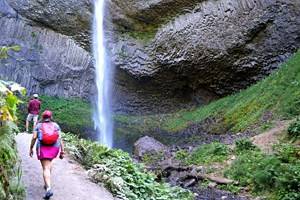
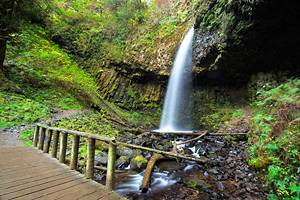
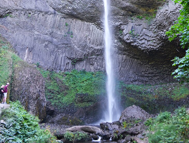
Portland, Oregon, is less than thirty miles from downtown to some of The Gorge's most significant attractions, including Multnomah Falls, receiving an estimated two million visitors annually. This short commute and heavy crowds make bringing a bicycle to The Gorge a great adventure option without ever having to worry about parking.
Bicycling to The Gorge from Portland is possible, and an additional car-free solution is hopping aboard the Columbia River Gorge Express, equipped with enough bike racks to transport a small peloton. Multiple shuttles run throughout the day and deliver hikers and bikers to three Gorge destinations, where the HCRH State Trail lends access to even more.
- Biking to the Columbia River Gorge from Portland
- Hop Aboard the Columbia River Gorge Express Shuttle Service
- The Historic Columbia River Highway State Trail
- Some of the State Trail Shares the Road with Vehicles
- Suggested Bicycle Day Trips in the Columbia River Gorge
- Bike Rentals in the Columbia River Gorge
Biking to the Columbia River Gorge from Portland
Troutdale and the beginning of the Historic Columbia River Highway is approximately 15 miles east of downtown Portland. This distance can be covered by a city bus or bicycling along any one of the city's several neighborhood greenways. City-spanning bike paths like the Springwater Corridor Trail, Interstate Pedestrian trails, or the bike trail along Marine Drive might also be a part of the route, depending on where in the city you are starting.
The Historic Columbia River Highway spans over 70 miles east of Troutdale, requiring quite a feat to bike in a day. But it's less than 20 miles from Troutdale to significant area attractions, including Multnomah Falls. And with the Columbia River Gorge Express available to shuttle bicycle riders back to Portland, it doesn't have to be a grueling round trip to enjoy the Gorge on Bicycle from Portland.
Hop Aboard the Columbia River Gorge Express Shuttle Service
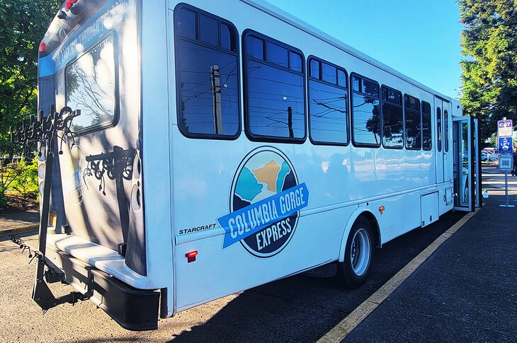
The Columbia River Gorge Express shuttle departs from the Gateway Transit Center in Portland and stops at three excellent adventure destinations in The Gorge. Ten shuttles run daily between the Gateway Transit Center, stopping at Multnomah Falls, Cascade Locks, and Hood River before turning around and making the stops back to Portland.
The entire route from Portland to Hood River takes just over an hour, while the ride from Portland to Multnomah Falls is less than thirty minutes. Strapping a bike to the front or rear rack of the bus is easy, and the ride is stress-free as you look out the windows to see the Gorge rolling by. Each stop of the shuttle bus also connects to the HCRH State Trail, offering easy access to the rest of the region.
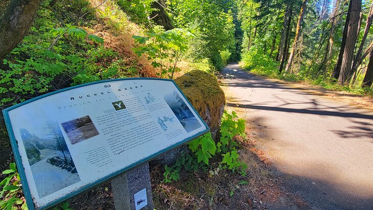
The Historic Columbia River Highway State Trail
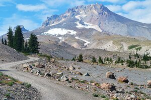
The original Columbia River Highway was completed during the dawn of the Motor Age in America in 1922, Today, the "King of Roads" spans approximately 74 miles between Troutdale and The Dalles, paralleling much of Interstate 84. The route is the country's oldest scenic highway, although it's not entirely intact, not for automobiles at least.
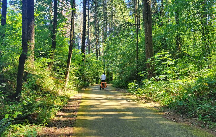
But for bicycle riders on the State Trail, which connects each gap in the historic highway with a non-motorized path, it's almost 80 miles of uninterrupted pavement. This paved path connects pedestrians with hiking trails, campgrounds, and rushing waterfalls.
Some of the State Trail Shares the Road with Vehicles
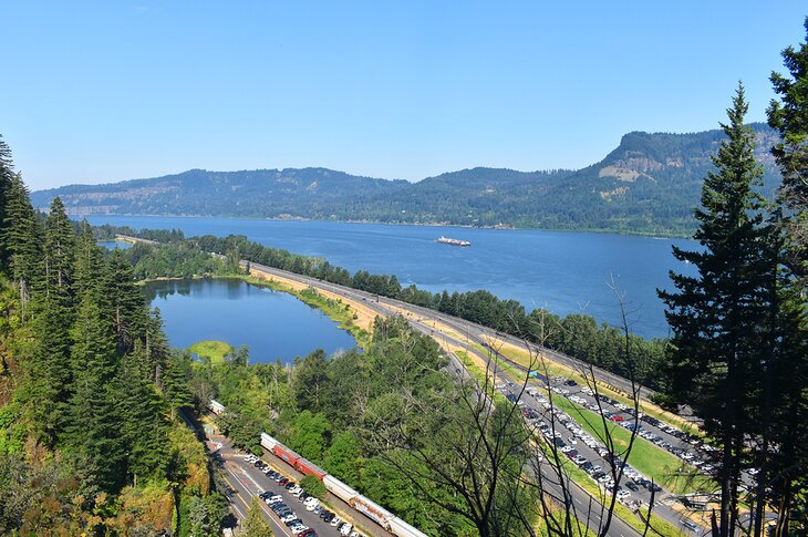
The entire State Trail follows the historic highway, with most of the route open to vehicles. The maximum vehicle speed limit is 35 mph, and several signs remind everyone to share the road. The most common congestion occurs around the sections surrounding Multnomah Falls.
The vehicle-free sections of the State Trail comprise three "ribbons" where the old highway is no longer drivable. A multi-use path is now in place of these missing highway segments, each around five miles long. And, in 2024, the state is expected to unveil the new pedestrian-only Mitchell Tunnel expansion to the trail, connecting two ribbons and eliminating the only portion of the State Trail currently on the shoulder of Interstate 84.
Suggested Bicycle Day Trips in the Columbia River Gorge
Troutdale to Multnomah Falls
- Best if you want to skip the Shuttle Bus
- Distance: 17 miles – around 1,000 feet of elevation gain
This first segment of the Columbia River Gorge National Recreation Area from Troutdale is a great option for those looking to explore the Gorge without a shuttle ride. Most bicyclists start at Lewis and Clark State Recreation Site on the other side of the Sandy River from Troutdale. The entire route shares the road with vehicles, and bicyclists should expect increased congestion the closer they get to Multnomah Falls.
Multnomah Falls to Cascade Locks
- Best to See the Most Iconic Waterfalls
- Distance: 14 miles - around 800 feet of elevation gain
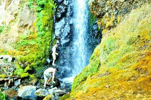
Several waterfalls line this popular route, split between shared vehicle traffic near Multnomah Falls and a pedestrian multi-use path heading into Cascade Locks. You can get off at either shuttle stop and head in either direction. Other attractions worth pulling over for include the roadside Horsetail Falls and the iconic Eagle Creek Trail.
Read More: Best Waterfalls near Portland
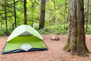
Cascade Locks to Viento State Park
- Best for Bicycle Camping
- 11 miles, 1,200 feet elevation gain
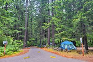
Visitors should head east from Cascade Locks along this route, following the bike lane through town. The route quickly picks up the HCRH and, about six miles in, converts to a multi-use path with no vehicles allowed. Competitive campsites are available at Wyeth Campground about halfway through, and easier-to-get campsites are found at Viento State Park at the end of the route.
Hood River to the Columbia River Gorge Discovery Center
- Best for a Bicycling Challenge
- Distance: 21 miles, 1,200 feet of elevation gain (42-mile round-rip, 2,600 feet elevation gain)
The final section of the HCRH State Trail is a quieter but challenging bicycle route. Rowena Crest Viewpoint offers a stunning view for about 14 miles east of Hood River. The Columbia River Gorge Discovery Center at the end of the route provides an excellent resource to learn more about the area.
Bike Rentals in the Columbia River Gorge
Don't own a bike? Don't worry. Plenty of Columbia River Gorge bike shops offer rentals by the half-day and full-day, including electric bicycles. Check out these local establishments, located a short walk from Columbia River Gorge Express shuttle stops, for two wheels of your own:
- Bike the Gorge; Cascade Locks; E-bikes and cruisers
- Discovery Bicycles; Hood River; Road bikes, mountain bikes, cruisers, electric & non-electric
- Sol Rides; Hood River; E-bike rentals and guided E-bike rides