Day Trips from Messina
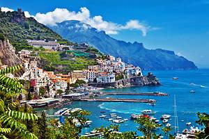
Within easy reach of Messina lies beautiful coastal scenery, as mountainous inland Sicily drops to the Tyrrhenian Sea. Just offshore are the Aeolian Islands, a scenic cluster of volcanoes, some extinct and others very much alive. Beaches line the shore, and winding roads climb into the hills to tiny villages, some crowned by castles.
Because of Sicily's continuing volcanic history, it's not surprising to find hot springs and spas here, too – look for town names that include "Terme" to indicate these. The attractions of the towns and villages along this lovely coast are low-key and enjoyed by locals more than foreign tourists, so you'll have a chance to mix with Sicilians and Italians and share their way of life.
While visiting this area of Sicily, take some time to discover interesting and scenic day trips from Messina.
Aeolian Islands
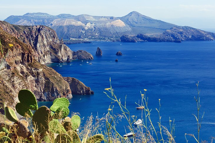
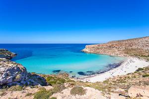
Off Sicily's north coast, the Aeolian Islands can be reached from Messina or Milazzo by ferry. Rising from sea depths of 4,000 meters, the archipelago's seven main islands are Vulcano (nearest to the Sicilian coast), Lípari, Salina, Filicudi, Alicudi, Panarea, and Stromboli.
The islands offer the ideal holiday destination, with a mild climate, volcanic landscapes, and ancient relics, but also with opportunities for hiking, diving, and water sports. These attractions are matched by the tourist infrastructure of hotels, guesthouses, campsites, and boat rentals.
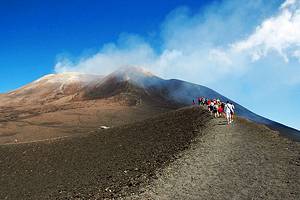
The islands are of volcanic origin, and you'll want to see their fumaroles, thermal and sulfur springs. Stromboli is an active volcano that puts on a spectacular display almost on cue each night. Independent hiking to the top is prohibited. All excursions are limited to a certain altitude (typically 250-400 meters) and must be done with a licensed volcanological guide.
The mountainous, rugged coasts that make these islands so beautiful are caused by past volcanic activity and by ceaseless erosion of the sea.
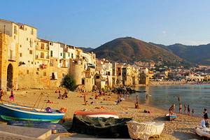
People have lived here since Neolithic times, when the inhabitants used the volcanic river of obsidian glass to make weapons and tools, which they traded elsewhere. Along with boats from Messina and Milazzo, you can access these beautiful islands during various seasons from Palermo, Cefalù, and Naples.
From any of the islands, each of which has its own individual flavor and appeal, be sure to take a boat trip to see the hidden coves and coastal scenery.
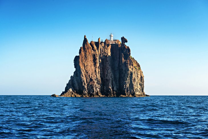
One of the interesting boat trips in the Aeolian Islands is to the 43-meter basalt sea stack of Strombolicchio, which means Little Stromboli. It lies about two kilometers off Stromboli and is thought to have been formed by the same volcano. In the 1920s, the top was blasted off to form a platform for a lighthouse, and a flight of 200 steps was carved into the cliff to access it. Because the island is home to exceedingly rare plant and lizard species, access is controlled, but you can ride around it by boat.
Lípari
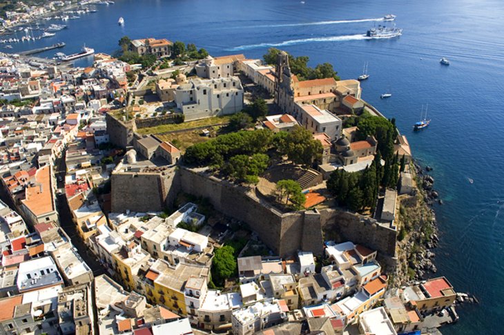
The main city of the Aeolian island of Lipari, also named Lípari, lies on the east coast, a picturesque town of narrow streets with a castle hill at its core, bordered by the Marina Lunga on the north and the Marina Corta on the south. In ancient times, the acropolis stood here, replaced by a medieval castle in the 13th century and by a fortress built under Emperor Charles V in the 16th century. From the harbor, Salita Melingunes climbs to Piazza Mazzini, from which stairs lead along the 16th-century town walls to the castle. A Greek tower dates from the fourth and third centuries BC.
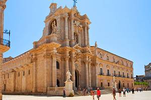
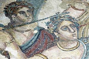
The Baroque Cathedral of San Bartolo is worth seeing, as is the excellent Museo Archeologico Eóliano in Via Castello beside the cathedral. Here, you'll see excavated finds going back to the Neolithic period, from the fifth millennium BC, when obsidian tools from Lípari were already being exported to the Italian mainland. The main feature is the collection of ceramic finds from graves dating from the sixth century BC up to the third century AD, including both the Greek and Roman periods.
Monti Peloritani
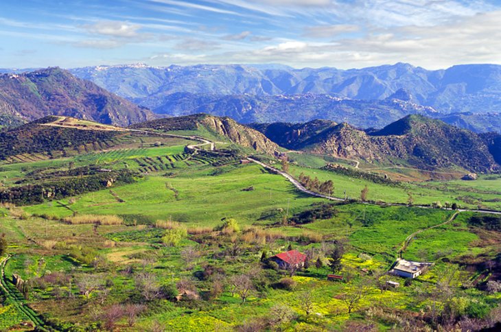
The Peloritani range stretches southwest from Messina, with deep, indented valleys that characterize the landscape. The highest mountains are the 1,340-meter Rocca di Novara; the Pizzo di Verna at 1,286 meters; and the 1,124-meter Antennamare, which you can reach from Messina on a panoramic road that follows the line of the ridge.
The sharp point of Rocca di Novara's summit has earned it the nickname of "The Matterhorn of Sicily." In the west, the Monti Peloritani merge with the Monti Nébrodi, the line between the two running more or less along the SS 185 between Taormina and Castroreale Terme. Any route you follow through these mountains will be scenic. To climb to the summit of Rocca di Novara, begin at Novara di Sicilia, on the SS 185, at a height of 650 meters.
The town of Rometta lies at a height of 593 meters on the northern slope of the Monti Peloritani. This town gained a place in history for its long resistance to the Arab invasion of Sicily. This began in 827 with the fall of Marsala, but Rometta maintained the last bastion and didn't fall until 965.
The Chiesa del Salvatore in Rometta has an unplastered, almost square exterior with an interior in the form of a Greek cross, its four arms of equal length. The unconventional building dates either from the Byzantine period, before 925, or from the Norman era in the 12th century.
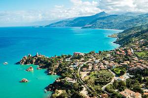
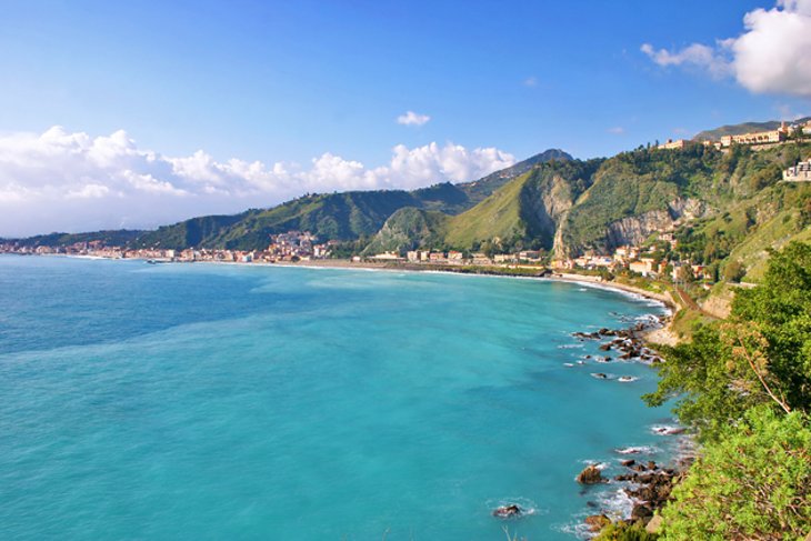
Messina to Taormina
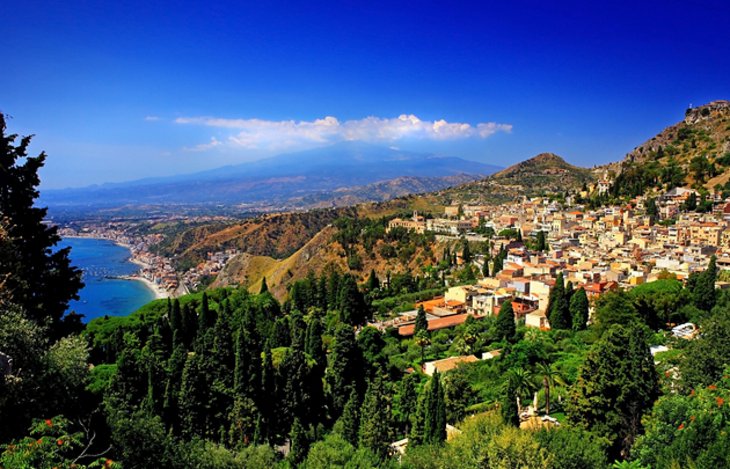
Between Messina and Taormina, the coastal road, SS 114, takes the slower route through beach towns and around the small peninsula of Santa Margherita, while the faster A 18 autostrada cuts a more direct path south. There is no can't-miss attraction along the way, but there are a number of interesting little towns and some beautiful scenery. Small roads head inland, climbing into the hills that rise quickly from the shore.
All along the northern part of the route are views across to the coast of Calabria. Although you have less freedom to explore, the scenery is also good from the train line that follows the coast between the two cities.
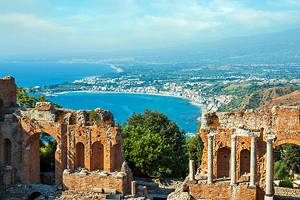
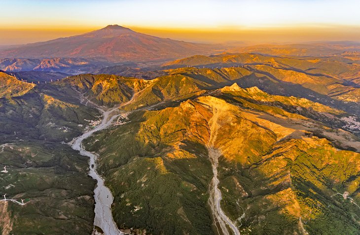
Taormina itself has one blockbuster tourist attraction and a lot of charm. The Greek Theater, the finest in Sicily, was built in the third century BCE and rebuilt by the Romans, with all the characteristics of a Roman theater. Atmospheric streets, stylish shops, and Baroque churches add to the beautiful views of Mt. Etna and the Ionian Sea and make the town a pleasure to stroll through.
Savoca and The Godfather Sites
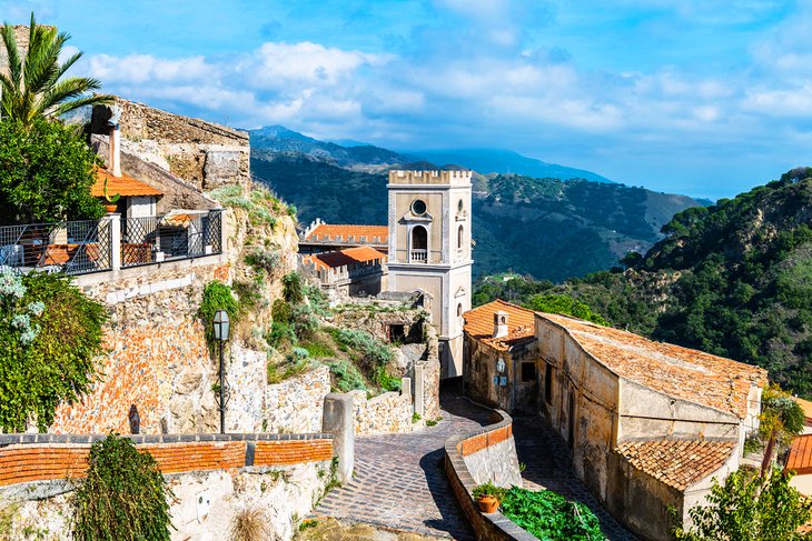
One of the most beautiful villages along the Ionian coast, Savoca, in the hills north of Taormina, is often packed with tourists, especially fans of director Francis Ford Coppola's The Godfather and its sequels. Many of the scenes were filmed here.
Several were filmed inside the 1773 Trimarchi Palace on the main piazza, and here you'll also find the Bar Vitelli, which can be very crowded in peak season. Mentioned in Mario Puzo's book, the bar was replicated for the film; inside you'll find photographs of the cast and film scenes. You'll recognize the church of San Nicolò as the scene of Michael Corleone's wedding.
The town is worth exploring. Stop to see the Church of San Michele, dating from the 1200s and the even earlier Church of Santa Maria, and admire the well-preserved palaces of wealthy Messina residents. Closer to Taormina, Forza D'Agrò was also the location for filming several scenes in all the Godfather films.
Montalbano di Elicona
This little town in the northeast of Sicily has a superb position on the western slope of the 960-meter Monte Burello, above the river Torrente Elicona. It is a starting point for several mountain walks and drives. In the Chiesa Madre in Montalbano is an altar relief depicting the life of St. Nicholas, a work of the Gagini school. The picturesque castle was built by Frederick of Aragon between 1302 and 1311. A scenic, winding road runs south from here as far as the pass of Portella Zilla, just underneath the summit of Monte Castellazzo, at 1,311 meters.
Monti Nébrodi
The Monti Nébrodi, also called Caronie, are a westward continuation of the Monti Peloritani range. At Monte Soro, they rise to a height of 1,847 meters. This range of rocky peaks and forests is less accessible by car, as mountain roads lead mostly around the perimeter. One does run from Sant'Agata di Militello on the north coast. From here, you can reach the mountain hamlet of San Fratello, followed by the watershed of Portella della Femmina Morta, at 1,524 meters.
A road leads to Monte Soro, from which the views extend to the Aeolian Islands and to Mt. Etna in the south. At Sant'Agata di Militello is a headquarters of the Parco Naturale dei Nébrodi, which covers this whole mountain area. Along with information on hiking trails, a museum covers both the natural and human history of the area.
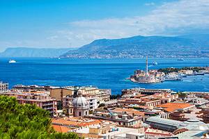
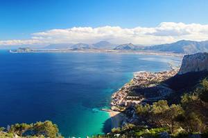
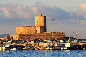
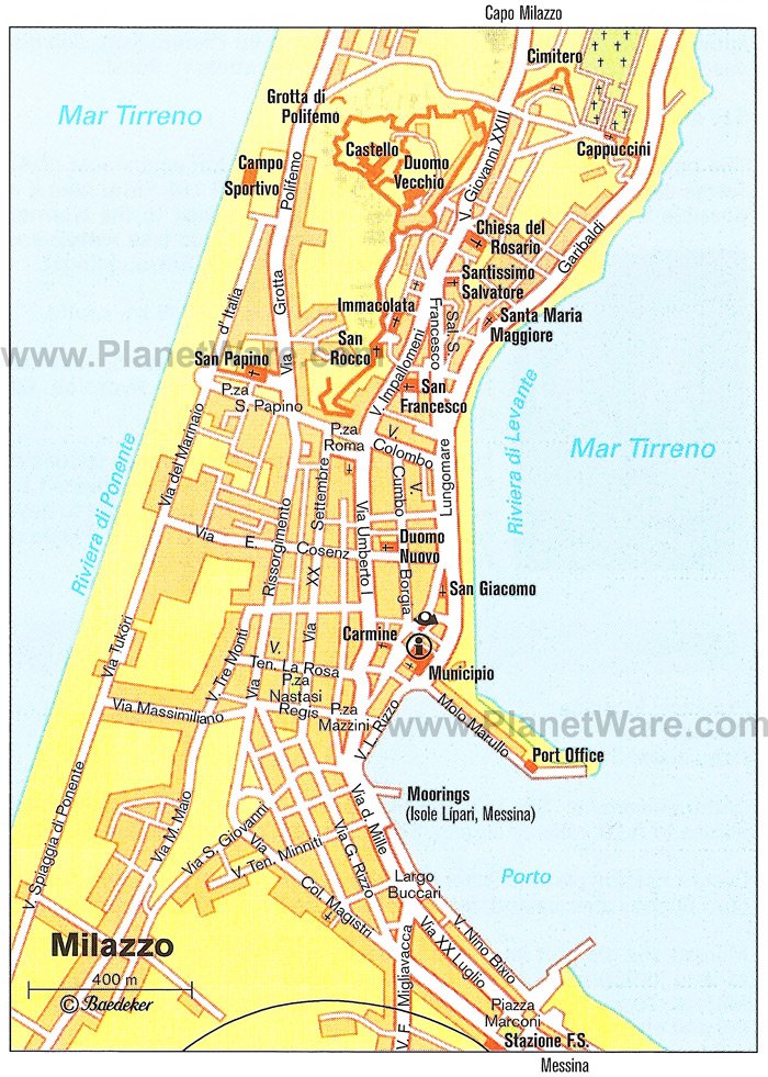
Milazzo
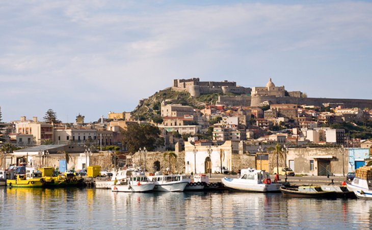
The seaside resort of Milazzo has an old upper town, complete with a castle, although you should be prepared for the initial impression of it being nothing more than an industrial port. But the Borgo Antico (old town) that clusters below the castle is well worth seeking out for its several churches and for the castle itself.
History lies layer upon layer here: Bronze Age huts (you can see the holes where the piles were driven); Arab foundations; a Greek acropolis; and a 13th-century castle later enlarged, then restored in the 1600s by the Spanish.
Even if you're here on Monday when it's closed, you should walk around the base of its walls for views of the Aeolian Islands and the surrounding coast. A surprisingly beautiful little peninsula extends into the sea north of the city, with pretty beaches and rocky coves. Milazzo is the closest place for boats to the islands.
Giardini Naxos
The basalt rocks of Capo Schisò jut out into the sea to the south of Capo Taormina, and in the bay between them is the pretty town of Giardini. Long stretches of sand and shingle beaches have led to it becoming a popular holiday resort. To the south, the Capo Schisò headland is the fertile plain at the mouth of the Alcántara River. This was where Naxos, the first Greek town in Sicily, was located.
Today's Naxos is part of the combined community of Giardini Naxos. The Vignazza Tower is a square watchtower built in 1544 to guard the coast from Barbary pirate raids. The medieval Schisò Castle, on a low hill above the coast, was rebuilt in the 16th century for the same use. It is not open to the public.
Castroreale
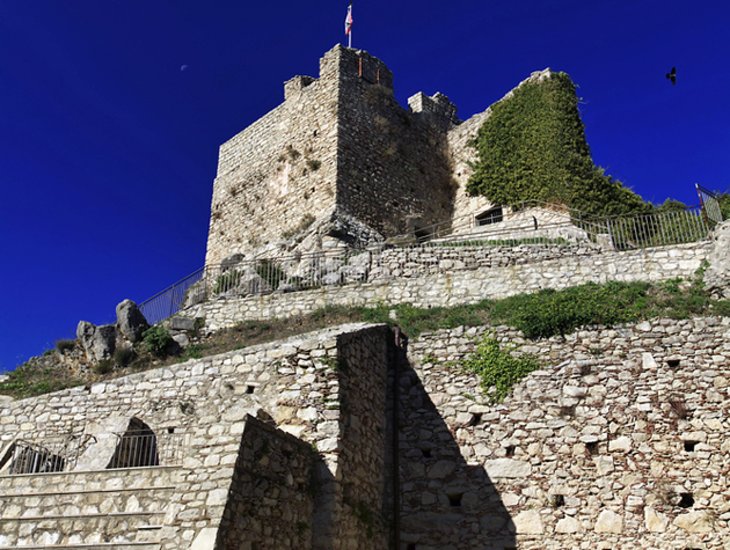
Crowning a 400-meter hilltop, Castroreale lies inland from the coastal town of Barcellona Pozzo di Gotto, connected to it by a very scenic road. The primary attractions of this medieval village are the spectacular views, the winding stone-paved streets, and the narrow lanes. The architectural highlights are its Baroque churches (Duomo di Santa Maria Assunta (main cathedral) and the Church of the Candelora) and the Tower of Frederick II, which is part of a ruined fortress dating from 1324.
The drive time from Messina to Castroreale is about 50 minutes, but the train takes only about half an hour.
Frazzanó
This mountain village, at an elevation of 560 meters, is close to the north coast, and is known for the monastery of San Filippo di Fragalà. Founded as long ago as the fifth century, the monastery was always highly regarded and survived its destruction by the Arabs in the ninth century. The reconstruction, which began immediately after the Norman conquest of Sicily, was completed in 1090 under the abbot Gregory. The church, consecrated to Saint Philip, dates from that year.
Despite alterations in the 15th, 17th, and 18th centuries, when the lantern and bell towers were built, the original character of this Basilian church, designed for Greek Orthodox monks, is still easily recognizable. The valley and hillsides below the monastery are covered in olive groves, orchards, and forests of oak and chestnut.