Loch Ness: Attractions & Things to Do
When you think of Scotland's most famous lake, you'll also think of Britain's most famous monster: Nessie (aka, the Loch Ness Monster). Although Nessie hasn't put in an appearance for decades, no place does a better job of keeping the centuries-old legend alive than the Loch Ness Centre and Exhibition, with its displays relating to the famous "beastie" and the history of the surrounding area.
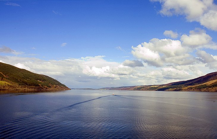
Even without its engaging tales of monsters, Loch Ness is extremely beautiful, especially around the romantic ruins of Urquhart Castle on its shoreline. One of the best places to visit in the Scottish Highlands, Loch Ness stretches along the Great Glen, a fault line where the tectonic plates collided to create the surrounding mountains. And at a depth of 755 feet, it's Scotland's second-deepest loch.
Best of all, Loch Ness and its surrounding tourist attractions are close enough to Glasgow and within an easy drive of Edinburgh, making it an ideal and fun day trip from either city. And if you're not interested in handling the logistics, a number of excellent organized tour options are available from either city. And for adventurers, you can now even walk around the entire loch on a dedicated route known as the Loch Ness 360° Trail.
To find out more about the many things to do when you get here, be sure to read through our list of the top attractions at Loch Ness, one of the best places to visit in Scotland, for an unforgettable UK adventure.
- Nessie: The Legend of the Loch Ness Monster
- Pay a Visit to Urquhart Castle
- Explore the Village of Drumnadrochit
- Tour the Loch Ness Centre and Exhibition
- See Historic Fort Augustus
- Take a Cruise along the Caledonian Canal
- Hike the Loch Ness 360° Trail
- See the Views from Spean Bridge
- Visit Loch Oich and Invergarry
Nessie: The Legend of the Loch Ness Monster
St. Columba, an Irish missionary, is said to have been the first person to encounter the oldest inhabitant of Loch Ness. The encounter reputedly occurred when the monster dragged the soon-to-be saint into the impenetrable depths. Then, in the 16th century, Hector Boece mentioned in The History of Scotland that a "terrible being" had suddenly emerged from the water and swallowed three men.
The next sighting, in 1933, took place while a couple sitting on the north bank saw a strange, writhing creature cross the road in front of them. A number of snapshots and eyewitness reports followed, not to mention a growing stream of visitors. Most descriptions say Nessie resembles a large sea reptile with a long neck, a small head, fins, and several humps.
The most famous picture of Nessiteras Rhombopteryx, to give Nessie its full name, came from London gynecologist Robert Wilson. On April 19, 1934, Wilson reported seeing something on the water and took a snap: a long neck of the monster had just emerged from the ice-cold water. It later turned out that Wilson belonged to a team who had set out to play a trick on the media.
Shortly before his death in 1993, Christian Spurling, one of the "conspirators," admitted his part in the great deception. According to the Sunday Times, Spurling, an amateur woodworker, had rigged up a dinosaur dummy on a toy submarine. The ruse worked perfectly.
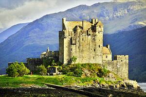
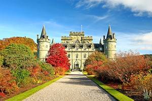
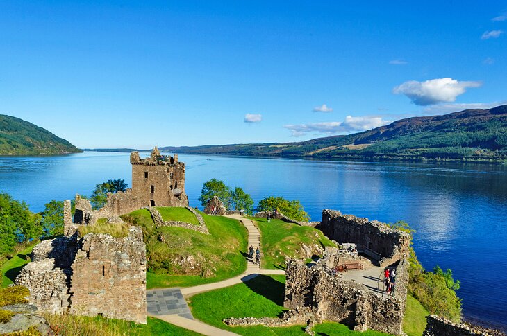
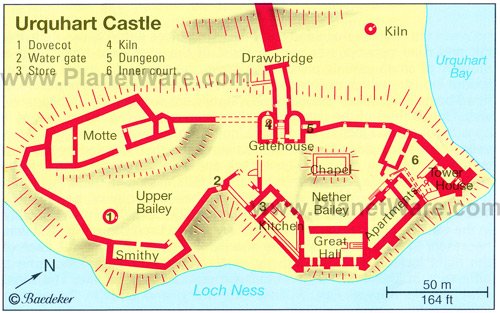
Pay a Visit to Urquhart Castle
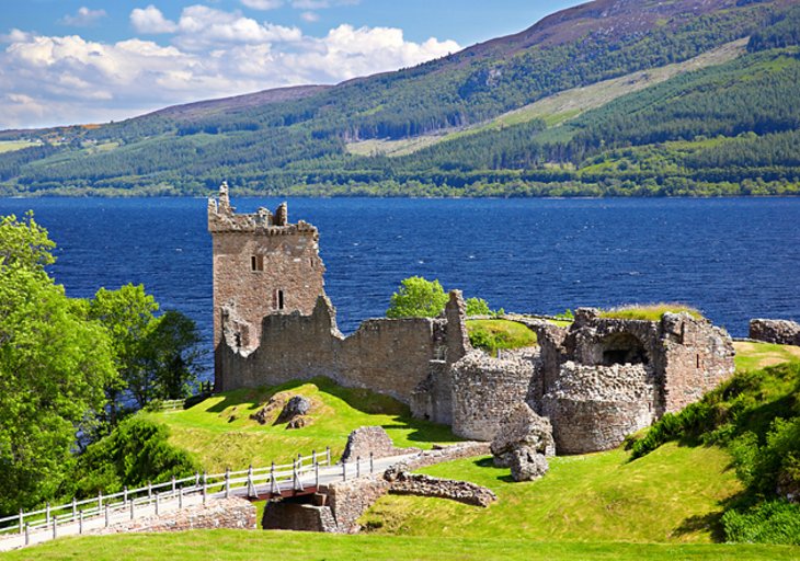
The impressive ruins of Urquhart Castle are located just a few minutes from Drumnadrochit and stand on a tongue of land jutting out into Loch Ness. One of the most picturesque castles in Scotland, Urquhart is set against the backdrop of the lake and mountain and was once one of Scotland's largest fortifications.
The center of many ancient myths ever since it was built back in the 12th century, the original castle was a typical example of a motte and bailey fortification. This original wood structure would have been replaced by the stone walls you see today around the 14th century.
Then in 1509, James IV gave the castle to John Grant of Freuchie, who commissioned the extension to the keep, and at the end of the 17th century, the fortified castle fell victim to a fire. Often making appearances in TV shows and movies, the castle was recently featured in an episode of the hit Outlander series. Today, visitors can enjoy on-site facilities including a café, gift shop, and stunning views of the loch.
Address: Drumnadrochit, Inverness, Inverness-shire
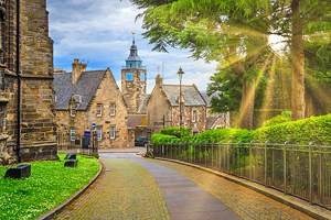
Explore the Village of Drumnadrochit
At the head of Urquhart Bay on Loch Ness's northern shore, the village of Drumnadrochit is a great place to begin exploring Scotland's most famous lake, along with its many myths and legends, as well as nearby Urquhart Castle.
You'll find plenty of things to do here. In addition to guesthouses, bed-and-breakfasts, cafés, and gift shops, it's home to the Loch Ness Centre and Exhibition, which tells the fascinating story of the loch's most famous resident, Nessie.
It's also a great place to take a boat cruise to do some monster spotting for yourself, go fishing, or simply enjoy the loch's stunning scenery. The village is also a popular spot for horse riding and pony trekking excursions.
Tour the Loch Ness Centre and Exhibition
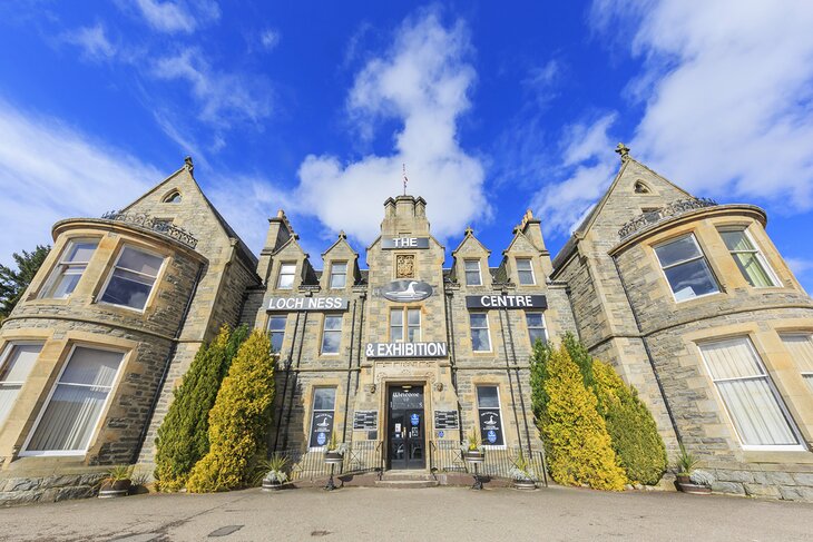
The Loch Ness Centre and Exhibition is a must-do attraction for anyone with even a modest amount of curiosity about the world's most famous beastie.
Exhibits here use audio-visual techniques and static displays to recount the evolutionary history of the region and its famed Loch Ness Monster. You can read up on the latest developments in the search for the monster and see depictions, newspaper headlines, and underwater photos.
The most interesting display focuses on Operation Deepscan in 1987 and includes sonar readings from the murky waters of Loch Ness. The images seem to confirm the existence of something down there, and the study certainly didn't rule out the existence of the beloved monster.
The center also features a café and gift shop, as well as a small hotel, and offers regular boat trips on the Deepscan research vessel itself for those interested in learning more about the monster and the loch while enjoying the spectacular scenery. Another monster-related exhibit is at the nearby theme park, Nessieland.
Address: Drumnadrochit, Loch Ness, Inverness-shire
See Historic Fort Augustus
Fort Augustus, at the south end of Loch Ness, is a favorite spot for tourists for its picturesque setting on the Caledonian Canal. One of the top free things to do here is simply sitting alongside the water and watching the boats head out into the loch.
Be sure to also pop into the interesting Caledonian Canal Heritage Centre, which provides plenty of detail regarding the construction and subsequent history of this major feat of engineering.
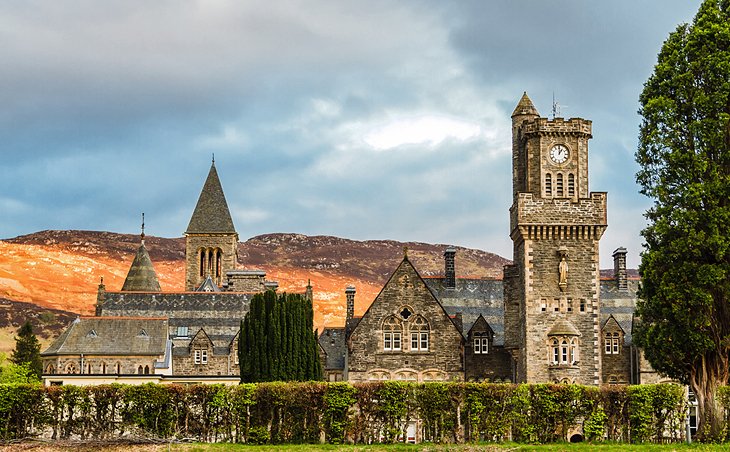
The fortress gave the place its name and was built in 1715 to become the headquarters of the English General Wade in 1729. After changing hands a number of times, the greater part of it was demolished in 1876. Benedictine monks have since built an abbey and a highly regarded school on the site. Another nearby attraction is the magnificent waterfall at Foyers.
Address: Fort Augustus PH32, Scotland
Take a Cruise along the Caledonian Canal
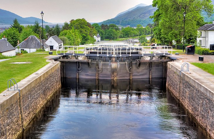
The Caledonian fault has been used for transport since Thomas Telford completed the Caledonian Canal in 1849 after work had begun in 1803. Stretching from Fort William and ending in the east at Inverness, the canal spared ships the hazardous northern route through the Pentland Firth between the Scottish mainland and the Orkneys.
Only a third of the canal's length is man-made, the major part of it consisting of narrow lochs including Loch Linnhe, Loch Lochy, the small Loch Oich, and then the longest and best-known, the 24-mile-long Loch Ness. All told, the canal, including lochs, extends 60 miles and passes through 29 locks, the most impressive group of which are the eight locks of Neptune's Staircase.
Today, it's the leisure industry that makes the most use of the canal, with holidaymakers in rental boats and canoes enjoying the magnificent scenery along the waterway.
Address: Canal Side, Fort Augustus PH32 4BA, Scotland
Hike the Loch Ness 360° Trail
For those with an adventurous streak and a few days to spare, there's no better way to get to know Scotland's most famous lake than by tackling the excellent Loch Ness 360° Trail. This exciting 80-mile route begins and ends in the beautiful city of Inverness, taking in along the way pretty much everything you'll have included on your Loch Ness "must-see" list.
Suitable for everything from a leisurely stroll to a serious hike, this excellent activity trail can in fact be accessed pretty much anywhere around the Loch. It even handily connects to longer trail networks including the Great Glen Way, and has also proven popular with cyclists and horseback riders.
If you do plan on doing the whole route, expect to spend six days if tackling it on foot, or three days for cyclists. If that sounds like you, consider making a Scottish weekend break of the experience by adding a stop at one of the many charming B&Bs, inns, or cottage rentals that line the route. These fun places to stay provide plenty of opportunities each evening for rest, relaxation, and mingling with the locals.
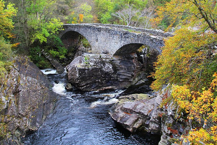
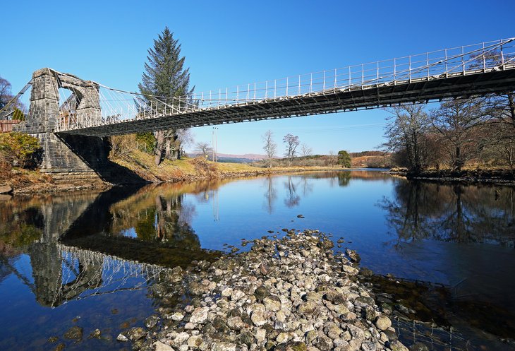
Along the way, you'll see most of the main attractions of Loch Ness. These include the spectacular Caledonian Canal, the charming Telford Bridge, as well as famous Urquhart Castle.
There are also a number of tour package options available, with reputable travel and excursion companies offering to handle all bookings and reservations. They'll also provide detailed itineraries, and you'll find some of the best of these detailed on the route's official website.
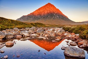
See the Views from Spean Bridge
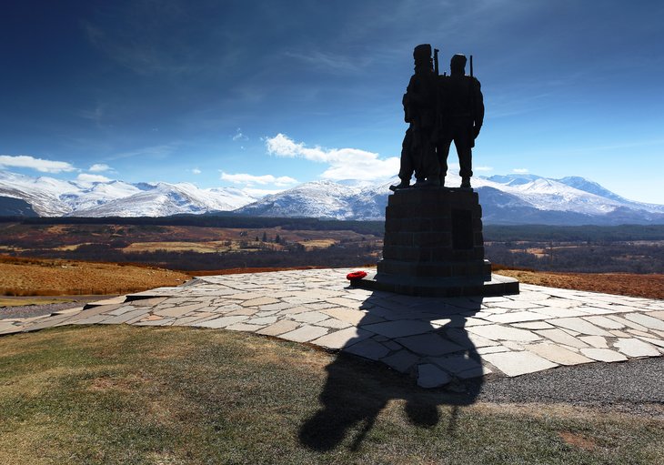
A little to the south of Loch Ness is the road to the village of Spean Bridge, offering splendid panoramas of the Caledonian fault and the northern side of Ben Nevis. Spean Bridge makes an excellent base for walks through the Glen Roy National Nature Reserve, with its "Parallel Roads," as the terraces that run along the slope are called.
These indicate the various water levels of a Pleistocene lake that was dammed by Ice Age glaciers. It's also where you'll find the Commando Memorial, a monument dedicated to the men of the British Commando Forces who trained at nearby Achnacarry Castle.
Visit Loch Oich and Invergarry
The small islands in Loch Oich to the south of Loch Lomond are set against a backdrop of steep hillsides and make a picturesque sight. On the west bank of the loch near a spring known as Tobar nan Ceann stands a remarkable memorial to a bloody incident that took place in the 17th century.
Here, seven brothers were executed for the deaths of two members of the Keppoch family: their heads were washed in the spring before being presented to the clan chief. Invergarry is another good base for hill walkers and is also a popular center for anglers as well as horseback treks through remote Highland glens and mountain passes.
More Related Articles on PlanetWare.com
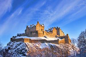
Scotland's Top Cities: Scotland's beautiful capital city of Edinburgh is a big tourist draw, not least of all for its magnificent medieval architecture, including the majestic Edinburgh Castle, connected to the historic Palace of Holyrood by the cobblestone Royal Mile. Widely regarded as the country's cultural capital, the port city of Glasgow is home to a magnificent cathedral, great museums, and top art galleries including Kelvingrove Art Gallery and Museum. The country's third largest city, Aberdeen is definitely worth exploring for its fabled architecture built from local stone.
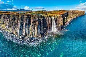
Scotland's Top Sights: If you've not had your fill of magnificent scenery, take a drive to the equally attractive Loch Lomond, popular among hikers and sightseers for the beautiful Loch Lomond and The Trossachs National Park. And of course, Loch Ness is just a short drive from the lovely city of Inverness, doorway to the many lovely sights and attractions of the Scottish Highlands. The beautiful scenery of the Isle of Skye, too, is worth including on your Scottish travel itinerary and is also popular with hikers and backpackers.
Scotland Travel Ideas: Scotland is a great place to visit for sports enthusiasts, especially golfers, many of whom arrive solely to play on the world's most famous courses in St. Andrews. Culture lovers would do well to pay a visit to the birthplace of Robbie Burns in Ayr, while history buffs and train fans should make a point of making the rail journey over the famous Forth Railway Bridge to the lovely city of Dundee, the country's fourth largest city and a great base from which to explore the country.