
One Of Rick Steves' Least Favorite Places In Europe Is An Overrated Tourist Destination
One German region is popular among tourists, but according to travel expert Rick Steves, it disappoints many who visit. Here's where to go instead.
Read More
One German region is popular among tourists, but according to travel expert Rick Steves, it disappoints many who visit. Here's where to go instead.
Read More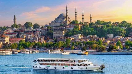
Experience two different continents, plus plenty of historic sites, stunning beaches, and top-tier shopping, without blowing your budget in this destination.
Read More
With over 102 million international visitors in 2025, this popular destination is the most visited country in Europe, as well as the entire world.
Read More
According to travel expert Rick Steves, there are a few key reasons to skip big capital cities in Europe and head to the "second cities" instead.
Read More
This underrated European destination gives you more bang for your buck with gorgeous castles, beach getaways, inexpensive meals, and charming cities.
Read More
Rick Steves has shared countless tips on attractions and activities in Europe, but he says one surprising thing is a must to avoid a "flat" experience.
Read More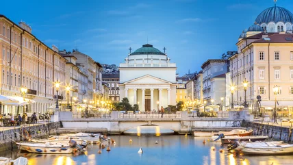
This Italian city that resembles Vienna more than it does Rome boasts a friendly environment for solo travelers, with charming cafes and stunning viewpoints.
Read More
In a French valley known for its wine and picturesque countryside, you'll find a massive castle estate dating back to the 1500s, with 80 rooms open to tourists.
Read More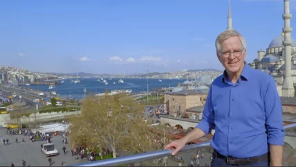
This major tourist destination is one of travel expert Rick Steves' favorites for its rich history, religious influences, and unique clash of cultures.
Read More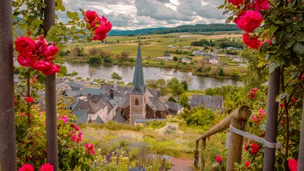
One region in Germany offers stunning scenery, delicious wine, and cool castles all along a famous river. No wonder it's a favorite of Rick Steves!
Read More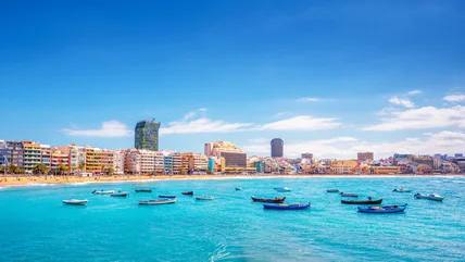
This sun-soaked archipelago welcomed 18.4 million visitors in 2025, but travelers are now being discouraged from visiting due to the impact of over-tourism.
Read More
Television host, author, and guidebook scribbler Rick Steves is a big fan of these European establishments, which he says are his go-to for saving money.
Read More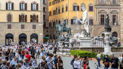
A troubling trend is on the rise in Europe and some locals are expressing frustration, saying that social media-fueled travel is partly to blame.
Read More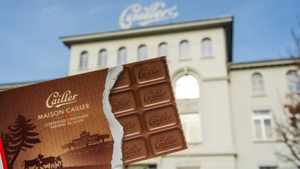
Set on the grounds of Switzerland's oldest chocolate factory, the new theme park will invite visitors to "discover the world of chocolate" in a whole new way.
Read More
Some airlines are set to make changes and cutbacks to their schedules, and European flights could be affected — here's what passengers need to know.
Read More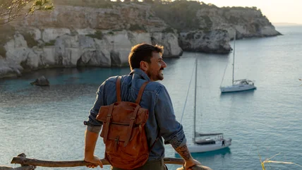
If you're traveling to Europe on a budget, consider spending your vacation time in these relatively affordable destinations recommended by travel experts.
Read More
From Europe to Africa to Asia, there are plenty of islands that'll give you the tropical vacation of your dreams without the price tag of Caribbean getaway.
Read More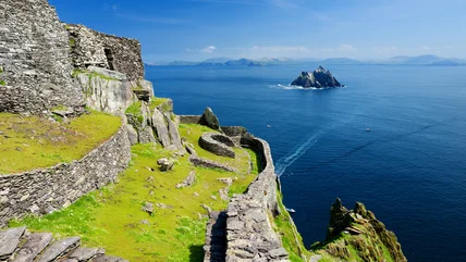
This new national park in Ireland is a unique, non-contiguous collection of landmarks, from historical islands to stunning coastal spots and hikeable mountains.
Read More
Europe offers a variety of tourist-friendly destinations, but in 2026, the most popular spots may start charging international visitors more than in past years.
Read More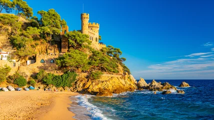
Europe is filled with top-notch destinations, but it also has some tourist traps. Here's where to skip according to Rick Steves and alternatives to try.
Read More
If this European country with an iconic capital city is on your travel bucket list, be aware: Many visitors and locals say there are too many tourists.
Read More
According to travel expert Rick Steves, these "zones" prevent you from experiencing a destination's authentic culture and connecting with its locals.
Read More
From Europe to North Africa, these hidden gems along the Mediterranean Sea offer quintessential coastal escapes for surprisingly affordable prices.
Read More
Europe travel expert Rick Steves has a simple, yet perspective-shifting, tip to avoid wasting precious time (and money) during your European getaway.
Read More
In the most popular European destinations, many attractions require a long line to enter. However, Rick Steves has a simple workaround to save you time.
Read More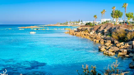
This country may beckon visitors with its beaches, but the U.S. government has issued a new warning cautioning travelers to rethink travel there.
Read More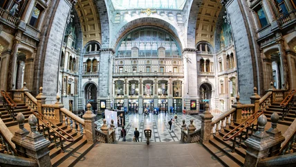
Traveling by rail is a great way to get around Europe, and some of its train stations are worth a visit in and of themselves, with fine dining and art on offer.
Read More