12 Best Day Hikes on the Pacific Crest Trail
The Pacific Crest National Scenic Trail (PCT) is a 2,600-mile contiguous hiking trail that stretches from the border of California and Mexico to the border of Washington and Canada. Traversing the most rugged environments found on the western coastal states, the trail crosses through 26 national forests, seven national parks, five state parks, and four national monuments. The trail also shares a path with the entire John Muir Trail of Central California.
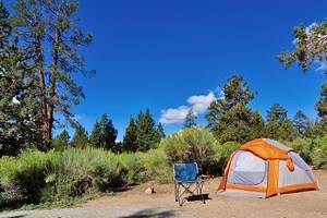
Every year, hundreds of hikers start at either border and attempt to "thru-hike" the entire PCT in one six-month window. Some hikers would prefer to hike longer, but winter conditions on either side of the year make navigating the mountainous terrain technical and dangerous for those unprepared. For those intrepid explorers attempting a thru-hike, expect to hike 20-plus miles a day consecutively throughout the journey.
For those who can't take six months off work, or are a little nervous about continuous backcountry travel, the PCT can be enjoyed in many other ways. Hikers can opt for backpacking smaller sections of the trail. Hiker beware, though, once you find yourself standing on the PCT, and you feel it stretch out in either direction across the entire country, it may be hard to get it out of your mind until you've explored the whole trail. But if you're limited on time, pick a shorter route with our list of the best day hikes on the Pacific Crest Trail.
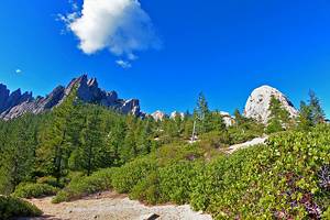
1. Eagle Rock
The Southern California portion of the PCT extends seven hundred miles through arid landscapes filled with twisted chaparral and few water breaks. While this formidable terrain is often a challenge for thru-hikers and day-trotters alike, the Southern California section of the PCT has many highlights of its own. No better example of that can be found than the aptly named Eagle Rock, just over 100 miles north of the Southern Terminus of the PCT.
If you are looking to make a day hike to Eagle Rock, all it takes is a 6.5-mile round-trip starting from Highway 7 near the Warner Springs fire station. Visitors can follow the PCT markers from the road. The trail bends alongside the Canada Verde Creek and ravine for the first half of the trip before continuing through arid grasslands and sparse vegetation. The total ascent for this day hike is less than 1,000 feet.
The enormous rock outcropping of Eagle Rock is an unmistakable icon on the horizon. The area is good for posing for a picture and taking a quick snack break before heading back.
Tackle this trail between March and May, before many of the thru-hikers will be found in the area, and there is a good chance you'll stumble across a stunning display of wildflowers blooming along the path.
2. Mount Baden-Powell
Mount Baden-Powell within the San Gabriel Mountains offers a challenging day hike on the Pacific Crest Trail. The nine-mile, round-trip hike to the top of Mount Baden-Powell gives hikers a healthy dose of vistas and maximum grade on the PCT. This popular summit hike isn't necessarily for everyone, though, and the roughly 4.5 miles it takes to climb more than 2,800 feet to the top is filled with enough switchbacks to make you consider turning back.
Make it to the top, however, and be prepared for stunning views of the opposing Mount Baldy and the surrounding Los Angeles National Forest. Hikers also encounter the old-growth Wally Waldron limber pine that has existed for more than a millennium at the top of the mountain.
No water sources exist along the trail or its 40 switchbacks, and hikers will want to pack plenty of their own.
3. Mount Whitney
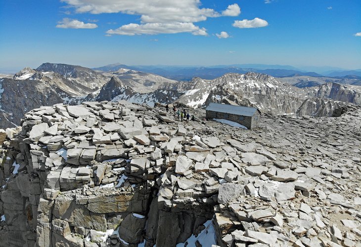
After traveling just over 700 miles through the arid and challenging landscapes of Southern California, the PCT transitions into Central California. This transition introduces hikers to the jaw-dropping and often snow-covered Sierra Mountains. At the height of the alpine action, the PCT joins up with the 211-mile John Muir Trail (JMT). The two trails navigate the different mountain passes and natural splendor found in this high-alpine paradise, including the upwards-gazing, snowcapped Mount Whitney.
Standing as the tallest summit in the contiguous United States, the peak of Mount Whitney is the southern terminus for the John Muir Trail. It is also a much-taken, alternate route on PCT. Hikers on the PCT approach Mount Whitney from the west side of the mountain, which is inaccessible for a day hike.
To hike to the top of this bucket-list peak in a day, hikers don't spend any time on the actual PCT. Instead, day hikers tackle it from the other side of the mountain, from the Whitney Portal, after obtaining a much sought-after permit. Accomplish this 22-mile round-trip, gaining over 6,000 feet as you climb to the top, and you'll get the most concentrated taste of the physical demands it takes to tackle the PCT found anywhere else along the trail.
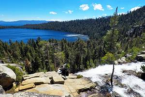
4. Tuolumne Meadows
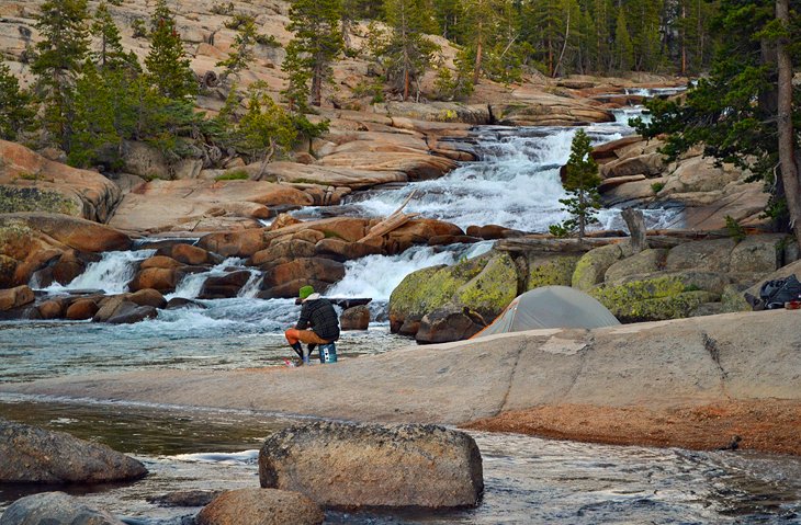
While Yosemite National Park marks some of the busiest places you can find on the PCT, there is a reason why this national park is so popular. To get a taste of the high-mountain splendor that is Yosemite, you can hop on the PCT starting from the Tuolumne Meadows Campgrounds, near the eastern Highway 120 entrance to the park, and head north alongside the Tuolumne River as it carves its way through the granite-infused scenery.
The cascading rapids of the Tuolumne River eventually lead hikers to the gushing Tuolumne and White Cascade Falls four miles down the trail. These waterfalls offer a great photo opportunity and turnaround point on a fantastic day hike.
For those with an early start or looking to camp overnight, the Glen Aulin High Sierra Camp is roughly six miles north of the Tuolumne Meadows Campground on the PCT and offers remarkable places to stay by reservation only.
Elevation for the first three miles of the trail is relatively flat and easy. The trail begins to descend a rocky footpath after that. Water sources are readily available along the trail, though hikers will want to pack a water filter for collecting from these natural sources.
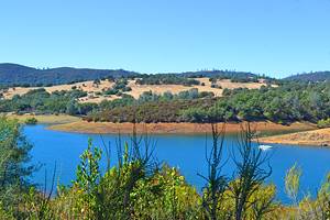
5. Sonora Pass
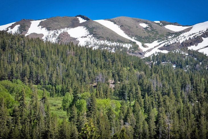
From the parking lot atop Sonora Pass (Highway 108), hikers have many trail options to explore. To see the biggest views and most awe-inspiring scenery, it's worth trekking south on the PCT from the parking area. The trail starts with a climb and eventually evens out as it treks across the flank of Leavitt Peak, exposing hikers to a stunning ridgeline and deep basins containing alpine lakes.
How far you want to go is your choice, because the PCT continues south for another 1,000 miles. Most day hikers get their fill by traveling five miles south of Sonora Pass and turning back. With standout views along the entire route, you won't be disappointed by checking them out again as you head back to the pass. Hikers can also accomplish an approximately nine-mile hike by leaving a car at Leavitt Lake. This point-to-point route encompasses nearly 2,300 feet of elevation gain.
6. Carson Pass
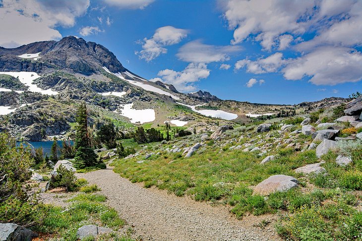
Just 30 miles south of Lake Tahoe, along Highway 88, and 55 trail miles north of Sonora Pass on the PCT, Carson Pass is a beautiful destination for day hiking. Both south and north on the PCT from Carson Pass leads hikers to stunning woodlands and alpine lakes.
Heading south, hikers encounter Lake Winnemucca, with nearly three miles of hiking and 500 feet of elevation gain. Farther south, Round Top Lake offers additional appeal.
Heading north from Carson Pass, the mountains of California offer rewarding scenery every mile of the way. For a heftier day hike or overnight trip, Echo Summit is 13 miles north of Carson Pass. This route entails over 3,700 feet of elevation change along the way. This route is best done with a shuttle and car parked in the community of Echo Lake.
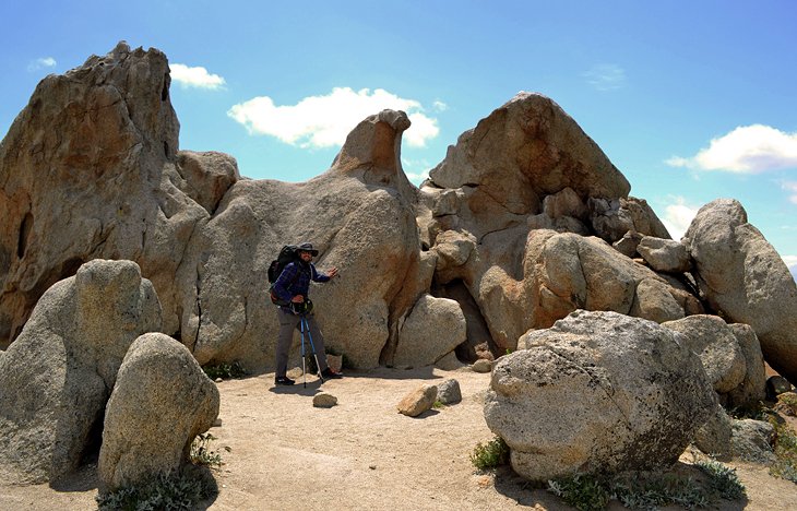
7. Lower Castle Crags
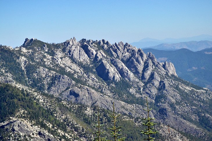
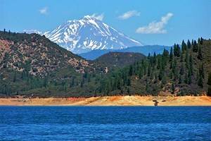
Spectacular views and scenery can still be found every step of the way after the PCT drops out of the highlands of Central California. This is especially true when hikers enter the vicinity of Castle Crags State Park and nearby Mount Shasta. The granite spires and impressive rock outcroppings of Castle Crags can be seen in clear sight along the 6.7 miles the PCT meanders through the state park. Stunning views of Mount Shasta are not far off in the distance.
While the PCT portion of this celebrated Northern California landmark is filled with enough scenery to make an out-and-back adventure worthy, many visitors also opt for the Castle Crags Dome Trail. The Dome Trail is the only route in the park that ventures up and into the actual Castle Crags. A nearly 12-mile round-trip, the Castle Dome Trail gains over 2,000 feet in elevation on its way up to the impressive rock features.
8. Crater Lake Rim Alternate
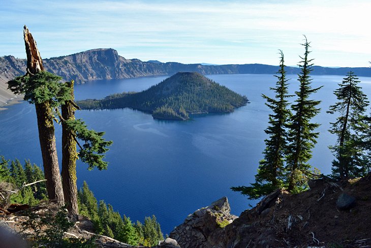
The official PCT takes a route that strays west of the ancient caldera that is known as Crater Lake. The Crater Lake Rim Alternate is a highly recognized and much encouraged departure from the original route. The route is also very popular for people visiting the park. That's because the Crater Lake Rim Alternate is lined with eye-popping scenery of the second-deepest lake in the nation.
The alternate trail officially begins at the Dutton Creek Trail Junction, but day hikers can cut some less-scenic miles out by starting at the Rim Village. From here, the trail follows along the rim for six miles, displaying dazzling views of Crater Lake and its sapphire waters the entire way.
When you're ready to head back, or you've hit the six miles the alternate trail encompasses, all you have to do is turn around and enjoy the same view twice.
Crater Lake is truly a highlight of the entire PCT experience and is one geological feature that everyone in their life should get to see. Few water sources exist on the rim, and hikers only encounter moderate elevation gain along the way. Be sure to give yourself enough time to sit down and enjoy the view.
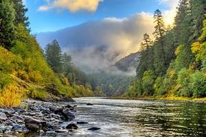
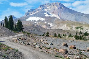
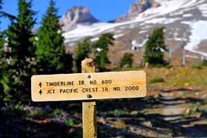
9. Paradise Park via Timberline Lodge
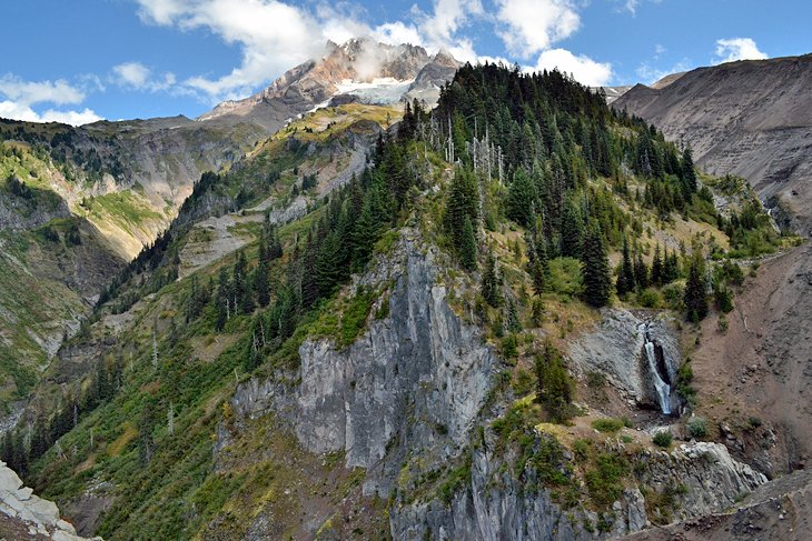
The portion of the trail that departs from the historic WPA Timberline Lodge in northern Oregon stacks up to be not only one of the best day hikes on the PCT, but it is a highlight of the entire cross-country trail. The trail meanders through the wildflowers and big mountain views of Paradise Park and the surrounding Mt. Hood National Forest.
The PCT nearly connects to the backdoor of the Timberline Lodge, making for a great starting point on a PCT day hike. Follow the trail north for six miles from the Timberline Lodge and be prepared to soak in the scenes of abundant wildflowers, cascading water sources, and up-close views of Mount Hood the entire way. Six miles down the trail is the Paradise Park Loop Trail Junction that can get you back to the Timberline Lodge. The lodge offers a historic place to stay the night and a first-class breakfast buffet to fill your hiker appetite.
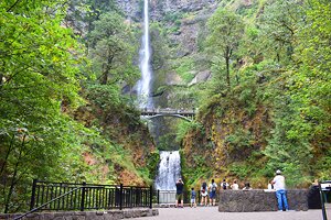
10. Eagle Creek Alternate
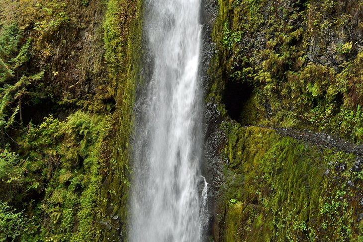
The Eagle Creek Trail of northern Oregon is another alternative route that departs from the official PCT. It is not only a common deviation for most thru-hikers, but it's one of the most popular spots in Oregon to see a high concentration of water features. Most thru-hikers navigate the many waterfalls of Eagle Creek heading north into the town of Cascade Locks. A day hiker's best bet will be to start from Cascade Locks to make their way south along this featured trail of the Columbia River Valley.
Just under two miles from the start of the trail, Punch Bowl Falls and its large basin of water waits to be seen. Nearly seven miles in, Tunnel Falls allows hikers to trek under a waterfall through an impressive tunnel carved out of the rock. The route to Tunnel Falls incorporates over 1,500 feet of elevation gain and takes most of the day.
The Eagle Creek trail is one of the most popular trails in the Pacific Northwest, so you might be sharing the trail with some other avid adventurers. The 2017 Eagle Creek Fire caused significant damage to the area and widespread trail closures. Check the official website before traveling to Eagle Creek for the most up-to-date conditions.
11. Chinook Pass
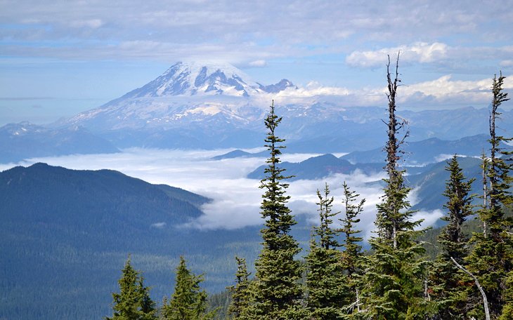
Every mile of the Washington portion of the PCT is filled with lush rain forest environments, craggy high-alpine terrain, and big views of defining Pacific Northwest attractions. Not much of the Washington PCT is easily accessible for day hikes. But where the trail crosses Highway 410 at Chinook Pass, complete with an ample parking area, day hikers can explore the PCT in either direction.
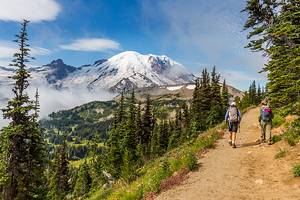
Heading north on the PCT from Chinook Pass, Sheep Lake is only 1.8 miles away with less than 500 feet of elevation gain. Heading south, Dewey Lake, Anderson Lake, and the Laughingwater Trail Junction encourages exploration. Chinook Pass also serves as the eastern border of Mount Rainier National Park. This outstanding national park and mountain feature contains a whole treasure trove of great hiking trails and place to camp.
12. Hart Pass
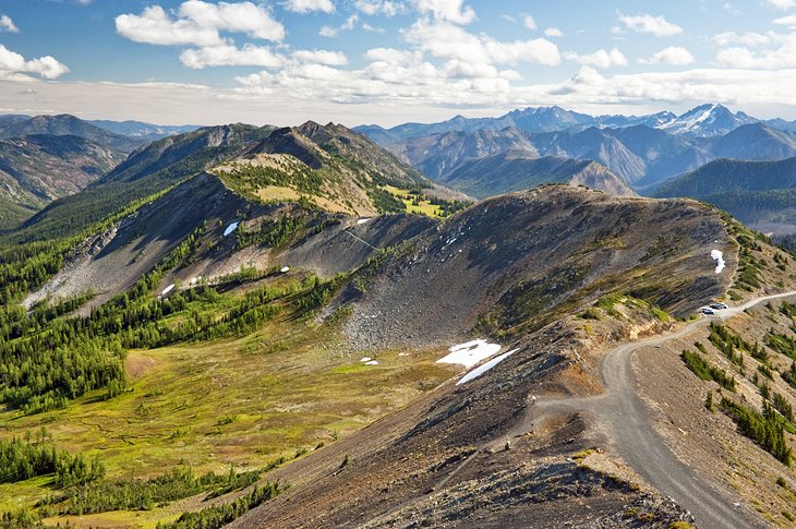
The North Cascades National Park section of the PCT in northern Washington is arguably the most rugged. With an adequate amount of sweat equity, the stunning views of the craggy Cascade Mountains are well worth the effort. Much of the terrain the PCT crosses through in northern Washington is inaccessible without multiple days of hiking. Not far from the Canadian border, however, just outside the small adventure town of Mazama, you can access great PCT day hiking from Harts Pass.
The Forest Service road to access Harts Pass is narrow, with a steep cliffside instead of a shoulder. For that reason the drive up to this day hiking destination could be your biggest challenge. Because Harts Pass is at an elevation of more than 6,000 feet, you don't have to climb much when you start hiking on the trail. Instead, the whole family can follow the relatively flat grade heading south or north on the PCT from Harts Pass, and take in some of the most dramatic ridgelines, mountain peaks, and craggy alpine environments found in the entire state of Washington.
Map of Day Hikes on the Pacific Crest Trail
More Related Articles on PlanetWare.com
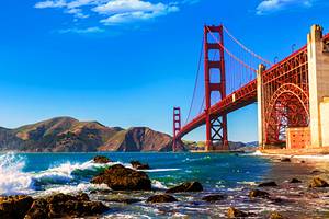
Hiking and Camping in California: The best hiking trails in California go well beyond the Pacific Crest Trail. For places to park an RV or pitch a tent in the southern half of the state, the top campgrounds in Southern California provide ample environments to explore. Similarly, the best places to camp in Northern California offer proximity to wild beaches and redwood trees.
Exploring Oregon: The many top hiking trails in Oregon deliver on the state's diversity of landscapes. For some moving water to hike towards, Oregon's best waterfalls lure visitors from across the country. Surrounded by the state's abundant national forest, hot springs in Oregon deliver with steaming appeal and a chance to soothe sore muscle.
Washington Wonders: The best hiking trails in Washington really take you somewhere special. The top campgrounds in the state also deliver with big views of features like Mount Rainier, Deception Pass, and the Hoh Rain Forest. To properly explore Washington, check out our guide to the best state and national parks in Washington and start checking destinations off the list.