15 Top-Rated Hikes in Mount Rainier National Park, WA
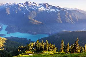
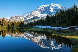
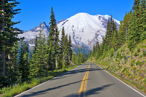
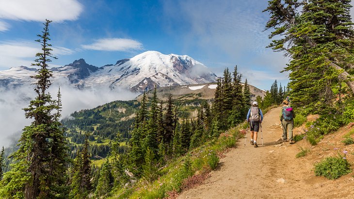
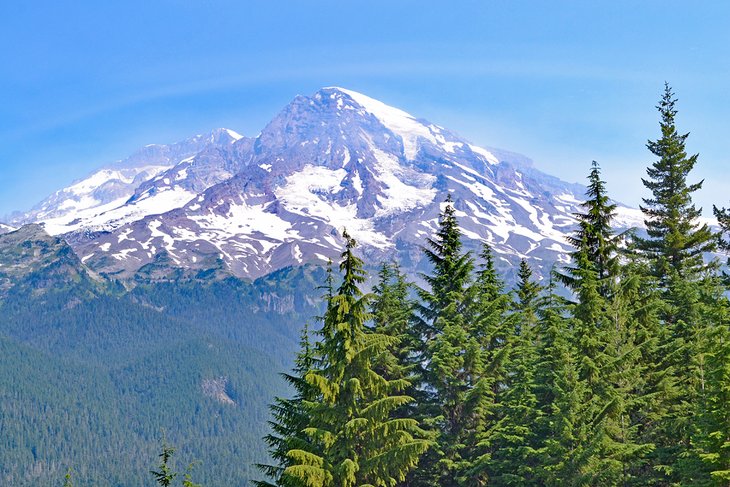
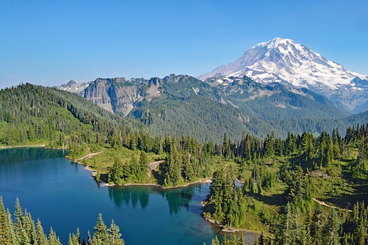
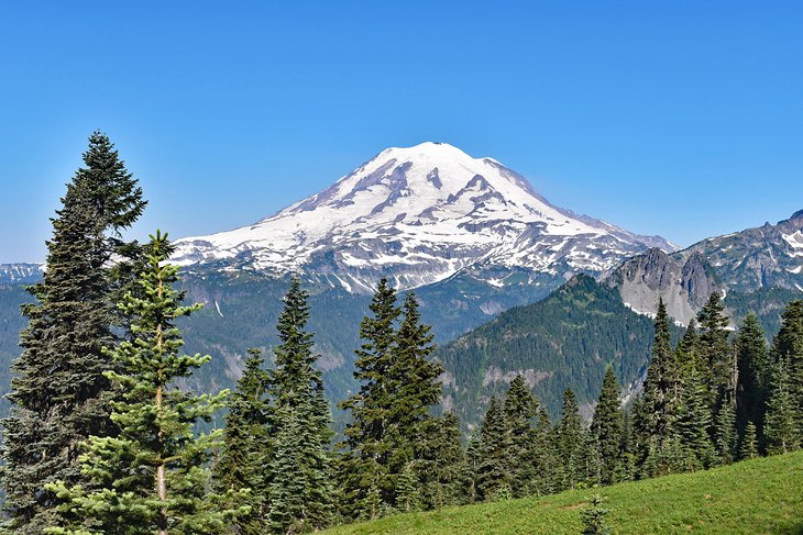
Mount Rainier National Park is a premiere hiking and backpacking destination in the Pacific Northwest, and this massive 14,411-foot mountain, the tallest in Washington, is one of the best National Parks in the United States. On every side of Rainier (and even on top), adventure awaits those who want to explore this rugged and enchanting environment.
The prime hiking season to explore Mount Rainier is between late July and the first half of September, when high-mountain trails are snow-free. From easy day hikes to the all-encompassing Wonderland Trail, all hiking trails at Mount Rainier National Park offer up-close views of this monster of a mountain and its many shimmering glaciers.
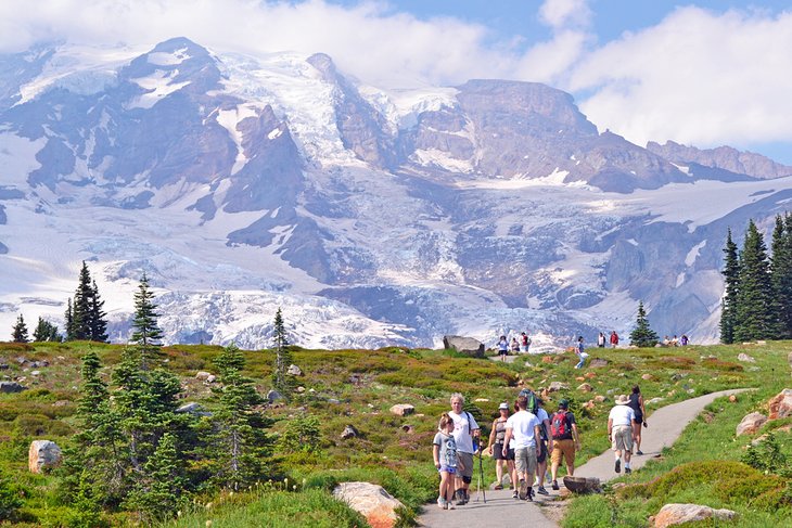
Visitors have four main entrances to begin their hiking adventures. The Southwest Nisqually Entrance tends to be the most popular, as it's the main funneling point for visitors coming from Seattle. And it's no slouch on hiking trails, with easy access to the Longmire and Paradise areas of the park, including the renowned Skyline Trail.
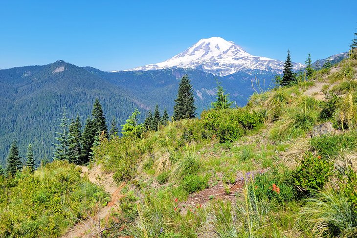
Rainier is rugged and home to a wild country. Even throughout the summer, variable weather conditions apply. Be sure to check current trail conditions before heading out on any trek.
To get started on your next bucket-list adventure, see our list of the best hiking trails in Mount Rainier National Park.
- 1. Skyline Trail
- 2. Burroughs Mountain Trail
- 3. Naches Peak Loop
- 4. Silver Falls Loop
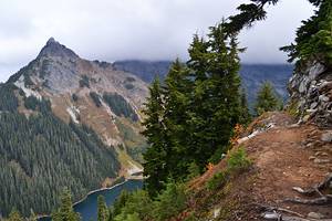
- 5. Mount Fremont Lookout
- 6. Grove of the Patriarchs
- 7. Rampart Ridge
- 8. Tolmie Peak
- 9. Bench and Snow Lakes
- 10. Spray Park
- 11. Glacier Basin
- 12. Summerland
- 13. Shriner Peak Trail
- 14. Narada Falls
- 15. Wonderland Trail
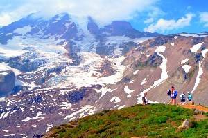
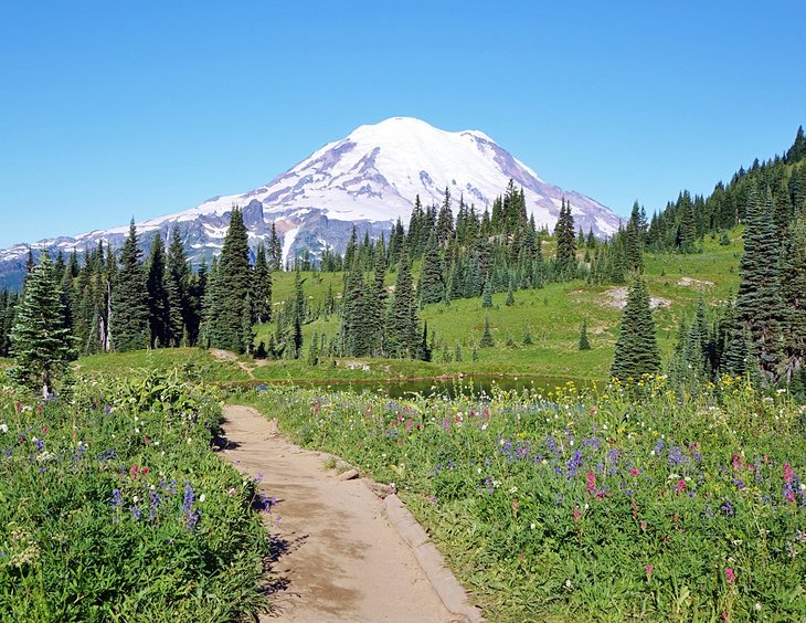
1. Skyline Trail
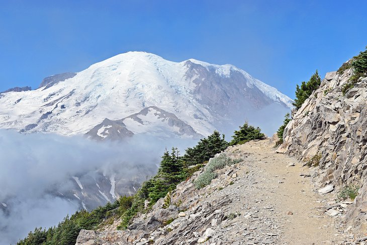
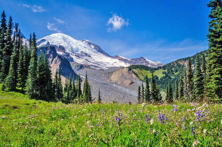
If you only have time to check out one hike in Mount Rainier, you should consider The Skyline Trail. It's one of the most quintessential hiking trails in Washington State, circumnavigating the iconic Paradise area of Mount Rainier National Park and providing up close and personal views of the mountain.
The hike begins at the Henry M. Jackson Visitor Center and the historic Paradise Inn. It's suitable for all levels of hikers, and the trail becomes very popular in the summer peak season between July and August, often taking the entire width of the wide path. During this peak season, a bouquet of wildflowers blossoms throughout the surrounding mountain meadows.
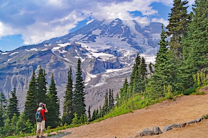
There is plenty of scenery to share on the 5.5-mile route, and whether trekking clockwise or counter along this well-marked loop, be prepared to stop a few times and admire the surrounding landscape. A close-up view of Mount Rainier and the Nisqually Glacier follows the hike the entire way.
The hike is punctuated by luscious meadows, cascading creeks, and a chance to see marmots and other wildlife frolicking in the splendor. Near the midpoint of the Skyline Trail, Panorama Point treats hikers to big views of the neighboring Mount Saint Helens, Mount Adams, and Mount Hood on clear days.
The entire 5.5-mile clockwise loop climbs over two miles in elevation gain and should be considered strenuous. Hikers should check trail conditions before attempting the hike. Many visitors make the trek an out-and-back experience from Paradise Inn, going as far as they'd like before turning back.
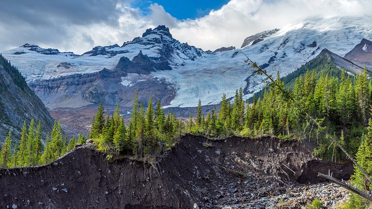
2. Burroughs Mountain Trail
The Burroughs Mountain Trail provides up-close exposure to the northeast side of Mount Rainier. The trail is accessible from the Sunrise parking area, with a few routes available. I'd recommend a clockwise looped trail from the parking area, beginning by hiking to Sunrise Camp.
The Burroughs Mountain Trail is easy to jump on from Sunrise Camp, high above the Glacier Basin Trail and the White River. After a bit of climbing, the trail navigates a subalpine terrain leading to the First and Second Burroughs Mountains. On a clear day, stunning views of Mount Rainier backdrop the route the entire way.
It's approximately 2.5 miles to reach the First Burroughs from Sunrise Camp and another mile to make it to Second Burroughs. A Third Burroughs also entices a closer view with another approximate mile of hiking and significant elevation gain. The view at all three Burroughs is incredible, rivaling any other viewpoint in the park.
To make it a round trip, hikers can head in the other direction toward Frozen Lake after descending First Burroughs. This path leads to Sourdough Ridge, which returns to the parking area. Sourdough Ridge is an iconic trail in the Paradise area, partly because it's so visible from the parking area as it cuts across a ridge. Sourdough Ridge is a great stand-alone hike if you're in the Sunrise area and short on time.
3. Naches Peak Loop
The Naches Peak Loop trail is a family-friendly, moderate loop on the northeast side of Mount Rainier National Park. This popular looped trail starts at Chinook Pass and spends half its time on the Pacific Crest Trail (PCT). The 3.5-mile roundtrip circumnavigates Naches Peak and provides stunning views of wildflower meadows and a beautiful backdrop of Mount Rainier.
Hikers begin by parking their cars at the scenic Tipsoo Lake. The 3.5-mile Naches Peak Loop can be tackled by going in either direction, with both ways providing big views of Dewey Lake at the trail's middle point. Clockwise is the most common approach. The hike starts at a high elevation and gains approximately 500 feet heading in either direction.
Hit this trail in late July or August for wildflowers, as well as an abundance of other people sharing the path.
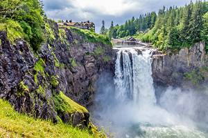
4. Silver Falls Loop
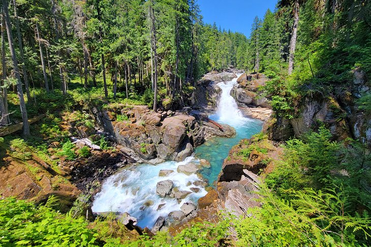
The Silver Falls Loop is a relatively flat three-mile loop that extends from the Ohanapecosh Campground. At the other end of this family-friendly trek is the stunning Silver Falls, which offers a high return on scenic beauty for the short walking distance.
The route sticks close to the icy waters of the Ohanapecosh River, though sometimes high above along the canyon sides. A surrounding old-growth forest contrasts with the rapidly moving river along the entire trek. The route is relatively flat the whole way, making for easy travel. Steep edges occasionally parallel the route, where parents will want to be extra mindful of young kids.
Plan to spend some time at Silver Falls. This amazing waterfall offers a good look at the grandeur surrounding Mount Rainier without having to travel deep into the mountain environment. A few small trails lead to closer viewpoints of the falls, and visitors should also be mindful of the slippery conditions.
A special series of hot springs also offers a small side adventure while traveling along the river's east side. Don't expect a soaking spot on this side adventure, but rather a boardwalk across a steaming bog.
5. Mount Fremont Lookout
The Mount Fremont Lookout trail departs from the Sunrise Visitors Center on the northeast side of Mount Rainier, taking hikers to the top of one of the few remaining fire lookouts in the park. On clear days, rewarding views of Mount Rainier are offered along this entire 5.6-mile hike.
The Fremont Fire Lookout sits at an elevation of over 7,000 feet. But with the Sunrise Visitors Center already at a height of 6,300 feet, the roundtrip hike involves less than 1,000 feet of climbing. This makes the route a good introduction for able-bodied hikers looking to get an excellent first impression of the mountain.
From the Sunrise Visitors Center, the route begins by heading west on Sourdough Ridge for 1.5 miles. It then connects with the Mount Fremont Lookout trail for the last 1.3 miles to the lookout. Hikers are exposed to extensive views the entire way, and if you catch them at the right time, an abundance of mountain goats call this rugged environment home.
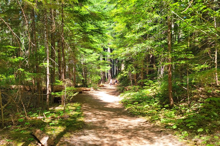
6. Grove of the Patriarchs
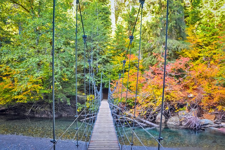
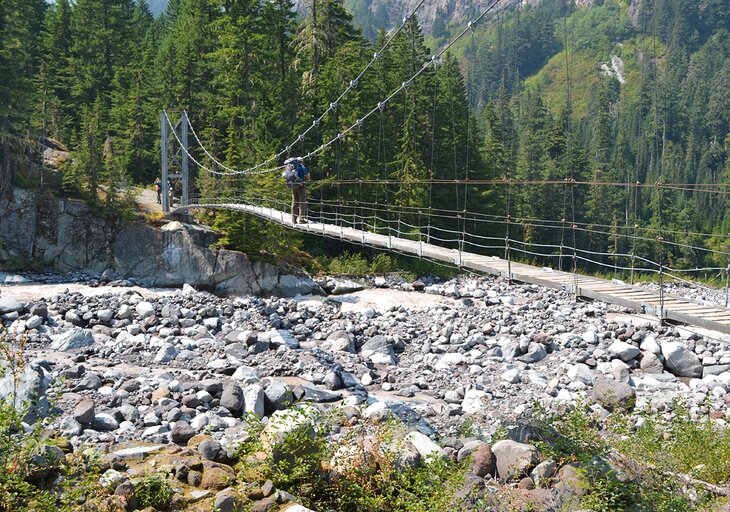
The Grove of the Patriarchs is a must-visit for families in Rainier, just west of the Stevens Canyon Entrance on the park's southeast side. Ancient Douglas fir and western red cedar trees line this 1.3-mile interpretive path, and a boardwalk navigates much of the way. The trail also includes an exciting suspension bridge that crosses the Ohanapecosh River.
The park's magnificence is presented at Grove of the Patriarchs, and anyone who visits feels the immediate impression of these ancient trees. With minimal elevation gain and generally wide paths, the Grove of the Patriarchs is one of the easiest hiking trails in Mount Rainier. This makes it especially popular for families with small children or strollers.
7. Rampart Ridge
This 4.6-mile loop hike has a trailhead near the Longmire Historic District and the National Park Inn. Mount Rainier makes a dramatic appearance on the horizon at about two miles when the trail tops out at Rampart Ridge. Visitors have to work for this view, and while there are only one or two significant viewpoints, the proximity to the mountain makes it worth it.
Heading clockwise on the Rampart Ridge Trail keeps Rainier in forward focus. It's a steady climb to reach the view, with nearly 1,400 feet of elevation gain overall, but the surrounding old-growth forest is a good distraction from the uphill climb. The Nisqually River Valley also comes into view about halfway through.
The trail connects to the Wonderland Trail to bring hikers back to Longmire. At the trailhead, the Trail of the Shadows is an easy interpretive trail to stretch the legs. This 0.7-mile loop is another popular family path worth the quick detour after tackling Rampart Ridge.
8. Tolmie Peak
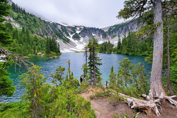
The Tolmie Peak trail begins at Mowich Lake on the northwest side of Mount Rainier. The 6.5-mile out-and-back hike follows the around-the-mountain Wonderland Trail for the first two miles. It then diverges off Ipsut Pass and follows its own path to the shores of the stunning Eunice Lake.
It's a steep half-mile climb up to Tolmie Peak and the Tolmie Peak Fire Lookout from Eunice Lake, but the effort is well rewarded with a stunning view of Mount Rainier. Tolmie Peak is a spectacular place to enjoy a packed lunch if the wind isn't too severe. The Tolmie Peak Fire Lookout is a designated historic structure not available for public use.
Getting to the trailhead, specifically the Mowich Lake region, is half the adventure. It's approximately a 30-mile drive on State Route 165 to reach this northwest region of the park on a mostly gravel and bumpy road. Despite these more-difficult travel conditions, finding a parking spot at the end of State Route 165 can also be an adventure.
9. Bench and Snow Lakes
These two subalpine lakes are a popular family hiking destination on the park's south side, with a trailhead 1.5 miles east of Reflection Lakes – where visitors can simply pull over and enjoy the shimmering waters. The parking lots for all these lakes tend to fill by midday in the summer, making an early arrival helpful to secure a spot.
The round trip to Bench and Snow Lakes is approximately 2.5 miles and several series of ups and downs along the route. The short distance does make it one of the more accessible hikes in Rainier, but the undulating elevation still provides a challenge. Having a walking stick really helps navigate the hilly terrain.
After less than a mile on the trail, the junction for Bench Lake encourages a hiking break. If the campsite is unoccupied, the signed backcountry camp at Bench Lake offers the best view. The lake is so named because it sits atop a natural "bench," which also serves as a viewing platform for Mount Rainier to the north on clear days.
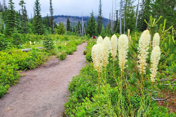
Snow Lake is farther up the trail and well worth the visit. Surrounding the entire route is a vertical rock face that reveals new details the more time you spend looking up at the rising landscape. The whole route also abounds with wildflowers throughout the summer, including ample beargrass. Expect to encounter all types of hikers along the trail.
10. Spray Park
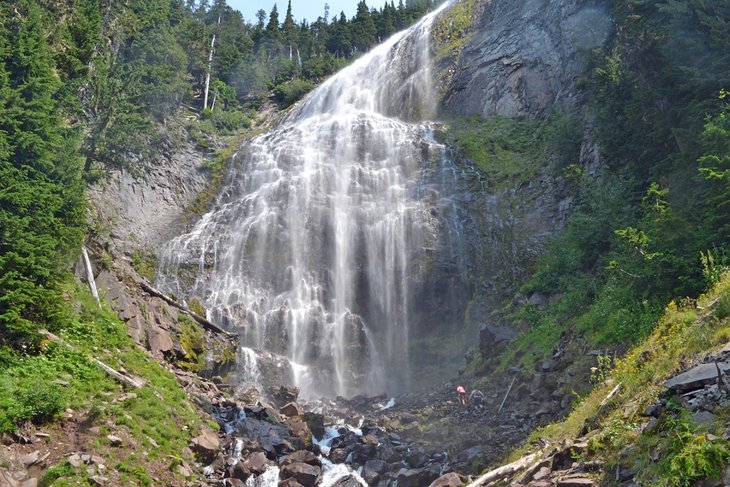
Spray Park is a stunning alpine meadow, often blooming with wildflowers throughout mid-July and August, located in the northwest region of the park. The hike to Spray Park, including a detour at the 350-foot Spray Falls, starts from the Mowich Lake walk-in campground, accessible with a long drive on the gravel State Route 165.
It's an uphill and strenuous hike, requiring six miles minimum to see the falls. This uphill climb makes Spray Park less busy than some other trails in the park. Still, the beautiful alpine meadows of Spray Park and the misty 350-foot waterfall do see some crowds.
There are two options to explore the Spray Park Trail. The first is a six-mile, out-and-back trek beginning at the Mowich Lake Campground. This trail passes through a dense forest and climbs 1,300 feet. Hikers can take the short but steep side trek to Spray Falls, about two miles up the trail. Continue another mile further, past the scenic Eagle Cliff viewpoint, and the luscious meadows of Spray Park come into view.
For more of a challenge, backpackers can approach Spray Park and Spray Falls from the other direction with a 17-mile backpacking loop. The loop starts at Mowich Lake and heads straight up towards Ipsut Pass along the Wonderland Trail. Highlights of this clockwise route include the Carbon River, the Carbon Glacier, and Seattle Park, all before trekking through Spray Park.
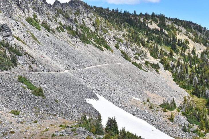
11. Glacier Basin
The Glacier Basin Trail is a favorite route for climbers looking to ascend the mighty Mount Rainier. The trail is also popular with day hikers who come to see the splendid scenery on the park's northeast side.
The most common spot to start the hike begins at the upper end of the White River Campground. This area of Mount Rainier has a mining history before its status as a national park, and evidence of that era is found underfoot as the trail follows an old mining road that leads into Glacier Basin. Trail runners and other long-distance hikers can access the basin from the Sunrise area of the park.
Along the converted trail to Glacier Basin, hikers take in big views of Mount Rainier, including an optional side trip to a viewpoint of Emmons Glacier. With minimal elevation gain, hikers are also treated to lush meadows and forests carved out by the cascading White River.
The trail becomes noticeably steeper as it approaches Glacier Basin Campground, approximately 3.5 miles into the trail. This backcountry camping area is a great turnaround point for an adventurous day.
12. Summerland
The Summerland area of the park is one of the most popular trails on summer weekends and warrants a large number of visitors. It's the big views of Mount Rainier that attract such big crowds, including views of Fryingpan Glacier and Little Tahoma Peak. The trailhead is accessible from the White River Entrance, and the parking area routinely fills to capacity.
It's approximately an 8.5-mile round trip to reach Summerland and back. Hikers often venture farther as they explore the different trails branching throughout the sub-alpine meadows of the area. Ambitious hikers can continue farther to Panhandle Gap, and those with permits can set up a tent in Summerland to spend the night.
13. Shriner Peak Trail
Despite its gorgeous views, Shriner Peak is colloquially known as the Loneliest Trail at Mount Rainier National Park. It's on the park's east side, four miles north of the Stevens Canyon Entrance. A thigh-busting incline and shadeless route account for the lack of hikers heading up Shriner Peak, especially in the summer, but the views are still well worth the effort.
Shriner Peak Trail tops out at the Shriner Peak Lookout, with approximately four miles of hiking and over 3,400 feet of elevation gain. This hearty hike doesn't reveal a view of Mount Rainier until about 2.5 miles up, but when it does, the vantage only increases in scenic appeal. And at the top, an outlook of the Ohanapecosh Valley and several other Cascade Mountains emerges on the horizon.
The best bet for Shriner Peak Trail in the summer is to get an early start before 7am. Another great option is to tackle the climb in the shoulder seasons, especially in the fall. Alongside cooler temperatures, the new shades of the fall season add extra scenic appeal. Bring plenty of water along the route, as there are no available resources along the way. The fire tower is physically closed to the public, although you can enjoy the view from its wrap-around balcony.
Finding the trailhead was a bit tricky. It was clearly marked, but there wasn't much room for parking in the designated spaces across the road. And these designated spaces were more like skinny pull-offs, and I had to ensure my tires were off the road before hiking.
14. Narada Falls
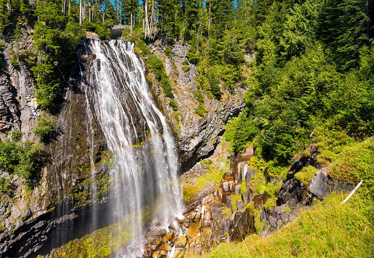
Narada Falls offers a popular photo opportunity at Mount Rainier National Park. Not only because the two tiers of this impressive waterfall cascade for more than 180 feet, but also because the Mount Rainier Highway crosses over the falls, making for a straightforward approach. While the 0.2-mile hike down to the best viewing platform is universally accessible, the trail has steep moments and is usually wet.
The Narada Falls trail offers another popular trailhead in the Paradise area of Mount Rainier. Hikers looking to explore more can continue past the 0.2-mile mark at Narada Falls and head towards a dazzling collection of Reflection Lakes. Several looped options open from here, many of which lead to fantastic Tatoosh Mountain Range vantage points.
15. Wonderland Trail
The Wonderland Trail is an all-encompassing 93-mile loop that circumnavigates the entire base of Mount Rainier. This bucket-list hike features significant elevation changes plus unbelievable landscapes of luscious meadows, dense forests, and wild water systems. The Wonderland Trail connects and shares footsteps with many of the abovementioned trails.
Hikers must obtain a much sought-after permit to trek along the Wonderland Trail and spend the night in the backcountry. The strenuous endeavor of thru-hiking the Wonderland Trail requires prior backpacking experience or a knowledgeable trip leader. It takes most hikers an average of 10 days. The route is filled with steep hiking, gaining over 23,000 feet of elevation.
Backpackers carry much of their food with them and can mail ahead future supplies to different caches along the trail. Permits for the trail are in high demand, and backpackers can start applying for the year's allocation in mid-March. The prime hiking season for the Wonderland Trail is from late July to mid-September.
More Related Articles on PlanetWare.com
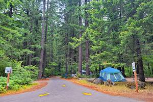
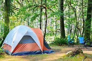
Camping at Mount Rainier National Park: The best way to experience all the hiking trails at Mount Rainier is to pitch a tent near the trailheads. Our guide to the best campgrounds at Mount Rainier National Park goes into detail about the best locations to pitch a tent or park an RV. For more inspiration for your next adventure, the best state and national parks in Washington add considerable scenic interest to the rest of the state.
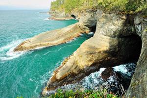
Hiking and Camping in Olympic National Park: Mount Rainier is far from the only national park in Washington, and the Evergreen State delivers with more amazement in Olympic National Park. On the Olympic Peninsula on the western side of the state, Olympic National Park encompasses rainforests, icy peaks, and a rugged coast. The best hiking trails in Olympic National Park explore it all. Likewise, the top camping spots feature dramatic landscapes where you can pitch a tent.