
Tunisia Travel Guide: Plan Your Perfect Trip
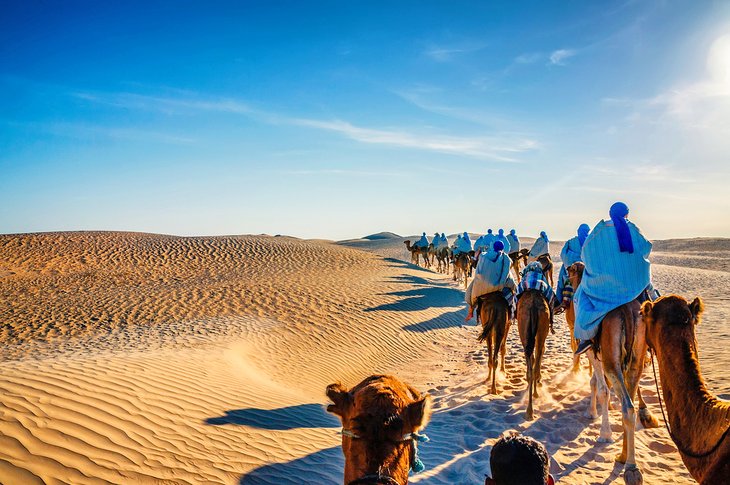
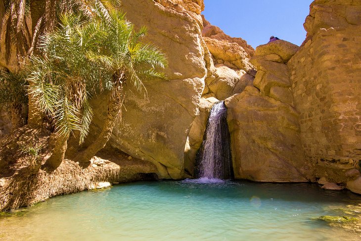
Tunisia may be mainly known as a summer sun and sea travel destination, but off the beach there is much more to discover. In the south, the Sahara's swath of desert sand scattered with lonely oases offers landscapes of rolling dunes that are ripe for adventure tourism activities, while in the north, the ruins of ancient towns sit snug within fertile hill country and are easy historic day trips from Tunis.
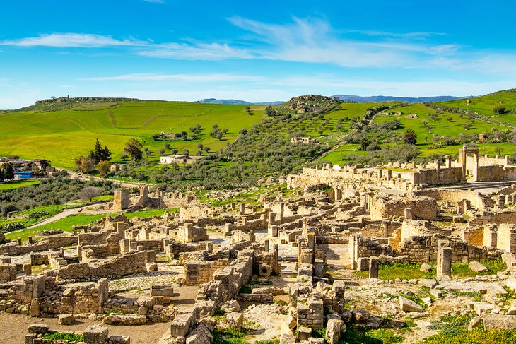
Tunisia's geographical situation laid it open from time immemorial to empire builders. The Roman amphitheater at El Djem is only the most famous of the country's historical sights, which take in Phoenician and Roman ruins, Roman and Byzantine mosaics, and Arab and Ottoman forts.
For those who want to explore beyond its feted beaches, Tunisia's small size makes it simple to experience a mix of culture, history, and landscapes even on a short trip.
On This Page:
Inspirational Ideas for Planning Your Trip to Tunisia
For beach vacations, head straight to the Mediterranean shore. Away from the coast, Tunisia provides plenty of adventure activities amid the vast desert landscapes of the Sahara, famous film locations for fans of movies such as the Star Wars franchise, and some of the grandest Roman ruins in north Africa.
Plan what not to miss in your holiday itinerary by checking out our overview articles on the country's highlights.
Best Time to Visit Tunisia
Summer: If you're traveling to Tunisia solely for the Mediterranean beaches, summer is high season, with sun and blue skies from June through August. Beach resort prices are highest during July and August. Desert trips are best avoided during this season due to rocketing temperatures.
Fall (September & October): As well as spring, fall is the best time to visit Tunisia if you want to travel around the country rather than simply bask on the beach. The weather is still mostly sunny and warm, but the high temperatures of July and August have tempered down in the south, so desert trips are back on the cards. Expect some rain in October in the north.
Winter: Tunisia's northern region and the Mediterranean coast receive most of their rain from around late October to May. It can get very chilly (including in the desert after dark), so bring warm clothing. The coastal beach resorts may be quiet, but this is a great time if you're traveling specifically for the desert.
Spring: Lots of blue skies (though expect rain along the coast and in the north) and moderate temperatures make this an excellent season for visitors who want to travel around the entire country.
Visitors Guide to Tunis
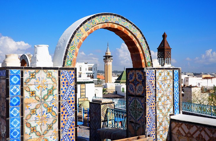
Tunisia's capital, Tunis, is a laid-back introduction to the country. Many tourists spend little time here, often only visiting as a day trip from the beach, but Tunis is the contemporary heartbeat of Tunisia and has plenty to keep visitors busy for a few days.
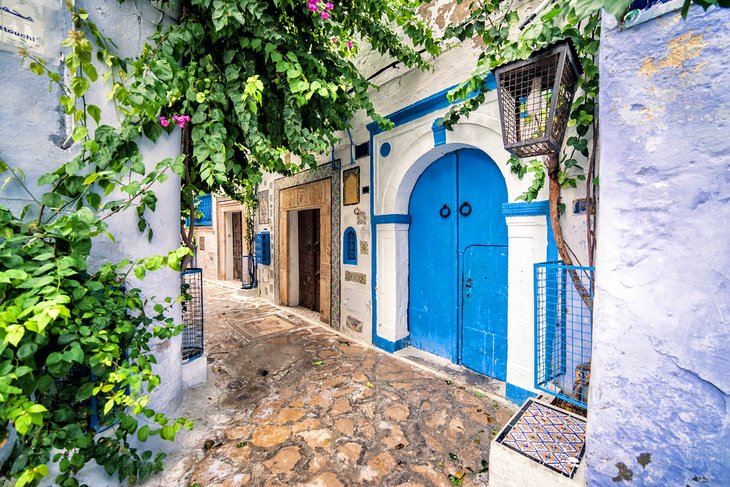
Spend some time exploring the wriggling alleys of the historic medina (old town), soaking up the ambience of Sidi Bou Said, admiring the world-famous mosaic collection inside the Bardo Museum, and visiting the rambling ruins of once-mighty Carthage before setting off on farther travels.
Best Towns in Tunisia
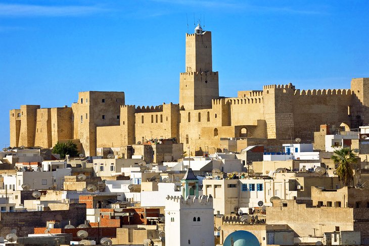
Many visitors here to soak up the sun on the beach head directly to the Mediterranean coastal towns of Hammamet and Sousse, and the island of Djerba, which are particular favorites with overseas tourists. If you're interested in history and culture, don't miss the town of Kairouan, with its labyrinthine medina, and the desert oasis town of Tozeur with its preserved brick architecture.
- Tourist Attractions in Hammamet
- Tourist Attractions in Sousse
- Tourist Attraction in Djerba
- Tourist Attractions in Kairouan
- Tourist Attractions in Tozeur
- Exploring Tozeur's Oasis: A Visitor's Guide
- Tourist Attractions in Monastir
- Tourist Attractions in Sfax
- Tourist Attractions in Mahdia
- Tourist Attractions in Bizerte
Historic Highlights of Tunisia
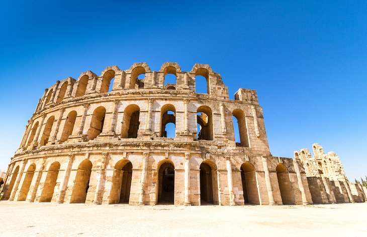
Tunisia's star historical attraction is El Djem, a massive and wonderfully preserved Roman amphitheater that was the fourth largest ever built during the Roman era. Tunisia, though, has a long and rich history, and there are plenty more historic remnants for travelers who want to delve further.
The two most impressive Roman city ruins, Dougga and Bulla Regia, are in the country's north and can be easily visited as day trips from either Tunis or Tabarka.
Essential Stats & Facts
- Population of Tunisia: The population of Tunisia is 11.8 million. Nearly the entire population lives in the country's northern half and along the coast. Around 70 percent of Tunisia's population live in urban areas.
- Capital of Tunisia: The capital of Tunisia is Tunis, which has a population of two million.
- Geography of Tunisia: Tunisia is a thin country rimming the Mediterranean Sea to the north and sharing borders with Algeria to the west and Libya to the east. The northern half of the country is mountainous, while the Sahara desert covers much of Tunisia's southern half. In total, Tunisia covers an area of 163,610 square kilometers.
- Languages of Tunisia: The official language of Tunisia is Arabic. French is widely spoken in Tunisia despite having no official language status. Tamazight is also spoken by the Amazigh (Berber).
- Currency of Tunisia: The currency of Tunisia is the Tunisian dinar.
- Time Zone of Tunisia: The time zone of Tunisia is UTC + 1.
First-Time Traveler Tips for Tunisia
Tourist Visas for Tunisia: Passport holders of 97 countries can enter Tunisia visa-free for stays of between 30 and 90 days (depending on the country). Nationalities that require a tourist visa need to apply pre-travel at the Tunisian Embassy. An online e-visa system is currently in the works to make the tourist visa application process easier and more streamlined.
Clothing: Tunisia is an easygoing society, but off the beach and away from the tourist resorts and Tunis, travelers should err on the conservative side in their clothing, covering shoulders and knees, particularly if traveling in rural areas.
Electricity: Tunisia uses two-prong European-style plugs.
Money: Apart from large hotels, big tourist-orientated shops, and a few fine-dining restaurants, credit cards aren't widely accepted in Tunisia, so expect to pay in cash. ATMs are widely available. It is very useful to have small change for public transport, small restaurants, and shops that may not be able to break larger bills.
Mosquitos: If you are traveling to the desert oases such as Tozeur, pack some insect repellent. The mosquitos can be ferocious.
Photography: Be aware that it is illegal to photograph government and military facilities in Tunisia, and don't bring along your drone for taking spectacular aerial shots of the desert. All drone photography is illegal in Tunisia without an official permit. Always ask permission before taking photos of people.
