13 Top-Rated Hiking Trails near Sacramento, CA
Excellent hiking trails and places to explore surround Sacramento. Several notable landscapes help define the capital city, including the American River flowing on the north side of town. Here, the Jedediah Smith Memorial Trail navigates the entire American River Parkway, stretching for 32 miles northeast to Folsom Lake.
The Sierra Nevada Mountains and their foothills also have tons of hiking trails close to Sacramento. Within this elevated terrain, less than an hour from the city, places like Auburn State Recreation Area and Cronan Ranch Regional Trails Park offer full-day experiences. And the inviting waters and shoreline trails at Folsom Lake are also within a short drive.
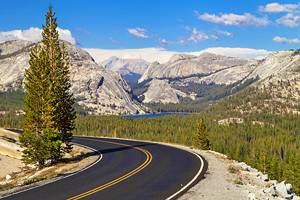
Farther east into the Sierra Nevada Mountains, the Tahoe and Eldorado National Forests contain a treasure trove of hiking trails and outdoor recreation near Sacramento, including portions of the historic Western States Trail. This is also the spot to find waterfall trails near Sacramento.
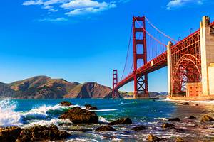
Lake Tahoe and the entire Bay Area including San Francisco are other hiking hot spots within a two-hour drive. And within every direction, day hikes highlight the river canyons, historic bridges, and gold-panning prospects of this iconic California region.
Plan your outdoor adventures around the California capital with our list of the best hikes near Sacramento.
- 1. Jedediah Smith Memorial Trail, American River Parkway
- 2. The Quarry Trail, Auburn State Recreation Area
- 3. Darrington Trail, Folsom Lake State Recreation Area
- 4. River Walk Trail, Cosumnes River Preserve
- 5. Cronan Ranch Regional Trails Park
- 6. Independence Trail, South Yuba River State Park
- 7. Western States Trail
- 8. Lake Clementine, Auburn State Recreation Area
- 9. Gold Discovery Loop, Marshall Gold Discovery State Historic Park
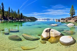
- 10. Rubicon Trail, South Lake Tahoe
- 11. Blue Heron Trails, Stone Lakes National Wildlife Refuge
- 12. Mount Diablo Summit, Mount Diablo State Park
- 13. Donner Memorial State Park Interpretive Trail
- Map of Hiking Trails near Sacramento, CA
- Sacramento, CA - Climate Chart
1. Jedediah Smith Memorial Trail, American River Parkway
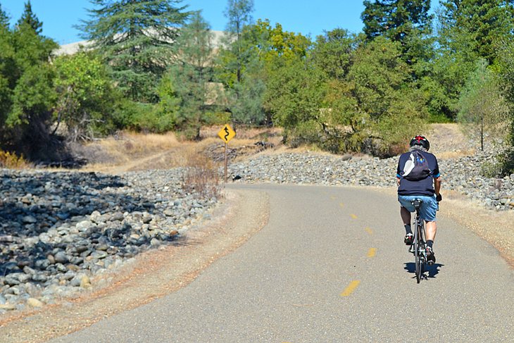
The American River Parkway is a collection of parklands along the banks of the American River on the northside of the city. This massive expanse of open space encompasses over 5,000 acres and spans over 20 miles between Discovery Park in Sacramento and the Nimbus Dam, part of Folsom Lake State Recreation Area.
The paved Jedediah Smith Memorial Trail runs the entire length of the parkway and more. It extends past the Nimbus Dam all the way up to Beal's Point on Folsom Lake's western shore, and dozens of access points line this protected riparian habitat and pedestrian trail.
The Jedediah Smith Trail is popular with bicyclists and joggers and for any non-motorized method of transportation. Several dirt hiking trails parallel the 32-mile trail, enabling visitors to explore off the pavement.
The trail's terminus at Beal's Point also lends access to one of the best campgrounds near Sacramento. Intrepid campers can bike their gear from Sacramento on the Jedediah Smith Trail to stay at the Beal's Point Campground.
Numerous scenic spots line the entire trail, particularly along the other reservoir within Folsom Lake State Recreation Area, Lake Natoma. Picnic spots, restroom facilities, and other public parks also line the trail.
Official site: https://arpf.org/
2. The Quarry Trail, Auburn State Recreation Area
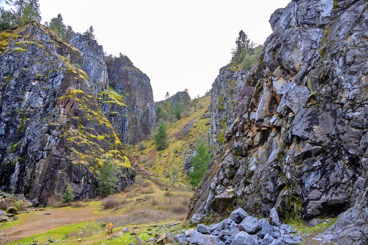
Auburn State Recreation Area encompasses a scenic landscape surrounding the North and Middle Fork of the American River, forty miles northeast of Sacramento. Over 100 miles of multi-use trails span this massive recreation area, where other popular activities include white-water rafting, camping, and gold panning.
The Quarry Trail is one of the most accessible trails, and perhaps the area's most scenic corridor. It follows the Middle Fork for 5.6 miles with a moderate grade and is popular for equestrian use and day hiking.
The Quarry Trail has numerous opportunities for side hikes and loops, including junctions with the historic Western States Trail. The mighty rapids of the American River are seen and heard along the trail at the ominously named Murderer's Bar. Remnants of the old quarry also line the route.
Other scenic trailheads extend from the Quarry Trail parking area, including a short trail that leads to No-Hands Bridge.
Official site: https://www.parks.ca.gov/?page_id=502
3. Darrington Trail, Folsom Lake State Recreation Area
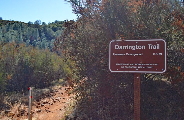
The Darrington Trail, also known as Salmon Falls, is on the South Fork of the American River within Folsom Lake State Recreation Area. It's popular for hikers and mountain bikers alike, and visitors from Sacramento can reach the trailhead within a 45-minute drive.
This single-track trail spans just over eight miles along the shoreline, eventually connecting to the Peninsula Campground. It follows undulating elevations, with less than 800 total feet of elevation gain total. The trail is most challenging at the beginning, with some steep cliff edges.
Limited water access on the trail and hot temperatures during the summer make packing hydration necessary when planning a trip. Hikers and mountain bikers often share the trail, as well as the gorgeous views of the American River Valley.
Numerous other lakeside hiking trails span the South Fork of the American River, including the Sweetwater Creek Trail on the other side of the Salmon Falls Bridge.
Address: Salmon Falls Road, Pilot Hill, California
4. River Walk Trail, Cosumnes River Preserve
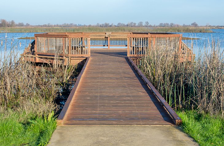
The Cosumnes River Preserve is a designated wildlife habitat, a 30-mile drive south of Sacramento, and home to over 250 species of birds. The preserve protects over 50,000 acres of vital wetlands and is co-managed by several state, federal, and non-profit partners.
The looped River Walk Trail is a good place to explore the preserve and witness the resident wildlife. This 3.5-mile route follows raised levees as it traverses the riparian habitat, making it very accessible and popular for family hikes.
The Lost Slough Wetlands Walk is another universally accessible, one-mile trail at the preserve with ample viewing platforms. In total, Cosumnes has over 10 miles of trails throughout the property.
Address: 13501 Franklin Boulevard, Galt, California
Official site: http://www.cosumnes.org/
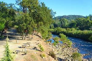
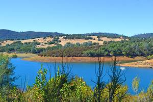
5. Cronan Ranch Regional Trails Park
Cronan Ranch Regional Trails Park is an hour's drive from Sacramento. It's nestled into the Sierra Nevada foothills just north of Folsom Lake and near the Gold Rush community of Coloma. The most popular trailhead to access this network of trails is off Highway 49.
Over 12 miles of trails span the rolling woodlands of Cronan Ranch. The ambling waters of the South Fork of the American River also make an appearance. The trails range from retired forest roads to sunny paths that climb across the rolling topography. Shade is limited throughout the area, and visitors should plan on sunny conditions.
A universally accessible trail system can be found just east of Cronan Ranch on Highway 49 at the Dave Moore Nature Area. This quiet spot offers a flat one-mile loop with a great vantage point of the South Fork. Both the Dave Moore Nature Area and Cronan Ranch are operated by the Bureau of Land Management (BLM).
Location: Pilot Hill, California
6. Independence Trail, South Yuba River State Park
South Yuba River State Park is parceled along the South Yuba River north of Sacramento, in the foothills of the Sierra Nevada Mountains. The park lends access to historic mining sites, gold panning opportunities, and numerous hiking trails that navigate the verdant river canyon.
One of the most unique hiking trails of the area, the Independence Trail, utilizes wooden flumes that once directed water to gold-mining operations in the area. These retired wooden flumes make the Independence Trail one of the nation's first recognized wheelchair-accessible wilderness trails.
There's an east and west Independence Trail to choose between. The wooden planks of Independence Trail West are the most recommended route, spanning over two miles above the South Yuba River and offering great views of the canyon. The trailhead is less than a 90-minute drive from Sacramento.
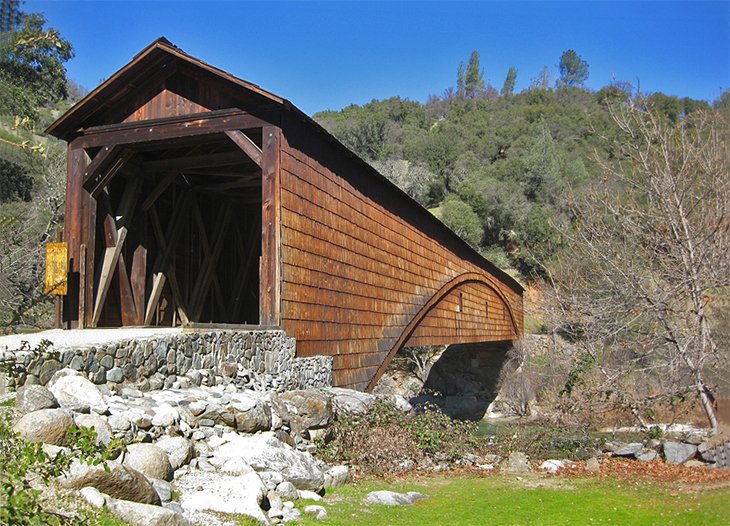
Other trails in the spread-out South Yuba River State Park include the Buttermilk Bend Trail and the Point Defiance Loop. Both trails are in the vicinity of the Bridgeport Bridge–one of the oldest covered bridges in the American West.
Address: CA-49, Nevada City, California
Official site: https://www.parks.ca.gov/?page_id=496
7. Western States Trail
This natural route across the Sierra Nevada Mountains is a trail trodden by the steps of history, first traveled by Indigenous cultures of the region. Gold miners later traversed the route between Nevada and California during the 1850s Gold Rush. And today, the Western States Trail near Sacramento is home to one of the most challenging ultra-marathons in the world.
Spanning 100 miles from Squaw Valley to Auburn State Recreation Area, the Western States Endurance Run includes over 40,000-plus feet of thigh-busting elevation change. The entire historic Western States Trail stretches from Salt Lake City to Sacramento, and the Western States Endurance Run utilizes the trans-Sierra portion of the route.
You don't have to be a long-distance runner to enjoy the trail, however. And while much of the trail crosses through wilderness areas that are hard to access with a car, the trail's western terminus near Auburn is easy to reach from Sacramento. The scenic No-Hands Bridge, near the Quarry Trail Trailhead, is one of the easiest places to step onto this historic route.
Official site: https://www.wser.org
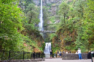
8. Lake Clementine, Auburn State Recreation Area
Among the 100 miles of multi-use trails in Auburn State Recreation Area, 40 miles northeast of Sacramento, the two-mile trail leading to Lake Clementine is one of the most popular. And with less than 500 feet of elevation gain, it's also one of the easier trails at the recreation area.
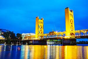
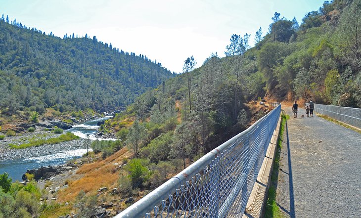
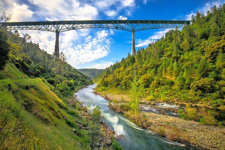
The trail follows the banks of the North Fork of the American River and includes impressive views of the Foresthill Bridge, one of the tallest bridges in California. Alongside this often-photographed attraction, the scenery surrounding the North Fork is also very photogenic.
After nearly two miles on the Lake Clementine Trail, hikers reach the paved Lake Clementine Road. Following Lake Clementine Road for less than a quarter-mile, a cascading view of Lake Clementine Dam greets hikers near the end of the trail, complete with a constant mist-shrouded waterfall. This overlook is a great place to eat some lunch before hiking the two miles back to the trailhead.
Address: 139 Old Foresthill Road, Auburn, California
Official site: https://www.parks.ca.gov/?page_id=502
9. Gold Discovery Loop, Marshall Gold Discovery State Historic Park
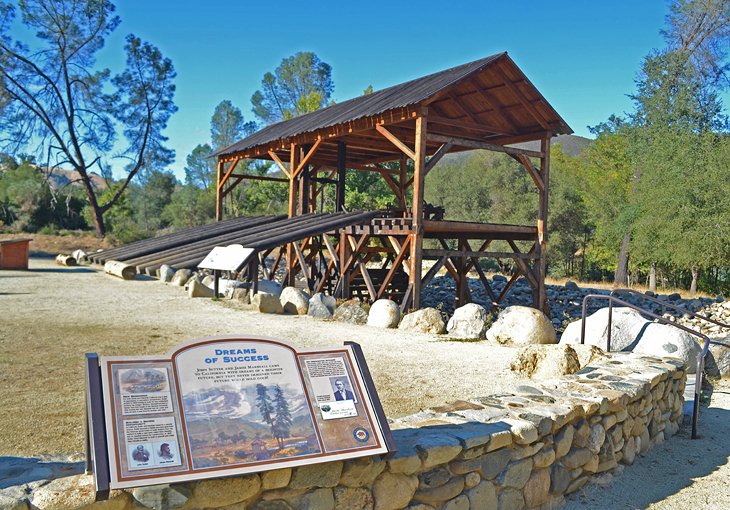
Within the charming community of Coloma, 45 miles from Sacramento, this historic park commemorates one of the biggest discoveries in California history. At this scenic site in the Sierra Nevada foothills, James Marshall discovered the first gold in California in 1848–spurring a Gold Rush that would forever change the land and culture of the state.
Interpretive opportunities and preserved artifacts line the park, and the Gold Discovery Loop is a family-friendly loop that tours the historic surroundings. Among the interpretive stops on the trail are 20 historic and reconstructed buildings, including a replica of the Sutter's original sawmill.
Address: 310 Back Street, Coloma, California
Official site: https://www.parks.ca.gov/?page_id=484
10. Rubicon Trail, South Lake Tahoe
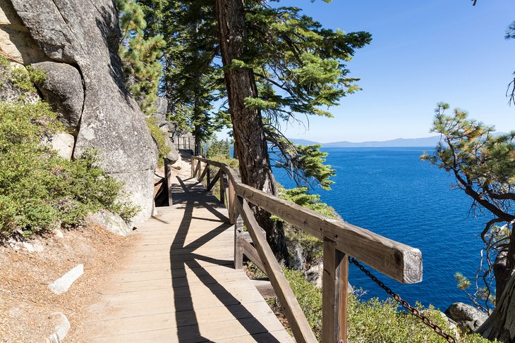
The sparkling blue water of Lake Tahoe attracts millions of visitors each year. And visitors from Sacramento reach the southern shores with just over a two-hour drive. This southern end of the lake, or South Lake Tahoe, is an excellent spot for weekend visits and extended vacations.
Resorts and campgrounds dot the shores of South Lake Tahoe, offering many hiking trails to explore. One of the best hiking trails near South Lake Tahoe, the Rubicon Trail, connects two of the most scenic state parks found on this side of the lake, D.L. Bliss State Park and Emerald Bay State Park.
The Rubicon Trail traverses this postcard-worthy shore in just over four miles, with an undulating route and relatively low elevation gain. Hikers can head in either direction, and without a shuttle placement, it's a near 10-mile, out-and-back hike. The views are outstanding no matter which direction traveled, and parking at either state park is competitive, particularly on summer weekends.
Official site: https://www.fs.usda.gov/ltbmu/
11. Blue Heron Trails, Stone Lakes National Wildlife Refuge
For an easy escape into nature, the Stone Lakes National Wildlife Refuge is located 20 minutes south of Sacramento. This urban refuge protects over 17,000 acres from future development and is a haven for migratory birds and native wildlife.
The Blue Heron Trails at the refuge offer great day hikes for the whole family. This trail system features a series of universally accessible paved hiking loops. These loops are popular with families and strollers and feature immediate access to the wild surroundings of the wildlife refuge.
The trailhead features plenty of parking and a vault toilet. Visitors should bring their own water and be aware that there is little shade along the route. The best season to visit is between October and May.
Address: 1624 Hood Franklin Road, Elk Grove, California
Official site: https://www.fws.gov/refuge/stone_lakes/
12. Mount Diablo Summit, Mount Diablo State Park
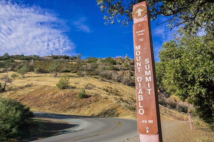
Mount Diablo State Park is one of the best hiking trails near San Francisco and is accessible from Sacramento with a two-hour drive. Numerous hiking trails span this 20,000-acre park, including a few different options to reach the summit of the 3,849-foot Mount Diablo.
The route leading to the summit from the Mitchell Canyon Staging Area provides the longest route at nearly eight miles in length, as well as the largest diversity of landscapes along the way.
Beginning at the Mitchell Canyon Staging Area, the route utilizes fire roads and the Eagle Peak Trail to reach the summit. Great views are afforded from the high vantage points and ridge routes along the trail, which also lend to over 3,000 feet of elevation gain.
For a much shorter summit hike, visitors can access the Summit Visitor Center via personal vehicle and hike the one-mile Mary Bowerman Interpretive Trail to the top.
Address: Summit Road, Walnut Creek, California
Official site: https://www.parks.ca.gov/?page_id=28159
13. Donner Memorial State Park Interpretive Trail
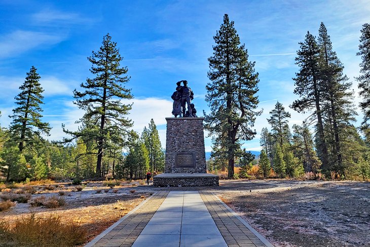
The charming town of Truckee is an approximately 100-mile drive from Sacramento, up and into the Sierra Nevada Mountains. Tahoe National Forest surrounds this mountain town, offering several hiking and skiing opportunities throughout the year.
Truckee is also home to Donner Memorial State Park, where emigrants in the 1800s used the nearby Donner Pass to navigate stagecoaches through the mountains. Prior to that, the Washoe People have a much longer history with the region. Visitors can learn more about this historically rich area at the Donner Memorial State Park Visitor Center, also known as the Emigrant Trail Museum.
The Donner Memorial Interpretive Trail is an extension of the visitor center. It leads outside and follows a half-mile path with historically significant sites and statues along the way. One of the most visible, the Pioneer Monument, is encountered almost immediately along the path.
The interpretive trail is only the tip of hiking trails in Donner Memorial State Park and the surrounding area. Hop on the Museum Lakeside Trail to reach the shore of Donner Lake. And farther west, visible from the shoreline, Donner Pass and Donner Summit are both hot spots for hiking.
Map of Hiking Trails near Sacramento, CA
Sacramento, CA - Climate Chart
| Average minimum and maximum temperatures for Sacramento, CA in °C | |||||||||||
| J | F | M | A | M | J | J | A | S | O | N | D |
| 13 5 | 17 7 | 19 8 | 23 10 | 28 12 | 32 14 | 34 16 | 34 16 | 32 15 | 26 12 | 18 8 | 13 4 |
| PlanetWare.com | |||||||||||
| Average monthly precipitation totals for Sacramento, CA in mm. | |||||||||||
| 106 | 96 | 80 | 30 | 15 | 5 | 1 | 1 | 9 | 25 | 66 | 70 |
| Average minimum and maximum temperatures for Sacramento, CA in °F | |||||||||||
| J | F | M | A | M | J | J | A | S | O | N | D |
| 55 41 | 62 45 | 67 47 | 74 50 | 82 54 | 89 58 | 94 61 | 93 61 | 89 59 | 79 54 | 64 46 | 55 40 |
| PlanetWare.com | |||||||||||
| Average monthly precipitation totals for Sacramento, CA in inches. | |||||||||||
| 4.2 | 3.8 | 3.2 | 1.2 | 0.6 | 0.2 | 0.1 | 0.1 | 0.4 | 1.0 | 2.6 | 2.8 |
More Related Articles on PlanetWare.com

More to Explore in Sacramento: To add a fun overnight experience to your hiking endeavors, the best campgrounds near Sacramento are found near many prominent trailheads. After exploring the outdoors surrounding Sacramento, the tourist attractions of the city offer a different slice of Central California culture. Our guide to the best things to do in Sacramento can help you navigate the city streets and discover all the fun to be had in California's capital city.
Hiking in California: For a look at all the state has to offer, our guide to the top-rated hiking trails in California presents all the different environments to explore. For some Southern California landscapes to discover, the best hiking trails in Southern California lead down memorable paths.