Watching Eruptions in Hawai'i Volcanoes National Park
It's always been a fantasy of mine to travel through time. Driving through over-developed communities across the U.S. I often stop and wonder what these places looked like centuries ago before housing communities, roads, and strip malls were a thing. I wonder about what life was like before European settlers arrived on our shores. And, sometimes, I wonder what it was like before there were any humans at all.
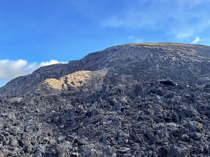
A recent visit to the Big Island's Hawai'i Volcanoes National Park is probably the closest I'll get to time travel. Every step across the crunchy, volcanic earth is literally walking through millennia, watching the primordial history of the earth unfold before my very eyes.
The culmination of this experience, for me, was the opportunity to watch the eruptions of the Kilauea volcano. Volcanic eruptions are tied to the formation of planets, and the shaping and reshaping of land masses, and continue to influence how the Earth and other celestial bodies change. If you think about it, not only is watching this natural phenomenon a glimpse into the past, but it also feels like looking into the early makings of the future.
Where is Volcanoes National Park?

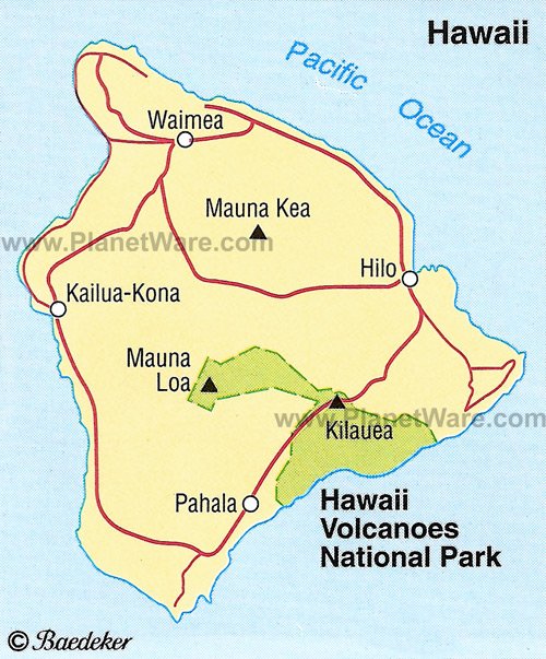
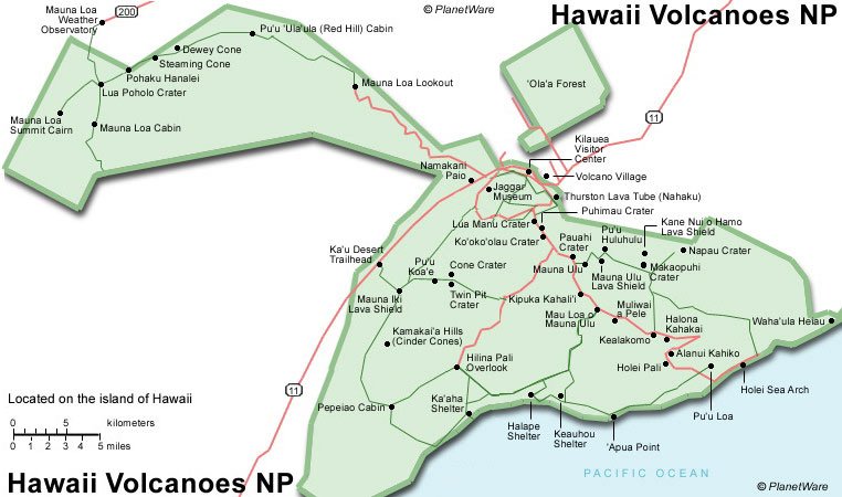
Volcanoes National Park is on the southeastern corner of the Big Island of Hawaii. The park starts at sea level and climbs to 13,680 feet. Today it is both an International Biosphere Reserve and a UNESCO World Heritage Site. Visitors can get to the park from either Kona or Hilo. It is a two-hour drive from Kona and a 45-minute drive from Hilo.
Volcanoes National Park is definitely a must-do if you're visiting Hilo, but it's also one of the top attractions on the Big Island.
What are the Volcanoes in Volcanoes National Park?
The two volcanoes in the park are Kilauea and Mauna Loa. Today, both volcanoes are some of the most active volcanoes in the world. For the past 200 years, Kilauea and Mauna Loa have erupted on average every two to three years. It was blissful timing that Kilauea began to erupt in early January 2023, right before I was set to touch down on the Big Island.
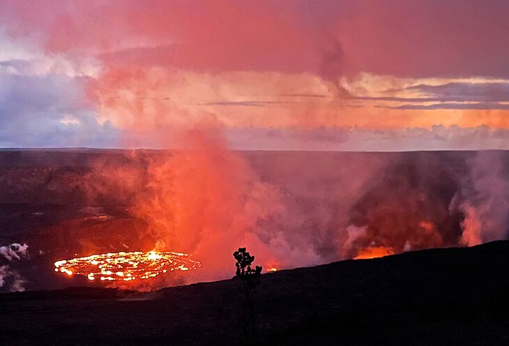
Kilauea is best viewed during the evening when the dark sky creates the perfect, velvety backdrop to watch the molten lava bubble and ooze in swirls of fiery orange. Fortunately, Volcanoes National Park is open 24 hours a day, making it very easy to visit at night.
How to Watch the Eruptions at Volcanoes National Park
My suggestion is to make an entire day of it, as there are so many hiking trails and other things to see within the national park.
South Rim
The best place to see the lava from Kilauea is along the south rim. This area has three main viewing locations including Kupina'i Pali from Crater Rim Trail, Kilauea Overlook, and Keanakakoi Crater. Rumor has it that the crater is the closest viewpoint to watch the eruptions.
Sadly, we arrived too late in the day to snag a parking spot to get to these viewpoints. If you are planning to hike, you may want to start early in the day so that you can get over to the south rim by late afternoon. You'll have to wait around longer for things to get dark, but you have a better chance of getting a parking spot.
Uwekahuna Bluff
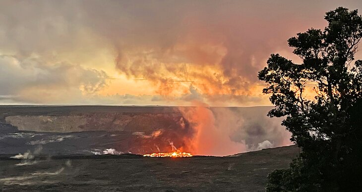
"It's like the guts of the sun are sloshing around right here on Earth."
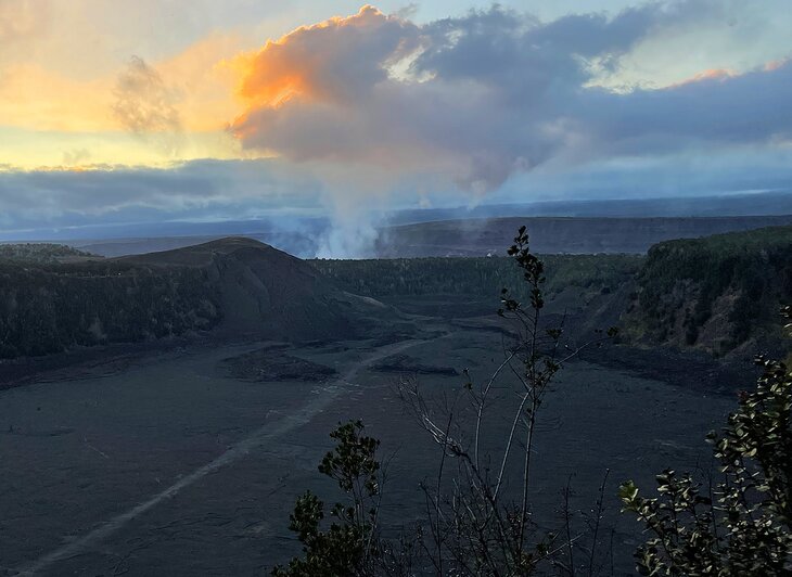
That said, all is not lost if you can't nab a spot from the Kilauea Overlook. We were directed over to the Uwekahuna Bluff, which is said to be the second-best spot to view the lava eruptions. Honestly, had we not known about the Kilauea Overlook, we would not have been disappointed because the view from Uwekahuna Bluff is really quite excellent.
We parked in a large, grassy parking lot and were directed by park employees to walk about half a mile along a paved trail that hugs a canyon rim overlooking Kilauea. The sun sank further below the horizon turning the sky from light navy to inky black in a matter of minutes. We walked by the light of the moon and the glow from dozens of cell phone flashlights that were lighting up the pathway.
Before long, in the distance, we started to see the gurgle of spitting fire that bubbled up from the dark rocky floor. If you've never seen lava before, it's exactly like you'd imagine it to be. It is quite literally liquid fire — it's like the guts of the sun are sloshing around right here on Earth. It reminds you of dinosaurs, of Lord of the Rings — of everything you've ever read about or seen in the movies, except it's right here in front of your eyes. And if you stand very quietly, you can actually hear the sputtering and spewing of the molten magma as it bubbles up to the surface of the earth.
It is simply mind-blowing. It is the most primordial event we as humans can actually witness here on earth. It is a reminder, impossible to ignore, that the earth was here long before us and will be here long after we are gone. For a brief moment, I was reminded of just how insignificant we are in the face of Mother Nature. It is a moment I will never forget and one that everyone should experience for themselves if they have the opportunity.
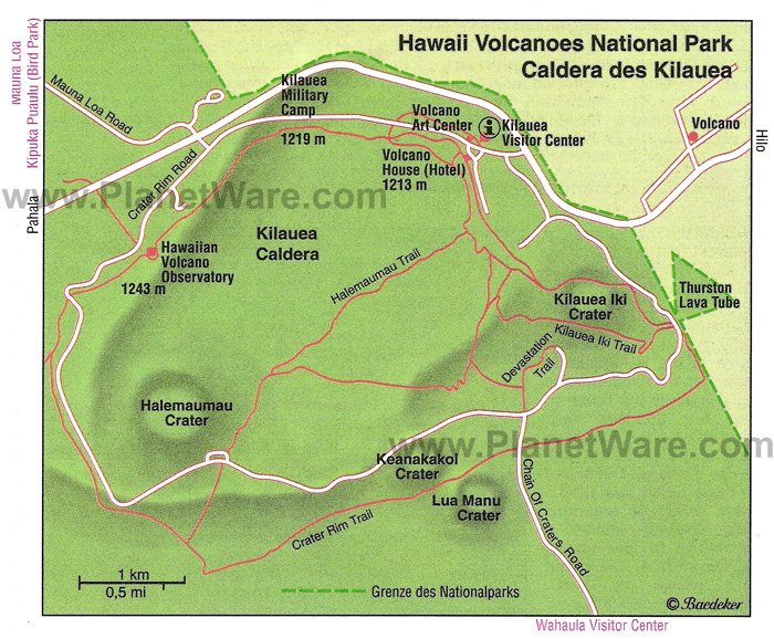
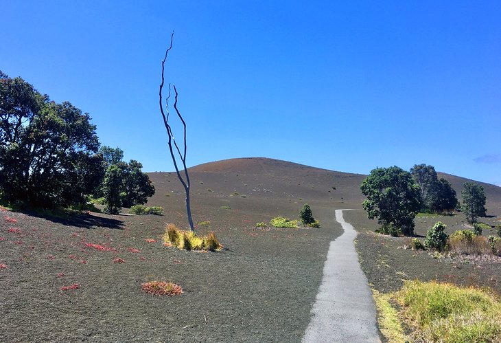
Kilauea Iki Trail
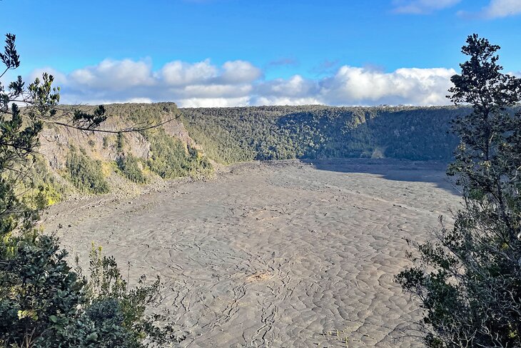
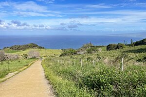
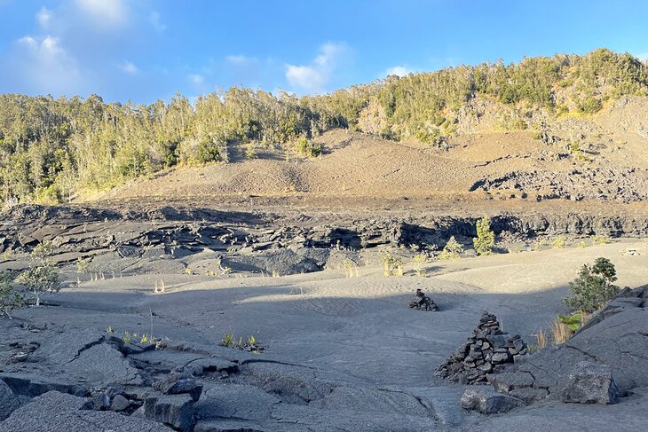
If you want to do some hiking in the park, the Kilauea Iki Trail is one of the best hikes to do on the Big Island. This 3.3-mile moderately difficult round-trip takes you down a steep, rocky descent across a once-active caldera floor.
It's hard not to feel a bit of trepidation and nervousness walking across a solidified lava lake that formed only 62 years ago. As you stroll along, steam hisses from vents as rainwater boils in the earth below. Take a moment to touch the ground, and you'll likely find that it's warm to the touch.
The trail also follows the rim of the crater, through ancient forest with spectacular views out over to the mouth of Kilauea, where, if you're lucky, you'll see the smoke hovering like a stationary cloud all day.
The trail is easy to follow and ends at a vent that allows you to peer deep into the earth. Count on two to three hours, and be sure to bring lots of water, as it's hot on the crater floor.
Kilauea Visitor Center
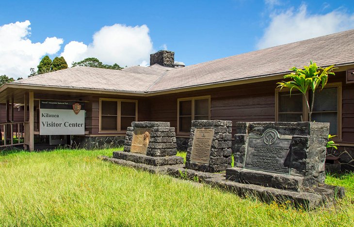
The Kilauea Visitor Center lies on the edge of Kilauea Caldera, 550 yards to the left of the entry kiosk to the Hawaii Volcanoes National Park. In addition to general information packs and maps, suggested routes for walks are available here.
To make the most of your visit, check out the film about the history and development of the volcano and its most recent eruptions. The center also has the latest information on what's open and closed due to the always-evolving volcanic activity.
Volcano Art Center
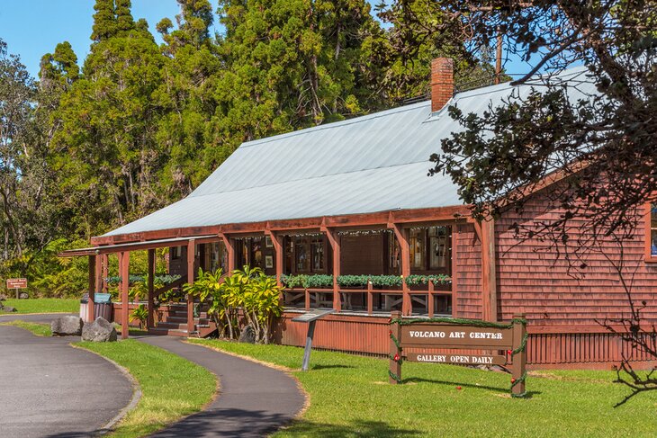
A visit to the Volcano Art Center, situated near the entrance to the national park, is also recommended. The art center is renowned across the island for having one of the best and broadest collections of original art. If you are shopping for a signature piece for one of your walls or a gift for a friend, this is the place to come. Various works of art from local artisans include paintings, glass-blown items, ceramics, fiber creations, and photography.
The Volcano Art Center occupies the old Volcano Hotel, built in 1877 and listed on the National Register of Historic Places.
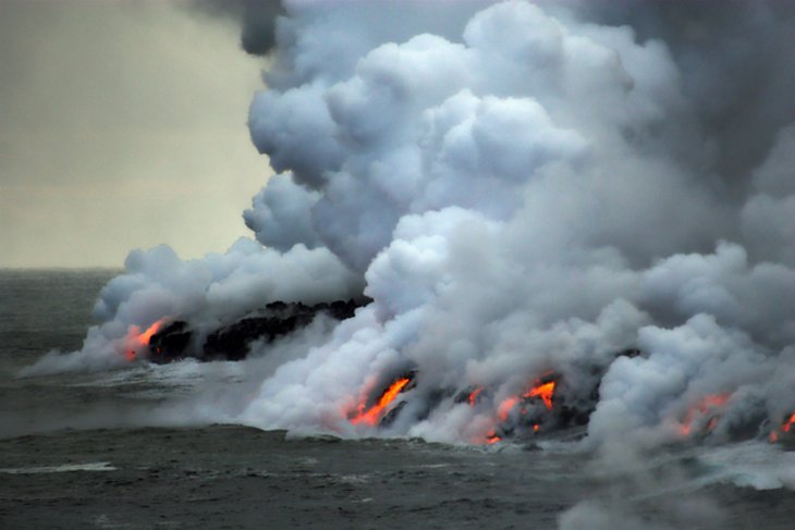
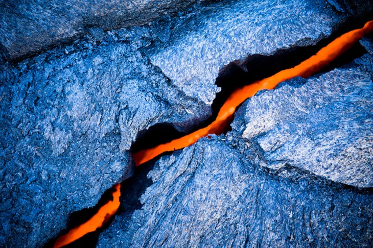
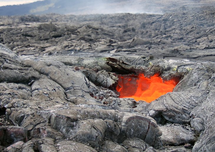
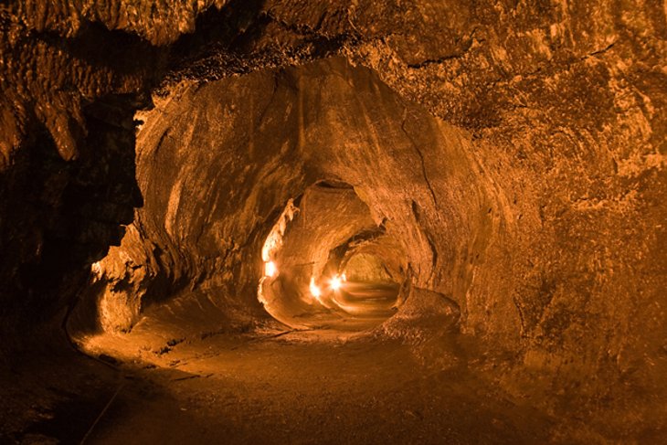
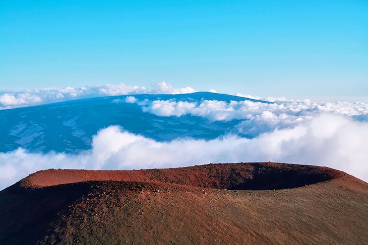
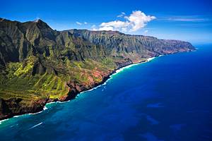
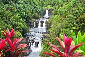
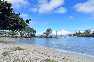
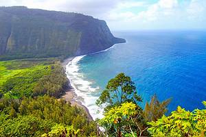
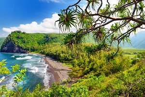
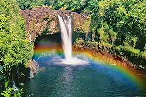
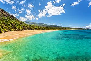
Photos of Hawai'i Volcanoes National Park