

One Of North America's Longest Hiking Trails Is Nearly 8,000 Miles Long With Scenic Views
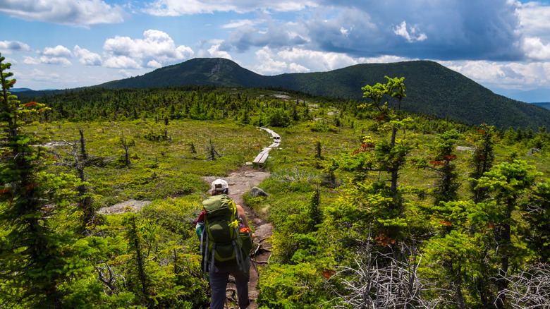
North America has seemingly endless miles of hiking trails of all lengths and difficulty levels, including some of the world's longest routes. Famed long-distance expeditions on the Appalachian Trail, the Pacific Crest Trail, and the North Country Trail span thousands of miles across multiple states, offering once-in-a-lifetime hiking challenges for the most dedicated adventurers. Yet this adventurous spirit is, by definition, never satisfied, and North America's most die-hard hikers are always forging new long-distance trails from the pieces of established ones. One of the most ambitious is the Sea-to-Sea (C2C) Route, a 7,800-mile network connecting the Atlantic and Pacific coasts.
The C2C Route traces its origins to 1996, when Ron Strickland, founder of the Pacific Northwest Trail, envisioned a transcontinental route built largely from existing long-distance trails. Andrew Skurka later became the first person to complete it, hiking 7,775 miles from Cape Gaspé in Quebec to Cape Alava in Washington. The C2C is not a single formally designated trail, and it remains a work in progress, with a lengthy gap where preexisting trails don't quite converge. Still, the C2C trail represents an epic tour of North America for long-distance hikers, including some of the most beautiful scenes in the United States and Canada. From Quebec's rocky coast to the rugged beaches of the Pacific Northwest, these are just some of the sublime sights along the nearly 8,000 miles of the Sea-to-Sea Route.
Cap Gaspé, Quebec
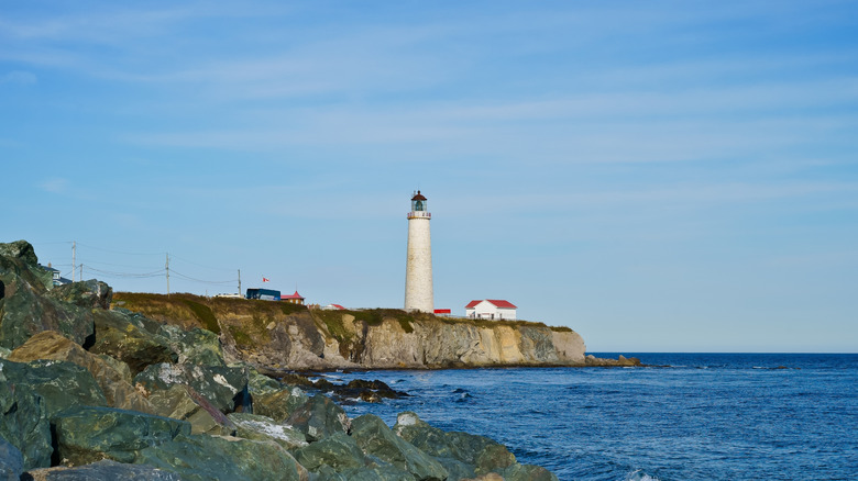
In the east, the C2C Route begins in Quebec via the International Appalachian Trail through Appalachian Canada. The eastern terminus of the C2C Route is Quebec's gorgeous Cap Gaspé, a rocky oceanside headland at the end of the Gaspé Peninsula (and the northern terminus of the 4,400-mile Eastern Continental Trail from Canada to Florida).
As the centerpiece of Canada's Forillon National Park, Cap Gaspé provides a stunning coastal backdrop for the first stage of the C2C's nearly 8,000 miles. Among other attractions is the picturesque Cap Gaspé Lighthouse, perched above the Gulf of St. Lawrence and Gaspé Bay.
Katahdin
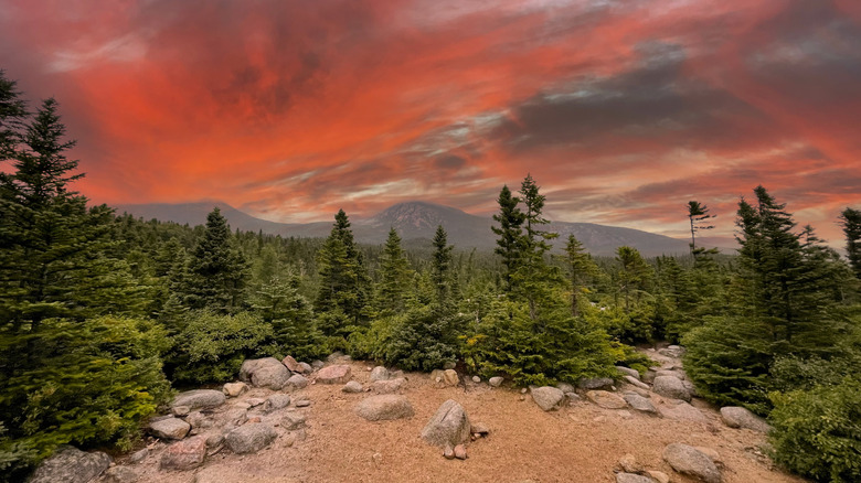
After crossing into the U.S., the C2C Route joins the Appalachian Trail at its northernmost extreme, the summit of Katahdin. At 5,269 feet high, Katahdin is the highest point in Maine and a scenic sentinel of New England's Appalachian Mountains.
C2C hikers will not just get to experience Katahdin's summit, of course. The Appalachian Trail segment of the C2C Route passes through Katahdin's home, Baxter State Park, a remarkable 200,000-acre wilderness park and a top spot for nature views and wildlife watching.
Crown Point, New York
The C2C enters Vermont's Green Mountains, then transitions into the North Country Trail, America's longest National Scenic Trail. The North Country Trail now extends more than 70 miles through Vermont to Maine Junction, where it connects with the Long Trail and Appalachian Trail.
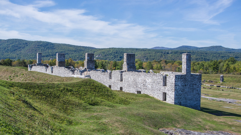
C2C hikers can traverse the gorgeous Lake Champlain region before reaching the former eastern terminus of the North Country Trail at New York's Crown Point State Historic Site, notable for its 18th-century French and British fortifications. From there, hikers continue through the Adirondack Hub region and Schroon Lake.
Allegheny National Forest
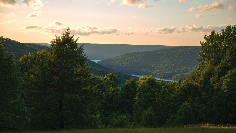
Following the North Country Trail, the C2C Route enters Pennsylvania, where it crosses the striking Allegheny National Forest and the broader Pennsylvania Wilds region. The Allegheny National Forest features stretches of hemlock, river valleys, mountain streams, and some of the northeast's richest old-growth forests.
The C2C Route and North Country Trail continue into Ohio, which hosts over 1,000 miles of the North Country Trail across public lands and urban settings. C2C travelers will pass through outdoor wonders like Hocking Hills State Park and the Wayne National Forest, as well as charming small Ohio communities like historic Lisbon.
Mackinac Bridge
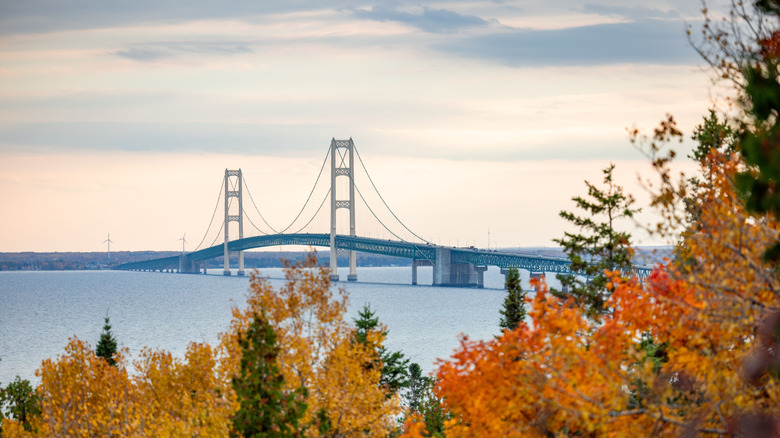
Long-distance routes like the C2C pass manmade wonders alongside outdoor attractions. The C2C's North Country Trail route through Michigan showcases the spectacular Mackinac Bridge while also highlighting the rich scenery of the Upper Peninsula.
The nearly 5-mile Mackinac Bridge is one of the world's longest suspension bridges, with 7,400 feet of roadway suspended by its cables. North Country Trail hikers cannot normally cross it on foot and must arrange transportation with the Mackinac Bridge Authority, usually $5 per person. Those with extra time can also make a ferry side trip to Michigan's serene tourist escape, Mackinac Island and other Mackinac-area destinations.
Lake Sakakawea
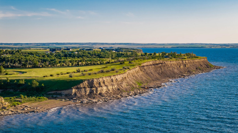
After crossing the Straits of Mackinac, C2C hikers continue along the North Country Trail through Wisconsin and Minnesota to its western terminus in North Dakota. Hikers have about 900 miles of Minnesota scenery to play with, including the Boundary Waters Canoe Area Wilderness, Chippewa and Superior National Forests, and plenty of classic Minnesota lakes.
North Dakota's Lake Sakakawea State Park is the official western endpoint of the North Country Trail, making it a major landmark for C2C thru-hikers. The park offers expansive lake views, plus opportunities for water recreation and wildlife watching before continuing west.
Waterton-Glacier International Peace Park
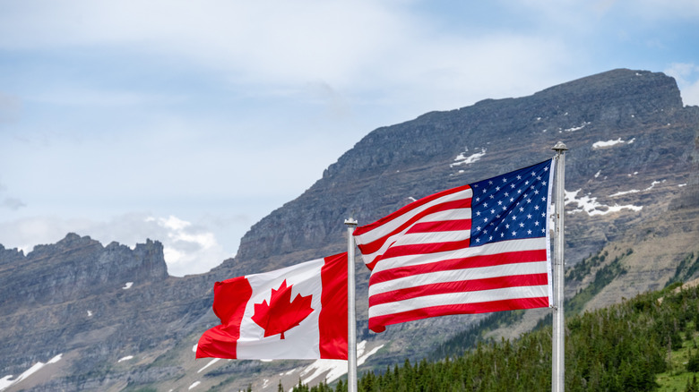
Lake Sakakawea marks one end of the longest current gap in the C2C Route, a nearly 800-mile stretch across North Dakota and Montana. Fortunately, that gap largely follows the Missouri River, so hikers do have a natural guidepost to follow.
Eventually, the C2C reaches the Continental Divide Trail in western Montana. The trail crosses the iconic mountain vistas of Glacier National Park and reaches one of its northern termini via the Waterton route near Waterton Lake. Here, C2C hikers can explore the binational Waterton-Glacier International Peace Park.
North Cascades and Pacific Crest Trail
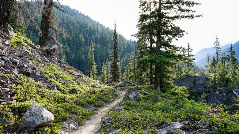
The C2C's final leg moves from the Continental Divide Trail to the 1,200-mile Pacific Northwest Trail. This section of the C2C Route also includes a junction with the Pacific Crest Trail at Holman Pass, about 17 miles south of the Pacific Crest Trail's northern terminus at the U.S.-Canada border.
The Pacific Northwest Trail section of the C2C Route also features some of the journey's most rugged mountain terrain courtesy of Washington's North Cascades. Roughly 63 miles of the trail pass through the North Cascades National Park Service Complex, with additional miles crossing the Pasayten Wilderness.
Cape Alava, Washington
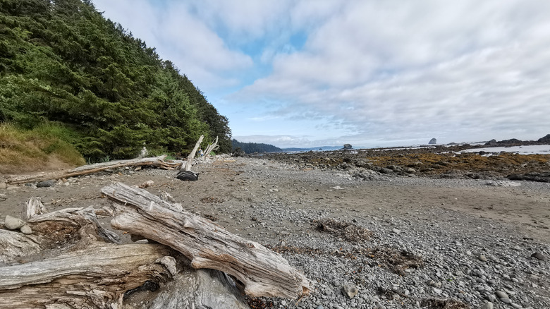
After hiking nearly 8,000 miles across North America, C2C hikers deserve a reward for all their hard work. That reward is Washington's spectacular Cape Alava, the western endpoint of the Pacific Northwest Trail and, therefore, the C2C Route.
Cape Alava is the westernmost point in the contiguous United States, and an ethereal gem on Washington's Wilderness Coast. The final stretch of the C2C crosses Olympic National Park and its diverse coastal ecosystems, so C2C hikers will experience the gorgeous Olympic Mountains and Lake Ozette before even getting to the sea.