One Of America's Most Beautiful Highways Offers A Scenic Drive Straight To Yellowstone
Taking the scenic route to one of America's national parks is a great way to soak in miles of dramatic landscapes before your outdoor adventure. If you're making the trip to see some of Yellowstone's must-visit natural attractions this summer, take the literal scenic route. A gorgeous 68-mile section of U.S. Highway 212 known as the Beartooth Highway has been called "the most beautiful drive in America" by journalist Charles Kuralt, according to Montana's official tourism website.
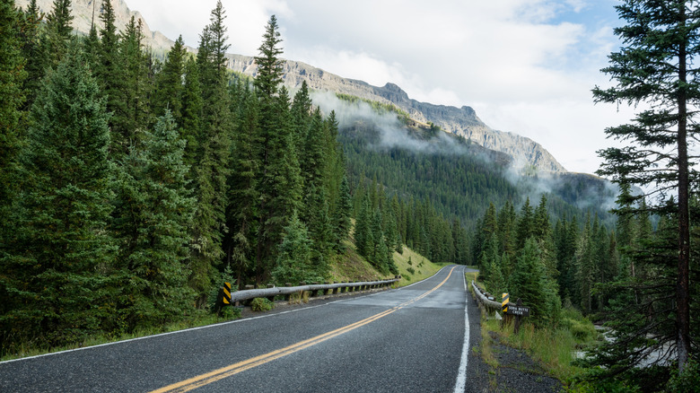
This stunning route connects two small towns in Montana, Red Lodge and Silver Gate, through northern Wyoming. The road leads through three national forests, winding past glacial alpine lakes and towering peaks, before reaching the Northeast Entrance of Yellowstone National Park. If you're renting a vehicle and making the drive, the closest commercial airport is in Billings, about an hour northeast of Red Lodge. For other travelers driving across Montana on I-90, take exit 434 for Laurel and Red Lodge, and drive for about 45 minutes. As you head outside of Red Lodge, note that you'll likely lose phone service.
The route is only open during the summer months, normally from Memorial Day to October, and can be navigated with an RV. However, drivers should be aware that the highway can still be closed due to snow — even in June. Before hitting the road, check the weather and the road's current conditions on the Montana and Wyoming Department of Transportation websites, as it can close suddenly. RV campers should be aware of the rules of the road, especially during the peak summer season. Expect to share lanes with other traffic during the middle of the day, including motorcyclists and bicyclists.
Exploring the Beartooth Highway

Elevation changes along the highway are as dramatic as the scenery. As you head west, the Beartooth Highway more than doubles in altitude, climbing from about 5,200 feet to nearly 11,000 feet at scenic (and chilly) Beartooth Pass – the highest point on the route – before dropping back down to about 7,600 feet outside of Cooke City. With these elevation changes, the local ecology and landscapes shift from high alpine tundra to thick forests. On your drive, you may spot wildlife along the road, including bears, elk, deer, and, at higher altitudes, mountains dotted with snow and mountain goats.
To really slow down and enjoy the scenery, stop and have a picnic at the Clark's Fork Trailhead, or snap a few photos at the Pilot and Index Peaks Overlook, one of the most popular photography spots on the route. Another well-known stop is the Top of the World Store and Resort, where you can find souvenirs and snacks. On Google Maps, past visitors have praised the store for its service, selection, and cleanliness. If you're taking your time soaking up the sights, the store offers suites and cabins for rent.
Since the highway is a major summer route to Yellowstone, one of the busiest national parks in the U.S., it can get congested. To avoid traffic, start your drive early in the morning, or drive the road in the fall when traffic is lighter — if it's open. Emptier roads make for great sightseeing; however, you should plan to be self-sufficient. Be sure to top off your gas tank in Red Lodge and keep a vehicle maintenance kit handy. Travelers visiting Colorado will also find similar road trip vibes and gorgeous mountain scenery at stunning Rocky Mountain National Park.