16 Top-Rated Hiking Trails near Spokane, WA
Author Brad Lane lives in the Pacific Northwest. He hikes around Spokane and discovered the Rocks of Sharon on his last visit to Spokane, and it has left a lasting impression.
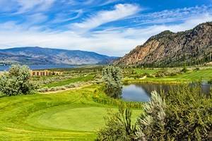
Several stunning places to hike surround Spokane in eastern Washington — the second-largest city in the state. Numerous landscapes invite all-day exploration, including the Spokane River corridor, which runs right through the center of town. The renowned Riverside State Park comprises several different units along this scenic waterway, each with memorable paths to follow.
Other standout natural landscapes include the Selkirk Mountains, rimrock canyons, and a collection of humungous outcroppings known as Rocks of Sharon. The city and county also maintain several Conservation Areas and public parks, with hiking trails and quiet surroundings lacing each one.
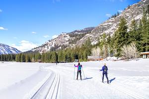
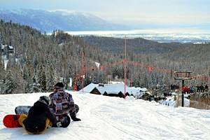
Spokane's stunning outdoor scenery isn't in one central location. Rather, it surrounds all sides of the city. This 360-degree coverage enables new hikes every day of the week. And with places like Mount Spokane State Park offering winter snowshoe adventures complete with warming huts, trekking near the city takes place throughout the year.
Find your next Eastern Washington adventure with our list of the top hikes near Spokane.
- 1. Rocks of Sharon, Iller Creek Conservation Area
- 2. Bowl and Pitcher, Riverside State Park
- 3. Kit Carson Loop Road, Mount Spokane State Park
- 4. Rimrock Drive, Palisades Park
- 5. Antoine Peak Trail, Antoine Peak Conservation Area
- 6. Liberty Lake Loop, Liberty Lake Regional Park
- 7. Riverside State Park Trail 25, Deep Creek Canyon
- 8. High Drive Bluff Park
- 9. Turtle Rock Trail, McKenzie Conservation Area
- 10. Knothead Loop, Little Spokane River Natural Area
- 11. Goldback Loop Trail, Dishman Hills Natural Area
- 12. John H. Shields Park
- 13. Indian Canyon Mystic Falls
- 14. Beacon Hill Park
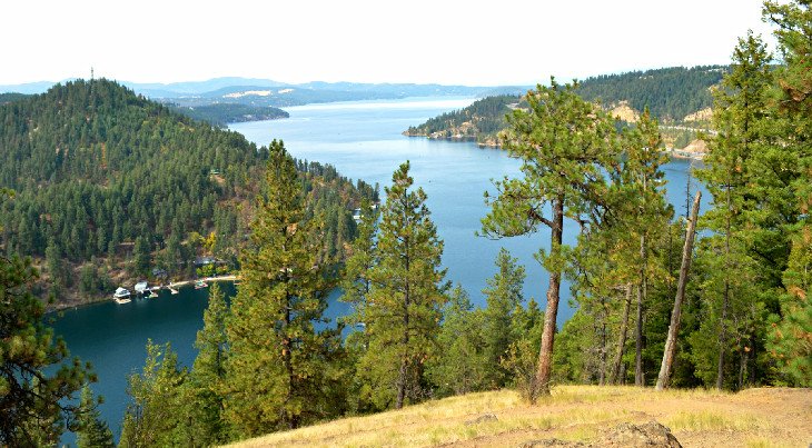
- 15. Mineral Ridge National Scenic Trail, Coeur d'Alene, Idaho
- 16. Fryxell Overlook, Palouse Falls State Park
- Where to Stay in Spokane after Hiking
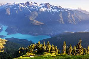
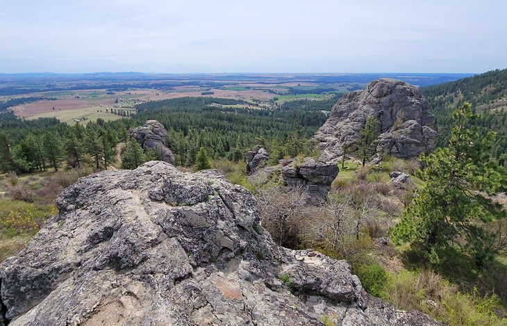
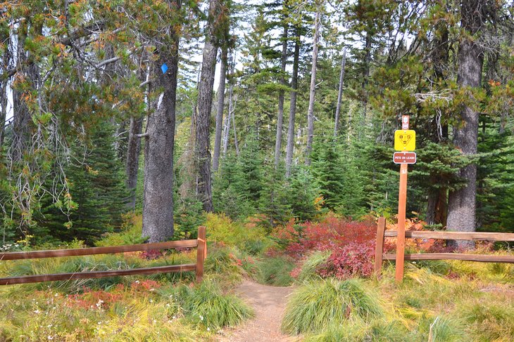
1. Rocks of Sharon, Iller Creek Conservation Area
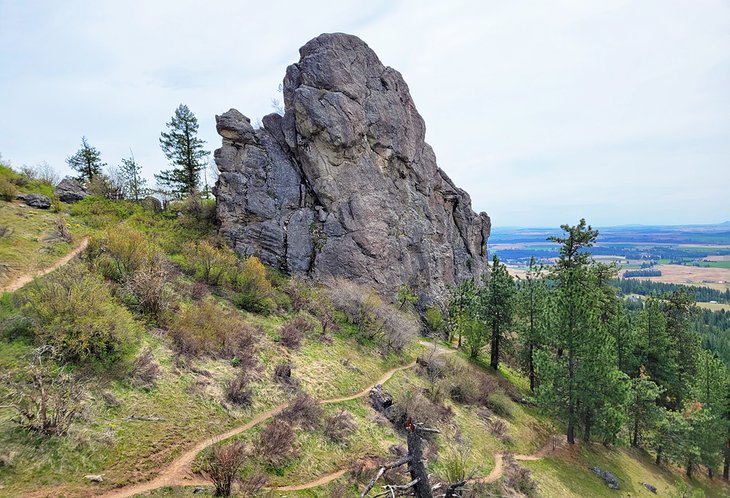
Iller Creek is part of the larger Dishman Hills Conservation Area, in a tucked-away wooded neighborhood on the southeast side of the city. This natural area is well worth the visit much in thanks to its most iconic feature, "Big Rock," also known as Rocks of Sharon.
These large granite outcroppings stand out among the scenery due to their humungous size. They provide sweeping views of the surrounding landscape, including the gold and green fields of the Palouse to the south.
A five-mile loop trail circles the conservation area, bounded on each side by two trailheads: Stevens Creek Trailhead and Iller Creek Trailhead. For the quickest access to Rocks of Sharon, head to the Stevens Creek Trailhead. From here, it's approximately a mile hike to reach the rocks with a steady elevation gain.
Stevens Creek is the trailhead preferred by rock climbers who carry their gear in to scale Big Rock. Several other outcroppings in the area also have permanent bolts for rock climbing.
Address: 9102 S Stevens Creek Road, Spokane, Washington
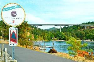
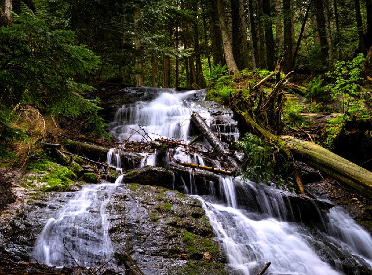
2. Bowl and Pitcher, Riverside State Park
The Bowl and Pitcher Area is one of the most popular areas of Riverside State Park and is home to one of the best campgrounds near Spokane. It provides nothing short of a postcard view of the Spokane River along a family-friendly hiking trail.
The hiking trail immediately encounters a Civilian Conservation Corps-era suspension bridge from the main parking area and Bowl and Pitcher Campground. Perhaps the best view of the area's namesake feature is on display from the bridge, and the massive basalt rock formations lining the riverbank stand out with scenic appeal.
After crossing the suspension bridge and climbing a collection of stairs built into the hillside, hikers to this popular area can head left or right along the river to admire more views of the valley and rock features. The total trail loop spans just over two miles with limited elevation gain.
Address: 9711 W. Charles Road, Nine Mile Falls, Washington
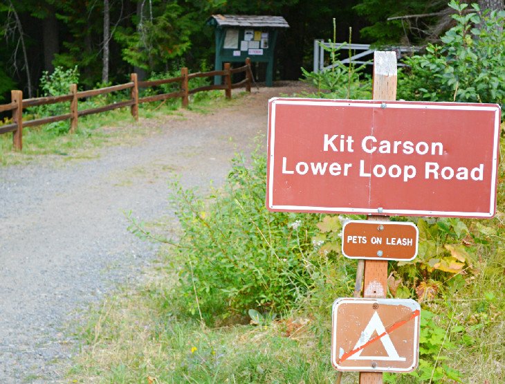
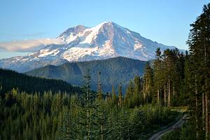
3. Kit Carson Loop Road, Mount Spokane State Park
Mount Spokane State Park encompasses over 12,000 acres and 100 miles of multi-use trails. This crown jewel of Spokane is one of the most accessible areas of the Selkirk Mountains and is only an hour's drive north of downtown.
All the trails at Mount Spokane transport visitors far from the city. One of the most trodden trails is the Kit Carson Loop Road. Hikers, bikers, and snowshoers take advantage of this flat and wide route throughout the year.
The Kit Carson Loop mainly follows a retired forest service road with an easy grade. It includes several starting points and side routes for different-sized adventures. The two main trailheads are at the Lower Loop Road Trailhead and the Cook's Cabin Trailhead at the summit. A common approach to the Kit Carson Loop Road is to set shuttle at the lower trailhead and start the hike at the summit.
The trail navigates over Smith Gap, where picnic tables and a great view encourage a rest. Smith Gap is also home to a renowned warming hut for winter pursuits. A few side trips along the route include options to summit Mount Kit Carson and Day Mountain. These two peaks offer challenging but non-technical climbs.
Address: 26107 N. Mt Spokane Park Drive, Mead, Washington
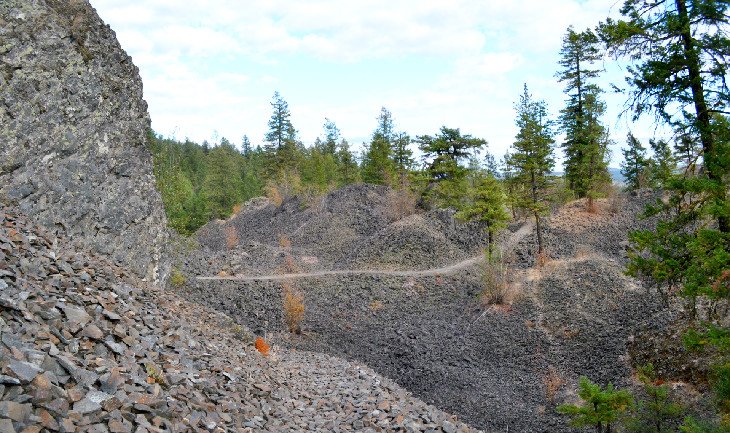
4. Rimrock Drive, Palisades Park
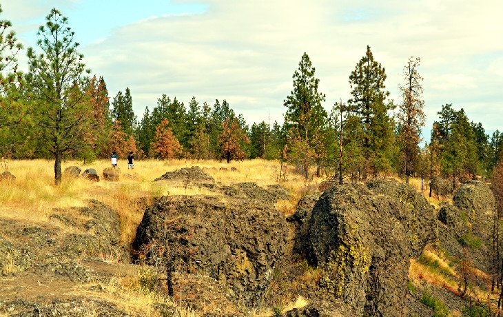
Palisades Park provides a network of trails atop a basalt cliffside overlooking the city. Hikers, bikers, and equestrians often utilize the many trails spanning this 700-acre park with easy access west of downtown. One of the most popular routes is along the gravel Rimrock Drive (not open to vehicles).
The view of Spokane from Rimrock Drive, backdropped by Selkirk Mountain peaks, is unparalleled anywhere else in the city. And thanks to its flat nature, it offers a family-friendly trek for all abilities. This accessibility makes Palisades Park a popular place to visit on the weekends, and parking can become a little tight. Arriving early to the trailhead is the recommended approach.
Palisades Park extends beyond Rimrock Drive. Indian Canyon is another popular place to explore at a lower elevation on the south side of the park. This historical and culturally important natural space is now adjacent to the Indian Canyon Golf Course. The popular Indian Canyon Mystic Falls is one of the main focal points of the area.
Address: 200-598 S Rimrock Drive, Spokane, Washington
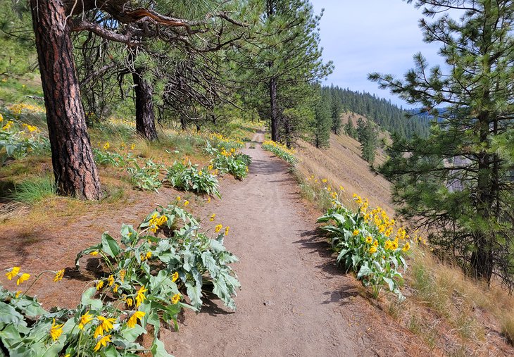
5. Antoine Peak Trail, Antoine Peak Conservation Area
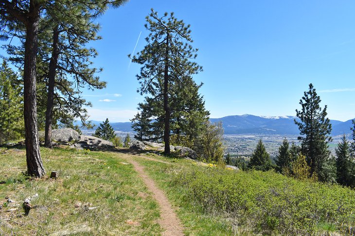
Antoine Peak Conservation Area encompasses over 1,000 acres on the northern edge of Spokane Valley. It is a popular natural space for wildlife and trail users of all kinds. Hiking, mountain biking, and horse riding are some of the most popular ways to explore. Coming from the west trailhead, visitors have two scenic routes to choose between.
The most popular route is the approximately two-mile Antoine Peak Trail. This moderate route reaches the top of the 3,373-foot mountain for panoramic views of the Spokane Valley, Liberty Lake, and the Selkirk Mountains. The route climbs approximately 700 feet in its journey up, making for a steady but not excruciating approach.
Alternatively, the Emerald Necklace Trail at Antoine Peak circles the entire mountain in just over five miles. It's often lined with vibrant displays of wildflowers come spring. Both routes can be combined for a variable-length journey.
Address: 15501 E Brevier Rd, Spokane, Washington
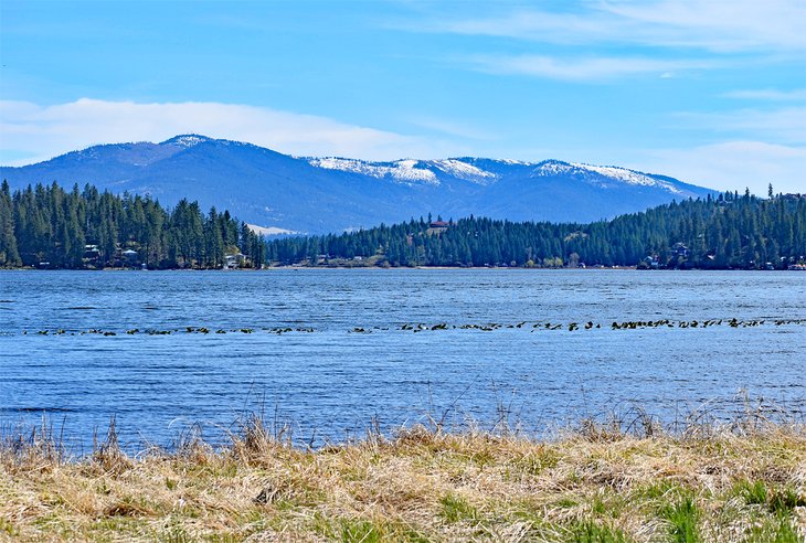
6. Liberty Lake Loop, Liberty Lake Regional Park
Liberty Lake is southeast of Spokane, near the Idaho border. It's home to a looped hiking trail that begins and ends at Liberty Lake Regional Park and winds through eight miles of forested environment.
The full loop trail is well-maintained and a long-time favorite of the region. It encourages a hearty hike with moderate elevation change. Shorter trips are available with out-and-back options and cut-off trails.
The first 2.5 miles of the trail are easily graded until reaching Cedar Grove Conservation Area. From this dense landscape and possible turnaround spot, it's recommended to follow the switchbacks up to Liberty Creek Falls, which are at their fullest come spring.
The Split Creek Trail provides an alternative route paralleling the Liberty Lake Loop, and a campground at this regional park encourages multiple days of exploring.
Location: Liberty Creek Road, Liberty Lake, Washington
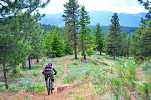
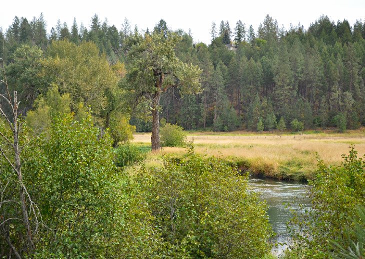
7. Riverside State Park Trail 25, Deep Creek Canyon
Trail 25 is a roughly six-mile round-trip traversing the scenic Deep Creek Canyon of Riverside State Park. It offers a lush environment sandwiched between tall canyon walls. The trail has various access points with one popular parking area off W 7 Mile Road. From here, the route crosses dry creek beds and winds through the forest with a moderate grade.
Hikers can follow the blazed Trail 25 or follow the contours of the creek bed when it's dry. The trail eventually leads through a unique basalt field complete with impressive rock features that make hikers forget how close they are to the city. Popular spots for rock climbing line this area and all down the trail.
Several routes span throughout the area extending from Trail 25. It helps to bring a map or reliable GPS when visiting this area of Riverside State Park.
Address: 4427 N Aubrey L White Parkway, Spokane, Washington
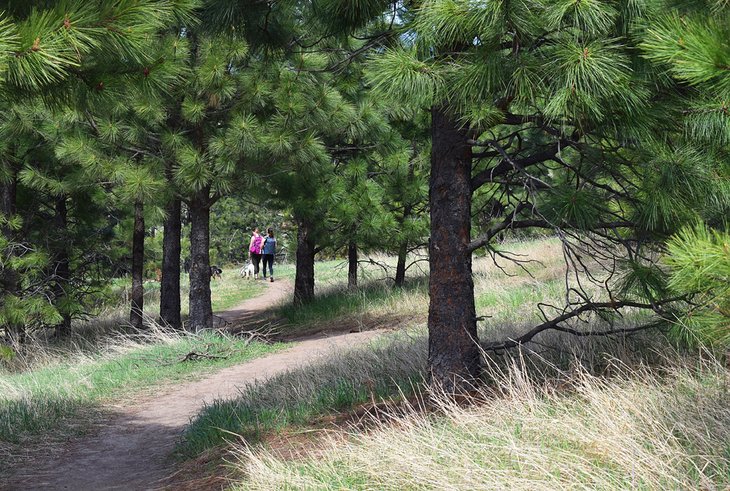
8. High Drive Bluff Park
Bluff Park encompasses over 500 acres of steep terrain lining much of High Drive Parkway on the south side of the city. The entire area offers extensive views of the Latah Valley neighborhood, with over 20 miles of trails cut into the side of the bluff. Every route leads through a picturesque ponderosa pine and bunchgrass landscape.
Several trailheads lining High Drive Parkway lend access to the bluff trails. And many trails define the area, with all generally cutting horizontally across the bluff. This trail construction means that while there's some elevation gain to reach the main path, the entire route is relatively flat. This easy contour makes it popular for trail running and mountain biking.
A paved pedestrian trail separates the parkway and the bluff. With this paved route connecting several trailheads, an unlimited variety of looped trail options are possible. The south end of High Drive Bluff Park takes hikers to the edge of Creek at Qualchan Golf Course. The northern reaches of the park stretch to 7th Avenue.
Address: 3418 S Jefferson Drive, Spokane, Washington
9. Turtle Rock Trail, McKenzie Conservation Area
The McKenzie Conservation Area is a 45-minute drive northeast of downtown, between Antoine Peak and Mount Spokane. It offers a small network of natural trails, all of which ultimately lead to the bank of Newman Lake. The most common sight to see in the Conservation Area is a large outcropping near the shoreline known as Turtle Rock.
It's less than 1.5 miles of easy hiking to reach Turtle Rock and the lakeshore. And much of the route is shaded thanks to the area's dense forest of cedar, fir, and pine trees. This forest opens up upon reaching the lake, where a beautiful view across the water invites a few moments to relax. Here, Mount Spokane, less than 10 miles north, is prominently in view.
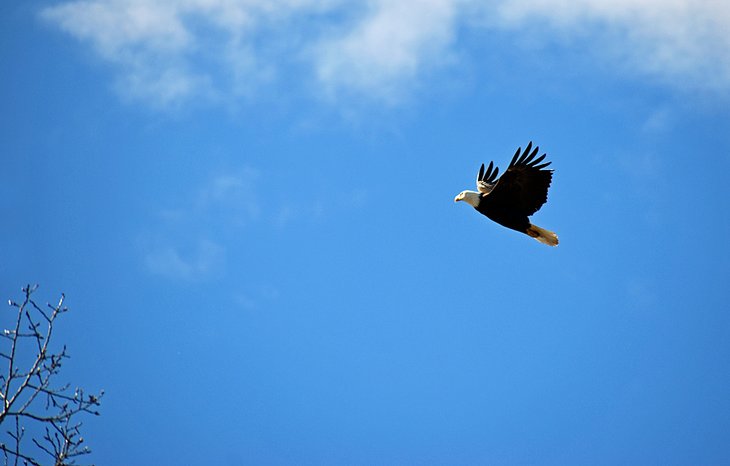
While enjoying the natural scene at Newman Lake, keep an eye out for resident wildlife in the area. Specifically, many birds are spotted soaring through the air, including several bald eagles that utilize the tall trees surrounding the lake. The trail network allows for an easy out-and-back hike from Turtle Rock or a slightly longer looped trail following Bedrock Ridge.
Address: 15898 N West, NW Newman Lake Drive, Newman Lake, Washington
Read More: Best Lakes in Washington
10. Knothead Loop, Little Spokane River Natural Area
The Little Spokane River is the northernmost section of Riverside State Park. This natural area highlights the lush river valley and soggy banks of the Little Spokane River. No swimming is allowed because it's a designated conservation space. However, the best way to take in this scenic riparian corridor is via the seven-mile Knothead Loop Trail.
Beginning at the Painted Rocks trailhead, the trail follows the flat contour of the river plain before meeting an old roadbed and ascending on the Knothead Loop Trail proper. Great views of the valley are seen below, weaving up and down across several hills. It's popular for trail runners and day hikers alike. Exposed areas on the trail can experience high heat in the summer.
Location: Rural Route 5, Spokane, Washington
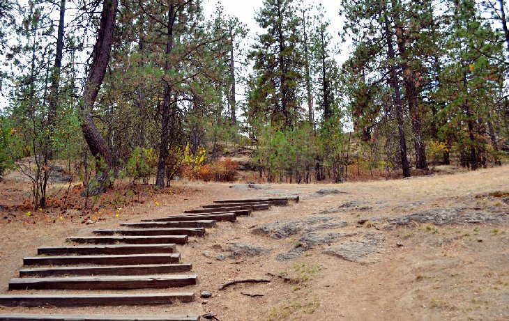
11. Goldback Loop Trail, Dishman Hills Natural Area
Dishman Hills Conservation Area is an ongoing conservation project, currently split into three distinct natural areas on the south side of the city. Alongside the popular Iller Creek area, including Rocks of Sharon, and the recent addition of the Glenrose Unit, the Dishman Hills Natural Area is a great place to explore outside.
Visitors encounter the beginning of the Goldback Loop Trail immediately upon parking at the eastern trailhead. Here, spherical mounds dot the landscape. The trail quickly climbs a set of stairs from the trailhead, and the route bobs up and down along these hillsides.
The Goldback Trail Loop is just the beginning of exploration in Dishman Hills. And it's a popular route as a good launching point for other loops that spread throughout the natural area.
Address: 625 S Sargent Road, Spokane Valley, Washington
12. John H. Shields Park
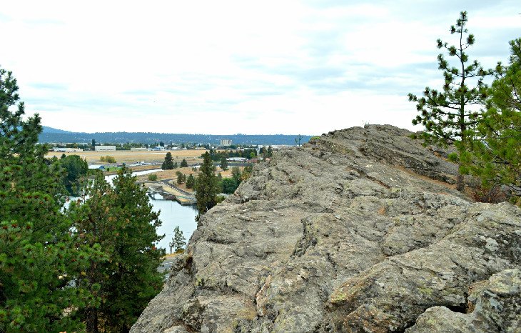
John H. Shields Park is a city and county-owned park on the north side of the city, adjacent to the Spokane River and Centennial Trail. The large basalt formation known as Minnehaha is the main focal point of the park, among many massive rock formations, and a destination for rock climbing adventures. A sprawling network of hiking trails surrounds this massive outcropping.
The main trail circles the entire rocky outcropping, revealing different places where rock climbers belay their partners. This main trail connects to the many other spur trails that wind throughout the area. More than one of these spur trails leads to the top of the basalt outcroppings, where anchors accommodate top-rope climbing. This elevation also delivers long-distance views of Spokane Valley.
Address: 5625 E Upriver Drive, Spokane, Washington
13. Indian Canyon Mystic Falls
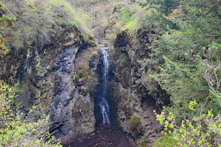
The area known as Indian Canyon offers excellent hiking opportunities and a waterfall three miles west of downtown and a short drive from Spokane International Airport. The site is part of the larger Palisades Park and is next to the Indian Canyon Golf Course.
Mystic Falls is nearly audible from the parking area on South Indian Canyon Drive. For those looking to lay eyes on the rushing water, the easiest route is taking a quick right from the parking area onto Trail 121. A great view of the waterfall immediately presents itself at the cliffside, where the trail then descends to the creek bed.
Users can follow the creek bed for a closer look at the falls or follow the trail on the opposite bank for a looped route. Several side trails and other established routes lace the entire area, offering variable distance hikes. This easy accessibility and variety of trails make Indian Canyon a popular spot for quick afternoon jaunts.
Address: 4812 W Canyon Drive, Spokane, Washington
14. Beacon Hill Park
Beacon Hill is a popular mountain biking and hiking destination on the northeast city limits, near Spokane Community College. Over 30 named trails make their way across the 1,000-plus acres and undeveloped ridgeline of the park. Expect to encounter other hikers and mountain bikers when enjoying the trails.
Several options leave hikers with variable-distance adventures. The self-named Beacon Hill Trail is a good place to start exploring the area, with a 2.5-mile loop and moderate elevation gain. The route crosses several other trails along the way, some signed and others not. It helps to bring a map the first few times visiting.
Other popular trails in the area include Esmeralda and "Dan". These two less-than-a-mile trails are especially popular with mountain bikers thanks to their quick descents. Always keep your eyes and ears out for riders when hiking at Beacon Hill.
Location: East Bridgeport Avenue, Spokane, Washington
15. Mineral Ridge National Scenic Trail, Coeur d'Alene, Idaho
The Mineral Ridge National Scenic Trail delivers long-distance views and an interesting look into the area's history. It's across state lines in Idaho and on the eastern bank of Lake Coeur d'Alene and is operated by the Bureau of Land Management (BLM). The trail begins at a paved parking area and adjacent picnic space and climbs steadily to the ridge from here.
Different interpretive markers match up with a guidebook published by the BLM along this well-maintained path. This guidebook is generally available at the trailhead and describes the flora, fauna, and history of this scenic area.
The ridgeline portion of the trail delivers sweeping views of the northern lake basin, including Beauty and Wolf Lodge bays. Hundreds of bald eagles descend upon Lake Coeur d'Alene throughout the winter, and Mineral Ridge is a well-known spot to see these massive birds flying in the air.
Address: 9200 ID-97, Coeur d'Alene, Idaho
Read More: Top-Rated Attractions & Things to Do in Coeur d'Alene, ID
16. Fryxell Overlook, Palouse Falls State Park
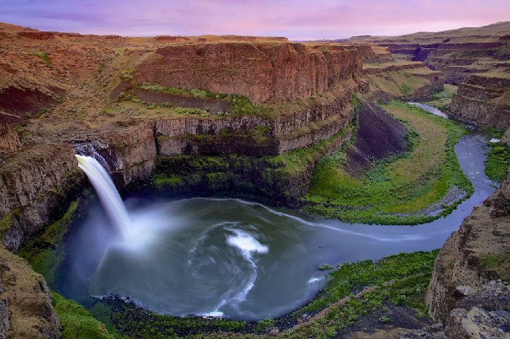
Palouse Falls is the designated state waterfall of Washington. It plunges over 200 feet into a colorful, columnar basalt gorge and was created by Ice Age floods thousands of years ago just upstream of the confluence of the Palouse and Snake Rivers. It's accessible from Spokane in less than a two-hour drive.
Palouse Falls and the surrounding 94-acre Palouse Falls State Park are in a remote part of the region, accessed via a gravel road and the small town of Washtucna, also known as the Gateway to Palouse Falls. Visitors should prepare to lose cellphone service when visiting, and pack in plenty of water. But with ADA-compliant hiking trails and parking areas, and a sea of changing color come sunset, it's well worth the gravel-road approach.
This short hiking trail that tours Palouse Falls State Park features three prominent viewpoints that illustrate why it's one of Washington's best waterfalls. From the parking area, a short ADA-accessible path leads to the first stunning view of the falls, and the second viewpoint is accessed via an interpretive path lined with information about the falls' creation.
The third viewpoint, the Fryxell Overlook, affords perhaps the best view of the falls and surrounding gorge. Sunset and sunrise are the most recommended times to climb the steep path to access the overlook. It's less than a quarter-mile of hiking between all three viewpoints. Summer temperatures are potentially dangerous at Palouse Falls during mid-day.
Location: Palouse Falls Road, LaCrosse, Washington
Where to Stay in Spokane after Hiking
Luxury Hotels:
- For the most luxurious stays in Spokane, the city hosts several Autograph Collection hotels, which deliver style, aesthetics, and service. In the heart of Spokane's cultural district downtown and a short drive to the Gonzaga University campus, The Historic Davenport is the epitome of class and comfort. Featuring large rooms, restored accommodations, and a Peacock Lounge, this fanciful boutique hotel provides a night to remember.
- Across the street, The Davenport Lusso provides equally elegant accommodations, and this charming hotel is well-reputed for its romantic inclinations.
- Less than a block away, The Davenport Tower also delivers decadent stays, with a heated pool, lounge area, and room service available.
Mid-Range Hotels:
- A large number of quality mid-range hotels can be found in and surrounding downtown Spokane, and hotels like The Madison Inn by Riversage on the city's south side deliver comfortable rooms, clean facilities, and friendly staff.
- North of Riverside City Park in the downtown district, Oxford Suites Downtown Spokane provides exceptional accommodations at affordable prices. Featuring an evening reception, full breakfast bar, and free Wi-Fi, Oxford Suites is also popular thanks to the indoor pool, sauna, and fitness facility also attached.
- Across the street from Oxford, the Holiday Inn Express Spokane Downtown is a dependable name-brand hotel, which delivers clean rooms, comfortable beds, and a friendly rate for upscale accommodations.
Budget Hotels:
- Many affordable hotels surround Spokane and the downtown district, and some hotels outshine others when it comes to cleanliness, friendliness, and comfort for a great rate. Ramada by Wyndham has two highly rated budget hotels in the city, and whether the Ramada by Wyndham North or Ramada by Wyndham Downtown suits your location needs, you can expect to have a good night's sleep surrounded by well-kept facilities.
- Alternatively, a little farther north of downtown, Apple Tree Inn provides quaint accommodations for an affordable rate and is known for its friendly employees.
More Related Articles on PlanetWare.com
Hiking Trails in Washington: The best hiking trails of Washington traverse the state's many environments, including three esteemed national parks. Hiking trails in Olympic expose the beach, rainforest, and high alpine scenery of this wild peninsula, and Mount Rainier hiking trails really test your legs, as do the top-rated hiking trails of North Cascades National Park. If Seattle is your base, the best hiking trails near Seattle make for an excellent day trip. To add extra scenery to your adventure, Washington's best waterfalls and top-rated hot springs add incentive to get out and hike.
Campgrounds in Washington: The best campgrounds near Spokane complement the surrounding hiking trails, and other top-rated places to stay the night can be discovered in our Best Campgrounds in Washington State article. To spend the night at some of the best state and national parks of Washington, campgrounds in Olympic, Mount Rainier, and North Cascades allow days of adventure. For a fun weekend trip away from the city, the best campgrounds near Seattle provide an easy getaway from noise and congestion.