14 Top-Rated Attractions & Things to Do in Gibraltar
Long famous as the "key to the Mediterranean," Gibraltar is a British Overseas Territory. Overlooking one of the world's busiest shipping lanes, the "Rock of Gibraltar," as it's still often known, rises out of the sea on the east side of Algeciras Bay and is linked to mainland Spain by a narrow isthmus.
The town of Gibraltar itself lies on the west side of the Rock. For such a small country — it only covers an area of four square kilometers — Gibraltar certainly has more than its fair share of tourist attractions and famous sights.
Plan your sightseeing adventures with our list of the best attractions and top things to do in Gibraltar.
See also: Where to Stay in Gibraltar
- 1. Head to Europa Point
- 2. See the Apes of Gibraltar
- 3. Visit the Upper Rock Nature Reserve
- 4. Ride the Gibraltar Cable Car
- 5. See the Views from O'Hara's Battery atop the Rock of Gibraltar
- 6. The Mediterranean Steps
- 7. Dolphin Watching
- 8. St. Michael's Cave
- 9. Gibraltar Skywalk & Windsor Suspension Bridge
- 10. The Moorish Castle
- 11. Main Street and Casemates Square
- 12. The Gibraltar National Museum
- 13. The Great Siege Tunnels
- 14. The Alameda: Gibraltar Botanic Gardens
- Where to Stay in Gibraltar for Sightseeing
- Gibraltar - Climate Chart
1. Head to Europa Point
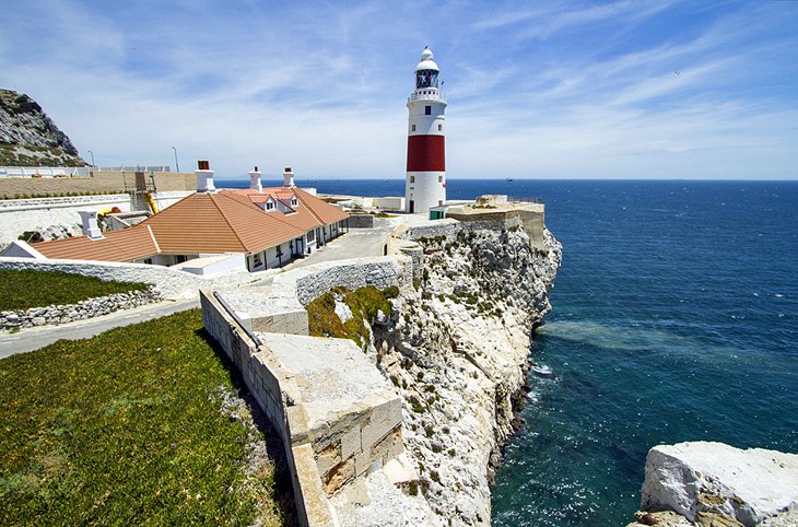
At the most southerly point of Gibraltar's peninsula is Europa Point. It's well worth a visit for the historic 19th-century Trinity Lighthouse, the old chapel of Nuestra Señora de Europa (the Shrine of our Lady of Europe), and the impressive Mosque of The Custodian of the Holy Mosques.
The subject of a great deal of redevelopment in recent years, the area is also where you'll find the impressive Harding Battery, a restored fortification built in 1859. It's also home to the Nun's Well, an ancient underground water reservoir.
More recently added attractions include the island's only cricket ground and the Sikorski Memorial, a monument to one of Poland's leading generals of WWII, who died here in a plane crash in 1943. You'll also be rewarded with excellent views across Algeciras Bay and the African coast.
2. See the Apes of Gibraltar

Gibraltar is famous for its Barbary macaques, a species native to Morocco and the only monkeys living wild anywhere in Europe. Legend has it that if the apes ever leave Gibraltar, so too will the British. But with more than 160 of the animals thriving on the island, this eventuality seems remote.
The best place to see them is in the Upper Rock Nature Reserve in the Upper Rock area of the island. Here, you'll find the famous Apes' Den, a great place to visit for you to get up close with these fascinating creatures without fear of being harassed. But visitors beware: as cute as these apes are, they're wild and do bite. Also, from time-to-time they venture into the town, so watch your belongings. Feeding is strictly prohibited.
A great way to ensure you get to see the monkeys, as well as the colony's top tourist attractions, is to join a Gibraltar Rock Tour. Setting off from the town center and accompanied by a professional tour guide, you'll be transported to see the monkeys at the famous Ape's Den area, as well as take in spectacular St. Michael's Cave, the tunnels used by the British army during WWII, as well as Europa Point.
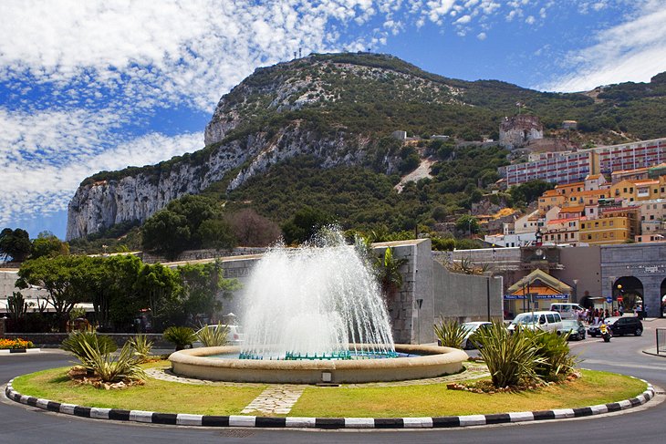
3. Visit the Upper Rock Nature Reserve
Not only does the Upper Rock Nature Reserve offer great views, it's also a good place to see some of the millions of birds that stop over while migrating between Africa and Europe. Encompassing more than 40 percent of the island, the reserve includes many of Gibraltar's most important attractions, including St. Michael's Cave, as well as Forbes' Quarry, where one of the world's first female Neanderthal skulls was found in 1848.
In addition to its unique flora and fauna, the reserve holds numerous reminders of the island's military importance, including a 100-ton gun at Magdala Battery, as well as informative displays relating to the island's history in the Heritage Centre at Princess Caroline's Battery.
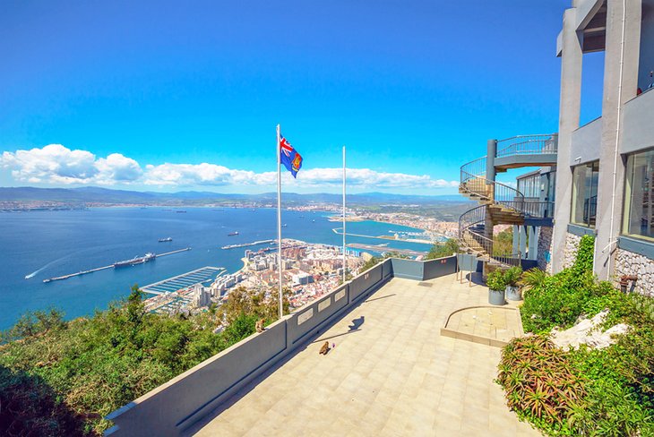
4. Ride the Gibraltar Cable Car
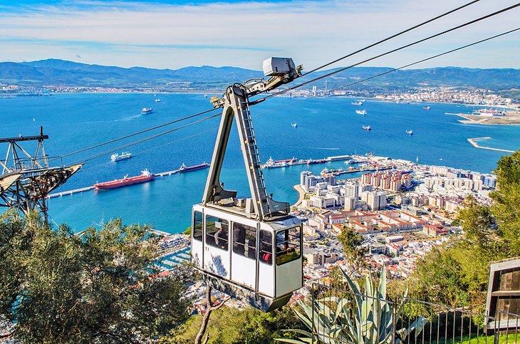
Pretty much everything that can be enjoyed at the Upper Rock area - the nature reserve, the monkeys, and the amazing views - can be accessed via the Gibraltar Cable Car. This spectacular aerial tramway was constructed in 1966, and is capable of carrying groups of up to 30 passengers at a time up the 412 meters to the "Top of the Rock."
It's a breathtaking journey, and even though it only takes six minutes, offers some of the best views you're ever likely to experience of the Mediterranean as you make your ascent. An interesting audio guide provides details of the top sights along the way.
From the upper station, you can access many of the top attractions included on this list, as well as enjoy a delightful café and terraces offering superb views over the Mediterranean all the way to Morocco. When you're done, either ride the cable car back down or, if you're feeling adventurous, take the famous Mediterranean steps back down to the town.
Address: Red Sands Road, Gibraltar
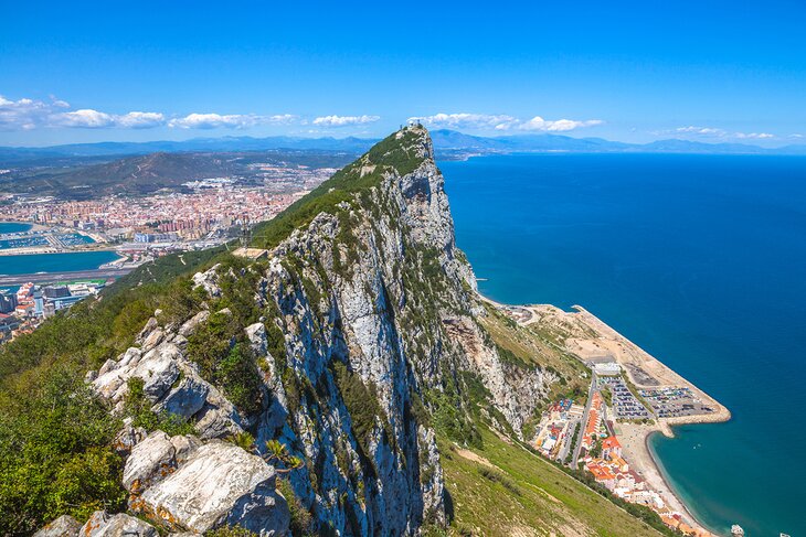
5. See the Views from O'Hara's Battery atop the Rock of Gibraltar
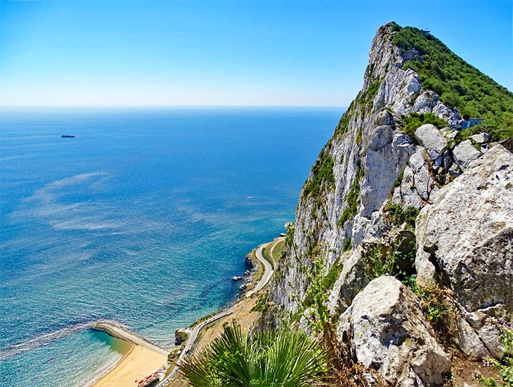
Gibraltar's highest point is some 425 meters tall, and is well worth exploring. The very top of the Rock of Gibraltar is accessed from the Gibraltar Cable Car, providing a vantage point with unparalleled views.
O'Hara's Battery, named for Charles O'Hara, who served as governor of Gibraltar from 1795 to 1802, was originally constructed during his term as a lookout point for watching ships' movements through the Strait of Gibraltar. Unfortunately, O'Hara's vision did not work as well as planned, and the site soon gained the nickname "O'Hara's Folly."
The original tower was destroyed in 1888 and replaced by the current structure, which houses a cannon that was actively used during World War II.
The site is on the grounds of the Upper Rock Nature Reserve in the Upper Battery, which is also home to Spur Battery and Lord Airey's Battery. Visitors can see the cannon, magazine, and engine room, as well as enjoy views of the Mediterranean, the strait, and the city below.
6. The Mediterranean Steps
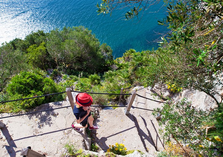
For the fit and adventurous, access to Gibraltar's Highest Point can also be achieved on foot. While it's a hard slog up the wonderful Mediterranean Steps - a steep staircase built by the British army in the 18th century that literally takes you from the top to the bottom of the island - it's not without its rewards.
The hour-long climb (accounting for rest stops) takes in some of the best views from the south end of the Rock, and gradually winds its way up to O'Hara's battery. Along the way, you'll enjoy many opportunities to stop, catch your breath, and enjoy Gibraltar's diverse flora and fauna. There are also numerous other trails that can easily be accessed via the steps that are worth exploring, too.
And if you don't fancy the climb up, well, you can, of course, always tackle the steps in reverse.
7. Dolphin Watching
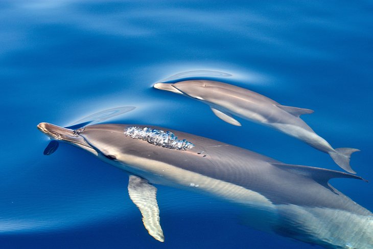
If you're interested in seeing marine animals up close, consider joining an exciting dolphin watching excursion. These highly rated tours are undoubtedly one of the top things to do in Gibraltar for families, and are suitable for kids of all ages.
Lasting approximately 75 minutes, these marine wildlife adventures include an exciting ride on a specially made viewing vessel designed to cruise alongside pods of up to 200 dolphins as they swim in the Strait of Gibraltar.
It's a truly breathtaking sight, especially with the backdrop provided by the 'Rock' itself, as well as the great views over Morocco and the Spanish coastline. Although the trips run throughout the day from Marina Bay, be sure to book ahead of time to secure your spot.
8. St. Michael's Cave
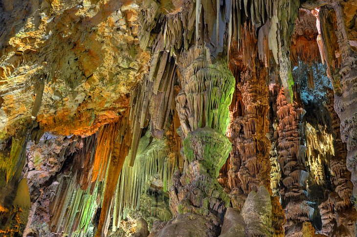
No visit to Gibraltar would be complete without paying a visit to the stunning St. Michael's Cave. The largest of the island's more than 150 caves, St. Michael's Cave lies at least 274 meters above sea level and is crammed full of spectacular stalactites and stalagmites.
First recorded in 45 CE, and known to have sheltered Neanderthals more than 40,000 years ago, the cave has many legends associated with it, including one suggesting the island is secretly connected to Africa via a 24-kilometer-long tunnel.
The reality, however, is equally impressive. The largest area of the cave, the Upper Hall, is connected via five passages to a smaller hall where you'll see spectacular drops of between 12 and 45 meters. A number of smaller chambers, some reaching depths of 76 meters, are accessible via a series of small holes.
During excavation work in WWII, the Lower St. Michael's Cave was discovered, containing many more equally breathtaking chambers, as well as a small underground lake.
For a truly unforgettable experience, take in a concert in the fabulous Cathedral Cave, a natural underground concert hall seating 400 people for performances of music, ballet, and drama. A variety of tour options are available, and the caves can even be used to host weddings.
Address: Spur Battery Rd, GX11 1AA, Gibraltar
9. Gibraltar Skywalk & Windsor Suspension Bridge
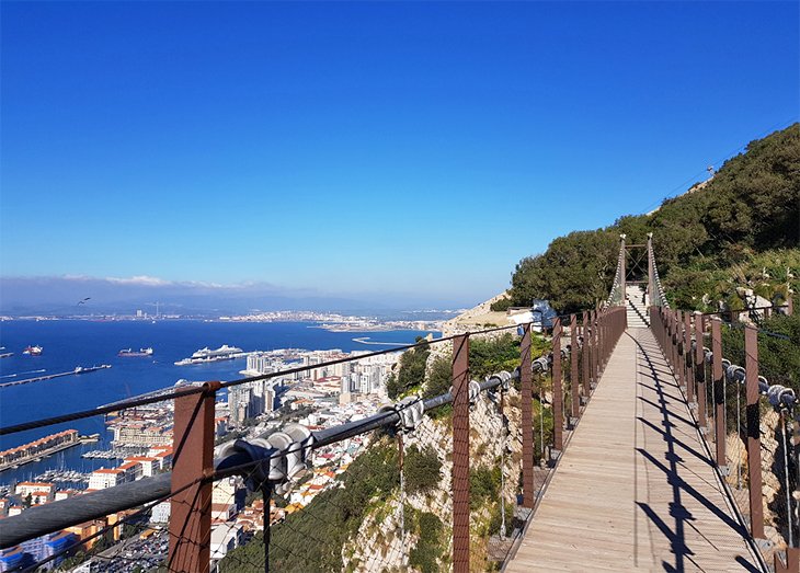
A relatively new attraction (it was only completed in 2018), the Skywalk is already one of the top things to do when visiting the Gibraltar Nature Reserve.
Perched 340 meters above the Mediterranean, the Skywalk is an incredible experience (unless you're afraid of heights) as the cliff falls away from under your feet to the shoreline far below. If you can overcome your fear of heights, the vistas are simply stunning as you're able to enjoy uninterrupted views in all directions.
From here, you're also able to enjoy the equally spectacular (and also very new) Windsor Suspension Bridge, connected by a series of fun walking trails. Stretching 71 meters over a spectacular 50-meter gorge, the views over the Straits of Gibraltar are breathtaking.
A visit to either site (admission is included with the Gibraltar Nature Reserve) is especially memorable at sunset.
10. The Moorish Castle
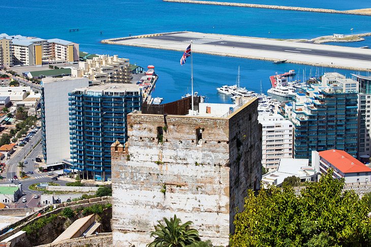
Perched high above the old town of Gibraltar and overlooking Casemates Square, the medieval Moorish Castle is certainly an imposing sight.
Originally built in the eighth century and rebuilt in the 14th century, much of the castle has been destroyed over time, although the parts that do remain — including the tall Tower of Homage, a massive gatehouse, and a few fragments of masonry — certainly suggest the building's former glory. In places, battle scars from the island's many sieges can still be seen.
The Tower of Homage is in fact the highest such Islamic structure left standing in the Iberian Peninsula, while the walled Kasbah, where local dignitaries would reside, is one of the largest in the area.
Address: 5 Moorish Castle Estate, Gibraltar GX11 1AA, Gibraltar
11. Main Street and Casemates Square
Located at the northern end of Main Street, Casemates Square is the largest public space in the old city center and is a popular gathering place due to its numerous restaurants, cafés, and shops. Although completed in 1817, evidence of settlements dating back to the Moors of the 10th century has been found.
While for centuries it served as a place of trade (and also execution), these days the square is where you'll find numerous cultural events and fun things to do, including open-air concerts, National Day celebrations, and the increasingly popular Calentita Food Festival.
Other landmarks along Main Street include the Roman Catholic Cathedral of St. Mary the Crowned, a former mosque rebuilt in Gothic style in 1502. In Cathedral Square stands the Moorish-style Anglican Cathedral (1821), while near the south end of Main Street is the Governor's Residence, originally a Franciscan convent built in 1531.
Also worth a visit, if time allows, is the attractive fishing village of Catalan Bay. It's located on the east shore, just a few minutes' drive from the town center.
12. The Gibraltar National Museum
With a focus on the cultural and natural history of Gibraltar, including the Strait of Gibraltar, the Gibraltar National Museum was established in 1930 and is located in Bomb House on Bomb Lane, the former residence of the Principal Artillery Officer. Highlights of this excellent (though small) museum are the well-preserved 14th-century Moorish Baths, and the huge model of the Rock as it would have looked in 1865.
Other galleries deal with the island's geological origins from the Jurassic Period to the present day, a collection of rare Roman anchors, and an exhibit detailing the Great Siege of Gibraltar from 1779-1783. Guided tours are available.
Address: 18, 20 Bomb House Ln, Gibraltar GX11 1AA, Gibraltar
Official site: www.gibmuseum.gi
13. The Great Siege Tunnels
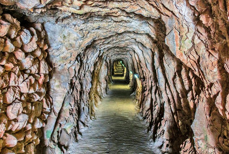
Perhaps the most significant military installation in the Mediterranean, the Great Siege Tunnels of Gibraltar are an engineering marvel. Carved out of the sheer face of the "Notch," the northern face of the Rock, using nothing but manual labor, this labyrinth of tunnels was built by the British in just six weeks as a defense against a combined force from France and Spain when they tried to recapture the Rock from the British.
The 14th of many sieges the island has endured over the centuries, the Great Siege lasted from 1779 to 1783 and, thanks to the tunnels, resulted in Britain's victory in what would, without the cannons that were able to be mounted here, have undoubtedly ended in defeat. Some of these canons are on display.
Additional tunnels were added in WWII, bringing the total length of the tunnel network to an impressive 51 kilometers. Admission to the siege tunnels is included with entrance to the Upper Rock Nature Reserve, and guided tours of both sets of tunnels are available.
14. The Alameda: Gibraltar Botanic Gardens
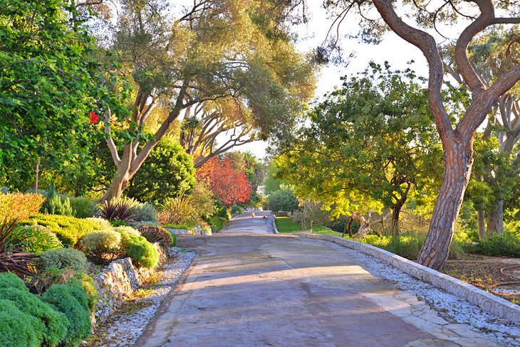
The beautiful Gibraltar Botanic Gardens - also known as La Alameda Gardens - is a great place to spend time away from the often-busy attractions elsewhere on the island. Located at the end of Main Street near the Southport Gates, this public garden, with its luxuriant subtropical vegetation, was commissioned in 1816 for the enjoyment of soldiers stationed here.
Visitors can also take in the Alameda Wildlife Conservation Park, a small zoo set up to house animals rescued by customs or police that can't be returned to the wild, as well as an open-air theater hosting many excellent cultural and musical events. Fun guided tours are available once a month, if you can catch one.
Address: Red Sands Road, Gibraltar GX11 1AA, Gibraltar
Official site: http://gibraltargardens.gi/
Where to Stay in Gibraltar for Sightseeing
Luxury Hotels:
- For a truly elegant stay, book into the spectacular Sunborn Gibraltar, a luxury super-yacht hotel boasting sleek décor, marble bathrooms, an outdoor pool, and a full-service spa.
- Other good high-end options include the Rock Hotel Gibraltar, popular for its lovely hilltop location and sea views from its rooms and wisteria-draped terrace, seasonal outdoor pool, and friendly staff, and the Eliott Hotel, featuring a rooftop pool, regular jazz nights, and an on-site restaurant.
Mid-Range Hotels:
- The Holiday Inn Express Gibraltar is another good mid-range priced option. It's located close to the airport and features bright décor in its rooms (each with an ensuite), plus free breakfasts and parking.
- For a unique experience, stay aboard the Con Dios, a moderately- priced B&B boat with friendly hosts, a delightful sun deck, a shared kitchen, and on-board bathrooms. The boat is located right in the marina near several restaurants and convenient to the ferry and sightseeing boats.
Budget Hotels:
- The Cannon Hotel is a no-frills budget hotel located in the heart of town, offering free Wi-Fi and breakfast.
- The Jasmine Coral Jay Boutique Boatel is a good budget option for tourists who want to stay right on the water at the marina, offering small but affordable rooms with basic amenities.
Gibraltar - Climate Chart
| Average minimum and maximum temperatures for Gibraltar in °C | |||||||||||
| J | F | M | A | M | J | J | A | S | O | N | D |
| 16 11 | 17 11 | 18 12 | 19 13 | 22 16 | 24 18 | 27 20 | 28 21 | 26 20 | 22 17 | 19 14 | 17 12 |
| PlanetWare.com | |||||||||||
| Average monthly precipitation totals for Gibraltar in mm. | |||||||||||
| 122 | 107 | 107 | 66 | 38 | 10 | 0 | 3 | 25 | 76 | 150 | 132 |
| Average minimum and maximum temperatures for Gibraltar in °F | |||||||||||
| J | F | M | A | M | J | J | A | S | O | N | D |
| 61 52 | 62 52 | 64 54 | 66 56 | 71 60 | 76 64 | 81 68 | 82 69 | 79 68 | 71 62 | 66 57 | 62 54 |
| PlanetWare.com | |||||||||||
| Average monthly precipitation totals for Gibraltar in inches. | |||||||||||
| 4.8 | 4.2 | 4.2 | 2.6 | 1.5 | 0.4 | 0 | 0.1 | 1.0 | 3.0 | 5.9 | 5.2 |
More Related Articles on PlanetWare.com
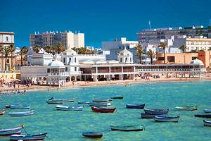
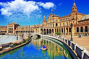
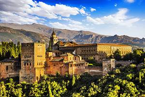
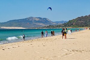
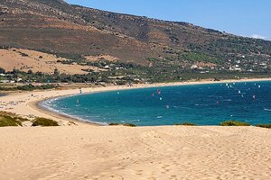
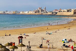
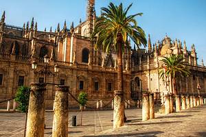
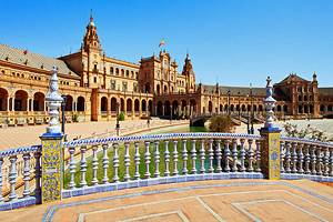
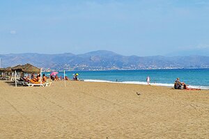
Viva España: If you didn't begin your journey in Spain, you're going to want to take advantage of Gibraltar's proximity to popular Spanish tourist destinations within an easy drive. Topping your list should be the attractive seaport of Cádiz, a must-visit for its magnificent Costa de la Luz beaches, as well as its great shopping and entertainment opportunities.
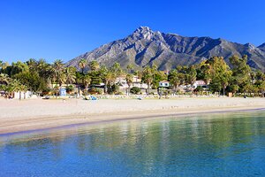
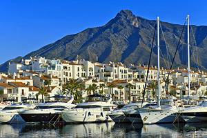
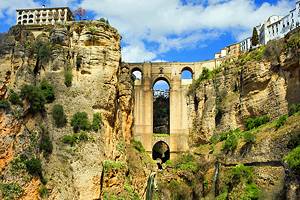
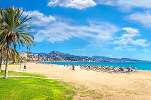
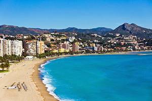
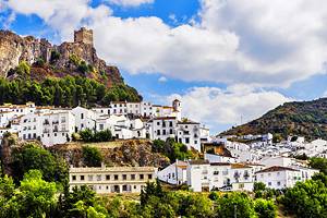
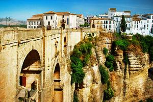
To the east and long the coast is the famous Spanish town of Marbella, the classiest of the Costa del Sol beach resorts, featuring high-end hotels, luxury golf courses, and private tennis clubs. Head north from here, and you're in the hills of Andalusia and the famous white villages of southern Spain. The best known of these is Rhonda, famous for its location straddling a deep gorge and its lovely architecture.
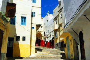
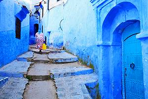
Marvelous Morocco: Thanks to its location on the Strait of Gibraltar, it's relatively easy to get across to the African mainland via ferry. If you're up for the adventure, head to the Moroccan city of Tangier, popular for its historic medina area, with its winding lanes and interesting street markets and vendors.