United Kingdom of Great Britain and Northern Ireland Map

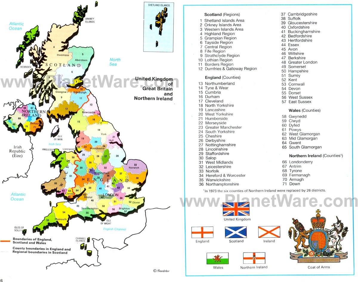
The United Kingdom of Great Britain and Northern Ireland lies west of mainland Europe and is comprised of several countries, including England, Scotland, Wales, and Northern Ireland.
Britain's Principal Mountains, Hills and Rivers
The Brittish Empire around 1900
Great Britain - Weather
The Track of King Arthur
Great Britain and Northern Ireland
Some attractions within Map of United Kingdom of Great Britain and Northern Ireland Map:
  • (6) Tayside Region
  • (7) Central Region
  • (9) Strathclyde Region
  • (10) Lothian Region
  • (14) Tyne and Wear
  • (16) Durham
  • (17) Cleveland
  • (18) North Yorkshire
  • (19) Lancanshire
  • (20) West Yorkshire
  • (21) Humberside
  • (22) Merseyside
  • (23) Greater Manchester
  • (24) South Yorkshire
  • (25) Cheshire
  • (26) Derbyshire
  • (27) Nottinghamshire
  • (28) Lincolnshire
  • (29) Staffordshire
  • (30) Salop
  • (31) West Midlands
  • (32) Leicestershire
  • (33) Norfolk
  • (34) Hereford and Worcester
  • (35) Warwickshire
  • (36) Northamptonshire
  • (37) Cambridgeshire
  • (38) Suffolk
  • (39) Gloucestershire
  • (40) Oxfordshire
  • (41) Buckinghamshire
  • (42) Bedfordshire
  • (43) Hertfordshire
  • (44) Essex
  • (45) Avon
  • (46) Wiltshire
  • (47) Berkshire
  • (48) Greater London
  • (49) Somerset
  • (50) Hampshire
  • (51) Surrey
  • (52) Kent
  • (53) Cornwall
  • (54) Devon
  • (55) Dorset
  • (56) West Sussex
  • (57) East Sussex
  • (58) Gwynedd
  • (59) Clwyd
  • (60) Dyfed
  • (61) Powys
  • (62) West Glamorgan
  • (63) East Glamorgan
  • (64) Gwent
  • (65) South Glamorgan
  • (66) Londonderry
  • (67) Antrim
  • (68) Tyrone
  • (69) Fermanagh
  • (70) Armagh
  • (71) Down

Natural Regions of Great Britain
London - Location
London - Location