13 Best Hiking Trails in Kelowna, BC
Some people travel to Kelowna with the intention of hiking. Other visitors might not be aware of such opportunities, but a hike is guaranteed to happen. Because Kelowna is such a walkable place, you will soon find your stride wherever you go in and around British Columbia's third-largest city.
For hikers, Kelowna is like stepping into a candy store: There are so many paved and dusty treats from which to choose. There's even a wet hike (27-kilometer Kelowna Paddle Trail), but for now we'll focus on the earth beneath our wandering feet.
If you don't want to drive anywhere, there are accessible hikes within Kelowna's city limits. Not far away are trails that exercise the body and soothe the soul. From mountaintop vistas to refreshing canyon pour-offs, you will experience marine, forest, and grassland diversity that is a magnet for outdoor enthusiasts.
Ask any outdoorsy local where to go hiking in Kelowna, and expect strong opinions about the best route to take. The answer to your question depends on time and ability but trust there is at least one hiking trail that is right for you. Get started with our list of the best hikes in Kelowna.
- 1. Apex Trail in Knox Mountain Park
- 2. Paul's Tomb Trail
- 3. Knox Mountain Loop
- 4. Canyon Rim Trail
- 5. Myra Canyon Trail
- 6. Kelowna Waterfront Boardwalk
- 7. Mission Creek Greenway
- 8. Scenic Canyon Regional Park
- 9. Gellatly Bay Trail
- 10. Black Mountain - sntsk'il'ntən Regional Park
- 11. Crawford Falls Trail
- 12. Mount Boucherie Trail
- 13. Rose Valley Lake Loop
- Map of Hiking Trails in Kelowna, BC
1. Apex Trail in Knox Mountain Park
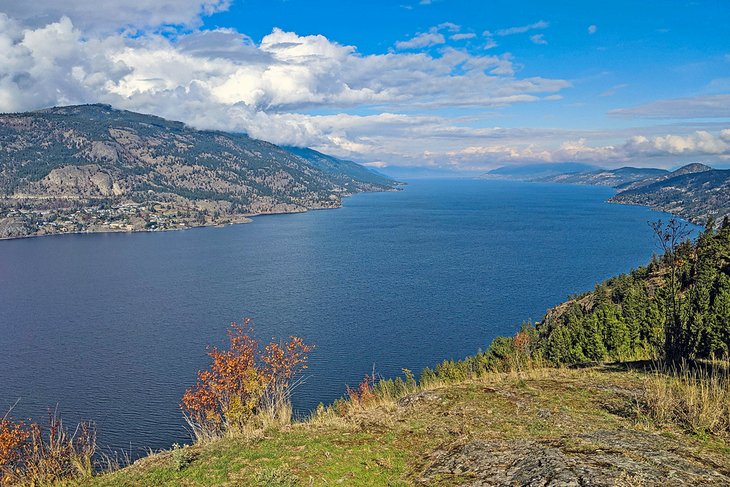
Knox Mountain Park offers nature trails that suit every hiking ability with easy access by car, bike, or on foot, only two kilometers from downtown at the north end of Ellis Street. For many people, the best time to hike these trails is during the warmer months when you can enjoy seasonal wildflowers and bird-watch. Start hiking the Apex Trail to reach the eagle's view of the city from the mountaintop.
The Apex Trail to the Upper Apex Lookout is four kilometers return, with an elevation gain of 262 meters. On a map, you will notice a four-kilometer road running from the bottom of Knox Mountain to a parking lot near the summit. Be aware that the gate at the bottom is likely to be locked, making this ideal for people with strollers and bicycles to roll up to the top without vehicles on the road.
You can shorten your hike and reduce your workout by hiking only to the Lower Crown Lookout, but most people finish what they start and complete this moderately challenging trail. This is a well-used trail that rewards hikers with some of the best panoramic lake views and glorious sunsets. It takes about two hours to complete.
2. Paul's Tomb Trail
Paul's Tomb Trail is the most popular nature trail in Knox Mountain Park and in the City of Kelowna. The hike to Paul's Tomb is an easy 2.7-kilometer trail (one way) with a marginal elevation gain of 100 meters. The trailhead is located at the Lower Crown Lookout parking lot one kilometer from the start of Knox Mountain Road.
As the name suggests, the trail leads to an old tomb of a family of one of Kelowna's early pioneers. Most of the tomb was buried beneath soil after it was vandalized, but you can still see a small portion of the arched door around 90 meters from the lake.
The entire trail is parallel to the shore of Okanagan Lake until it ends at a pebble beach. This turnaround is the perfect place to picnic, swim, and—for the more adventurous—jump from the rocks. The summertime payoff for Paul's Tomb is diving off the deep end into Okanagan Lake.
3. Knox Mountain Loop
Energetic trail enthusiasts have found a faster way to wear out the treads of their hiking boots by combining three exciting hikes into one loop trail. The Knox Mountain Loop is almost seven kilometers starting with the ascent of the Apex Trail at 262 meters in elevation.
After catching your breath and soaking in the view, hop on the relatively level Pavilion Trail that connects with a steep descent along switchbacks of the Ogopogo Trail to Paul's Tomb Trail (and soak up the beautiful Okanagan Lake views along the journey!). To complete the loop, enjoy the pleasant lakeside return to your car on Paul's Tomb Trail.
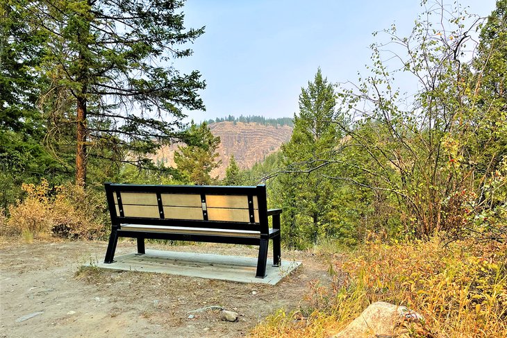
4. Canyon Rim Trail
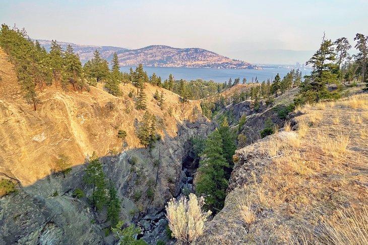
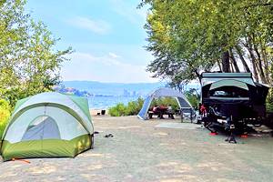
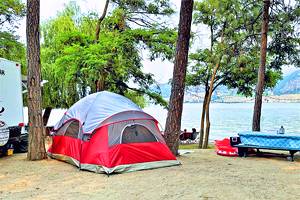
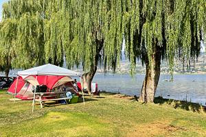
As the longest and best-known hike in Bear Creek Park, Canyon Rim Trail is especially popular in the summer and fall. If you are spending the night in the park (which is one of the best campgrounds in Kelowna), you can access the trail early in the morning to enjoy a solo hike. To see more water flowing over the falls, hike during the spring.
Elevated outlooks along the trail provide inspirational views of the canyon, waterfalls, and surrounding area. Atop the eastern slope on the south side of the creek, expect a spectacular panorama of Kelowna and Okanagan Lake.
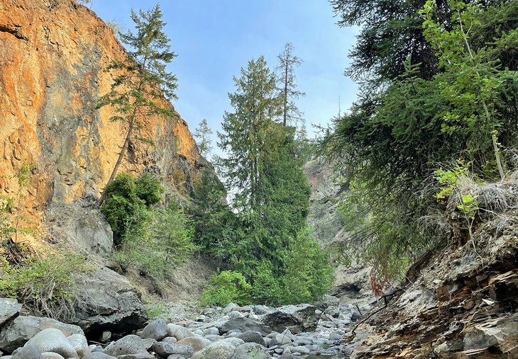
The bridge across the creek at the mid-way section of the trail enables you to experience two distinct microclimates. On the dryer north side of Bear Creek Canyon, expect to see tufts of grass and whispering ponderosa pines. On the south side, moss grows in the moist shadows where tall Douglas fir trees shoot up for the light.
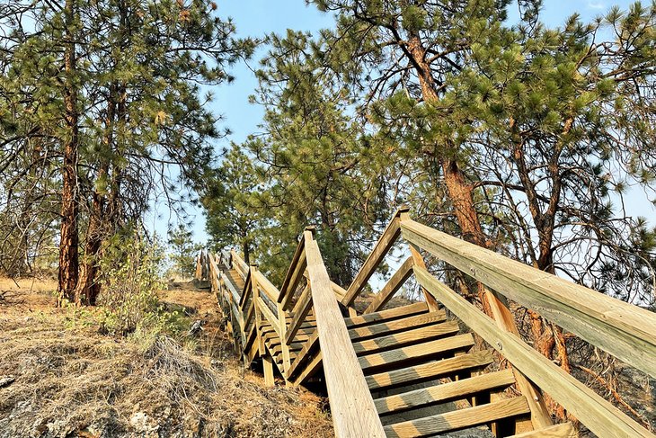
The Canyon Rim Trail is a moderate 2.5-kilometer well-maintained and marked trail that has 90 meters of elevation gain. Most hikers complete the trail in two hours. Hiking the loop clockwise, you ascend steep terrain on a set of switchbacks. Counterclockwise, your climb is accomplished on a series of sturdy stairs with handrails. For a shorter hike, use the Mid-Canyon cut-off.
To reach the trail, drive 11 kilometers north of downtown on Westside Road to Bear Creek Park. The parking lot for the trailhead is located across the road from the gate to the park.
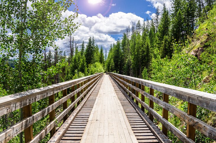
5. Myra Canyon Trail
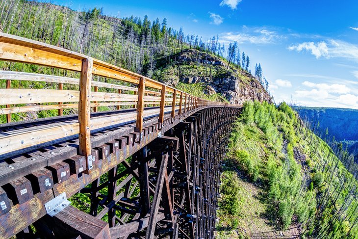
A historic engineering marvel awaits you while hiking the Myra Canyon Trail. This is the original route of the Kettle Valley Railway, constructed more than a century ago.
Flat and easily walked, the trail is nearly 25 kilometers round-trip, but you don't have to complete the entire distance. Walking only the first two kilometers takes you through one tunnel and across six trestle bridges. There's no end of views you will enjoy of the canyon and beyond.
The Myra Station trailhead is about 24 kilometers southeast of downtown and sits at an elevation of 1,219 meters—almost 800 meters higher than Kelowna. Pass Gallagher's Canyon Golf & Country Club on McCulloch Road and turn onto the Myra Forest Service Road. This rough gravel road leads you to the Myra Station trailhead parking lot.
Consider renting a bicycle if you want to experience the whole trail but don't have time to hike it. Following the path on two wheels will allow you to see more than 18 trestles, two steel bridges, and two tunnels in about an hour-long ride.
Bike rentals are conveniently located at the trailhead. Other tour companies in Kelowna can save you the drive. They transfer you to the trailhead from downtown, set you up on a guided bike tour, and even pack you a lunch.
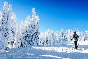
In the winter, you can also go fatbiking or snowshoeing on this trail.
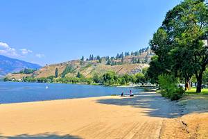
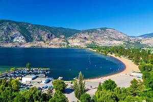
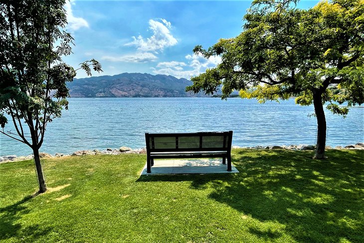
6. Kelowna Waterfront Boardwalk
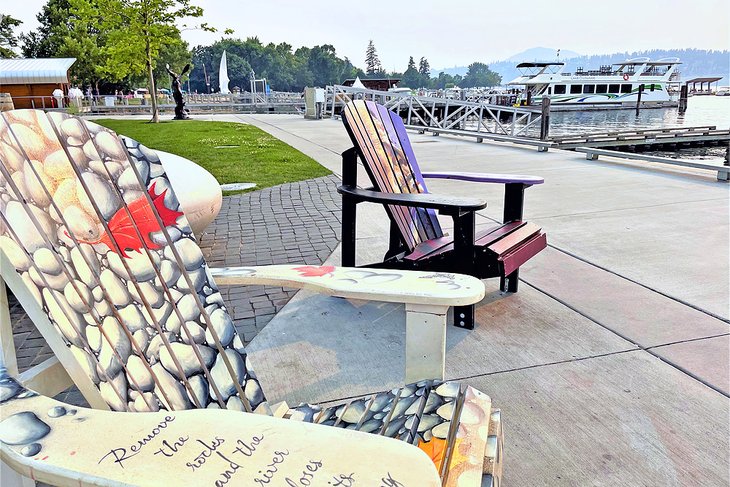
Mix with locals and other visitors along the Kelowna Waterfront Boardwalk. Used year-round, it's a popular gateway for urban folk to exercise, walk their dog, commute to work, and enjoy a leisurely stroll to a favorite park bench or beach. The surface includes pavement, a wooden boardwalk, and gravel—all suitable for strollers, wheelchairs, and bikes. Sections of the trail climb to a maximum elevation of 66 meters, allowing you to soak in sunsets and appreciate vistas of the city and Okanagan Lake.
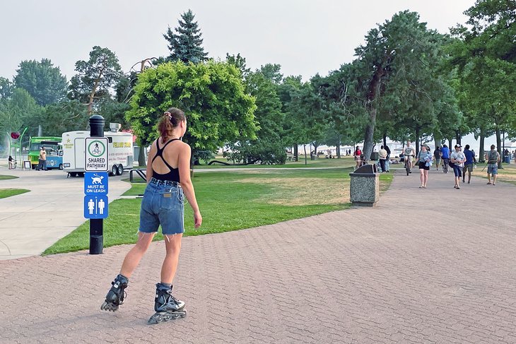
Access this trail anywhere that's most convenient. If you want to hike the entire route, start at Kelowna's City Park and Hot Sands Beach where there is adequate parking. Kelowna Waterfront Trail is 5.3 kilometers round-trip. You are sure to hop on and off the trail to swim in the lake, ogle fancy boats moored at the Kelowna Yacht Club, photograph a beaver or great blue heron at Rotary Marsh Park, or grab a cool beverage.
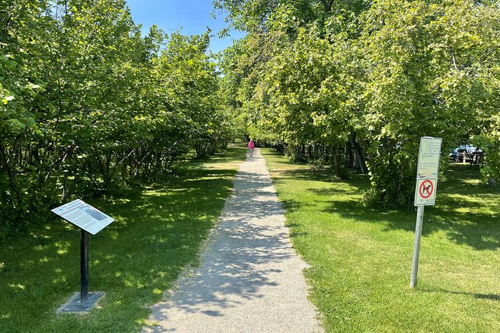
7. Mission Creek Greenway
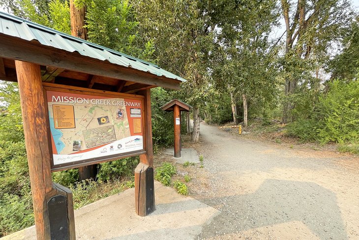
The Mission Creek Greenway is a 36-hectare park corridor that encompasses the main trail, side trails and loops, picnic and rest areas, places to interpret the natural world around you, and city parks. The greenway can be accessed at many points along 16.5 kilometers of level walking and cycling trails. The trail follows salmon-bearing Mission Creek from west of Gallagher's Canyon Golf & Country Club to where it flows into Okanagan Lake south of downtown Kelowna.
Part of the appeal of hiking the Mission Creek Greenway is what you can learn along the way. In addition to directional maps that pinpoint where you are along the trail, there is extensive educational signage to explain the social and natural history around you.
Midway along the trail is the Environmental Education Centre for the Okanagan, with exhibits that interpret plants and animals in the area. It also provides information on all the parks in the central Okanagan to inspire you to visit natural areas nearby.
As you traipse around south and southeast Kelowna, you are bound to cross the Mission Creek Greenway. Stop at one of the trailhead parking lots and go for a stroll. You don't need to walk the entire greenway trail to appreciate its scenery and the exercise. The city celebrates the completion of phase one and two, as well as a portion of the third phase, of the greenway. Eventually, the trail will cover 26 kilometers all the way to Mission Creek Falls.
8. Scenic Canyon Regional Park
A standout section of the Mission Creek Greenway offers some of the best natural eye candy in Kelowna: Scenic Canyon Regional Park. It contains a five-kilometer return hike that is popular year-round and rated easy with an elevation gain of 158 meters.
The best place to access the trail into Scenic Canyon Regional Park is from the parking lot at 3965 Field Road near Gallagher's Canyon Golf & Country Club. This trailhead is 15 kilometers east of downtown. In addition to jaw-dropping scenery, the trail connects you to exposed geological formations and steep-walled canyon faces. View preserved rock ovens used by early Chinese laborers.
For more time on the greenway, you can extend your hike beyond the 2.5-kilometer turnaround point of the trail.
9. Gellatly Bay Trail
For people who like to stroll or pick up the pace, the Gellatly Bay Trail combines a range of things to see along a flat, hard-surfaced four-kilometer return route. This marine trail can be enjoyed any time of the day or year. During the summer, you might want to take a swimsuit to enjoy a dip at one of the beaches, or plunge off the historic wharf.
Park your car in the lot of the Gellatly Nut Farm Regional Park, and make your way to the beach to soak in the view across Okanagan Lake. Hop on the trail north that skirts around Cove Lakeside Resort. The trail then follows parallel to Gellatly Road, passing by Marina Park and the West Kelowna Yacht Club. Before crossing the bridge, walk to the end of Powers Point to survey the boats or admire a great blue heron fishing along the shore.
Across Powers Creek is the start of Willows Beach, where there are restrooms and a place for you to change into a bathing suit. Willows is the best place to wade into the water or enjoy a swim.
You might opt to walk a little farther up the trail to a converted railway wharf that has become a summertime destination for children, youth, and the young at heart. Gellatly Bay Aquatic Park features ziplines that swing you above the water until you let go and make a splash. You can climb back onto the wharf or swim to a platform where another zipline awaits.
If you are walking with canine companions, free them up to make a splash of their own. Gellatly Dog Beach is a fenced, off-leash area between the aquatic park and Rotary Park. At Rotary Park, stretch out on the green grass or sit for a while on a park bench. This is your turnaround point of the hike.
When you return to Gellatly Nut Farm, wander through the peaceful surroundings of what was once part of a 120-hectare farm. The Gellatly brothers hybridized 58 nut tree varieties that now grow around the world. On a hot day, this is a good place to picnic with the cooler of treats in the trunk of your car.
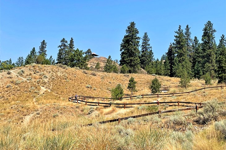
10. Black Mountain - sntsk'il'ntən Regional Park
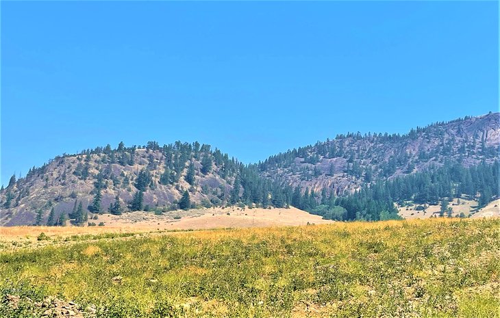
Black Mountain - sntsk'il'ntən Regional Park offers a collection of short trails.
Located 13 kilometers east of downtown, this 640-hectare park is a fresh addition to Kelowna's bounty of places to roam. Drive Hwy 33 east of the city and gain access to the trails from the end of Swainson Road.
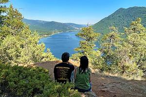
You can choose from several easy-to-moderate hikes on the grassy and scree slopes that surround the pinnacle of the park: Black Knight Mountain. From just about anywhere on these trails, there are sweeping western views of Kelowna and Okanagan Lake.
The trail system connects each of the trails, starting with either of the two easiest hikes, the Coyote Trail or Ephemeral Pond Trail. Both trails are packed gravel, 1.9 kilometers long, and intersect with the shortest of the bunch, the Hoodoo Trail. This trail is rated as moderate and is a few arrowheads longer than one kilometer.
The Hoodoo Trail leads to another moderate hike, the 1.8-kilometer Grassland Trail. You can complete the Grassland Trail all the way to where it ends at the Upper Access Trail (a service road), or take the spur on the one-kilometer Ridge Trail. This trail also links through to the Upper Access Trail, which you can take to return to the Swainson Road trailhead.
11. Crawford Falls Trail
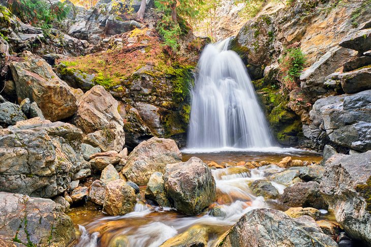
If you love to see and be near waterfalls, the Crawford Falls Trail is a match made in heaven. With a couple of falls along Bellevue Creek to see in a scenic and natural setting, you're in for a treat.
Crawford Falls Trail is enclosed in the 9.85-hectare Canyon Falls Park less than 12 kilometers from downtown. The trail is a short one kilometer and mostly follows a level surface. While rated easy, the trail requires good balance and extra effort to gain access to each of the falls. The first and second set of falls are six and 12 meters high, each unique in shape, size, and surroundings.
Expect to spend about an hour hiking this trail (although you can easily spend lots more time enjoying the falls).
12. Mount Boucherie Trail
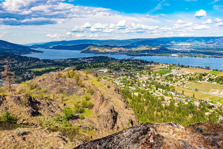
Some of the best and most popular hiking trails in West Kelowna are in Mount Boucherie Regional Park, 10 kilometers from downtown Kelowna. The most scenic trail that takes you to spectacular views atop Mount Boucherie starts from East Boundary Road. This 5.6-kilometer round-trip trail is well-used by locals during spring, summer, and winter, and is rated moderate.
With limited shade on the trail, temperatures can soar here during the summer. Some of the exposed dark rock looks as if it's melted by the sun, but you are seeing remnants of lava flows when this mountain was a 2,000-meter-high volcano and blew its top 50 million years ago.
Climbing Mount Boucherie today represents a 300-meter elevation gain via the three-kilometer Boucherie Rush trail. The unique point of view from the summit captures Kelowna's skyline and all the way up Okanagan Lake.
Along the trail, expect to see the occasional bald eagle, a deer near a marshy meadow, and inukshuk-shaped cairns at the top. While appreciating the views, take a moment to inspect the soles of your boots for free-riding pieces of prickly cactus.
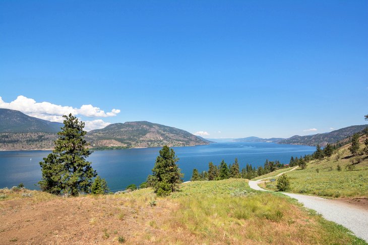
13. Rose Valley Lake Loop
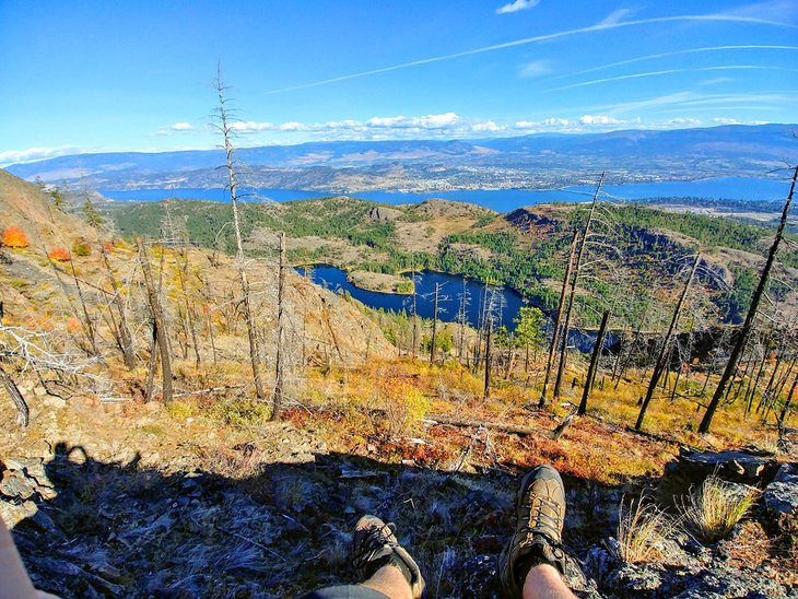
The trailhead for the Rose Valley Lake Loop is nine kilometers west of downtown within the regional park of the same name. A parking lot is located off Westlake Road in the Rose Valley neighborhood of West Kelowna.
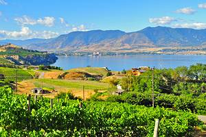
As part of the 250-hectare park, this roughly 13-kilometer loop trail leads you through open forests of Douglas fir and ponderosa pine around the Rose Valley Reservoir. You also see the panorama of Okanagan Lake and a view of the former volcano of Mount Boucherie. The trail is rated as moderate with an elevation gain of 477 meters.
Like other park trails in Kelowna, many optional spurs and informal social trails are encountered. Consult the park map to confirm routing for the Lake Loop, or consider a shorter option to fit your schedule.
This is a popular trail for bird-watchers and nature lovers. In springtime, locals come here to appreciate the bloom of Okanagan sunflowers, known elsewhere as arrowleaf balsamroot.
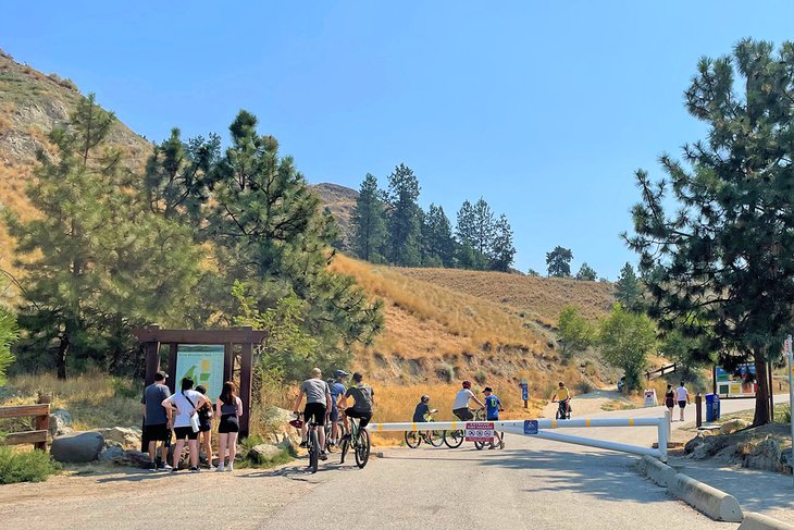
Before setting out hiking in Kelowna, pick up a copy of the Kelowna Outdoor Trails map from the visitor center. It conveniently folds up and will be your constant companion on the trail.