13 Bizarre Travel Facts Everyone Should Know
Travel often presents moments that seem inexplicable and can be deeply unsettling. These experiences aren't just random — they actually happen because of the way geography, politics, and Earth systems intersect to structure our experiences of the world.
This article explores surprising facts about maps, borders, time zones, and natural processes that travelers regularly encounter but that are nevertheless...strange. Learning about why deserts can be icy, how islands outnumber expectations, or why volcanoes respond to melting glaciers can inform your trip planning. Awareness of shifting tides, auroras, or international date lines can prevent missed connections or geographic disorientation.
Yet, the most important effect of pulling back the curtain on these strange events is the way it fuels even more wonder about the world. We've uncovered a few hidden explanations for the truly bizarre to whet any traveler's curiosity about the weird and delightful ways that incongruities cross our paths when we're out on the road.
Earth's magnetic poles are moving
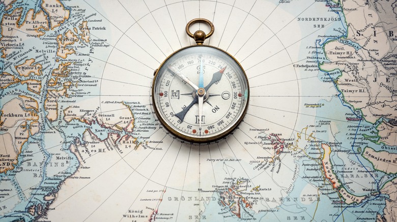
The Earth's magnetic field, on which many navigation systems rely, is shifting. Specifically, scientists report that the North magnetic pole is drifting away from Canada towards Russia. Every five years, researchers release the World Magnetic Model report that contains detailed modeling so that navigation systems can be updated according to the Earth's magnetic changes. Without this, industries such as aviation and shipping would literally be quite lost.
Most passenger planes use GPS systems that rely on satellite systems rather than the magnetic field for orientation. However, just about every cockpit still contains a magnetic compass. Pilots still rely on magnetic compasses as a power-independent navigation tool. As the magnetic fields shift, pilots may no longer be able to use magnetic compasses as a reliable backup, and the aviation industry will likely become more dependent on GPS systems.
Changes in Earth's magnetic fields are not well understood. We know they happen as a result of chaotic processes in the molten core beneath the Earth's surface. And, although it happens very slowly, these changes happen relatively regularly. In fact, the north and south magnetic poles have reversed positions at least 183 times in the last 83 million years. The good news is that these changes will not affect the Earth's geographic poles. Geographic poles remain fixed points bound by Earth's axis of rotation.
Beach tides are more complex than just low tide and high tide
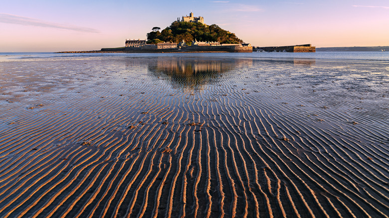
Tides affect swimming conditions, beach accessibility, wildlife viewing, and even whether a beach exists at all at certain times of day. Common knowledge splits the tides in two: high and low. In reality, most coastlines experience four tidal phases each day–two high tides and two low tides–driven by the gravitational dance between the Earth and the moon.
As the moon orbits the Earth, its gravity pulls ocean water toward it, creating a bulge on the side of the planet facing the moon. At the same time, a second bulge forms on the opposite side due to the Earth–moon system's rotation. As Earth spins through these bulges, most coastal locations pass through two high tides and two low tides roughly every 24 hours.
It's also important to keep in mind that tides are not evenly spaced or equal in height everywhere. Local geography plays a major role. Coastline shape, seafloor depth, and the presence of bays or estuaries can amplify or dampen tides. This is why some beaches experience subtle changes, while others see dramatic differences between high and low tide. That beach you stroll across in the morning may be underwater by afternoon, and back again by sunset.
Some countries exist inside other countries

We tend to think of countries being cleanly separated by borders. In reality, political geography is far messier. One of the strangest examples is the existence of enclaves –territories that are completely surrounded by another country. While they may seem rare, enclaves are more common than many travelers realize.
The most dramatic example of an enclave is perhaps Lesotho, a fully independent nation that is entirely enclosed by South Africa. Vatican City offers another well-known case: it is a sovereign state nestled entirely within the city of Rome, which is part of Italy. Despite its very small size, Vatican City maintains its own government, postal system, and diplomatic relations.
Closely related are exclaves, which are portions of a country physically separated from the rest of its territory by foreign land. One well-known example is Alaska, an integral part of the United States that can only be reached by crossing through Canada (or, technically, by sea). Lesser-known examples include Ceuta, a part of Spain that is enclosed in Morocco (an enclave and exclave at the same time, and the island of Providencia, which belongs to Colombia but is located off the coast of Nicaragua.
The only place in the world where four countries meet in a single point is in Southern Africa
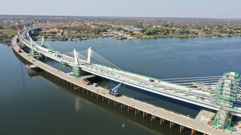
Quadripoints–- places where four countries meet at a single point — are extraordinarily rare. In fact, there is only one recognized example in the world, located in southern Africa. At this precise geographic point, Zambia, Zimbabwe, Botswana, and Namibia converge. The configuration exists largely because of colonial-era boundary decisions layered onto the region's rivers. On a map, the quadripoint looks almost accidental. Traveling to this rare convergence is a fascinating way to deepen your understanding of borders as human inventions.
There are many ways to visit this unique destination, and most involve traveling to the town of Kazungula, where the borders intersect. There is a bridge easily connecting Botswana and Zimbabwe across the Zambezi River, and folks often stop at the bridge's midpoint for photo opportunities in the so-called "no-man's land." The nearby city of Livingstone on the Zambia side is a popular hub for people who want to see the river's famous Victoria Falls–a thunderous and spectacular waterfall technically located in Zimbabwe and a UNESCO World Heritage Site.
China only has one time zone

China is so vast that it stretches across what would normally be five geographical time zones. Yet, despite this enormous east–west span, the entire country officially operates on a single clock: China Standard Time, often referred to as "Beijing Time." This system has been in place since 1949, when the newly established People's Republic of China centralized timekeeping as part of a broader effort to administratively and symbolically unify the nation.
In practical terms, this means that all train timetables, flights, and government offices within China run on Beijing time, regardless of local daylight conditions. Sunrise and sunset hours can vary dramatically depending on where you are. In eastern cities like Shanghai or Beijing, daylight hours feel relatively conventional. But in far western regions, such as Xinjiang, the sun may not rise until close to 10 a.m. by the clock, and can set well into the evening. The halfway point tends to happen much later than 12 p.m. For travelers, this can be disorienting. Jet lag behaves differently when long-distance travel doesn't involve changing clocks, even though the sun clearly suggests otherwise.
The international dateline on which all time zones depend is not a neat straight line
On most maps, the International Date Line looks like a clean, straight boundary slicing the Pacific Ocean in two. In reality, it's one of the strangest borders on Earth. Instead of following a neat line, the Date Line zigzags wildly to accommodate countries, island chains, and communities that prefer to share the same calendar day.
The Date Line marks where each new day officially begins, anchoring the world's system of time zones. But unlike longitude lines, it isn't governed by natural laws. It's a human-made compromise, adjusted over decades to prevent nations from being split across different days. Entire island groups bend the line east or west so residents don't wake up a day ahead or behind their neighbors.
The result is a geographic paradox. In some places, two locations separated by just a few miles are a full 24 hours apart. This is most famously visible between parts of eastern Russia and Alaska, in what are known as the Diomede Islands. The Diomede Islands include Big Diomede, often referred to as "Today Island," which belongs to Russia, and Little Diomede, also known as "Yesterday Island," which belongs to the U.S. Standing in "today," you can look just over 2 miles across the water at "yesterday."
France's largest border is with Brazil
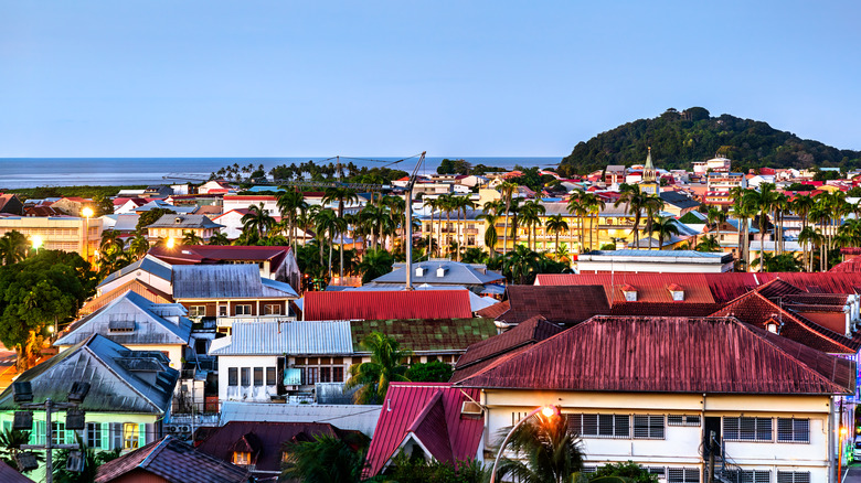
When people think about France's borders, neighboring European countries like Spain, Belgium, or Germany usually come to mind. Surprisingly, France's longest land border isn't in Europe at all. It's in South America, where France shares a roughly 450-mile border with Brazil.
This is possible because France still maintains 13 overseas territories spread across the globe–a fact that also means France is the country with the most time zones in the world. One of these territories is French Guiana, an overseas department on the northeast coast of South America. Politically and legally, it is as much a part of France as Paris or Marseille. They use the euro, speak French, and are governed by French laws.
In other ways, however, French Guiana couldn't feel more different. Travelers visit French Guiana for its lush Amazonian rainforest, vibrant Creole culture, and rich biodiversity, including howler monkeys, toucans, and rare orchids. The region is also famous for the Guiana Space Centre, one of the world's most important launch sites, where visitors can witness rocket launches first hand.
This capital city is the only one in the world with a rainforest inside it
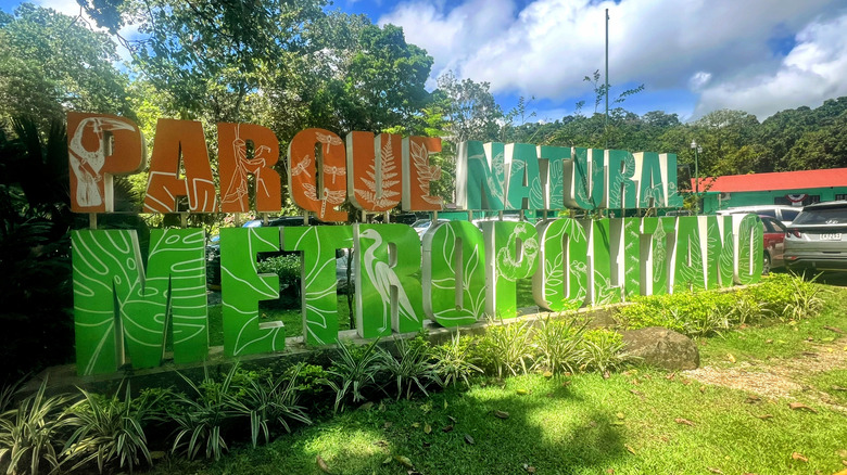
Most capital cities are defined by monuments, government buildings, and dense urban development. Panama City, the capital of Panama, stands apart from the rest for a very different reason: it's the only capital city in the world with a protected tropical rainforest inside its city limits. That rainforest is Panama Metropolitan Natural Park, a vast green oasis located just minutes from the downtown skyline.
The park covers 573 acres of lowland tropical forest and functions as a buffer between the city and the Panama Canal watershed. Despite its proximity to highways and skyscrapers, the park is home to sloths, monkeys, toucans, and hundreds of plant species native to Central America. Visitors to the park can hike forest trails, spot wildlife, and look out over the Pacific Ocean and city skyline from elevated viewpoints, all in a single visit. Few capitals offer the chance to move so quickly from urban bustle to a dense tropical rainforest.
Volcanic eruptions will become more frequent in the future
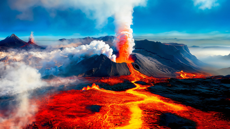
New research suggests that glacier melt driven by climate change could make volcanic eruptions both more frequent and more explosive in the future. The key lies in pressure. Thick ice sheets act like enormous weights on the Earth's crust. When they melt and retreat, that pressure is suddenly lifted. Subterranean magma chambers respond by expanding and releasing gas, which can trigger eruptions.
Scientists have seen this effect in Iceland. When Icelandic glaciers retreated at the end of the last Ice Age, volcanic activity surged dramatically. A 2025 study examined volcanoes in Chile's Andes and found similar clues: glacial retreat reduces suppression of volcanic systems, making eruptions more likely as ice vanishes. Scientists describe the mechanism as analogous to opening a pressurized bottle; once the "lid" of ice is gone, pressure builds and can pop like a champagne bottle.
Hundreds of potentially active volcanoes are located beneath or near glaciers in places like Antarctica, Russia, New Zealand, and North America, meaning this process could influence volcanic behavior worldwide as warming continues. Maybe thrill seekers of the future who want to see volcanoes up close will have to start traveling to different regions that are less likely to be affected by this phenomenon.
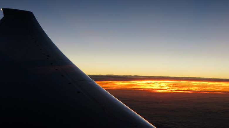
The longest flight in the world
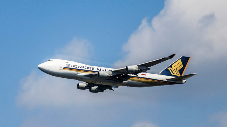
Ultra-long-haul air travel has pushed the limits of both aircraft design and human endurance. The longest nonstop commercial flight in the world connects New York and Singapore, covering roughly 9,500 miles in a single stretch. Operated by Singapore Airlines, the route links Newark Liberty International Airport with Singapore's Changi Airport and can keep passengers in the air for nearly 19 hours.
Flights of this length were once considered impractical, but advances in aircraft technology have made them viable. The route relies on long-range, fuel-efficient planes designed to carry fewer passengers in optimized cabin conditions. Read: there are no basic economy class seats on these planes — only premium economy and business. Temperature, meals, and lighting are carefully calibrated to help make the journey a little less grueling.
For travelers, the experience is less about distance and more about time. Crossing half the globe without a layover means skipping airport transfers and immigration queues, but it also requires careful planning around sleep, hydration, and movement. While the world feels smaller than ever, the sheer scale of the planet remains evident when a single plane flies nearly halfway around it.
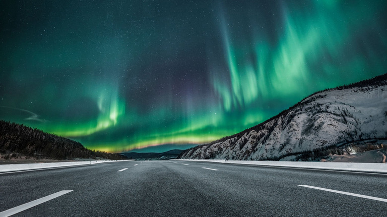
The famous northern lights have a lesser known counterpart in the south
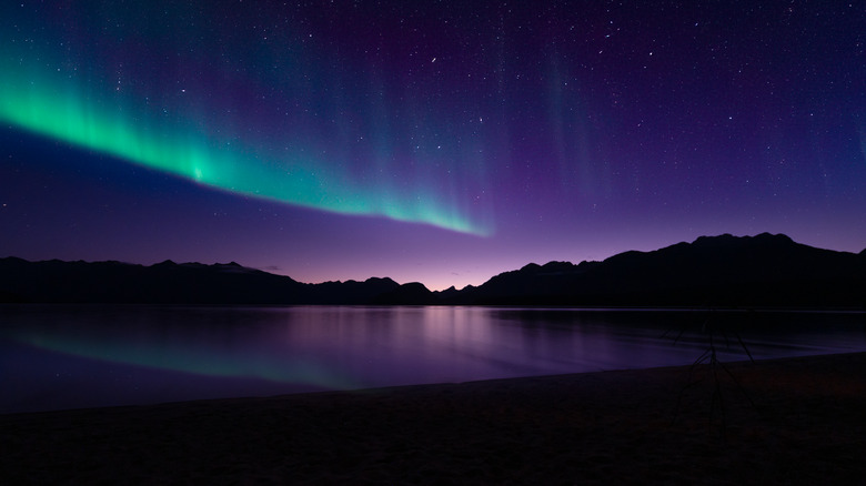
The glowing ribbons of green and purple known as the northern lights, formally the aurora borealis, are one of the world's most famous natural spectacles. Few travelers realize that they have an almost perfect counterpart in the opposite hemisphere. Known as the aurora australis, or southern lights, this phenomenon appears over Antarctica and the southern oceans. They're produced by the same space-weather conditions that produce the aurora borealis in the north.
Both displays are created when charged particles from the sun are carried by solar winds and collide with gases in Earth's upper atmosphere. These particles are guided by the planet's magnetic field, which stretches in a roughly symmetrical pattern from the North Pole to the South Pole. These lights are visible in the southern hemisphere winter from amazing destinations such as Tasmania, southern Australia, New Zealand's South Island (especially Stewart Island), and parts of the vast wilderness of Patagonia.
The best season for chasing the aurora australis runs from March to September, when nights are longest in the Southern Hemisphere. There are mobile apps where you can check the space weather forecasts, as strong solar storms dramatically increase your chances. Clear skies are essential too, so flexibility is key–build extra nights into your itinerary and be ready to move around on short notice.
The country with the most islands might surprise you
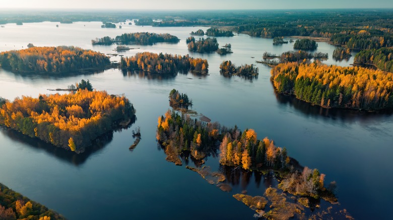
When you think of a nation dotted with islands, tropical archipelagos like Indonesia or the Philippines might spring to mind. Surprisingly, however, the record for the most islands belonging to a single country goes to Sweden. By the most comprehensive counts, Sweden boasts 267,570 islands within its territory — far more than Indonesia's roughly 13,558 islandsor the comparatively paltry 7,641 islands of the Philippines.
The majority of Sweden's islands are small and uninhabited, many found in the sprawling Stockholm archipelago and the rugged skerries of its Baltic coastline. However, many island regions are home to rich marine cultures and communities, such as the Bohuslän, Gothenburg, Blekinge, and Östgöta archipelagos. There are some serious gems tucked into this scattering of sand and sea, such as Hvrångö, a quiet, car-free island, and Holmön, a nature-lover's paradise.
By contrast, Indonesia's islands may be far fewer in number, but they are generally much larger and more populous. Indonesia's islands also hold the title of the best island-hopping nation in the world due to their affordability and ease of access. Still, Sweden's record highlights how geography can challenge our assumptions about place and scale.
Most deserts don't have sand
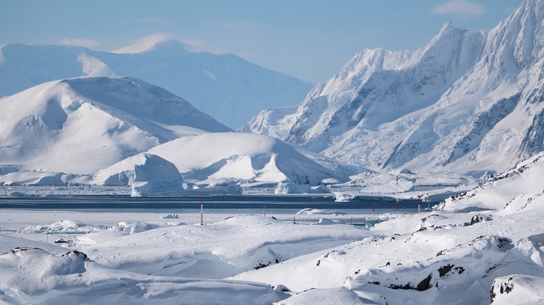
When most people imagine a desert, they picture endless dunes, scorching heat, and rippling sand. In reality, sand has very little to do with what defines a desert. The key factor is annual rainfall. Deserts are regions that receive extremely little precipitation, regardless of their temperature or other geographical features.
This definition leads to a surprising conclusion: the largest desert on Earth is Antarctica. Despite being covered in ice rather than sand, Antarctica qualifies as a desert because it receives very little rainfall–in fact, less precipitation than the Sahara. Most of the continent, which covers 5.5 million square miles, gets under 2 inches of snowfall per year (measured as water equivalent), making it drier than many hot deserts.
Even among warm deserts, sand is often the exception rather than the rule. Only a small percentage of deserts worldwide are dominated by sand dunes. The Gobi Desert, for example, is largely made of rocks and sand.
Methodology

To find the whackiest facts about our wonderful world, we scoured many sources, including Smithsonian Magazine, Live Science, and peer-reviewed studies available through ScienceDirect on topics related to geography and Earth systems. Additional context and examples were identified through searches on Reddit forums, particularly in forums where travelers and geography enthusiasts discuss firsthand experiences, unusual border cases, and lesser-known geographic phenomena.