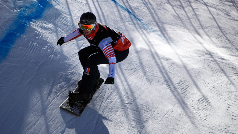
10 Utah Ski Resorts You Can't Miss On Your Next Trip
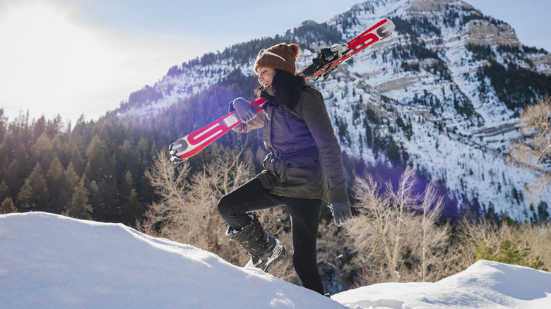
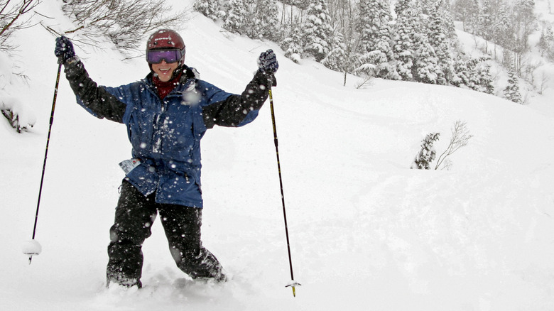
Inside a 1960s issue of The Salt Lake Tribune, a magazine supplement was first to publish the phrase "The Greatest Snow on Earth." Ever since, the slogan has been used to convey how great Utah's powder is for skiing and snowboarding. There's some science to it, too, which can be described through a phenomenon known as flotation. It exists when lightweight snow has a kind of "bottomless" effect, with enough body to keep skis and boards on the freshest upper level of snow. Thanks to this, Utah boasts some of the best skiing in the U.S.
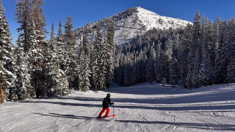
Most of the state's popular resorts are within an hour from Salt Lake City. Snowbird, an idyllic getaway known for spas, festivals, and outdoor fun, is only about a 40-minute drive from downtown or the airport. That's the magic of the Wasatch Mountains being so gloriously close to town. You also have your choice between expansive resorts — including the largest in the nation — with luxurious lodges or smaller, budget-friendly destinations perfect for a day out with the whole family.
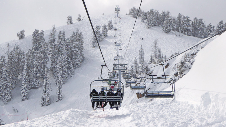
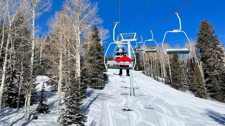
If you're heading to some of the biggest resorts that are closest to Salt Lake City, you'll likely run into traffic on the weekends. Locals call the winding trail of taillights in Little Cottonwood Canyon "the red snake," and developers have proposed a gondola that would provide scenic access through the canyon and help alleviate the traffic. Environmentalists and local associations oppose the move, though, so that remains to be seen. In the meantime, visit during the week or get to your chosen spot early. With 15 resorts to choose from in the state, there's something for everyone. Here are 10 that are not to be missed.
Snowbird
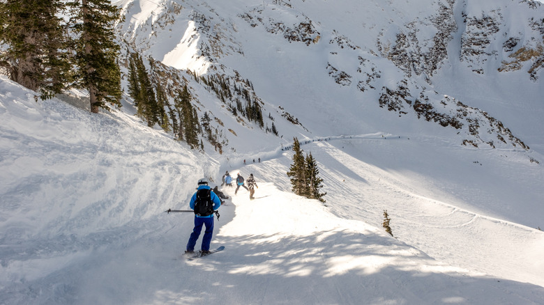
Snowbird, located in the Little Cottonwood Canyon area, is a go-to for skiers thanks to an average snowfall of more than 500 inches annually. It's especially attractive for those who are advanced on the slopes, with 68% of the runs suited for very experienced or expert skiers. About 8% are accessible for beginners, and nearly a quarter of the area is great for intermediate skiers. You'll find a solid range of cruisers, dramatic steeps, scenic glades, and open bowls to suit your taste across 2,500 skiable acres. Not to mention, it's also the most accessible resort from Salt Lake City. "The skiing is phenomenal," experienced skier @DavidL188 raved in a review on Tripadvisor, adding a helpful tip: "More than half of the runs are double black diamonds. All the ratings here are one higher than ratings at other resorts."
A variety of lodging options await at Snowbird, including The Cliff Lodge, The Lodge at Snowbird, and The Inn, plus a shared ownership program perfect for regulars called Iron Blosam. And there are dining options galore throughout the resort, from walk-up counters like Birdfeeder to sit-down options like Steak Pit and The Lodge Bistro. With the annual Summit Pass, you have unlimited access to the slopes of your choosing, as often as you'd like, along with summer activities like the Peruvian Chairlift and tram rides. And to sweeten the deal even more, Snowbird has partnered with neighboring Alta Ski Area for the Alta-Bird Pass that covers unlimited skiing at both locations. It's also part of the Ikon Pass program and Mountain Collective.
Snowbasin
Taking the top spot in a number of ski destination awards from Ski Magazine, Outside Magazine, and USA Today's 10 Best, Snowbasin is a fan favorite. It's part of the Mountain Collective program, which also includes Snowbird and Alta Ski Area in Utah, and pass holders are eligible for two days at Snowbasin, with 50% off additional days. Access 3,000 skiable acres and 3,000 vertical feet to make the most of this winter haven. Thirteen lifts give you access to 115 trails, including one of the resort's most famous, the double black diamond Lone Tree run. Numerous trails were also featured during the 2002 Winter Olympics, like Grizzly Downhill and Wildflower Downhill.
If you need gear or a gift, don't miss the shop at the Grizzly Center. And there are six areas to grab a bite or an aprés-ski beverage, including the upscale lounge vibe of The Cinnabar, The Overlook in Needles Lodge, and the Strawberry Patio at Strawberry Lodge, which features a large outdoor seating area and three different dining options around the patio. There's no lodging at Snowbasin proper, which is really this destination's only drawback, and the closest options you'll find are in Ogden, Utah's charming mountain town full of history and art, about a 30-minute drive away. If you're in the mood to explore the best destinations on your trip to Salt Lake and don't mind a little drive back and forth — it usually takes a little less than an hour — Snowbasin recommends two hotels operated by the same folks who run the ski resort: Grand America Hotel and Little America Hotel.
Deer Valley Resort
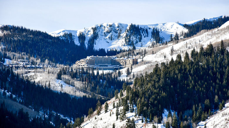
Situated near Park City, Deer Valley is a skier's dream — there's no snowboarding at this high-end resort. For the 2025/'26 season, Deer Valley is opening a huge development that expands its skiable area with 100 new runs, 10 additional chairlifts, and a gondola called the East Village Express. The project effectively doubles the resort's existing terrain, making this tried-and-true spot well worth multiple visits. It's also slated to host events during the 2034 Olympics, so you can check out the new additions in advance of the resort's moment on the world stage. Aim for three different base areas: Empire Pass, Snow Park, or Silver Lake. All three offer plenty of options for comfortable accommodations, from the immanently rustic Grand Lodge near the Northside Express chairlift to luxury vacation rentals like Moonshadow 8927. You can use your Ikon Pass here, but just remember that lift reservations are required.
Guided Mountain Host tours are led daily by enthusiastic staff who share insights into the terrain and history so that intermediate and expert skiers can take advantage of lesser-known runs. Deer Valley's ski school offers clinics and both group and private lessons that accommodate skiers of all skill levels, and its family-friendly atmosphere is well rounded with lessons tailored for teens and kids as young as 4 years old. There's plenty to keep the advanced skiers happy here, too, with several black diamond routes, especially on Bald Mountain and Little Baldy Peak. Make your way to great powder stashes like Ontario Bowl, toward Hidden Treasure, which is long and winding between scenic stands of aspens.
Alta Ski Area
While we're on the topic of skier-only resorts, we'd be remiss to not mention Alta Ski Area. This acclaimed resort on Little Cottonwood Canyon sits near Albion Basin, a high-alpine escape that brims with blooms in the spring. And it's just a 2-mile drive from Snowbird, which makes both places perfect for a joint destination. If you're using your Ikon Pass, you can split your seven-day access between Alta Ski Area and Snowbird. You can also combine experiences year-round with the Alta-Bird Pass, or choose from adult, senior, kids, and family season passes to Alta specifically.
Alta Ski Area has been around since 1938, and its independent ownership and well-groomed runs keep people coming back. "We had a wonderful time skiing Alta," visitor @799sharic wrote in a Tripadvisor review after giving Alta a try for the first time with her teen kids. "Great grooming. Beautiful scenery. Good runs for our green and blue skiers. Everyone around us was friendly. Would definitely go back." Plan ahead for your visit, as parking reservations are required in Alta on weekends and holidays between 8 a.m. and 1 p.m. You can access the slopes from two bases, Wildcat and Albion, which have transportation links between them. Albion is perfect for learners and intermediate skiers and features casual dining options, like The Albion Grill, to refuel after ripping down your favorite run. More advanced skiers will love the Wildcat base area, where the Goldminer's Daughter Lodge is a perfect place to warm up, grab a bite, or get some ZZZs.
Powder Mountain
A little bit north of Snowbasin and about an hour and 20 minutes' drive from Salt Lake City, Powder Mountain is a worthwhile destination for a less-crowded experience on the slopes. This resort spans more than 5,000 skiable acres and averages around 360 inches of snowfall annually. More than 150 designated runs are great for a range of skill levels, with 56% geared toward advanced skiers, 29% for intermediate, and 15% for beginners. There are also a total of five lifts, plus three more that are for the exclusive use of residents. But the thing that makes Powder Mountain stand out is its ticket-limiting system, which recently changed. Until the 2024/'25 season, the resort capped the number of day tickets at 1,500 and season passes at 3,000. But it no longer caps the season passes, which, as of this writing, run $1,699 for adults, with a little bit of a discount if purchased before mid-December. If you book more than two weeks in advance, you'll get the best deal on a single-day ticket.
Back in the mid-1980s, Powder Mountain was the first Utah ski resort to welcome snowboarders, and today this spot still features two terrain parks called Sundown and Hidden Lake. Sundown is great for beginners with smaller features, and Hidden Lake is ideal for those with more experience, boasting a mix of small to large features. And while Powder Mountain doesn't have its own lodging options, it's situated in an area where vacation rentals and other accommodations are pretty easy to find. If you don't need a whole place to yourself, Compass Rose Lodge in nearby Huntsville might just fit the bill!
Park City Mountain Resort
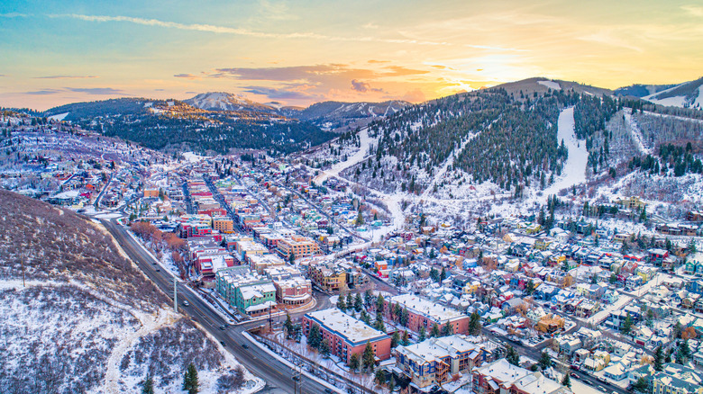
At 7,300 acres of skiable area, Park City Mountain Resort clocks in as the largest ski resort in the U.S. It's also one of the most broadly attractive to skiers and snowboarders thanks to terrain that's great for beginners, experts, and everyone in between. In addition to natural snow, the resort employs the largest snowmaking system in the state, so fresh powder is guaranteed. Historic Park City, which sits at the base of the slopes, is also one of the U.S.' prettiest mountain towns that looks like Europe's Alps.
Park City Mountain has two distinct bases: Park City Mountain Village and Canyons Village. Canyons, formerly Park West, hosted the 2002 Winter Olympics and is a hub for restaurants, lodging, and entertainment throughout the year. Check out the Umbrella Bar for panoramic views while enjoying an aprés-ski beer. Canyons is also where you can access the Orange Bubble Express, the country's first heated and bubbled high-speed lift, making the ride up the slope way more comfortable.
Park City Mountain Village also offers lodging, dining, and retail experiences. Both bases provide ski and snowboard schools, and free daily parking is available in both places — or you can hop aboard Park City's free public transit. The resort also participates in the Epic Pass program, which allows access to a number of Colorado parks and dozens more farther afield. Park City Mountain can get crowded, with visitors sharing that long lines sometimes develop for lifts. It's an iconic location with a great choice of runs, but you may need patience when it comes to transportation and lifts.
Sundance Mountain Resort
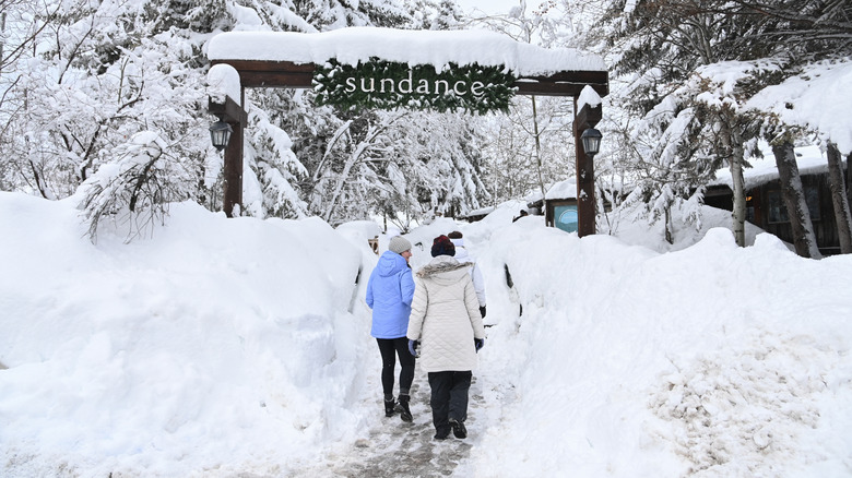
Sundance Mountain Resort sits in a storied canyon that Robert Redford purchased in 1969 with the vision of creating a community that balanced the arts, culture, and stewardship of nature. Over the years, it became home to the Sundance Institute, which announced in 2025 that the Sundance Festival is moving to idyllic Boulder, Colorado, and today, it continues as a ski resort with Michelin Key-designated lodging that's perfect for a luxurious winter escape. In 2020, Redford sold the resort to new owners who are committed to retaining and expanding upon this unique place's original mission to embrace nature and the arts.
Of the 5,000 acres Redford originally purchased, most of which he made sure would remain totally natural, about 500 total acres are skiable, making this resort a much more intimate but completely unique experience in comparison to other nearby options. Additional parking and new lifts have made it easier to access the slopes — and much quicker! — and the recent addition of 40 new acres of skiable terrain add more beginner-friendly options. Also new for the 2025/'26 season is The Inn at Sundance Mountain Resort, which features more than 60 ski-in, ski-out hotel rooms, a comfy lounge, and a wraparound porch with great views at the resort's base.
Solitude
Solitude Mountain Resort is, as its name suggests, a little less crowded than some of the other bigger resorts. It's run by the same folks who own Deer Valley, so a similar high quality is a priority. Tucked in Big Cottonwood Canyon just 40 minutes by car from downtown Salt Lake City, Solitude is a favorite among locals and offers numerous dining and lodging options to make you feel right at home. And 82 named runs across 1,200 skiable acres allow for plenty of options to explore new trails or return to your favorites. Head up the Summit Express for your choice of several intermediate and advanced runs from more than 10,000 feet.
Thanks in part to its easily navigable layout and many of the routes ending up in a similar area near two bases, Solitude Village and Moonbeam, it's a little easier to keep track of others in your group here compared to some other resorts. Moonbeam Base Area is likely where you'll head if you're visiting on a day ticket, as it has the biggest parking area and a large, eponymous lodge where you can grab lunch and aprés treats. If you're staying for a longer time, Solitude Village will likely be your primary base. That's where you'll find accommodations like The Inn at Solitude, numerous condominiums, and the Silver Aspen Townhome luxury home rental. St. Bernard's at The Inn is a perfect place to warm up near a hearth with cuisine inspired by the mountains, and the Thirsty Squirrel defines "laid-back aprés" with great beer and a game of pool.
Brighton Resort
Just a few minutes down the road from Solitude at the top of Big Cottonwood Canyon, and only 45 minutes from Salt Lake City, Brighton Resort is a marginally smaller but mighty destination to add to your list. It basks in more than 500 inches of annual snowfall, making this powder-covered resort a must-try. Brighton is actually the oldest ski resort in Utah, dating back to 1936 when a local ski club began towing skiers up the mountain using a rope mechanism they designed themselves. Today, accessibility is still the name of the game at Brighton. This resort aims to make skiing and snowboarding enjoyable for all, so night riding is available on 24 runs between mid-December and early April so that you can extend your time or fit in a visit on a weekday until 9 p.m. It's also a great place to bring the whole fam thanks to being easy to get around — there's just one base, Brighton Center — and its laid-back feel. Snowboarders have it made with a total of six terrain parks with a wide variety of features, too.
Brighton participates in the Ikon Pass program, with three different options available for accessing the resort over the course of two, three, four, five, or seven days. Numerous ticket and pass options are on offer, including a Flex Pass that's perfect for three, four, or five days during any part of peak season you choose (no blackouts!) plus unlimited days during the shoulder season. You can also opt for a 10-Ticket Pack or a Boyne Explorer Pass, which includes access to nine other resorts in the Boyne portfolio across the country.
Eagle Point
Slightly off the beaten path, relative to so many other resorts on this list that are quite close to Salt Lake City, Eagle Point is located in Beaver, in southwestern Utah. A small resort easily reachable off of Interstate 15, it's more accessible for those coming from Las Vegas, as you can get here in a little more than three hours by car — the same as from Salt Lake City. Season passes to Eagle Point are at least half the price of many other Utah resorts, making this a perfect destination for those on a budget and large families. The pass also gets you 10% off food, retail, and one full tune during the winter.
Eagle Point isn't huge, at 650 skiable acres, but it still boasts 1,500 vertical feet and more than 350 inches of natural annual snowfall. Its 43 runs range from wide trails perfect for beginners on the upper mountain to black diamond challenges on the lower mountain — the "steep side." You also won't have to deal with wait times for the park's five lifts like you'll often encounter at bigger resorts. And rather than high-rise hotels and crowded base areas, you'll be able to enjoy a more serene experience with ski-in, ski-out condos, vacation homes, and cabins, plus central condos right in Eagle Point Village. On site, you can choose from Canyonside Bar & Grill for a home-cooked kind of feel or the more casual Skyline Lodge Cafeteria, which is open during the winter only. For season pass holders, Eagle Point also participates in the Indy Add-On Pass program, allowing for access and discounts at other Indy resorts.
Methodology
To round up the 10 ski resorts absolutely worth a visit in Utah, we consulted VisitUtah.com and SkiUtah.com, plus visitor reviews on sites like Tripadvisor and Google. We took recent ownership changes and infrastructure developments into consideration, and we included parks that range from well over 100 runs to just a few dozen. Specific mountain information was found on each resort's independent website, and we also looked for specific offerings and added value with pass programs like Mountain Collective, Epic, Indy, and Ikon.