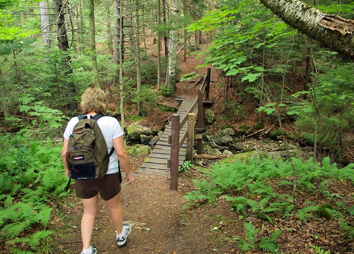
14 Top-Rated Hiking Trails in Vermont
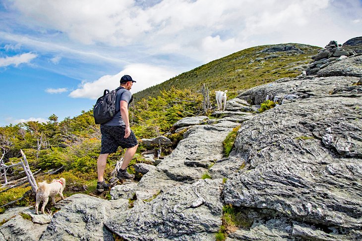
Following the state's highest ridgelines from the northern border with Canada to the Massachusetts state line in the south, Vermont's Long Trail is America's oldest long distance hiking trail. But day hikers can enjoy segments of the trail, and use the miles of well-maintained side trails to reach the more than 40 summits the Long Trail connects.
Because the Long Trail — and the Green Mountains themselves — run north-to-south through the center of the state, they are never far from Vermont's many tourist attractions, making the state a good vacation choice for families with both hikers and non-hikers.
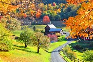
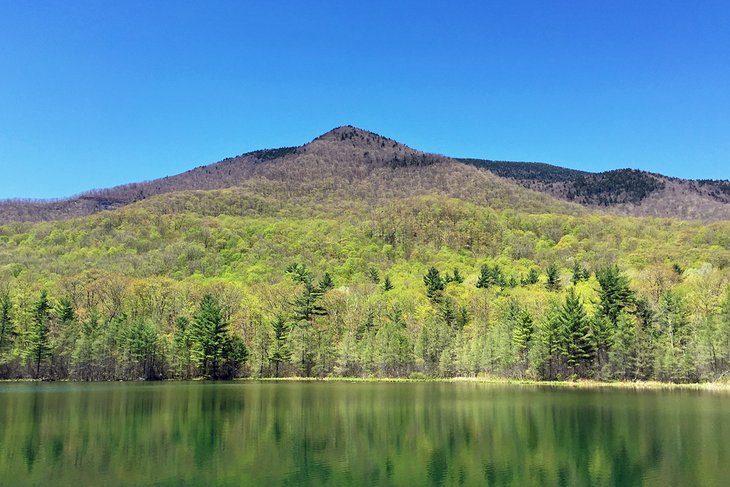
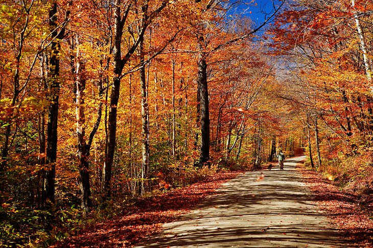
Not all of the hiking trails climb mountains. Vermont's state and local parks are filled with gentle walking trails that explore the state's natural sights — waterfalls, bogs, and geological formations left by the glaciers — or simply provide a chance to enjoy its beautiful meadows and woodlands.
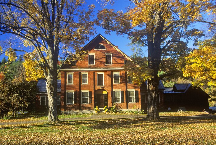
Vermont's abundant green space and wilderness means that it is also a prime place for observing wildlife and plants. Birders will find hawks circling mountain peaks and rare boreal birds in its forests. In the spring, trails may be lined with woodland flowers, and in the fall, the whole state becomes a riot of reds, oranges, and yellows as foliage changes color.
Explore the state's beautiful scenery with our list of the top hiking trails in Vermont.
- 1. Mt. Mansfield
- 2. Mt. Pisgah
- 3. Hamilton Falls
- 4. The Long Trail
- 5. Camel's Hump
- 6. Cantilever Rock
- 7. Mt. Abraham
- 8. Owl's Head and Peacham Bog
- 9. Spruce Peak
- 10. Mount Equinox
- 11. Mt. Olga
- 12. Brattleboro Retreat Trail Network
- 13. Mt. Tom Loop
- 14. Inn-to-Inn Walking Tours
- Map of Hiking Trails in Vermont
1. Mt. Mansfield
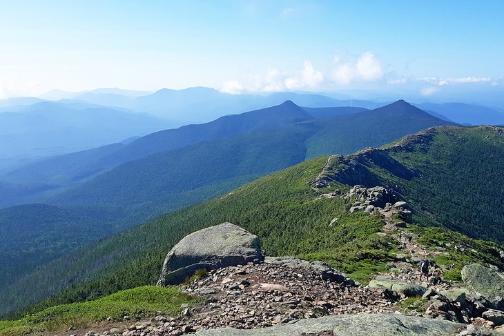
Vermont's highest mountain is also one of its most interesting and rewarding, not only for the sweeping views, but for the more than two miles of ridge-top hiking above tree line.
This is one of only two places to visit in Vermont where rare arctic-alpine tundra exists. There is a much smaller area on Camel's Hump, but Mt. Mansfield supports 200 acres of rare tundra plants. Because of its profile viewed from the east, locations along Mt. Mansfield's long ridgeline are described as the Adam's Apple, Chin-the highest point at 4,393 feet, Nose, and Forehead.
A number of routes reach its summit. The Long Trail crosses Route 108 at the foot of Smugglers' Notch, from which it is a steady 2.3-mile climb to the Chin. From farther up Smugglers' Notch, the even more difficult Hell Brook Trail covers nearly the same elevation gain in only 1.8 miles.
For a beautiful four-mile hike without the grueling climb, you can drive the Toll Road from Stowe to the Nose, or ride the gondola to just below the Long Trail and hike just the summit portion. Whichever route you take, stay on the trail to avoid harming the very delicate plants of this fragile ecosystem. Tundra once covered a far greater area, but as the glacier receded, the climate grew too warm for these cold-loving plants.
Only on the exposed summits did conditions remain hospitable. The tundra looks like a grassy meadow, and in the lower areas where moisture gathers, small peat bogs have formed. While it is tempting to get as close as possible to these rare plants, remember that although they are resistant to severe weather, they are very sensitive to foot traffic.
Close to the crossing point of the Long Trail and Route 108 at the base of Smugglers' Notch, Topnotch Resort offers rooms with mountain views, three pools, a full-service spa, and a fine-dining restaurant.
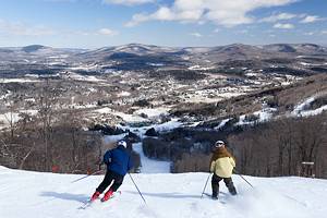
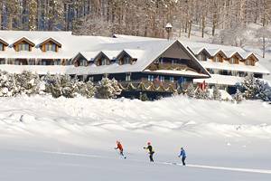
If you're visiting Vermont in winter, Mt. Mansfield is also home to Stowe Mountain Resort. One of the state's best ski resorts, it also offers snowshoe trails for walks in the winter wonderland.
Address: Route 108, Stowe, Vermont
Read More: Best Things to Do in Vermont
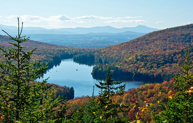
2. Mt. Pisgah
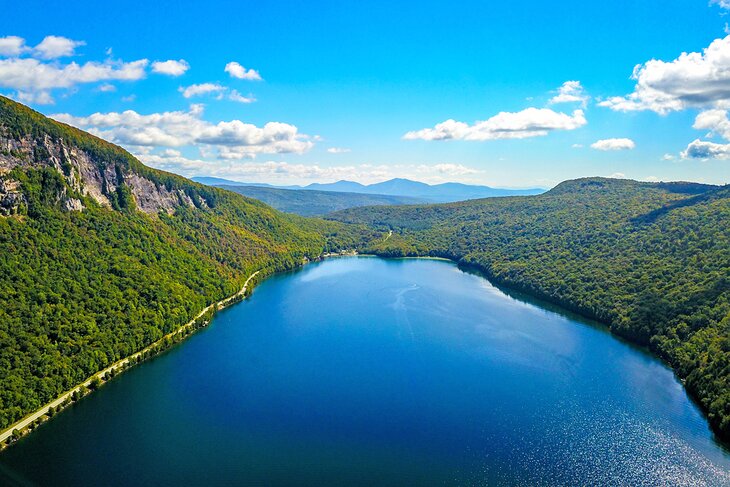
One of the most memorable views in Vermont is the reward for this moderately stiff climb with a vertical rise of about 1,500 feet. You can take either of two trails, one from the north end of long Lake Willoughby, the other from the lake's southern end.
Or if you don't mind walking almost three miles back along the road, you can make a seven-mile loop. The walk along Route 5A borders Lake Willoughby, and traffic is rarely heavy. Getting to the top of the cliffs is about the same from either direction, a mix of woodland and rocky trail, with some brook crossings on the North Trail. There are some steep sections either way.
The North Trail is about half a mile longer, but South Trail includes the view from Pulpit Rock, 550 feet directly above Lake Willoughby and one of the most dramatic in the state. Also impressive are the long-distance views at North Lookout and West Lookout just north of the summit (which is wooded and offers no view at all). These reach to Lake Memphremagog, the mountains of Quebec's Eastern Townships, Camel's Hump, and New Hampshire's White Mountains.
Address: Route 5A, Westmore, Vermont
Read More: Best Lakes in Vermont
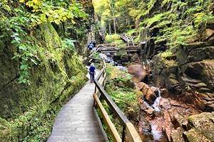
3. Hamilton Falls
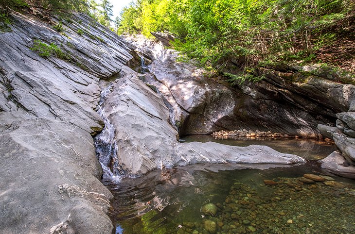
To reach one of Vermont's highest waterfalls, a particularly attractive one in an unspoiled natural setting, follow the West River Trail from the campground at Jamaica State Park. This is a converted railroad bed along the West River, in which you'll see a group of boulders known as The Dumplings.
About 1.5 miles past The Dumplings, where the West River Trail crosses Cobb Brook, a trail to the right leads to Hamilton Falls. This was originally an old wagon road, and after about a mile, you'll see a steep path descending on your left. This leads to the base of the 125-foot waterfall, the best viewpoint.
The old wagon road continues to a T, where a left will take you to the top of the falls. Under no circumstances should you attempt to swim at the top or climb along the edge of the falls. Not only is this a protected fragile environment, but it is exceedingly dangerous. Stay on the marked trails to safeguard both yourself and the environment, and save swimming for the pool at the bottom of the falls.
Address: 48 Salmon Hole Ln., Jamaica, Vermont
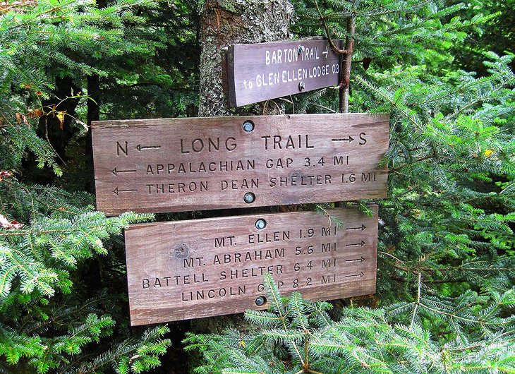
4. The Long Trail
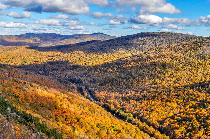
The oldest long distance hiking trail in the United States, the Long Trail was completed in 1930. It stretches about 265 miles from the Canadian border to the Massachusetts state line, connecting more than 40 of the state's highest peaks. The route follows the ridgelines, descending into valleys between peaks and crossing highways periodically.
Parking areas are at most of these crossings, but there's no formal hiker shuttle, so hikers need to make arrangements with friends, local taxi companies, or private shuttles. Trailside shelters and huts are available for camping along the way, but long-distance hikers need to be prepared to carry everything with them. It is essential to be fully prepared and to have a copy of the most recent Guidebook of the Long Trail before setting out.
Several sections are well-suited to overnight hikes. The section between Brandon and Middlebury Gaps is a popular two-day hike, and from Lincoln to Middlebury Gap is a three-day trip. One of the most scenic sections, from Lincoln Gap to the summit of Mt. Abraham from the top of Lincoln Gap, where the Long Trail crosses a road, is a popular day hike.
The view from Mt. Abraham's summit extends to New Hampshire's Mt. Washington and the Adirondacks in New York.
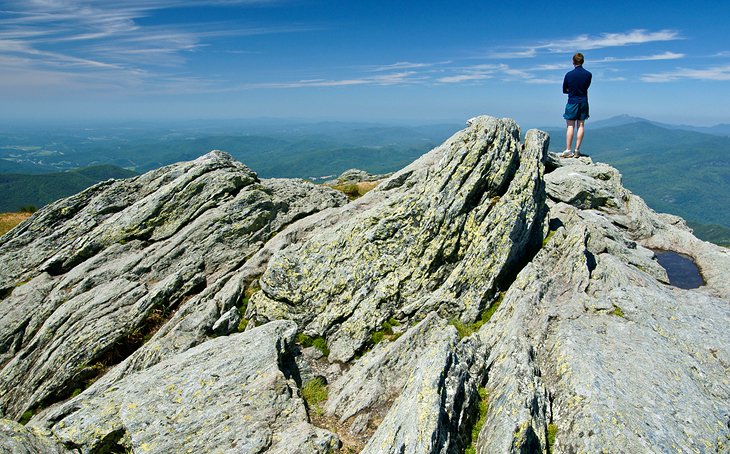
5. Camel's Hump
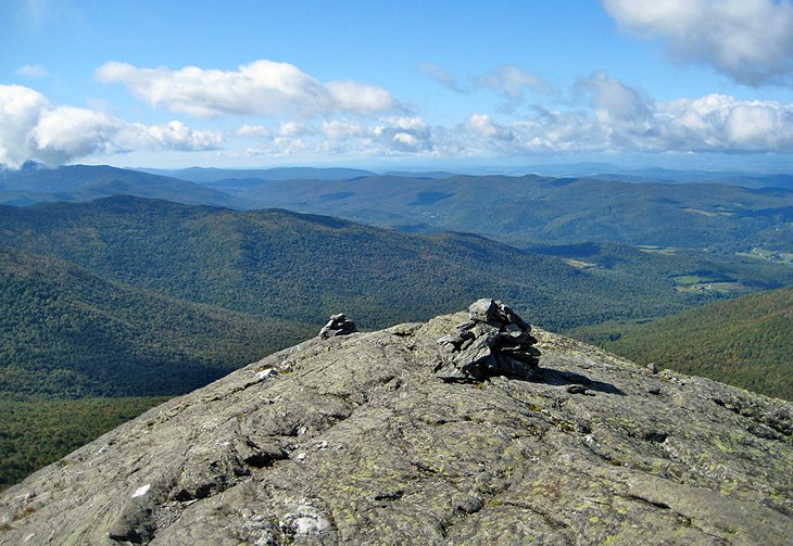
At just over 4,000 feet, Camel's Hump is Vermont's third highest peak, and several trails reach its bare, rocky summit. Two of the best begin from the Monroe area of Camel's Hump State Park, south of Route 2 in North Duxbury, which is west of Waterbury.
You can either hike the Monroe Trail to the summit and back or you can make a somewhat longer loop route, following the Long Trail as it drops steeply south from the summit to an intersection at Wind Gap, and returning to the Monroe Trail by the Dean Trail. Whichever route you take, it's a demanding climb, often steep, but on well-maintained trails.
Views from the summit are the reward on a clear day, when you can see west to the Adirondacks, east to New Hampshire's White Mountains, and north-south along the spine of the Green Mountains. The vegetation along the summit is a rare area of arctic-alpine tundra and very fragile, so be careful to walk only on the trail.
Address: Camel's Hump State Park, Camel's Hump Road, Waterbury, Vermont
6. Cantilever Rock
On the western slopes of Mt. Mansfield, from halfway up a cliff face, juts a sword-shaped slice of rock about 40 feet long. You can reach it via the Sunset Ridge Trail from Underhill State Park, west of Burlington. Trail maps are at the ranger station at the park entrance, but the route is well marked.
The Sunset Ridge Trail ascends steadily through the woods with only two spots that are difficult when the rocks are wet and slippery. Trailside benches are placed facing scenic overlooks. At 0.7 mile is a junction; follow trail signs for Cantilever Rock, to the left. At about 0.1 mile, after passing through a narrow, rocky area, you will come to the base of a 100-foot cliff. Above is Cantilever Rock, about halfway up the cliff, sticking out at a right angle from the rock face.
The area below and beyond is almost as interesting, a jumbled hillside of huge boulders that have fallen from the cliffs above. You can look up and match the pieces of talus around you to the clefts and faces of the cliff overhead, as if working on a giant three-dimensional jigsaw puzzle.
Address: Underhill State Park, Underhill Center, Vermont
7. Mt. Abraham
One of the most scenic sections of the Long Trail stretches from Lincoln Gap, where it crosses an unnumbered road between Lincoln and Warren, just off Route 100. From here it's about 2.5 miles to the summit of Mt. Abraham.
The Long Trail crosses at a high point, giving you a head start on the ascent to Mt. Abraham's 4,052-foot summit. Although the trail has only a 1,600-foot overall rise, be prepared to do more climbing than that suggests-the trail dips steeply several places before climbing again.
It's easy to find the trailhead, as the crossing is well marked. Head north on the Long Trail, staying to the left at the top of the embankment. The trail runs along a ridge covered in stunted firs and spruce trees, under moss-covered ledges and in one place between large glacial boulders.
The unobstructed view from Mt. Abraham's rocky summit includes the distinctive silhouette of Camel's Hump and extends to New Hampshire's Mt. Washington, Lake Champlain, and the Adirondacks in New York.
8. Owl's Head and Peacham Bog
Groton State Forest covers a large swath of land in Vermont's Northeast Kingdom region, and includes more than a dozen hiking trails. Geology and a fine view of the mountains and ponds are the main interests in the 10-minute climb up the CCC-built steps from the parking area to the top of Owl's Head.
You can also climb from the base via a trail from the road between New Discovery Campground and Osmore Pond. The granite ledges at the top were formed more than 300 million years ago. After the granite had solidified from its molten state, cracks appeared and were filled by molten rock that was forced into the space and cooled here, creating the dramatic stripes that crisscross the bald dome.
From the nature center (where you can pick up a trail map) allow about two hours to explore the 748-acre Peacham Bog Natural Area, one of Vermont's largest bogs and one of only two known "raised" bogs in the state. It is surrounded by a coniferous forest of tall trees, and at one point, the environment seems almost like a rain forest, with moisture-loving plants and mosses.
Along with pitcher plants and bog rosemary, you may find several orchid varieties, and you will get a good look at a beaver dam. The bog does not have a boardwalk, so waterproof boots are helpful, especially in wet seasons. Because the bog is fragile and often unstable, and because you are far from traveled areas, you should stay on the trail.
Address: Route 232, Plainfield, Vermont
9. Spruce Peak
The Appalachian Trail joins the Long Trail for about 100 miles through southern Vermont, and the section that climbs Spruce Peak, in the Green Mountain National Forest near Manchester, is a favorite day hike.
From the Appalachian/Long Trail crossing on Route 11/30 in Winhall, the trail heads south through the woods along a ridge, climbing and descending several times. It crosses an old forest road that was once the stagecoach turnpike between the towns of Manchester, Bondville, and Peru.
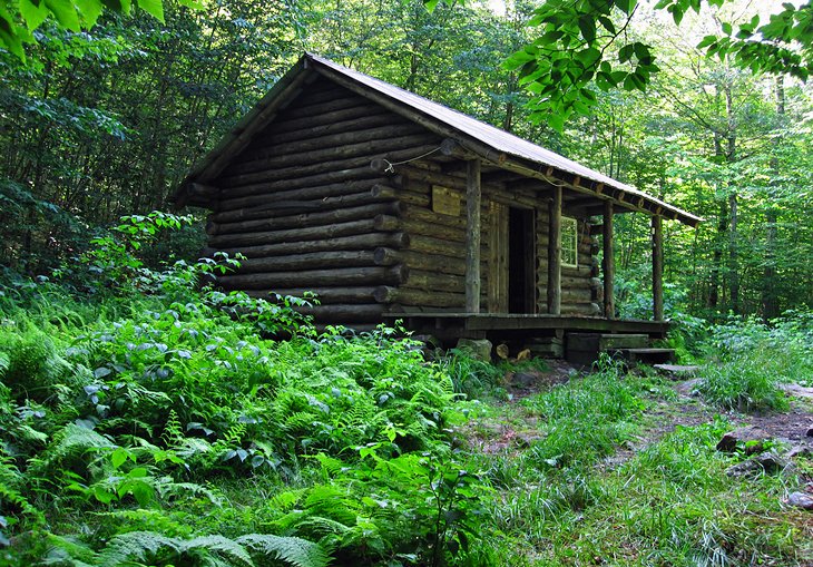
A short side trail to the right leads to the peak, with views of Mt. Equinox and the Taconic Mountains. About a half mile south of that is Spruce Peak Shelter, a rustic log cabin used by through hikers. The round trip to the shelter is about five miles, with about 600 feet elevation change, an easy three-hour hike.
Address: Route 11/30, Winhall, Vermont
10. Mount Equinox
Despite having to share the summit with tourists who have driven up the other side of the mountain on the Mt. Equinox Skyline Drive, hikers all agree that this is a very satisfying climb. It's also a strenuous one, with long steep sections that are almost as taxing on the way down as they are on the ascent.
The reward for all the effort is one of the finest views in southern Vermont. Mt. Equinox, the tallest in the Taconic Range, stands apart from its neighboring peaks, and commands views of the entire Valley of Vermont. The 360-degree panorama encompasses the Taconics and Berkshire Mountains of Massachusetts to the south and the Green Mountains to the east. Beyond these, the higher White Mountains in New Hampshire form a backdrop to the northeast, and the Adirondacks in New York form the western skyline.
The 6.3-mile out-and-back trail climbs steadily upward, through wildflower carpeted woods, to the 3,855-foot summit. The vertical rise from the trailhead is 2,800 feet. About halfway, a spur trail leads to a mountain spring, and from the summit, a 0.2-mile trail leads to Lookout Rock at 3,662 feet elevation, from which you can look down into Manchester Village.
The trail, known both as the Burr & Burton and Red Gate Trail, begins behind the Burr & Burton Academy in Manchester Village and is managed by the Equinox Preservation Trust.
Address: West Union Street, Manchester Village, Vermont
11. Mt. Olga
Because the trail begins in Molly Stark State Park, which is located at one of the highest road access points in the southern Green Mountains, Mt. Olga provides big views for a relatively short and moderate hike. The entire loop from the park to the summit and back is about two miles. You can begin by following the Stonewall Trail up and return by the Mt. Olga Trail, or vice versa. The Vertical rise is only about 520 feet, and the trails have much the same grade.
At the summit is a fire tower with views of nearby Hogback Mountain and, to the north, the Green Mountains. To the south, views extend across the Mohawk Valley to the Berkshires in Massachusetts, and to the east, you can see Mt. Monadnock in New Hampshire.
An alternative longer trail begins a bit east on Route 9, at the crest of Hogback, where parking is free (there is a fee for parking in the state park). Either route gives you access to about five miles of trails in the state park and adjacent Hogback Mountain Conservation Area.
Address: 705 Route 9, Wilmington, Vermont
12. Brattleboro Retreat Trail Network
In the southeast corner of Vermont, close to the Massachusetts and New Hampshire borders, Brattleboro Retreat is a private mental health and addictions hospital overlooking the Connecticut River. The Retreat Trail network, like the Retreat Farm from which the network can be accessed, began in the 1800s and has since grown to include nine miles of walking paths crisscrossing a hillside above the river.
Trail maps are available at several access points, but the most central are at the Retreat Farm or opposite the Retreat itself, both of which have ample parking. The great variety of terrain and loop lengths makes the trails especially appealing, as you can create long or short itineraries without backtracking.
Several interesting features found along the paths are marked on the trail map: The medieval-style battlemented stone Retreat Tower was built by staff and patients in the late 1800s as a viewpoint for enjoying the river scenery, the Ice Pond once provided as many as 32,000 ice blocks a year for the Retreat's ice house, the 1926 Harris Hill Ski Jump is still the venue for national ski jumping competitions.
A Woodlands Interpretive Trail makes a one-mile loop at the far south end of the trail system. The trails are open year-round, and are popular for cross-country skiing and snowshoeing.
Address: Linden Street (Route 30), Brattleboro, Vermont
Read More: Things to Do in Brattleboro, VT
13. Mt. Tom Loop
More than 20 miles of trails form a network across Mt. Tom, a 1357-foot elevation that rises sharply from the village center of Woodstock. Some of these are casual hikes on former carriage roads, but others can be more challenging, especially the two-mile Precipice Trail.
The loop trail follows carriage roads up a gentle incline to Mt. Tom' South Peak, where views sweep across Woodstock and the beautiful Ottauquechee River Valley to the wooded hills beyond. You can make a loop, combining South Peak with The Pogue, a peaceful mountain pond surrounded by forest.
Many of the trails are groomed in the winter, and this is one of the best places in Vermont for cross-country skiing. You can reach the trails in a short walk from the village or park at the Marsh-Billings-Rockefeller National Park.
Address: 69 Old River Road, Woodstock, Vermont
14. Inn-to-Inn Walking Tours
Several travel companies offer walking tours that lead between Vermont country inns, with luggage transport each day. These can either include small groups of walkers or be arranged independently for solos, couples, or groups of friends. Some are custom trips designed exclusively for each client.
The Vermont Inn to Inn Walking Tour is a four-night adventure that includes inn stays in the towns of Proctorsville, Ludlow, Chester, and Weston. This circular route incorporates four days of hiking, up to 13 miles each, with the final day returning to your starting point. Breakfast and supper at each inn is included, and you can ask to be dropped off closer to the next point if you're not up to a full day on your feet at any point during the trip.
Although they don't provide luggage transportation (you will need to do some driving each day), Inn to Inn offers four- and five-night "all-inclusive" plans that encompass lodging, day use fees for parks, taxes, gratuities, and even meals (with a brown bag lunch to eat trailside). While the tour is self-guided, maps and trail-specific advice are part of the package, and you will get to experience a different set of day hikes than the point-to-point tours.
Map of Hiking Trails in Vermont
More Related Articles on PlanetWare.com
Hiking Trails in New England: Just to the east of Vermont's Green Mountains, the taller and rockier White Mountains provide plenty of hiking trails in New Hampshire. In neighboring Maine, you'll find hiking trails and other things to do outdoors in Acadia National Park. This is also a popular area for camping.
Hiking in Other National Parks: If you are looking for bigger hiking adventures and interested in heading out west, have a read through our articles on the best Hiking Trails in Yellowstone National Park and Yosemite National Park.