19 Top-Rated Tourist Attractions in Sydney
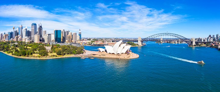
Sydney the oldest, biggest, and most beautiful of all Australian cities, lies amid a seductive intermingling of land and sea. Glide along the glittering harbor on a ferry, see the white sails of the Opera House gleaming in the sunshine, admire the graceful arch of the Harbour Bridge, and you'll see why this is one of the world's top cities.
It's hard to imagine this vibrant state capital of New South Wales was once a convict colony. In 1788, it was at Sydney Cove where Captain Arthur Phillip, commander of the First Fleet, established the first British colony in Australia. Today, you can explore Sydney's fabled history in the narrow, cobbled laneways and historic buildings of the Rocks, and learn about the Gadigal Aboriginal people, the traditional custodians of this land, on guided tours and at the city's excellent museums.
Sydney still fizzes with the adventurous spirit of its settlers. Climb the harbor bridge, surf the green-barrel breaks at Sydney's golden beaches, or fly over the city on a scenic tour. And the adventures don't end in the city. Wildlife-rich wilderness areas surround the city providing appealing day trip possibilities.
Discover all the best places to visit in this famous harbor city with our list of the top things to do in Sydney, Australia.
See also: Where to Stay in Sydney
- 1. See the Sydney Opera House
- 2. The Sydney Harbour Bridge
- 3. Stroll around The Rocks
- 4. Hop aboard a Harbor Cruise at Circular Quay
- 5. Spend a Day at Darling Harbour
- 6. Smell the Roses at The Royal Botanic Garden Sydney
- 7. Shop 'til You Drop at the Queen Victoria Building
- 8. Zoom up the Sydney Tower Eye
- 9. Bask on Sydney's Beaches
- 10. Bike or Walk around Barangaroo Reserve
- 11. Go Wild at Taronga Zoo
- 12. Wander along George Street
- 13. Enjoy a Picnic in Hyde Park
- 14. Admire the Masterpieces at the Art Gallery of New South Wales
- 15. Visit St. Mary's Cathedral
- 16. Explore Macquarie Street & the State Library of New South Wales
- 17. Enjoy Yum Cha in Chinatown
- 18. Find Vintage Treasures and Colorful Street Art in Newtown
- 19. Check Out Kings Cross
- Where to Stay in Sydney for Sightseeing
- Tips and Tours: How to Make the Most of Your Visit to Sydney
- Sydney, Australia - Climate Chart
- More Exciting Adventures near Sydney
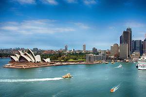
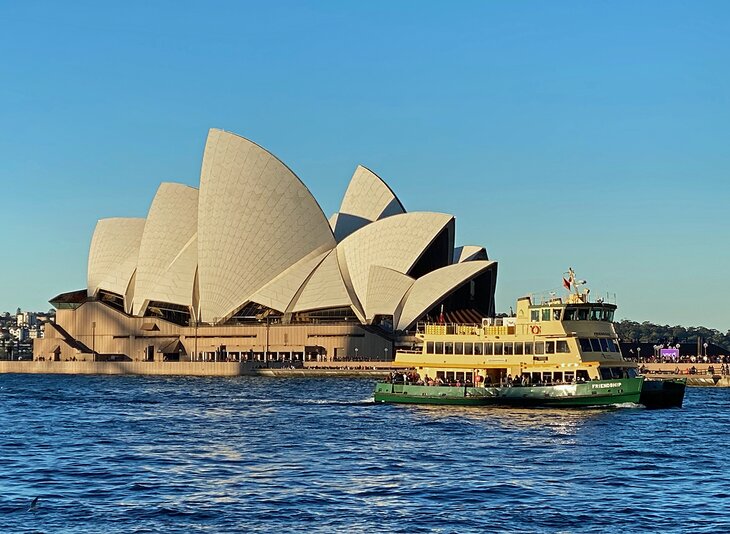
1. See the Sydney Opera House
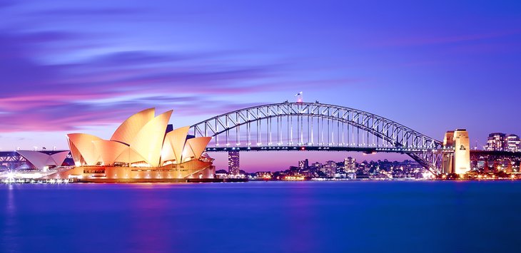
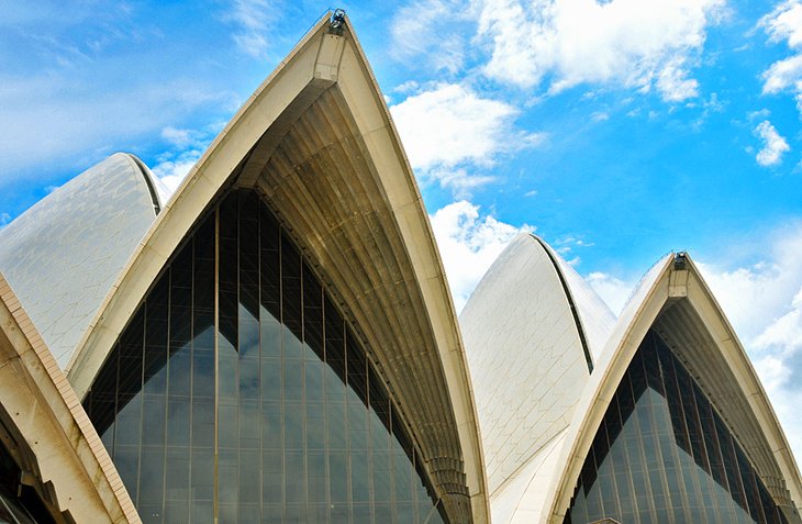
One of the world's great icons, the Sydney Opera House is a UNESCO World Heritage Site and the star attraction on the glittering harbor. This graceful building, shaped like shells or billowing sails, perches on a finger of land surrounded by water.
You have several options for visiting the Sydney Opera House. Snap a photo while gliding by on a harbor cruise, relax at one of the restaurants, stroll around its exterior, or take an organized tour of this magnificent structure. Inside, you'll find theaters, studios, exhibition rooms, a concert hall, and a cinema.
Book a Sydney Opera House Guided Walking Tour to learn about the history and get a behind-the-scenes look at this famous building. This is a flexible ticket that allows you to join any one of the tours throughout the day, departing every half hour from 9am to 5pm.
Avid photographers should head to Mrs Macquarie's Chair for one of the best photo opportunities.
The Sydney Opera House just emerged from an almost $300-million "Decade of Renewal." Among the many improvements is a renovated Concert Hall — try and catch a show here when you visit.
Author's Tip: If you happen to be in Sydney in late May or early June during the Sydney Vivid festival, stop by at night to see the white sails lit up with colorful digital art.
Location: Bennelong Point, Sydney, New South Wales
2. The Sydney Harbour Bridge
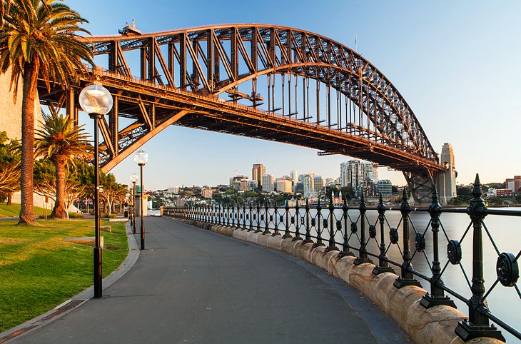
Nicknamed the "Coathanger," the Sydney Harbour Bridge is another Sydney icon. Supported by massive double piers at each end, it was built in 1932 and remains the world's largest steel arch bridge.
You can drive over it, cruise below it, chug over it on a train, or photograph it from afar. But one of the best ways to appreciate this marvel of engineering, and soak up the spectacular views of Sydney Harbour, is on a climb to its 135-meter-high summit.
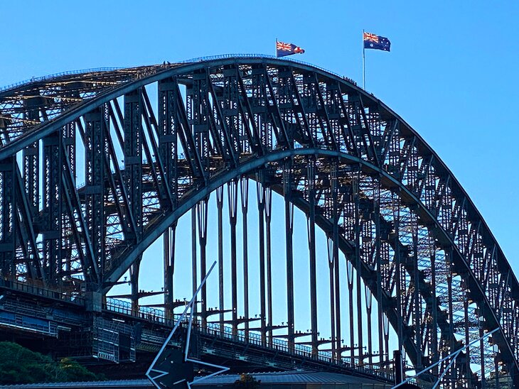
Scaling the bridge is one of Australia's top outdoor adventures, and you can choose from a range of different tours. Sydney BridgeClimb takes groups on an approximately 3.5-hour climb to the top of the outer arch. Tours run throughout the day, beginning with a dawn climb and ending with a night climb. You can also choose from different types of climbs, including an Indigenous storytelling experience and a climb right across the arch to the other side — the bridge connects the harbor's north and south shores.
Guided ascents of the bridge with BridgeClimbSydney include a pre-climb prep talk, safety gear, and a photo on the summit. Along the way, you'll learn all kinds of entertaining stories about the history of the bridge. One of its most famous workers was Paul Hogan, aka Crocodile Dundee, before he became famous.
To learn more about the fascinating history of the bridge's construction, visit the museum in the southeastern pier.
Address: 5 Cumberland Street, Sydney, New South Wales
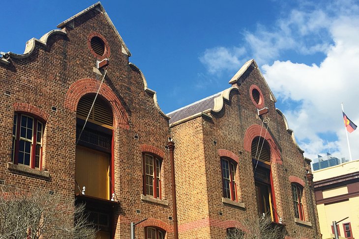
3. Stroll around The Rocks
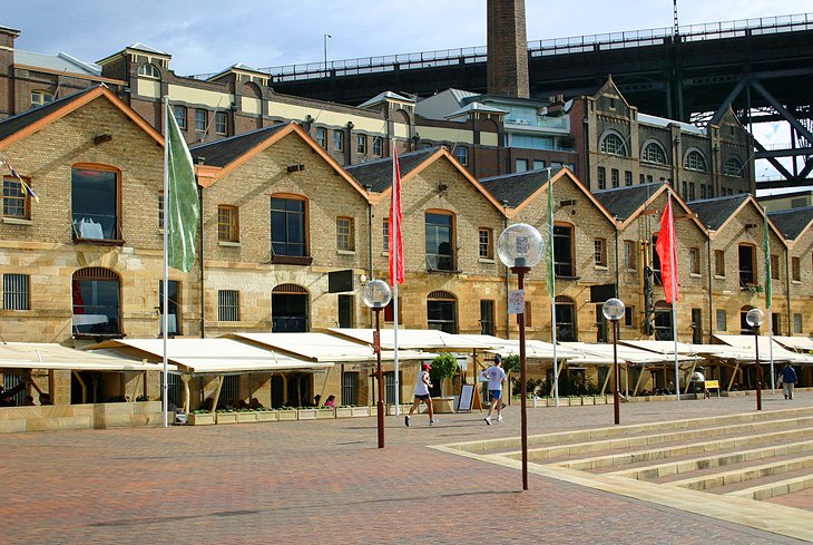
Want to soak up a bit of Sydney history? Take a stroll around The Rocks. Located on a tongue of land protruding into Sydney Harbour, the Rocks historic area was once home to the Gadigal Aboriginal people. Later, it became the country's first site of European settlement.
The Rocks was named for the rocky coast on the west side of Sydney Cove where the convicts pitched their tents. Today, more than 100 heritage sites and buildings jostle along the narrow streets, including Sydney's oldest surviving house, Cadmans Cottage, built in 1816.
The first stop should be a visit to The Rocks Discovery Museum. Here, you can learn about the area's fascinating transformation from traditional Aboriginal lands to convict slum to tourist hot spot. You can also join a 30-minute free guided tour at 1pm and 1:30pm daily.
Afterward, wander around the narrow, cobbled streets. Pick up some souvenirs at the gift shops, buy handcrafted goodies at the market stalls (Friday nights, Saturdays, and Sundays), and admire Aboriginal and contemporary art in the galleries. You'll also find plenty of atmospheric little restaurants and cafés here.
Guided tours run the gamut, from Aboriginal heritage walks to photographic excursions, and if you're looking for unusual things to do in Sydney, you can book a nighttime ghost tour.
Address: 66 Harrington Street, Level 6, The Rocks, Sydney, New South Wales
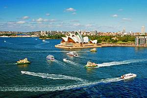
4. Hop aboard a Harbor Cruise at Circular Quay
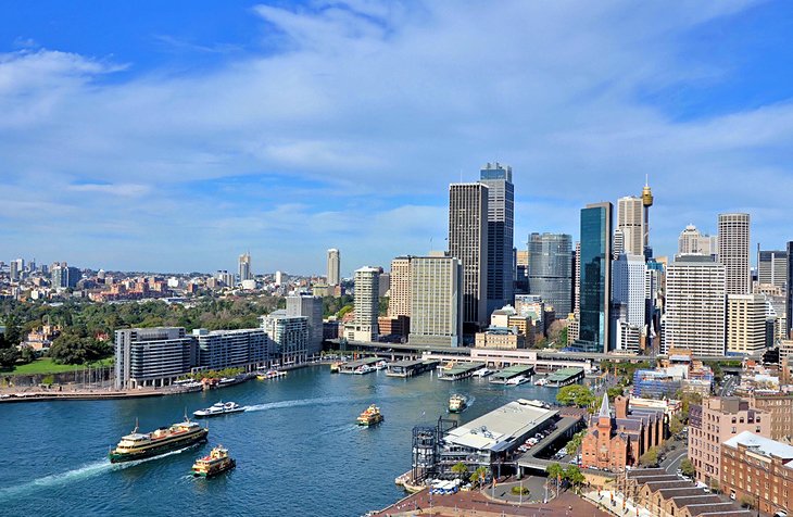
Sydney is famous for its sparkling waterfront setting, and one of the most popular things to do in Sydney Harbour is a sightseeing cruise. Most harbor cruises depart from Circular Quay in Sydney Cove, which is also home to the city's main ferry terminal.
Short on time? Book the two-hour Sydney Harbour Coffee Cruise, which takes you past all the harbor highlights and to some of the most scenic places in Sydney, including the Opera House, the Sydney Harbour Bridge, and Fort Denison. Learn fascinating facts about the key sights along the way, and keep your camera ready — you'll have plenty of photo ops.
Prefer to spot some wildlife during your tour? During the annual winter whale migration, the Sydney Whale-Watching Cruise takes passengers out past Sydney Heads to view these magnificent creatures.
If you don't have time for a harbor cruise, you can still see some of the top sites on a ferry ride around the harbor. Ferries depart from Circular Quay to prime spots, such as Manly, Watsons Bay, and Taronga Park Zoo.
Author's Tip: From Circular Quay, you can easily walk to other top Sydney tourist attractions. Head south along the waterfront promenade to the Sydney Opera House and the Royal Botanic Gardens, and a short walk to the north leads to the Sydney Harbour Bridge and the Rocks historic area. To the west, the free Museum of Contemporary Art, housed in an Art Deco building, displays cutting-edge, and often controversial, exhibitions.
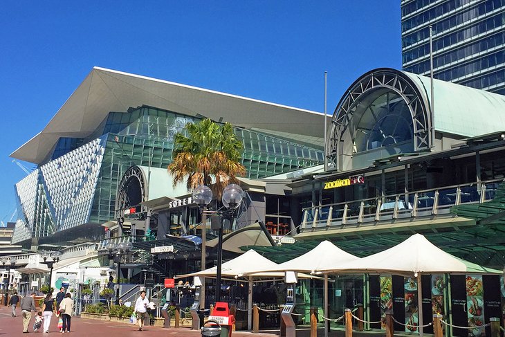
5. Spend a Day at Darling Harbour
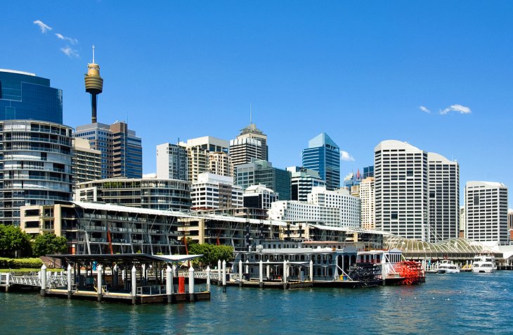
Darling Harbour has something for everyone. Packed with tourist attractions, this waterfront precinct on the western side of Sydney's CBD is a hub for tourists and locals alike. You'll find everything here, from shops, restaurants, and entertainment venues to museums, a zoo, an aquarium, and an IMAX theater.
Families will love Madame Tussaud's; the WILD LIFE Sydney Zoo; and the SEA LIFE Sydney Aquarium, which contains the world's largest collection of Australian marine creatures. The SEA LIFE Sydney Aquarium Entrance Ticket is a great way to get ahead of the crowds.
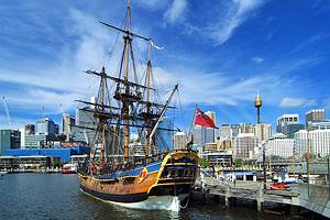
Nautical-minded history buffs can board a replica of Captain Cook's ship, the HMB Endeavour, at the Australian National Maritime Museum. And while you're wandering around, keep an eye out for colorful artwork along the Darling Harbour Street Art Trail.
Younger children will love the carousel, playgrounds, and water park. An IMAX and 9D theater, harbor jet boat rides, simulated flights, and racing car adventures round out the exciting attractions.
Seeking a tranquil patch of green? Slip into the Chinese Garden of Friendship, and sip tea among the willows and koi ponds.
As well as offering a one-stop shop of Sydney attractions for families, Darling Harbour also hosts an exciting line-up of events, from art exhibitions and film festivals to music concerts at the Aware Super Theatre.
6. Smell the Roses at The Royal Botanic Garden Sydney
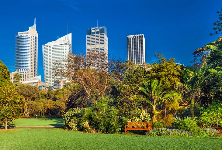
Need a break from the hustle and bustle of the city? Chill out at The Royal Botanic Garden Sydney in Farm Cove. A visit to this tranquil oasis is one of the many relaxing things to do in the city for free — especially if you're in need of a nature fix — and it's only a short stroll from the Sydney Opera House.
Established in 1816, the gardens are Australia's oldest botanic garden. They encompass 30 hectares of themed gardens with towering trees, palm groves, orchids, ferns, succulents, tropical gardens, rainforest plants, herbs, and Oriental gardens.
Garden lovers will be in heaven. The Palace Rose Garden blushes with around 1,800 roses. The Glasshouse Latitude 23 and Fernery brims with tropical foliage, begonias, and orchids; and the Cadi Jam Ora - First Encounters Garden tells the story of the Gadigal people, the land's traditional custodians, and explores the relationship between people and plants.
Aboriginal cultural tours and guided walks are offered, as well as events such as bush tucker morning teas and picnics.
Wondering what's nearby? Surrounding the gardens is the Domain, a popular event venue, with open green space and sports areas. And while you're visiting the gardens, you can enjoy views of Government House, the official residence of the governor of New South Wales.
Address: Mrs Macquarie's Road, Sydney, New South Wales
7. Shop 'til You Drop at the Queen Victoria Building
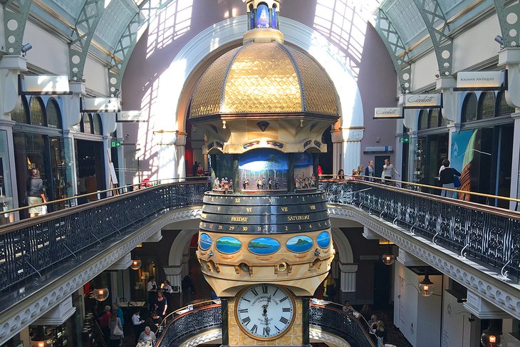
If shopping is high on your agenda, head to the Romanesque-style Queen Victoria Building ("QVB"). Even if you're not planning to buy anything, it's worth a visit just to admire this beautifully restored building and its colorful stained-glass windows and mosaic floors.
A high central dome surrounded by 20 smaller domes crowns this elegant building, which was originally built as a market hall between 1893 and 1898. After decades of neglect and even plans for demolition, this grand sandstone building was restored to its original state in the early 1980s.
Today, more than 200 high-end shops line its light-filled galleries. Australian stores include R.M. Williams, Lorna Jane, and Haigh's chocolates, as well as many Aussie designer boutiques, and you'll also find homeware stores, gift stores, and galleries.
Feeling peckish? The Tea Room QVB hosts a popular High Tea under crystal chandeliers.
You can access the QVB from Town Hall Station through underground arcades.
If you want to learn more about the history of this magnificent heritage building, sign up for a 45-minute QVB History Tour.
Address: 455 George Street, Sydney, New South Wales
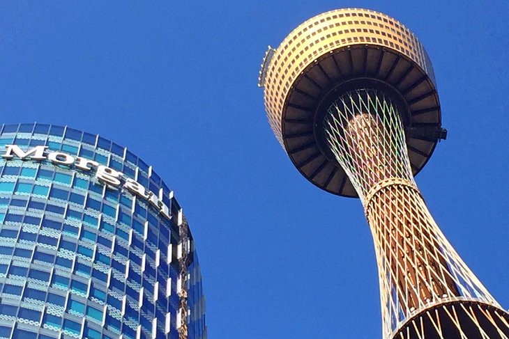
8. Zoom up the Sydney Tower Eye
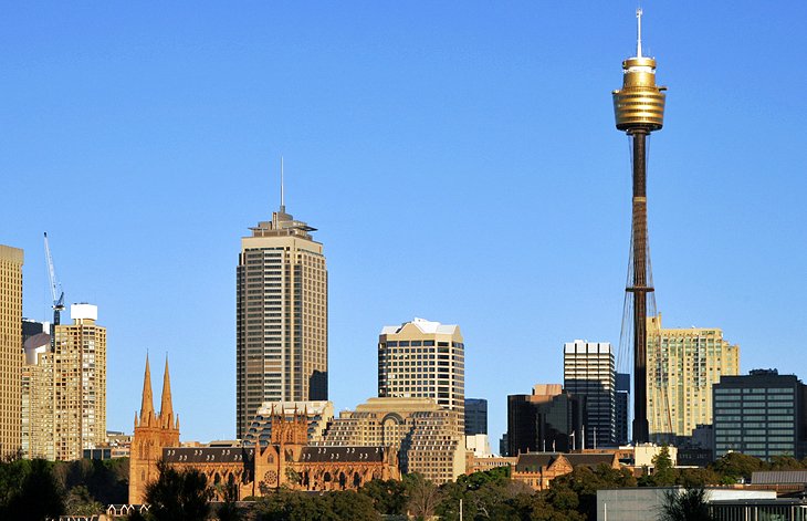
Soaring above the city skyline, the 309-meter-high Sydney Tower Eye is the city's tallest building and one of its great landmarks (other than the Opera House and Harbour Bridge, of course). This golden spire-topped turret rises from the busy Centrepoint shopping mall.
Zooming up the Sydney Tower Eye is one of the popular things to do in the Sydney CBD for tourists. Express lifts whisk visitors to the observation deck at the top, or to SKYWALK, an alfresco glass-floor viewing platform, the perfect spot for sightseeing. While you're up here, you can enjoy panoramic views of Sydney and its surrounding suburbs, or enjoy a bite to eat at one of the revolving restaurants or the café.
Also on offer is a 4D cinema experience, which provides an overview of the city's major icons.
Address: 100 Market Street, Sydney, New South Wales
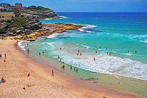
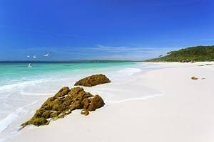
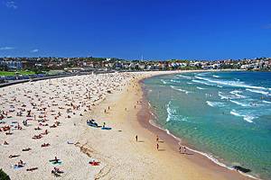
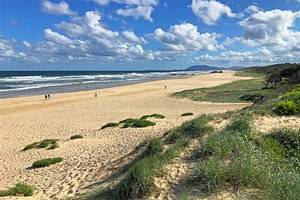
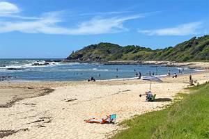
9. Bask on Sydney's Beaches
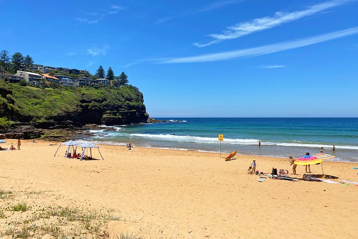
Sydney is famous for its beautiful beaches. Tucked around the harbor are many sheltered coves with calm water and sugary sands.
You don't need to venture far from the CBD to find an inviting stretch of sand and sea. Iconic Bondi Beach is less than a 15-minute drive from the city, with great surf, a buzzing café scene, and a cosmopolitan vibe. For fantastic ocean views, take the coastal walk along the cliffs from Bondi to Coogee Beach.

If you're traveling by public transport, Cronulla is the only beach accessible by train from the city, and Manly Beach is only a 30-minute ferry ride from Circular Quay. Here, you can swim in the surf or the netted ocean pool, take a surf lesson, or stroll along the beachfront promenade and stop in at the excellent shops and restaurants.
Farther north of the city, surfers will find some fantastic breaks at Collaroy, Dee Why, and Narrabeen. Swimming is enjoyable at most Sydney beaches — especially during the summer months — but you should always stay between the red and yellow flags.
10. Bike or Walk around Barangaroo Reserve
Barangaroo Reserve is an excellent example of a successful urban renewal project. Named after the influential female Indigenous leader at the time of European colonization, the area was transformed from an unsightly container terminal and opened to the public in 2015 with a commitment to sustainability and enhancing community wellbeing.
With more than 75,000 native trees and shrubs, as well as walking and cycling tracks, this 22-hectare waterfront precinct is a lovely spot for a stroll or bike along the harbor. You'll also find shops, restaurants, and event and exhibition space here.
One of the most popular things to do at Barangaroo is the Wulugul Walk. This scenic waterfront promenade skirts the six-hectare re-created Sydney Harbour headland at the reserve's northern end and extends for two kilometers between Walsh Bay and Darling Harbour.
Along the way, you can admire an evocative series of public art installations. Keep an eye out for shell wall, a 22-meter-tall vertical panel on the side of a building at the reserve's southern gateway, created by two of Australia's leading Indigenous artists. You can learn about the area's rich Indigenous heritage on an Aboriginal cultural tour.
In 2023, a new recreation space opened in Barangaroo as part of the planned Harbour Park open space on Sydney's foreshore. Bring the kids here to bounce around in the play area and challenge each other to a game of handball. Parents can work out in the outdoor gym or relax in the shady sitting areas.
Barangaroo is only a four-minute walk from Wynyard station, and you can also catch a ferry direct to the new Barangaroo Wharf.
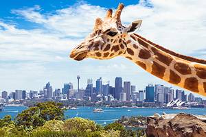
11. Go Wild at Taronga Zoo
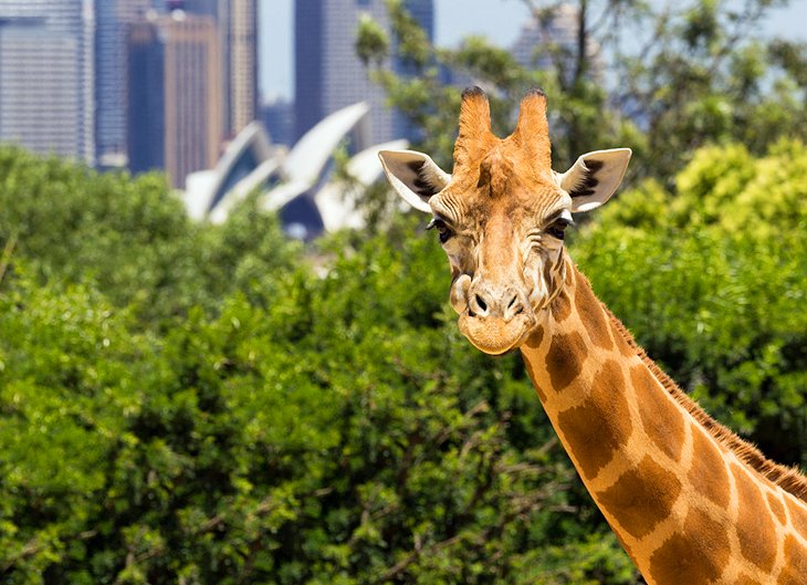
At Taronga Zoo, you can see all your favorite animals, as well as spectacular city views. Nestled on a point along the north side of the harbor, the zoo inhabits prime Sydney real estate in the posh suburb of Mosman, and it's one of the top things to do with kids in Sydney.
Here, you can enjoy close-up encounters with iconic Aussie wildlife and other animals from around the world. Highlights include the African Savannah exhibit, Tiger Trek, chimpanzees, and gorillas.
Daily keeper presentations and animal shows add to all the fun. Feed the giraffes, meet the Asian elephants, get up close to a cuddly koala, or make friends with a meerkat. Another bonus: Entertaining shows are included with your entry ticket, including a Seals for the Wild presentation and a Free Flight Birds show.
The zoo's lively events calendar includes "Roar and Snore" overnight zoo stays and a summer concert series. You can purchase a Sydney Taronga Zoo Entry Ticket in advance, which includes a ride on the Sky Safari gondola.
Want to stay longer? Book a room at the Wildlife Retreat at Taronga. This unique eco-retreat on the zoo grounds gives you after-hours viewings of some of the animals, as well as all kinds of other perks.
From the city, buses to the zoo depart from Wynyard. Better still, hop aboard a ferry at Circular Quay.
Address: Bradleys Head Road, Mosman, New South Wales
12. Wander along George Street
Bustling George Street, in the heart of the city, is Australia's oldest street. Once a nameless track trodden by convicts fetching supplies of water, it's now one of the city's major traffic arteries. It's worth exploring to feel the pulse of this vibrant city and browse the shops.
You'll see a mix of architectural styles here. Gleaming high-rise office blocks brush shoulders with historic buildings. A highlight is the elegant Romanesque-style Queen Victoria Building replete with graceful domes, stained-glass windows, and high-end stores.
Nearby, the Sydney Town Hall (1869) is a major city landmark sporting a medley of architectural styles (it's been compared to a richly decorated wedding cake). Another architectural standout is the neo-Gothic St. Andrew's Cathedral, completed and consecrated in 1868.
Need a shopping fix? You'll find plenty of high-end shops in the Queen Victoria Building, and designer boutiques and jewelry stores line the Victorian-style Strand Arcade. If you're looking for more accessible name brands, Pitt Street Mall, one block east of George Street, is one of the city's major shopping precincts.
13. Enjoy a Picnic in Hyde Park
Named after Hyde Park in London, Sydney's Hyde Park is Australia's oldest park. It's a peaceful sanctuary in the heart of the city and a lovely spot for a picnic. Sprawling lawns, shady picnic spots, flowers, fountains, and fig trees provide a welcome escape, and the park offers prime people-watching - especially at lunch when city workers come here to kick off their shoes.
Several monuments and memorials punctuate this popular 16-hectare green space. The park's bronze Archibald Fountain (1932) commemorates Australia's alliance with France during WWI, and the Art Deco Anzac War Memorial (1934), in the southern half of the park, honors its victims.
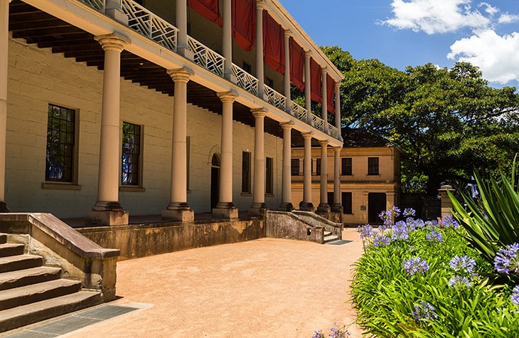
At the north end of Hyde Park, in Queens Square, are three fine Georgian buildings, masterpieces of the convict architect Sir Francis Greenway: Hyde Park Barracks, St. James' Church, and the Supreme Court. Built by convict labor in 1817-19, the UNESCO World Heritage-listed Hyde Park Barracks was restored to its original condition in 1975-84 and now houses a museum on the history of Sydney, portraying the lives of the first involuntary "settlers."
On the east side of Hyde Park is the Australian Museum, with the largest natural history collection in the country.
Address: Elizabeth Street, Sydney, New South Wales
Official site: http://www.cityofsydney.nsw.gov.au/explore/facilities/parks/major-parks/hyde-park
14. Admire the Masterpieces at the Art Gallery of New South Wales
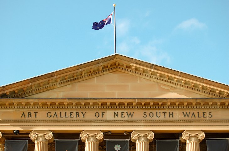
Surrounded by beautiful parklands, the Art Gallery of New South Wales is one of the country's most distinguished art museums. The building dates from 1885 and houses spacious, light-filled galleries and Grand Courts, with collections ranging from works by European masters and Asian artists to evocative contemporary art from around the world. The gallery also houses one of the largest collections of Aboriginal art in Australia.
Currently, the Art Gallery of New South Wales is undergoing a transformation and expansion -The Sydney Modern Project - which includes the addition of a brand new sustainable building, a public art garden, and a grand forecourt, as well as restoration of the historic building. Once completed in late 2022, the museum will occupy double the exhibition space, flowing between indoor and outdoor spaces, and will continue to be a major destination for Aboriginal and Torres Strait Islander art.
After admiring all the masterpieces, you can relax at the café or restaurant, or browse the gallery gift shop.
Address: Art Gallery Road, The Domain, Sydney, New South Wales
Official site: http://www.artgallery.nsw.gov.au/
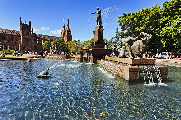
15. Visit St. Mary's Cathedral
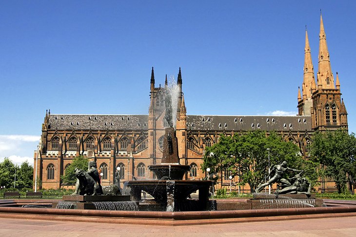
Facing Hyde Park, St. Mary's Cathedral (1868-82) is a symbol of the spiritual beginnings of the Catholic Church in Australia. This striking landmark, in neo-Gothic style, is the seat of the Archbishop of Sydney.
Topped by twin spires, the building was modeled on Lincoln Cathedral, and its imposing façade reflects the design of Notre-Dame in Paris. Inside the cathedral, intricate stained-glass windows cast beautiful patterns of light. Christmas is an especially evocative time to visit, when the cathedral is adorned with lights and decorations.
Location: St. Mary's Road and College Street, Sydney, New South Wales
Official site: http://www.stmaryscathedral.org.au/
16. Explore Macquarie Street & the State Library of New South Wales
Stretching from Hyde Park in the south to the Sydney Opera House in the north, Macquarie Street was once Sydney's most fashionable street. Governor Macquarie commissioned the construction of many of the colony's grand public buildings along this strand, some designed by convict architect Francis Greenway. Impressive sandstone residences soon followed, with verandas to capture the beautiful views of the surrounding parklands and Sydney Harbour.
In 1816, the completion of Sydney Hospital on Macquarie Street encouraged doctors to set up offices nearby. However, the hospital's capacity exceeded demand, and legislative offices moved into some of its buildings. Today, Parliament House occupies the hospital's northern wing and is open to the public when the New South Wales Parliament is in session.
A top attraction on Macquarie Street is the State Library of New South Wales, the oldest library in Australia. Among its jewels are the journals of Captain Cook and Joseph Banks, as well as Captain Bligh's log from the Bounty. The permanent and temporary exhibitions here are always worth visiting, and you can relax with a snack in the café or pick up a quirky Australian souvenir at the gift shop.
You'll also find The Mint on Macquarie Street in the southern wing of the former hospital. It's now home to a library, central courtyard, and café.
Official site: http://www.sl.nsw.gov.au/
17. Enjoy Yum Cha in Chinatown
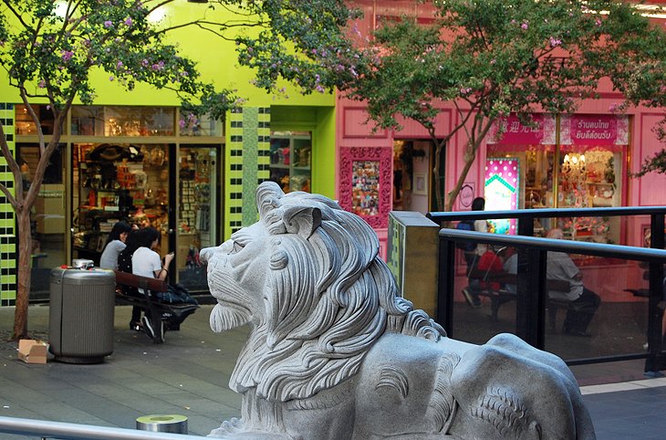
Inhale the fragrance of sizzling Szechuan spices, shop for Chinese specialty items, or feast on authentic Asian cuisine at Sydney's Chinatown. Framed by lion gates at each end, this small district lies in the pedestrian zone of Dixon Street, between Darling Harbour and Central Station.
Yum cha is a popular pastime here, and the Friday night market is a feast for the senses, with everything from dim sum and Vietnamese pho to teppanyaki. On the first full moon after January 21, the streets of Chinatown come alive during the celebration of the Chinese New Year.
Near Chinatown, Paddy's Markets at Haymarket is a Sydney institution from Wednesdays through Sundays, with hundreds of stalls selling fresh produce, bargain fashions, and souvenirs.
Address: Dixon Street, Haymarket, New South Wales
18. Find Vintage Treasures and Colorful Street Art in Newtown
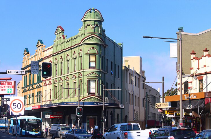
Fashionistas, take note: fun and funky Newtown is a hot spot for vintage treasures and thrift store shopping. You'll find this hipster-packed inner-city suburb about a 10-minute drive from the city center.
One-of-a-kind pieces cram the racks in the best boutiques here. Favorites include The Wilde Merchant selling everything from retro tees to workwear and Japanese pieces, while Storeroom Vintage displays rare music tees and other hand-picked gems from the 70s to the 2000s. Stitch Up Sydney specializes in collectible band tees and designer sneakers. Real King Vintage also sells vintage T-shirts, as well as sportswear and preloved goodies from top brands like Tommy Hilfiger Nike, Carharrt, and Polo Ralph Lauren. Is Western wear and Americana more your jam? Head to Route 66.
After hitting all the hottest vintage shops, fuel up with a snack at one of the area's eclectic restaurants and cafés — you'll find everything here from Turkish cuisine and Thai food to Italian trattorias. Then polish it off with an award-winning gelato from Cow & the Moon — their Mandorla Affogato flavor once won the "best in the world" award.
Newtown is also famous for its vibrant street art. Start with the "I have a dream" mural on King Street, and keep your eyes peeled. You'll find other murals popping from the walls on Lennox Street, Mary Street, and Bedford Street to name a few.
Author's Tip: About a five-minute drive from Newtown, the Markets at Glebe is one of the best places to find deals on designer vintage treasures — from pre-loved designer clothing, shoes, and accessories to hand-crafted jewelry and cutting-edge creations from new local designers. The markets are open every Saturday from 10am to 4pm.
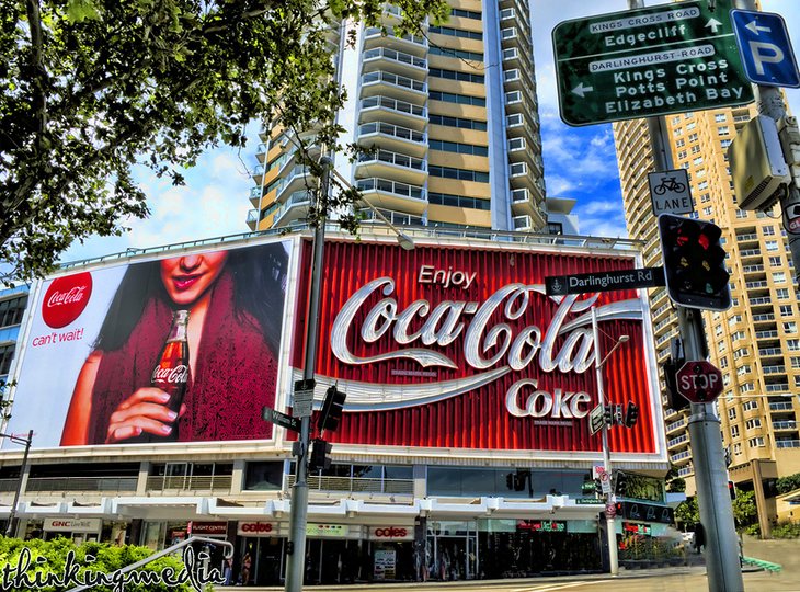
19. Check Out Kings Cross
About two kilometers east of the CBD, Kings Cross is Sydney's multi-faceted red light district and the city's nightlife hub. If you're interested in experiencing an edgier part of the city, this is a great place to visit. You can also catch a play at one of the theaters.
Called "The Cross" by locals, it has an intriguing, Bohemian past. The area was an artistic quarter around 1920, until it evolved into a popular haunt for beatniks during the 1950s and later, hippies. During the Vietnam War, the area started its slow slide to depravity when large numbers of American troops came here on "rest and recreation" leave. You can find out more about the area's spicy history on a guided walking tour.
Despite the area's less-than-savory reputation at night, it wears a different face during the day. Backpackers from the many hostels in the area huddle at hip cafés. Boutique hotels shelter fashionistas, and foodies come here to dine at the trendy restaurants.
To find Kings Cross, look for the large Coca-Cola billboard, at the intersection of William Street and Darlinghurst Road. It's a famous Sydney landmark and is often referred to as the "Gateway to The Cross."
Where to Stay in Sydney for Sightseeing
For first-time visitors to Sydney, a fantastic base for sightseeing is The Rocks, the city's historic district. Spectacular harbor views, heritage-listed buildings, museums, shops, galleries, and cute courtyard cafés make this a great place to stay. From here, many of Sydney's top tourist attractions are within easy walking distance, including the Sydney Harbour Bridge, the Opera House, and the Royal Botanic Gardens. Also a short stroll from here is Circular Quay, the departure point for harbor cruises and ferries. Here are some highly rated hotels in the area:
Luxury Hotels:
- Deluxe hotel options include the harborfront Park Hyatt, one of the country's top hotels; The Langham, Sydney; and the Four Seasons; all with stunning harbor views.
Mid-Range Hotels:
- Near Wynyard Station, the Little National Hotel Sydney offers affordable, compact rooms with comfy beds.
- For families and travelers seeking apartment-style accommodation, Sky Suites Sydney is a top choice, with studios and one- and two-bedroom suites.
- The 90-room boutique Ovolo 1888 Sydney Harbour occupies a heritage-listed old wool store and factory. Bold, contemporary interior design contrasts with the historic building.
Budget Hotels:
- For cost-conscious travelers, The Australian Heritage Hotel and The Mercantile Hotel offer affordable rooms in a superb location.
Tips and Tours: How to Make the Most of Your Visit to Sydney
In contrast to the regular and spacious layout of the younger Australian cities, Sydney is a complicated maze of one-way streets and narrow lanes. Public transport or tours are highly recommended for first-time visitors.
- See the Sights: For the best introduction to the sights of Sydney, book a Sydney and Bondi Hop-On Hop-Off Bus Tour, which stops near the major sights in the city center, around the harbor, and Bondi Beach. Tickets are valid for 24 or 48 hours, and you can hop on and off the bus as often as you please.
- Save Money: Planning to visit several Sydney tourist attractions? Save money on admission by purchasing a Sydney Attractions Pass. You can choose from a combination of two, three, or four attractions, such as WILD LIFE Sydney Zoo, SEA LIFE Sydney Aquarium, the Sydney Tower Eye, and more.
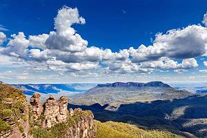
- Take a Day Trip: Just a short drive outside the city is some spectacular mountain scenery. If you have time for just one day trip, take the Blue Mountains Nature and Wildlife Day Tour from Sydney. This small group tour provides pickup and drop-off from your hotel, lunch, entrance fee to the Featherdale Wildlife Park, and a guide.
Sydney, Australia - Climate Chart
| Average minimum and maximum temperatures for Sydney, Australia in °C | |||||||||||
| J | F | M | A | M | J | J | A | S | O | N | D |
| 26 19 | 26 19 | 25 18 | 23 15 | 20 12 | 18 10 | 17 8 | 18 9 | 20 12 | 22 14 | 24 16 | 26 18 |
| PlanetWare.com | |||||||||||
| Average monthly precipitation totals for Sydney, Australia in mm. | |||||||||||
| 130 | 127 | 163 | 132 | 102 | 140 | 56 | 99 | 64 | 89 | 117 | 84 |
| Average minimum and maximum temperatures for Sydney, Australia in °F | |||||||||||
| J | F | M | A | M | J | J | A | S | O | N | D |
| 78 66 | 79 66 | 77 64 | 73 59 | 68 53 | 63 49 | 62 47 | 64 48 | 68 52 | 72 57 | 74 60 | 77 64 |
| PlanetWare.com | |||||||||||
| Average monthly precipitation totals for Sydney, Australia in inches. | |||||||||||
| 5.1 | 5.0 | 6.4 | 5.2 | 4.0 | 5.5 | 2.2 | 3.9 | 2.5 | 3.5 | 4.6 | 3.3 |
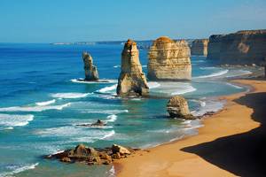
More Exciting Adventures near Sydney
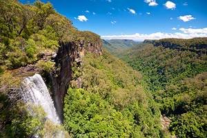
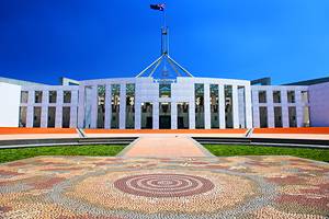
One of the most beautiful cities in Australia, Sydney is surrounded by plenty of enticing day trip destinations. The World Heritage-listed Blue Mountains has some of the best hikes in Australia; the beautiful Hunter Valley is a hot spot for foodies; and Canberra, the nation's capital, is only a three-hour drive away.