18 Top-Rated Attractions & Things to Do in Rotterdam
The second largest city in the Netherlands, Rotterdam lies on both banks of the Nieuwe Maas, the tidal southern arm of the Rhine, where it's joined by the little River Rotte. It's also the world's largest port, home to the massive Europoort facility through which so much freight passes on its way to and from the continent.
Although almost completely destroyed by German air attacks in 1940, central Rotterdam was energetically rebuilt after the war and replanned with modern shopping streets, residential districts, and high-rises. Today, it is one of the most modern and architecturally interesting places to visit in Europe.
Despite its modernity, the city dates back to medieval times and was already prosperous by the 13th century, when a dam was built to separate the Rotte from the Nieuwe Maas, hence the city's name. Rotterdam has also long been important as a cultural hub, its early prosperity leading to the birth of Rotterdam's most celebrated citizen, the humanist Erasmus, born here in 1467.
For visitors and travelers, Rotterdam is as popular for its vibrant entertainment options as it is for its many fine museums, splendid architecture, and maritime tourist attractions. It's well worth including on your Netherlands travel itinerary.
To help you make the most of your time, be sure to read our list of the top tourist attractions and things to do in Rotterdam.
See also: Where to Stay in Rotterdam
- 1. Walk around the Old Harbor and Marine Museums
- 2. Explore the Art Collections of Museum Boijmans-van Beuningen
- 3. Discover World Cultures at Wereldmuseum
- 4. Take a Tour of Grote of Sint-Laurenskerk
- 5. Take a Peek at the Cube Houses
- 6. Get Your Design Fix at Het Nieuwe Instituut
- 7. Enjoy International Cuisine at the Market Hall
- 8. See the Kinderdijk Windmills
- 9. Wander through Coolsingel
- 10. Take a Boat Tour of the Europoort
- 11. Take the Kids to Rotterdam Zoo
- 12. See the Euromast
- 13. Make a Pilgrimage to Delfshaven
- 14. Get Your Art Fix at Kunsthal Rotterdam
- 15. See the Netherlands in Miniature at Miniworld Rotterdam
- 16. Learn about the City's History at Museum Rotterdam
- 17. Enjoy a Day Trip from Rotterdam
- 18. Take the Train to Schoonhoven
- Where to Stay in Rotterdam for Sightseeing
- Tips and Tours: How to Make the Most of Your Visit to Rotterdam
- Rotterdam - Climate Chart
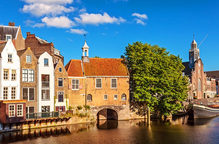
1. Walk around the Old Harbor and Marine Museums
Rotterdam's Old Harbor (Oude Haven), part of the city's revitalized Maritime District, is a boat basin filled with restored historic boats, including houseboats lived in by locals.
In good weather, you can sit outside one of the many cafés and restaurants and enjoy people watching, or stroll around and watch the boats being painted or repaired. Signs identify the ages of the boats and show pictures of this area in its heyday as a commercial port and shipyard.
A short walk from here is Maritime Museum Rotterdam. Established in 1873, the museum provides a fascinating look into the city's connection to the sea and its many waterways. Its large collections cover the history of shipping and seafaring, including ship models, a reconstruction of a 2,000-year-old vessel, and numerous seafaring paintings.
Another marine-related tourist attraction is the adjoining Maritime Museum Harbor, an open-air facility that's home to the well-preserved 19th-century ironclad Buffel, as well as an old lightship. All told, more than 20 historic vessels are on display here. Both facilities offer English-language guided tours.
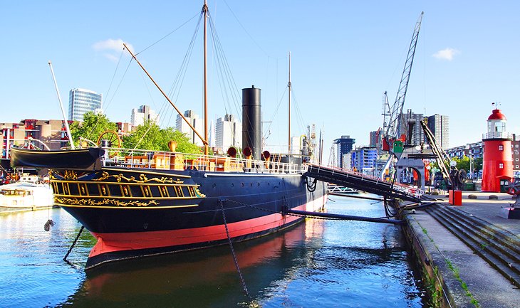
A recent addition to Rotterdam's roster of important old vessels is the SS Rotterdam. Launched in 1958, it's considered the finest Dutch-built passenger vessel ever to sail. This sumptuously decorated vessel is now a hotel and museum, and one of the favorite things to do here is have lunch or dinner in its dining room.
For those traveling with kids, check out the Kids Marina, were youngsters can captain their own mini-version of a cargo or passenger vessel.
Address: Leuvehaven 1, 3011 EA Rotterdam
Official site: www.maritiemmuseum.nl/en
2. Explore the Art Collections of Museum Boijmans-van Beuningen
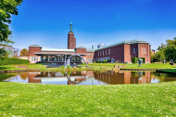
Museum Boijmans Van Beuningen, one of the Netherlands' (and Europe's) most important art centers, is known for its superb collections of paintings, sculptures, and applied and decorative arts from across the continent.
Painters of the 14th to 16th centuries are particularly well represented, with works by Hubert and Jan van Eyck, Hieronymus Bosch, and Pieter Bruegel the Elder. The 17th century is represented by Rembrandt and Rubens (26 of the latter's works can be viewed), while later centuries are represented by Monet, Gauguin, and Van Gogh. Modern painters represented include Picasso, Matisse, and Chagall.
For a truly memorable experience, check into tickets for the museum's occasional opening of the "depot." This unique event allows public access to the museum's storage areas, allowing a behind-the-scenes glimpse of a gallery's workings and rarely seen artworks.
Address: Museumpark 18, 3015 CX Rotterdam
Official site: www.boijmans.nl/en/
3. Discover World Cultures at Wereldmuseum
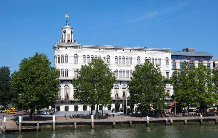
Wereldmuseum Rotterdam, or "World Museum," is another great museum to visit. Founded in 1883, this ethnographic museum features more than 1,800 different artifacts from across the globe. Most ancient and modern cultures are featured to some degree here, providing a fascinating look at the evolution of world cultures.
The museum also holds related events and lectures throughout the year, including family-friendly activities. Guided tours are available. A restaurant and shop are located on the premises.
Address: Willemskade 25, 3016 DM Rotterdam
Official site: www.wereldmuseum.nl/en
4. Take a Tour of Grote of Sint-Laurenskerk
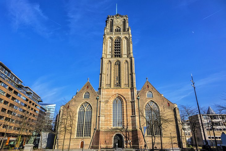
Great St. Lawrence Church (Grote of Sint-Laurenskerk) is all that's left of Rotterdam's medieval buildings, most of which were destroyed during WWII. Located in Grote Kerkplein, the late Gothic church dates from the 15th century and was built on once marshy ground giving the building a peculiar lean that was only halted after its foundation was rebuilt in 1650. It was heavily damaged in bombings, but was fully restored at the end of the war.
Upon entering the church, you'll be struck by the beauty of the bright interior, an effect heightened by the colored glass of its windows. The church is famous for its three Danish organs, the largest of which stands on a marble base on the inside wall of the tower. The bronze doors of the main entrance, on the theme of War and Peace, are by the Italian artist Giacomo Manzu, and in front of the church is a statue of Rotterdam's most famous son, Erasmus.
Guided tours are available, and the modest admission fee includes a very informative English-language audio guide. The church also hosts frequent music concerts and other events.
Address: Grotekerkplein 15, Rotterdam
Official site: https://laurenskerkrotterdam.nl/en/
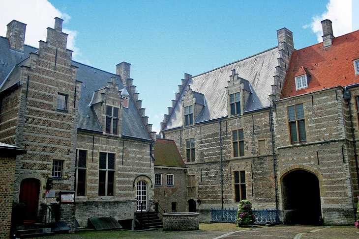
5. Take a Peek at the Cube Houses

Rotterdam is home to many fine examples of modern architecture, much of it inspired by the city's waterside setting, as well as a response to the devastation of WWII. Pushing the architectural envelope to the max are the city's famous Cube Houses (Kubuswoningen).
Designed by Dutch architect Piet Blom, this block of houses, with their unique cube-shaped upper stories, are clearly visible from a walk through the Old Harbor. One of them, the Show Cube, is open to visitors and contains displays on the design and history of the buildings. An interesting museum dedicated to chess is also located here.
Another architectural gem is the White House (Witte Huis). Once Europe's tallest building, this stunning 10-story Art Nouveau structure was built in 1898 and is now a National Heritage Site, with superb views from its rooftop.
Address: Overblaak 70, 3011 MH Rotterdam
Official site: https://kubuswoning.nl/en/
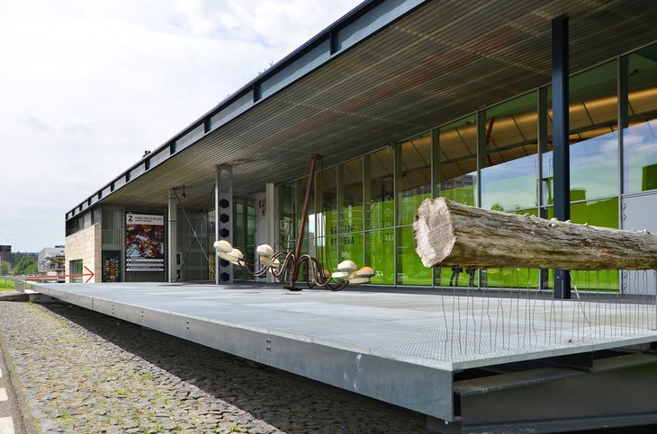
6. Get Your Design Fix at Het Nieuwe Instituut
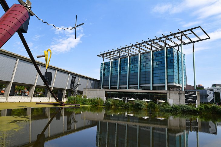
Those with an interest in architecture and building design should visit the Het Nieuwe Instituut (HNI). Translated literally as "The New Institute," this modern museum focuses on the development of various architectural movements over the decades. There is of course a particular emphasis on Dutch styles, but other global design movements are also featured.
Newer exhibits have been added that feature the field of digital culture. In addition to its exhibits, visitors can visit Sonneveld House, an example of a modernist architectural style dating from the 1920s that's located just across the street. A shop and café, along with a pleasant garden, are also open to visitors.
Address: Museumpark 25, 3015 CB Rotterdam
Official site: https://hetnieuweinstituut.nl/en
7. Enjoy International Cuisine at the Market Hall
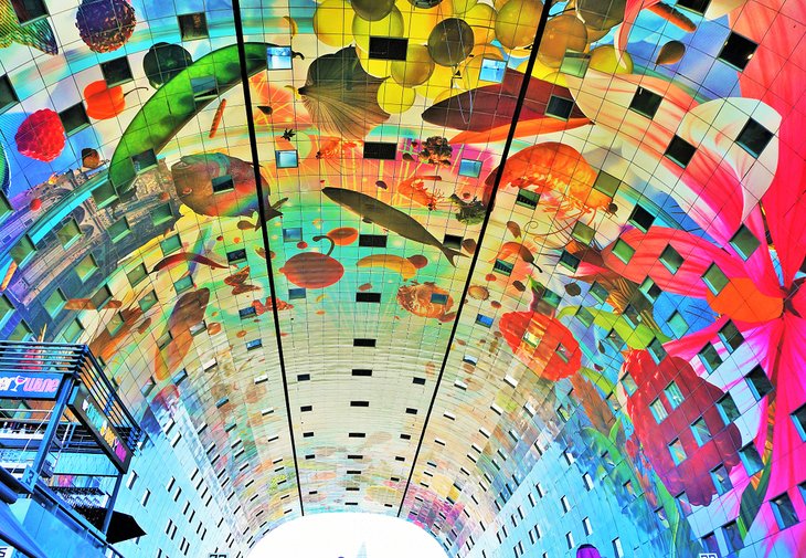
One of the most popular gathering points in Rotterdam is the impressive Market Hall (Markt), a huge office complex that opened in 2014.
Nicknamed "Koopboog" (Horseshoe) by locals, it's an architectural marvel, with the soaring arched ceiling of its food hall covered in larger-than-life murals of vegetables, fish, and other produce, celebrating the fact the market itself is a kaleidoscope of fresh and prepared foods.
You'll find fast foods of every sort here, along with classy restaurants serving everything from traditional Dutch favorites, like Stroopwafels, to Balkan foods, Spanish tapas, and exotic Indonesian dishes.
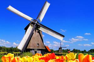
8. See the Kinderdijk Windmills
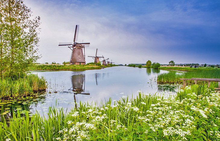
On the River Noord, just 23 kilometers east of Rotterdam, is the beautiful little village of Kinderdijk. Taking its name from a famous legend that describes a baby's cradle being stranded here during the St. Elizabeth's Day flood of 1421 – the name literally translates as "the "children's dyke" – it's one of the most visited places in the Netherlands.
Each of its 19 perfectly preserved 18th-century windmills is designated as a UNESCO World Heritage Site. Built between 1722 and 1761, together they comprise the largest surviving concentration of windmills in the country, a history that's celebrated during special Mill Days, when their sails are once again set in motion.
Fun things to do include exploring the museums located in the Blookwer and Nederwaard mills, as well as the Wisdom pumping station. Fun tours along the canals are also available.
Address: Molenkade Nederwaard 1, 2961 AS Kinderdijk
Official site: www.kinderdijk.com
9. Wander through Coolsingel
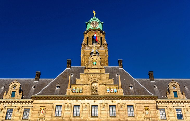
The centerpiece of Coolsingel – nicknamed the city's "Cool" district and the main street of Rotterdam's city center – is the Town Hall (Stadhuis).
Built between 1914 and 1920 in Dutch Renaissance style, it miraculously escaped destruction in the bombing of the city during World War II. While you can't visit the richly decorated interior on your own, guided tours are available and can be booked through the city's tourist office.
Opposite the Town Hall, in the busy Stadhuisplein, is a war memorial designed by Mari Andriessen. Other Coolsingel highlights include the Beurs-World Trade Center, a high-rise building with a facade of greenish-blue glass, and the Bijenkorf ("Beehive") department store, designed by leading architect Marcel Breuer in 1958. Fronting Bijenkorf is the 26-meter-high work of sculpture, Construction (1957), by Naum Gabo, a French sculptor of Russian origin.
The popular shopping streets of Lijnbaan and Koopgoot are also in this area. A few blocks northwest from Bijenkorf, you'll come to De Doelen, a concert hall and congress center rebuilt in 1966 after its destruction in 1940. It offers seating for 2,200 people, excellent acoustics, and a superb roster of concerts. Nearby is Theater Rotterdam Schouwburg, the city's municipal theater, which opened in 1988.
10. Take a Boat Tour of the Europoort
Rotterdam's massive port occupies half the city's total area of 247 square kilometers, much of it in turn occupied by Europoort, a huge complex known as the "Gateway to Europe." In addition to countless large freight vessels, you'll see mile after mile of quays and storage facilities built to service the world's busiest port.
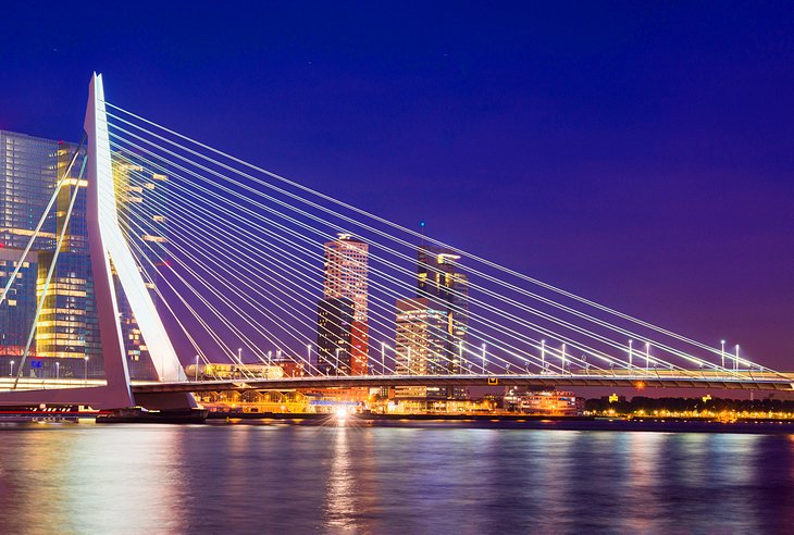
One of the most popular sightseeing tours of the port area begins at Maeslantkering near Hoek van Holland (Hook of Holland) and includes a close-up look at the city's massive surge barrier. Evening tours are also fun, especially with Rotterdam's most famous landmarks, including the superb Erasmus Bridge, being spectacularly illuminated.
11. Take the Kids to Rotterdam Zoo

Established in 1857 and one of the oldest zoos in the Netherlands, Rotterdam Zoo (Diergaarde Blijdorp) is well known for its successful breeding programs. Highlights of this include a number of young elephants, as well as the rare red panda, fascinating creatures to watch as they explore the large enclosures designed to resemble their natural habitats.
Natural habitats are, in fact, a priority here: the Asian section includes a swamp forest with two large aviaries for exotic birds, a Mongolian steppe, a bat cave, a Chinese garden, and numerous creatures indigenous to the region.
Also worth exploring is the zoo's Oceanium, an excellent aquarium featuring a large collection of marine life from the Americas. And, if after your visit the kids still have energy to burn, pay a visit to Plaswijckpark. This fun family park features boat and train rides, an adventures playground, plus a petting zoo.
Address: Blijdorplaan 8, 3041 JE Rotterdam
Official site: www.diergaardeblijdorp.nl/en/
12. See the Euromast

One of Rotterdam's most distinctive landmarks, the Euromast lies at the north entrance to the Maas Tunnel. Erected in 1960, this 185-meter-high tower houses two restaurants with superb city views, each at the 92-meter mark.
For thrill seekers looking for more than just great views there's the chance to abseil down the building, while those looking for a unique overnight stay can book one of two stunning suites located at the 100-meter point. English language guided tours are available.
Address: Parkhaven 20, 3016 GM Rotterdam
Official site: www.euromast.nl/en
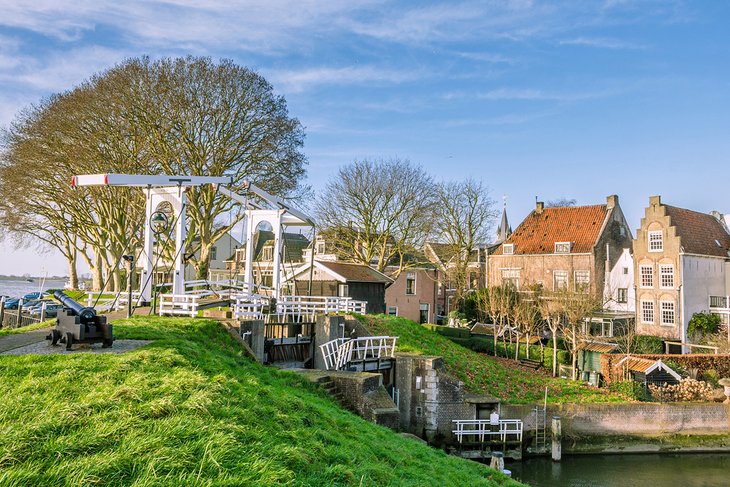
13. Make a Pilgrimage to Delfshaven
The old district of Delfshaven, unlike much of the rest of Rotterdam, survived WWII largely unscathed. Consequently, its unspoiled old architecture has resulted in it becoming one of the most popular spots in this big bustling city.
Delfshaven is revered by the Dutch as the birthplace of Admiral Piet Hein, a 16th-century hero of the country's long war against Spain. For Americans, it's notable for the Old Church (Oude Kerk), where the last service was held in 1620 by the Pilgrims before sailing for the New World to found Plymouth, Massachusetts. This is commemorated with a memorial and bronze tablet.
14. Get Your Art Fix at Kunsthal Rotterdam
Another example of the city's modern-yet-functional architecture is the Rotterdam Kunsthal, or Art Hall. This trendy gallery opened in 1992 and hosts a variety of constantly changing exhibits of visual arts, design, architecture, and culture from across the globe.
Another gallery of note is the Chabot Museum, which features the works of Dutch painter and sculptor Henk Chabot. It's housed in a superb white villa built in 1938.
Those with an interest in photography should plan on visiting the Netherlands Photo Museum (Nederlands Fotomuseum). Highlights include a broad collection of historical images by a number of Dutch photographers.
Address: Museumpark, Westzeedijk 341, 3015 AA Rotterdam
Official site: www.kunsthal.nl/
15. See the Netherlands in Miniature at Miniworld Rotterdam
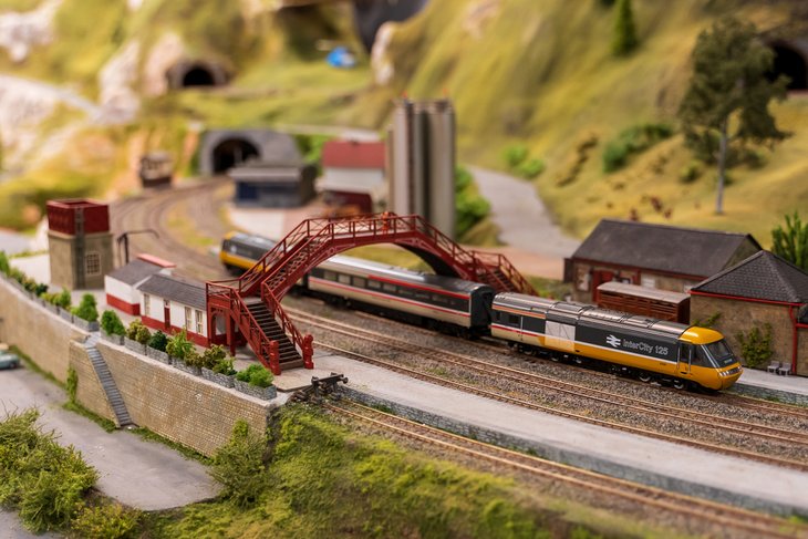
Miniworld Rotterdam is one of the newest tourist attractions in the Netherlands – and one of the best for kids. Set in a large warehouse and covering an area of over 535 square meters, Miniworld recreates many of the most recognizable landmarks and places to visit in the Netherlands on a miniature scale.
Crisscrossing these displays is a 2.3-kilometer-long network of model rail tracks, with some 150 trains buzzing around at any one time, between them pulling an impressive collection of over 1,800 pieces of rolling stock. Close to half the exhibit features parts of Rotterdam, allowing the little ones in your party to recognize some of the many attractions they may already have visited.
If you've got the time, book a fun behind-the-scenes tour. Along the way, you'll visit the Miniworld workshop and learn how the trains are controlled from the command center, including how the whole display is lit up when night falls – an event that happens every 25 minutes in Miniworld Rotterdam.
Address: Weena 745, 3013 AL Rotterdam
Official site: www.miniworldrotterdam.com/ENGindex.htm
16. Learn about the City's History at Museum Rotterdam
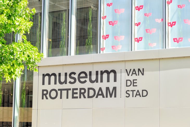
Museum Rotterdam is one of the best places to visit for those wanting to learn more about the history of this fascinating port city. Established in the 1950s, the museum displays a rich collection of documents and artifacts, including artworks from the 17th and 18th centuries. Of these, the most important works are by Dutch painter Pieter de Hooch.
More recent history is also featured at the museum's Coolhaven annex. Dedicated to World War II, Museum Rotterdam '40 -'45 NU opened in 2015 and features exhibits relating specifically to the Dutch wartime experience. A notable artifact on display is the original flag of surrender used in May 1940 after the country was invaded by Germany.
Address: Rodezand 26, 3011 AN Rotterdam
Official site: https://museumrotterdam.nl/en/
17. Enjoy a Day Trip from Rotterdam
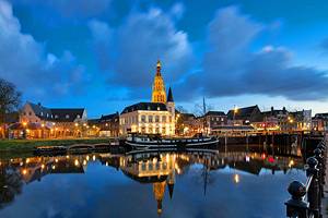
Many pleasant excursions await within an easy commute of Rotterdam. One of the most popular places to visit is Bergen op Zoom, a historic old town some 67 kilometers south that is noted for its large squares and pleasant pedestrian zones. It's also where you'll find Markiezenhof Palace, a 15th-century mansion that now houses a cultural center and museum with numerous fine paintings and period furniture.
Also worth a visit are Breda, 52 kilometers southeast of Rotterdam, with its museums and monuments, and the town of Gorinchem, 44 kilometers to the east. Another must-see is the Witches Weigh House (Museum de Waag) in Oudewater, famous for once having been used to weigh those suspected of witchcraft. If you were considered light enough to ride a broomstick, the theory was that you were a witch (fortunately for the women of Oudewater, none of the accused were considered light enough to be punished).
About 70 kilometers from Rotterdam, Zierikzee on the island of Schouwen-Duiveland lures tourists with its yacht harbor, a picturesque old town center, and beautiful beaches fringed by wooded dunes.
18. Take the Train to Schoonhoven
Situated halfway between Rotterdam and Utrecht, and just an hour away by train, Schoonhoven is a good day's excursion for its superbly preserved medieval buildings. St. Bartholomeuskerk, founded in the 13th century and notable for its tendency to lean off the vertical, has stalls carved with scenes from the life of Christ. Look out for the 17th-century pulpit with its figures of the 12 Apostles, and the tomb of Olivier van Noort, the first Dutchman to circumnavigate the globe in the early 1600s.
The Schoonhoven Town Hall (Stadhuis), built in 1452 in Late Gothic style but much altered in later centuries, has a domed hexagonal tower containing a carillon of 50 bells.
Other town highlights include the picturesque Weigh House (Waag) from 1617 on top of a dam above the harbor; and the Edelambachtshuis, a granary built in 1566 that now houses a collection of jewelry from the 1600s to the 1900s.
Where to Stay in Rotterdam for Sightseeing
If you're visiting Rotterdam for the first time and want to see some of the city's top sights, the best area to stay is in the city center. From here, you're near attractions such as the Museum Boijmans Van Beuningen; the Euromast; Erasmus Bridge; and Coolsingel, the city's main street. Here are some of our most highly rated hotels in and near the city center:
Luxury Hotels:
- Located in a prime location just a five-minute walk from the city center, Mainport Hotel presides over impressive views of the city skyline from the banks of the river Maas and blends influences from East to West in its sultry, modern style. The spa features a Finnish sauna and hammam, while other notable amenities consist of a heated indoor swimming pool and on-site parking.
- Across the river from the city center and just a few steps away from public transport, the Green-Key-certified Suite Hotel Pincoffs is a classy boutique hotel worth booking. Set in a historic 19th-century customs house, this great spot frequently rates as the city's best boutique hotel with its affordable yet swanky suites. Breakfast and lunch are available for a fee.
- If you prefer a large chain luxury hotel, the pet-friendly Hilton Rotterdam could be just the ticket. Featuring a modern 24-hour fitness center, an indoor swimming pool, and a Michelin-star restaurant, it's within easy walking distance of Central Station and the shopping district. A mix of classy rooms and suites are available.
Mid-Range Hotels:
- At the top-end of the city's many mid-range hotels, citizenM Rotterdam offers quality accommodations just steps from Blaak station and a short stroll to the maritime museum and Coolsingel. Billed as affordable luxury, its clean, bright rooms feature wall-to-wall windows, a homey lobby that feels like a living room, and an innovative design concept.
- The nearby Ibis Rotterdam City Centre is also a worthy contender in the mid-range category. Situated on a small canal, this great-value hotel features small, bright rooms with free Wi-Fi and large-screen TVs. Amenities worth noting include a good on-site restaurant, as well as free parking.
- Just a short walk away from the city's Central Station and fabulous shopping, the Holiday Inn Express Rotterdam - Central Station offers the kind of quality rooms and amenities you'd expect from a big brand like Holiday Inn. The rooms are spacious and bright and include coffee makers and free Wi-Fi, while guests are treated to a complimentary continental breakfast each morning.
Budget Hotels:
- Located near the Museumpark, Central Station, and great shops and restaurants, easyHotel Rotterdam City Centre is one of the city's top-rated budget hotels. It features small yet bright rooms in the heart of the city, with affordable prices and clean public areas.
- Just a two-minute walk from Rotterdam's city center, Bienvenue offers basic rooms for a budget-friendly price. Standard rooms feature comfortable beds, along with work desks and free Wi-Fi. Guests often comment on how peaceful this hotel is, a fact due to its location in a quiet neighborhood of an otherwise large and busy city.
- Hotel Baan is another good budget accommodation option, located near a train station and within walking distance of the iconic Euromast. Rooms are clean and simple, with some offering views directly over a canal.
Tips and Tours: How to Make the Most of Your Visit to Rotterdam
- Half-Day Walking Tour and Harbor Cruise: You can see Rotterdam's top sights from both land and sea on the half-day Rotterdam Walking Tour Including Harbor Cruise. The Old Harbour, Cube Houses, and Museumpark are just some of the attractions on the itinerary of this private tour. After strolling around the city streets, you can relax on a harbor cruise and view the city from a different perspective.
- Architecture Tour: If you're interested in learning more about Rotterdam's landmark buildings, the Private Rotterdam Architecture Walking Tour is an excellent option. On this three-hour walking tour, you'll see impressive buildings, like Rotterdam Central Station, the Cube Houses, and Rotterdam Market Hall (Markthal), and hear fascinating stories about their history.
Rotterdam - Climate Chart
| Average minimum and maximum temperatures for Rotterdam, Netherlands in °C | |||||||||||
| J | F | M | A | M | J | J | A | S | O | N | D |
| 6 1 | 6 1 | 9 3 | 12 4 | 16 8 | 19 11 | 21 13 | 21 13 | 18 11 | 14 8 | 9 4 | 7 2 |
| PlanetWare.com | |||||||||||
| Average minimum and maximum temperatures for Rotterdam, Netherlands in °F | |||||||||||
| J | F | M | A | M | J | J | A | S | O | N | D |
| 42 34 | 42 33 | 48 37 | 53 39 | 61 46 | 66 52 | 69 56 | 70 55 | 64 51 | 57 46 | 49 40 | 44 36 |
| PlanetWare.com | |||||||||||
More Related Articles on PlanetWare.com
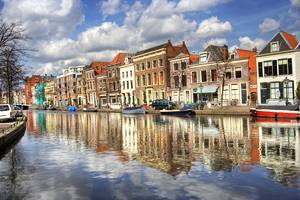
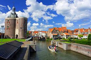
Nearby Places to Visit: Almost any point in the Netherlands is within easy reach of Rotterdam. Just a short commute to the north is the country's porcelain center of Delft, known for its famous Delftware, a type of pottery that has graced shelves and dining room hutches around the world since the 17th century. The capital of the Netherlands, The Hague, also makes for an easy excursion, and is well worth visiting for its fine old palaces. Fun attractions in Leiden, one of the country's main cultural centers, include its old castle and world-class museums.
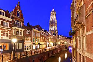
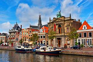
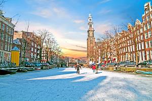
Netherlands Travel Ideas: Only 40 minutes from Rotterdam by train, busy Amsterdam is another good base for day trips, especially for art lovers, who can enjoy such art-related attractions as the Rijksmuseum, home of many works by Rembrandt. And to the north of Amsterdam is the city of Haarlem, boasting one of the most attractive and pedestrian-friendly city centers in the country. A few kilometers east of Rotterdam is the country's fourth largest city, Utrecht, popular among sightseers for its picturesque setting and well-preserved medieval architecture.