Malta Travel Guide
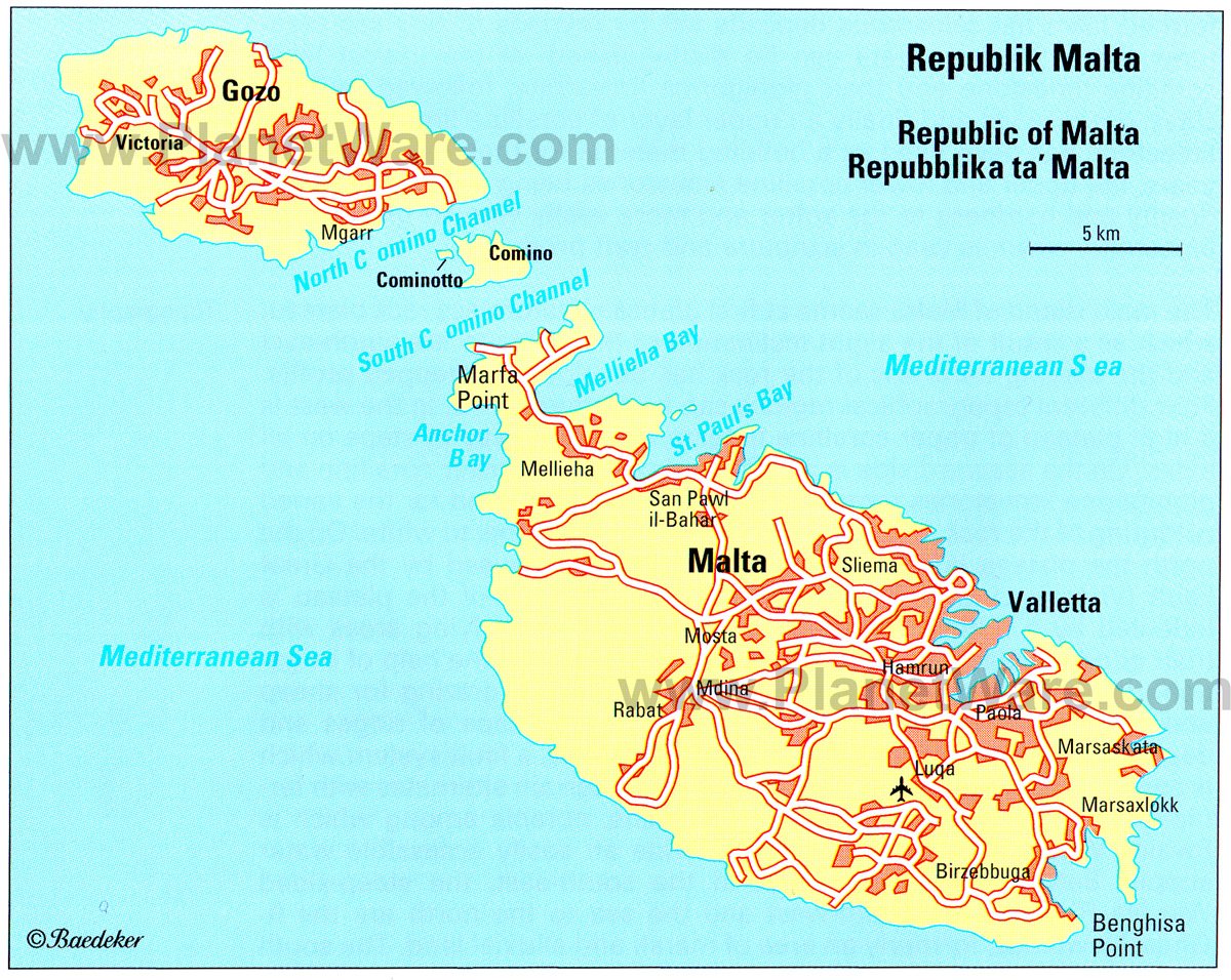
The independent State of Malta, a Republic within the British Commonwealth consisting of the main island of Malta(area 95sq.mi/246 sq. km), the adjoining islands of Gozo (26 sq. miles/67 sq. km) and Comino (1 sq. mile/2-6 sq. km) and the uninhabited rocky islets of Cominotto, Filfla and Selmunett, lies in the Central Mediterranean at the E end of the Sicilian Channel, 60 miles/93 km from the southern tip of Sicily and 180 miles/288 km from the Tunisian coast to the W. The islands extend from NW to SE for a distance of some 27 miles/44 km, rising to a maximum height of 830 ft/253 m. The Maltese Islands are the last remains of a land bridge which during the Late Tertiary era and the Glacial periods of the Pleistocene linked Sicily with North Africa and divided the Mediterranean into two.
Read More
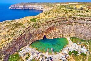
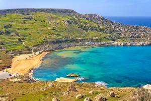
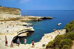
On the main island, Malta, the land rises in stages from NE to SW. In the east is a region of gently rolling hills never rising above 330 ft/100 m, which in the west, along a clearly marked fault line, gives place to a plateau of Tertiary limestones, much broken up by karstic action and reaching its highest points along the west coast. On the east side of the island there are a number of excellent natural harbors drowned river valleys - while the west coast, edged by sheer cliffs, offers little shelter to shipping. The cultivable land is mostly in the larger basins in the eastern half of the island, and it is in these areas that the Main concentrations of population and economic activity have developed.
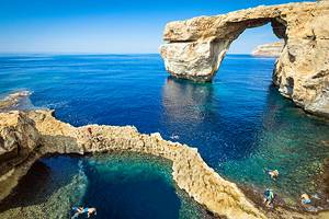
The neighboring island of Gozo is separated from Malta by a channel some 3 miles/5 km wide, divided into two (the North Comino Channel and the South Comino Channel) by the little island of Comino. Like Malta, Gozo rises gradually toward the SW, though here the limestone hills are lower and the cliffs on the SW coast are correspondingly less formidable. The NE coast, with few indentations, has no natural harbors like those of the main island.
The Maltese Archipelago has a characteristically Mediterranean climate. During the summer it lies wholly within the subtropical belt of high pressure, but in winter this withdraws southward, so that during this period the whole of the Mediterranean may be reached by sub-polar troughs of low pressure. Accordingly the summers are hot and dry, while the winters are mild but rainy. In July the average temperature is 81°F/27°C; in January it is still as high as 54°F/12°C. Frost is unknown on the islands. Most of the annual rainfall of barely 23.6 in./600 mm occurs in November and December; the month of lowest rainfall is July. From April to September the Maltese climate can be classed as arid: i.e. the total rainfall is less than the loss of moisture by evaporation,
The typically Mediterranean evergreen scrub known as macchia or garrigue is found all over Malta. Among its principal constituents are spurges, feathergrass, thyme, heaths, juniper and pistachio, which in the rainy spring period cove, the ground with a carpet of flowers. The garrigue has replaced the original forest cover. About 900 B.C. the islands were still covered with trees, which provided the Phoenicians and Carthaginians with timber for shipbuilding. The destruction of the forests led to a sharp fall in the moisture content of the soil and to increased erosion two factors which have greatly reduced the agricultural potential of the land. Characteristic elements in the vegetation of Malta apart from the macchia are other warmth-loving plants such as the carob tree, Aleppo pine, prickly pear, agave and oleander. These were introduced by man over the centuries, as was the olive, which was supplanted during the 19th c. by the more profitable cultivation of cotton.
Attractions in Popular Destinations
More Destinations and Attractions
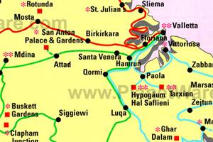
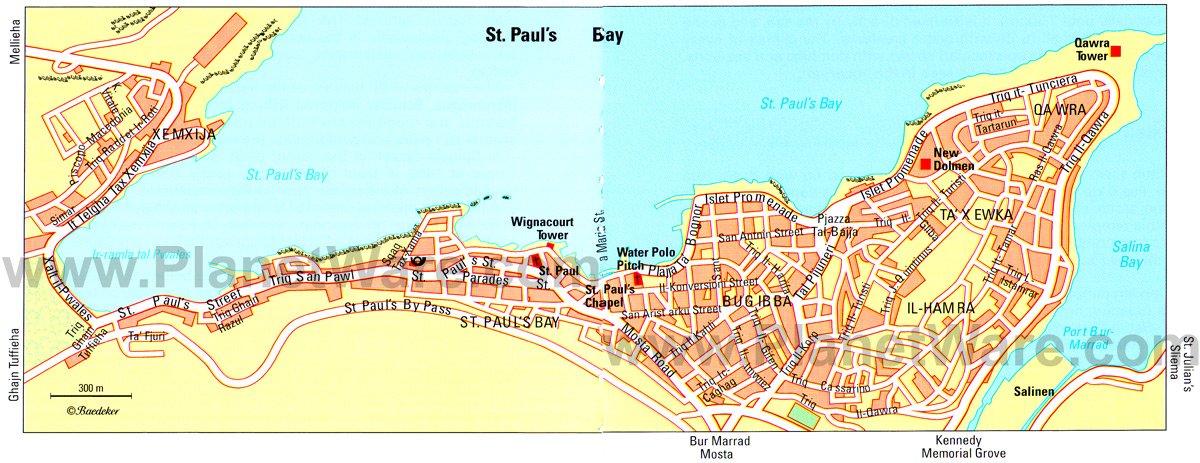
Malta Maps