Explore Your World
Europe
North America
Caribbean
Central & South America
Africa & Middle East
Asia & Pacific
×
Close
Popular
Nepal Travel Guide
Tourist Attractions in Nepal
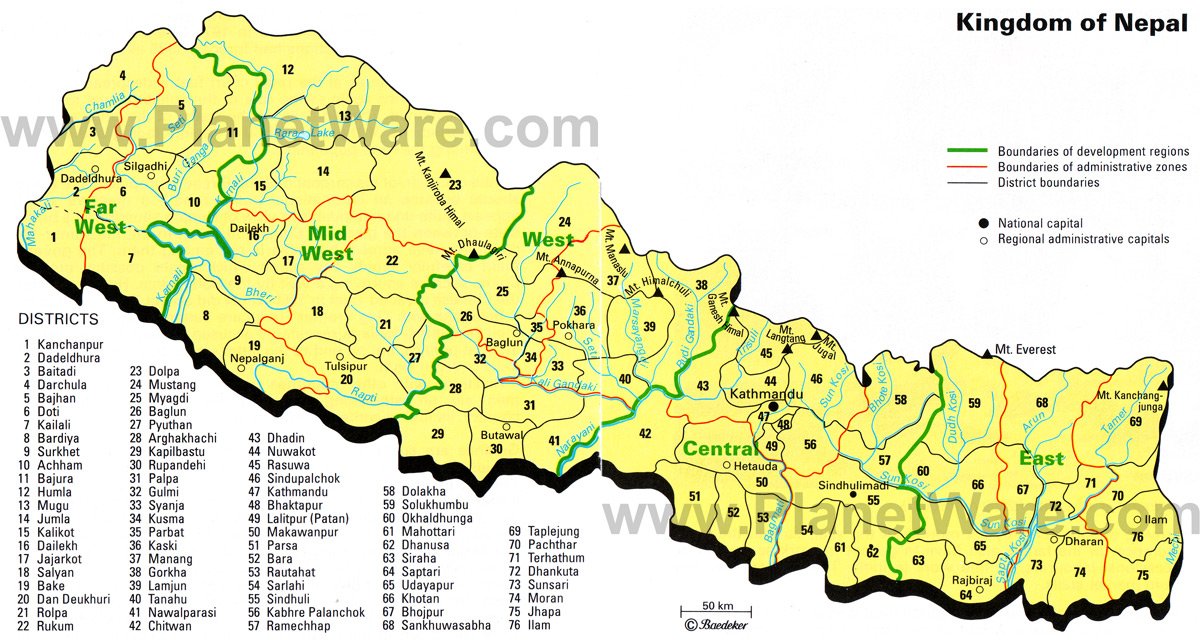
Nepal Districts Map
Nepal
is divided into numerous districts.
Follow us on
Instagram
More on Nepal
Nepal Travel Guide
Tourist Attractions in Nepal
Destinations popular right now
Tourist Attractions in Nepal