15 Top-Rated Hiking Trails in California
California is a hiker's paradise with an incredible diversity of landscapes to explore. For nature lovers, hiking is one of the top things to do in California. The nature sites are so sublime that simple descriptions only hint at their grandeur: the magnificent, glacier-carved valley of Yosemite; a breathtaking, mountainous coastline in Big Sur; the serenely barren Mojave Desert; the majestic, snowcapped Mount Shasta; and a rugged, untamed wilderness in Solstice Canyon.
Several of California's national parks boast record-breaking statistics. Yosemite National Park has the longest waterfall in North America, while Mount Whitney in Sequoia National Park has the highest summit in the continental United States, and the tallest trees in the world are found in the Redwood National and State Parks.
This list of top-rated hikes covers the highlights of California's nature trails, with a range of moderate to strenuous hikes at famous places like Yosemite and Mount Shasta. For those ready to take on an extreme challenge, the list includes two epic hikes at legendary nature sites, Mount Whitney and the Lost Coast, that should only be attempted by advanced hikers.
Find some space in the wilderness with our list of the top hiking trails in California.
- 1. Yosemite Falls Trail: A Spectacular Hike to North America's Tallest Waterfall
- 2. Mount Shasta
- 3. McWay Waterfall Trail: The Most Iconic Site in Big Sur
- 4. Sea Lion Point Trail in Point Lobos
- 5. James Irvine Trail at Prairie Creek Redwoods State Park
- 6. Redwood National Park: Boy Scout Tree Trail
- 7. Lost Palms Oasis and 49 Palms Trails at Joshua Tree National Park
- 8. Runyon Canyon Park, Los Angeles
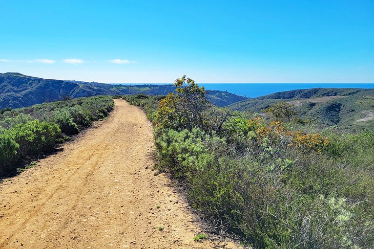
- 9. Solstice Canyon Trail in Malibu
- 10. Pomo Canyon to Shell Beach in Sonoma County
- 11. High Peaks Trail, Pinnacles National Park
- 12. Laguna Coast Wilderness Park in Southern California
- 13. See Waterfalls on the McCloud River Trail
- 14. An Epic Hike to the Summit of Mount Whitney
- 15. Lost Coast Trail: An Extreme Outdoor Adventure
- Map of Hiking Trails in California
- More Related Hiking Articles on PlanetWare.com
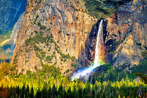
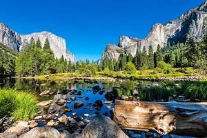
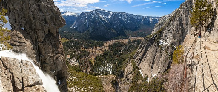
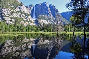
1. Yosemite Falls Trail: A Spectacular Hike to North America's Tallest Waterfall
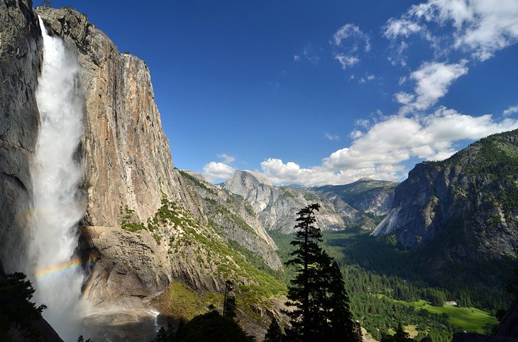
One of the best hikes in Yosemite National Park, this trail provides close-up views of Yosemite's most spectacular waterfall, as well as panoramic vistas of the valley floor. The trail includes two parts. With both sections combined, the Yosemite Falls Trail is a nine-mile round-trip hike.
The first part of the Yosemite Falls Trail is the one-mile section to Columbia Rock, a moderate hike that ascends 1,000 feet through a switchback trail. Views from Columbia Rock sweep across the Yosemite Valley to Half Dome in the distance. If you decided not to complete the second part of Yosemite Falls Trails, this section alone is a two-mile round-trip hike that takes about two to three hours.
The second part of the trail up to Yosemite Falls is more difficult. This strenuous, seven-mile round-trip hike includes an elevation gain of 2,700 feet, up rugged terrain, and steep hillside staircases. To complete this round-trip hike takes another six to eight hours from Colombia Rock.
The Yosemite Falls Trail is thrillingly close to Yosemite Falls. While climbing the trail, hikers often feel the mist from the waterfalls. After reaching the summit of this challenging trail, hikers are dazzled by expansive vistas of the entire Yosemite Valley.
Best Time to Hike to Yosemite Falls: The best time to hike the Yosemite Falls Trail is in the spring when the waterfalls are abundantly flowing. By August, the water levels are lower, and the falls are less impressive.
In summer, begin the hike early in the day because the trail can be very hot by noon, and the upper portion is exposed, with no shade by the late afternoon.
In spring and autumn, consider the length of the round-trip hike and the time of sunset; be sure to set out early enough to complete the round-trip in daylight.
Hiking Tips: Wear hiking shoes with good treads because this trail can be slippery. Bring bottled water; drinking water is not available on the trail.
Safety Tips: Always stay on the path. Wandering off can lead to dangerous sheer drop-offs near the trail.
Watch out for areas of loose sand and rocky terrain that can be slippery. Do not stray from the trail, some areas lead to dangerous, steep drops.
During winter, ice and snow can make the upper portion of the trail unsafe for hiking. Do not hike the second part of the trail up to the top of Yosemite Falls in freezing or snowy weather conditions.
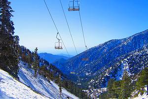
2. Mount Shasta
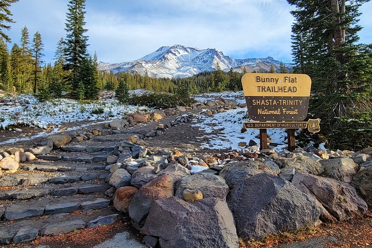
The majestic, snowcapped Mount Shasta is one of the most inspiring places to hike in California. Many visitors come to Mount Shasta seeking a spiritual experience in nature. Adventurous outdoor enthusiasts come for the challenge of climbing to the mountain's summit. However, Mount Shasta has plenty of hiking trails that are suitable for the average hiker.
A popular hike on Mount Shasta is the Gray Butte Trail. With a trailhead above 7,000 feet in elevation, this moderate, 3.5-mile round-trip trail gains 750 feet and takes about three hours to complete.
The trail begins at the Panther Meadows Campground parking lot, crosses through the expansive Lower Panther Meadow and continues up through a pristine forest of old-growth Red Fir Trees.
At the fork in the trail, the righthand-side ascends through a stand of fragrant Mountain Hemlock Trees. The trail continues past the Lower Peak to the Upper Peak of Gray Butte, offering splendid panoramic views at several vantage points along the way.
Hiking Tip: This hike is only accessible in the summer and early fall, from late June until late October.
3. McWay Waterfall Trail: The Most Iconic Site in Big Sur
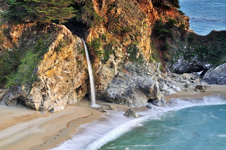
Leading to Big Sur's most frequently photographed sight, this trail is in Julia Pfeiffer Burns State Park. Named after the female pioneer who owned a ranch in Big Sur country in the early 1900s, the park stretches along the mountainous Big Sur coastline, with its forested 3,000-foot ridges that drop off dramatically into the Pacific Ocean. Julia Pfeiffer Burns State Park has two walk-in campsites, which are among Big Sur's best campgrounds.
The McWay Waterfall Trail is a very short hike to a lookout of the McWay Waterfall. Despite the grandeur of the scenery, this trail is surprisingly easy and short. More of a stroll than a hike, the 0.6-mile round-trip trail takes only about 30 minutes to complete.
The lookout provides a stunning perspective of the 80-foot McWay Waterfall, which drops from a sheer granite cliff onto a sandy beach in the secluded cove below. Hikers may spend more time admiring the waterfall and ocean views than actually hiking. The overlook is also a good spot to view whales during the migration season.
Safety Notes: There is no access to the beach from the McWay Waterfall Trail. Attempting to hike down to the beach is extremely dangerous and strictly prohibited.
Stay away from the edges of the trail. Signs posted warn of danger due to unstable cliffs.
4. Sea Lion Point Trail in Point Lobos
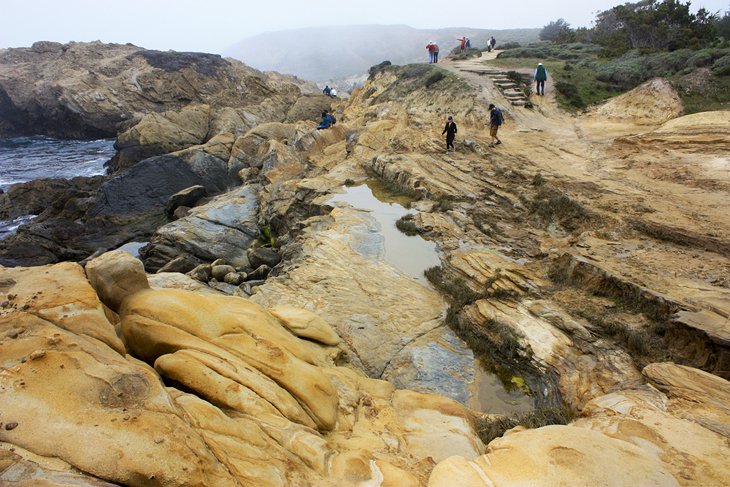
The Sea Lion Point Trail delights nature lovers who appreciate marine wildlife and ocean views. the 0.6-mile loop trail is a short and easy hike within an especially scenic portion of Point Lobos State Reserve, just south of the Monterey Peninsula.
The Sea Lion Point Trail winds around peaceful coves and rocky ocean bluffs, meeting with crashing waves that give hikers a chance to spot barking sea lions on offshore rocks. The trail also passes by Headland Cove and Sea Lion Cove, two quiet coves where seals swim, and sea otters bask in the protected waters.
To get a closer view of the animals, hikers may walk down a staircase that provides access to the coves. If taking the steps down to the coves, be careful to stay away from the edges and watch out for unexpected waves.
The charming seaside village of Carmel is less than 20 minutes to the north, with white sandy beaches that are also fun to explore.
5. James Irvine Trail at Prairie Creek Redwoods State Park
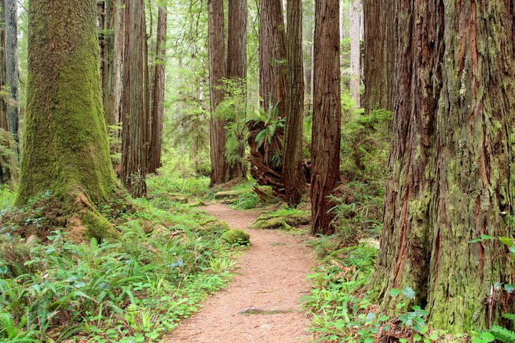
Hikers admire some of the word's tallest and oldest trees at Prairie Creek Redwoods State Park, which is one of the jointly managed Redwood National and State Parks in northern California. This grove of old-growth coastal redwood trees descends from a primeval forest that existed when dinosaurs roamed the Earth.
The best of the Redwood National and State Parks hikes, the 10-mile round-trip James Irvine Trail in Prairie Creek Redwoods State Park offers varied and majestic scenery. This moderate trail winds through dense redwood forest, along hillside and ridges and valleys.
Even if you do not complete the entire hike, it is well worth going about a mile or so out and back. That way, you can at least experience the magnificence of towering redwoods and the refreshing feel of their leafy canopies shading the path.
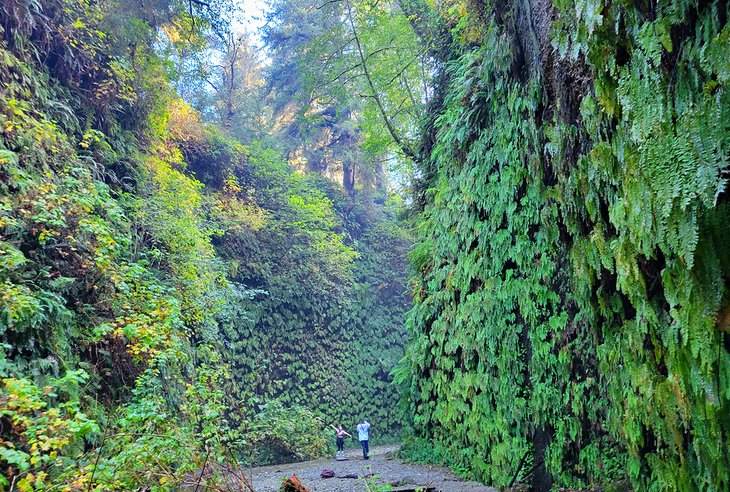
At the end of the James Irvine Trail, the path connects with the short (0.6-mile) Fern Canyon Trail, which leads to the beach. Seven different types of ferns blanket the canyon. The dense vegetation absorbs sounds, lending a sense of peacefulness. It's completely quiet here, except for the chirping of birds, the rushing (or trickle) of a freshwater creek, and ocean waves crashing in the distance.
Fern Canyon is so remarkable that it was chosen by Hollywood directors as a backdrop for scenes in the Jurassic Park film. In fact, relatives of today's living coastal redwoods existed 160 million years ago, during the Jurassic Era.
6. Redwood National Park: Boy Scout Tree Trail
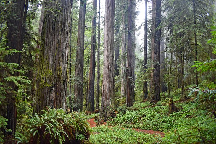
In Northern California near the Oregon border, Jedediah Smith Redwoods State Park is one of the Redwood National and State Parks. The hiking areas of Jedediah Smith Redwoods State Park give visitors a wonderful feeling of being far removed from the urban environment.
A moderate trail through an old-growth redwood forest, the 5.6-mile round-trip Boy Scout Tree Trail is among the best hikes in the Redwood National and State Parks. The trail is generally easy, except for some areas of switchback turns and steep grades. Allow about a half-day to hike the trail and take your time admiring the dense canopy of giant trees.
About 2.5 miles from the trailhead, a spur trail leads up to a 2,000-year-old double redwood tree, named the Boy Scout Tree because it was discovered by a Boy Scout troop leader. The trail concludes at the picturesque Fern Falls before hikers loop back to the trailhead.
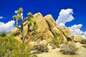
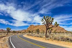
7. Lost Palms Oasis and 49 Palms Trails at Joshua Tree National Park
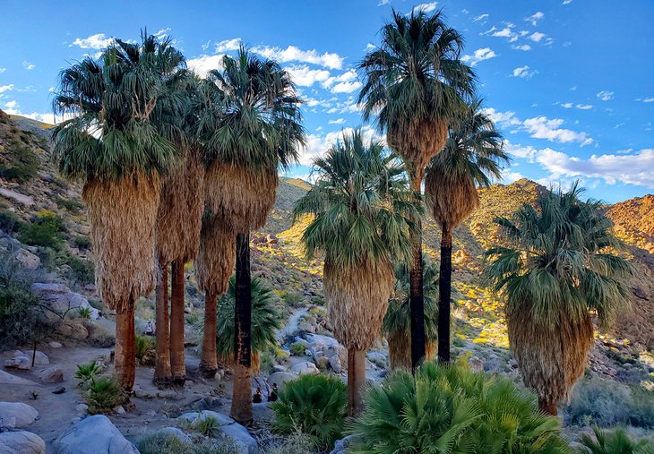
Joshua National Park is at the intersection of the rugged and barren Mojave and Colorado Deserts, a distinct area of the California desert region. Although most famous for the Joshua tree, this national park also has several interesting trails that travel through palm oases.
The Lost Palms Oasis Trail is a moderate, 7.2-mile round-trip hike that traverses through a canyon filled with leafy palms and refreshing pools of water. The trail ends at Cottonwood Campground, which has a picnic area and drinking water.
The 49 Palms Oasis Trail is a moderately strenuous, three-mile round-trip trail that rewards hikers with palm-shaded pools of fresh water. This hike involves a 300-foot elevation gain, so it requires that hikers be in good shape, because the ascent is especially difficult in the desert heat.
Hiking Tips: Be prepared for the heat by bringing an adequate supply of drinking water. Avoid hiking in the summer, when the temperature can exceed 100 degrees Fahrenheit.
Nearby Campsites: Joshua Tree National Park has nine campgrounds, and most are available on a first-come, first-served basis. However, availability is limited during the high season (October to May). A couple of the campgrounds allow reservations. Staying overnight at one of the Joshua Tree National Park campgrounds is the best way to experience the park.
8. Runyon Canyon Park, Los Angeles
Runyon Canyon Park is a hidden gem right in the center of Los Angeles, a city where residents are rarely seen walking. The 130-acre park is just two blocks from Hollywood Boulevard. However, it's undiscovered by most tourists. Locals come here to get fresh air, exercise, and walk their dogs.
Runyon Canyon Park offers several different trails, all with amazing views of the rugged landscape and Los Angeles cityscape. From some vantage points, it's possible to see the Pacific Ocean and Catalina Island in the distance. Tourists should also check out Griffith Park for other excellent hiking trails within the city of Los Angeles.
Location: 2000 North Fuller Ave, Los Angeles, California
- Read More: Top-Rated Tourist Attractions in Los Angeles
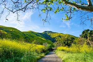
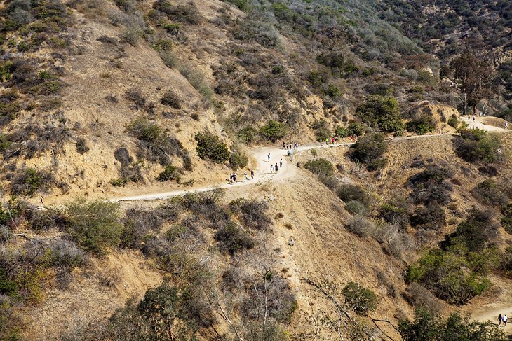
9. Solstice Canyon Trail in Malibu
Near the coast in Malibu, a great day trip from Los Angeles, the Solstice Canyon Trail is a place of serene beauty. The trail is part of the Santa Monica Mountains National Recreation Area, which was historically an important site for the native Chumash people.
The Solstice Canyon Trail is among the most popular hiking trails in Southern California, as well as one of the best places to visit and admire nature in the Santa Monica Mountains. This two-mile round-trip hike begins at the parking lot and meanders alongside a creek, through oak groves and coastal shrub. The trail features thrilling views of dramatic canyons, sagebrush-covered mountains, and the deep blue Pacific Ocean.
Because of the trail's location near Malibu beaches, it tends to get crowded on weekends. Yet, the Solstice Canyon Trail manages to retain a sense of solitude and is a peaceful escape from the bustling Southern California urban life.
Hiking Tips: Watch out for poison oak, bees, and rattlesnakes. Be sure to wear the right footwear and clothing to protect against ticks.
Bring drinking water or a bottle to fill up with water. There is a drinking fountain at the parking lot.
Location: 3455 Solstice Canyon Road, Malibu, California
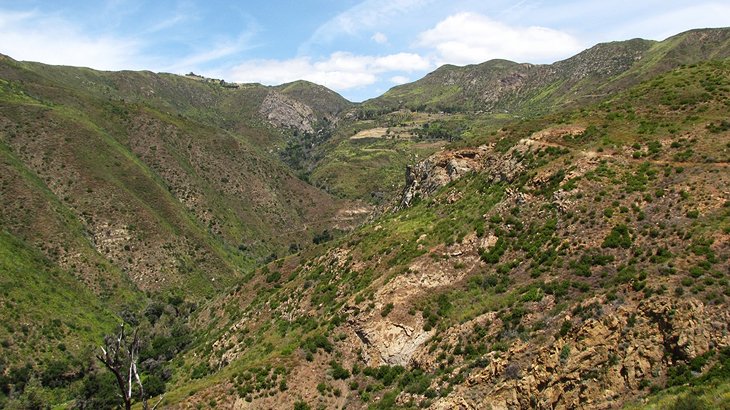
10. Pomo Canyon to Shell Beach in Sonoma County
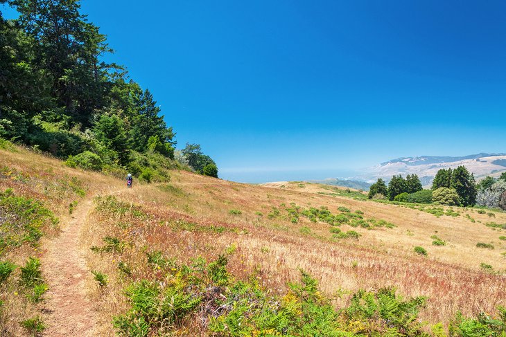
Some of California's most breathtaking coastal scenery is found in Sonoma County, 75 miles (about a two-hour drive) from San Francisco. The moderately challenging 3.5-mile Pomo Canyon Trail in the Sonoma Coast State Park traverses a diversity of landscapes. First, the trail climbs through a lush redwood forest, then it follows along a wooded ridge with stunning vistas of the Pacific Ocean.
The trail curves around into grasslands with colorful seasonal wildflowers and crosses over several small, picturesque creeks. Towards the end of the hike, the trail joins up with an old road that descends down to Highway 1.
From the highway, it's a short walk through the headlands to the sandy shoreline of Shell Beach. After spending time at the beach, head back up to the Pomo Canyon trailhead to complete the seven-mile round-trip hike. Alternatively, hikers could do the reverse hike, beginning at the Shell Beach parking lot (rather than at the Pomo Canyon Campground).
The area north of San Francisco (Marin County and Sonoma County) is known for its beautiful natural scenery and wonderful hiking trails. It is worth discovering some of the other fabulous
11. High Peaks Trail, Pinnacles National Park
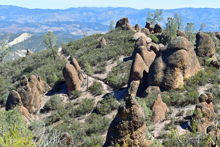
Pinnacles was established as a national park in 2013, making it California's newest national park. It's east of the Salinas Valley, with no road connecting the park's east and west access points, meaning visitors head to the park from either Salinas or Hollister.
All roads lead toward the High Peaks area of the park. These outstanding rock spires are a result of ancient volcanic eruptions and today host a wonderful network of hiking trails. The pinnacle of these trails, the High Peaks Trail, is a challenging upward climb with a few footholds chiseled out of the rock.
The High Peaks Trail is accessible from any one of the four staging points within Pinnacles. The quickest access is from the Bear Gulch Trailhead. It's approximately a 7.7-mile loop from Bear Gulch to see all the High Peaks Trail, with generous elevation gain. Several different loop options are available.
Pinnacles has plenty to see besides the strenuous high peaks trail. Visitors don't have to hike more than a couple of miles on the Condor Gulch Trail for a chance to see the namesake birds flying high above.
Hiking Tips: Every trail at Pinnacles National Park becomes extremely hot during the summer. Bring and drink plenty of water, and get as early a start as possible. An early start also helps with the other obstacle of summer travel: finding a parking space.
12. Laguna Coast Wilderness Park in Southern California
Laguna Coast Wilderness park comprises over 7,000 acres within some of the last remaining coastal canyons of Southern California. Sagebrush and elevation gains define much of the landscape, as well as a vast network of tamped-down hiking trails. And any one of these routes through the wilderness park transports hikers far from the hustle and bustle of the region.
The city of Laguna Beach buffers Laguna Coast Wilderness Park from the ocean. Dartmoor Street and Poplar Street have public access points into the park. Alternatively, most visitors access the wilderness park from several staging areas along Highway 133, also known as Laguna Canyon Road.
Expect elevation gain at Laguna Coast Wilderness Park. But this elevation lends to tremendous views, especially farther west in the park, closer to the ocean. The Big Bend Staging Area is a popular place to start a hike with an ocean view, requiring a short but steep trek to a saltwater vista.
Laguna Coast Wilderness Park is one of the largest units of the South Coast Wilderness area. The adjacent Crystal Cove State Park is also part of the larger wilderness area. Other units include Aliso and Wood Canyons Wilderness Park to the south and The City of Irvine Open Space farther inland. Similar hiking trails lace the entire South Coast Wilderness area.
13. See Waterfalls on the McCloud River Trail
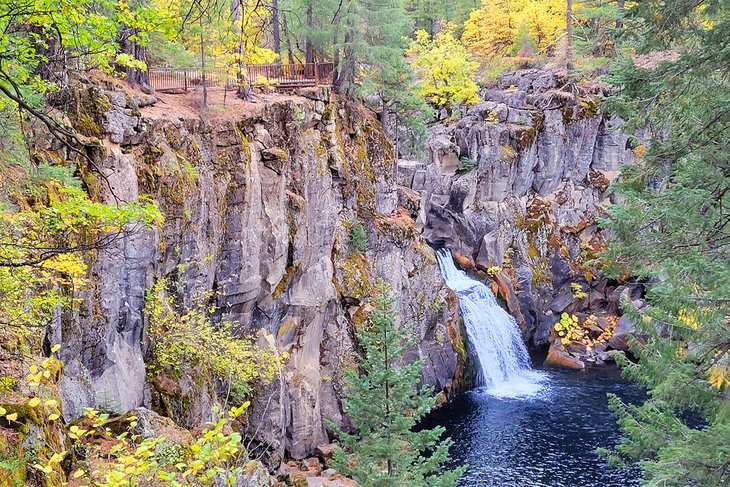
The McCloud River in Northern California is home to a series of stunning waterfalls. These brilliant displays of gravity are approximately seven miles east of McCloud, within Shasta-Trinity National Forest. And while it's hard to say which of the falls is the most scenic, it's a relatively easy four-mile round trip to see all three.
Many visitors start their waterfall journey at the popular Fowlers Campground. Here, alongside 39 sites, a paved trail quickly leads to Lower Falls via a stone staircase. The lower falls are little but incredibly scenic, with a lush pine forest surrounding the drop into the pool.
It's less than a mile upriver to the Middle Falls with minimal elevation gain. Middle falls drape across its rock edge rather than a full-fledge drop, offering a different perspective of the McCloud River. The Middle Falls are a popular swimming spot for those that bring their bathing suits.
The trail steepens from the base of Middle Falls to its top and toward Upper Falls. This switchbacking hike is well worth the moderate effort, though, as many would argue the Upper Falls is the best. An additional steep trail leads down from the viewing platform for a better look at the rushing water.
14. An Epic Hike to the Summit of Mount Whitney
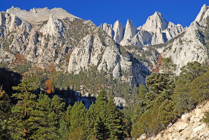
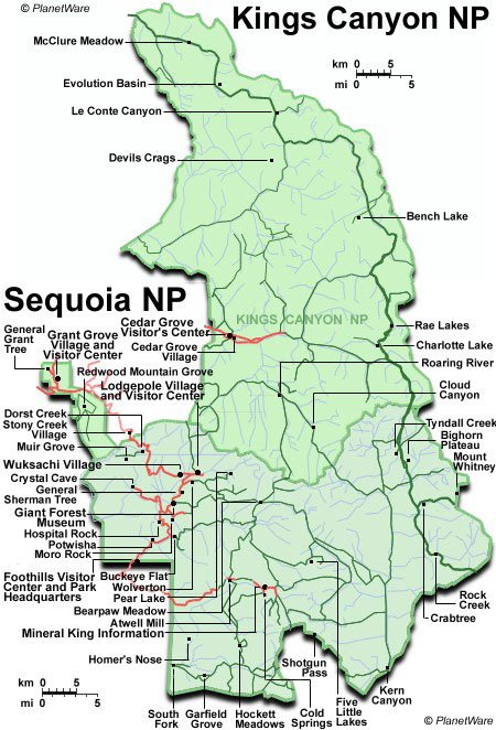
Soaring high above all the other mountains in California's Sierra Nevada range, Mount Whitney is the highest point in the lower 48 states. Mount Whitney is in Sequoia & Kings Canyon National Parks and is the southern endpoint of the John Muir Trail, named after the famous naturalist and advocate of wilderness preservation.
This epic hike requires a high level of fitness including altitude conditioning. Hikers need to set out before sunrise in order to complete the round-trip to and from the summit in one day.
The most direct trail to the peak of Mount Whitney is the 11-mile (22-mile round-trip) trail from the Mount Whitney Portal, 13 miles west of Lone Pine town. Starting at a trailhead with 8,360-foot elevation, the hike has a challenging 6,000-foot gain to the summit at 14,494 feet.
The Mount Whitney Portal also joins up with the legendary Pacific Crest Trail. This hike is one of the most physically demanding Pacific Crest Trail day hikes.
Hikers must start around 5 am in the morning in order to complete the 12-hour to 14-hour round-trip hike in daylight. The trail goes deep into the park's wilderness areas and offers sensational views along the way.
Hiking Tips: The Mount Whitney Portal Trail requires an exceptional fitness level and should only be attempted by advanced hikers who are well-conditioned. Besides being in peak physical fitness, hikers must be acclimated to the altitude (to avoid altitude sickness).
Hiking Conditions by Season: The hike does not require technical expertise from mid-July to early October. However, in spring and early summer, mountaineering techniques, including ice axes and crampons, are necessary.
Required permits: Hikers and overnight backpackers must obtain a wilderness permit before entering the Mount Whitney zone. Wilderness permits are available from visitor centers, ranger stations, and permit stations in Sequoia & Kings Canyon National Parks.
15. Lost Coast Trail: An Extreme Outdoor Adventure
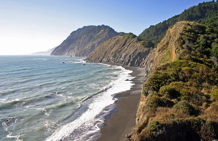
The Lost Coast Trail offers a rare glimpse of Northern California's most rugged and remote coastline wilderness. The trail extends for 34 miles alongside the Pacific Ocean in Humboldt County, nestled in ancient redwood forests several hours' drive north of Mendocino.
Adventurous backpackers are the only hikers seen on the Lost Coast. To hike the Lost Coast Trail requires at least a three- to four-day backpacking expedition. Advanced preparation is required before setting out (and carrying a tide chart is recommended). Portions of the trail become submerged and disappear at high tide, explaining the trail's name.
The northern part of the Lost Coast Trail is a 25-mile hike from Mattole Beach to Black Sands Beach in the King Range National Conservation Area. This part of the trail includes beach hiking, crossing streams, and tide pools, and hiking along rocky ocean bluffs. Many vantage points afford panoramic coastal views.
The southern part of the Lost Coast Trail is a nine-mile hike from Hidden Valley to Needle Rock in Sinkyone Wilderness State Park. This part of the trail traverses meadows, old-growth redwood forests, and chaparral-covered mountain ridges.
The Pacific Ocean along the Lost Coast has a deep turquoise hue, reminiscent of a tropical island, and the landscape of the Lost Coast is sublime. Hikers are awestruck by the almost mythical scenery of canyons, tide pools, waterfalls, dark sand beaches, and meadows blooming with vibrant wildflowers.
The Lost Coast's coves are home to sea lions and seals. During winter and early spring, it's possible to spot gray whales on their annual migration. Throughout the year, Roosevelt elk can be seen roaming the grasslands.
Hiking Tips: This hike is only suitable for advanced hikers and requires a challenging backpacking expedition. The trails are steep, and several portions of the trail vanish at high tide. Hikers must know the times when high tide occurs (twice a day) to avoid crossing certain sections of the beach at those times.
Trip Preparation: Advance preparation is the key to tackling the Lost Coast Trail. You must plan your itinerary ahead of time and bring a tide chart with you.
Permits are required for overnight camping in the King Range National Conservation Area. Request a permit in advance. A limited number of permits are issued on a first-come, first-served basis. No permits are available for walk-ins. Permits are not required for day use.
Shuttle services are available so that you can complete one leg of the trail without having to do the return trip. You can arrange to have a shuttle drop you off and pick you up at a specific time.
The King Range National Conservation Area is in a very remote area of Humboldt County, with long stretches not serviced by gas stations. Be sure to arrive in the area with a full tank of gas.
Camping Preparation: Campsites are rustic, with no potable water or trash cans. Backpackers must bring their own gear, food, and drinking water, as well as a filter to purify stream water. Food must be locked in bear canisters.
Campgrounds are available at King Range National Conservation Area on a first-come, first-served basis. Sinkyone Wilderness State Park has campgrounds available on a first-come, first-served basis; campgrounds must be reserved and paid for.
Know the Rules & Regulations of King Range National Conservation Area and Sinkyone Wilderness State Park before planning an expedition to the Lost Coast.
Map of Hiking Trails in California
More Related Hiking Articles on PlanetWare.com
Hiking Areas in California: If you are heading out to a specific area, or looking for a good place to base yourself for hiking, we've got a comprehensive list of articles to help you plan your adventure. Beginning with the parks, see our lists on the best hikes in Yosemite National Park and Redwood National and State Parks. In summer, the best hikes around Lake Tahoe are extremely popular. And if you happen to be in the Santa Barbara area, be sure to check out our top hikes in Santa Barbara.