15 Top-Rated Attractions & Places to Visit in Manitoba
Author Lana Law lived in Manitoba and returns every summer to spend time in Winnipeg and Whiteshell Provincial Park.
In the heart of central Canada, Manitoba is often overlooked as a tourist destination, but those who take the time to explore the province will find a wealth of unique experiences. Watching polar bears in the wild, seeing the northern lights, or enjoying a winter festival celebrating French Canadian history are just some of the memorable things to do in Manitoba.
The beaches around Lake Winnipeg and the beautiful provincial parks offer great retreats on hot summer days in this prairie province. For cultural attractions and city entertainment, it's hard to beat Winnipeg, the provincial capital.
For a more complete look at the highlights, see my list of top tourist attractions in Manitoba.
- 1. The Forks, Winnipeg
- 2. Polar Bears of Churchill
- 3. Canadian Museum of Human Rights, Winnipeg
- 4. Grand Beach
- 5. Riding Mountain National Park
- 6. Gimli & the Icelandic Festival of Manitoba
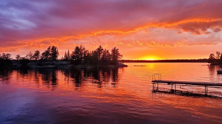
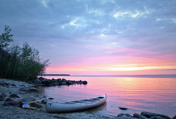
- 7. Whiteshell Provincial Park
- 8. Festival du Voyageur, Winnipeg
- 9. Lower Fort Garry National Historic Site
- 10. The Royal Canadian Mint
- 11. Narcisse Snake Dens
- 12. Pinawa Dam Provincial Park
- 13. Hecla Island & Lakeview Hecla Resort
- 14. Canadian Fossil Discovery Center, Morden
- 15. Mennonite Village in Steinbach
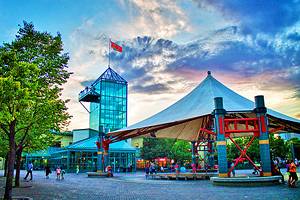
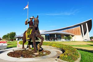
1. The Forks, Winnipeg
The Forks, located at the junction of the Red and Assiniboine Rivers near Winnipeg's downtown core, is the place to be in summer and equally fun in winter. The Forks Market and the Johnston Terminal Building are restored historical buildings housing a lovely market area with interesting shops, restaurants, and casual food stalls.
Some restaurants feature outdoor patios overlooking the Riverwalk that runs along the river. In winter, the outdoor skating rink is particularly popular with families. Also located at The Forks are the Manitoba Children's Museum and the new Canadian Museum of Human Rights. Skateboarders and BMX riders can try out their latest moves on Winnipeg's best skate park.
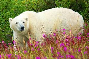
2. Polar Bears of Churchill
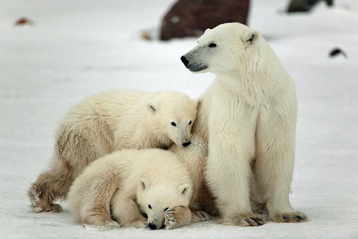
Churchill, popularly known as the "Polar Bear Capital of the World," lies on the harsh, rocky coast of Hudson Bay. In autumn, polar bears wander onto the ice-floes in the bay to hunt seals, and the town comes to life with visitors from around the world who come here to see these amazing animals. Tours in tundra buggies - giant large-wheeled vehicles with caged windows - allow visitors close up encounters with the bears.
Also of interest is the Itsanitaq Museum (also known as the Eskimo Museum) with exhibits of Inuit works of art and tools dating from 1700 BC through the Dorset and Thule cultures to the present day.
Fort Prince of Wales National Historic Site, built by the Hudson's Bay Company in the 1700s, can be visited during July and August, and is reached by boat.
Depending on the night, visitors may also be lucky enough to see a display of northern lights.
3. Canadian Museum of Human Rights, Winnipeg
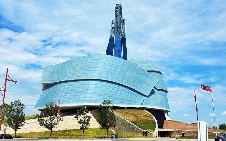
The Canadian Museum of Human Rights is Winnipeg's newest major attraction and an important addition to Canada's national museums. Many years in the making, the structure containing the museum is a unique, standout building with a design based on the Canadian landscape.
The museum focuses on a variety of themes that tell the stories of human rights issues from different perspectives. Permanent exhibits offer a look at the subject of human rights as it pertains to Canada and around the world. Changing exhibits offer insight into current human rights issues taking place across the globe.
Determining which stories would be told became the source of much tension and controversy during the planning stages, an indication of how important this museum is to so many people.
Address: 85 Israel Asper Way, Winnipeg, Manitoba
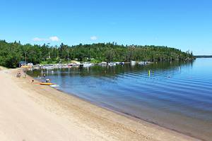
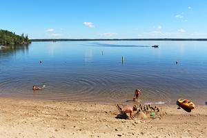
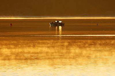
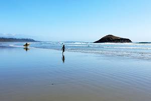
4. Grand Beach
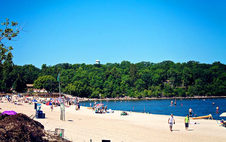
Grand Beach Provincial Park encompasses a huge stretch of soft sand beach on the shores of Lake Winnipeg, one of Manitoba's best lakes. The beach here is one of the best beaches in Canada and in the summer, it's a hot spot for sunseekers looking to get away from the city.
The park is about a one-hour drive from Winnipeg, and there are a variety of accommodation options in the area, from motels to cottage rentals. Restaurants in the area offer casual dining and entertainment.
Nestled in the trees and just a short stroll from the beach and towering sand dunes is the park campground with 350 sites. Spread over 17 bays, the sites are a mix of serviced and unserviced; some bays are alcohol free.
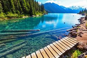
5. Riding Mountain National Park
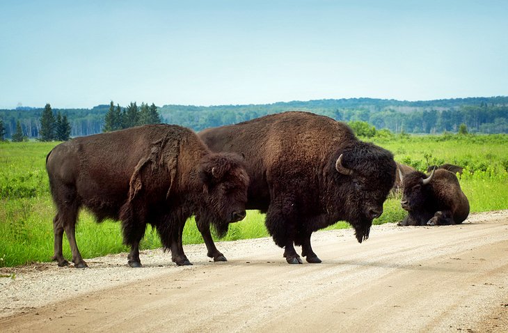
Accessible throughout the year, this scenic park is a combination of recreation area and nature reserve, with a varied landscape of prairie, forest, and wonderfully clear lakes and streams. The park extends over part of the glacially-formed Manitoba Escarpment where a series of plateaus rising to heights of about 340 meters overlook the surrounding prairies of gentle hills, meadows, and lakes.
The deep lakes in Riding Mountain such as Clear Lake, Lake Katherine, and Deep Lake are popular fishing spots. Near Lake Audy, you'll find a herd of bison roaming freely in a 552-hectare enclosure, Bears, wolves, elk, and deer also inhabit the park.
Numerous walking and cycling trails can be found throughout the park. One trail leads to the log cabin formerly belonging to the English naturalist Grey Owl who, in the early 1920s, wrote books about the wildlife of the area.
Official site: http://www.pc.gc.ca/eng/pn-np/mb/riding/index.aspx
6. Gimli & the Icelandic Festival of Manitoba
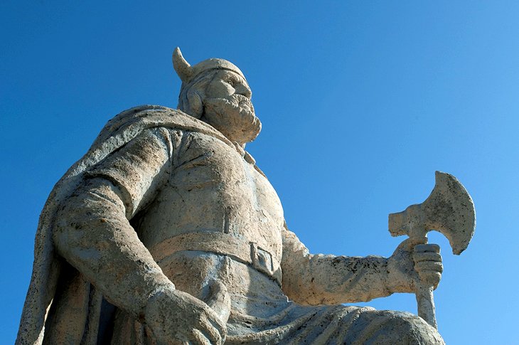
Gimli is a small resort town, approximately an hour's drive north of Winnipeg, on the shores of Lake Winnipeg. In the summer, Gimli comes to life as visitors and cottagers flock to this area to enjoy the beaches, restaurant patios, and ice-cream stands, and to take a stroll along the 298-meter-long seawall.
One of the annual highlights is the Icelandic Festival of Manitoba, known as Islendingadagurinn, which takes place over the long weekend at the start of August. The festival is a fun event for everyone with all kinds of activities and entertainment for children and adults.
Official site: http://www.icelandicfestival.com/
7. Whiteshell Provincial Park
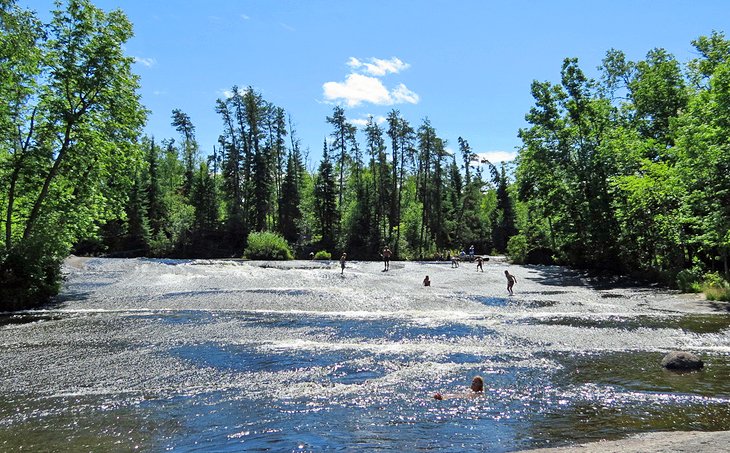
About a 1.5-hour drive east of Winnipeg is the Whiteshell Provincial Park, a popular summer destination for Winnipeggers looking to get away from the heat of the city and spend some time by the lake. The landscape is typical of the Canadian Shield, with hills, lakes, valleys, forests, and rivers. Moose, deer, black bear, and other wildlife inhabit the park. Cottages dot the shorelines of the lakes but much of the wilderness area is undisturbed.
The Whiteshell, as it's called locally, has four of the best campgrounds in Manitoba, and is also home to some of Manitoba's best beaches. The resort communities of Falcon Lake and West Hawk Lake, located in the southern end of the park, are popular weekend destinations, with small towns back from the lakes.
Golfers take note: Falcon Lake has one of Manitoba's best courses, a 6,922-yard track with some seriously challenging holes. The course has recently built a brand new architecturally stunning clubhouse with a fantastic patio out front, a perfect spot to relive the highlights and lowlights of your recent game.
Official site: http://www.whiteshell.mb.ca/no_flash.html
8. Festival du Voyageur, Winnipeg
One of Manitoba's premier winter events is the Festival du Voyageur, celebrating the French Voyageurs who transported furs in birch bark canoes. The Festival takes place each year in February in St. Boniface, the French-speaking district of Winnipeg.
The festival is popular with families, as well as adults. Outdoor events are featured prominently, from games to snow sculpting competitions. Traditional French music, cuisine, and other entertainment is held in outdoor tents. Despite the cold weather at this time of year, the event draws large crowds.
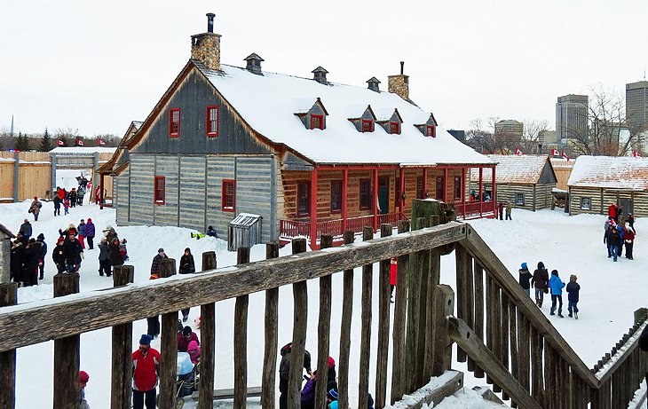
9. Lower Fort Garry National Historic Site
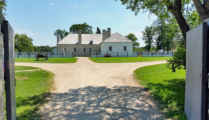
The Fort Garry National Historic Park outside Selkirk has as its centerpiece the only stone fort from the fur trading era to survive intact anywhere in North America. Lower Fort Garry was erected by the Hudson's Bay Company in the 1830s, becoming an important center for the fur trade and serving as a base for the exploration of the Northwest Territories. In later years, Lower Fort Garry was used successively as a training camp for the Royal Canadian Mounted Police, a prison, a mental institution, and a company headquarters.
The fort displays period furniture and household items painstakingly gathered together over a period of years from within Canada and also from Britain and the USA. Costumed Parks Canada employees act out the roles of the fort's earlier inhabitants. Visitors are able to talk to the "Governor" and his wife and to various employees and domestic staff. The result is a vivid impression of the complexities of life in a fur trading community.
Displayed in the building where the furs were stored are samples of pelts of every kind and a Hudson's Bay Company shop has been recreated, stocked with everything from clothing and household goods to beads, horse bells, traps, and blankets.
Address: 5925 Hwy 9, St. Andrews, Manitoba
Official site: https://www.pc.gc.ca/en/lhn-nhs/mb/fortgarry/
10. The Royal Canadian Mint
If you've ever wondered where the coins we use on a day to day basis come from, then you should be sure to make some time when visiting Winnipeg to stop in at the Royal Canadian Mint. This high tech and high security facility is open to the public and provides informative tours.
The tours are led by knowledgeable guides who provide history and background and also explain the production process. A boutique on site sells specialty coins along with other souvenirs.
Official site: https://www.mint.ca/store/mint/visit-the-mint/visit-the-mint-1200026
11. Narcisse Snake Dens
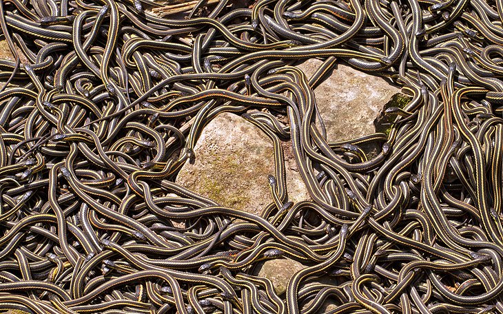
The Narcisse Snake Dens offer visitors a unique opportunity to witness a spectacle of nature each spring. In late April and early May tens of thousands of red-sided garter snakes emerge from their winter slumber and exit the dens, ready to mate. See the action from observation platforms near the four dens, and while you are peering down, watch for mating balls, which see as many as a hundred male snakes swarming a female.
The snakes leave the dens for the summer but return in the fall, where visitors again have the chance to see them, before the weather turns cold. The dens are six kilometers from the town of Narcisse, which is approximately 100 kilometers north of Winnipeg.
12. Pinawa Dam Provincial Park
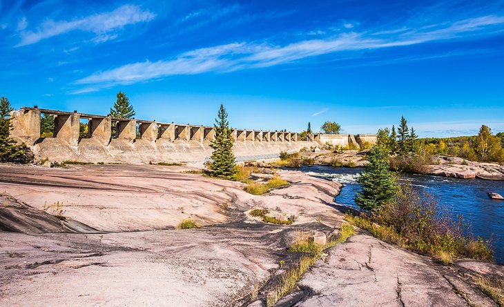
The crescent-shaped ruins of the 1906 Pinawa Dam are the central feature of this park, just a short drive north of the town of Pinawa. Set in a picturesque area of the Canadian Shield in Manitoba's cottage country, the park makes a nice day trip from Winnipeg, just 1.5 hours away.
Visitors can wander around the site on a self-guided tour and appreciate views of the old dam, which stopped operating in 1951, from the Centennial Spillway Trail. Also in the park are picnic facilities and an amphitheater.
13. Hecla Island & Lakeview Hecla Resort
For a nice escape to nature and a relaxing getaway in Manitoba, Hecla Island is a favorite destination. Part of Hecla-Grindstone Provincial Park, Helca Island is located on Lake Winnipeg, two hours north of Winnipeg.
In summer, you can hike the trails, golf at the 18-hole golf course, or simply enjoy the beaches and lake. In winter, head out on the cross-country ski trails, book a treatment at the spa, or relax around a fire.
For many people, Lakeview Hecla Resort is the main reason to come to Hecla Island. Set on the northern tip of the island, this resort offers indoor and outdoor pools, dining, a spa, and lovely rooms with views, some of which are pet friendly.
14. Canadian Fossil Discovery Center, Morden
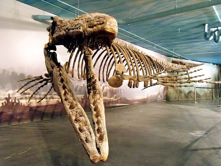
Containing Canada's largest collection of marine reptile fossils, the Canadian Fossil Discovery Center is worth making the 1.5-hour trip from Winnipeg to see. All the fossils here, including the huge mosasaur, known as Bruce, are from Manitoba. Due to ongoing research in the field, fossils are continually being added to the collection.
The center is open seven days a week. If you're coming to the town or driving across Highway 3 in southern Manitoba, you may want to plan a little extra time to stop in at the CFDC.
Address: 111-B Gilmour Street, Morden, Manitoba
Official site: https://discoverfossils.com/
15. Mennonite Village in Steinbach
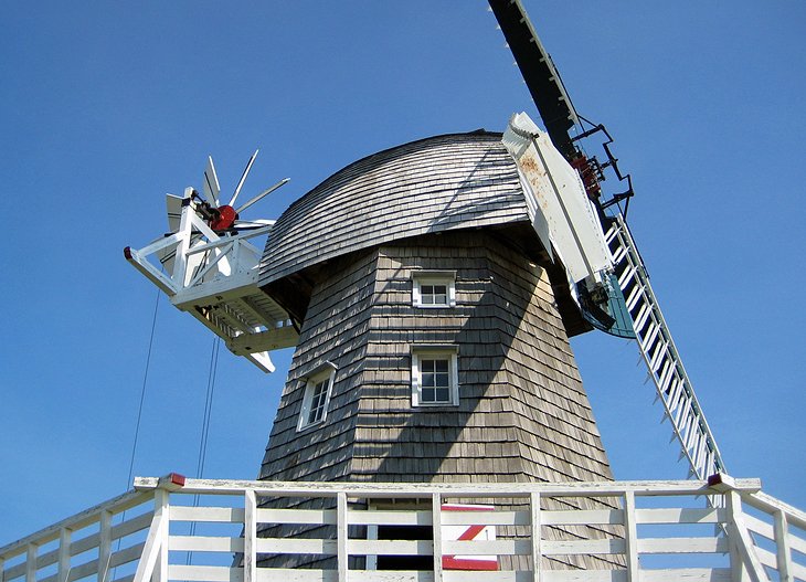
The Mennonite Heritage Village in Steinbach recreates Mennonite life from the 16th century to the present day, and features changing themes. More than 20 furnished buildings are spread over 17 hectares, showcasing a time when villages like this could be found all across Southern Manitoba.
One of the most prominent structures on the site is the large Dutch windmill, which can be seen from the highway. Be sure to stop in at the gift shop and check out the locally made hand crafted items.
Address: 231 PTH 12N, Steinbach, Manitoba
Official site: http://www.mennoniteheritagevillage.com/
More Related Articles on PlanetWare.com
The Best of Canada: To make Manitoba part of your larger trip across Canada, have a read through our Canada Itineraries. Manitoba's central location means it's often visited in combination with the provinces of Ontario and Saskatchewan, but flights from Winnipeg can quickly connect you with cities across the country. Explore other options with our articles on the Best Places to Visit in Canada and the Top Tourist Attractions in Canada.