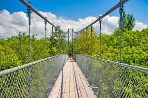
12 Best Hiking Trails in Algonquin Provincial Park
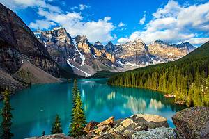
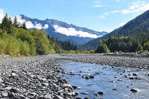
Just a few hours north of Toronto, Algonquin Provincial Park is Ontario's most popular park, with beautiful lakes, rivers, and unspoiled wilderness teeming with wildlife. Excellent hiking trails, ranging from less than a kilometer to multi-day treks, allow access to some of this wild terrain.
Trails range from easy, flat walks along boardwalks to more difficult routes that climb over ridges to outstanding lookouts. Many of these lead through marshes and bogs, around beaver ponds and lakes, through stands of old pines, along rock outcrops, and past remnants of historic logging camps.
In the spring, you can often see moose and other animals along the roadside or trails. Summer is the busy season, but there are enough hikes in the park that trails are not overly congested.
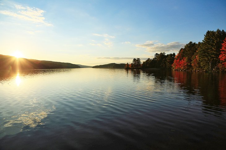
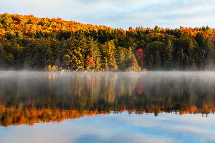
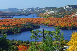
In the fall, Algonquin puts on a spectacular show as the leaves turn bright red, orange, and yellow. Hiking the trails along the high ridges that look out over the forest and lakes is one of the best ways to experience the season.
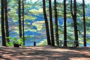
Most of the trails listed here are located along the Highway 60 corridor running through the park, but a couple are found on the east side, near Achray. If you are camping, you'll find hiking trails that leave directly from some of the campgrounds in Algonquin.
Determine the trail you want to tackle with our list of the best hikes in Algonquin Park.
- 1. Centennial Ridges
- 2. Track and Tower
- 3. Beaver Pond Trail
- 4. The Lookout
- 5. Mizzy Lake Trail
- 6. Barron Canyon, Achray
- 7. Big Pines
- 8. Spruce Bog Boardwalk
- 9. Hardwood Lookout
- 10. Jack Pine Trail, Achray
- 11. Logging Museum Outdoor Exhibit Trail
- 12. Whiskey Rapids
- Map of Hiking Trails in Algonquin Provincial Park
- When to Hike in Algonquin Park
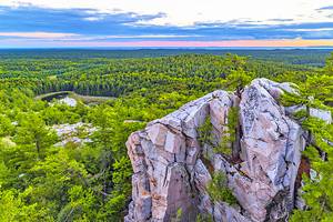
1. Centennial Ridges
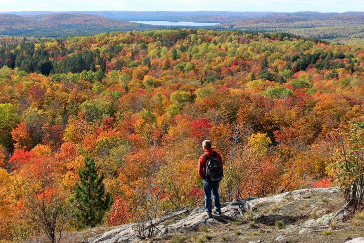
Centennial Ridges is a spectacular hike along a series of rock ridges with lookouts in various directions, over lakes and trees. This is arguably one of the best fall hikes in all of Ontario, with deciduous trees that show off bright yellow, orange, and red colors, mixed in with the green of the pines.
This 10.4-kilometer hike is rated difficult by the park. Technically, it is only moderately difficult but it does have many ups and downs as you traverse ridges and it is one of the longer hikes in the park. The suggested time for this trail is six hours, but most hikers can complete it in 4.5 to five hours.
The turn for Centennial Ridges is at kilometer 37.6 on Highway 60, and is about two kilometers from the highway. On fall weekends, this trail can be very busy, and you may have to park well back from the trailhead.
2. Track and Tower
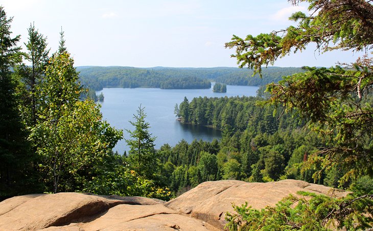
The Track and Tower Trail is a 7.5-kilometer hike with a mix of scenery. The highlight is the spectacular view from the top over Cache Lake, but the trail winds through the forest, past huge rock cliffs, along the lakeshore, and down an old railway bed. There are a number of interesting things to see along the hike, including the remains of old railway bridges.
This hike is rated difficult by the park but this is largely due to the fact that it has a considerable amount of elevation. Otherwise, it is not a technically difficult trail.
The steepest section has a huge set of stairs that will get your heart racing, but it does make the climb easier than having to walk up over rocks and roots.
The trailhead parking is at kilometer 25 on Highway 60. The total time for this hike is between three and four hours.
You can also do a hiking and biking combination that includes a ride along the Old Railway Bike Trail and a short hike up to the lookout point of the Track and Tower Trail. From the Lake of Two Rivers Campground, which is also the location of the Two Rivers Store, where bike rentals are available, you can bike about 8.5 kilometers along the well-marked rail trail until it dead ends and joins up with the Track and Tower hiking trail.
Washrooms and bike stands are located at this point, so you can lock up your bike. From here, hike 1.35 kilometers uphill, including up a long set of stairs, to the lookout point and then return along the same route. The round-trip for this hike-and-bike trip takes about three hours.
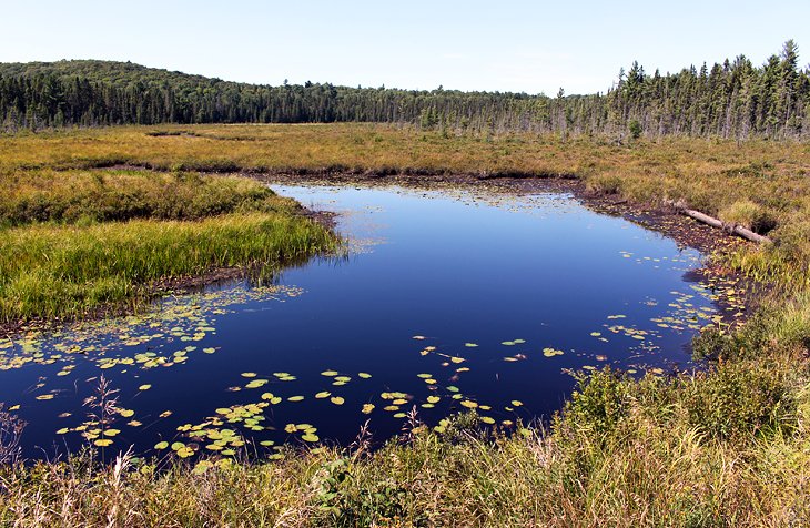
3. Beaver Pond Trail
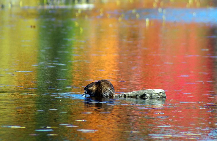
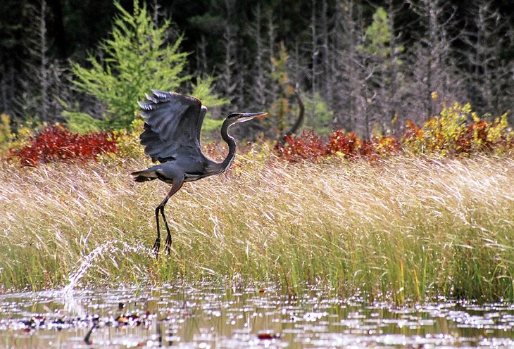
This trail leads past two beaver ponds and is a favorite hike for many repeat visitors to Algonquin. This is a good place to spot wildlife, especially beaver, which can often be seen dragging trees through the ponds or moving along the shorelines on game trails. Chances are much better in the spring and fall, but they can be seen at any time. At the very least, you can see some of their work, with beaver dams and beaver houses visible in the ponds.
Depending on the time of year and some luck, you may also see moose, turtles, and other small animals.
The landscape on this trail is very typical of Algonquin and Ontario wilderness in general. The trail leads through forest; past beaver formed lakes, some of which is crossed on a boardwalk; and up and over rock ridges that provide good lookout points along the hike.
Although this is only a two-kilometer trail, it is over uneven ground with roots and some up-and-down sections. It will take about one to 1.5 hours to complete; longer if you see animals and decide to linger.
4. The Lookout
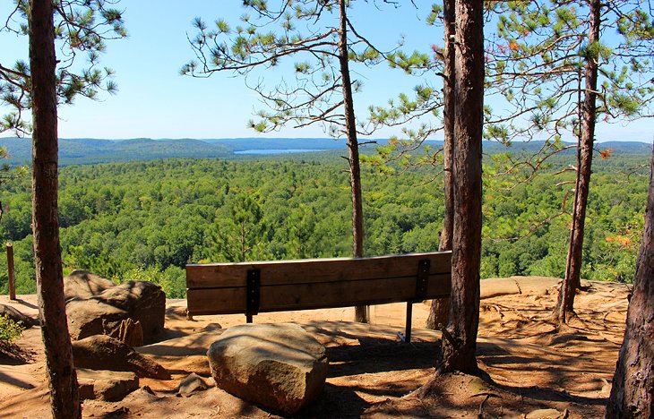
The Lookout Trail, at kilometer 39.7 on Highway 60, is a two-kilometer hike up to a beautiful lookout point that can be particularly inspiring when the fall colors are peaking.
This is a fairly steep hike to the top along a wide trail. At the top are a series of lookouts along a pine-covered ridge. The view extends out over a forest of mainly deciduous trees, rolling hills, and a small lake in the distance. A couple of shade covered benches at the top provide a great resting spot.
The park rates this hike as difficult but this is not a technically difficult trail, just a cardio workout due to the steep trail. Total time for this trail is about one hour.
At marker #2 along the trail, which marks a glacial erratic, an arrow points to the right. If you instead go left, this is a slightly shorter trail to the lookout but it is steeper. The shorter trail doesn't save much time, and the best option is to hike the full route.
5. Mizzy Lake Trail
If you are looking for a full-day hike, Mizzy Lake Trail is perfect. This 10.8-kilometer trail leads through typical Canadian Shield topography, past ponds, marshes, and lakes. Leave early in the morning because this hike will likely take longer than you expect. This will also give you the best chance of spotting wildlife.
The Mizzy Lake trailhead is located off Highway 60, east of the Hardwood Lookout trail. Note that in the spring or after heavy rains, this trail can be very wet and muddy.
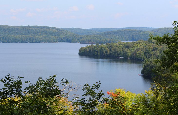
6. Barron Canyon, Achray
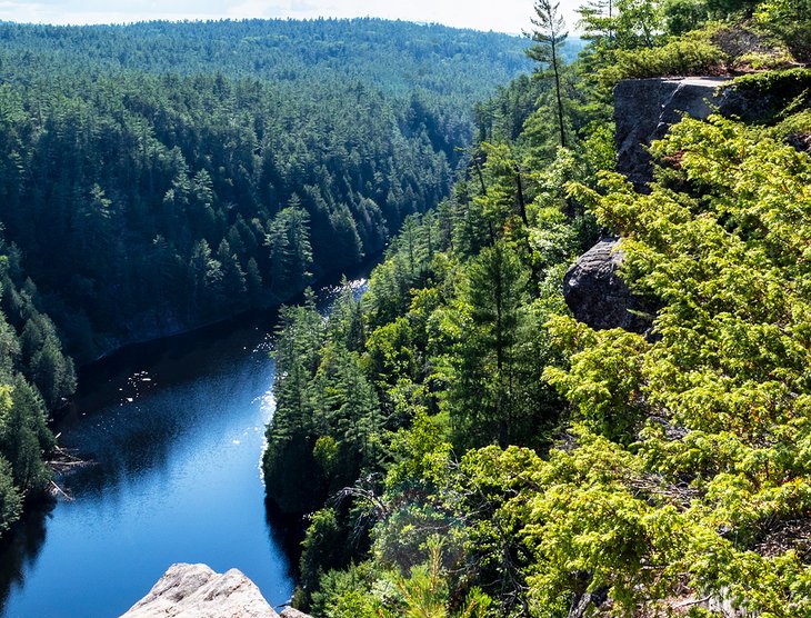
Barron Canyon is one of Algonquin's lesser visited attractions, not because it is less spectacular, but because it's in a more remote part of the park. Canyon walls rise up 100 meters along the sides of the Barron River, which is also a popular canoeing area.
Along the north rim, the 1.5-kilometer Barron Canyon Trail (loop) provides beautiful views over the water and forest.
Barron Canyon is not set along Highway 60. It's located on the east side of the park near Achray, about an hour from Pembroke, on Barron Canyon Road.
7. Big Pines
At kilometer 40.3 on highway 60, the Big Pines hiking trail is a 2.9-kilometer trail through forest and past the remains of an 1880s logging camp. The ruins are fenced off and almost non-existent to the untrained eye.
This hike is about seeing some really large white pines and learning a little about the logging history in the area. The giant trees scattered along the trail remain because they were not cut down when the area was logged.
Most of these big pines are located near the start of the trail, which is hiked in a counter-clockwise direction. The trail then passes the location of the former logging camp and loops around, past a wetland area.
A trail guide, which can be obtained at the start of the hike, corresponds to signposts along the way and discusses the history of the area and provides information on the trees.
This is a fairly easy trail but does have uneven ground and rolling terrain. The park's suggested hiking time for this trail is two hours, but it can be easily completed in one to 1.5 hours.
If you don't have much time but want to see some big white pines, just walk in to marker three or four. The largest tree on the trail is at marker three, but just beyond here are some of these towering pines growing over huge rocks, with exposed tangled roots that trail down over the boulders.
8. Spruce Bog Boardwalk
In the same vicinity as the Big Pines and Lookout trails is the Spruce Bog Boardwalk, at kilometer 42.5 on Highway 60. This 1.5-kilometer trail is an easy walk that the whole family can enjoy. Much of the trail is along a boardwalk over the bog or on flat and hard-packed trail through a spruce forest.
The Spruce Bog trail is a good introduction to this type of wetland, where you might see birds, turtles, water lilies, and other wildlife. Much of this trail is in full sun with no shade, so it is best to hike it in the morning or on cooler days. Total time for this trail is about 30 minutes, although the park recommends one hour.
9. Hardwood Lookout
This short hike is just under one kilometer in length round trip but is a steady climb up to the scenic lookout point. The view over the trees and Smoke Lake is lovely, and there is a bench at the top, so you can stop and rest.
The trail runs in a counter-clockwise direction, but if you do this hike in a clockwise direction, the lookout is only a short walk from the trailhead and much less strenuous.
The trailhead and parking is at kilometer 13.8 on Highway 60, just a short distance from the Tea Lake Campground, and the hike takes between 30 minutes and one hour to complete.
10. Jack Pine Trail, Achray
One of Canada's famous Group of Seven artists, Tom Thomson, spent several summers in Algonquin Park. One of his most famous works, The Jack Pine, was inspired by the landscape of Algonquin at Achray on Grand Lake.
The Jack Pine Trail is a 1.6-kilometer trail that leaves from the Achray Campground and leads to a lookout over Grand Lake, where the actual jack pine, long since dead, once stood. This short hike is no more impressive than other hikes, but the historical significance makes it worthwhile if you are in this area of the park.
Achray Campground is located a little over 1.5 hours from Pembroke, on the east side of Algonquin Park.
11. Logging Museum Outdoor Exhibit Trail
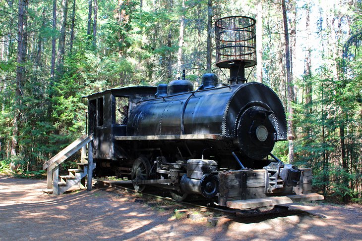
Near the East Gate, at kilometer 54.5 on Highway 60, is the Algonquin Logging Museum and the Outdoor Exhibit Trail. This 1.3-kilometer trail runs behind the museum through the forest, past a marshy area and small river. Along this scenic walking trail are exhibits related to the logging history in the park.
The progression of the industry and the equipment is laid out in a chronological order, with the oldest equipment and methods displayed at the start of the trail. Recreated buildings also show the lodging and what life in a logging camp was like.
This is an easy, level trail that takes about one hour if you stop to read the plaques and see the sites, less if you are just out to enjoy nature or are looking for birds and wildlife.
12. Whiskey Rapids
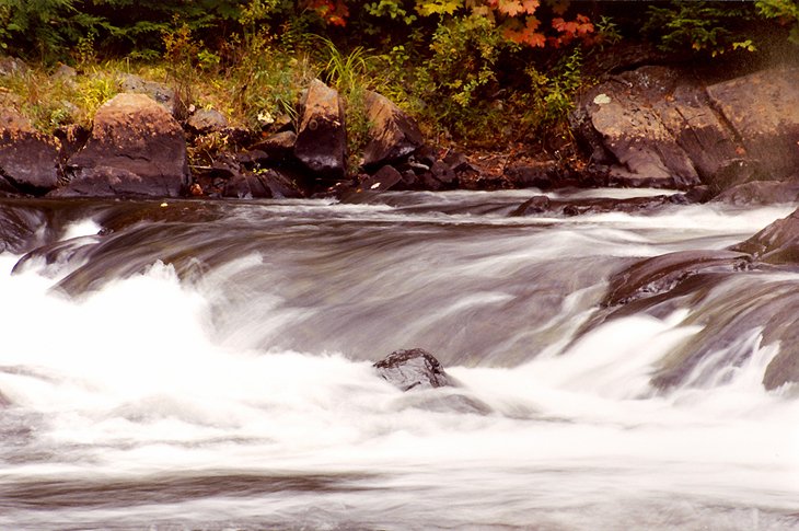
At the west end of Algonquin Park, Whiskey Rapids is a relatively easy 2.1-kilometer loop trail, with a couple of steep sections near the start and end. The route follows the Oxtongue River to Whiskey Rapids, the highlight of the walk. Since this is a river hike, the water level varies depending on the season and can be flooded in the spring, so be sure to check with the park office.
This hike takes about 1 to 1.5 hours and is usually less busy than hikes in the more central area of Algonquin, and offers a good chance of seeing wildlife.
Map of Hiking Trails in Algonquin Provincial Park
When to Hike in Algonquin Park
When you plan a hike in Algonquin Park, it's important to pay attention to the weather forecast. Algonquin Park is part of the Algonquin Dome and is higher than the surrounding areas. This elevation creates its own weather: it can be sunny and warm in nearby Huntsville, but pouring rain and cold up at the Track & Tower Hike, while over at Achray, on the east side, the wind is howling.
With regards to the seasons, the central part of the park is also colder in general, meaning later spring melts, and the fall colors show up earlier. Don't be surprised to see snow in the park into May.
The other main thing to bear in mind is that insects can be a significant barrier to enjoyment. Late May and almost all of June are black fly season, a pesky insect that will drive you mad, as they bite you mercilessly. Bring bug spray. A stretch of hot weather usually wipes them out. You'll only need to deal with mosquitos and horseflies for the balance of July. Mid-August, September, and October are almost bug-free.
Ensure you bring bug repellant with DEET, it's the only thing that stops the biting insects in the park.
July and August are wonderful months for hiking, but this is also high season, so be prepared for busy trails. If you go early in the morning, you'll likely have the trails to yourself and have the best chance for spotting wildlife. September is a pleasant month as well, with few other people around. Come the first or second week of October, the leaf peepers descend on the park, and the trails are packed.
More Related Articles on PlanetWare.com
Ontario Outdoors: For more great hiking in Ontario check out our guide to the Best Hikes in Killarney Provincial Park. For a look at where to camp in Algonquin see our article on the Best Campgrounds in Algonquin or extend your geographical range a little further north and learn about the Best Camping Areas in Killarney Provincial Park. Plan more Ontario wilderness adventures with our guide to the Top Ontario Parks.