9 Best Hikes in Killarney Provincial Park, ON
Author Lana Law lives in southern Ontario and has spent years camping and hiking in Killarney Provincial Park.
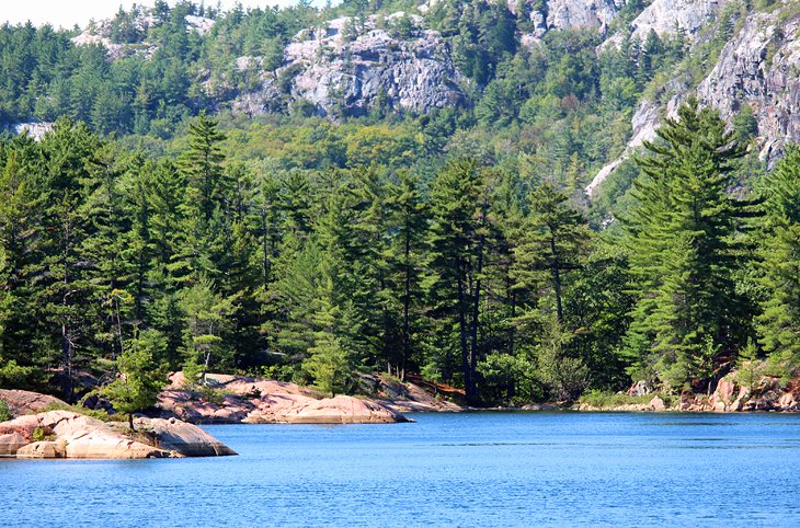
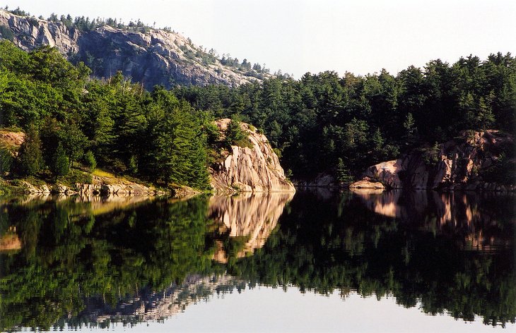
Killarney Provincial Park and the surrounding mountains and forests just outside the park are home to some of the best hiking trails in Ontario. The white quartzite mountains, the placid inland lakes, and the dramatic scenery of Lake Huron's Georgian Bay create a diverse landscape that offers a range of hiking experiences.
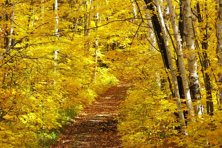
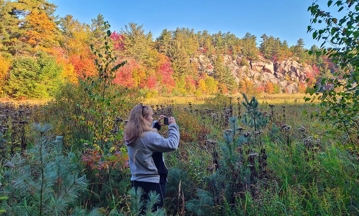
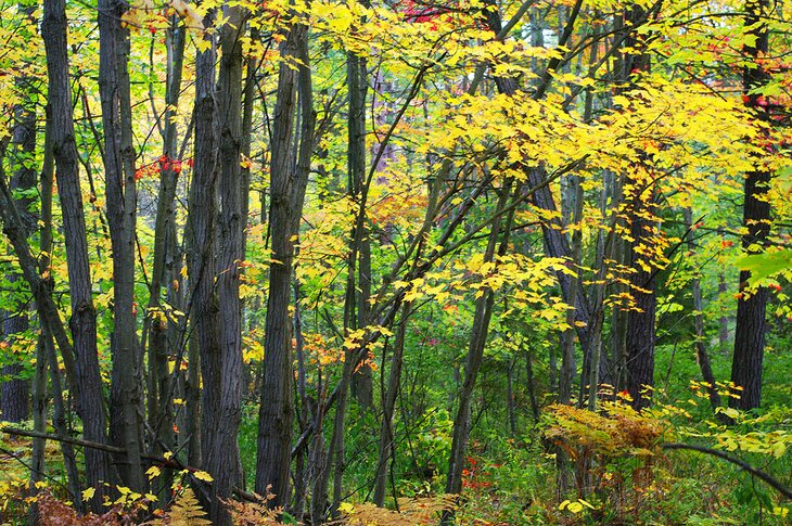
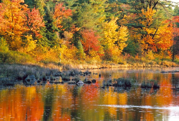
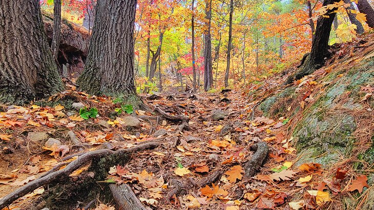
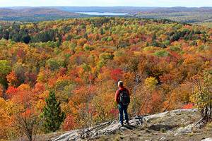
This is my favorite park in Ontario, specifically because of the fabulous hiking. And I never get sick of hiking here. Each season is different. Fall is spectacular for photography but it's also extremely busy. The spring is a great time to see wildlife but you have to be sure and bring your bug spray. Summer is simply wonderful when you can swim in the lakes and really enjoy all that this park has to offer.
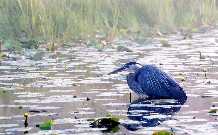
From the trails, you can see sailboats racing across the sparkling blue water of the Bay and canoes drifting silently along still lakes. Wildlife is abundant in the park: black bears, deer, moose, and fox are all common sights.
The park maintains a number of trails within the park boundary. Outside the park, most trails are maintained by the municipality or local hotels.
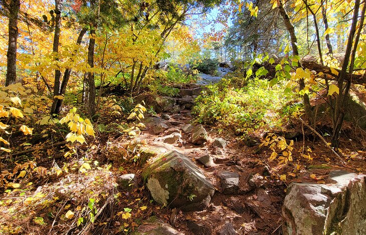
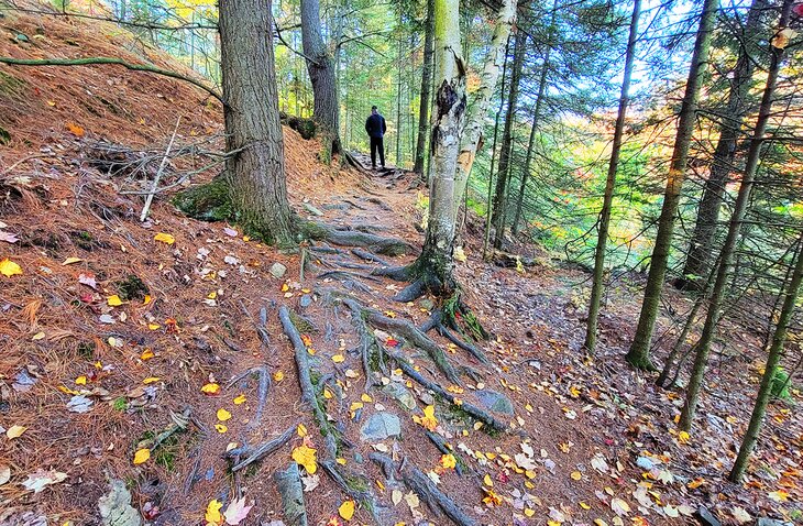
In the park, most hiking trails are marked by blue and red markers on trees or painted on rocks. Over open rock sections, stone piles also indicate the direction. Trails outside the park use a range of markers but are usually noted by colored paint marks on trees and rocks. Some of these routes are more difficult to follow than those within the park.
Hiking distances listed below are for round trips unless otherwise stated.
Killarney Provincial Park is one of the most popular parks in Ontario, not just for hiking, but also for camping. If you're planning on camping while you're here, book well in advance.
To decide which trail is best for you, see my list of the best hikes in Killarney.
See also: Where to Stay in Killarney
1. The Crack
Overview: A difficult hike with fantastic views over the park
- Difficulty: Difficult (elevation gain and technical challenges)
- Length: 6 km
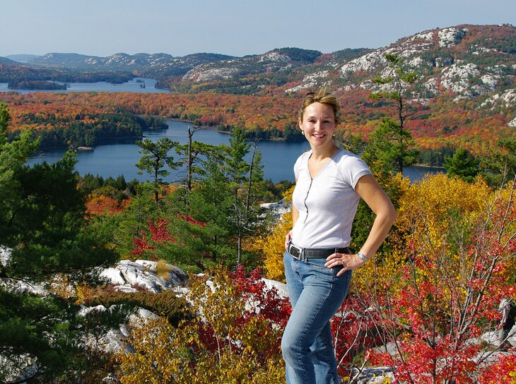
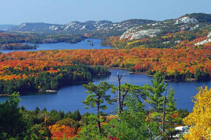
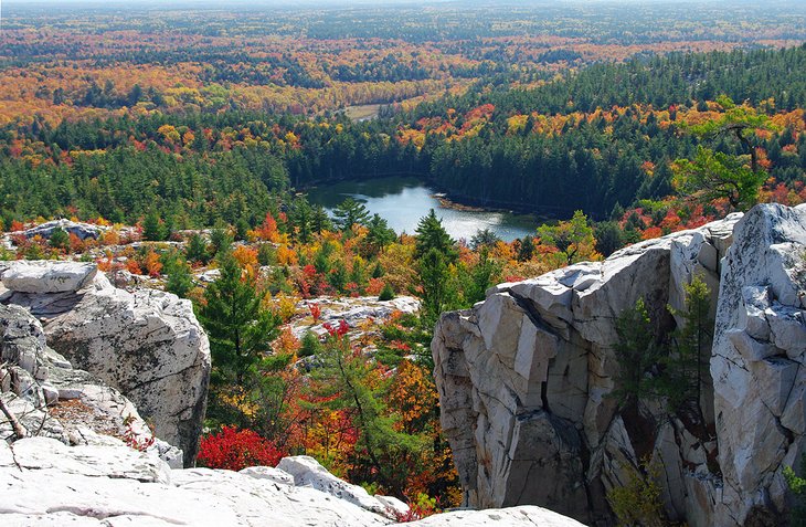
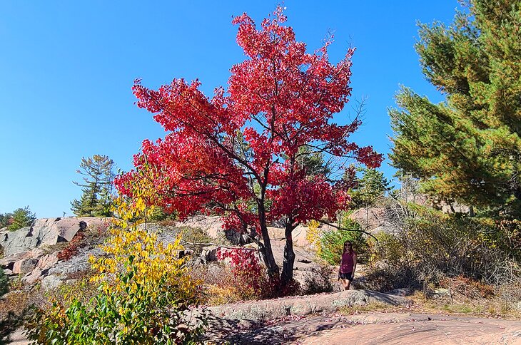
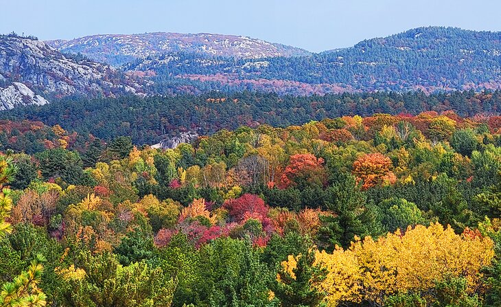
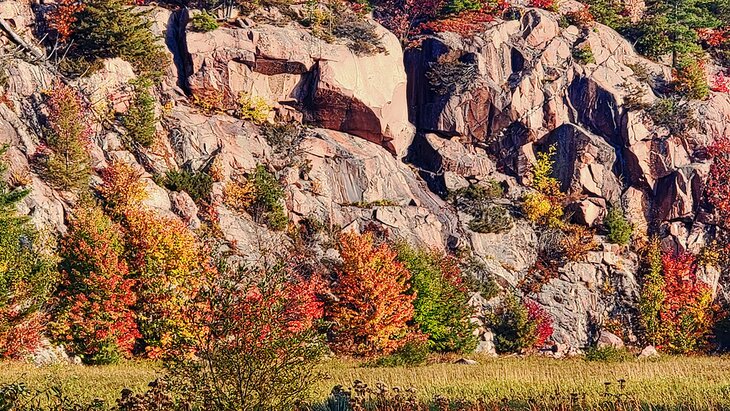
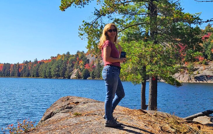
The Crack is Killarney's premier hike, showcasing the area's white rock mountains and offering an amazing view of the inland lakes. In the fall, when the leaves change color, this hike is one of the best in all of Ontario.
But the reward does not come easy. The Crack is so named for a crack in the mountains, where huge rocks have tumbled down the upper portion of the hike, creating a tough scramble over boulders that requires the use of both hands and feet.
Fortunately, the crack is only one small section near the top, and most hikers can easily do it if they are fit enough to handle the ascent up to this point.
Unlike many of the hiking trails around Killarney that are a chain of short ups and downs, this trail is like a mountain hike, with a long grind to the top and a return trip down the same route. I often see people turning around halfway through the trail, or waiting near the top just before the crack for the rest of their group who has gone on to the top, when they realize it is more than they were expecting.
The entire trail is six kilometers, and it lies within Killarney Provincial Park. The route is well marked and well maintained and on average takes between three and four hours.
The trailhead is located along the main highway, seven kilometers east of the park office.
Note: This is the busiest hike and you may not get parking if you are here on a fall weekend. You must be registered with the park to hike this trail, so do not plan on doing this hike before going to the park office unless you have a park pass.
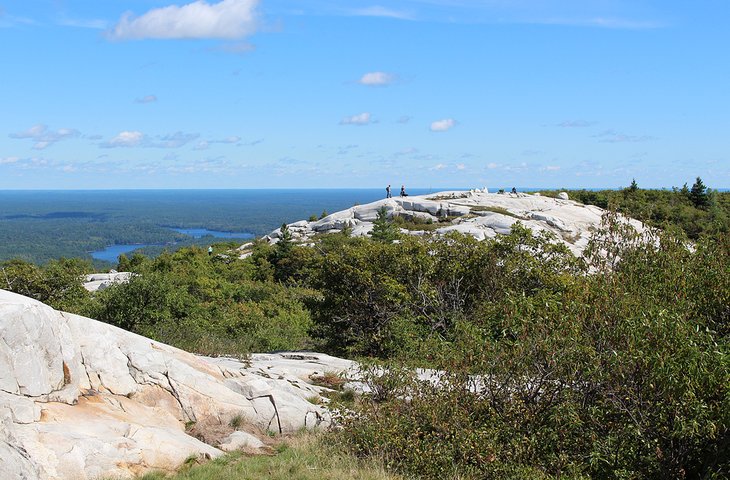
2. Silver Peak
Overview: Short paddle to the trailhead, moderately difficult hike, views from the highest point in the park
- Difficulty: Difficult (strenuous but not technically difficult)
- Distance: 6 km paddle, 12 km hike
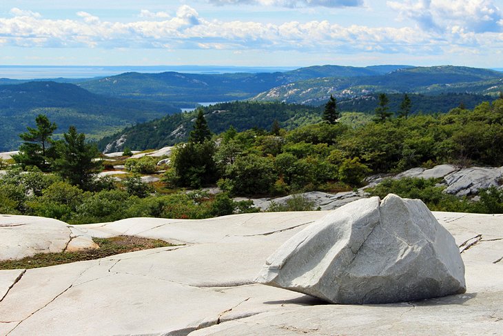
Silver Peak, in the La Cloche Mountains, is the highest point in Killarney Provincial Park and is regularly featured in paintings and photographs of the park. From the top of this gleaming white quartzite peak are unobstructed views in every direction, looking out over the surrounding lakes, rolling mountains, and beyond to Georgian Bay. This is without a doubt, the best view in the park, but it takes a bit of effort to get here.
To do this as a day hike, the trailhead is only accessible by canoe or kayak, with a three-kilometer paddle one-way.
From the trailhead, the hike follows an even path through the forest for about three kilometers and then takes a sharp turn and climbs up 2.5 kilometers to the peak. This last section is a steady climb with steep sections and eventually climbs out of the trees onto the gleaming, white bald mountain peak. At the top are two lookout areas on adjacent peaks.
This is a 12-kilometer round-trip hike, with a six-kilometer round-trip paddle. The only other option is to do this hike as a spur off the 78-kilometer La Cloche Silhouette hiking trail. From the George Lake Campground, it is 25 kilometers one way on the La Cloche Silhouette trail to the Silver Peak trail.
The access for this hike is at the end of the Bell Lake Road, where a park office and on-site canoe rentals are available through Killarney Kanoes. The paddle is quite easy, and the trailhead is relatively easy to find at the far end of a bay, meaning you can't paddle past the trailhead.
I like this hike for the views at the top but the rest of the hike is just about getting to the viewpoint.
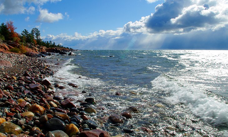
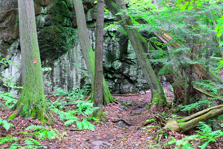
3. Chikanishing Creek
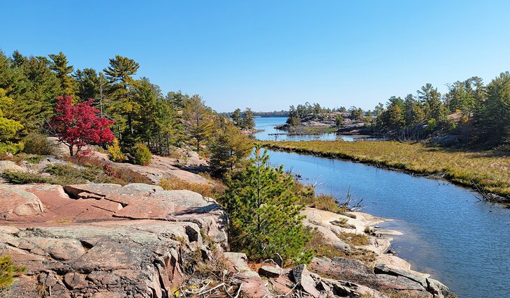
Overview: Scenic hike along ridges with views over Georgian Bay
- Difficulty: Moderate (uneven ground and ridges to negotiate)
- Distance: 3 km
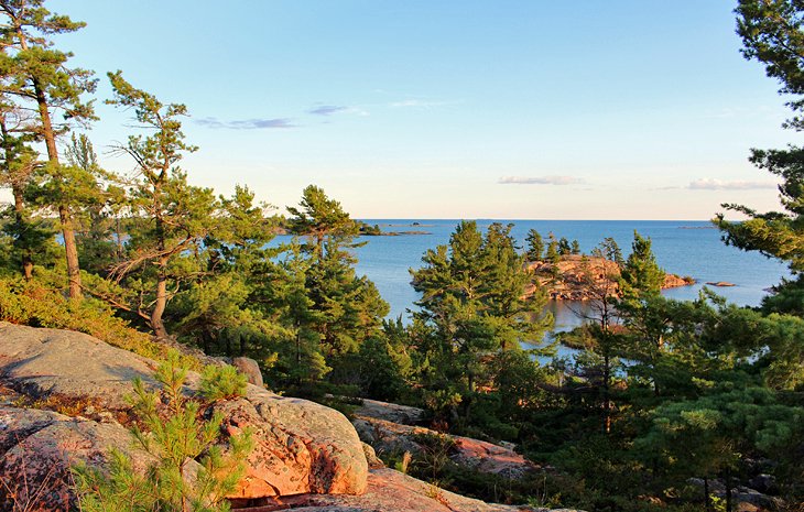
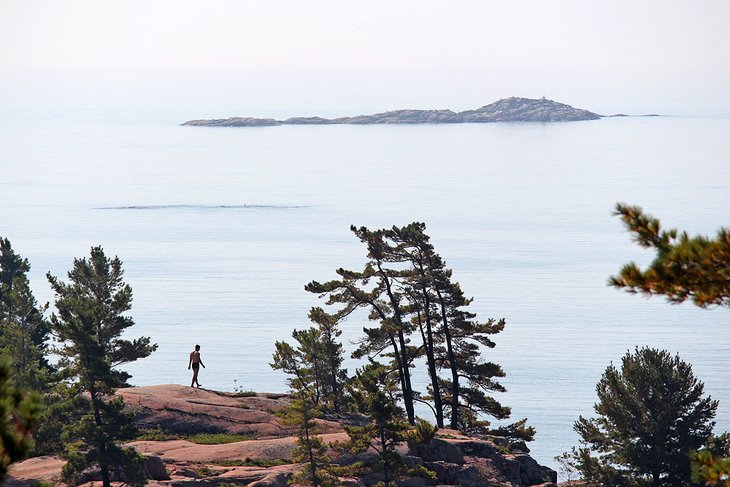
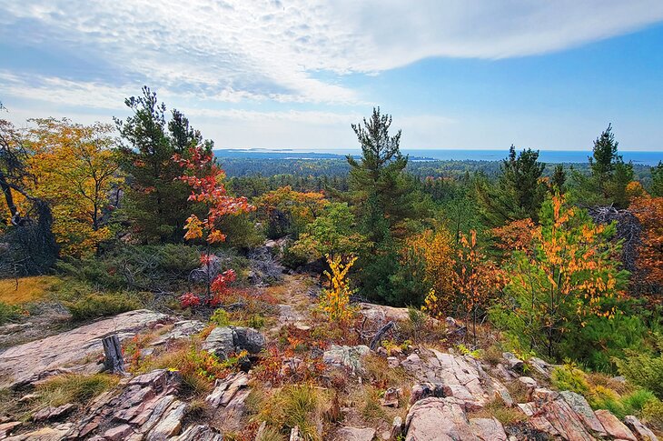
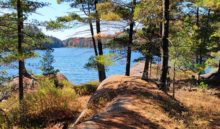
Chikanishing Creek is a lovely hike that affords beautiful high views over the creek, Georgian Bay, and islands and rocks. It also allows direct access to the rocky shoreline of Georgian Bay.
This is my go-to hike that I always do when I go to Killarney. It's more than just the view at the end, the whole hike is enjoyable and it has a good effort-to-reward ratio. I don't always go right out to the water's edge, I often just go to the high lookout over the Bay.

This three-kilometer hike traverses rock ridges along Chikanishing Creek all the way out to Georgian Bay. To the highest lookout, just before the descent to the shoreline, the trail is relatively easy to moderate. Beyond the lookout, the trail makes its way down to the water, with some tricky rock sections that may require the use of both arms and legs to climb over ridges.
On a hot summer's day, I suggest going right to the end. Along the shoreline, the smooth rocks offer a delightful area to relax or go for a swim. Long, wide veins of quartzite run through the red rock and snake their way into the shockingly clear water. The trail then climbs back up and over the ridge and returns through a forest path.
Total time for this hike is about one to 1.5 hours. If you are short on time or don't want to tackle the hike down the rocks to the Bay, you can hike out to the lookout, where there is a plaque, in about 20 minutes, and return the same way you came for a round-trip of 40 minutes. This is the most scenic portion of the route.
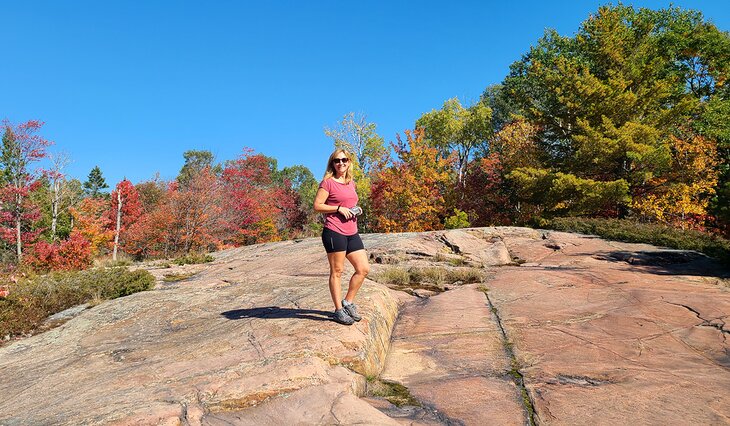
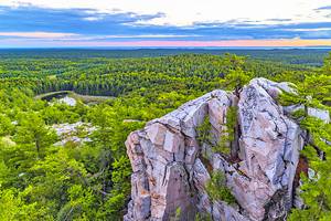
4. Granite Ridge
Overview: Hike past remains of old cars and up to a ridge for sweeping views
- Difficulty: Moderate (steep sections)
- Distance: 2 km
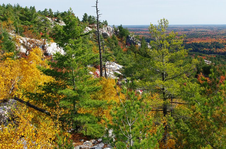
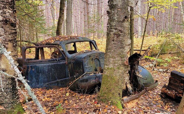
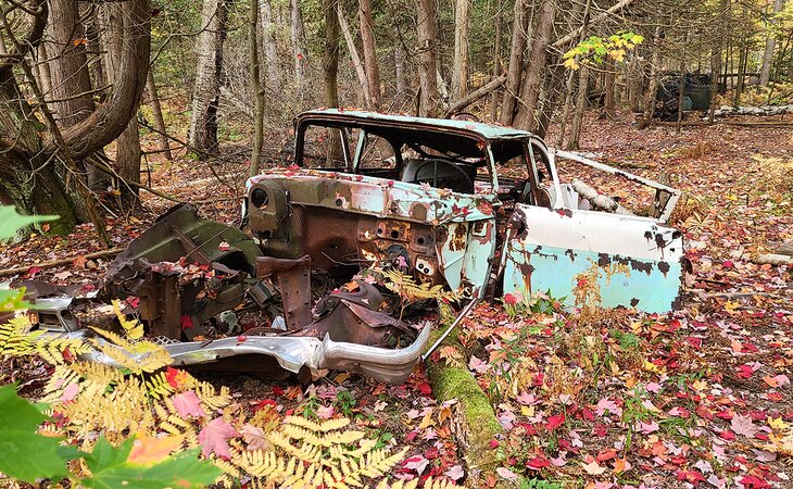
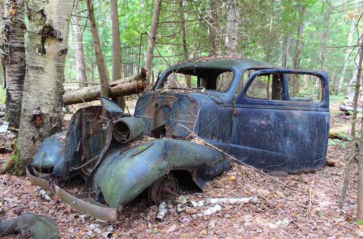
Granite Ridge is a fabulous two-kilometer hike with a mix of history and scenery. Most people hike this trail for the view from the high points that look out over the forest to the La Cloche range and to a distant view of Georgian Bay, but there are other attractions along the trail.
This area was once occupied by homesteaders, and remnants from their time here still remain. If you know where to look, there are some hidden treasures along the way, particularly for photographers.
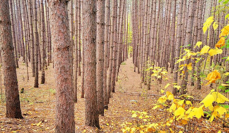
The trailhead is directly across the highway from the Killarney Provincial Park office. The hike begins as a very easy walk in the woods along a level path through stands of pines, planted long ago in uniform rows, and naturally growing mature birch trees. Sign-posted numbers found along the route correspond to a pamphlet that is sold at the park office and offers information on the vegetation and some of the sites along the way.
At marker #3, a trail leads off to the right, down a gentle hill through a row of pine trees. This is not a maintained portion of the trail, but at the bottom, and just off to the right about 50 meters, are a number of old cars and trucks from around the 1950s. They were abandoned here decades ago, and trees have fallen on some of them or grown up between the frames.
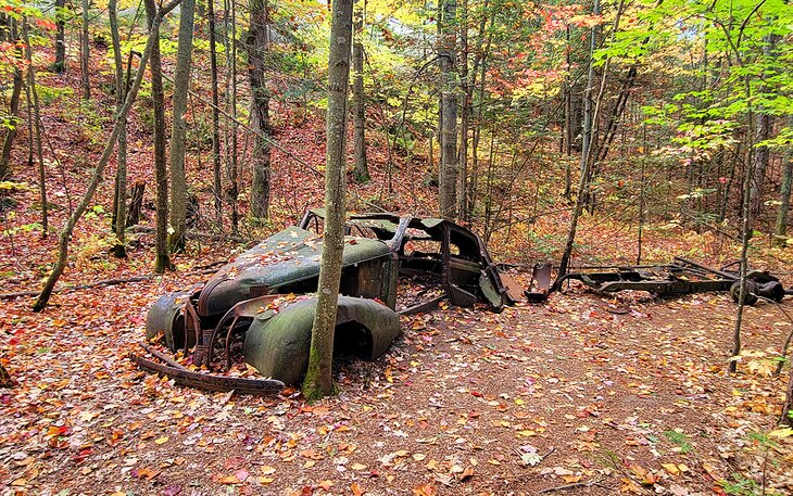
Beyond the #3 marker on the main path, the trail then passes one rusted-out old Dodge vehicle that is clearly visible. A little further on, the path turns to the left, with signs indicating the corner, and the trail then begins a steady and sometimes steep ascent to the lookout. This portion requires a bit of exertion but is not technically difficult.
The view from the ridge is beautiful and it's the main reason to do this hike. The vista out over Georgian Bay (at marker #10) is worth the hike any time of year, but the view from the ridge back towards the La Cloche Mountains (just beyond marker #10) in the fall is breathtaking.
Total time for this hike is about one hour, but longer if you plan to spend some time lingering at the top.
5. Cranberry Bog
Overview: A peaceful forest hike past wetlands
- Difficulty: Moderate (small elevation gains)
- Distance: 4 km
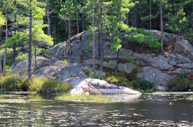
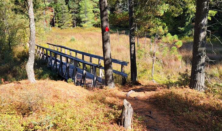
The Cranberry Bog hike is a delightful trail that leads through mixed forest, over a beaver dam, and past wetlands and lakes. On Cranberry Bog, you can see several beaver houses, as well as beaver and other wildlife, if you're lucky. The trail follows the bog on a shore of smooth, pink rock dotted with pine trees.
On the last quarter of the hike, the trail joins up with the La Cloche Silhouette trail and leads past A. Y. Jackson Lake, terminating at the George Lake Campground, not far from where you started the hike. You can tack on a short side trail, where the two trails join, for some additional lake scenery. At the junction of the two trails, the Cranberry Bog trail continues to the left, but if you turn right and walk approximately 300 meters on the La Cloche Silhouette trail, you will come to Sheguiandah Lake.
There is a backcountry campsite on this lake, marked with a yellow arrow. If no one is camping here, you can walk out to the campsite to find excellent views out to the colorful cliff walls on the opposite shoreline. From here, backtrack until you join up again with the Cranberry Bog trail.
Another scenic extension to this trail is possible when you reach A.Y. Jackson Lake. From the hiking trail, you can see a full view down the lake to the white cliffs of the La Cloche Mountains. As you walk along, you will see a yellow marker pointing towards a trail jutting off to the right, which leads to campsites located about 700 or 800 meters along the lakeshore. You can hike halfway up this campground trail to a high lookout point with a fantastic view over the lakes and mountains. Again, return along this path out to the main trail. Total time for this hike is about 2 to 2.5 hours.
My favorite portion of this trail is the extension but it's not necessary to add on the extra steps to enjoy this hike. I like this trail because it's fairly easy and not overly busy.
6. George Island
Overview: Take a boat shuttle to hike across the island and enjoy views of Georgian Bay (this hike is outside of the park)
- Difficulty: Moderate (mostly flat but a longer hike)
- Distance: 7.5 km
George Island is just across the channel from downtown Killarney and most easily accessible by a quick boat shuttle from the Sportsman's Inn. The fact that this hike is on an island makes it feel a little more remote than most others in the area, and since it is not promoted by the park, it is often much less busy. Add to that the beautiful scenery of beaver ponds and the rugged, exposed shoreline of Georgian Bay, and it's definitely worth venturing out of the park for this hike.
The George Island hike leaves from the dock and heads inland, through a forest of pines and deciduous trees, past beaver ponds, popping out onto Georgian Bay. Smooth, wave-polished stones of red, grey, green, yellow, and orange line the water's edge, and further on, pink granite outcrops form the shoreline. At some points, the shore is marshy and may be tricky depending on the water level, but alternate routes that skirt around high water are usually easy to find.
Along the shoreline are the remains of an old tar vat, once used by fishermen to reinforce their nets. Eventually, the trail heads back inland and returns to the dock.
The full hike is approximately 7.5 kilometers and takes three to four hours to complete. If you are looking for a quicker, easier alternative, hike in a counterclockwise direction until you reach Georgian Bay, take in the views along this section, and then return on the same route. This turns the hike into about a 4- to 4.5-kilometer round-trip hike, depending on how much of the shore you choose to explore, and can be completed in a couple of hours.
The George Island trail offers a good chance to see wildlife. The staff at the Sportsman's Inn will usually let you know if there are bears in the area, which you may encounter on the trail.
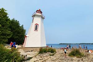
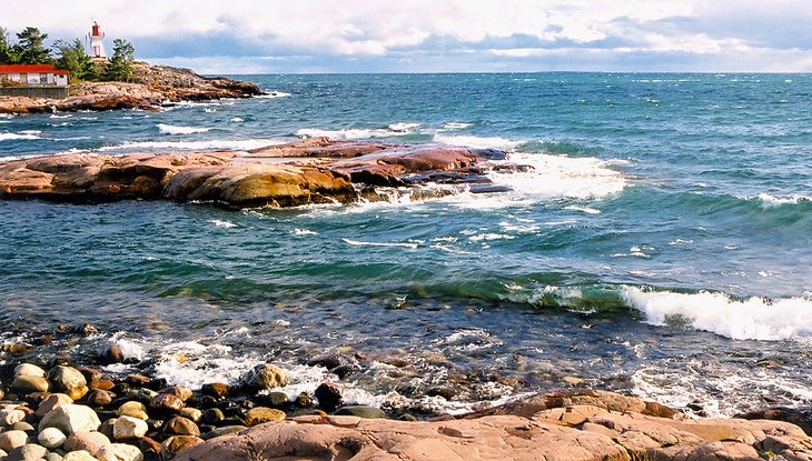
7. Lighthouse to Tar Vat Bay
Overview: Hike through a wetland area and along the shores of Georgian Bay (this hike is outside the park)
- Difficulty: Moderate (mostly flat but a longer hike)
- Distance: 6 km
Many people come to the lighthouse simply to walk along the rocks and shoreline in the vicinity of this landmark structure. It's a beautiful area to wander about and watch the waves crash on windy days. It's also the starting point for the hike to Tar Vat Bay.
This is a rewarding hike past beautiful waterlily-filled ponds that lie just inside the smooth orange rock shorelines of Georgian Bay and out to the crystal clear waters of the bay itself. Turtles bask on rocks and floating logs, muskrat and beaver navigate their way through the wetlands, and the iconic windswept pine trees of Georgian Bay line the shores.
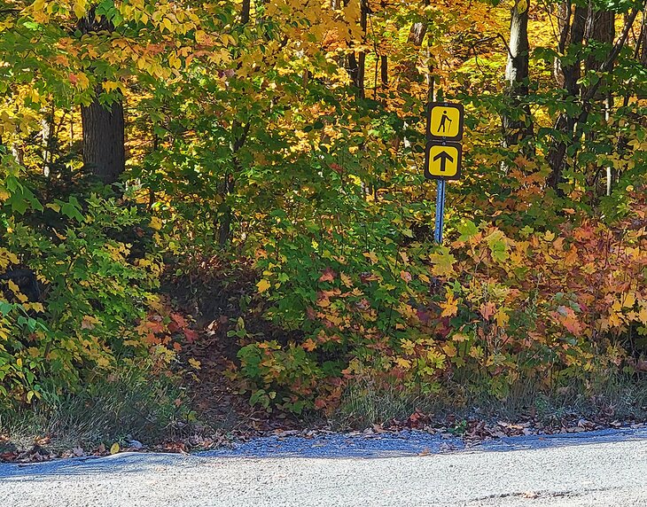
The trailhead leaves from the small parking area at the gate for the lighthouse, and there is no sign indicating the trailhead. Yellow paint on trees and rocks marks the path, but the markings are not as frequent as those found along park trails.
At the end of the first large pond, the trail crosses a marshy area and is less defined due to the fact that it may run in a slightly different location depending on the water level of the pond. At the end of the marsh the trail ascends a ridge and eventually comes out to Georgian Bay. Outer rocks protect the shoreline making it a good area for swimming or stopping for a picnic.
To reach Georgian Bay takes about 30 to 40 minutes. From here, you can continue hiking along the shoreline to the left, out to Tar Vat Bay. You can see remnants of tar along the shoreline, where fishermen once used the tar to mend their nets. The trail along the shore, out to the tar pits, is less defined and might be easy to miss. The real reward is the scenery on the hike out to the bay and the lack of people on this trail, which you will likely have all to yourself.
The hike from the Lighthouse to Tar Vat Bay is about six kilometers round-trip and takes a little over two hours. If you decide to modify the hike and only do the hike out to Georgian Bay and back, the round-trip is a little more than two kilometers and takes about 1.5 hours.
8. Lake of the Woods
Overview: Hike around Lake of the Woods with views from high ridges and lake level, less crowded than other hikes
- Difficulty: Difficult (many steep sections)
- Distance: 3.5 km
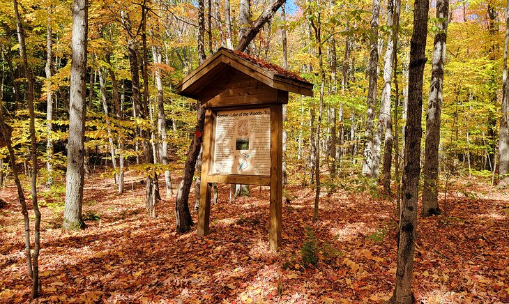
One of Killarney's newest hikes is the Lake of the Woods hiking trail. This short but intense 3.5-kilometer trail circles the small Lake of the Woods as it traverses over huge rock cliffs and peaceful shorelines while transitioning through a full range of forest types, including stands of huge pines and birch. The rewards of this hike are the views over the lake and to Silver Peak, which you can see from the high ridges.
Blueberry bushes are everywhere along this trail, and the fruit are ripe for picking from mid-July into August. In late September and October, this is a good place to see fall colors.
Along the shoreline, a single pine-covered island, connected by a boardwalk, juts out into the lake, providing a lovely perspective on the lake and the surrounding cliff walls. This is an excellent place to stop for a rest or a picnic lunch. Since this trail is quite a distance from the park campground and the town of Killarney, it is not busy, and you may have the trail all to yourself.
While the distance may seem short, the terrain is rugged, with many short but steep sections that can be difficult both going up and coming down. If the trail is wet, these sections are very tricky, with slippery tree roots and rocks.
The trail is a loop and can be done in either direction. If you begin the trail by walking to the left, the island is only a short walk in from the parking area, and takes about 20 to 30 minutes to reach. If you are not up for the whole hike but are just looking for somewhere to enjoy some nature and nice views, this is a good alternative to walking the whole trail.
The park recommends allowing three hours for this hike, but fit hikers can complete it in two hours. The trailhead is seven kilometers down the Bell Lake Road, which is off highway 637, about 20 minutes from the Killarney Provincial Park office.
Note on the Trailhead: The trail begins across the road from the parking lot. There is a brown sign with a hiker on it but it does not look like an obvious start to a trail. Once you walk past this sign you can see that the trail opens up and the larger sign with a map of the trail and information is right there, but you can't see this from the road or the parking lot. There is a trail from the parking lot to a portage, and it has a blue sign. This is NOT the trail you want.
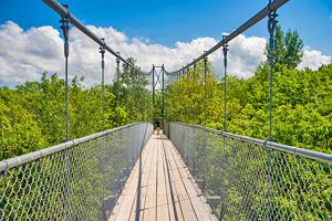
9. La Cloche Silhouette Trail
Overview: Multi-day hiking trail through remote and beautiful terrain
- Difficulty: Difficult
- Length: 78 km
This trail is one of Ontario's classic multi-day hikes. The trail is named for a painting entitled La Cloche Silhouette, by Franklin Carmichael, a member of the Group of Seven, who drew inspiration for his paintings from Killarney. The full trail is a 78-kilometer loop that will take you past some of the park's most scenic lakes, to the highest lookouts, and through a variety of forest types.
Backcountry campsites, which need to be booked in advance, are set up along the trail, and hikers must carry in all their gear. The complete trip usually takes a week to 10 days to complete.
From the main trail, marked with blue markers, side trails, marked in red, lead off the lookouts of some of the main hikes in the park, including The Crack and Silver Peak. This is a challenging hike through remote wilderness and requires some serious advance planning, from reservations to food and gear. Outfitters in Killarney, including Killarney Outfitters, can help hikers with their preparations.
Where to Stay in Killarney
Luxury Hotels:
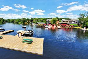
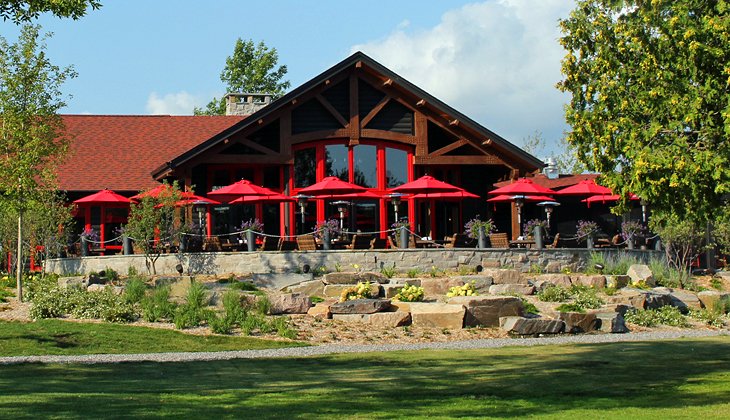
- The Killarney Mountain Lodge is a true Canadian retreat, with charming cabins and rooms with pine interiors, a huge fireplace, and wood furniture in the main hall. It also offers casual and fine dining, with indoor and outdoor eating areas, and options for all-inclusive stays. The resort is along Killarney Channel, with views out to Georgian Bay and across to George Island. On site are a pool, outside patio areas, and Muskoka chairs along the waterfront. Kayaks and canoes are available for guests.
- Nearby, the Sportsman's Inn is a luxury hotel, operated by the same owner. This is an old-style three-story hotel, looking out over the docks along Killarney Channel, with fully upgraded rooms.
More Related Articles on PlanetWare.com
Camping in Killarney: Camping is another popular pastime for outdoor lovers. If you are coming here to camp, see our suggestions for the best places for camping in Killarney. This includes car camping and backcountry sites.
Algonquin & Other Parks: Another popular park for hiking is Algonquin Provincial Park. The landscape is different than what you'll find at Killarney. Gain inspiration and ideas from our list and descriptions of the best hikes in Algonquin Provincial Park. And similarly, if you are interested in heading over to Algonquin, have a read through our best campgrounds in Algonquin Provincial Park. For a complete overview of the best provincial and national parks in the province, see our article on the top parks in Ontario.